Saville Wood
Wood, Forest in Yorkshire
England
Saville Wood

Saville Wood is a picturesque forest located in Yorkshire, England. Spanning over a vast area, this woodland is known for its rich biodiversity and natural beauty. It is a popular destination for nature enthusiasts and hikers, attracting visitors from near and far.
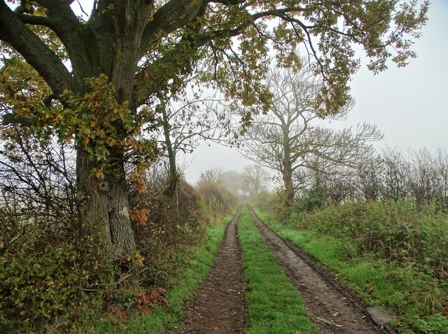
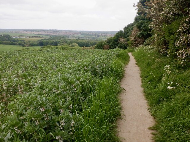
The wood is home to a diverse range of flora and fauna, with towering oak, beech, and birch trees dominating the landscape. The forest floor is covered with a thick carpet of moss and ferns, adding to its enchanting atmosphere. Numerous bird species can be spotted in Saville Wood, including woodpeckers, owls, and various songbirds. Squirrels and rabbits are also commonly seen darting through the undergrowth.
Traversing through the forest, visitors can find well-maintained trails that lead to scenic viewpoints and hidden gems. The wood offers a sense of tranquility and serenity, making it an ideal escape from the hustle and bustle of everyday life. The clean, fresh air and soothing sounds of nature provide a calming and rejuvenating experience for all who venture into its depths.
Saville Wood offers a range of recreational activities, including hiking, picnicking, and wildlife photography. There are also designated areas for camping and barbecues, allowing visitors to fully immerse themselves in the beauty of the surroundings. The forest is well-preserved and protected, ensuring that future generations can continue to enjoy its wonders.
Overall, Saville Wood in Yorkshire is a haven for nature lovers, offering a unique opportunity to connect with the natural world and appreciate the wonders of the British countryside.
If you have any feedback on the listing, please let us know in the comments section below.
Saville Wood Images
Images are sourced within 2km of 53.555554/-1.405176 or Grid Reference SE3906. Thanks to Geograph Open Source API. All images are credited.


Saville Wood is located at Grid Ref: SE3906 (Lat: 53.555554, Lng: -1.405176)
Division: West Riding
Unitary Authority: Barnsley
Police Authority: South Yorkshire
What 3 Words
///recital.timidly.inversion. Near Cudworth, South Yorkshire
Nearby Locations
Related Wikis

Dearne FM
Greatest Hits Radio South Yorkshire (Barnsley) is an Independent Local Radio station serving Barnsley. The station, originally known as Dearne FM, was...
Ardsley, South Yorkshire
Ardsley is a small village approximately 3 miles (5 km) east from Barnsley and forms part of the Metropolitan Borough of Barnsley of South Yorkshire, England...
Barnsley (speedway)
Barnsley were a British speedway team from Barnsley, England, that competed in the English Dirt Track League in the inaugural season of British Speedway...
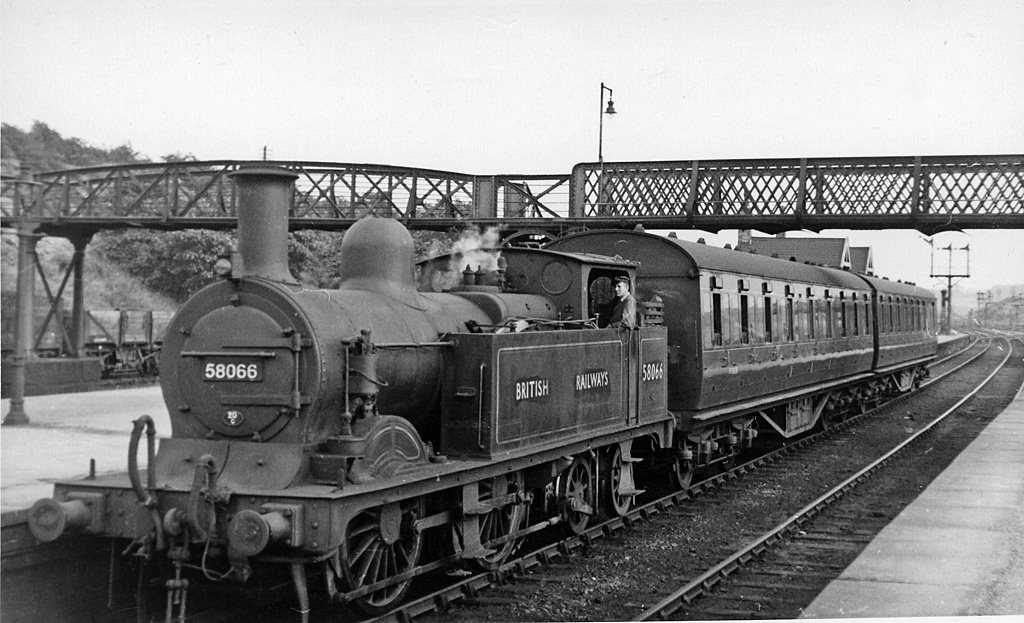
Cudworth railway station
Cudworth railway station (English: ) was a railway station that served Cudworth, South Yorkshire, England. == History == The station was built by the North...
Nearby Amenities
Located within 500m of 53.555554,-1.405176Have you been to Saville Wood?
Leave your review of Saville Wood below (or comments, questions and feedback).