Arlescote Woods

Wood, Forest in Warwickshire Stratford-on-Avon

England

Arlescote Woods

Edge Hill inclined plane The trees mark the route of the Edge Hill Light Railway inclined plane.  This was a rope-worked incline used to take wagons up and down from ironstone quarries at the top of Edge Hill to Burton Dassett sidings on the Stratford & Midland Junction Railway.  The line closed almost as soon as it was opened in the 1920's due to the changes in ironstone mining after WW1.  It lay dormant in a timewarp until it was dismantled in 1946.
Edge Hill inclined plane Credit: Bob Walters

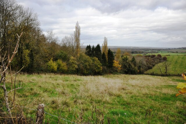
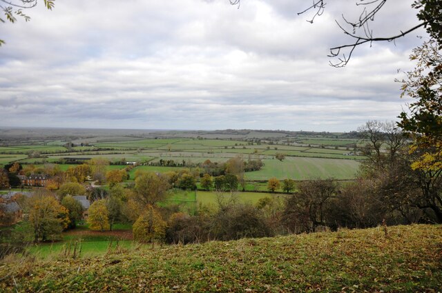
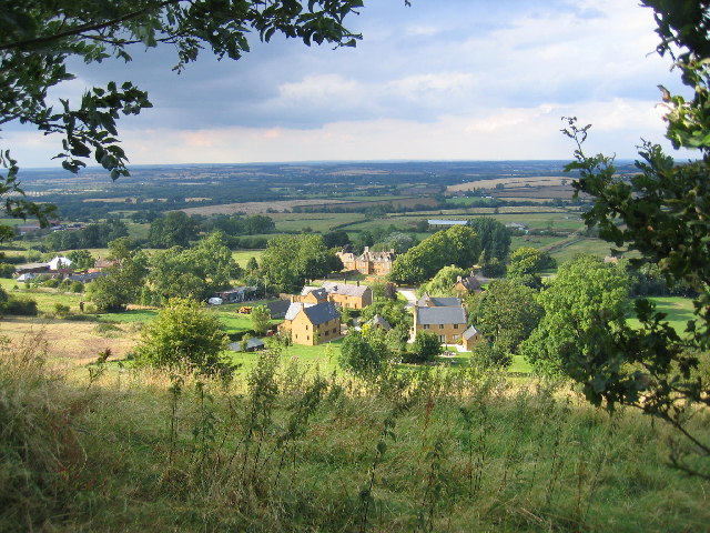
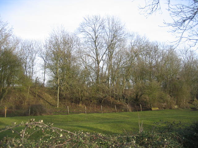
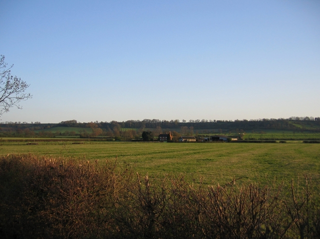
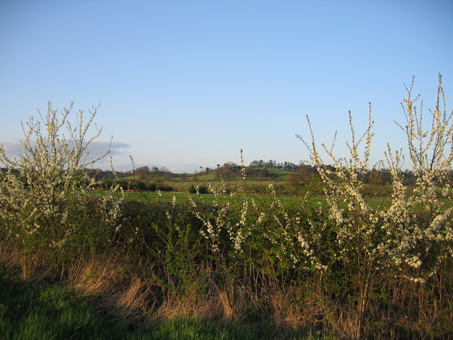
Arlescote Woods is a picturesque woodland located in the county of Warwickshire, England. Covering an area of approximately 50 hectares, this enchanting forest is nestled in the heart of the countryside, offering visitors a peaceful and serene escape from the bustling city life.

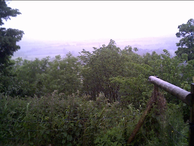
The woods are predominantly composed of native broadleaf trees, including oak, beech, and ash, which create a dense canopy, allowing only dappled sunlight to filter through. This creates a magical atmosphere, especially during the spring and summer months when the forest floor is adorned with a carpet of vibrant wildflowers.

Arlescote Woods is home to a rich variety of wildlife, making it a popular destination for nature enthusiasts. Birdwatchers can spot a plethora of species, including woodpeckers, jays, and various songbirds. Squirrels scurry through the branches, and if lucky, visitors may catch a glimpse of a roe deer gracefully bounding through the undergrowth.

The woods are crisscrossed by a network of well-maintained walking trails, making it an ideal location for leisurely strolls and family picnics. There are also designated areas for cycling and horse riding, allowing visitors to explore the woods from a different perspective.

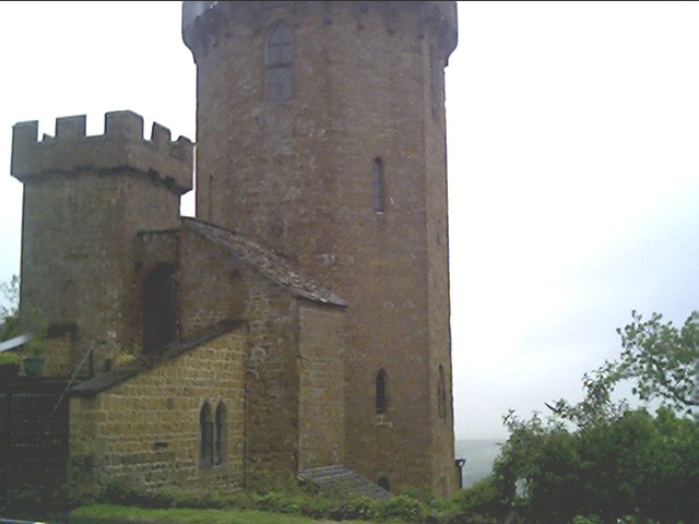
Arlescote Woods is steeped in history, with remnants of ancient earthworks and a medieval motte-and-bailey castle located within its boundaries. These historical features add an intriguing dimension to the woodland, captivating visitors with a sense of wonder and curiosity.

Overall, Arlescote Woods is a truly enchanting forest, offering a haven of tranquility and natural beauty to all who visit.

If you have any feedback on the listing, please let us know in the comments section below.

Arlescote Woods Images

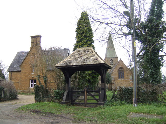
Images are sourced within 2km of 52.129299/-1.4265356 or Grid Reference SP3948. Thanks to Geograph Open Source API. All images are credited.

Edge Hill inclined plane The trees mark the route of the Edge Hill Light Railway inclined plane.  This was a rope-worked incline used to take wagons up and down from ironstone quarries at the top of Edge Hill to Burton Dassett sidings on the Stratford & Midland Junction Railway.  The line closed almost as soon as it was opened in the 1920's due to the changes in ironstone mining after WW1.  It lay dormant in a timewarp until it was dismantled in 1946.
Edge Hill inclined plane
The trees mark the route of the Edge Hill Light Railway inclined plane. This was a rope-worked incline used to take wagons up and down from ironstone quarries at the top of Edge Hill to Burton Dassett sidings on the Stratford & Midland Junction Railway. The line closed almost as soon as it was opened in the 1920's due to the changes in ironstone mining after WW1. It lay dormant in a timewarp until it was dismantled in 1946.
View from Edge Hill Looking across over Arlescote towards the Burton Hills.
View from Edge Hill
Looking across over Arlescote towards the Burton Hills.
The Tower next to the Public House, Edge Hill At this spot Charles the first raised his standard to mark the start of the English Civil War.
The Tower next to the Public House, Edge Hill
At this spot Charles the first raised his standard to mark the start of the English Civil War.
Looking down onto the battle field of Edge Hill From the Public House Garden at Edge Hill.
Looking down onto the battle field of Edge Hill
From the Public House Garden at Edge Hill.
View from Edgehill Looking NNE from the Edgehill escarpment, with Arlescote at the foot and then across towards Kineton in the distance, with the site of the Battle of Edge Hill some 2-3 miles away.
View from Edgehill
Looking NNE from the Edgehill escarpment, with Arlescote at the foot and then across towards Kineton in the distance, with the site of the Battle of Edge Hill some 2-3 miles away.
Edge Hill Light Railway embankment This embankment is close to the point at which the line crossed the road to Radway and is still shown on modern OS maps.  This three mile long standard gauge line was built for the Oxfordshire Ironstone Company in 1920 and ran from a junction with the Stratford-on-Avon & Midland Junction Railway at Burton Dassett to ironstone mines at Edge Hill around <a href="https://www.geograph.org.uk/gridref/SP3747">SP3747</a>. It was only operated for five years before the iron ores ran out and the line was closed. The railway and its rolling stock lay derelict for another 22 years before it was dismantled. The 1940s map still shows the line as being in existence.  See also <span class="nowrap"><a title="http://www.hfstephens-museum.org.uk/pages/his_railways/edgehill.htm" rel="nofollow ugc noopener" href="http://www.hfstephens-museum.org.uk/pages/his_railways/edgehill.htm">Link</a><img style="margin-left:2px;" alt="External link" title="External link - shift click to open in new window" src="https://s1.geograph.org.uk/img/external.png" width="10" height="10"/></span>
Edge Hill Light Railway embankment
This embankment is close to the point at which the line crossed the road to Radway and is still shown on modern OS maps. This three mile long standard gauge line was built for the Oxfordshire Ironstone Company in 1920 and ran from a junction with the Stratford-on-Avon & Midland Junction Railway at Burton Dassett to ironstone mines at Edge Hill around SP3747. It was only operated for five years before the iron ores ran out and the line was closed. The railway and its rolling stock lay derelict for another 22 years before it was dismantled. The 1940s map still shows the line as being in existence. See also LinkExternal link
Splash Leys Farm Looking across the square from the Banbury Road with the escarpment of Edge Hill beyond.
Splash Leys Farm
Looking across the square from the Banbury Road with the escarpment of Edge Hill beyond.
Arlescote Pond Farm, one of the colourful ironstone houses in this picturesque the village.
Arlescote
Pond Farm, one of the colourful ironstone houses in this picturesque the village.
Blossom Blossom by the layby on the Banbury Road with the Dassett Hills visible beyond.
Blossom
Blossom by the layby on the Banbury Road with the Dassett Hills visible beyond.
Arlescote The evening sunlight catches some outbuildings near the centre of the village.
Arlescote
The evening sunlight catches some outbuildings near the centre of the village.
Footpath to Poplars Farm Looking along the footpath from Ratley as it crosses the valley of the Sor Brook.
Footpath to Poplars Farm
Looking along the footpath from Ratley as it crosses the valley of the Sor Brook.
View from Camp Lane Camp Lane is running along a ridge at this point behind the hedge on the left of the picture.  The northern face of this ridge is a familiar sight and leads into Edge Hill, however this view is looking along to more concealed southern slope of the ridge towards Fir Tree Farm.
View from Camp Lane
Camp Lane is running along a ridge at this point behind the hedge on the left of the picture. The northern face of this ridge is a familiar sight and leads into Edge Hill, however this view is looking along to more concealed southern slope of the ridge towards Fir Tree Farm.
Ratley Town Hall That's what it says in the stonework!  This is tucked away at the far corner of this delightfully secluded ironstone village.
Ratley Town Hall
That's what it says in the stonework! This is tucked away at the far corner of this delightfully secluded ironstone village.
The Rose & Crown, Ratley The evening sunlight brings out the warm colours of the local ironstone construction.
The Rose & Crown, Ratley
The evening sunlight brings out the warm colours of the local ironstone construction.
The Old School Ratley The former school building at the top of the village has now been converted into housing.
The Old School Ratley
The former school building at the top of the village has now been converted into housing.
View towards Hornton Hill Farm Looking across the valley of the Sor Brook from the footpath from Ratley towards Hornton Hill Farm and the communications tower near the southern edge of the square.
View towards Hornton Hill Farm
Looking across the valley of the Sor Brook from the footpath from Ratley towards Hornton Hill Farm and the communications tower near the southern edge of the square.
The church of St Peter ad Vincula, Ratley There is a sign by the gate which mentions ".. a bell-ringer of 1967 producing 'an astonishing sight' by the ringing of the 3 bells in the church tower. Now there are 4 bells and the present bell-ringer will gladly produce 'an astonishing sight' (for £1)! before a 10 a.m. or 6.30 p.m. service."!
The church of St Peter ad Vincula, Ratley
There is a sign by the gate which mentions ".. a bell-ringer of 1967 producing 'an astonishing sight' by the ringing of the 3 bells in the church tower. Now there are 4 bells and the present bell-ringer will gladly produce 'an astonishing sight' (for £1)! before a 10 a.m. or 6.30 p.m. service."!
View from Camp Lane Looking south to the small valley of the Sor Brook with a light blue tinge, possibly flax, over the fields.
View from Camp Lane
Looking south to the small valley of the Sor Brook with a light blue tinge, possibly flax, over the fields.
Show me another place!

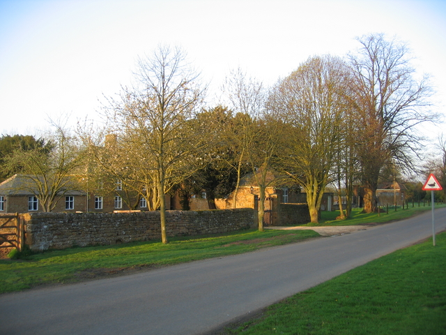
Arlescote Woods is located at Grid Ref: SP3948 (Lat: 52.129299, Lng: -1.4265356)

Administrative County: Warwickshire

District: Stratford-on-Avon

Police Authority: Warwickshire

What 3 Words

///numeral.perplexed.cycles. Near Farnborough, Warwickshire

Related Wikis

Arlescote

Arlescote is a village in Warwickshire, England. Arlescote forms part of the district of Stratford-on-Avon and the civil parish of Warmington. This small...

Ratley

Ratley is a village in the civil parish of Ratley and Upton, Stratford-on-Avon District, Warwickshire, England. The population of the civil parish in 2011...

Warmington, Warwickshire

Warmington is a village and civil parish in the Stratford-on-Avon district of Warwickshire, England. It is located on the border with Oxfordshire, around...

National Herb Centre

The National Herb Centre is a herbarium and garden centre located in Warmington, Warwickshire, England. The centre was opened in 1997 by Peter Turner...

Farnborough Rural District

Farnborough was a rural district in Warwickshire, England from 1894 to 1932. It was formed from that part of the Banbury rural sanitary district which...

Avon Dassett

Avon Dassett is a village and civil parish in the Stratford district of Warwickshire, England, nestling among the Burton Dassett Hills about four miles...

St John the Baptist's Church, Avon Dassett

St John the Baptist's Church is a redundant Anglican church in the village of Avon Dassett, Warwickshire, England. It is recorded in the National Heritage...

Radway

Radway is a village and civil parish in Warwickshire, England, about 7 miles (11 km) north-west of Banbury in neighbouring Oxfordshire. The population...

Nearby Amenities

Located within 500m of 52.129299,-1.4265356
Barrier: kissing_gate
Source: survey
Lat/Long: 52.1322829/-1.425104
Barrier: kissing_gate
Source: survey
Lat/Long: 52.1274611/-1.430556
Barrier: kissing_gate
Source: survey
Lat/Long: 52.1322492/-1.4250353
Barrier: kissing_gate
Source: survey
Lat/Long: 52.1298051/-1.4286672
Barrier: kissing_gate
Source: survey
Lat/Long: 52.1292374/-1.429225
Barrier: kissing_gate
Source: survey
Lat/Long: 52.1316204/-1.4211617
Barrier: kissing_gate
Source: survey
Lat/Long: 52.1303858/-1.4286827
Edgehill Country Park
Office: yes
Lat/Long: 52.1282263/-1.4217212
Bicycle Parking
Bicycle Parking: shed
Lat/Long: 52.1282304/-1.4223259
The data included in this document is from www.openstreetmap.org. The data is made available under ODbL.

Have you been to Arlescote Woods?

Leave your review of Arlescote Woods below (or comments, questions and feedback).