Aldermoor

Wood, Forest in Hampshire New Forest

England

Aldermoor

Open heath - Gurnetfields Furzebrake
Open heath - Gurnetfields Furzebrake Credit: John Lucas

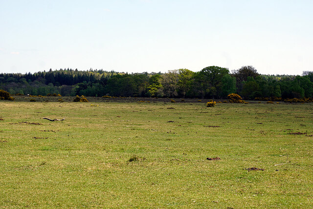
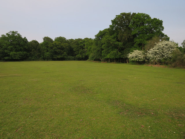
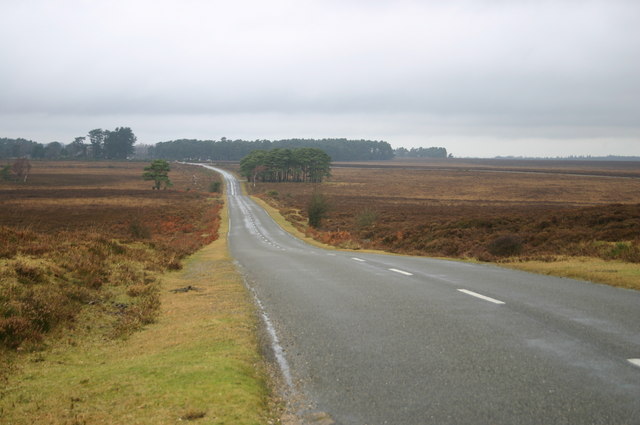
Aldermoor, Hampshire is a picturesque wood located in the southern region of England. This enchanting forest, known for its natural beauty and tranquil atmosphere, covers a vast area of land, making it a popular destination for nature enthusiasts and hikers alike.

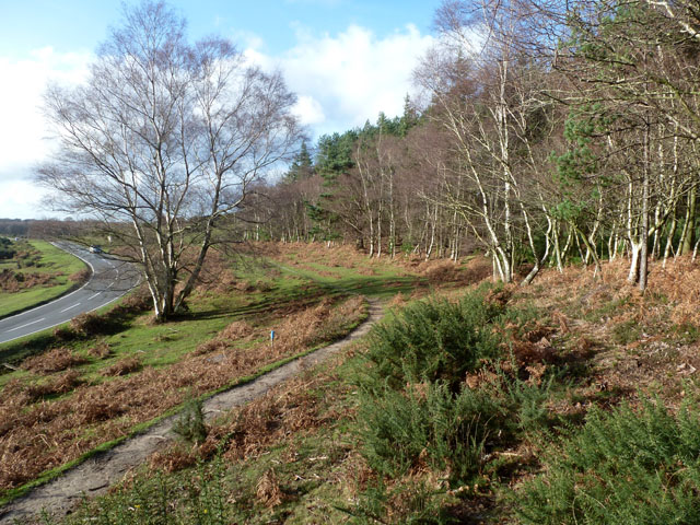
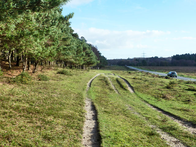
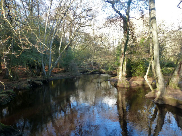
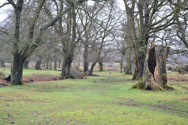
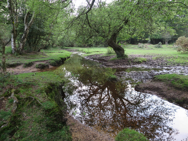
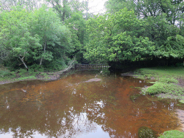
The wood is predominantly made up of tall, majestic alder trees, giving it its name and creating a dense canopy that provides shade and shelter. The forest floor is covered with a thick layer of fallen leaves, creating a soft carpet for visitors to tread upon. The rich, earthy scent of moss and damp soil fills the air, adding to the sense of serenity.

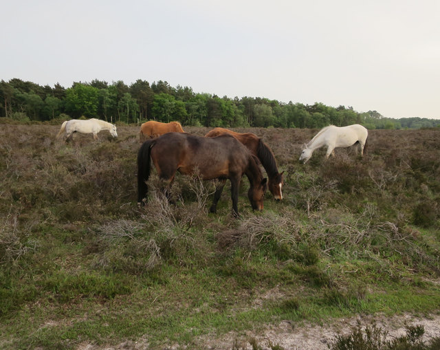
Aldermoor is home to a diverse range of wildlife, including various bird species, such as woodpeckers and owls, which can be heard throughout the day. Small mammals, like squirrels and rabbits, can also be spotted scurrying amongst the undergrowth.

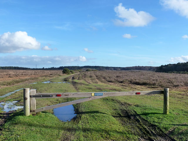
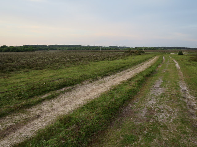
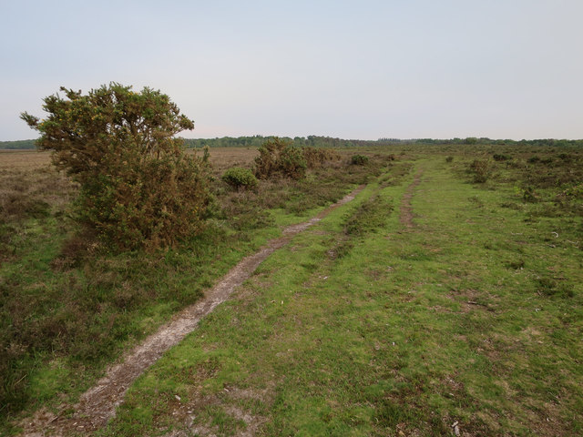
The wood is crisscrossed with a network of well-maintained trails, allowing visitors to explore its hidden treasures. These paths wind their way through the forest, offering glimpses of babbling brooks and secluded glades. Nature lovers can revel in the beauty of wildflowers that bloom in the spring and summer months, adding vibrant splashes of color to the verdant landscape.

Aldermoor provides a peaceful escape from the bustling city life, allowing visitors to immerse themselves in the beauty of nature. Its idyllic setting and abundant wildlife make it a haven for those seeking solace and a deeper connection with the natural world.

If you have any feedback on the listing, please let us know in the comments section below.

Aldermoor Images

Images are sourced within 2km of 50.860434/-1.4620818 or Grid Reference SU3706. Thanks to Geograph Open Source API. All images are credited.

Open heath - Gurnetfields Furzebrake
A field of harvested sweetcorn A fairly benign looking field, but when attempting to follow a public footpath around the edge, I slipped into a deep furrow and was trapped there in the mud for some 36 hours. A police team and dog eventually found me after establishing my location from the last 'ping' of my phone (which had been rendered useless by water).

After some 16 years of Geographing, I doubt that I shall again be exploring new ground 'off the beaten track', mostly at the exhortations of my family, but the event also shook my own confidence - we shall see if I can overcome that.

It's somewhat ironic that, after wild camping and exploring the wilds of Scotland, The Peaks, Snowdonia etc., it should be in an ordinary field in the county of my birth which has bought my 'wild' Geographing exploration to an end. 

This image was the last that I took before finding myself in my 'predicament'. Thankfully, I was able to rescue the memory cards from my ruined camera gear!
A field of harvested sweetcorn
A fairly benign looking field, but when attempting to follow a public footpath around the edge, I slipped into a deep furrow and was trapped there in the mud for some 36 hours. A police team and dog eventually found me after establishing my location from the last 'ping' of my phone (which had been rendered useless by water). After some 16 years of Geographing, I doubt that I shall again be exploring new ground 'off the beaten track', mostly at the exhortations of my family, but the event also shook my own confidence - we shall see if I can overcome that. It's somewhat ironic that, after wild camping and exploring the wilds of Scotland, The Peaks, Snowdonia etc., it should be in an ordinary field in the county of my birth which has bought my 'wild' Geographing exploration to an end. This image was the last that I took before finding myself in my 'predicament'. Thankfully, I was able to rescue the memory cards from my ruined camera gear!
Twiggs Lane Straight on the lane becomes Twiggs Lane End, a dead end. The major route bends right to become Arters Lawn.
Twiggs Lane
Straight on the lane becomes Twiggs Lane End, a dead end. The major route bends right to become Arters Lawn.
Path by Marchwood Inclosure It is certainly used by horses, but whether ridden or free ranging is hard to tell.
Path by Marchwood Inclosure
It is certainly used by horses, but whether ridden or free ranging is hard to tell.
Three strand path Between Marchwood Inclosure on the left and the road to Dibden.
Three strand path
Between Marchwood Inclosure on the left and the road to Dibden.
Forestry track, New Forest Not the usual forestry tack, as the woodland is rather remote, but the sign does say Forestry Commission.
Forestry track, New Forest
Not the usual forestry tack, as the woodland is rather remote, but the sign does say Forestry Commission.
Beaulieu River, King's Hat Crossed by a footbridge here, the view point.
Beaulieu River, King's Hat
Crossed by a footbridge here, the view point.
Path through the trees near Farrant's Copse
Junction of paths on Yew Tree Heath
Path towards Decoy Pond Farm Saturated ground and waterlogged paths across Yew Tree Heath.
Path towards Decoy Pond Farm
Saturated ground and waterlogged paths across Yew Tree Heath.
Path across Yew Tree Heath Heavily waterlogged path across the heath with Farrant's Copse in the distance.
Path across Yew Tree Heath
Heavily waterlogged path across the heath with Farrant's Copse in the distance.
Lawn near Aldermoor Lodge
Ponies on Dibden Bottom
Track to Dibden Bottom The area to the left is marked as woodland on the 1:25000 map, but clearly hasn't been for a while.
Track to Dibden Bottom
The area to the left is marked as woodland on the 1:25000 map, but clearly hasn't been for a while.
Track by Beaulieu River Generally the 1:25000 map is much better than the 1:50000 in the New Forest, but in this square there are several discrepancies between the 1:25000 and what is there.
Track by Beaulieu River
Generally the 1:25000 map is much better than the 1:50000 in the New Forest, but in this square there are several discrepancies between the 1:25000 and what is there.
Tributary of Beaulieu River Not the easiest stream to cross.
Tributary of Beaulieu River
Not the easiest stream to cross.
Watergate across Beaulieu River Fenceline crossing the river.
Watergate across Beaulieu River
Fenceline crossing the river.
Dibden Bottom Pond in the heathland.
Dibden Bottom
Pond in the heathland.
Show me another place!

Aldermoor is located at Grid Ref: SU3706 (Lat: 50.860434, Lng: -1.4620818)

Administrative County: Hampshire

District: New Forest

Police Authority: Hampshire

What 3 Words

///sings.sling.ranged. Near Marchwood, Hampshire

Related Wikis

Applemore College

Applemore College is a secondary school in Hampshire, England, situated in the village of Dibden Purlieu on the edge of the New Forest. It offers education...

Testwood School

Testwood School (formerly Testwood Sports College) is a secondary school with academy status located in the town of Totton and Eling, England. The school...

Denny Lodge

Denny Lodge is a large civil parish in the New Forest in Hampshire, England. It covers a large area of heathland and woodland encompassing much of the...

Beaulieu Road railway station

Beaulieu Road railway station is located at the point where the South West Main Line from London Waterloo to Weymouth crosses the B3056 road from Beaulieu...

Hythe & Dibden F.C.

Hythe & Dibden Football Club is a football club based in Hythe, near Southampton in Hampshire. They are currently members of the Wessex League Premier...

Southampton F.C. Under-21s and Academy

Southampton F.C. Under-21s and Academy or Saints U21s and Academy is the youth organisation run by Southampton F.C. to encourage and develop young footballers...

Dibden

Dibden is a small village in Hampshire, England, which dates from the Middle Ages. It is dominated by the nearby settlements of Hythe and Dibden Purlieu...

Staplewood Campus

Staplewood Campus in Marchwood, Hampshire is the training ground of Southampton Football Club. It was the home ground of Road-Sea Southampton until 1987...

Related Videos

1st Tring Scouts @ Ferny Crofts July 2023

1st Tring on Summer Camp at Ferny Crofts July 2024.

Vanlife Cooking Disaster in the Forest | Vanlife Eats Campervan Recipies

We headed out into the forest to cook a couple of recipes that will be in our Vanlife Eats Cookbook. Was it a disaster? Join us for ...

Good Friday - Hour at The Cross - Friday 2nd April 2021

Our 'Hour at The Cross' service, for Good Friday (Friday 2nd April), from All Saints' Church, Dibden.

Nearby Amenities

Located within 500m of 50.860434,-1.4620818
Natural: wetland
Lat/Long: 50.8576/-1.45892
Ford: yes
Lat/Long: 50.8576946/-1.458913
Ford: yes
Lat/Long: 50.8580704/-1.4568839
Barrier: cattle_grid
Lat/Long: 50.8598869/-1.4605705
The data included in this document is from www.openstreetmap.org. The data is made available under ODbL.

Have you been to Aldermoor?

Leave your review of Aldermoor below (or comments, questions and feedback).