Asby

Settlement in Cumberland Copeland

England

Asby

Houses at High House
Houses at High House Credit: David Medcalf

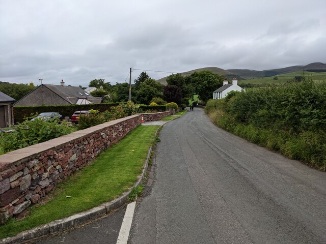
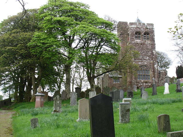
Asby is a small village located in the county of Cumberland, in the northwest of England. Situated in the Eden district, it lies within the beautiful rural landscape of the Lake District National Park. Asby is a quintessential English village, known for its picturesque surroundings and charming historical buildings.

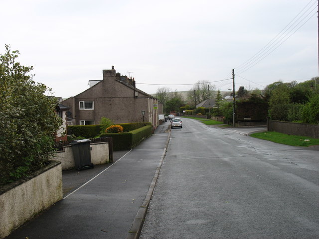
The village is home to a close-knit community, with a population of around 200 residents. Asby boasts a peaceful and tranquil atmosphere, making it an ideal place for those seeking a quiet and idyllic countryside lifestyle. The village is predominantly residential, with a scattering of traditional cottages and farmhouses.

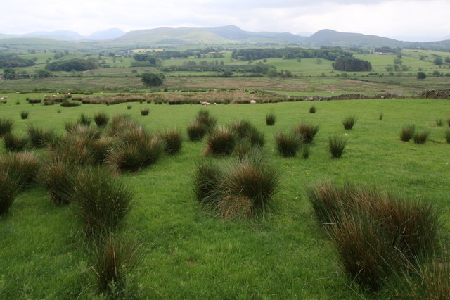
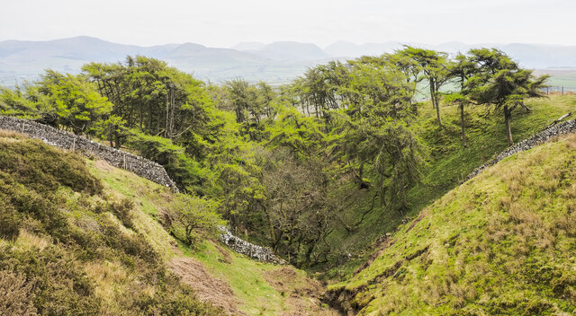
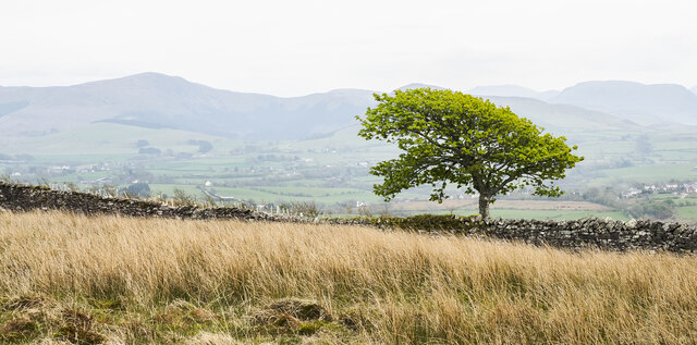
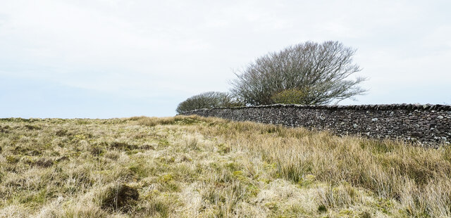
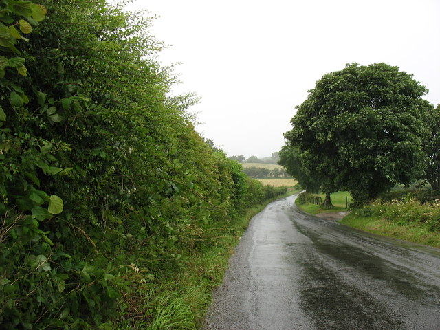
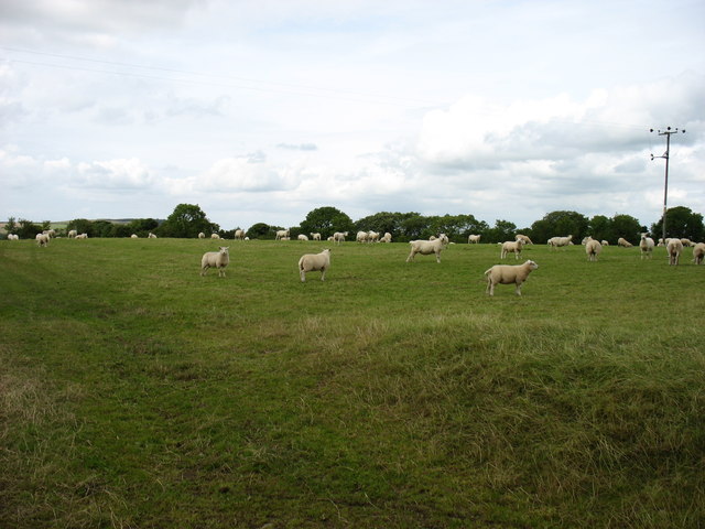
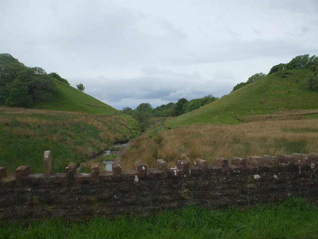
Asby is surrounded by rolling hills and lush green fields, making it a haven for nature lovers and outdoor enthusiasts. The area offers numerous walking trails and cycling routes, allowing visitors to explore the stunning natural beauty of the Lake District. Just south of the village, lies the renowned limestone escarpment of the North Pennines, offering breathtaking views and unique geological formations.

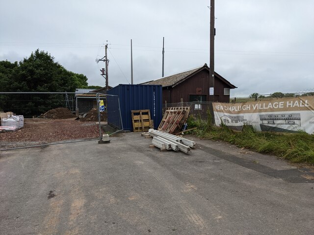
Although small, Asby has a strong sense of community and offers basic amenities to its residents. The village features a local pub, providing a gathering place for locals and visitors alike. Additionally, a small primary school serves the educational needs of the village.

Overall, Asby is a charming and peaceful village, perfect for those seeking an escape from the hustle and bustle of city life. Its stunning natural surroundings and tight-knit community make it a hidden gem within the picturesque landscape of Cumberland.

If you have any feedback on the listing, please let us know in the comments section below.
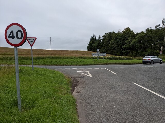
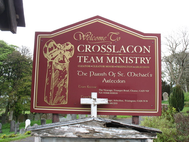
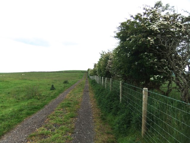
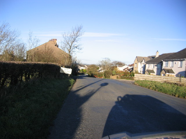
Asby Images

Images are sourced within 2km of 54.570187/-3.453202 or Grid Reference NY0620. Thanks to Geograph Open Source API. All images are credited.

Houses at High House
Old Boundary Marker on Crossgates Bridge Township Boundary Marker at the north end of the east parapet of Crossgates Bridge. On the former boundary of Murton and Lamplugh townships but now entirely in Lamplugh parish.

Milestone Society National ID: CU_LAMP07pb
Old Boundary Marker on Crossgates Bridge
Township Boundary Marker at the north end of the east parapet of Crossgates Bridge. On the former boundary of Murton and Lamplugh townships but now entirely in Lamplugh parish. Milestone Society National ID: CU_LAMP07pb
Old Boundary Marker on Dubbeck Bridge Township Boundary Marker set on top of the parapet of Dubbeck Bridge, Dub Beck, on the southwest side of the road east of Brownrigg. Inscribed ARLECDON and WHILLIMOOR on opposite faces. On the boundary of Arlecdon and Whillimoor townships in Arlecdon parish, now entirely in Arlecdon and Frizington parish. See also <a title="https://www.geograph.org.uk/photo/4000552" href="https://www.geograph.org.uk/photo/4000552">Link</a> , <a title="https://www.geograph.org.uk/photo/4000502" href="https://www.geograph.org.uk/photo/4000502">Link</a> and <a title="https://www.geograph.org.uk/photo/4000486" href="https://www.geograph.org.uk/photo/4000486">Link</a>.

Milestone Society National ID: CU_ARLFRI02pb
Old Boundary Marker on Dubbeck Bridge
Township Boundary Marker set on top of the parapet of Dubbeck Bridge, Dub Beck, on the southwest side of the road east of Brownrigg. Inscribed ARLECDON and WHILLIMOOR on opposite faces. On the boundary of Arlecdon and Whillimoor townships in Arlecdon parish, now entirely in Arlecdon and Frizington parish. See also Link , Link and Link. Milestone Society National ID: CU_ARLFRI02pb
Southerly view from near Whitekeld I was greatly impressed by the solitude of this region. The tourist droves trip over themselves elsewhere but here is idyllic, unspoiled, and peaceful. However there seems to be a dearth of bird life in the region. On this terrain you'd expect to see a good head of Peewit and curlew to name a few. there were none.
Southerly view from near Whitekeld
I was greatly impressed by the solitude of this region. The tourist droves trip over themselves elsewhere but here is idyllic, unspoiled, and peaceful. However there seems to be a dearth of bird life in the region. On this terrain you'd expect to see a good head of Peewit and curlew to name a few. there were none.
Larch trees in cleft of stream In late April the larches are in 'new leaf'. The cleft is that of a stream which according to OS mapping fades away as do others in the area; it's assumed that the waters somehow enter Dub Beck.
The western hills of the Lake District are seen hazily in the distance.
Larch trees in cleft of stream
In late April the larches are in 'new leaf'. The cleft is that of a stream which according to OS mapping fades away as do others in the area; it's assumed that the waters somehow enter Dub Beck. The western hills of the Lake District are seen hazily in the distance.
Lone tree beyond dry stone wall The wall crosses the High Park area of moorland.
Hills of the western side of the Lake District are in the distance; Blake Fell is to the left.
Lone tree beyond dry stone wall
The wall crosses the High Park area of moorland. Hills of the western side of the Lake District are in the distance; Blake Fell is to the left.
Moorland alongside wall The moorland is part of the area known as High Park.
Moorland alongside wall
The moorland is part of the area known as High Park.
Junction with the A5086
The new Lamplugh Village Hall Work in progress!
The new Lamplugh Village Hall
Work in progress!
Direction Sign – Signpost on the A5086 near Lamplugh Located east of Rowrah on the southwest side of the junction between the A5086 and a minor road to Salter Hall. Lamplugh parish. 2 arms but missing finial.

Milestone Society National ID: CU_NY0618
Direction Sign – Signpost on the A5086 near Lamplugh
Located east of Rowrah on the southwest side of the junction between the A5086 and a minor road to Salter Hall. Lamplugh parish. 2 arms but missing finial. Milestone Society National ID: CU_NY0618
The road north of Kirkland
A field near Scallow Beck
Embankments but no viaduct A section of the Cleator and Workington Junction Railway, built c.1879. It was mainly used for coal, limestone and iron ore traffic for the local industries. Most of the line was taken up in the 1960's; bridges, viaducts & even parts of the trackbed are now lost to history, but some parts of the old network are now cycle ways & footpaths.
Embankments but no viaduct
A section of the Cleator and Workington Junction Railway, built c.1879. It was mainly used for coal, limestone and iron ore traffic for the local industries. Most of the line was taken up in the 1960's; bridges, viaducts & even parts of the trackbed are now lost to history, but some parts of the old network are now cycle ways & footpaths.
Arlecdon village I am afraid that the Sun Inn, shown in <a href="https://www.geograph.org.uk/photo/79457">NY0419 : Public House on the edge of Arlecdon</a>, has long since closed.
Arlecdon village
I am afraid that the Sun Inn, shown in NY0419 : Public House on the edge of Arlecdon, has long since closed.
St Michael's church, Arlecdon
St Michael's church entrance parapet This feels more like a castle wall than the entrance to a church! But there is a steep drop ahead, and so one can see the need to keep the parishioners from a premature meeting with their Maker.
St Michael's church entrance parapet
This feels more like a castle wall than the entrance to a church! But there is a steep drop ahead, and so one can see the need to keep the parishioners from a premature meeting with their Maker.
St Michael's church sign St Michael's church stands between Arlecdon and Asby. I have not yet established the origin of the name "Crosslacon": it does not appear on any map that I have seen.
St Michael's church sign
St Michael's church stands between Arlecdon and Asby. I have not yet established the origin of the name "Crosslacon": it does not appear on any map that I have seen.
Track to High Leys
Track to High Leys
Show me another place!

Asby is located at Grid Ref: NY0620 (Lat: 54.570187, Lng: -3.453202)

Administrative County: Cumbria

District: Copeland

Police Authority: Cumbria

What 3 Words

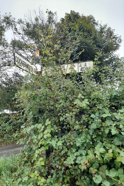
///maybe.chains.bystander. Near Frizington, Cumbria

Nearby Locations

Asby

Related Wikis

Asby, Copeland

Asby is a village in Cumbria, England, historically part of Cumberland, near the Lake District National Park. == Location == It lies by road 7.5 miles...

Lamplugh railway station

Lamplugh railway station was built by the Whitehaven, Cleator and Egremont Railway. It served the scattered community of Lamplugh, Cumbria, England....

Crossgates, Cumbria

Crossgates is a hamlet in Cumbria, England. It is located just to the northeast of Asby. == References ==

Kelton Head

Kelton Head is a hamlet in Cumbria, England. It has just four houses, and is very close to Kelton Head Quarry, near Rowrah. Despite this, it is in the...

Rowrah railway station

Rowrah railway station was built by the Whitehaven, Cleator and Egremont Railway. It served the village of Rowrah, Cumbria, England. == Local lines... ==

Frizington

Frizington is a village in Cumbria, England, historically part of Cumberland, near the Lake District National Park. Historically, it was a collection of...

Arlecdon and Frizington

Arlecdon and Frizington is a civil parish in the Borough of Copeland in Cumbria, England. The parish had a population of 3,678 in the 2001 census, decreasing...

Rowrah

Rowrah is a village in Cumbria, England, and spans the civil parishes of Arlecdon and Frizington and Lamplugh. The majority of Rowrah is within Arlecdon...

Nearby Amenities

Located within 500m of 54.570187,-3.453202
Asby
Local Ref: BY
Naptan AtcoCode: 090050010056
Naptan Bearing: S
Naptan BusStopType: CUS
Naptan CommonName: Village
Naptan Indicator: by
Naptan Landmark: public telephone box
Naptan NaptanCode: cumatjtj
Naptan Street: No name
Naptan Verified: no
Place: village
Source: naptan_import
Wikidata: Q4803763
Lat/Long: 54.5704699/-3.4507704
Post Box
Post Box Type: lamp
Ref: CA14 104
Royal Cypher: EIIR
Royal Cypher Wikidata: Q33102113
Lat/Long: 54.5705942/-3.450863
Booth: KX100
Covered: booth
Disused Amenity: telephone
Man Made: telephone_box
Lat/Long: 54.570663/-3.4507245
Waste Basket
Lat/Long: 54.5706507/-3.4507681
Grit Bin
Lat/Long: 54.5706214/-3.4508058
High Asby
Place: locality
Lat/Long: 54.5674345/-3.4521116
Sunny Howe
Place: locality
Lat/Long: 54.5676651/-3.4586573
Bench
Lat/Long: 54.5705672/-3.4509024
Advertising: board
Lat/Long: 54.5707051/-3.4506681
Power: pole
Lat/Long: 54.5662477/-3.4567631
Power: pole
Lat/Long: 54.5672096/-3.4566294
Power: pole
Lat/Long: 54.5679248/-3.4565342
Power: pole
Lat/Long: 54.5687303/-3.4558172
Power: pole
Lat/Long: 54.56986/-3.4547901
Power: pole
Lat/Long: 54.5707619/-3.4539809
Power: pole
Lat/Long: 54.5716355/-3.4532395
Power: pole
Lat/Long: 54.5725315/-3.4536082
Power: pole
Lat/Long: 54.5732912/-3.4539161
Power: pole
Lat/Long: 54.5742751/-3.4543334
Power: pole
Lat/Long: 54.5687292/-3.4574741
Power: pole
Lat/Long: 54.5687374/-3.4590055
Power: pole
Lat/Long: 54.5716719/-3.4514124
The data included in this document is from www.openstreetmap.org. The data is made available under ODbL.

Have you been to Asby?

Leave your review of Asby below (or comments, questions and feedback).