Docking

Settlement in Norfolk King's Lynn and West Norfolk

England

Docking

Stubble field and York Hill Plantation
Stubble field and York Hill Plantation Credit: Jonathan Thacker

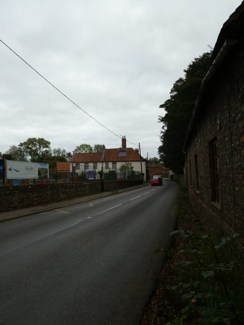
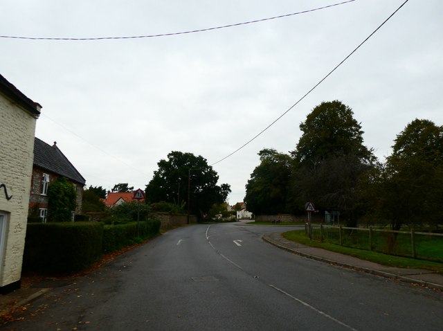
Docking is a charming village located in the county of Norfolk, England. Situated approximately 16 kilometers inland from the North Sea coast, it falls within the district of King's Lynn and West Norfolk. With a population of around 1,100 residents, it offers a peaceful and tranquil environment for both residents and visitors alike.

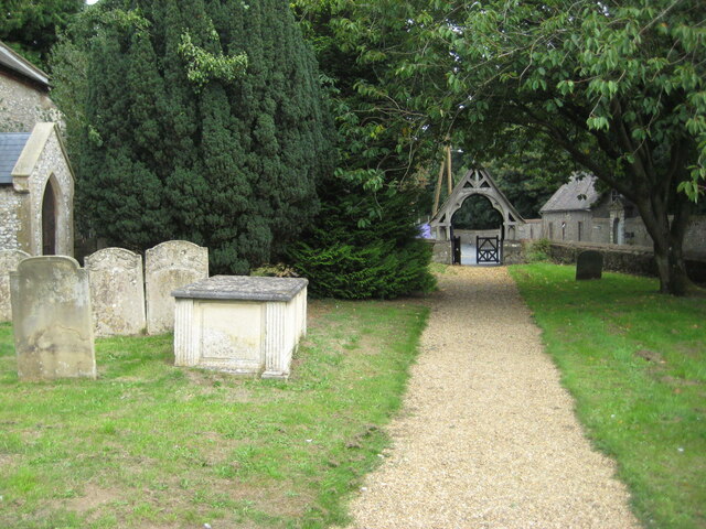
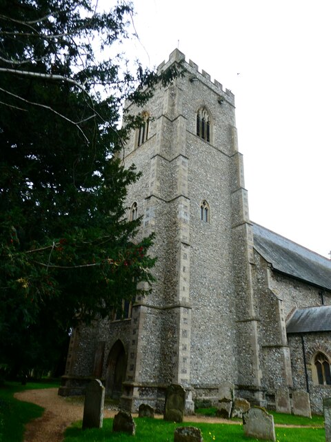
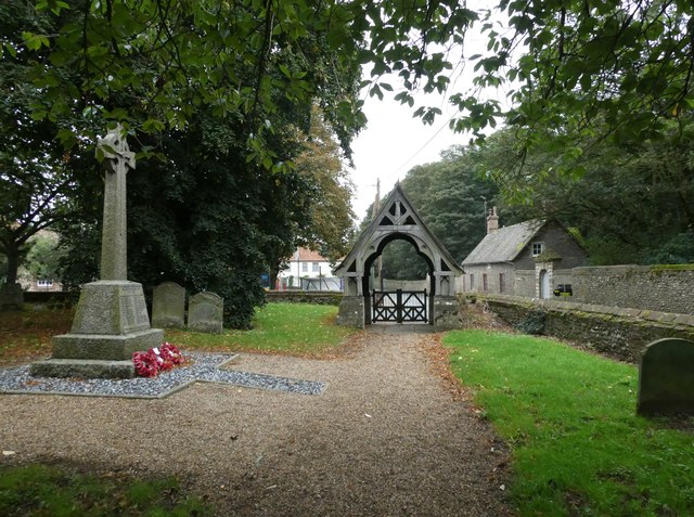
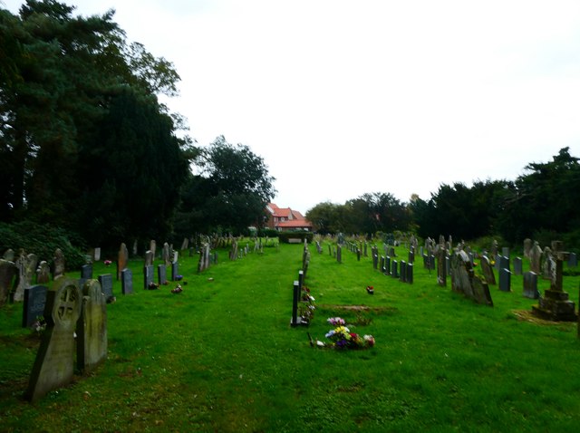
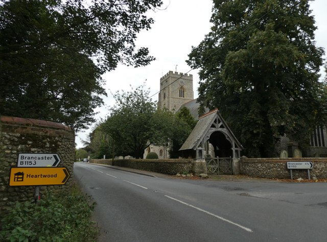
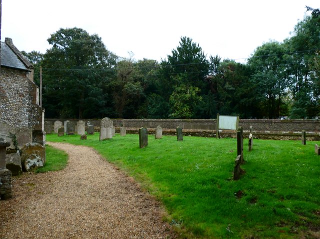
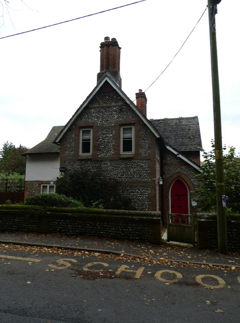
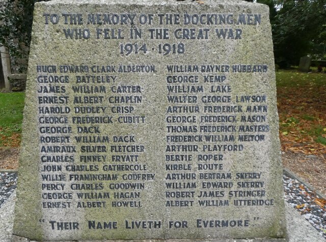
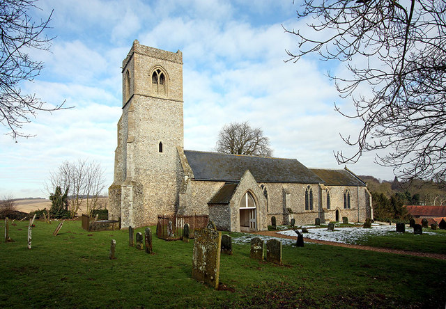
The village of Docking has a rich history, dating back to medieval times. It was once an important market town and a center for the local agricultural community. Today, remnants of its past can still be seen in the form of historic buildings, including the 14th-century All Saints Church.

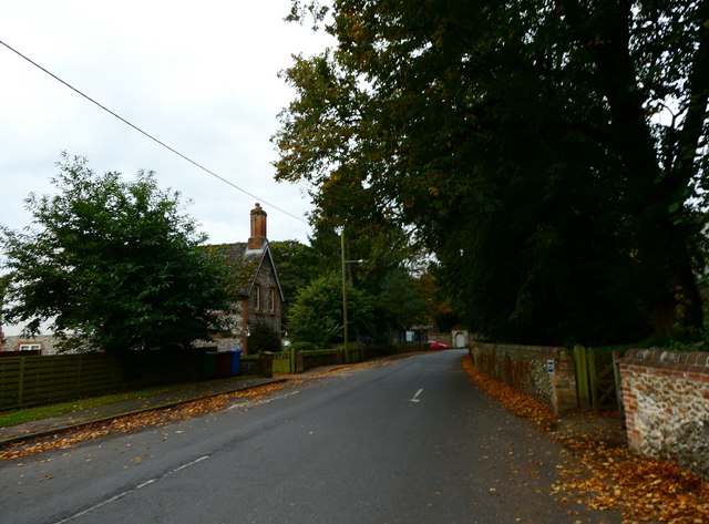
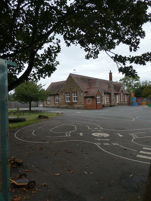
Despite its small size, Docking offers a range of amenities and services to cater to the needs of its residents. These include a local primary school, a village hall, a post office, and a small supermarket. Additionally, there are several pubs and restaurants where visitors can enjoy a meal or a drink.

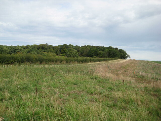
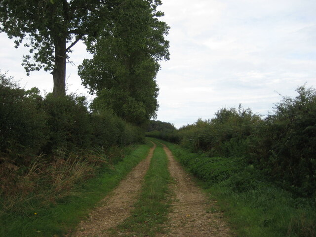
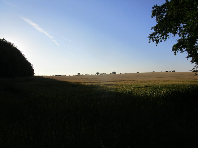
Surrounded by picturesque countryside, Docking is a popular destination for those seeking outdoor activities. The village is an excellent base for exploring the nearby Norfolk Coast Area of Outstanding Natural Beauty, which is renowned for its stunning coastal landscapes, sand dunes, and wildlife. Moreover, the famous Royal Sandringham Estate, the country retreat of the British royal family, is just a short drive away.

In conclusion, Docking offers a peaceful and idyllic setting with a rich historical background. With its amenities, proximity to natural beauty, and cultural attractions, it is a delightful place to visit or call home.

If you have any feedback on the listing, please let us know in the comments section below.

Docking Images

Images are sourced within 2km of 52.90093/0.623717 or Grid Reference TF7636. Thanks to Geograph Open Source API. All images are credited.

Stubble field and York Hill Plantation
The churchyard at Docking The lychgate <span class="nowrap"><a title="https://historicengland.org.uk/listing/the-list/list-entry/1152487?section=official-list-entry" rel="nofollow ugc noopener" href="https://historicengland.org.uk/listing/the-list/list-entry/1152487?section=official-list-entry">Link</a><img style="margin-left:2px;" alt="External link" title="External link - shift click to open in new window" src="https://s1.geograph.org.uk/img/external.png" width="10" height="10"/></span> dates from about 1875 and was probably designed by Frederick Preedy <span class="nowrap"><a title="https://en.wikipedia.org/wiki/Frederick_Preedy" rel="nofollow ugc noopener" href="https://en.wikipedia.org/wiki/Frederick_Preedy">Link</a><img style="margin-left:2px;" alt="External link" title="External link - shift click to open in new window" src="https://s1.geograph.org.uk/img/external.png" width="10" height="10"/></span>
The churchyard at Docking
The lychgate LinkExternal link dates from about 1875 and was probably designed by Frederick Preedy LinkExternal link
Former smithy, Docking
Farm track, Docking
Farm track, Docking
Wheat field near Docking in early morning light
Looking southwards in Church Place towards Chequers Street
St Mary, Docking: tower
St Mary, Docking: path
St Mary, Docking: the churchyard at twilight
Looking eastwards along Chequers Street
Looking northwards along Church Place towards Well Street
St Mary's seen from Chequers Street
St Mary, Docking: churchyard
Docking C of E Primary School: early October 2023
The Old School House, Docking
Docking War Memorial: 1914-1918 names
Docking War Memorial: 1939-1945 names
St Mary, Docking: looking out of the south door
Show me another place!

Docking is located at Grid Ref: TF7636 (Lat: 52.90093, Lng: 0.623717)

Administrative County: Norfolk

District: King's Lynn and West Norfolk

Police Authority: Norfolk

What 3 Words

///divider.committee.fairly. Near Snettisham, Norfolk

Related Wikis

Docking, Norfolk

Docking is a village and ancient civil parish in the north-west of the English county of Norfolk. It is near the North Norfolk Coast Site of Special Scientific...

Docking railway station

Docking railway station was a station in Norfolk, serving the village of Docking. It closed to passengers in 1952. == References ==

Bircham Newton

Bircham Newton is the smallest of the three villages that make up the civil parish of Bircham, in the west of the English county of Norfolk. The village...

RAF Bircham Newton

Royal Air Force Bircham Newton or more simply RAF Bircham Newton is a former Royal Air Force station located 2.1 miles (3.4 km) south east of Docking,...

Stanhoe

Stanhoe is a village and civil parish in the English county of Norfolk, 6.4 miles (10.2 km) from the North Sea. It covers an area of 6.06 km2 (2.34 sq...

RAF Docking

Royal Air Force Docking or more simply RAF Docking is a former Royal Air Force satellite station a few miles from Bircham Newton in Norfolk, England....

Fring, Norfolk

Fring is a civil parish in the English county of Norfolk. It covers an area of 6.93 km2 (2.68 sq mi) and had a population of 94 in 41 households at the...

Stanhoe railway station

Stanhoe was a railway station which served the village of Stanhoe in Norfolk, England. Opened by the West Norfolk Junction Railway in 1866, it closed to...

Nearby Amenities

Located within 500m of 52.90093,0.623717
Docking
Is In District: King's Lynn and West Norfolk
Place: village
Wikidata: Q2659115
Wikipedia: en:Docking, Norfolk
Lat/Long: 52.9004031/0.6284595
nursery, opp
Naptan AtcoCode: 2900D1017
Naptan Bearing: S
Naptan BusStopType: CUS
Naptan CommonName: nursery
Naptan Indicator: opp
Naptan Landmark: nursery
Naptan Locality: Docking
Naptan NaptanCode: nfogmjmj
Naptan ShortCommonName: nursery
Naptan Street: Wells Street
Naptan Verified: no
Source: naptan_import
Lat/Long: 52.9017028/0.6248959
Village Hall, opp
Naptan AtcoCode: 2900D108
Naptan Bearing: W
Naptan BusStopType: CUS
Naptan CommonName: Village Hall
Naptan Indicator: opp
Naptan Landmark: village hall
Naptan Locality: Docking
Naptan NaptanCode: nfoamjdt
Naptan ShortCommonName: village hall
Naptan Street: High Street
Naptan Verified: no
Source: naptan_import
Lat/Long: 52.9000497/0.6280824
Village Hall, adj
Naptan AtcoCode: 2900D109
Naptan Bearing: SE
Naptan BusStopType: CUS
Naptan CommonName: Village Hall
Naptan Indicator: adj
Naptan Landmark: village hall
Naptan Locality: Docking
Naptan NaptanCode: nfoamjdw
Naptan ShortCommonName: village hall
Naptan Street: High Street
Naptan Verified: no
Source: naptan_import
Lat/Long: 52.9001346/0.6283106
Post Office
Docking Post Office
Addr City: King's Lynn
Addr Country: GB
Addr Postcode: PE31 8LS
Addr Suburb: Docking
Brand: Post Office
Brand Wikidata: Q1783168
Contact Website: https://www.postoffice.co.uk/branch-finder/0671312/docking
Ref Pol Id: 469
Lat/Long: 52.9033512/0.6239119
Telephone
Booth: K6
Covered: booth
Lat/Long: 52.9002921/0.6276061
Manor Farm
Place: farm
Lat/Long: 52.9023997/0.6250093
North Farm
Place: farm
Lat/Long: 52.9048141/0.6238628
Hall Farm
Place: farm
Lat/Long: 52.900534/0.6215881
The Mount
Ele: 89
Natural: peak
Lat/Long: 52.8985945/0.6191149
The Park
Place: locality
Lat/Long: 52.898336/0.6259107
Leisure: picnic_table
Lat/Long: 52.901217/0.623863
Entrance: yes
Lat/Long: 52.9011595/0.6233811
Barrier: lych_gate
Foot: yes
Lat/Long: 52.9010292/0.6235895
Entrance: main
Lat/Long: 52.9011336/0.6229791
Give Way
Lat/Long: 52.9008741/0.6259017
Docking
Colour: brown
Inscription: Docca. / G.R. / 12th May. / 1937.
Man Made: village_sign
Material: wood
Lat/Long: 52.9009597/0.6257017
Defibrillator
Defibrillator Location: outside Docking Village hall - to right of entrance
Emergency: defibrillator
Indoor: no
Lat/Long: 52.9002194/0.6282816
Entrance: yes
Lat/Long: 52.9002223/0.6282567
Post Box
Collection Times: Mo-Fr 17:00; Sa 10:00
Operator: Royal Mail
Operator Wikidata: Q638098
Post Box Design: type_a
Post Box Type: pillar
Ref: PE31 160
Lat/Long: 52.9033155/0.6238027
Material: wood
Power: pole
Lat/Long: 52.9025166/0.6265552
Material: wood
Power: pole
Lat/Long: 52.9042123/0.6252434
Material: wood
Power: pole
Lat/Long: 52.9025709/0.6252924
Material: wood
Power: pole
Lat/Long: 52.9008075/0.6281489
Material: wood
Power: pole
Lat/Long: 52.9020682/0.6269807
Material: wood
Power: pole
Lat/Long: 52.9014543/0.6275564
Material: wood
Power: pole
Lat/Long: 52.9050347/0.6252104
Material: wood
Power: pole
Lat/Long: 52.903423/0.6252532
The data included in this document is from www.openstreetmap.org. The data is made available under ODbL.

Have you been to Docking?

Leave your review of Docking below (or comments, questions and feedback).