Otters Hill Copse

Wood, Forest in Hampshire New Forest

England

Otters Hill Copse

Pylewell, farm buildings At Pylewell Home Farm.
Pylewell, farm buildings Credit: Mike Faherty

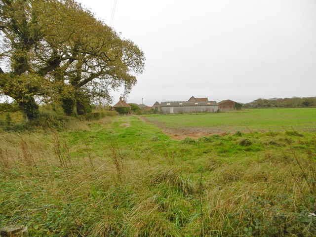
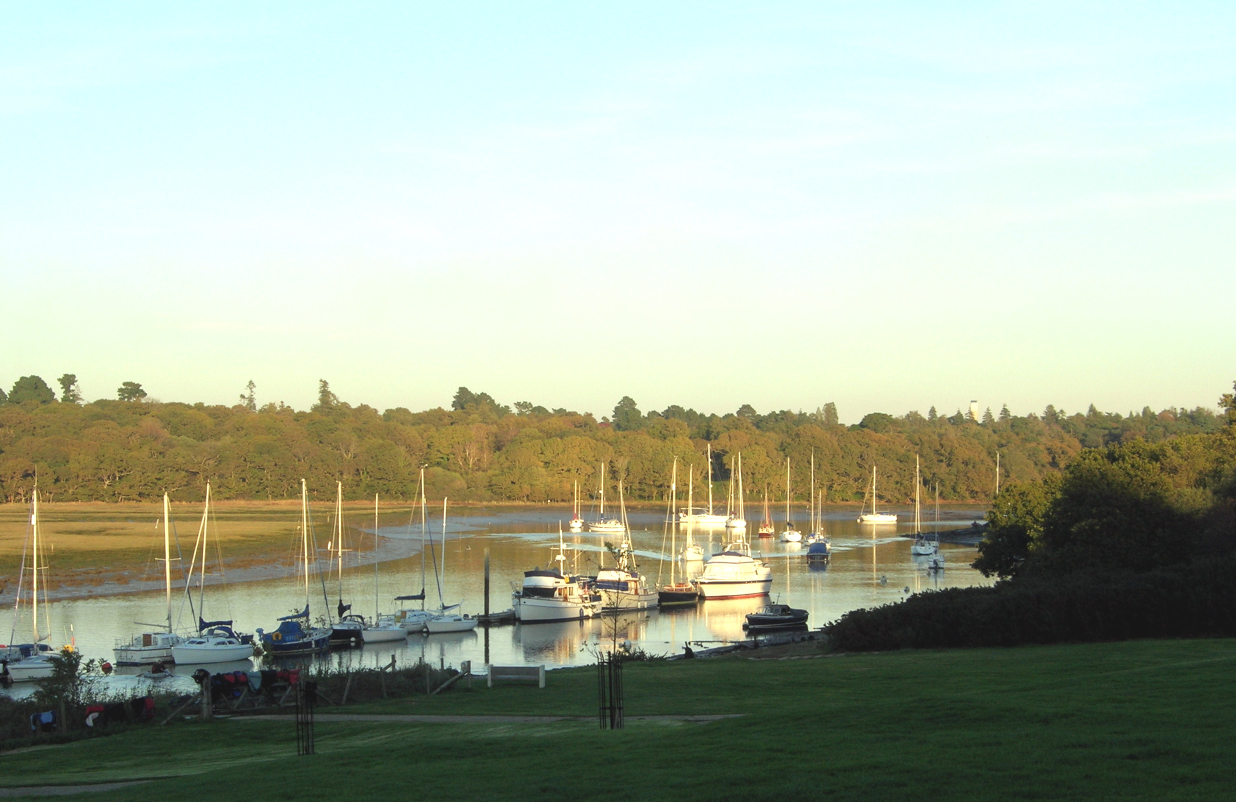
Otters Hill Copse is a charming woodland located in the county of Hampshire, England. Stretching across an area of approximately 100 acres, this copse is a delightful natural retreat for both locals and visitors alike.

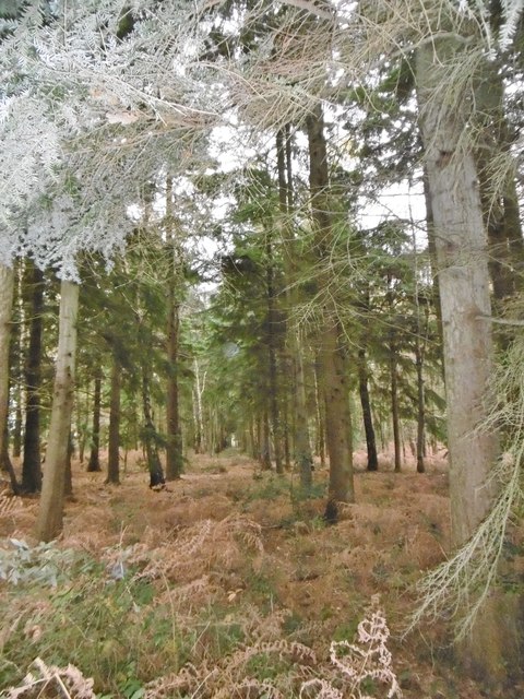
The copse is predominantly composed of native tree species such as oak, beech, and birch, which create a diverse and verdant canopy. The dense foliage provides a cool and tranquil atmosphere, making it a perfect escape from the hustle and bustle of everyday life. Throughout the year, the copse undergoes a beautiful transformation, with vibrant spring blossoms, lush summer greenery, and stunning autumn foliage.

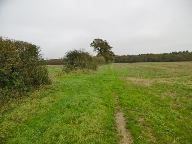
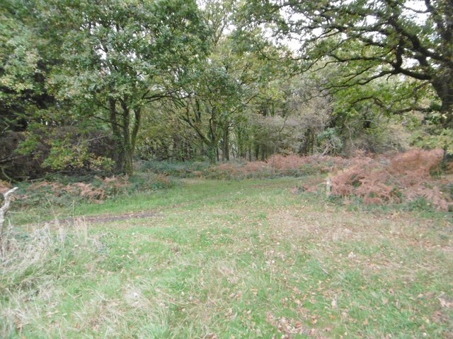
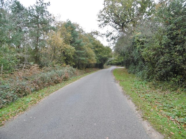
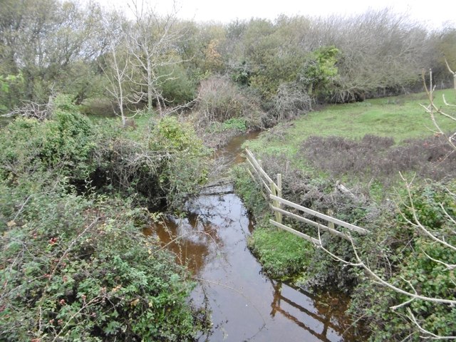
Within Otters Hill Copse, a network of well-maintained footpaths meander through the woodland, offering visitors the opportunity to explore the area at their own pace. These paths wind around babbling brooks, tranquil ponds, and open clearings, providing picturesque spots for picnics or simply enjoying the peaceful surroundings.

The copse is also home to a wide variety of wildlife, including the elusive otter, which gives the woodland its name. Other notable species that can be spotted here include deer, foxes, badgers, and a plethora of bird species. Nature enthusiasts and birdwatchers will certainly find themselves captivated by the copse's biodiversity.

Otters Hill Copse is open to the public year-round, free of charge. Its natural beauty, tranquility, and abundant wildlife make it a popular destination for nature lovers, hikers, and families seeking a peaceful retreat in the heart of Hampshire.

If you have any feedback on the listing, please let us know in the comments section below.

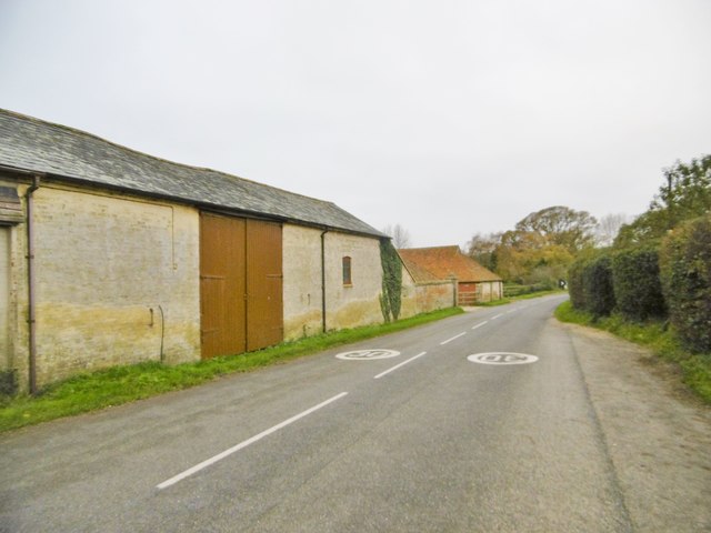
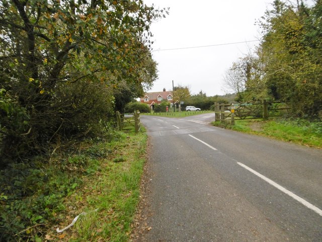
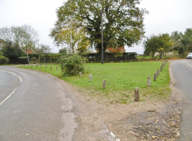
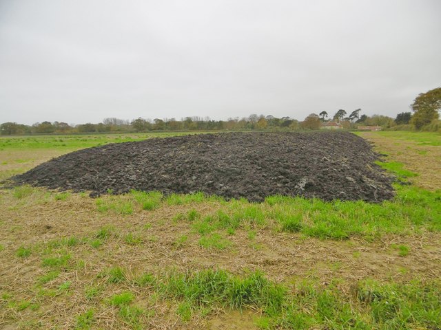
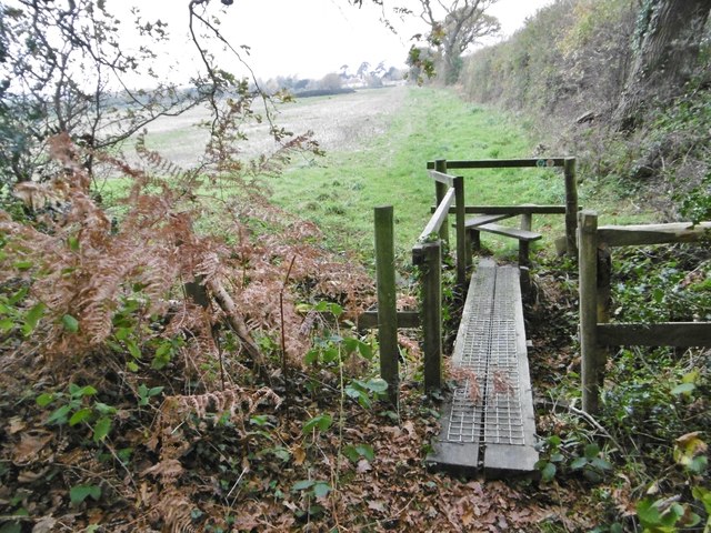
Otters Hill Copse Images

Images are sourced within 2km of 50.760213/-1.488567 or Grid Reference SZ3695. Thanks to Geograph Open Source API. All images are credited.

Pylewell, farm buildings At Pylewell Home Farm.
Pylewell, farm buildings
At Pylewell Home Farm.
Pylewell, cattle grid At the settlement's entrance. East of here, New Forest Commoners' livestock are allowed to graze.
Pylewell, cattle grid
At the settlement's entrance. East of here, New Forest Commoners' livestock are allowed to graze.
Pylewell, green At the junction of roads to Sowley, East End and Walhampton. This forms part of the Solent Way. <span class="nowrap"><a title="http://www3.hants.gov.uk/longdistance/walking-solentway.htm" rel="nofollow ugc noopener" href="http://www3.hants.gov.uk/longdistance/walking-solentway.htm">Link</a><img style="margin-left:2px;" alt="External link" title="External link - shift click to open in new window" src="https://s1.geograph.org.uk/img/external.png" width="10" height="10"/></span>
Pylewell, green
At the junction of roads to Sowley, East End and Walhampton. This forms part of the Solent Way. LinkExternal link
Pylewell, footpath Along a field margin, from Pylewell to Sowley Lane, via Sowley Brooms. This path forms part of the Solent Way: <span class="nowrap"><a title="http://www3.hants.gov.uk/longdistance/walking-solentway.htm" rel="nofollow ugc noopener" href="http://www3.hants.gov.uk/longdistance/walking-solentway.htm">Link</a><img style="margin-left:2px;" alt="External link" title="External link - shift click to open in new window" src="https://s1.geograph.org.uk/img/external.png" width="10" height="10"/></span>
Pylewell, footpath
Along a field margin, from Pylewell to Sowley Lane, via Sowley Brooms. This path forms part of the Solent Way: LinkExternal link
Sowley, clamp In a field next to Sowley Brooms.
Sowley, clamp
In a field next to Sowley Brooms.
Sowley, footbridge & stile Leaving Sowley Brooms to cross farmland to Pylewell, on the Solent Way: <span class="nowrap"><a title="http://www3.hants.gov.uk/longdistance/walking-solentway.htm" rel="nofollow ugc noopener" href="http://www3.hants.gov.uk/longdistance/walking-solentway.htm">Link</a><img style="margin-left:2px;" alt="External link" title="External link - shift click to open in new window" src="https://s1.geograph.org.uk/img/external.png" width="10" height="10"/></span>
Sowley, footbridge & stile
Leaving Sowley Brooms to cross farmland to Pylewell, on the Solent Way: LinkExternal link
Sowley Brooms A mixed woodland plantation; in this section, conifers.
Sowley Brooms
A mixed woodland plantation; in this section, conifers.
Sowley Brooms, footpath junction Take the second path for Pylewell, on the Solent Way. <span class="nowrap"><a title="http://www3.hants.gov.uk/longdistance/walking-solentway.htm" rel="nofollow ugc noopener" href="http://www3.hants.gov.uk/longdistance/walking-solentway.htm">Link</a><img style="margin-left:2px;" alt="External link" title="External link - shift click to open in new window" src="https://s1.geograph.org.uk/img/external.png" width="10" height="10"/></span>
Sowley Brooms, footpath junction
Take the second path for Pylewell, on the Solent Way. LinkExternal link
Sowley, farm track Between Sowley Brooms (left) and open farmland; on the Solent Way. <span class="nowrap"><a title="http://www3.hants.gov.uk/longdistance/walking-solentway.htm" rel="nofollow ugc noopener" href="http://www3.hants.gov.uk/longdistance/walking-solentway.htm">Link</a><img style="margin-left:2px;" alt="External link" title="External link - shift click to open in new window" src="https://s1.geograph.org.uk/img/external.png" width="10" height="10"/></span>
Sowley, farm track
Between Sowley Brooms (left) and open farmland; on the Solent Way. LinkExternal link
Sowley, Solent Way Part of the long-distance path from Milford to Emsworth; this section skirts farmland to Sowley Lane. <span class="nowrap"><a title="http://www3.hants.gov.uk/longdistance/walking-solentway.htm" rel="nofollow ugc noopener" href="http://www3.hants.gov.uk/longdistance/walking-solentway.htm">Link</a><img style="margin-left:2px;" alt="External link" title="External link - shift click to open in new window" src="https://s1.geograph.org.uk/img/external.png" width="10" height="10"/></span>
Sowley, Solent Way
Part of the long-distance path from Milford to Emsworth; this section skirts farmland to Sowley Lane. LinkExternal link
Sowley, cropland A field of young cereals.
Sowley, cropland
A field of young cereals.
Sowley, kissing gate Leaving Sowley Lane, to walk next to farmland towards Pylewell, on the Solent Way: <span class="nowrap"><a title="http://www3.hants.gov.uk/longdistance/walking-solentway.htm" rel="nofollow ugc noopener" href="http://www3.hants.gov.uk/longdistance/walking-solentway.htm">Link</a><img style="margin-left:2px;" alt="External link" title="External link - shift click to open in new window" src="https://s1.geograph.org.uk/img/external.png" width="10" height="10"/></span>
Sowley, kissing gate
Leaving Sowley Lane, to walk next to farmland towards Pylewell, on the Solent Way: LinkExternal link
Sowley, Browns Lane One of several lanes from Sowley Lane to the coastline; all are private, and give no access to the coast. This lane leads to Sowley Gate House.
Sowley, Browns Lane
One of several lanes from Sowley Lane to the coastline; all are private, and give no access to the coast. This lane leads to Sowley Gate House.
Sowley Farm Looking at surrounding fields, the farm is given over to cereal production.
Sowley Farm
Looking at surrounding fields, the farm is given over to cereal production.
Sowley Pond In scale, more of a lake than a pond; fed by Crockford Stream, and flowing into the Solent at Sowley Marsh. <span class="nowrap"><a title="https://en.wikipedia.org/wiki/Sowley_Pond" rel="nofollow ugc noopener" href="https://en.wikipedia.org/wiki/Sowley_Pond">Link</a><img style="margin-left:2px;" alt="External link" title="External link - shift click to open in new window" src="https://s1.geograph.org.uk/img/external.png" width="10" height="10"/></span>
Sowley Pond
In scale, more of a lake than a pond; fed by Crockford Stream, and flowing into the Solent at Sowley Marsh. LinkExternal link
Sowley, drive Entrance to Sowley House (in the distance), centrepiece of the Sowley Estate.
Sowley, drive
Entrance to Sowley House (in the distance), centrepiece of the Sowley Estate.
Sowley Lane Country lane from Pylewell to St Leonards Road.
Sowley Lane
Country lane from Pylewell to St Leonards Road.
East End, Crockford Stream Looking upstream from East End Bridge.
East End, Crockford Stream
Looking upstream from East End Bridge.
Show me another place!

Otters Hill Copse is located at Grid Ref: SZ3695 (Lat: 50.760213, Lng: -1.488567)

Administrative County: Hampshire

District: New Forest

Police Authority: Hampshire

What 3 Words

///swooning.thigh.loser. Near Lymington, Hampshire

Related Wikis

Pylewell Park

Pylewell Park is a country house and park near Lymington in Hampshire. It is listed as grade II*. == History == A settlement on the site of Baddesley Manor...

Boldre Foreshore

Boldre Foreshore is a 193.3-hectare (478-acre) Local Nature Reserve east of Lymington in Hampshire. It is owned by New Forest District Council and managed...

South Baddesley

South Baddesley is a small village in the civil parish of Boldre in the New Forest National Park of Hampshire, England. It lies 2.3 miles (3.7 km) north...

East End, Hampshire

East End is a hamlet in the civil parish of East Boldre in the New Forest National Park of Hampshire, England. Its nearest town is Lymington, which lies...

South Hampshire Coast

The South Hampshire Coast was an Area of Outstanding Natural Beauty (AONB) in Hampshire, England, UK that was subsumed into the New Forest National Park...

Sowley Pond

Sowley Pond is a 49.3-hectare (122-acre) biological Site of Special Scientific Interest east of Lymington in Hampshire. It is part of Solent and Southampton...
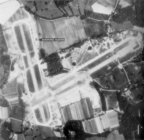
RAF Lymington

Royal Air Force Lymington or more simply RAF Lymington is a former Royal Air Force Advanced Landing Ground in Hampshire, England. The airfield is located...

Norley Wood

Norley Wood (or Norleywood) is a hamlet in the New Forest National Park of Hampshire, England. It is in the civil parish of Boldre. Its nearest town...

Nearby Amenities

Located within 500m of 50.760213,-1.488567
The data included in this document is from www.openstreetmap.org. The data is made available under ODbL.

Have you been to Otters Hill Copse?

Leave your review of Otters Hill Copse below (or comments, questions and feedback).