Church Wood

Wood, Forest in Yorkshire Harrogate

England

Church Wood

Newby Hall
Newby Hall Credit: habiloid

Church Wood is a picturesque woodland located in Yorkshire, England. Situated in the heart of the county, it covers a vast area of approximately 150 acres. The wood is known for its rich biodiversity, featuring a diverse range of plant and animal species, making it a popular destination for nature enthusiasts and hikers.

The wood is predominantly composed of broadleaf trees, including oak, beech, and ash, which provide a stunning canopy during the summer months. These trees create a tranquil and serene atmosphere, offering a peaceful escape from the hustle and bustle of city life.

Church Wood is crisscrossed with a network of well-maintained walking trails, allowing visitors to explore its beauty at their own pace. The trails lead to various points of interest within the wood, such as a charming pond teeming with aquatic life and a quaint wooden bridge that adds to the enchanting ambiance.

Wildlife thrives within the wood, with a plethora of bird species, including woodpeckers, owls, and various songbirds. The wood is also home to many small mammals, such as squirrels, rabbits, and hedgehogs. If lucky, visitors may even catch a glimpse of deer grazing amidst the trees.

The wood's historical significance is evident in the presence of an ancient church ruin, which stands as a testament to its past. This historical landmark adds an extra layer of intrigue and charm to the wood, making it a fascinating place to explore.

Overall, Church Wood offers a delightful and immersive experience in nature, where visitors can immerse themselves in its beauty and tranquility. Whether it be for a leisurely stroll, birdwatching, or simply enjoying the peace and solitude, Church Wood is a treasure trove waiting to be discovered in Yorkshire.

If you have any feedback on the listing, please let us know in the comments section below.

Church Wood Images

Images are sourced within 2km of 54.107049/-1.4500195 or Grid Reference SE3668. Thanks to Geograph Open Source API. All images are credited.

Newby Hall
Newby Hall
Pond and statue, Newby Hall
River Ure at Roecliffe Grange
Westwick Lock
Westwick Lock
Skelton, Pasture Lane, Low Moor House The benchmark is cut into the gable end of a stone agricultural building and is to the left of a drainpipe. The cutmark is damaged.
Skelton, Pasture Lane, Low Moor House
The benchmark is cut into the gable end of a stone agricultural building and is to the left of a drainpipe. The cutmark is damaged.
Skelton, Pasture Lane, Low Moor House There is a benchmark cut into the gable end of the stone agricultural building and is to the left of the furthest left green drainpipe. The cutmark is damaged.
Skelton, Pasture Lane, Low Moor House
There is a benchmark cut into the gable end of the stone agricultural building and is to the left of the furthest left green drainpipe. The cutmark is damaged.
Skelton on Ure, old agricultural barn The benchmark is cut into the left cornerstones of this old farm building situated on the edge of the village.
Skelton on Ure, old agricultural barn
The benchmark is cut into the left cornerstones of this old farm building situated on the edge of the village.
Skelton on Ure, old agricultural building There is a benchmark cut into the left cornerstones of this old farm building which is situated on the edge of the village and road junction.
Skelton on Ure, old agricultural building
There is a benchmark cut into the left cornerstones of this old farm building which is situated on the edge of the village and road junction.
Skelton on Ure, converted Methodist church The OS Flush Bracket S6737 is embedded in the south facing wall of the converted Methodist church.
Skelton on Ure, converted Methodist church
The OS Flush Bracket S6737 is embedded in the south facing wall of the converted Methodist church.
Skelton on Ure, converted Methodist church There is OS Flush Bracket S6737 embedded into the south facing wall of the converted Methodist church.
Skelton on Ure, converted Methodist church
There is OS Flush Bracket S6737 embedded into the south facing wall of the converted Methodist church.
Skelton on Ure, Black Lion PH The benchmark is cut across 2 courses of bricks on the left hand side of the road facing wall.
Skelton on Ure, Black Lion PH
The benchmark is cut across 2 courses of bricks on the left hand side of the road facing wall.
Skelton on Ure, closed Black Lion PH There is a benchmark cut across 2 courses of bricks on the left hand side of the road facing wall. Another closed and boarded up village pub.
Skelton on Ure, closed Black Lion PH
There is a benchmark cut across 2 courses of bricks on the left hand side of the road facing wall. Another closed and boarded up village pub.
Skelton on Ure, Christ the Consoler The benchmark is cut into the north-east facing wall, directly under a marvellous rose shaped stained glass window.
Skelton on Ure, Christ the Consoler
The benchmark is cut into the north-east facing wall, directly under a marvellous rose shaped stained glass window.
Skelton on Ure, Christ the Consoler There is a benchmark cut into the north-east facing wall, directly under the marvellous rose shaped stained glass window.
Skelton on Ure, Christ the Consoler
There is a benchmark cut into the north-east facing wall, directly under the marvellous rose shaped stained glass window.
Skelton on Ure, Christ the Consoler This is the 2nd benchmark cut into the church wall, and is on the south east facing wall.
Skelton on Ure, Christ the Consoler
This is the 2nd benchmark cut into the church wall, and is on the south east facing wall.
Skelton on Ure, Christ the Consoler There is a 2nd benchmark cut into the church wall, and this one is cut into the south east facing wall.
Skelton on Ure, Christ the Consoler
There is a 2nd benchmark cut into the church wall, and this one is cut into the south east facing wall.
Skelton on Ure, 18 Main Street The benchmark is cut into the right side of the road facing wall of this house.
Skelton on Ure, 18 Main Street
The benchmark is cut into the right side of the road facing wall of this house.
Skelton on Ure, 18 Main Street There is a benchmark cut into the right side of the road facing wall of this house. The mark is about 18 inches from ground level and is slightly damaged.
Skelton on Ure, 18 Main Street
There is a benchmark cut into the right side of the road facing wall of this house. The mark is about 18 inches from ground level and is slightly damaged.
Show me another place!

Church Wood is located at Grid Ref: SE3668 (Lat: 54.107049, Lng: -1.4500195)

Division: West Riding

Administrative County: North Yorkshire

District: Harrogate

Police Authority: North Yorkshire

What 3 Words

///clearcut.essays.moved. Near Boroughbridge, North Yorkshire

Related Wikis

Church of Christ the Consoler

The Church of Christ the Consoler is a Victorian Gothic Revival church built in the Early English style by William Burges. It is located in the grounds...

Spectre of Newby Church

The Spectre of Newby Church (or the Newby Monk) is the name given to a figure found in a photograph taken in the Church of Christ the Consoler, on the...

Skelton-on-Ure

Skelton-on-Ure or Skelton is a village and civil parish in the district and county of North Yorkshire, England. It is situated 1.9 miles (3 km) west of...

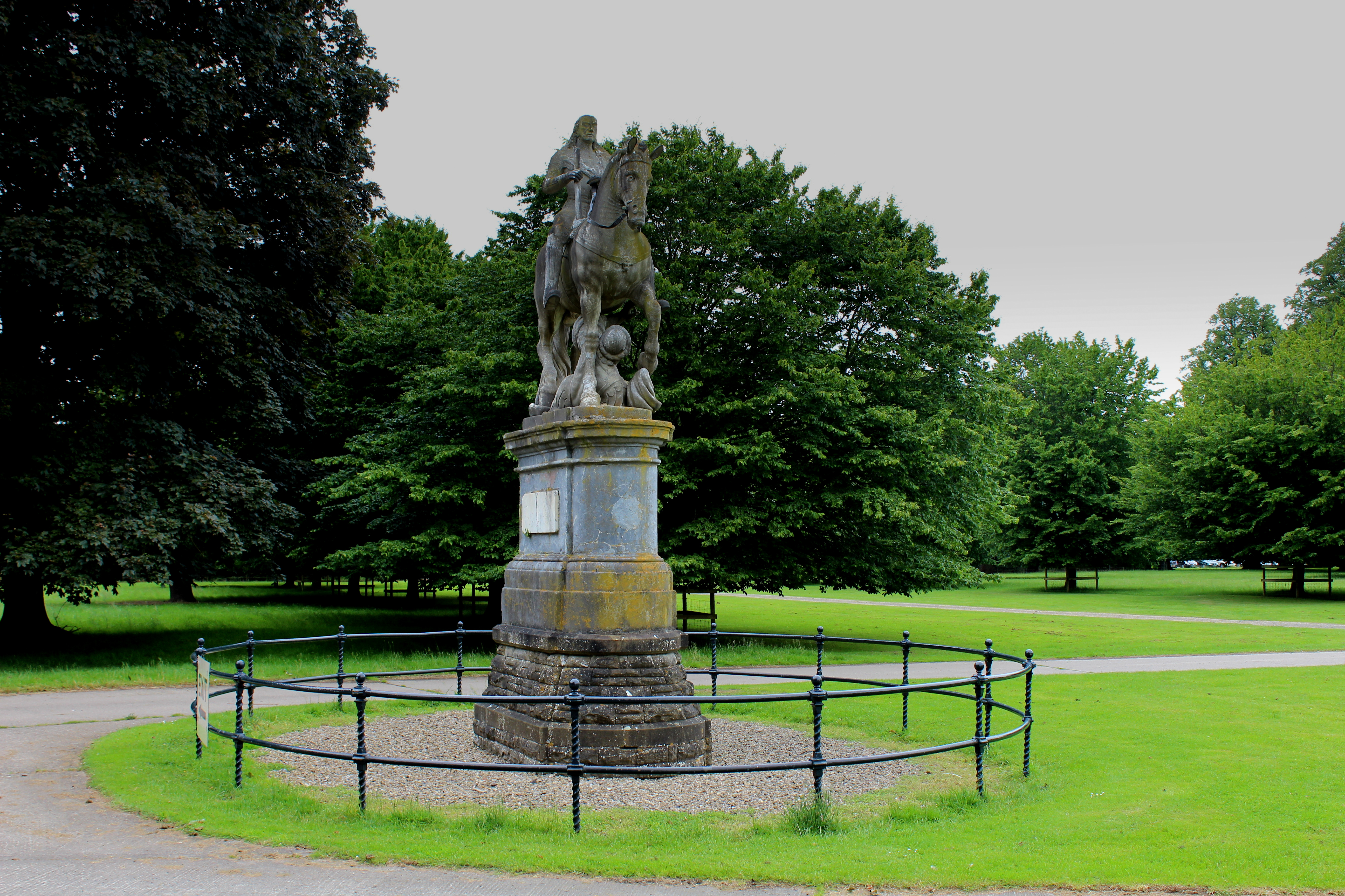
Equestrian statue of Charles II trampling Cromwell

An equestrian statue of Charles II trampling Cromwell stands near Newby Hall in North Yorkshire, England. It was previously sited at Gautby Hall in Lincolnshire...
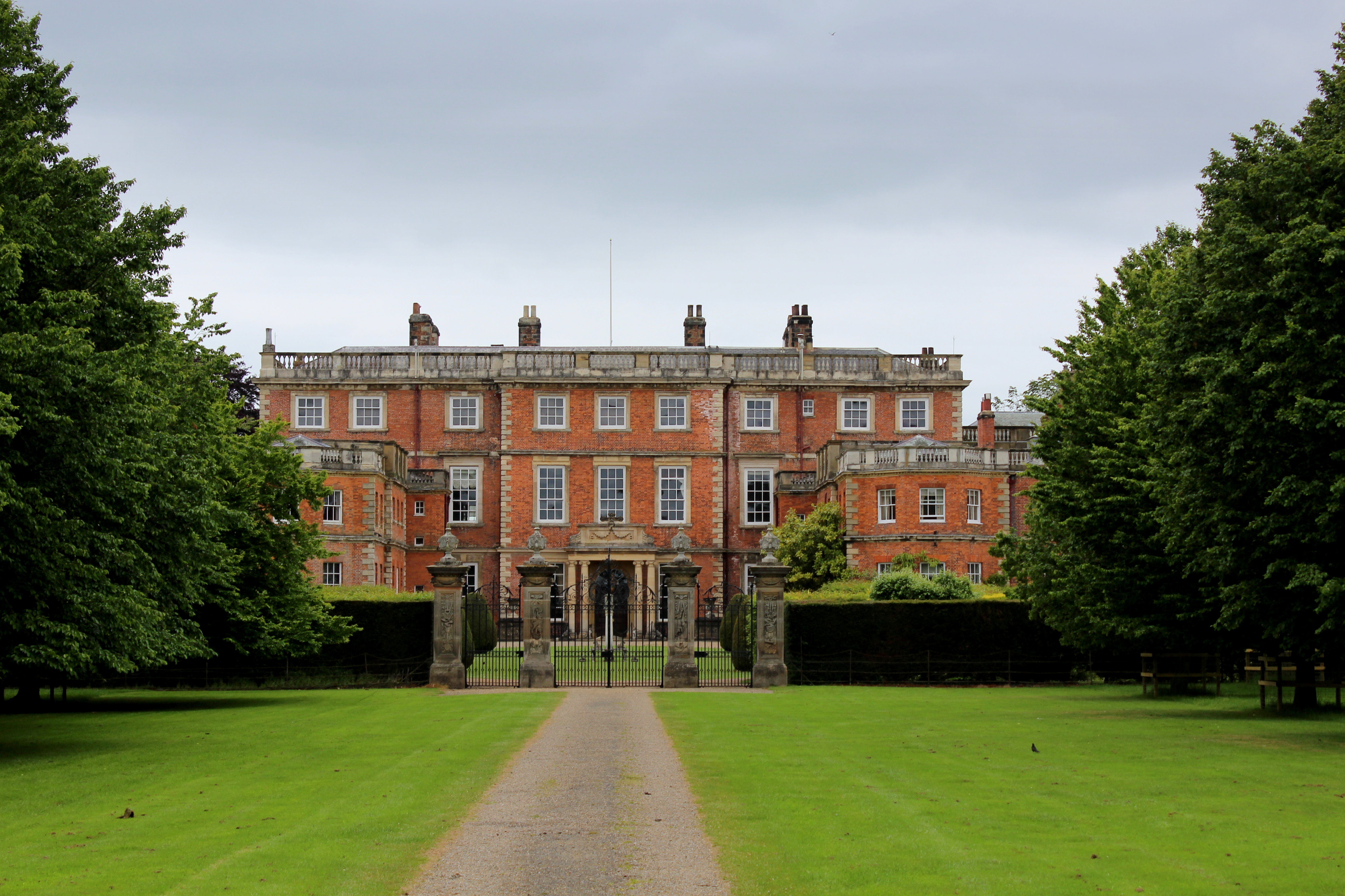
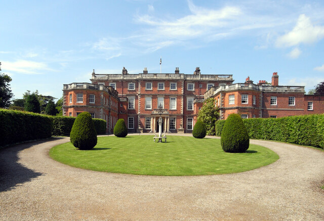
Newby Hall

Newby Hall is a country house beside the River Ure in the parish of Skelton-on-Ure in North Yorkshire, England. It is 3 miles (4.8 km) south-east of Ripon...

Westwick, North Yorkshire

Westwick is a civil parish in Harrogate district in North Yorkshire, England. It lies 3 miles (5 km) west of Boroughbridge, on the south bank of the River...
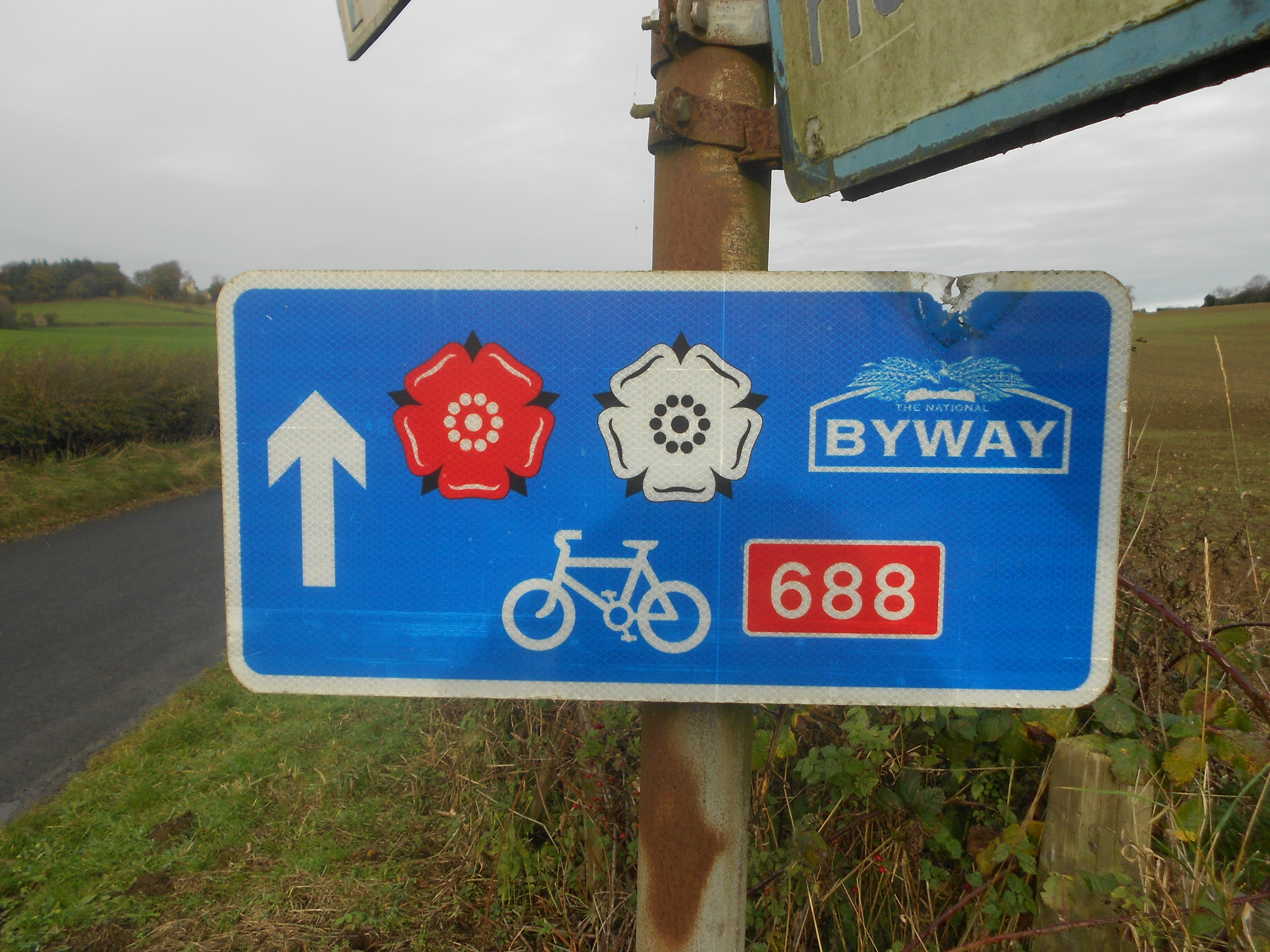
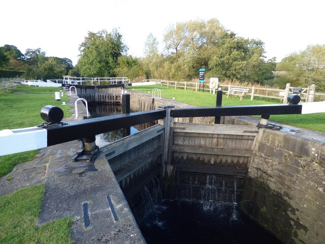
Way of the Roses

The Way of the Roses is the newest of Great Britain's coast-to-coast long-distance cycle routes and is based on minor roads, disused railway lines and...

St Mary's Church, Roecliffe

St Mary's Church is a redundant Church of England parish church in the village of Roecliffe, North Yorkshire, England (grid reference SE375659). It is...

Nearby Amenities

Located within 500m of 54.107049,-1.4500195
Created By: Merkaartor 0.13
Lat/Long: 54.1090553/-1.4492351
Created By: Merkaartor 0.13
Lat/Long: 54.1082817/-1.4490816
Created By: Merkaartor 0.13
Lat/Long: 54.1075288/-1.4486567
Created By: Merkaartor 0.13
Lat/Long: 54.1076256/-1.4480311
Created By: Merkaartor 0.13
Lat/Long: 54.1075151/-1.4448086
Post Box
Collection Times: Mo-Fr 16:15; Sa 09:45
Operator: Royal Mail
Post Box Type: wall
Ref: HG4 48
Royal Cypher: EIIR
Royal Cypher Wikidata: Q33102113
Lat/Long: 54.1100998/-1.4493724
Leisure: playground
Lat/Long: 54.1096996/-1.4511551
Post Office
Village Store
Shop: convenience
Lat/Long: 54.1101046/-1.4495965
Bus Stop
Naptan AtcoCode: 3200YNA01344
Naptan NaptanCode: 32001344
Shelter: yes
Lat/Long: 54.1102241/-1.4493457
Pub
Black Lion
Lat/Long: 54.1091337/-1.4491005
Defibrillator
Emergency: defibrillator
Opening Hours: 24/7
Lat/Long: 54.1101422/-1.4496176
Public Bookcase
Village Office
Booth: K6
Disused Amenity: telephone
Man Made: telephone_box
Public Bookcase Type: phone_box
Lat/Long: 54.108032/-1.4490904
The data included in this document is from www.openstreetmap.org. The data is made available under ODbL.

Have you been to Church Wood?

Leave your review of Church Wood below (or comments, questions and feedback).