Parlour Spinney

Wood, Forest in Warwickshire Warwick

England

Parlour Spinney

HS2 in the Leam Valley, June 2021 (2) HS2 will cross the picture in a cutting through the field second from the camera. This view is some way to the right of <a href="https://www.geograph.org.uk/photo/6902780">SP3568 : HS2 in the Leam Valley, June 2021 (1)</a>, from further up Welsh Road. Some field boundaries are missing.
HS2 in the Leam Valley, June 2021 (2) Credit: Robin Stott

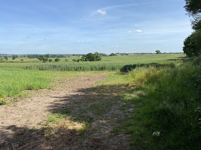
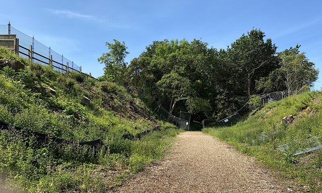
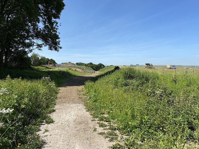
Parlour Spinney is a charming woodland area located in Warwickshire, England. This hidden gem is nestled within the heart of the county, offering a tranquil retreat for nature lovers and outdoor enthusiasts alike. The spinney covers an area of approximately 20 acres and is characterized by its dense canopy of trees, creating a secluded and peaceful atmosphere.

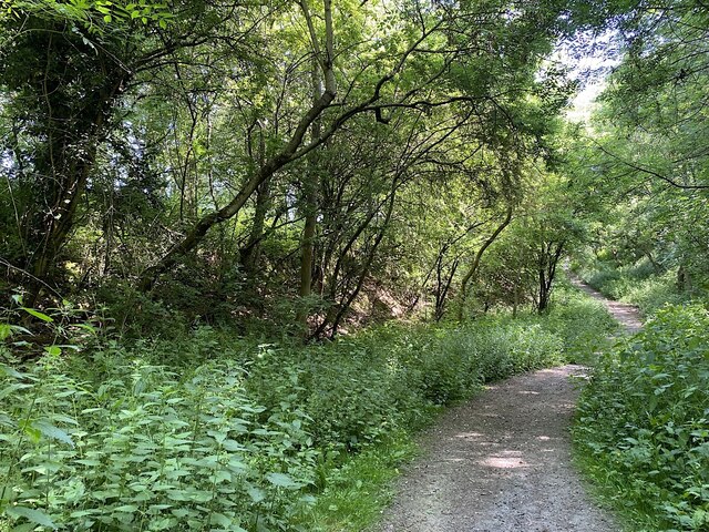
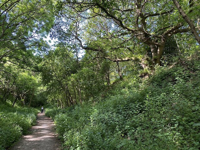
The woodland is predominantly made up of native British species, including oak, ash, birch, and beech trees. These towering giants provide a protective canopy that shields the forest floor from excessive sunlight, resulting in a rich and diverse understory of plants and wildlife.

The forest floor is carpeted with a variety of wildflowers, such as bluebells, wood anemones, and primroses, which burst into a riot of color during the spring months. The area is also home to an abundance of wildlife, including deer, foxes, badgers, and a myriad of bird species. Birdwatchers can spot woodpeckers, finches, and thrushes among the treetops.

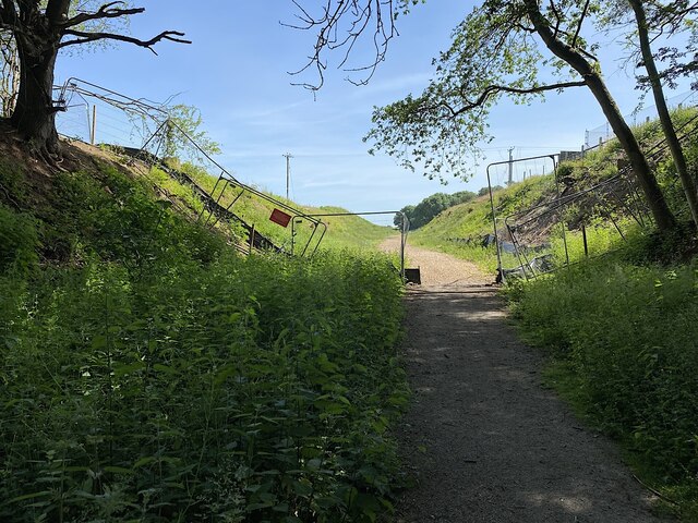
Parlour Spinney offers a network of meandering footpaths, allowing visitors to explore the woodland at their own pace. These paths wind through the forest, taking visitors past babbling streams and picturesque clearings. The peaceful ambiance of the spinney makes it an ideal spot for nature walks, picnics, or simply finding a quiet spot to relax and enjoy the natural beauty.

Overall, Parlour Spinney is a delightful woodland retreat in Warwickshire. Its serene atmosphere, diverse plant life, and abundant wildlife make it a perfect destination for those seeking a peaceful escape into nature.

If you have any feedback on the listing, please let us know in the comments section below.

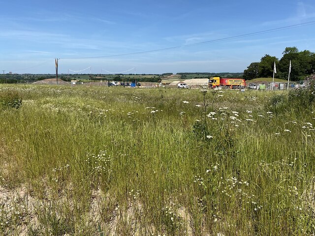
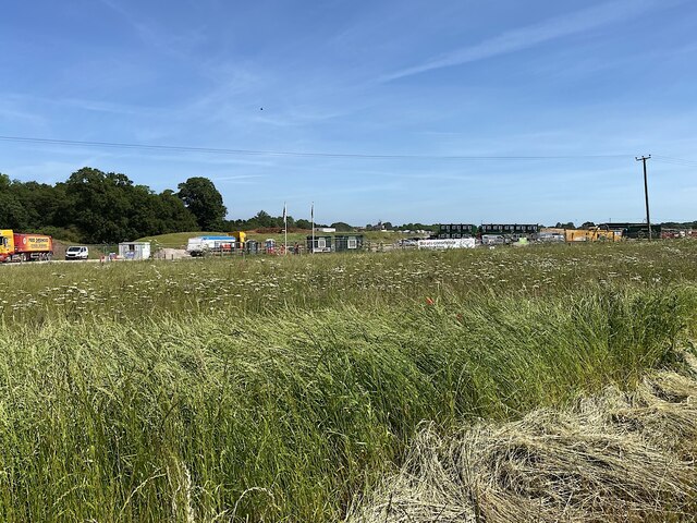
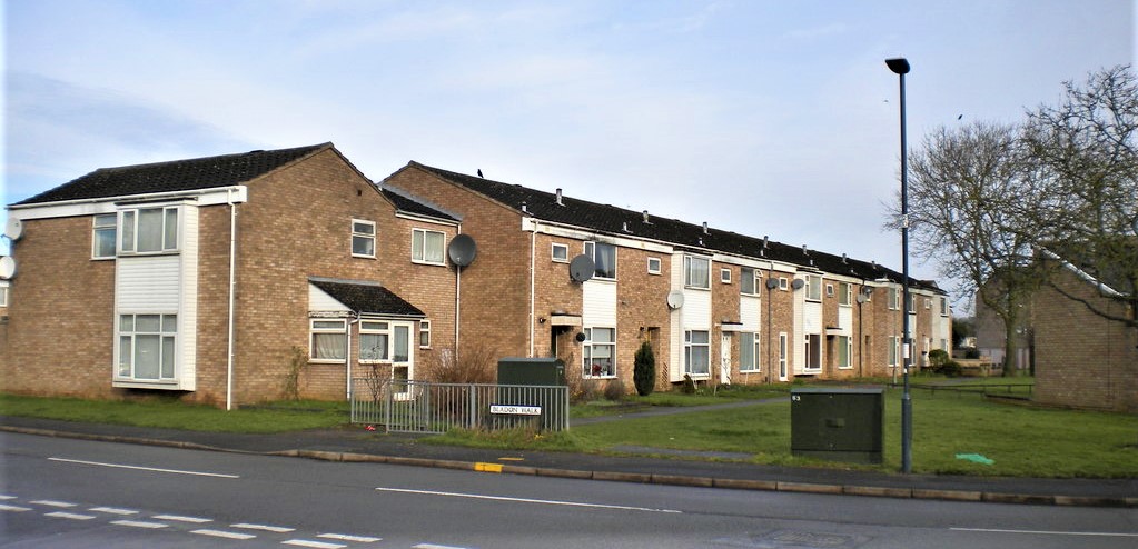
Parlour Spinney Images

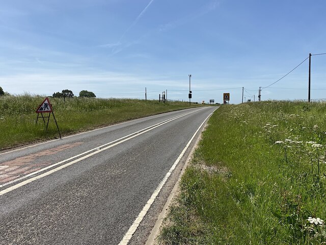
Images are sourced within 2km of 52.274074/-1.4730638 or Grid Reference SP3664. Thanks to Geograph Open Source API. All images are credited.

HS2 in the Leam Valley, June 2021 (2) HS2 will cross the picture in a cutting through the field second from the camera. This view is some way to the right of <a href="https://www.geograph.org.uk/photo/6902780">SP3568 : HS2 in the Leam Valley, June 2021 (1)</a>, from further up Welsh Road. Some field boundaries are missing.
HS2 in the Leam Valley, June 2021 (2)
HS2 will cross the picture in a cutting through the field second from the camera. This view is some way to the right of SP3568 : HS2 in the Leam Valley, June 2021 (1), from further up Welsh Road. Some field boundaries are missing.
HS2 enabling works, Welsh Road area, June 2021 (1) This is the entry to the northern leg of the Offchurch Greenway, a footpath and cycleway following the line of the former railway between Rugby and Leamington Spa, much of it in cuttings. It will be crossed by HS2. This gate is on the west side of the junction of Welsh Road and Long Itchington Road. <span class="nowrap"><a title="https://countryparks.warwickshire.gov.uk/offchurchgreenway" rel="nofollow ugc noopener" href="https://countryparks.warwickshire.gov.uk/offchurchgreenway">Link</a><img style="margin-left:2px;" alt="External link" title="External link - shift click to open in new window" src="https://s1.geograph.org.uk/img/external.png" width="10" height="10"/></span>
HS2 enabling works, Welsh Road area, June 2021 (1)
This is the entry to the northern leg of the Offchurch Greenway, a footpath and cycleway following the line of the former railway between Rugby and Leamington Spa, much of it in cuttings. It will be crossed by HS2. This gate is on the west side of the junction of Welsh Road and Long Itchington Road. LinkExternal link
HS2 enabling works, Welsh Road area, June 2021 (2) This is the staggered junction of Welsh Road, to right and left (out of shot), Offchurch Lane ahead continuing as Long Itchington Road behind the camera. Originally there was a railway bridge here with a two-way junction at either end. In time, the bridge was removed and the railway cutting filled in to form the present junction. It is fast, unpredictable and risky: remodelling as part of the HS2 works should make it safer.
HS2 enabling works, Welsh Road area, June 2021 (2)
This is the staggered junction of Welsh Road, to right and left (out of shot), Offchurch Lane ahead continuing as Long Itchington Road behind the camera. Originally there was a railway bridge here with a two-way junction at either end. In time, the bridge was removed and the railway cutting filled in to form the present junction. It is fast, unpredictable and risky: remodelling as part of the HS2 works should make it safer.
HS2 enabling works, Welsh Road area, June 2021 (3) This is the sign on the gate into the Offchurch Greenway <a href="https://www.geograph.org.uk/photo/6902975">SP3665 : HS2 enabling works, Welsh Road area, June 2021 (1)</a>. It says that the Greenway will be closed temporarily from mid-to-late November 2020. The plan shows a short section and a diversion.
HS2 enabling works, Welsh Road area, June 2021 (3)
This is the sign on the gate into the Offchurch Greenway SP3665 : HS2 enabling works, Welsh Road area, June 2021 (1). It says that the Greenway will be closed temporarily from mid-to-late November 2020. The plan shows a short section and a diversion.
HS2 enabling works, Welsh Road area, June 2021 (4) Because the former railway cutting was filled in to create the road junction <a href="https://www.geograph.org.uk/photo/6902994">SP3665 : HS2 enabling works, Welsh Road area, June 2021 (2)</a>, the Greenway has to drop down steeply to reach trackbed level.
HS2 enabling works, Welsh Road area, June 2021 (4)
Because the former railway cutting was filled in to create the road junction SP3665 : HS2 enabling works, Welsh Road area, June 2021 (2), the Greenway has to drop down steeply to reach trackbed level.
HS2 enabling works, Welsh Road area, June 2021 (5) The banks of the old railway cutting are rich with plant life; the air full of birdsong. The man approaching turned out to be from one of the HS2 contractors in the area.
HS2 enabling works, Welsh Road area, June 2021 (5)
The banks of the old railway cutting are rich with plant life; the air full of birdsong. The man approaching turned out to be from one of the HS2 contractors in the area.
HS2 enabling works, Welsh Road area, June 2021 (6) The scene shows that the Offchurch Greenway was reopened after a temporary closure in autumn 2020, as notified here <a href="https://www.geograph.org.uk/photo/6903008">SP3665 : HS2 enabling works, Welsh Road area, June 2021 (3)</a>. The reason for the closure is not known but, speculating, it was to fell trees on the banks or to facilitate surveying. HS2 will cross the Greenway just this side of Sutton Spinney, ahead.
HS2 enabling works, Welsh Road area, June 2021 (6)
The scene shows that the Offchurch Greenway was reopened after a temporary closure in autumn 2020, as notified here SP3665 : HS2 enabling works, Welsh Road area, June 2021 (3). The reason for the closure is not known but, speculating, it was to fell trees on the banks or to facilitate surveying. HS2 will cross the Greenway just this side of Sutton Spinney, ahead.
HS2 enabling works, Welsh Road area, June 2021 (7) This view is the reverse of <a href="https://www.geograph.org.uk/photo/6904996">SP3665 : HS2 enabling works, Welsh Road area, June 2021 (6)</a>, showing the tree stumps left and right. The Greenway will cross HS2 (behind the camera) on a 'green overbridge'. Perhaps this is where the bike-friendly ramp will start.
HS2 enabling works, Welsh Road area, June 2021 (7)
This view is the reverse of SP3665 : HS2 enabling works, Welsh Road area, June 2021 (6), showing the tree stumps left and right. The Greenway will cross HS2 (behind the camera) on a 'green overbridge'. Perhaps this is where the bike-friendly ramp will start.
HS2 enabling works, Welsh Road area, June 2021 (8) The plans show that HS2 will cross the Offchurch Greenway right here, just west of Sutton Spinney behind the camera. There is much earth to be moved to form a wide cutting. See <span class="nowrap"><a title="https://assets.publishing.service.gov.uk/government/uploads/system/uploads/attachment_data/file/532883/C223-CSI-CV-DPP-030-000003-FPD.pdf" rel="nofollow ugc noopener" href="https://assets.publishing.service.gov.uk/government/uploads/system/uploads/attachment_data/file/532883/C223-CSI-CV-DPP-030-000003-FPD.pdf">Link</a><img style="margin-left:2px;" alt="External link" title="External link - shift click to open in new window" src="https://s1.geograph.org.uk/img/external.png" width="10" height="10"/></span> just to the right of the 132+000 km mark. This view continues to the right with <a href="https://www.geograph.org.uk/photo/6907982">SP3665 : HS2 enabling works, Welsh Road area, June 2021 (9)</a>.
HS2 enabling works, Welsh Road area, June 2021 (8)
The plans show that HS2 will cross the Offchurch Greenway right here, just west of Sutton Spinney behind the camera. There is much earth to be moved to form a wide cutting. See LinkExternal link just to the right of the 132+000 km mark. This view continues to the right with SP3665 : HS2 enabling works, Welsh Road area, June 2021 (9).
HS2 enabling works, Welsh Road area, June 2021 (9) The plans show that HS2 will cross the Offchurch Greenway right here, just west of Sutton Spinney behind the camera. See <span class="nowrap"><a title="https://assets.publishing.service.gov.uk/government/uploads/system/uploads/attachment_data/file/532883/C223-CSI-CV-DPP-030-000003-FPD.pdf" rel="nofollow ugc noopener" href="https://assets.publishing.service.gov.uk/government/uploads/system/uploads/attachment_data/file/532883/C223-CSI-CV-DPP-030-000003-FPD.pdf">Link</a><img style="margin-left:2px;" alt="External link" title="External link - shift click to open in new window" src="https://s1.geograph.org.uk/img/external.png" width="10" height="10"/></span> just to the right of the 132+000 km mark The man observing the work was from one of the contractors. He was courteous, informed, and relaxed in talking about work in progress here and elsewhere including changes to the published plans. This view continues to the left with <a href="https://www.geograph.org.uk/photo/6907972">SP3665 : HS2 enabling works, Welsh Road area, June 2021 (8)</a>.
HS2 enabling works, Welsh Road area, June 2021 (9)
The plans show that HS2 will cross the Offchurch Greenway right here, just west of Sutton Spinney behind the camera. See LinkExternal link just to the right of the 132+000 km mark The man observing the work was from one of the contractors. He was courteous, informed, and relaxed in talking about work in progress here and elsewhere including changes to the published plans. This view continues to the left with SP3665 : HS2 enabling works, Welsh Road area, June 2021 (8).
HS2 enabling works, Welsh Road area, June 2021 (10) HS2 will cross the picture in a cutting. Earthworks have some way to go. The Offchurch Greenway will cross the line by a 'green overbridge'.
HS2 enabling works, Welsh Road area, June 2021 (10)
HS2 will cross the picture in a cutting. Earthworks have some way to go. The Offchurch Greenway will cross the line by a 'green overbridge'.
HS2 enabling works, Welsh Road area, June 2021 (14) Southwest on Fosse Way approaching the junction with the Long Itchington Road. The plans show realignments and new provision between the 131 and 132 kilometre marks <span class="nowrap"><a title="https://assets.publishing.service.gov.uk/government/uploads/system/uploads/attachment_data/file/532883/C223-CSI-CV-DPP-030-000003-FPD.pdf" rel="nofollow ugc noopener" href="https://assets.publishing.service.gov.uk/government/uploads/system/uploads/attachment_data/file/532883/C223-CSI-CV-DPP-030-000003-FPD.pdf">Link</a><img style="margin-left:2px;" alt="External link" title="External link - shift click to open in new window" src="https://s1.geograph.org.uk/img/external.png" width="10" height="10"/></span>
HS2 enabling works, Welsh Road area, June 2021 (14)
Southwest on Fosse Way approaching the junction with the Long Itchington Road. The plans show realignments and new provision between the 131 and 132 kilometre marks LinkExternal link
HS2 enabling works, Welsh Road area, June 2021 (16) The camera is looking southwest from the northwest corner of a crossroads where the B4455 Fosse Way, left, is crossed by the Long Itchington Road from the direction of Offchurch. The battered sign relates to the Fosse and should be seen from across the busy, nerve-racking junction. HS2 will cross the Fosse down the road between here and the Welsh Road crossroads. The latter will be remodelled as a roundabout: much safer. This side of the Long Itchington Road will be stopped up and the eastern leg will turn off a realigned Fosse Way a little to the right of and behind the camera. <span class="nowrap"><a title="https://assets.publishing.service.gov.uk/government/uploads/system/uploads/attachment_data/file/532883/C223-CSI-CV-DPP-030-000003-FPD.pdf" rel="nofollow ugc noopener" href="https://assets.publishing.service.gov.uk/government/uploads/system/uploads/attachment_data/file/532883/C223-CSI-CV-DPP-030-000003-FPD.pdf">Link</a><img style="margin-left:2px;" alt="External link" title="External link - shift click to open in new window" src="https://s1.geograph.org.uk/img/external.png" width="10" height="10"/></span>
HS2 enabling works, Welsh Road area, June 2021 (16)
The camera is looking southwest from the northwest corner of a crossroads where the B4455 Fosse Way, left, is crossed by the Long Itchington Road from the direction of Offchurch. The battered sign relates to the Fosse and should be seen from across the busy, nerve-racking junction. HS2 will cross the Fosse down the road between here and the Welsh Road crossroads. The latter will be remodelled as a roundabout: much safer. This side of the Long Itchington Road will be stopped up and the eastern leg will turn off a realigned Fosse Way a little to the right of and behind the camera. LinkExternal link
HS2 enabling works, Welsh Road area, June 2021 (17) HS2 will cross the picture here in a cutting. The Long Itchington Road from the direction of Offchurch will be stopped up to serve only the property among the distant trees.
HS2 enabling works, Welsh Road area, June 2021 (17)
HS2 will cross the picture here in a cutting. The Long Itchington Road from the direction of Offchurch will be stopped up to serve only the property among the distant trees.
HS2 enabling works, Welsh Road area, June 2021 (18) HS2 will cross the picture in a cutting near here. Heavy plant was going back and forth across Long Itchington Road from the contractors' compound, right, and the field, left. The man controlling the light signals was highly qualified, so he said, courteous, informed and jovial – the second person I'd met who created a good impression of HS2 and of themselves. I wondered if there had been some PR training.
HS2 enabling works, Welsh Road area, June 2021 (18)
HS2 will cross the picture in a cutting near here. Heavy plant was going back and forth across Long Itchington Road from the contractors' compound, right, and the field, left. The man controlling the light signals was highly qualified, so he said, courteous, informed and jovial – the second person I'd met who created a good impression of HS2 and of themselves. I wondered if there had been some PR training.
HS2 enabling works, Welsh Road area, June 2021 (18) This is the southern end of the contractors' compound that occupies much of the land between the Offchurch Greenway and the B4455 Fosse Way. HS2 will come through here eventually, heading for that notch on the skyline which is the swathe cut through South Cubbington Wood <a href="https://www.geograph.org.uk/photo/6765887">SP3568 : HS2 enabling works near Cubbington, February 2021 (8)</a>. Making a guest appearance in this photo is Eden Court, far left, a block of flats in Leamington and visible for miles around. This view continues to the right in <a href="https://www.geograph.org.uk/photo/6916995">SP3765 : HS2 enabling works, Welsh Road area, June 2021 (21)</a>.
HS2 enabling works, Welsh Road area, June 2021 (18)
This is the southern end of the contractors' compound that occupies much of the land between the Offchurch Greenway and the B4455 Fosse Way. HS2 will come through here eventually, heading for that notch on the skyline which is the swathe cut through South Cubbington Wood SP3568 : HS2 enabling works near Cubbington, February 2021 (8). Making a guest appearance in this photo is Eden Court, far left, a block of flats in Leamington and visible for miles around. This view continues to the right in SP3765 : HS2 enabling works, Welsh Road area, June 2021 (21).
HS2 enabling works, Welsh Road area, June 2021 (20) A view of the southern end of the contractors' compound that occupies much of the land between the Offchurch Greenway and the B4455 Fosse Way. The northern part of the compound is obscured by grassed mounds of soil. Sutton Spinney, left, untouched according to plans; dark-coloured contractors' offices or possibly accommodation, half right. This view continues to the left in <a href="https://www.geograph.org.uk/photo/6916995">SP3765 : HS2 enabling works, Welsh Road area, June 2021 (21)</a>.
HS2 enabling works, Welsh Road area, June 2021 (20)
A view of the southern end of the contractors' compound that occupies much of the land between the Offchurch Greenway and the B4455 Fosse Way. The northern part of the compound is obscured by grassed mounds of soil. Sutton Spinney, left, untouched according to plans; dark-coloured contractors' offices or possibly accommodation, half right. This view continues to the left in SP3765 : HS2 enabling works, Welsh Road area, June 2021 (21).
HS2 enabling works, Welsh Road area, June 2021 (21) This is the main entrance to the southern part of the contractors' compound that occupies much of the land between the Offchurch Greenway and the B4455 Fosse Way. Sutton Spinney in the background is untouched according to the plans. This view continues to the left in <a href="https://www.geograph.org.uk/photo/6916968">SP3665 : HS2 enabling works, Welsh Road area, June 2021 (18)</a>, and to the right in <a href="https://www.geograph.org.uk/photo/6916981">SP3765 : HS2 enabling works, Welsh Road area, June 2021 (20)</a>.
HS2 enabling works, Welsh Road area, June 2021 (21)
This is the main entrance to the southern part of the contractors' compound that occupies much of the land between the Offchurch Greenway and the B4455 Fosse Way. Sutton Spinney in the background is untouched according to the plans. This view continues to the left in SP3665 : HS2 enabling works, Welsh Road area, June 2021 (18), and to the right in SP3765 : HS2 enabling works, Welsh Road area, June 2021 (20).
Show me another place!

Parlour Spinney is located at Grid Ref: SP3664 (Lat: 52.274074, Lng: -1.4730638)

Administrative County: Warwickshire

District: Warwick

Police Authority: Warwickshire

What 3 Words

///gratuity.doubts.segregate. Near Royal Leamington Spa, Warwickshire

Nearby Locations

Parlour Spinney

Related Wikis

Radford Semele

Radford Semele is a village and civil parish in Warwickshire, England, situated close to the Regency spa town of Leamington Spa. According to the 2001...

Offchurch

Offchurch is a village and civil parish on the River Leam, 3 miles (4.8 km) east of Leamington Spa in Warwickshire. The population of the civil parish...

Offchurch Bury

Offchurch Bury is a manor house one mile north-west of the centre of the village of Offchurch, Warwickshire, England. It is supposed to represent the...

Sydenham, Leamington Spa

Sydenham is an eastern suburb of the town of Leamington Spa, Warwickshire, England. Prior to the 1960s the area was rural, with only agricultural buildings...

Campion School, Leamington Spa

Campion School was formed in 1977 when it moved to the present site on Sydenham Drive in Leamington Spa, Warwickshire, England. In 2006, Campion was awarded...

Ufton Fields

Ufton Fields is a biological Site of Special Scientific Interest and local nature reserve in Warwickshire, England. It is situated on the A425 close to...

Newbold Comyn

Newbold Comyn is a park on the Eastern edge of Leamington Spa, Warwickshire, England. == History == The first mention of Newbold Comyn in history was in...

Bascote Locks

Bascote locks form a flight of four locks on the Grand Union Canal, which is part of the British canal system and connects London and Birmingham. The lock...

Nearby Amenities

Located within 500m of 52.274074,-1.4730638
Seamark Type: gate
Source: survey
Waterway: lock_gate
Lat/Long: 52.2785278/-1.4735652
Seamark Type: gate
Waterway: lock_gate
Lat/Long: 52.2765402/-1.4685402
Seamark Type: gate
Source: survey
Waterway: lock_gate
Lat/Long: 52.2767056/-1.4688612
Waste Disposal
Source: survey
Lat/Long: 52.2754995/-1.4668181
Seamark Type: gate
Waterway: lock_gate
Lat/Long: 52.2783835/-1.4732215
Speed Camera
Colour: yellow
Direction: 230
Height: 2
Image: https://openstreetcam.org/details/1358856/349
Man Made: mast
Maxspeed: 60 mph
Lat/Long: 52.2725973/-1.4687132
Sanitary Dump Station
Fosse Elsan Point
Access: customers
Centralkey: crt_watermate
Operator: Canal and River Trust
Sanitary Dump Station: yes
Sanitary Dump Station Accepted: black_water
Sanitary Dump Station Basin: yes
Sanitary Dump Station Pump-out: no
Waste: toilet
Waterway: sanitary_dump_station
Lat/Long: 52.2753888/-1.4662977
Water Point
Fosse Water Point
Access: permissive
Drinking Water: yes
Man Made: water_tap
Operator: Canal and River Trust
Waterway: water_point
Lat/Long: 52.2753514/-1.4661923
Barrier: bollard
Lat/Long: 52.2702037/-1.4693949
Leasowe Farm
Brand: National Grid
Brand Wikidata: Q1465461
Frequency: 50
Location Transition: yes
Material: wood
Operator: National Grid Electricity Distribution
Operator Old: Western Power Distribution
Operator Wikidata: Q7988183
Owner: National Grid Electricity Distribution (East Midlands) Plc
Owner Wikidata: Q114348127
Power: pole
Ref: 932945
Transformer: distribution
Voltage Primary: 11000
Voltage Secondary: 400
Lat/Long: 52.2752283/-1.4800456
The data included in this document is from www.openstreetmap.org. The data is made available under ODbL.

Have you been to Parlour Spinney?

Leave your review of Parlour Spinney below (or comments, questions and feedback).