Ditteridge

Settlement in Wiltshire

England

Ditteridge

Bancey Bathrooms at Ashley
Bancey Bathrooms at Ashley Credit: Anthony Parkes

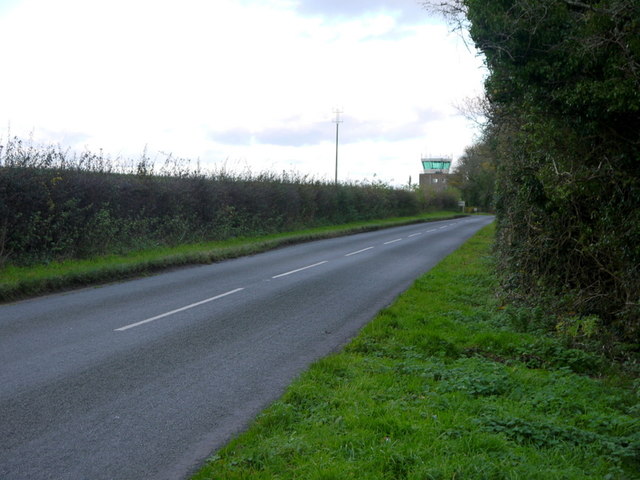
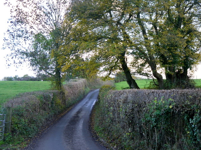
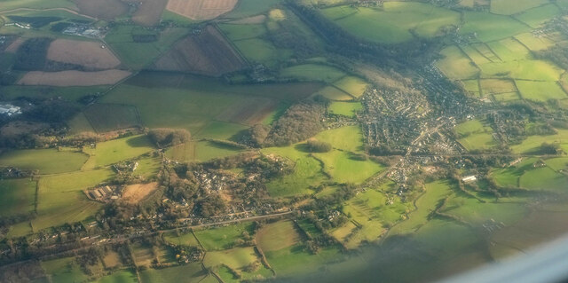
Ditteridge is a small village located in the county of Wiltshire, England. Situated in the southern part of the county, it is nestled within the picturesque countryside, surrounded by rolling hills and lush green fields. The village is part of the parish of Box, and is located just a few miles southeast of the town of Bath.

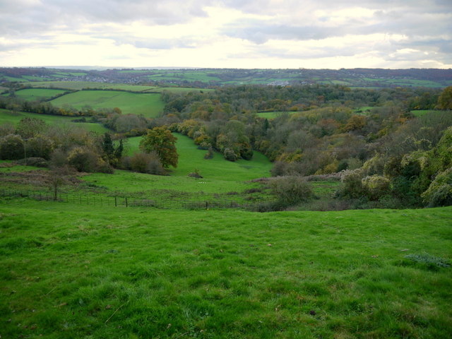
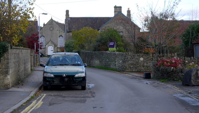
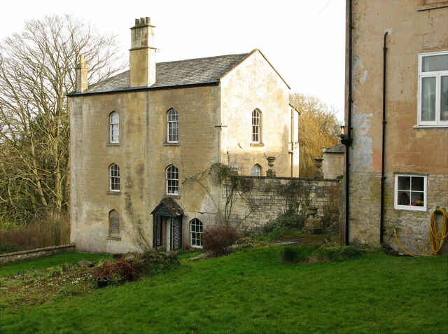
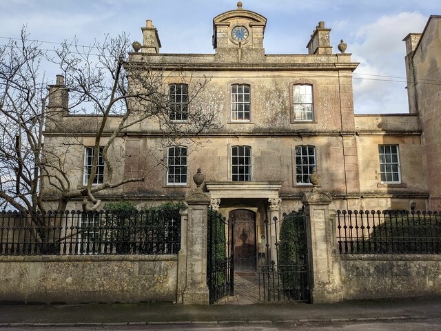
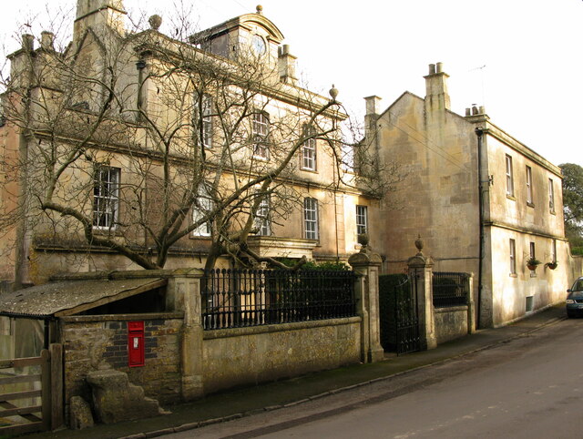
Ditteridge is known for its tranquil and idyllic setting, providing a peaceful escape from the hustle and bustle of city life. The village is characterized by its charming stone cottages and historic buildings, which give it a distinct rural charm.

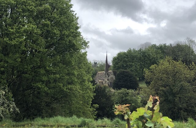
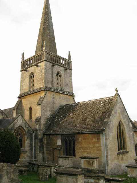
The village is home to a close-knit community, with a population of approximately 200 residents. It boasts a strong sense of community spirit, with regular social events and activities organized by local residents. The village also has a church, St. Christopher's, which dates back to the 12th century and serves as a focal point for community gatherings and religious services.

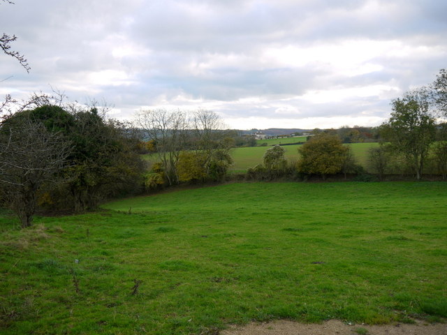
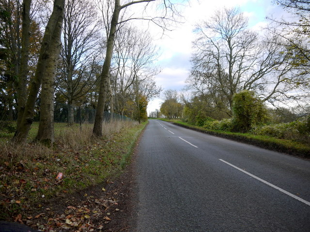
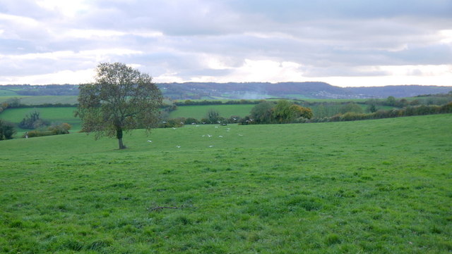
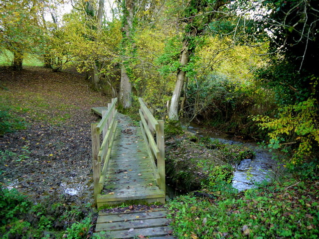
Surrounded by beautiful countryside, Ditteridge offers ample opportunities for outdoor activities and exploration. The area is crisscrossed with footpaths and bridleways, making it a popular destination for walkers, hikers, and cyclists. The nearby Box Hill provides stunning panoramic views of the surrounding landscape and is a popular spot for picnicking and enjoying nature.

Despite its rural setting, Ditteridge benefits from its proximity to the town of Bath, which is just a short drive away. This allows residents to easily access a wide range of amenities, including shops, restaurants, and cultural attractions.

Overall, Ditteridge is a charming village that offers a peaceful and picturesque lifestyle, with a strong sense of community and easy access to nearby amenities.

If you have any feedback on the listing, please let us know in the comments section below.

Ditteridge Images

Images are sourced within 2km of 51.424336/-2.266048 or Grid Reference ST8169. Thanks to Geograph Open Source API. All images are credited.

Bancey Bathrooms at Ashley
Ordnance Survey Cut Mark This OS cut mark can be found on the west angle of St John the Baptist's Church. It marks a point 162.739m above mean sea level.
Ordnance Survey Cut Mark
This OS cut mark can be found on the west angle of St John the Baptist's Church. It marks a point 162.739m above mean sea level.
Pastures above the Lid Brook Valley View south of the Bath Road, west of Colerne.
Pastures above the Lid Brook Valley
View south of the Bath Road, west of Colerne.
Bath Road Heading east towards Colerne.
The control tower for Colerne Airfield can be seen over the hedge, and in the next square north.
Bath Road
Heading east towards Colerne. The control tower for Colerne Airfield can be seen over the hedge, and in the next square north.
Bath Road, Colerne The road grazes the southern edge of the Gridsquare.
looking east towards Colerne.
Bath Road, Colerne
The road grazes the southern edge of the Gridsquare. looking east towards Colerne.
Bowl of landscape Part of the Lid Brook valley to the south of Colerne.
Land-use is mainly pasture and woodland.
Bowl of landscape
Part of the Lid Brook valley to the south of Colerne. Land-use is mainly pasture and woodland.
Seen better days A motor on the Old Bath Road, Colerne.
Seen better days
A motor on the Old Bath Road, Colerne.
View from Tutton Hill Pasture land drops away to the Lid Brook.
The Kingsdown Hill plateau can be seen in the distance.
A small flock of gulls are in the middle distance.
View from Tutton Hill
Pasture land drops away to the Lid Brook. The Kingsdown Hill plateau can be seen in the distance. A small flock of gulls are in the middle distance.
Footbridge over Lid Brook The stream flows left to right; the path ascends Tutton Hill to Colerne.
Footbridge over Lid Brook
The stream flows left to right; the path ascends Tutton Hill to Colerne.
Tutton Hill The lane ascends south out of Lidbrook Bottom towards Box.
Tutton Hill
The lane ascends south out of Lidbrook Bottom towards Box.
Little used hangars on the periphery of Colerne airfield
Ashley Garage This Shell service station <span class="nowrap"><a title="https://find.shell.com/gb/fuel/12449960-ashley-garage" rel="nofollow ugc noopener" href="https://find.shell.com/gb/fuel/12449960-ashley-garage">Link</a><img style="margin-left:2px;" alt="External link" title="External link - shift click to open in new window" src="https://s1.geograph.org.uk/img/external.png" width="10" height="10"/></span> stands on the A4 a little west of Box.  As with all petrol stations in the Bath area, the price of fuel is rather high compared with the going rate in nearby Bristol and Chippenham, which is where canny Bathonians tend to fill up.
Ashley Garage
This Shell service station LinkExternal link stands on the A4 a little west of Box. As with all petrol stations in the Bath area, the price of fuel is rather high compared with the going rate in nearby Bristol and Chippenham, which is where canny Bathonians tend to fill up.
Cemetery Chapel, Box
3 Kingsdown House, Kingsdown, Box Grade II listed early 19th-century house
<span class="nowrap"><a title="https://historicengland.org.uk/listing/the-list/list-entry/1022797" rel="nofollow ugc noopener" href="https://historicengland.org.uk/listing/the-list/list-entry/1022797">Link</a><img style="margin-left:2px;" alt="External link" title="External link - shift click to open in new window" src="https://s1.geograph.org.uk/img/external.png" width="10" height="10"/></span>

From the listing: Built as part of the extensions to the private asylum at Kingsdown House, possibly as a doctor's residence.
3 Kingsdown House, Kingsdown, Box
Grade II listed early 19th-century house LinkExternal link From the listing: Built as part of the extensions to the private asylum at Kingsdown House, possibly as a doctor's residence.
1 Kingsdown House, Kingsdown, Box Grade II listed former lunatic asylum, now house, early 18th century with Victorian embellishment.
<span class="nowrap"><a title="https://historicengland.org.uk/listing/the-list/list-entry/1181591" rel="nofollow ugc noopener" href="https://historicengland.org.uk/listing/the-list/list-entry/1181591">Link</a><img style="margin-left:2px;" alt="External link" title="External link - shift click to open in new window" src="https://s1.geograph.org.uk/img/external.png" width="10" height="10"/></span>

Gate piers and railings, early 19th, also listed.
<span class="nowrap"><a title="https://historicengland.org.uk/listing/the-list/list-entry/1363625" rel="nofollow ugc noopener" href="https://historicengland.org.uk/listing/the-list/list-entry/1363625">Link</a><img style="margin-left:2px;" alt="External link" title="External link - shift click to open in new window" src="https://s1.geograph.org.uk/img/external.png" width="10" height="10"/></span>
1 Kingsdown House, Kingsdown, Box
Grade II listed former lunatic asylum, now house, early 18th century with Victorian embellishment. LinkExternal link Gate piers and railings, early 19th, also listed. LinkExternal link
1 and 2 Kingsdown House, Kingsdown, Box Grade II listed former lunatic asylum, now houses, early 18th century with Victorian embellishment.
<span class="nowrap"><a title="https://historicengland.org.uk/listing/the-list/list-entry/1181591" rel="nofollow ugc noopener" href="https://historicengland.org.uk/listing/the-list/list-entry/1181591">Link</a><img style="margin-left:2px;" alt="External link" title="External link - shift click to open in new window" src="https://s1.geograph.org.uk/img/external.png" width="10" height="10"/></span>

No.1 (left) early 18th century, No. 2 19th century.
1 and 2 Kingsdown House, Kingsdown, Box
Grade II listed former lunatic asylum, now houses, early 18th century with Victorian embellishment. LinkExternal link No.1 (left) early 18th century, No. 2 19th century.
St Thomas a Becket church, Box, from SE Parish church of Box, Wiltshire. Grade I listed.
<span class="nowrap"><a title="https://historicengland.org.uk/listing/the-list/list-entry/1180500" rel="nofollow ugc noopener" href="https://historicengland.org.uk/listing/the-list/list-entry/1180500">Link</a><img style="margin-left:2px;" alt="External link" title="External link - shift click to open in new window" src="https://s1.geograph.org.uk/img/external.png" width="10" height="10"/></span>
St Thomas a Becket church, Box, from SE
Parish church of Box, Wiltshire. Grade I listed. LinkExternal link
Box from the air The main railway line crosses the right side of the image horizontally and then abruptly disappears into the Box Tunnel before reaching the central wood. Below is the A4.
Box from the air
The main railway line crosses the right side of the image horizontally and then abruptly disappears into the Box Tunnel before reaching the central wood. Below is the A4.
Show me another place!

Ditteridge is located at Grid Ref: ST8169 (Lat: 51.424336, Lng: -2.266048)

Unitary Authority: Wiltshire

Police Authority: Wiltshire

What 3 Words

///springing.ditched.coasters. Near Colerne, Wiltshire

Nearby Locations

Briary Wood Ditteridge

Related Wikis

Ditteridge

Ditteridge is a village in the civil parish of Box, Wiltshire, England. It is about 0.8 miles (1.3 km) northwest of Box village and 3.5 miles (6 km) west...

Box railway station

Box railway station served the town of Box in Wiltshire, England. The station was on the main Great Western Railway line from London to Bristol and was...

Ashley, Wiltshire

Ashley is a small village in the civil parish of Box in Wiltshire, England. Its nearest town is Corsham, which lies approximately 3.5 miles (5.6 km) east...

Box (Mill Lane) Halt railway station

Box (Mill Lane) Halt railway station served the town of Box in Wiltshire, England. The station was on the main Great Western Railway line from London to...

Nearby Amenities

Located within 500m of 51.424336,-2.266048
Ditteridge
Place: hamlet
Wikidata: Q5283720
Lat/Long: 51.4237251/-2.262759
Historic: monument
Lat/Long: 51.423421/-2.2636731
Post Box
Post Box Type: wall
Ref: SN13 95D
Royal Cypher: EVIIR
Royal Cypher Wikidata: Q33102324
Lat/Long: 51.4233772/-2.2645212
Public Bookcase
Booth: K6
Disused Amenity: telephone
Listed Status: Grade II
Man Made: telephone_box
Public Bookcase Type: phone_box
Lat/Long: 51.4234358/-2.2637675
Barrier: stile
Lat/Long: 51.4249511/-2.2629629
Barrier: stile
Lat/Long: 51.4203522/-2.2647114
Barrier: stile
Lat/Long: 51.4205752/-2.2645141
Barrier: stile
Lat/Long: 51.4232454/-2.2633397
Barrier: stile
Lat/Long: 51.4241203/-2.2631408
Barrier: stile
Lat/Long: 51.4255007/-2.2620827
Barrier: stile
Lat/Long: 51.4250474/-2.2716002
Barrier: stile
Lat/Long: 51.4246128/-2.2702594
The data included in this document is from www.openstreetmap.org. The data is made available under ODbL.

Have you been to Ditteridge?

Leave your review of Ditteridge below (or comments, questions and feedback).