Barleypark Wood

Wood, Forest in Oxfordshire West Oxfordshire

England

Barleypark Wood

Ducklington Churchyard Looking from the original churchyard outside St Bartholomew's Church across to the later cemetery on the other side of Church Street.
Ducklington Churchyard Credit: Des Blenkinsopp

Barleypark Wood is a picturesque forest situated in the heart of Oxfordshire, England. Covering an area of approximately 50 hectares, the wood is a haven of natural beauty and tranquility. It is located just a short distance from the village of Barleypark, and can be easily accessed by a network of well-maintained footpaths.

The wood is predominantly composed of native broadleaf trees, including oak, ash, and beech, which create a dense and verdant canopy. The forest floor is carpeted with a diverse range of wildflowers and ferns, adding to its enchanting atmosphere. The abundance of wildlife in the area is a testament to the wood's ecological significance, with sightings of deer, foxes, and a variety of bird species being common.

Barleypark Wood is a popular destination for nature enthusiasts and walkers, who flock to its peaceful surroundings to enjoy its natural beauty. The wood offers a range of well-marked trails, varying in length and difficulty, catering to visitors of all ages and fitness levels. These trails provide an opportunity to explore the different sections of the wood, each with its own unique charm and character.

Visitors to Barleypark Wood can immerse themselves in the sights and sounds of nature, with the gentle rustle of leaves, the melodious chirping of birds, and the occasional scurrying of woodland creatures. The wood also boasts several picnic areas, making it an ideal spot for a leisurely outdoor lunch or a family gathering.

Barleypark Wood is not only a place of natural beauty but also an important habitat for local flora and fauna. Its preservation and protection are of utmost importance, ensuring that future generations can continue to enjoy its magical charm.

If you have any feedback on the listing, please let us know in the comments section below.

Barleypark Wood Images

Images are sourced within 2km of 51.754306/-1.4991238 or Grid Reference SP3406. Thanks to Geograph Open Source API. All images are credited.

Ducklington Churchyard Looking from the original churchyard outside St Bartholomew's Church across to the later cemetery on the other side of Church Street.
Ducklington Churchyard
Looking from the original churchyard outside St Bartholomew's Church across to the later cemetery on the other side of Church Street.
Aston Road Aston Road (or Aston Mile) is a very bumpy road with rather adverse camber between North Street in Aston and Standlake Road (the A415) near Ducklington.
Aston Road
Aston Road (or Aston Mile) is a very bumpy road with rather adverse camber between North Street in Aston and Standlake Road (the A415) near Ducklington.
Road by Barleypark Farm Cottages A road off Aston Road (or Aston Mile), leading to Barleypark Farm and Barleypark Farm Cottages. The road is the route of a public footpath.
Road by Barleypark Farm Cottages
A road off Aston Road (or Aston Mile), leading to Barleypark Farm and Barleypark Farm Cottages. The road is the route of a public footpath.
Blocked road by Barleypark Farm Cottages Metal barriers and a farm vehicle block the road to allow sheep to be led from one field to another over the road.

The road is off Aston Road (or Aston Mile), leading to Barleypark Farm and Barleypark Farm Cottages. The road is the route of a public footpath.
Blocked road by Barleypark Farm Cottages
Metal barriers and a farm vehicle block the road to allow sheep to be led from one field to another over the road. The road is off Aston Road (or Aston Mile), leading to Barleypark Farm and Barleypark Farm Cottages. The road is the route of a public footpath.
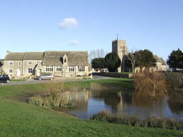
Ducklington village green and pond
Ducklington war memorial
River Windrush, Ducklington
A415 at the junction for Ducklington
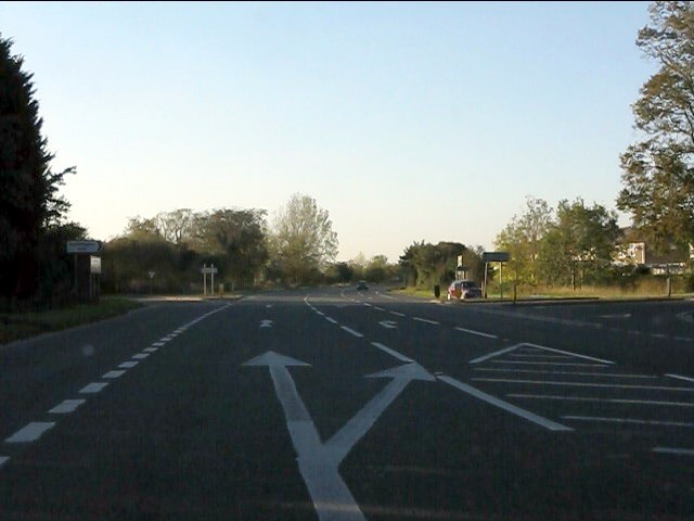
A415 approaching Ducklington crossroads
Ducklington crossroads, A415
A415 at the turning for Curbridge
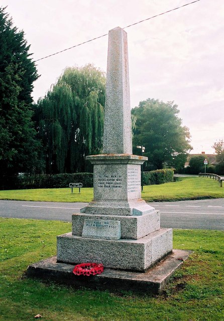
Ducklington Parish War Memorial - southwest side, Standlake Road, Ducklington The War Memorial is near the village pond, and the Parish Church. It seems to date from 1919, having been unveiled in January 1920. It now commemorates 17 men from the village who died in the First World War, 2 from the Second World War, and one from the Korean War.

<a href="https://www.geograph.org.uk/photo/2654580">SP3507 : Ducklington Parish War Memorial - northeast side, Standlake Road, Ducklington</a>.
Ducklington Parish War Memorial - southwest side, Standlake Road, Ducklington
The War Memorial is near the village pond, and the Parish Church. It seems to date from 1919, having been unveiled in January 1920. It now commemorates 17 men from the village who died in the First World War, 2 from the Second World War, and one from the Korean War. SP3507 : Ducklington Parish War Memorial - northeast side, Standlake Road, Ducklington.
Ducklington Parish War Memorial - southwest side (close-up), Standlake Road, Ducklington The War Memorial is a short distance from the village pond.

<a href="https://www.geograph.org.uk/photo/2654569">SP3507 : Ducklington Parish War Memorial - southwest side, Standlake Road, Ducklington</a>.
Ducklington Parish War Memorial - southwest side (close-up), Standlake Road, Ducklington
The War Memorial is a short distance from the village pond. SP3507 : Ducklington Parish War Memorial - southwest side, Standlake Road, Ducklington.
Ducklington Parish War Memorial - inscriptions on southwest side, Standlake Road, Ducklington The names of two men who died in the Second World War (1939-1945), are recorded on this side of the monument.

<a href="https://www.geograph.org.uk/photo/2654569">SP3507 : Ducklington Parish War Memorial - southwest side, Standlake Road, Ducklington</a>.
Ducklington Parish War Memorial - inscriptions on southwest side, Standlake Road, Ducklington
The names of two men who died in the Second World War (1939-1945), are recorded on this side of the monument. SP3507 : Ducklington Parish War Memorial - southwest side, Standlake Road, Ducklington.
Ducklington Parish War Memorial - inscriptions on southeast side, Standlake Road, Ducklington Other photos:- <a href="https://www.geograph.org.uk/photo/2654580">SP3507 : Ducklington Parish War Memorial - northeast side, Standlake Road, Ducklington</a>.
Ducklington Parish War Memorial - inscriptions on southeast side, Standlake Road, Ducklington
Ducklington Parish War Memorial - inscriptions on northeast side, Standlake Road, Ducklington The inscription at the bottom, relating to the Korean War, would have been added to the memorial many years after it was built.

Other photos:- <a href="https://www.geograph.org.uk/photo/2654580">SP3507 : Ducklington Parish War Memorial - northeast side, Standlake Road, Ducklington</a>.
Ducklington Parish War Memorial - inscriptions on northeast side, Standlake Road, Ducklington
The inscription at the bottom, relating to the Korean War, would have been added to the memorial many years after it was built. Other photos:- SP3507 : Ducklington Parish War Memorial - northeast side, Standlake Road, Ducklington.
Show me another place!

Barleypark Wood is located at Grid Ref: SP3406 (Lat: 51.754306, Lng: -1.4991238)

Administrative County: Oxfordshire

District: West Oxfordshire

Police Authority: Thames Valley

What 3 Words

///usual.pokers.slimy. Near Ducklington, Oxfordshire

Nearby Locations

Barleypark Wood

Related Wikis

Ducklington

Ducklington is a village and civil parish on the River Windrush 1 mile (1.6 km) south of Witney in West Oxfordshire. The 2011 Census recorded the parish...

Ducklington Mead

Ducklington Mead is a 4.6-hectare (11-acre) biological Site of Special Scientific Interest east of Ducklington in Oxfordshire. This traditionally managed...

Yelford

Yelford is a village and former civil parish, now in the parish of Hardwick-with-Yelford, in the West Oxfordshire district, in the county of Oxfordshire...

Lew, Oxfordshire

Lew is a village and civil parish about 2+1⁄2 miles (4 km) southwest of Witney in the West Oxfordshire District of Oxfordshire, England. The 2001 Census...

Have you been to Barleypark Wood?

Leave your review of Barleypark Wood below (or comments, questions and feedback).