Ridge Copse

Wood, Forest in Hampshire Test Valley

England

Ridge Copse

Roadbridge - M27 southbound
Roadbridge - M27 southbound Credit: Dave Thompson

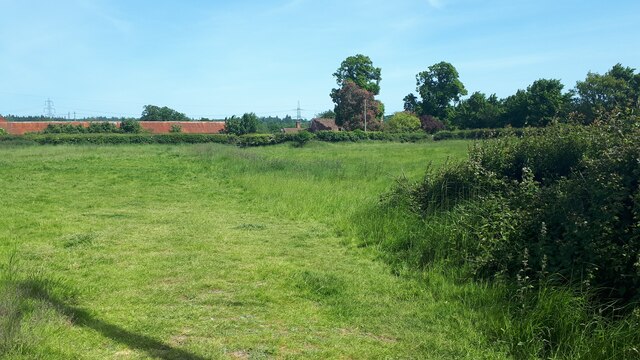
Ridge Copse is a picturesque woodland located in Hampshire, England. Covering an area of approximately 200 acres, it is known for its serene beauty and diverse wildlife. The copse is situated on a gentle slope, offering visitors breathtaking views of the surrounding countryside.

The woodland is predominantly composed of native broadleaf trees, such as oak, beech, and ash, creating a dense canopy that provides shade and shelter for a variety of flora and fauna. The forest floor is adorned with bluebells, primroses, and wild garlic during the spring, creating a colorful and enchanting atmosphere.

Ridge Copse is a haven for wildlife enthusiasts, with a wide range of species calling the woodland home. Birdwatchers can spot woodpeckers, nuthatches, and tree creepers, while lucky visitors may even catch a glimpse of the elusive red kite soaring above the treetops. The copse is also home to several mammals, including deer, foxes, and badgers.

Visitors to Ridge Copse can explore the numerous walking trails that wind through the woodland, offering a chance to immerse themselves in nature and enjoy the tranquility of the surroundings. The copse is a popular destination for families, with designated picnic areas and a children's play area.

Managed by the Hampshire Wildlife Trust, Ridge Copse is a conservation area that aims to protect and preserve this valuable habitat. The copse is open to the public throughout the year, providing a peaceful retreat for those seeking solace in the beauty of nature.

If you have any feedback on the listing, please let us know in the comments section below.
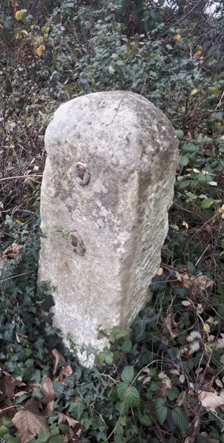
Ridge Copse Images

Images are sourced within 2km of 50.962896/-1.5096277 or Grid Reference SU3418. Thanks to Geograph Open Source API. All images are credited.

Roadbridge - M27 southbound
Footbridge - M27 southbound
Roadbridge over M27
Roadbridge over M27
Grazing near Lee Manor Farm
M27 looking east from Wade Hill Drove
River Blackwater from Wade Bridge
Unnamed channel in the River Test floodplain near Moorcourt One of several channels which eventually drain into the River Test.
Unnamed channel in the River Test floodplain near Moorcourt
One of several channels which eventually drain into the River Test.
Wooden barn at Skidmore
Field at Lee The long red-roofed building is at Lee Park Farm.
Field at Lee
The long red-roofed building is at Lee Park Farm.
River Test at Lee Looking north from the bridge near Longbridge Farm.
River Test at Lee
Looking north from the bridge near Longbridge Farm.
On the Test Way between Moorcourt and Lee Long-distance footpath on private track.
On the Test Way between Moorcourt and Lee
Long-distance footpath on private track.
The Test Way on farm track near Moorcourt Long distance footpath on farm access track.
The Test Way on farm track near Moorcourt
Long distance footpath on farm access track.
Old Milestone by the A3090, Pauncefoot Hill, Romsey Extra parish Stone post (plate lost) by the A3090, in parish of ROMSEY EXTRA (TEST VALLEY District), Pauncefoot House; 10m North of junction with road marked to West Wellow, by the road, on East side of road. Romsey rectangle stone, erected by the Romsey & Ringwood turnpike trust in the 19th century. 

Inscription once read:-
(Romsey 1)
(Ringwood 17)

Grade II listed. 
List Entry Number: 1301221 <span class="nowrap"><a title="https://historicengland.org.uk/listing/the-list/list-entry/1301221" rel="nofollow ugc noopener" href="https://historicengland.org.uk/listing/the-list/list-entry/1301221">Link</a><img style="margin-left:2px;" alt="External link" title="External link - shift click to open in new window" src="https://s1.geograph.org.uk/img/external.png" width="10" height="10"/></span>

Milestone Society National ID: HA_RORI01.
Old Milestone by the A3090, Pauncefoot Hill, Romsey Extra parish
Stone post (plate lost) by the A3090, in parish of ROMSEY EXTRA (TEST VALLEY District), Pauncefoot House; 10m North of junction with road marked to West Wellow, by the road, on East side of road. Romsey rectangle stone, erected by the Romsey & Ringwood turnpike trust in the 19th century. Inscription once read:- (Romsey 1) (Ringwood 17) Grade II listed. List Entry Number: 1301221 LinkExternal link Milestone Society National ID: HA_RORI01.
The Test Way leaving Nursling and the outer limits of Southampton The Test Way is a 44 mile path running  from the chalk downs of Inkpen Hill in West Berkshire, south to Eling Wharf near the head of Southampton Water. Most of the route follows the valley of the River Test, one of the country's finest chalk rivers. <span class="nowrap"><a title="https://www.hants.gov.uk/thingstodo/countryside/walking/testway" rel="nofollow ugc noopener" href="https://www.hants.gov.uk/thingstodo/countryside/walking/testway">Link</a><img style="margin-left:2px;" alt="External link" title="External link - shift click to open in new window" src="https://s1.geograph.org.uk/img/external.png" width="10" height="10"/></span>
The Test Way leaving Nursling and the outer limits of Southampton
The Test Way is a 44 mile path running from the chalk downs of Inkpen Hill in West Berkshire, south to Eling Wharf near the head of Southampton Water. Most of the route follows the valley of the River Test, one of the country's finest chalk rivers. LinkExternal link
The River Test Five miles from my start at the southern end of the Test Way, and this is the first proper view of the river. The clarity of its chalk-fed water is striking.
The River Test
Five miles from my start at the southern end of the Test Way, and this is the first proper view of the river. The clarity of its chalk-fed water is striking.
Ready for Halloween Whatever happened to our traditional celebration of 'Guy Fawkes Night'? With fireworks so non-Health 'n Safety, perhaps we failed to commercialise it enough?
Ready for Halloween
Whatever happened to our traditional celebration of 'Guy Fawkes Night'? With fireworks so non-Health 'n Safety, perhaps we failed to commercialise it enough?
The Test Way approaching Moorcourt Crossing to the west side of the river flood plain
The Test Way approaching Moorcourt
Crossing to the west side of the river flood plain
Tin barn, Moorcourt Listed Grade II, circa 1700 <span class="nowrap"><a title="https://historicengland.org.uk/listing/the-list/list-entry/1166645?section=official-list-entry" rel="nofollow ugc noopener" href="https://historicengland.org.uk/listing/the-list/list-entry/1166645?section=official-list-entry">Link</a><img style="margin-left:2px;" alt="External link" title="External link - shift click to open in new window" src="https://s1.geograph.org.uk/img/external.png" width="10" height="10"/></span>
Tin barn, Moorcourt
Listed Grade II, circa 1700 LinkExternal link
Show me another place!

Ridge Copse is located at Grid Ref: SU3418 (Lat: 50.962896, Lng: -1.5096277)

Administrative County: Hampshire

District: Test Valley

Police Authority: Hampshire

What 3 Words

///fault.petulant.snacks. Near Romsey, Hampshire

Related Wikis

Lee, Hampshire

Lee is a hamlet and civil parish in the Test Valley district of Hampshire, England. Its nearest town is Romsey, which lies approximately 3.7 miles (4.5...

Romsey Extra

Romsey Extra was a civil parish in the Borough of Test Valley and the English county of Hampshire. At the 2011 census, it had a population of 3,276, although...

Ashfield, Hampshire

Ashfield is a small village in the Test Valley district of Hampshire, England. It lies 1.6 miles (2.5 km) south-east from Romsey, its nearest town. It...

Broadlands

Broadlands is a country house located in the civil parish of Romsey Extra, near the town of Romsey in the Test Valley district of Hampshire, England. Its...

Ower

Ower is a hamlet in the New Forest district of Hampshire, England. Its nearest towns are Totton – approximately 3 miles (4.8 km) to the southeast, and...

Sadler's Mill

Sadler's Mill, also referred to as Saddlers Mill, is a watermill in Romsey, Hampshire, England. It is probably the best known of Romsey's surviving mills...

Grove Place

Grove Place is a Grade I listed building in Nursling, Hampshire. The building was originally a country house and was converted into a lunatic asylum in...

The Atherley School

The Atherley School was an independent girls' school based in Southampton, Hampshire, England, from 1926 - 2006 until it merged with Embley Park school...

Nearby Amenities

Located within 500m of 50.962896,-1.5096277
Hunting Stand
Lat/Long: 50.9655744/-1.5080261
Hunting Stand
Lat/Long: 50.9668178/-1.5099238
Ridge
Place: hamlet
Lat/Long: 50.9627403/-1.5164197
Watering Place
Lat/Long: 50.9608619/-1.515316
Man Made: utility_pole
Lat/Long: 50.9619429/-1.5163087
Man Made: utility_pole
Lat/Long: 50.961565/-1.5164122
Man Made: utility_pole
Lat/Long: 50.9622368/-1.5162151
The data included in this document is from www.openstreetmap.org. The data is made available under ODbL.

Have you been to Ridge Copse?

Leave your review of Ridge Copse below (or comments, questions and feedback).