Jubilee Wood
Wood, Forest in Yorkshire Harrogate
England
Jubilee Wood
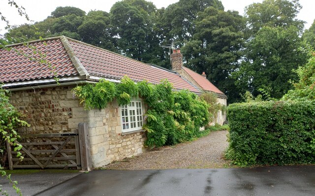
Jubilee Wood, located in Yorkshire, is a beautiful woodland area that covers a vast expanse of land. Spanning over several acres, this forest is a cherished natural treasure in the region. The wood was established to commemorate the Queen's Diamond Jubilee, hence its name.
Jubilee Wood is home to a diverse range of flora and fauna. The woodland is primarily composed of native tree species, including oak, beech, and birch, which create a dense canopy overhead. The forest floor is adorned with a vibrant carpet of bluebells, wild garlic, and various other wildflowers during the spring season.
Walking through Jubilee Wood is a sensory delight, with the earthy scent of damp leaves and the soothing rustle of foliage in the breeze. The wood offers a tranquil retreat for nature enthusiasts, providing an opportunity to observe and appreciate the local wildlife. Visitors may catch glimpses of deer, squirrels, and a plethora of bird species that call this forest their home.
The wood is equipped with well-maintained walking trails, allowing visitors to explore its natural beauty at their own pace. Information boards are strategically placed throughout the woodland, providing educational insights into the diverse ecosystem and the history of the forest.
Jubilee Wood is not only a haven for wildlife and nature lovers but also serves as a community space. It offers a peaceful setting for picnics, family outings, and outdoor recreational activities. The wood is often a venue for local events, including guided nature walks and conservation workshops.
Overall, Jubilee Wood is a cherished woodland gem in Yorkshire, offering a serene escape into nature's embrace while also providing educational and recreational opportunities for all who visit.
If you have any feedback on the listing, please let us know in the comments section below.
Jubilee Wood Images
Images are sourced within 2km of 54.068726/-1.4825081 or Grid Reference SE3363. Thanks to Geograph Open Source API. All images are credited.


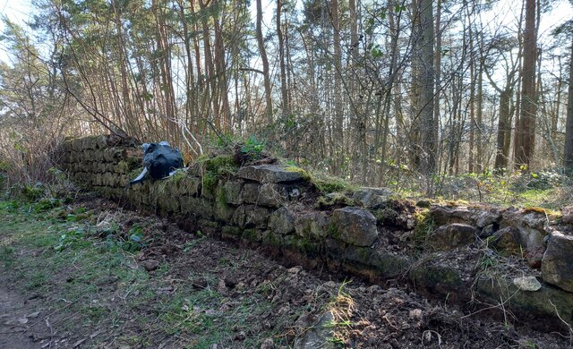
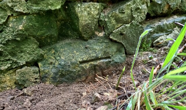
![A stream revisited I took a photo here in the autumn of 2009 and commented about springs, but after checking out the first edition 6" map of the area, it looks as though I was mistaken. There are a lot of 'humps and bumps' in this area, as well as odd bits of masonry [as in the foreground of this photo], and it appears that this is the site of a former water mill - 'Burton Mill' which is described as a corn mill. The mill has long gone, and the mill race has been reduced to little more than a meandering ditch, but this must be part of it.](https://s2.geograph.org.uk/geophotos/07/36/36/7363662_2cc6cae5.jpg)

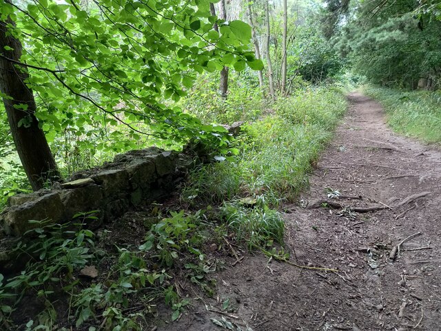
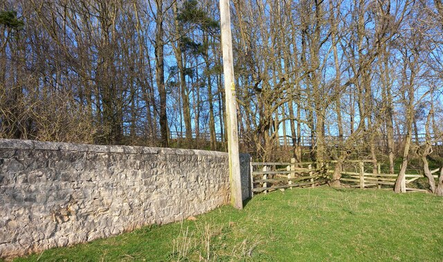
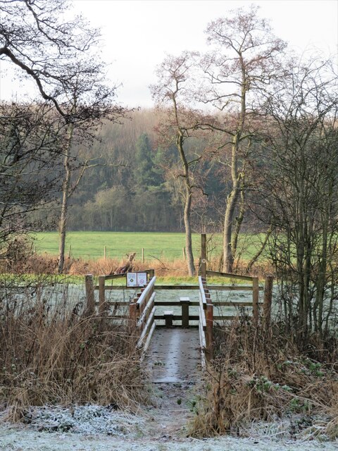
![Path into the wood [maybe] A waymark post at the edge of Kettlewell Carr suggests that one is on the right path, but there is no stile or gate and one must step over a semi derelict wire fence. Fortunately it would be difficult to get lost within the woodland.](https://s3.geograph.org.uk/geophotos/07/36/36/7363667_54e4542f.jpg)
Jubilee Wood is located at Grid Ref: SE3363 (Lat: 54.068726, Lng: -1.4825081)
Division: West Riding
Administrative County: North Yorkshire
District: Harrogate
Police Authority: North Yorkshire
What 3 Words
///masking.teamed.suspends. Near Boroughbridge, North Yorkshire
Nearby Locations
Related Wikis

Burton Leonard
Burton Leonard is a village and civil parish in the Harrogate district of North Yorkshire, England, and approximately 7 miles (11 km) south from Ripon...

Copgrove
Copgrove is a village and civil parish in the Harrogate district of North Yorkshire, England, five miles (8 km) south-west of Boroughbridge and the A1...

Bishop Monkton Ings
Bishop Monkton Ings is a Site of Special Scientific Interest, or SSSI, situated east of Bishop Monkton village in North Yorkshire, England. It consists...

Bishop Monkton
Bishop Monkton is a village and civil parish in the Harrogate district of North Yorkshire, England, about five miles south of Ripon. According to the...

Staveley, North Yorkshire
Staveley is a village and civil parish in the Harrogate district of North Yorkshire, England. It is situated 4 miles (6.4 km) north of Knaresborough and...

Westwick, North Yorkshire
Westwick is a civil parish in Harrogate district in North Yorkshire, England. It lies 3 miles (5 km) west of Boroughbridge, on the south bank of the River...
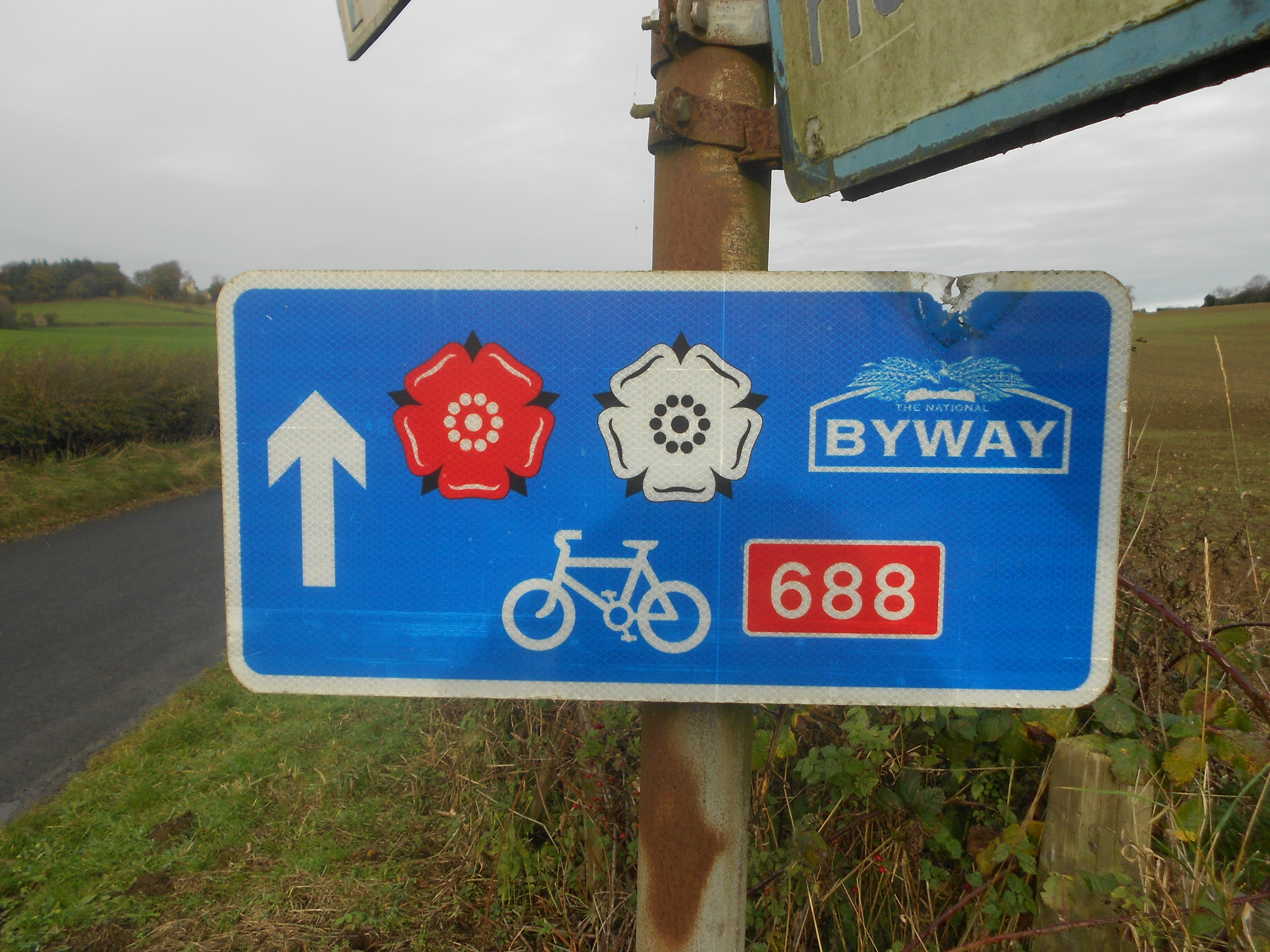
Way of the Roses
The Way of the Roses is the newest of Great Britain's coast-to-coast long-distance cycle routes and is based on minor roads, disused railway lines and...

South Stainley
South Stainley is a small village in the Harrogate District, in the county of North Yorkshire, England. Nearby settlements include the city of Ripon, the...
Nearby Amenities
Located within 500m of 54.068726,-1.4825081Have you been to Jubilee Wood?
Leave your review of Jubilee Wood below (or comments, questions and feedback).