Checkers Carr

Wood, Forest in Yorkshire Harrogate

England

Checkers Carr

Farnham/Copgrove Green Lane This bench mark is cut into the old stone wall on the west side of the green lane which runs to/from Farnham and Copgrove.
Farnham/Copgrove Green Lane Credit: Mel Towler

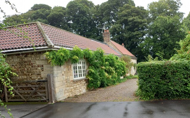
Checkers Carr, located in Yorkshire County, is a picturesque woodland area known for its enchanting forest and captivating beauty. Nestled amidst the rolling hills and verdant landscapes, Checkers Carr is a haven for nature lovers and outdoor enthusiasts alike.

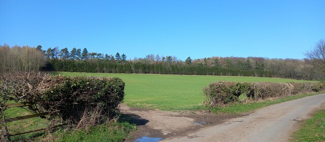
The forest, which covers a vast expanse of land, is composed of a diverse range of tree species, including oak, beech, and birch. The dense canopy provides a cool and tranquil atmosphere, making it a perfect escape from the hustle and bustle of city life. The forest floor is carpeted with a vibrant mix of wildflowers, ferns, and mosses, creating a stunning tapestry of colors.

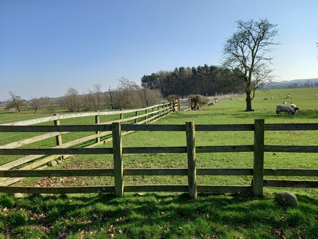
Checkers Carr is renowned for its abundant wildlife. The forest is a habitat for various species, such as deer, foxes, badgers, and a myriad of bird species, making it a haven for birdwatching enthusiasts. The tranquil environment also attracts photographers and artists who seek inspiration from the natural beauty that surrounds them.

The forest offers numerous walking trails and hiking paths, allowing visitors to explore its hidden gems. These paths wind through the woods, leading to breathtaking viewpoints and secluded spots, where one can truly immerse themselves in the serenity of nature.

Moreover, Checkers Carr has a rich history, with ancient ruins and archaeological sites scattered throughout the area. These remnants serve as a reminder of the region's past and provide a fascinating insight into its cultural heritage.

In summary, Checkers Carr, Yorkshire, is a captivating woodland area that offers a serene escape for nature enthusiasts. With its diverse flora and fauna, scenic walking trails, and rich history, it is a must-visit destination for anyone seeking solace and natural beauty.

If you have any feedback on the listing, please let us know in the comments section below.

Checkers Carr Images

Images are sourced within 2km of 54.064982/-1.485366 or Grid Reference SE3363. Thanks to Geograph Open Source API. All images are credited.
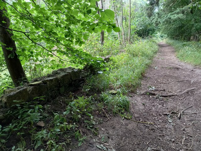
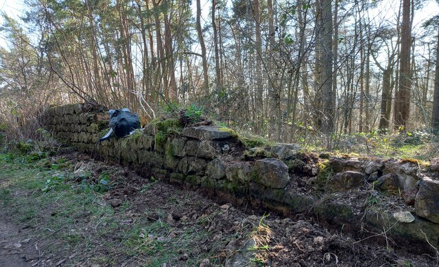
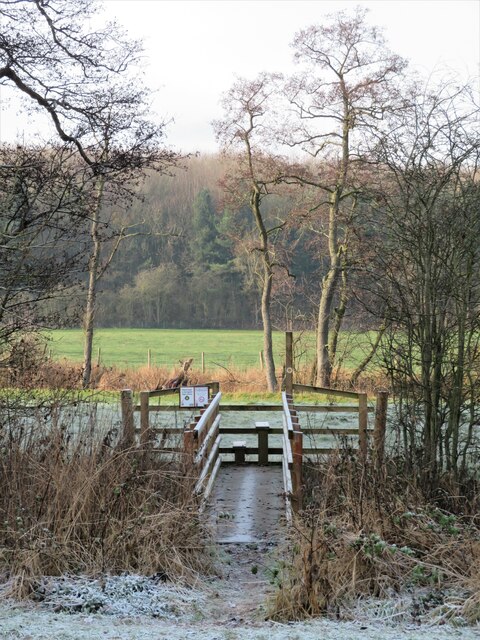
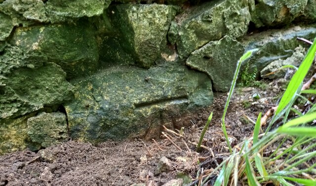
Farnham/Copgrove Green Lane This bench mark is cut into the old stone wall on the west side of the green lane which runs to/from Farnham and Copgrove.
Farnham/Copgrove Green Lane
This bench mark is cut into the old stone wall on the west side of the green lane which runs to/from Farnham and Copgrove.
Farnham/Copgrove Green Lane A wider angle showing Green Lane and the track northwards, and the old stone wall on the west side of the lane. There is a bench mark cut into the  1st stone course of the wall along this stretch.
Farnham/Copgrove Green Lane
A wider angle showing Green Lane and the track northwards, and the old stone wall on the west side of the lane. There is a bench mark cut into the 1st stone course of the wall along this stretch.
Robert Beck bridge This bridge is on the north/south track which runs to and from Farnham to Copgrove. According to the OS database there was a benchmark in this location. Today there is a more substantial bridge for the heavier machinery using the lanes, and no benchmark to be found.
Robert Beck bridge
This bridge is on the north/south track which runs to and from Farnham to Copgrove. According to the OS database there was a benchmark in this location. Today there is a more substantial bridge for the heavier machinery using the lanes, and no benchmark to be found.
Copgrove, Firlands Farm Firlands Farm is on the south side of the Burton Leonard/Farnham road. On the north facing gable end which is roadside, there is a benchmark cut into the lowest course of stone.
Copgrove, Firlands Farm
Firlands Farm is on the south side of the Burton Leonard/Farnham road. On the north facing gable end which is roadside, there is a benchmark cut into the lowest course of stone.
Copgrove, Firlands Farm A wider angle showing Firlands Farm on the south side of the Burton Leonard/Farnham road. On this north facing gable end, there is a benchmark cut into the lowest course of stone.
Copgrove, Firlands Farm
A wider angle showing Firlands Farm on the south side of the Burton Leonard/Farnham road. On this north facing gable end, there is a benchmark cut into the lowest course of stone.
Burton Leonard, The Toll House The Toll House is on the north side of the Burton Leonard/Copgrove road and is now a private residence. On the second course of stone, on the left corner stone of the house, there is a benchmark.
Burton Leonard, The Toll House
The Toll House is on the north side of the Burton Leonard/Copgrove road and is now a private residence. On the second course of stone, on the left corner stone of the house, there is a benchmark.
Burton Leonard, The Toll House A wider angle showing the Toll House which is on the north side of the Burton Leonard/Copgrove road and is now a private residence. On the second course of stone, on the left corner stone of the house, there is a benchmark. To the right of the wooden gatepost.
Burton Leonard, The Toll House
A wider angle showing the Toll House which is on the north side of the Burton Leonard/Copgrove road and is now a private residence. On the second course of stone, on the left corner stone of the house, there is a benchmark. To the right of the wooden gatepost.
Brearton, Warren Lane According to the OS benchmark database one of the gateposts in this field entrance had a benchmark cut into the face. Today there are no gateposts, and no gate and the benchmark has been destroyed.
Brearton, Warren Lane
According to the OS benchmark database one of the gateposts in this field entrance had a benchmark cut into the face. Today there are no gateposts, and no gate and the benchmark has been destroyed.
Brearton, Warren Lane According to the OS benchmark database there was a small building stood in the corner of this field with a benchmark cut into the north-west face. The building has been demolished and the benchmark destroyed.
Brearton, Warren Lane
According to the OS benchmark database there was a small building stood in the corner of this field with a benchmark cut into the north-west face. The building has been demolished and the benchmark destroyed.
Brearton, Green Lane According to the OS benchmark database there is a benchmark cut into a lower stone on this stretch of wall. The wall remains intact and having cleared some of the growth around the wall base no mark was found.
Brearton, Green Lane
According to the OS benchmark database there is a benchmark cut into a lower stone on this stretch of wall. The wall remains intact and having cleared some of the growth around the wall base no mark was found.
Farnham green lane The wall is to the left/west of the green lane, and has a very clear benchmark cut into the south face.
Farnham green lane
The wall is to the left/west of the green lane, and has a very clear benchmark cut into the south face.
Farnham green lane The wall is 90 degrees to the left/west of the green lane, and has a very clear benchmark cut into the south face, and is to the left of the telegraph pole.
Farnham green lane
The wall is 90 degrees to the left/west of the green lane, and has a very clear benchmark cut into the south face, and is to the left of the telegraph pole.
Burton Leonard church The benchmark is cut into the east face of the church.
Burton Leonard church
The benchmark is cut into the east face of the church.
Burton Leonard church There is a benchmark cut into the east face of the church.
Burton Leonard church
There is a benchmark cut into the east face of the church.
Junction of lanes at Burton Leonard The wider lane to the left is Common Balk Lane and is a dead end for vehicles, whilst to the right is the rather curved Straight Lane which links into the road from Knaresborough to Bishop Monkton.
Junction of lanes at Burton Leonard
The wider lane to the left is Common Balk Lane and is a dead end for vehicles, whilst to the right is the rather curved Straight Lane which links into the road from Knaresborough to Bishop Monkton.
Burton Leonard church, from the NE A Victorian church that doesn't get more than 5 lines of description in the updated Pevsner guide. St Leonard's dates from 1877. This apparently replaced a medieval church, of which nothing remains.
Burton Leonard church, from the NE
A Victorian church that doesn't get more than 5 lines of description in the updated Pevsner guide. St Leonard's dates from 1877. This apparently replaced a medieval church, of which nothing remains.
New bridge over the beck I photographed this beck crossing in 2009, but the bridge is not the same one. The gabion and handrail on this side have both gone, and the current bridge is longer with more rails and stanchions. The bridge doesn't appear to line up exactly with the path as shown on the OS map.
New bridge over the beck
I photographed this beck crossing in 2009, but the bridge is not the same one. The gabion and handrail on this side have both gone, and the current bridge is longer with more rails and stanchions. The bridge doesn't appear to line up exactly with the path as shown on the OS map.
A stream revisited I took a photo here in the autumn of 2009 and commented about springs, but after checking out the first edition 6" map of the area, it looks as though I was mistaken. There are a lot of 'humps and bumps' in this area, as well as odd bits of masonry [as in the foreground of this photo], and it appears that this is the site of a former water mill - 'Burton Mill' which is described as a corn mill. The mill has long gone, and the mill race has been reduced to little more than a meandering ditch, but this must be part of it.
A stream revisited
I took a photo here in the autumn of 2009 and commented about springs, but after checking out the first edition 6" map of the area, it looks as though I was mistaken. There are a lot of 'humps and bumps' in this area, as well as odd bits of masonry [as in the foreground of this photo], and it appears that this is the site of a former water mill - 'Burton Mill' which is described as a corn mill. The mill has long gone, and the mill race has been reduced to little more than a meandering ditch, but this must be part of it.
Show me another place!

Checkers Carr is located at Grid Ref: SE3363 (Lat: 54.064982, Lng: -1.485366)

Division: West Riding

Administrative County: North Yorkshire

District: Harrogate

Police Authority: North Yorkshire

What 3 Words

///redouble.refrain.overtones. Near Boroughbridge, North Yorkshire

Related Wikis

Burton Leonard

Burton Leonard is a village and civil parish in the Harrogate district of North Yorkshire, England, and approximately 7 miles (11 km) south from Ripon...

Copgrove

Copgrove is a village and civil parish in the Harrogate district of North Yorkshire, England, five miles (8 km) south-west of Boroughbridge and the A1...

Bishop Monkton Ings

Bishop Monkton Ings is a Site of Special Scientific Interest, or SSSI, situated east of Bishop Monkton village in North Yorkshire, England. It consists...

Brearton

Brearton is a village and civil parish in the Harrogate borough of North Yorkshire, England, situated about 3 miles (4.8 km) north of Knaresborough. The...

Bishop Monkton

Bishop Monkton is a village and civil parish in the Harrogate district of North Yorkshire, England, about five miles south of Ripon. According to the...

Staveley, North Yorkshire

Staveley is a village and civil parish in the Harrogate district of North Yorkshire, England. It is situated 4 miles (6.4 km) north of Knaresborough and...

Farnham Mires

Farnham Mires is a Site of Special Scientific Interest, or SSSI, to the east of the village of Farnham, North Yorkshire, England. It consists of a spring...

South Stainley

South Stainley is a small village in the Harrogate District, in the county of North Yorkshire, England. Nearby settlements include the city of Ripon, the...

Nearby Amenities

Located within 500m of 54.064982,-1.485366
Power: pole
Lat/Long: 54.0673099/-1.4788561
Power: pole
Lat/Long: 54.0687725/-1.4836264
Power: pole
Lat/Long: 54.0613615/-1.4880429
Power: pole
Lat/Long: 54.0618507/-1.4876746
Power: pole
Lat/Long: 54.0623895/-1.4877092
Power: pole
Lat/Long: 54.0609613/-1.4882914
Power: pole
Lat/Long: 54.0636825/-1.4877931
Power: pole
Lat/Long: 54.0629211/-1.487744
Power: pole
Lat/Long: 54.0651416/-1.4871319
Power: pole
Lat/Long: 54.0646098/-1.4878584
Power: pole
Lat/Long: 54.0643702/-1.4879558
Power: pole
Lat/Long: 54.0658766/-1.4861105
Power: pole
Lat/Long: 54.0665793/-1.4851506
Power: pole
Lat/Long: 54.06716/-1.4843389
Power: pole
Lat/Long: 54.0678123/-1.4834553
Line Management: branch
Power: pole
Lat/Long: 54.0684622/-1.4825538
Power: pole
Lat/Long: 54.0678559/-1.4804175
Power: pole
Lat/Long: 54.0693634/-1.4857783
The data included in this document is from www.openstreetmap.org. The data is made available under ODbL.

Have you been to Checkers Carr?

Leave your review of Checkers Carr below (or comments, questions and feedback).