Pancho Plantation

Wood, Forest in Hampshire Test Valley

England

Pancho Plantation

Romsey - Sadler's Mill Bridge Bridge across the River Test at historic Sadler's Mill.
Romsey - Sadler's Mill Bridge Credit: Colin Smith

Pancho Plantation is a picturesque woodland area located in Hampshire, England. Covering a vast expanse, the plantation is known for its dense forest, towering trees, and serene atmosphere. Situated in the heart of the Hampshire countryside, Pancho Plantation offers a tranquil escape from the bustling city life.

The woodland is home to a variety of tree species, including oak, beech, and pine, creating a diverse ecosystem that supports a rich array of flora and fauna. The woodland floor is covered with a thick carpet of mosses, ferns, and wildflowers, adding to its natural beauty.

Pancho Plantation is a haven for nature lovers and outdoor enthusiasts. It offers numerous walking trails and paths that wind through the forest, allowing visitors to immerse themselves in its enchanting surroundings. The plantation is also a popular spot for birdwatching, with a wide range of avian species calling it home.

In addition to its natural beauty, Pancho Plantation also has historical significance. The woodland was once part of a larger estate and has witnessed centuries of human activity. Remnants of old farm buildings and ancient stone walls can still be found within its boundaries, providing glimpses into the area's past.

Overall, Pancho Plantation in Hampshire is a captivating woodland destination that offers a perfect blend of natural beauty, tranquility, and historical charm. Whether it's for a leisurely stroll, birdwatching, or simply enjoying the peaceful surroundings, visitors are sure to find solace and inspiration within its lush greenery.

If you have any feedback on the listing, please let us know in the comments section below.

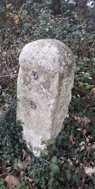
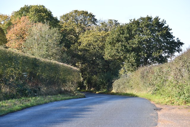
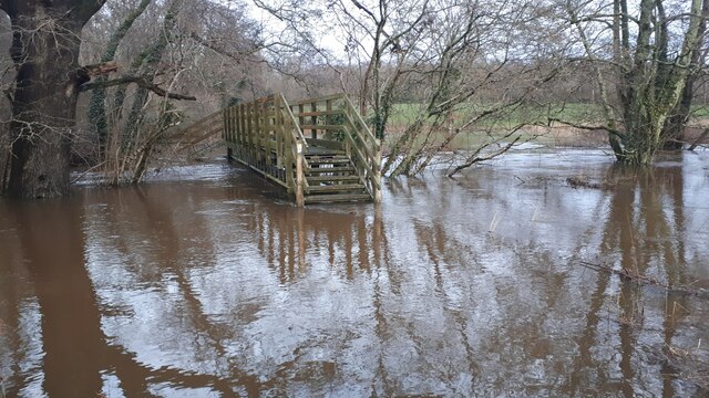
Pancho Plantation Images

Images are sourced within 2km of 50.971253/-1.5190534 or Grid Reference SU3319. Thanks to Geograph Open Source API. All images are credited.

Romsey - Sadler's Mill Bridge Bridge across the River Test at historic Sadler's Mill.
Romsey - Sadler's Mill Bridge
Bridge across the River Test at historic Sadler's Mill.
Romsey - River Test A crystal clear chalk stream downriver of Sadler's Mill.
Romsey - River Test
A crystal clear chalk stream downriver of Sadler's Mill.
Romsey - River Test Reflective scene on the chalk stream downriver from Sadler's Mill.
Romsey - River Test
Reflective scene on the chalk stream downriver from Sadler's Mill.
Romsey - Heritage Trail Waymarker on the pavement - depicting portcullis and trout.
Romsey - Heritage Trail
Waymarker on the pavement - depicting portcullis and trout.
Entrance to play area, the War Memorial Park, Romsey
Flood defences on The Causeway, Romsey This bridge is part of a new flood alleviation scheme, opened July 2022, and permits floodwater to pass under The Causeway into the River Test. Compare <a href="https://www.geograph.org.uk/photo/3840928">SU3420 : Floodwater beside the River Test</a> at almost the same spot.
Flood defences on The Causeway, Romsey
This bridge is part of a new flood alleviation scheme, opened July 2022, and permits floodwater to pass under The Causeway into the River Test. Compare SU3420 : Floodwater beside the River Test at almost the same spot.
Old Milestone by the A3090, Pauncefoot Hill, Romsey Extra parish Stone post (plate lost) by the A3090, in parish of ROMSEY EXTRA (TEST VALLEY District), Pauncefoot House; 10m North of junction with road marked to West Wellow, by the road, on East side of road. Romsey rectangle stone, erected by the Romsey & Ringwood turnpike trust in the 19th century. 

Inscription once read:-
(Romsey 1)
(Ringwood 17)

Grade II listed. 
List Entry Number: 1301221 <span class="nowrap"><a title="https://historicengland.org.uk/listing/the-list/list-entry/1301221" rel="nofollow ugc noopener" href="https://historicengland.org.uk/listing/the-list/list-entry/1301221">Link</a><img style="margin-left:2px;" alt="External link" title="External link - shift click to open in new window" src="https://s1.geograph.org.uk/img/external.png" width="10" height="10"/></span>

Milestone Society National ID: HA_RORI01.
Old Milestone by the A3090, Pauncefoot Hill, Romsey Extra parish
Stone post (plate lost) by the A3090, in parish of ROMSEY EXTRA (TEST VALLEY District), Pauncefoot House; 10m North of junction with road marked to West Wellow, by the road, on East side of road. Romsey rectangle stone, erected by the Romsey & Ringwood turnpike trust in the 19th century. Inscription once read:- (Romsey 1) (Ringwood 17) Grade II listed. List Entry Number: 1301221 LinkExternal link Milestone Society National ID: HA_RORI01.
The A3090 entering Romsey Taking the Test Way into the historic town. Well worth a visit.
The A3090 entering Romsey
Taking the Test Way into the historic town. Well worth a visit.
The River Test, Romsey 17th and 18th century buildings on the bank <span class="nowrap"><a title="https://historicengland.org.uk/listing/the-list/list-entry/1232367?section=official-list-entry" rel="nofollow ugc noopener" href="https://historicengland.org.uk/listing/the-list/list-entry/1232367?section=official-list-entry">Link</a><img style="margin-left:2px;" alt="External link" title="External link - shift click to open in new window" src="https://s1.geograph.org.uk/img/external.png" width="10" height="10"/></span>
The River Test, Romsey
17th and 18th century buildings on the bank LinkExternal link
Sadler's Mill  on the River Test 18th century mill building (with evidence for an earlier, 17th century structure) <span class="nowrap"><a title="https://en.wikipedia.org/wiki/Sadler%27s_Mill" rel="nofollow ugc noopener" href="https://en.wikipedia.org/wiki/Sadler%27s_Mill">Link</a><img style="margin-left:2px;" alt="External link" title="External link - shift click to open in new window" src="https://s1.geograph.org.uk/img/external.png" width="10" height="10"/></span> . Now in residential use.
Sadler's Mill on the River Test
18th century mill building (with evidence for an earlier, 17th century structure) LinkExternal link . Now in residential use.
Maybe not today Flooded footpath near Sadler's Mill, Romsey. Water is flowing across the meadows beyond the flood defence bank on which the photographer is standing.
Maybe not today
Flooded footpath near Sadler's Mill, Romsey. Water is flowing across the meadows beyond the flood defence bank on which the photographer is standing.
Water beyond flood defence bank, Sadler's Mill
Flood water flowing beneath The Causeway Water is flowing from <a href="https://www.geograph.org.uk/photo/7642552">SU3420 : Maybe not today</a> and back into the River Test beneath <a href="https://www.geograph.org.uk/photo/7335550">SU3420 : Flood defences on The Causeway, Romsey</a> (seen here from the opposite direction).
Flood water flowing beneath The Causeway
Water is flowing from SU3420 : Maybe not today and back into the River Test beneath SU3420 : Flood defences on The Causeway, Romsey (seen here from the opposite direction).
Ryedown Lane Looking west from a conspicuous lay-by.
Ryedown Lane
Looking west from a conspicuous lay-by.
Footbridge cut off by floodwater The River Blackwater is here well out of its usual channel and the lower three steps of the bridge are under water.
Footbridge cut off by floodwater
The River Blackwater is here well out of its usual channel and the lower three steps of the bridge are under water.
Passing Copse Cottages on the Test Way Start of a two mile section along the western edge of the flood plain. A harvested field of maize on the right.
Passing Copse Cottages on the Test Way
Start of a two mile section along the western edge of the flood plain. A harvested field of maize on the right.
Along the edge of Moorcourt Copse The footbridge at the bend ahead is presumably meant to give access to the wood. But the bridge is completely blocked by briars and nettles.
Along the edge of Moorcourt Copse
The footbridge at the bend ahead is presumably meant to give access to the wood. But the bridge is completely blocked by briars and nettles.
The Test Way on the western edge of the river's flood plain The Test Way is a 44 mile path running  from the chalk downs of Inkpen Hill in West Berkshire, south to Eling Wharf near the head of Southampton Water. Most of the route follows the valley of the River Test, one of the country's finest chalk rivers. <span class="nowrap"><a title="https://www.hants.gov.uk/thingstodo/countryside/walking/testway" rel="nofollow ugc noopener" href="https://www.hants.gov.uk/thingstodo/countryside/walking/testway">Link</a><img style="margin-left:2px;" alt="External link" title="External link - shift click to open in new window" src="https://s1.geograph.org.uk/img/external.png" width="10" height="10"/></span>
The Test Way on the western edge of the river's flood plain
The Test Way is a 44 mile path running from the chalk downs of Inkpen Hill in West Berkshire, south to Eling Wharf near the head of Southampton Water. Most of the route follows the valley of the River Test, one of the country's finest chalk rivers. LinkExternal link
Show me another place!

Pancho Plantation is located at Grid Ref: SU3319 (Lat: 50.971253, Lng: -1.5190534)

Administrative County: Hampshire

District: Test Valley

Police Authority: Hampshire

What 3 Words

///bets.mammoth.decently. Near Romsey, Hampshire

Nearby Locations

Pancho Plantation

Related Wikis

Romsey Extra

Romsey Extra was a civil parish in the Borough of Test Valley and the English county of Hampshire. At the 2011 census, it had a population of 3,276, although...

Broadlands

Broadlands is a country house located in the civil parish of Romsey Extra, near the town of Romsey in the Test Valley district of Hampshire, England. Its...

Sadler's Mill

Sadler's Mill, also referred to as Saddlers Mill, is a watermill in Romsey, Hampshire, England. It is probably the best known of Romsey's surviving mills...

Embley (school)

Embley School (formerly Hampshire Collegiate School) is an independent day and boarding school for both girls and boys aged 2 to 18 located in Embley Park...

Embley Park

Embley Park, in Wellow (near Romsey, Hampshire), was the family home of Florence Nightingale from 1825 until her death in 1910. It is also where Florence...

Romsey Town Hall

Romsey Town Hall is a municipal building in the Market Place in Romsey, Hampshire, England. The structure is the meeting place of Romsey Town Council....

Romsey Abbey

Romsey Abbey is the name currently given to a parish church of the Church of England in Romsey, a market town in Hampshire, England. Until the Dissolution...

Corn Exchange, Romsey

The Corn Exchange is a commercial building in the Corn Market, Romsey, Hampshire, England. The structure, which is has been used extensively as a bank...

Nearby Amenities

Located within 500m of 50.971253,-1.5190534
Pancho Plantation
Place: locality
Lat/Long: 50.9713495/-1.5191425
Access: permit
Depth: 147.1
Man Made: water_well
Operator: Pauncefoot farm
Pump: no
Lat/Long: 50.9739139/-1.5139883
Power: pole
Lat/Long: 50.9673691/-1.5217758
Power: pole
Lat/Long: 50.9678839/-1.5218957
Power: pole
Lat/Long: 50.9696892/-1.5212074
Power: pole
Lat/Long: 50.9705258/-1.520465
Power: pole
Lat/Long: 50.9713577/-1.5197299
Power: pole
Lat/Long: 50.9689083/-1.521555
Passing Place
Lat/Long: 50.9681944/-1.5215689
Power: pole
Lat/Long: 50.9729786/-1.517928
Power: pole
Lat/Long: 50.9725931/-1.5173795
Power: pole
Lat/Long: 50.9719134/-1.516426
Power: pole
Lat/Long: 50.9713573/-1.5155944
Power: pole
Lat/Long: 50.9708618/-1.5149429
Power: pole
Lat/Long: 50.9704098/-1.5142752
Power: pole
Lat/Long: 50.9702042/-1.5132662
Power: pole
Lat/Long: 50.9700686/-1.5122761
Power: pole
Lat/Long: 50.973612/-1.5188399
Pauncefoot Hill
Ele: 52
Natural: peak
Lat/Long: 50.9720197/-1.513962
The data included in this document is from www.openstreetmap.org. The data is made available under ODbL.

Have you been to Pancho Plantation?

Leave your review of Pancho Plantation below (or comments, questions and feedback).