Loperwood Copse

Wood, Forest in Hampshire New Forest

England

Loperwood Copse

Footbridge - M27 southbound
Footbridge - M27 southbound Credit: Dave Thompson

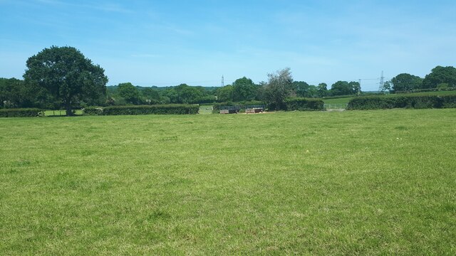
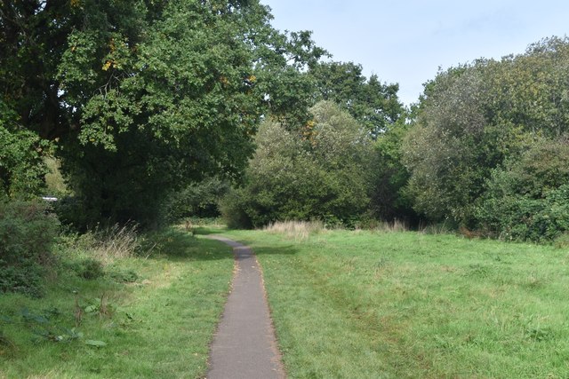
Loperwood Copse is a picturesque woodland located in Hampshire, England. Spanning approximately 50 acres, it is a cherished natural habitat that offers a serene escape from the bustling city life. The copse is nestled within the New Forest National Park, which is renowned for its diverse flora and fauna.

The woodland boasts a rich and varied ecosystem, with a dense canopy of towering trees that include oak, beech, and birch. These ancient trees provide shade and shelter for a myriad of wildlife species, making Loperwood Copse an ideal spot for nature enthusiasts and wildlife photographers.

The forest floor is adorned with a vibrant carpet of wildflowers, including bluebells, primroses, and wood anemones, which bloom in a riot of colors during the spring months. This creates a stunning visual display and attracts a plethora of insects and butterflies.

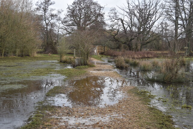
Visitors to Loperwood Copse can explore a network of well-marked trails that wind through the woodland, offering the opportunity for leisurely walks and peaceful contemplation. The tranquil atmosphere is enhanced by the gentle babbling of the nearby streams that meander through the copse, adding to the overall charm and tranquility of the area.

Loperwood Copse is also home to an array of wildlife, including deer, foxes, badgers, and a wide variety of bird species. Birdwatchers can spot woodpeckers, jays, and tawny owls, among others, while lucky visitors may even catch a glimpse of the elusive red squirrels that make their homes among the treetops.

Overall, Loperwood Copse in Hampshire offers a captivating and enchanting woodland experience, allowing visitors to immerse themselves in the natural beauty and tranquility of this idyllic forest setting.

If you have any feedback on the listing, please let us know in the comments section below.

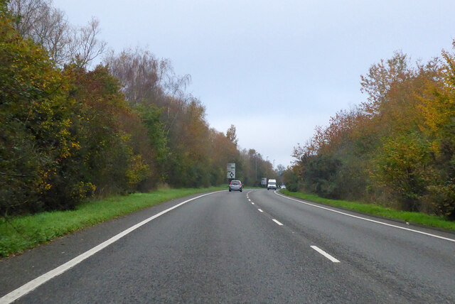
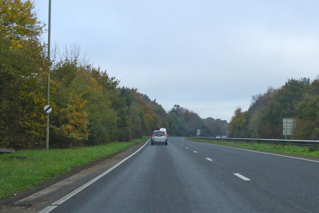
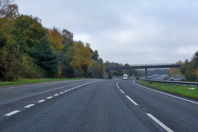
Loperwood Copse Images

Images are sourced within 2km of 50.929169/-1.5278683 or Grid Reference SU3314. Thanks to Geograph Open Source API. All images are credited.

Footbridge - M27 southbound
A36 bridge - M27 southbound
Signage - M27 northbound
A36 crossing M27
A36 crossing M27
Morrisons Supermarket This large branch of Morrisons is on the western edge of Totton close to the bypass.
Morrisons Supermarket
This large branch of Morrisons is on the western edge of Totton close to the bypass.
New housing development, Loperwood Lane
A326 northwards towards M27
A326 northwards towards M27 Approaching the roundabout crossing of the A336.
A326 northwards towards M27
Approaching the roundabout crossing of the A336.
A326 northwards towards M27
A326 northwards towards M27 The  A36 crosses the bridge, there is full interchange here.
A326 northwards towards M27
The A36 crosses the bridge, there is full interchange here.
Flooded path towards footbridge, Testwood Lakes Local water levels have been much higher in the last few days: the path is now almost uncovered again.
Flooded path towards footbridge, Testwood Lakes
Local water levels have been much higher in the last few days: the path is now almost uncovered again.
View across field near Brookes's Hill
Modern local authority housing in Calmore This is part of the development seen in <a href="https://www.geograph.org.uk/photo/5569914">SU3414 : New local authority housing under construction at Calmore</a>.
Modern local authority housing in Calmore
Roadside trees, Calmore Drive
Modern housing in West Totton The end of Shetland Close seen from Stonechat Drive.
Modern housing in West Totton
The end of Shetland Close seen from Stonechat Drive.
Path between playing fields at Testwood
Show me another place!

Loperwood Copse is located at Grid Ref: SU3314 (Lat: 50.929169, Lng: -1.5278683)

Administrative County: Hampshire

District: New Forest

Police Authority: Hampshire

What 3 Words

///failed.pocket.teardrop. Near Totton, Hampshire

Related Wikis

Tatchbury Mount Hospital

Tatchbury Mount Hospital is a health facility to the north of Totton, Hampshire, England. It is owned and managed by Southern Health NHS Foundation Trust...

A.F.C. Totton

Amalgamated Football Club Totton is a football club based in Totton, Hampshire, England. The club is affiliated to the Hampshire Football Association and...

Netley Marsh

Netley Marsh is a village and civil parish in Hampshire, close to the town of Totton. It lies within the New Forest District, and the New Forest National...

Totton College

Totton College is a further education college located in Totton, Hampshire, providing courses for mainly 16- to 19-year-olds as well as adult education...

Testwood Lakes

Testwood Lakes is a 55-hectare (140-acre) nature reserve on the northwest edge of Southampton in Hampshire, England. It is managed by the Hampshire and...

Winsor, Hampshire

Winsor is a village in the civil parish of Copythorne, in Hampshire, England. It is situated within the boundaries of the New Forest National Park. Surrounding...

Totton & Eling F.C.

Totton & Eling Football Club are a football club based in Totton & Eling, Hampshire, England. The club is affiliated to the Hampshire Football Association...

Ower

Ower is a hamlet in the New Forest district of Hampshire, England. Its nearest towns are Totton – approximately 3 miles (4.8 km) to the southeast, and...

Nearby Amenities

Located within 500m of 50.929169,-1.5278683
Bus Stop
Loperwood Lane
Bus: yes
Naptan AtcoCode: 1900HA080066
Naptan Bearing: E
Naptan CommonName: Loperwood Lane
Naptan Crossing: Forest Way
Naptan NaptanCode: hamamdjt
Naptan Street: Loperwood
Naptan Verified: no
Public Transport: platform
Source: naptan_import
Lat/Long: 50.9321551/-1.5254569
Bus Stop
Loperwood Lane
Bus: yes
Naptan AtcoCode: 1900HA080067
Naptan Bearing: W
Naptan CommonName: Loperwood Lane
Naptan Crossing: Forest Way
Naptan NaptanCode: hamamdjw
Naptan Street: Loperwood
Naptan Verified: no
Public Transport: platform
Source: naptan_import
Lat/Long: 50.9320922/-1.5254576
Bus Stop
Tatchbury Mount Hospital
Bus: yes
Naptan AtcoCode: 1900HA080068
Naptan Bearing: E
Naptan CommonName: Tachbury Mount Hospital
Naptan NaptanCode: hamamapw
Naptan Street: Loperwood
Naptan Verified: no
Public Transport: platform
Source: naptan_import
Lat/Long: 50.9321605/-1.5312487
Bus Stop
Tatchbury Mount Hospital
Bus: yes
Naptan AtcoCode: 1900HA080069
Naptan Bearing: W
Naptan CommonName: Tachbury Mount Hospital
Naptan NaptanCode: hamamapj
Naptan Street: Loperwood
Naptan Verified: no
Public Transport: platform
Source: naptan_import
Lat/Long: 50.932116/-1.531363
Mini Roundabout
Lat/Long: 50.9312405/-1.5281784
Crossing
Lat/Long: 50.9311304/-1.5277786
Crossing
Source: Bing
Lat/Long: 50.9308261/-1.5288118
Crossing
Lat/Long: 50.9307074/-1.5291109
Post Box
Collection Plate: CP7
Collection Times: Mo-Fr 16:15; Sa 07:15
Operator: Royal Mail
Operator Wikidata: Q638098
Post Box Type: lamp
Ref: SO40 601
Royal Cypher: EIIR
Royal Cypher Wikidata: Q33102113
Lat/Long: 50.9321035/-1.5312614
Noexit: yes
Lat/Long: 50.9308843/-1.5292373
Direction: S
Generator Method: photovoltaic
Generator Output Electricity: yes
Generator Solar Modules: 14
Generator Source: solar
Generator Type: solar_photovoltaic_panel
Location: roof
Power: generator
Lat/Long: 50.9294053/-1.5225013
Direction: SE
Generator Method: photovoltaic
Generator Output Electricity: yes
Generator Solar Modules: 12
Generator Source: solar
Generator Type: solar_photovoltaic_panel
Location: roof
Power: generator
Lat/Long: 50.9281695/-1.522796
Direction: SW
Generator Method: photovoltaic
Generator Output Electricity: yes
Generator Solar Modules: 15
Generator Source: solar
Generator Type: solar_photovoltaic_panel
Location: roof
Power: generator
Lat/Long: 50.9283157/-1.5225197
Chestnut Plantation
Place: locality
Lat/Long: 50.9327132/-1.5277841
Tatchbury Mount
Ele: 55
Natural: peak
Lat/Long: 50.9287365/-1.5319937
Crossing
Crossing: marked
Lat/Long: 50.9311003/-1.5293598
Barrier: lift_gate
Lat/Long: 50.9310921/-1.5316529
The data included in this document is from www.openstreetmap.org. The data is made available under ODbL.

Have you been to Loperwood Copse?

Leave your review of Loperwood Copse below (or comments, questions and feedback).