Rigg Moor Plantation

Wood, Forest in Yorkshire Harrogate

England

Rigg Moor Plantation

Farnham, Branton Court Branton Court is on the west side of Shaw Lane, a track which leads from Farnham to Copgrove. On the north-east facing wall which is alongside the track, there is a very large benchmark cut into the stonework to the left of 2 black letter boxes.
Farnham, Branton Court Credit: Mel Towler

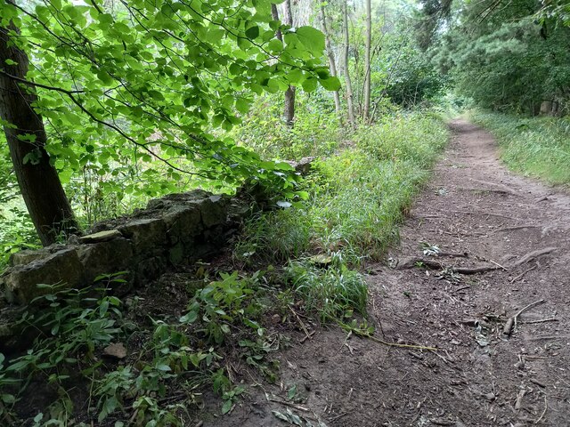
Rigg Moor Plantation is a picturesque woodland located in the county of Yorkshire, England. Covering an area of approximately 500 hectares, it is situated on Rigg Moor, a prominent hill in the region. The plantation is part of the larger North York Moors National Park, known for its diverse landscapes and rich biodiversity.

The forest primarily consists of coniferous trees, predominantly Scots pine and Sitka spruce, which were planted in the mid-20th century to provide timber resources. These tall, evergreen trees create a dense canopy that stretches across the landscape, offering shelter and nesting sites for various bird species. In addition to the conifers, there are also pockets of deciduous trees such as oak, birch, and rowan scattered throughout the plantation.

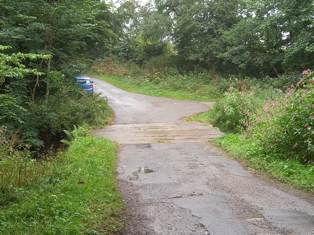
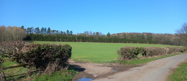
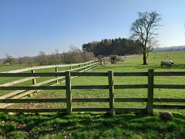
Rigg Moor Plantation is a popular destination for nature enthusiasts and outdoor enthusiasts alike. The forest is crisscrossed by a network of well-maintained walking trails, offering visitors the opportunity to explore the woodland and enjoy its tranquility. The scenic beauty of the area, with its rolling hills and sweeping vistas, attracts photographers and artists seeking inspiration from the natural surroundings.

The plantation also plays a vital role in the conservation of local wildlife. It provides a habitat for numerous species, including deer, foxes, badgers, and various woodland birds. The diverse flora and fauna found in Rigg Moor Plantation contribute to the overall ecological balance of the region.

Overall, Rigg Moor Plantation in Yorkshire is a cherished natural treasure, offering a peaceful retreat for visitors and serving as an essential habitat for a wide range of plant and animal life.

If you have any feedback on the listing, please let us know in the comments section below.

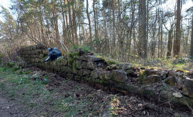
Rigg Moor Plantation Images

Images are sourced within 2km of 54.050739/-1.494523 or Grid Reference SE3361. Thanks to Geograph Open Source API. All images are credited.

Farnham, Branton Court Branton Court is on the west side of Shaw Lane, a track which leads from Farnham to Copgrove. On the north-east facing wall which is alongside the track, there is a very large benchmark cut into the stonework to the left of 2 black letter boxes.
Farnham, Branton Court
Branton Court is on the west side of Shaw Lane, a track which leads from Farnham to Copgrove. On the north-east facing wall which is alongside the track, there is a very large benchmark cut into the stonework to the left of 2 black letter boxes.
Farnham, Branton Court A wider angle looking south along Shaw Lane to Farnham. On the right is the house wall of Branton Court and a clear benchmark is cut into the stonework to the left of 2 black letter boxes.
Farnham, Branton Court
A wider angle looking south along Shaw Lane to Farnham. On the right is the house wall of Branton Court and a clear benchmark is cut into the stonework to the left of 2 black letter boxes.
Farnham, Shaw Bridge Shaw Bridge crosses a small stream; the track to the north goes to Copgrove, and the track to the south to Farnham. The OS database records a rivet on the eastern parapet of the bridge. Nothing was found. The bridge does not appear to be rebuilt. The parapet was only one stone course deep. It is likely the rivet and benchmark may now be covered with the deposits of mud on the track.
Farnham, Shaw Bridge
Shaw Bridge crosses a small stream; the track to the north goes to Copgrove, and the track to the south to Farnham. The OS database records a rivet on the eastern parapet of the bridge. Nothing was found. The bridge does not appear to be rebuilt. The parapet was only one stone course deep. It is likely the rivet and benchmark may now be covered with the deposits of mud on the track.
Farnham/Copgrove Green Lane This bench mark is cut into the old stone wall on the west side of the green lane which runs to/from Farnham and Copgrove.
Farnham/Copgrove Green Lane
This bench mark is cut into the old stone wall on the west side of the green lane which runs to/from Farnham and Copgrove.
Farnham/Copgrove Green Lane A wider angle showing Green Lane and the track northwards, and the old stone wall on the west side of the lane. There is a bench mark cut into the  1st stone course of the wall along this stretch.
Farnham/Copgrove Green Lane
A wider angle showing Green Lane and the track northwards, and the old stone wall on the west side of the lane. There is a bench mark cut into the 1st stone course of the wall along this stretch.
Robert Beck bridge This bridge is on the north/south track which runs to and from Farnham to Copgrove. According to the OS database there was a benchmark in this location. Today there is a more substantial bridge for the heavier machinery using the lanes, and no benchmark to be found.
Robert Beck bridge
This bridge is on the north/south track which runs to and from Farnham to Copgrove. According to the OS database there was a benchmark in this location. Today there is a more substantial bridge for the heavier machinery using the lanes, and no benchmark to be found.
Copgrove, Firlands Farm Firlands Farm is on the south side of the Burton Leonard/Farnham road. On the north facing gable end which is roadside, there is a benchmark cut into the lowest course of stone.
Copgrove, Firlands Farm
Firlands Farm is on the south side of the Burton Leonard/Farnham road. On the north facing gable end which is roadside, there is a benchmark cut into the lowest course of stone.
Copgrove, Firlands Farm A wider angle showing Firlands Farm on the south side of the Burton Leonard/Farnham road. On this north facing gable end, there is a benchmark cut into the lowest course of stone.
Copgrove, Firlands Farm
A wider angle showing Firlands Farm on the south side of the Burton Leonard/Farnham road. On this north facing gable end, there is a benchmark cut into the lowest course of stone.
Burton Leonard, The Toll House The Toll House is on the north side of the Burton Leonard/Copgrove road and is now a private residence. On the second course of stone, on the left corner stone of the house, there is a benchmark.
Burton Leonard, The Toll House
The Toll House is on the north side of the Burton Leonard/Copgrove road and is now a private residence. On the second course of stone, on the left corner stone of the house, there is a benchmark.
Burton Leonard, The Toll House A wider angle showing the Toll House which is on the north side of the Burton Leonard/Copgrove road and is now a private residence. On the second course of stone, on the left corner stone of the house, there is a benchmark. To the right of the wooden gatepost.
Burton Leonard, The Toll House
A wider angle showing the Toll House which is on the north side of the Burton Leonard/Copgrove road and is now a private residence. On the second course of stone, on the left corner stone of the house, there is a benchmark. To the right of the wooden gatepost.
Brearton, St John's church The benchmark is cut into a north-west face of the church.
Brearton, St John's church
The benchmark is cut into a north-west face of the church.
Brearton, St John's church There is a benchmark cut into the north-west face of the church.
Brearton, St John's church
There is a benchmark cut into the north-west face of the church.
Brearton, Warren Lane According to the OS benchmark database there was a benchmark cut into a stone on the roadside wall on the north side of the lane. The wall has gone, and the cutmark has been destroyed.
Brearton, Warren Lane
According to the OS benchmark database there was a benchmark cut into a stone on the roadside wall on the north side of the lane. The wall has gone, and the cutmark has been destroyed.
Brearton, Warren Lane According to the OS benchmark database one of the gateposts in this field entrance had a benchmark cut into the face. Today there are no gateposts, and no gate and the benchmark has been destroyed.
Brearton, Warren Lane
According to the OS benchmark database one of the gateposts in this field entrance had a benchmark cut into the face. Today there are no gateposts, and no gate and the benchmark has been destroyed.
Brearton, Warren Lane According to the OS benchmark database there was a small building stood in the corner of this field with a benchmark cut into the north-west face. The building has been demolished and the benchmark destroyed.
Brearton, Warren Lane
According to the OS benchmark database there was a small building stood in the corner of this field with a benchmark cut into the north-west face. The building has been demolished and the benchmark destroyed.
Brearton, Green Lane According to the OS benchmark database there is a benchmark cut into a lower stone on this stretch of wall. The wall remains intact and having cleared some of the growth around the wall base no mark was found.
Brearton, Green Lane
According to the OS benchmark database there is a benchmark cut into a lower stone on this stretch of wall. The wall remains intact and having cleared some of the growth around the wall base no mark was found.
Farnham, Shaw Bridge According to the OS benchmark database there was a OS rivet cut into a wall a slight distance from the east parapet. Nothing was found.
Farnham, Shaw Bridge
According to the OS benchmark database there was a OS rivet cut into a wall a slight distance from the east parapet. Nothing was found.
Farnham green lane The wall is to the left/west of the green lane, and has a very clear benchmark cut into the south face.
Farnham green lane
The wall is to the left/west of the green lane, and has a very clear benchmark cut into the south face.
Show me another place!

Rigg Moor Plantation is located at Grid Ref: SE3361 (Lat: 54.050739, Lng: -1.494523)

Division: West Riding

Administrative County: North Yorkshire

District: Harrogate

Police Authority: North Yorkshire

What 3 Words

///landscape.teaspoons.sitting. Near Knaresborough, North Yorkshire

Related Wikis

Brearton

Brearton is a village and civil parish in the Harrogate borough of North Yorkshire, England, situated about 3 miles (4.8 km) north of Knaresborough. The...

Farnham Mires

Farnham Mires is a Site of Special Scientific Interest, or SSSI, to the east of the village of Farnham, North Yorkshire, England. It consists of a spring...

Burton Leonard

Burton Leonard is a village and civil parish in the Harrogate district of North Yorkshire, England, and approximately 7 miles (11 km) south from Ripon...

Farnham, North Yorkshire

Farnham is a village and civil parish in the Harrogate district of North Yorkshire, England. It is situated 2 miles (3.2 km) north of Knaresborough....

Copgrove

Copgrove is a village and civil parish in the Harrogate district of North Yorkshire, England, five miles (8 km) south-west of Boroughbridge and the A1...

Scotton, Harrogate

Scotton is a small village and civil parish in the Harrogate district of North Yorkshire, England with a population of 524 in the 2001 census, increasing...

Nidd Hall

Nidd Hall was a 19th-century country house, now a hotel, in the village of Nidd, North Yorkshire, England. It is a Grade II listed building. It is constructed...

South Stainley

South Stainley is a small village in the Harrogate District, in the county of North Yorkshire, England. Nearby settlements include the city of Ripon, the...

Have you been to Rigg Moor Plantation?

Leave your review of Rigg Moor Plantation below (or comments, questions and feedback).