Furzy Ground

Wood, Forest in Hampshire New Forest

England

Furzy Ground

Nelson Place, Lymington Nelson Place in the town of Lymington, in Hampshire.  This street is on the route of the Solent Way as it makes its way through the town.
Nelson Place, Lymington Credit: Malc McDonald

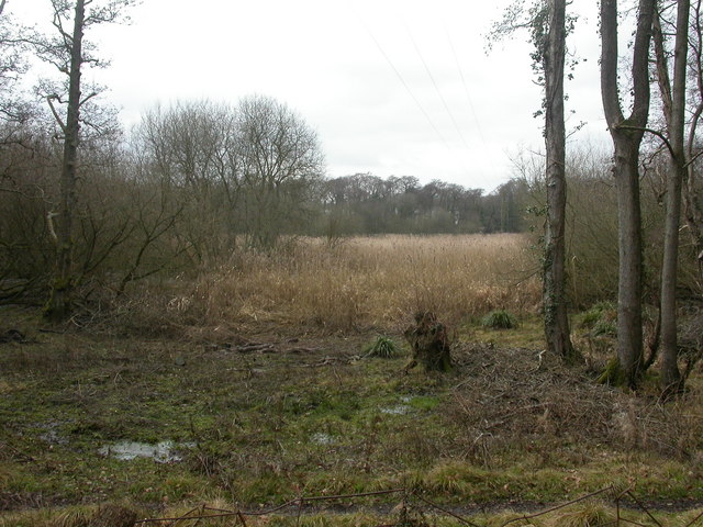
Furzy Ground is a charming woodland area located in Hampshire, England. Situated near the village of Wood, this forested landscape offers a picturesque setting for nature enthusiasts and those seeking tranquility. Covering an area of approximately 50 acres, Furzy Ground is characterized by its dense growth of trees, including a mix of broadleaf and coniferous species.

Upon entering Furzy Ground, visitors are greeted by a network of well-maintained footpaths that wind their way through the woodland. These paths provide easy access to explore the various sections of the forest, offering opportunities for leisurely walks, hiking, and even cycling. The forest floor is carpeted with a rich layer of fallen leaves and moss, creating a natural and serene environment.

The diverse range of flora and fauna found in Furzy Ground is another notable feature. Among the trees, visitors may encounter oak, beech, birch, and pine, providing a diverse canopy that changes with the seasons. Wildflowers, such as bluebells and primroses, add vibrant splashes of color to the forest floor during springtime.

The forest is also home to a variety of wildlife, including squirrels, deer, and a wide array of bird species. Birdwatchers can spot woodpeckers, owls, and various songbirds within the dense foliage.

Furzy Ground offers a peaceful retreat from the hustle and bustle of everyday life, making it an ideal destination for individuals looking to reconnect with nature. Whether it's a leisurely stroll or a more adventurous hike, visitors are sure to find solace and beauty in this enchanting woodland.

If you have any feedback on the listing, please let us know in the comments section below.

Furzy Ground Images

Images are sourced within 2km of 50.774212/-1.5351729 or Grid Reference SZ3297. Thanks to Geograph Open Source API. All images are credited.

Nelson Place, Lymington Nelson Place in the town of Lymington, in Hampshire.  This street is on the route of the Solent Way as it makes its way through the town.
Nelson Place, Lymington
Nelson Place in the town of Lymington, in Hampshire. This street is on the route of the Solent Way as it makes its way through the town.
Captain's Row, Lymington Captain's Row is a street in the town of Lymington, in Hampshire.  This street is on the route of the Solent Way as it makes its way through the town.
Captain's Row, Lymington
Captain's Row is a street in the town of Lymington, in Hampshire. This street is on the route of the Solent Way as it makes its way through the town.
Lymington Quay Boats moored at a quay on the Lymington River in the town of Lymington.  In the background, a train crosses the bridge between Lymington Town and Lymington Pier stations.
Lymington Quay
Boats moored at a quay on the Lymington River in the town of Lymington. In the background, a train crosses the bridge between Lymington Town and Lymington Pier stations.
Slipway at Lymington Quay A slipway at Lymington Quay, on the Lymington River.
Slipway at Lymington Quay
A slipway at Lymington Quay, on the Lymington River.
The Ship Inn, Lymington The Ship Inn and adjoining buildings on the quayside at Lymington, in Hampshire.
The Ship Inn, Lymington
The Ship Inn and adjoining buildings on the quayside at Lymington, in Hampshire.
Quay Street, Lymington Quay Street is a narrow pedestrianised street in Lymington, in Hampshire.
Quay Street, Lymington
Quay Street is a narrow pedestrianised street in Lymington, in Hampshire.
Quay Hill, Lymington Quay Hill is a pedestrianised cobbled street in Lymington, in Hampshire.
Quay Hill, Lymington
Quay Hill is a pedestrianised cobbled street in Lymington, in Hampshire.
Quay Hill, Lymington Quay Hill is a pedestrianised cobbled street in Lymington, in Hampshire.
Quay Hill, Lymington
Quay Hill is a pedestrianised cobbled street in Lymington, in Hampshire.
Station Street, Lymington Station Street in Lymington, in Hampshire.  As its name suggests, it leads to a railway station, Lymington Town.
Station Street, Lymington
Station Street in Lymington, in Hampshire. As its name suggests, it leads to a railway station, Lymington Town.
Bosun's Chair, Lymington The Bosun's Chair pub in the town of Lymington, in Hampshire.  The pub's name, with a nautical theme, is a clue that Lymington is close to the coast.  The town is a base for boating and yachting.
Bosun's Chair, Lymington
The Bosun's Chair pub in the town of Lymington, in Hampshire. The pub's name, with a nautical theme, is a clue that Lymington is close to the coast. The town is a base for boating and yachting.
Lymington Town station forecourt The forecourt at Lymington Town railway station.  The older brick building in the background, to the left, is the station building.
Lymington Town station forecourt
The forecourt at Lymington Town railway station. The older brick building in the background, to the left, is the station building.
Rodlease Lane
Rodlease Lane
Junction at the southern end of Rodlease Lane
The Red Lion public house at Boldre
Lymington River north of Boldre Bridge
High Street Lymington Viewed from an elevated position - open topped bus!.
High Street Lymington
Viewed from an elevated position - open topped bus!.
Norleywood Road Near Bull Hill.
Norleywood Road
Near Bull Hill.
Quay Street, Lymington Probably the most photographed street in Lymington, Quay Street is in the heart of the old town centre leading down from the High Street to the waterfront.
Quay Street, Lymington
Probably the most photographed street in Lymington, Quay Street is in the heart of the old town centre leading down from the High Street to the waterfront.
Show me another place!

Furzy Ground is located at Grid Ref: SZ3297 (Lat: 50.774212, Lng: -1.5351729)

Administrative County: Hampshire

District: New Forest

Police Authority: Hampshire

What 3 Words

///lump.seemingly.sweeter. Near Lymington, Hampshire

Related Wikis

Walhampton School

Walhampton School is a coeducational private preparatory school situated in the hamlet of Walhampton, near Lymington, England. It is the result of the...

Lymington River Reedbeds

Lymington River Reedbeds is a 41.7-hectare (103-acre) biological Site of Special Scientific Interest in Lymington in Hampshire. It is a nature reserve...

Portmore, Hampshire

Portmore is a hamlet in the New Forest National Park of Hampshire, England. It is in the civil parish of Boldre. Its nearest town is Lymington, which...

Lymington New Forest Hospital

Lymington New Forest Hospital is a community hospital in Lymington, Hampshire. It is managed by the Southern Health NHS Foundation Trust. == History... ==

Nearby Amenities

Located within 500m of 50.774212,-1.5351729
Warborne Farm
Place: farm
Lat/Long: 50.7770308/-1.5336013
Power: pole
Lat/Long: 50.7731755/-1.5327457
Power: pole
Lat/Long: 50.7725445/-1.5371794
Power: pole
Lat/Long: 50.7718575/-1.5383059
Power: pole
Lat/Long: 50.7719372/-1.5402961
Power: pole
Lat/Long: 50.7730737/-1.5409559
Warborne
Place: hamlet
Lat/Long: 50.775896/-1.5363747
Vicars Hill
Ele: 25
Natural: peak
Lat/Long: 50.7755994/-1.5396088
The data included in this document is from www.openstreetmap.org. The data is made available under ODbL.

Have you been to Furzy Ground?

Leave your review of Furzy Ground below (or comments, questions and feedback).