Great Fry's Hill Copse

Wood, Forest in Hampshire New Forest

England

Great Fry's Hill Copse

Houses on Undershore Road Looking across Lymington River, with the sluices under the road between the tidal and non-tidal river discharging a fair amount of water.
Houses on Undershore Road Credit: Robin Webster

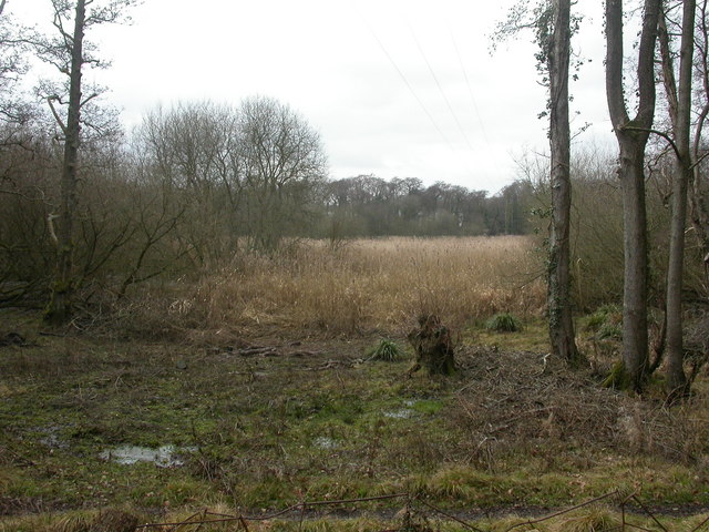
Great Fry's Hill Copse is a picturesque woodland located in Hampshire, England. Spread across a sprawling area, this forest is a natural haven for nature enthusiasts and wildlife lovers alike. With its lush greenery and diverse ecosystem, it offers a serene escape from the hustle and bustle of urban life.

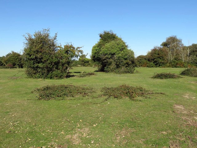
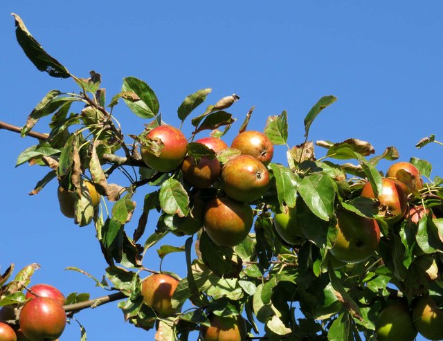
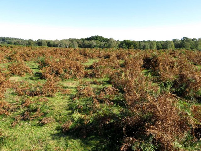
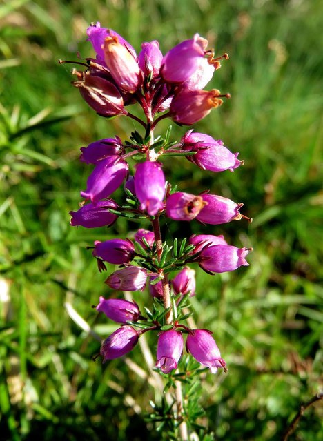
The woodland is primarily composed of broadleaf trees, including oak, beech, and ash, which create a dense canopy overhead. This provides a shaded and cool environment, perfect for leisurely walks or picnics during warmer months. The forest floor is carpeted with a rich array of flora, such as bluebells, primroses, and wild garlic, which add vibrant pops of color to the landscape.

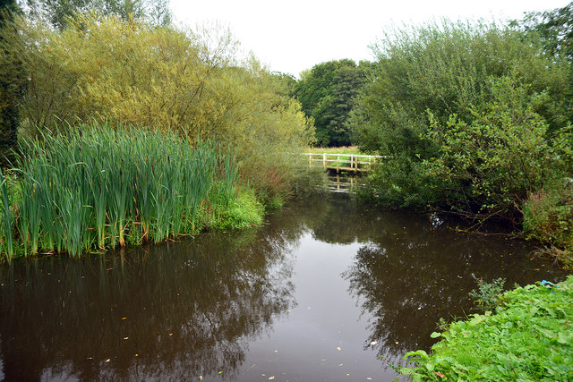
Great Fry's Hill Copse is also home to a variety of wildlife species. Visitors may catch a glimpse of deer, foxes, badgers, and numerous bird species, including woodpeckers and owls. The forest's diverse habitats, including glades and ponds, attract a wide range of insects and amphibians as well.

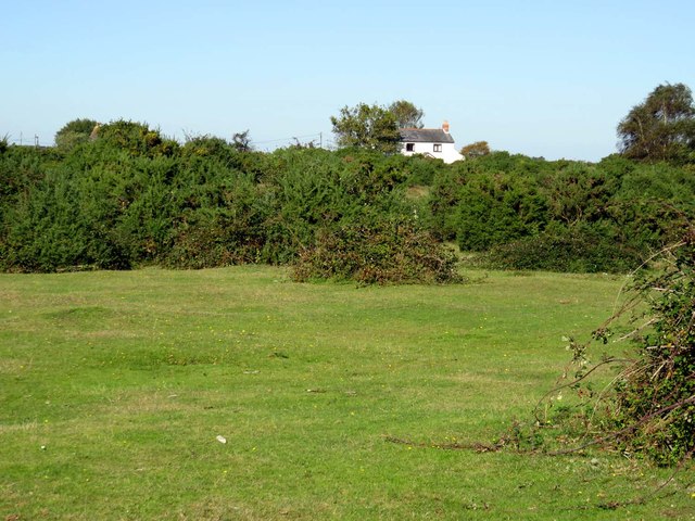
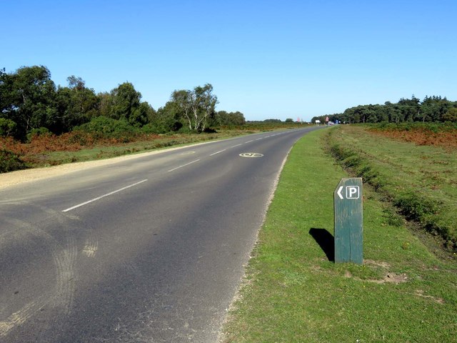
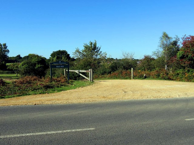
Several walking trails wind through the woodland, allowing visitors to explore its beauty at their own pace. These paths are well-maintained and offer stunning views of the surrounding countryside. Additionally, the forest is equipped with picnic areas and benches, providing ample opportunities to relax and enjoy the tranquility of the natural surroundings.

Overall, Great Fry's Hill Copse presents an idyllic retreat for those seeking solace in nature. Its enchanting woodlands, abundant wildlife, and well-marked trails make it a must-visit destination for anyone looking to connect with the great outdoors.

If you have any feedback on the listing, please let us know in the comments section below.

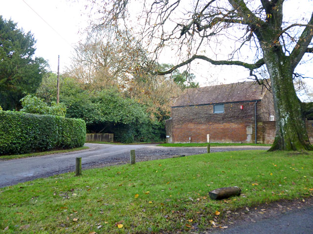
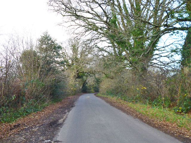
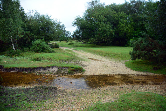
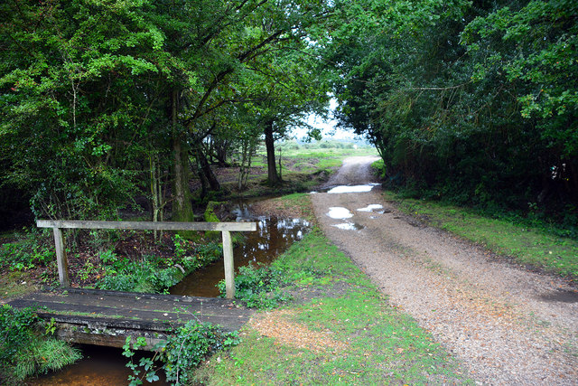
Great Fry's Hill Copse Images

Images are sourced within 2km of 50.780368/-1.5410125 or Grid Reference SZ3297. Thanks to Geograph Open Source API. All images are credited.

Houses on Undershore Road Looking across Lymington River, with the sluices under the road between the tidal and non-tidal river discharging a fair amount of water.
Houses on Undershore Road
Looking across Lymington River, with the sluices under the road between the tidal and non-tidal river discharging a fair amount of water.
Junction of Undershore and Hundred Lane Hundred Lane goes to the left of the building.
Junction of Undershore and Hundred Lane
Hundred Lane goes to the left of the building.
Rodlease Lane Rodlease House is a little further on, to the right.
Rodlease Lane
Rodlease House is a little further on, to the right.
Boldre church The remotely situated church of St. John the Baptist, with a surprisingly large and well filled churchyard.
Boldre church
The remotely situated church of St. John the Baptist, with a surprisingly large and well filled churchyard.
Warborne Lane, Boldre At least Google thinks it is, but there is some doubt. There are no road signs, except at the northern end in Pilley two lanes merge to form this, and these are both signed as Burnt House Lane.
Warborne Lane, Boldre
At least Google thinks it is, but there is some doubt. There are no road signs, except at the northern end in Pilley two lanes merge to form this, and these are both signed as Burnt House Lane.
Lymington River Above the tidal limit. The view is from above the sluices under Bridge Road that discharge the river into the tideway.
Lymington River
Above the tidal limit. The view is from above the sluices under Bridge Road that discharge the river into the tideway.
Ford at Pilley This is the first of two fords found at the end of Wooden House Lane at Pilley.
Ford at Pilley
This is the first of two fords found at the end of Wooden House Lane at Pilley.
Ford at Pilley This is the second of the fords at the end of Wooden House Lane at Pilley.
Ford at Pilley
This is the second of the fords at the end of Wooden House Lane at Pilley.
Former Ford at Boldre This ford on Shallow Lane on the Lymington River does not look to have been used for some time.
Former Ford at Boldre
This ford on Shallow Lane on the Lymington River does not look to have been used for some time.
Heath near Bull Hill
Apples near Bull Hill
Heath near Bull Hill
The B3054 near Bull Hill
Bracken heath near Bull Hill
Heather growing near Bull Hill
The entrance to Bull Hill car park
New Forest: Rodlease Rough
Boldre, St. John the Baptist's Church: The west doorway 1
Show me another place!

Great Fry's Hill Copse is located at Grid Ref: SZ3297 (Lat: 50.780368, Lng: -1.5410125)

Administrative County: Hampshire

District: New Forest

Police Authority: Hampshire

What 3 Words

///patrolled.crossing.rebounder. Near Lymington, Hampshire

Related Wikis

Pilley, Hampshire

Pilley is a small village in the civil parish of Boldre, in the New Forest national park in Hampshire, England. Pilley is located 2 miles north of the...

Boldre

Boldre is a village and civil parish in the New Forest district of Hampshire, England. It is in the south of the New Forest National Park, above the broadening...

Lymington River Reedbeds

Lymington River Reedbeds is a 41.7-hectare (103-acre) biological Site of Special Scientific Interest in Lymington in Hampshire. It is a nature reserve...

Ampress Works Halt railway station

Ampress Works Halt was a halt station on the Lymington Branch Line which, between 1956 and 1989, served the Wellworthy engineering works near Lymington...

Lymington New Forest Hospital

Lymington New Forest Hospital is a community hospital in Lymington, Hampshire. It is managed by the Southern Health NHS Foundation Trust. == History... ==

Walhampton School

Walhampton School is a coeducational private preparatory school situated in the hamlet of Walhampton, near Lymington, England. It is the result of the...

Portmore, Hampshire

Portmore is a hamlet in the New Forest National Park of Hampshire, England. It is in the civil parish of Boldre. Its nearest town is Lymington, which...
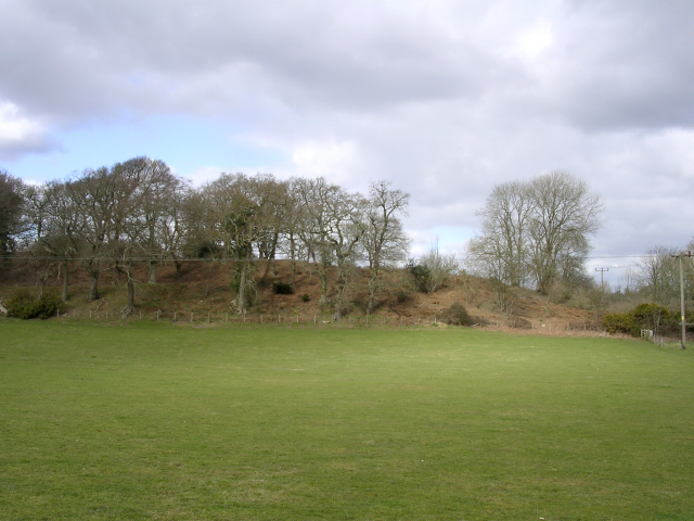
Buckland Rings

Buckland Rings is the site of an Iron Age hill fort in the town of Lymington, Hampshire. Today, the mounds and dykes around the outside which once constituted...

Nearby Amenities

Located within 500m of 50.780368,-1.5410125
Source: Landsat
Lat/Long: 50.7796754/-1.5464153
Source: Landsat
Lat/Long: 50.779374/-1.5461903
Source: Landsat
Lat/Long: 50.7791887/-1.5453173
Source: Landsat
Lat/Long: 50.7789027/-1.5453709
Source: Landsat
Lat/Long: 50.778689/-1.5454063
Source: Landsat
Lat/Long: 50.7781823/-1.5455404
Source: Landsat
Lat/Long: 50.7773568/-1.5460702
Bus Stop
Shallow Lane
Bus: yes
Naptan AtcoCode: 1900HA080580
Naptan Bearing: SE
Naptan CommonName: Shallow Lane
Naptan Crossing: Shallow Lane
Naptan NaptanCode: hamajwdm
Naptan Street: Pilley Hill
Naptan Verified: no
Source: naptan_import
Lat/Long: 50.7826088/-1.5443773
Bus Stop
Shallow Lane
Bus: yes
Naptan AtcoCode: 1900HA080581
Naptan Bearing: NW
Naptan CommonName: Shallow Lane
Naptan Crossing: Shallow Lane
Naptan NaptanCode: hamajwdg
Naptan Street: Pilley Hill
Naptan Verified: no
Source: naptan_import
Lat/Long: 50.782591/-1.54442
Bus Stop
William Gilpin School
Bus: yes
Naptan AtcoCode: 1900HA080582
Naptan Bearing: E
Naptan CommonName: William Gilpin School
Naptan Crossing: Gilpin Close
Naptan NaptanCode: hamajwtd
Naptan Street: Pilley Hill
Naptan Verified: no
Source: naptan_import
Lat/Long: 50.7824226/-1.5381803
Bus Stop
William Gilpin School
Bus: yes
Naptan AtcoCode: 1900HA080583
Naptan Bearing: W
Naptan CommonName: William Gilpin School
Naptan Crossing: Gilpin Close
Naptan NaptanCode: hamajwtg
Naptan Street: Pilley Hill
Naptan Verified: no
Source: naptan_import
Lat/Long: 50.7823596/-1.5381809
Bus Stop
Church Lane Corner
Bus: yes
Naptan AtcoCode: 1900HA080584
Naptan Bearing: W
Naptan CommonName: Church Lane Corner
Naptan Crossing: Opp Church Lane Corner
Naptan NaptanCode: hamamagw
Naptan Street: Pilley Hill
Naptan Verified: no
Source: naptan_import
Lat/Long: 50.7827981/-1.5353679
Bus Stop
Church Lane Corner
Bus: yes
Naptan AtcoCode: 1900HA080585
Naptan Bearing: E
Naptan CommonName: Church Lane Corner
Naptan Crossing: Church Lane Corner
Naptan NaptanCode: hamamagt
Naptan Street: Pilley Hill
Naptan Verified: no
Source: naptan_import
Lat/Long: 50.7828522/-1.5353958
Pilley
Is In: Hampshire, England, UK
Place: hamlet
Wikidata: Q11817067
Lat/Long: 50.7827109/-1.536465
Spinners Garden
Leisure: garden
Lat/Long: 50.7811408/-1.5414864
Post Box
Operator: Royal Mail
Operator Wikidata: Q638098
Ref: SO41 150
Lat/Long: 50.7824458/-1.5384347
Bench
Lat/Long: 50.7794027/-1.5466516
The data included in this document is from www.openstreetmap.org. The data is made available under ODbL.

Have you been to Great Fry's Hill Copse?

Leave your review of Great Fry's Hill Copse below (or comments, questions and feedback).