Windertonroad Spinney
Wood, Forest in Warwickshire Stratford-on-Avon
England
Windertonroad Spinney

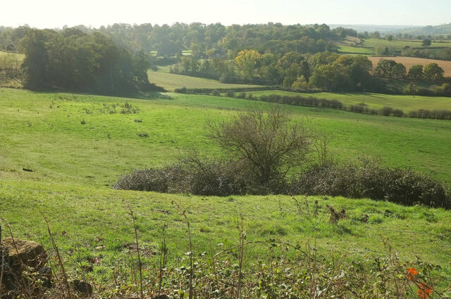
Windertonroad Spinney is a picturesque woodland located in Warwickshire, England. Nestled in the heart of the countryside, it covers an area of approximately 20 acres. The spinney is characterized by a dense growth of various tree species, including oak, beech, ash, and birch, creating a lush and vibrant environment.
The woodland is known for its rich biodiversity and is home to a wide range of flora and fauna. The forest floor is carpeted with a variety of wildflowers, such as bluebells, primroses, and wood anemones, which bloom in abundance during the spring season. The diverse vegetation provides a habitat for numerous bird species, including woodpeckers, owls, and thrushes, making it a haven for birdwatchers and nature enthusiasts.
Windertonroad Spinney offers a tranquil and serene escape from the hustle and bustle of everyday life. It is a popular destination for walkers, joggers, and dog walkers, who can explore the numerous pathways that wind through the woods. The enchanting atmosphere and the soothing sound of rustling leaves make it an ideal spot for relaxation and meditation.
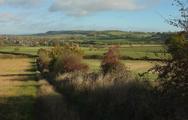
The spinney is located near the village of Winderton, and its proximity to surrounding farmland adds to its charm. The woodland is well-maintained, with designated picnic areas and benches scattered throughout, allowing visitors to enjoy a peaceful outdoor meal amidst nature.
Overall, Windertonroad Spinney is a delightful woodland retreat in Warwickshire, offering a stunning natural landscape, abundant wildlife, and a tranquil ambiance for visitors to enjoy.
If you have any feedback on the listing, please let us know in the comments section below.
Windertonroad Spinney Images
Images are sourced within 2km of 52.073328/-1.5224238 or Grid Reference SP3241. Thanks to Geograph Open Source API. All images are credited.


Windertonroad Spinney is located at Grid Ref: SP3241 (Lat: 52.073328, Lng: -1.5224238)
Administrative County: Warwickshire
District: Stratford-on-Avon
Police Authority: Warwickshire
What 3 Words
///admiral.sanded.stiffly. Near Lower Brailes, Warwickshire
Nearby Locations
Related Wikis
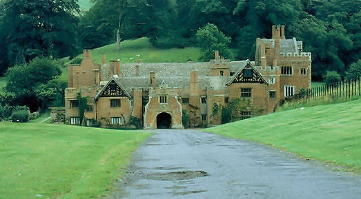
Compton Wynyates
Compton Wynyates is a Tudor country house in Warwickshire, England, a Grade I listed building. The Tudor period house is constructed of red brick and built...
Compton Wynyates (parish)
Compton Wynyates or Compton Wyniates is an ancient parish and civil parish in Stratford-on-Avon District, Warwickshire, England. It includes the house...
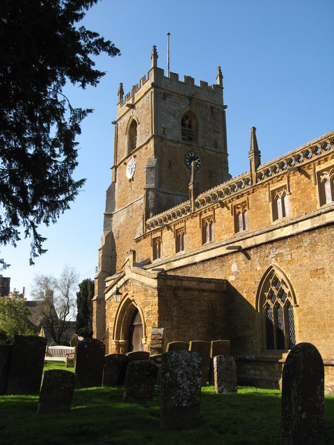
Tysoe
Tysoe is a civil parish in the Stratford-on-Avon District of Warwickshire, England. The parish is on the boundary with Oxfordshire, about 7+1⁄2 miles...
Brailes
Brailes is a civil parish about 3 miles (5 km) east of Shipston-on-Stour in Warwickshire, England. It includes the two villages of Lower and Upper Brailes...

Epwell
Epwell is a village and civil parish in the north of Oxfordshire about 6 miles (10 km) west of Banbury. The 2011 Census recorded the parish population...

Whatcote
Whatcote is a village and civil parish in Warwickshire, England, about 4 miles (6.4 km) northeast of Shipston on Stour in the Vale of the Red Horse. The...

Red Horse of Tysoe
The Red Horse of Tysoe was a hill figure in the parish of Tysoe, South Warwickshire, England, cut into the red clay below the escarpment of Edgehill. It...

Oxhill, Warwickshire
Oxhill is a village in South Warwickshire, England, off the A422 road between Stratford-upon-Avon and Banbury. The population taken at the 2011 census...
Nearby Amenities
Located within 500m of 52.073328,-1.5224238Have you been to Windertonroad Spinney?
Leave your review of Windertonroad Spinney below (or comments, questions and feedback).