Balls Plantation

Wood, Forest in Hampshire Test Valley

England

Balls Plantation

Footpath sculpture A group of rooks beside the Monarch's Way and Clarendon Way.
Footpath sculpture Credit: David Martin

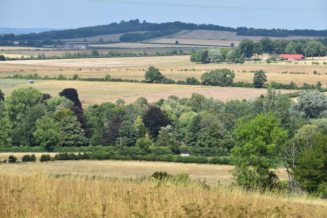
Balls Plantation is a picturesque woodland located in Hampshire, England. Nestled within the heart of the Hampshire countryside, this enchanting forest covers an area of approximately 50 hectares. With its diverse range of tree species, meandering trails, and tranquil atmosphere, Balls Plantation offers a serene escape from the bustling city life.

The woodland is primarily composed of native broadleaf trees such as oak, beech, and birch, creating a rich and varied ecosystem. These majestic trees provide a haven for numerous bird species, including woodpeckers, tits, and finches, as well as small mammals like squirrels and rabbits.

Visitors to Balls Plantation can explore its well-maintained footpaths, which wind through the forest and offer breathtaking views of the surrounding landscape. The trails are suitable for both leisurely strolls and more challenging hikes, catering to visitors of all ages and abilities. Along the way, walkers may encounter wildflowers, ferns, and mosses that add a touch of vibrant color to the woodland.

In addition to its natural beauty, Balls Plantation also provides recreational opportunities, with designated picnic areas and benches scattered throughout the forest. These spots offer visitors a chance to relax, unwind, and enjoy the peaceful ambiance of their surroundings.

Overall, Balls Plantation is a haven for nature lovers, offering a diverse range of flora and fauna, well-maintained trails, and a tranquil atmosphere. Whether one seeks a leisurely walk or a deeper connection with nature, this charming woodland in Hampshire provides a perfect escape from the demands of everyday life.

If you have any feedback on the listing, please let us know in the comments section below.

Balls Plantation Images

Images are sourced within 2km of 51.082272/-1.5348353 or Grid Reference SU3231. Thanks to Geograph Open Source API. All images are credited.

Footpath sculpture A group of rooks beside the Monarch's Way and Clarendon Way.
Footpath sculpture
A group of rooks beside the Monarch's Way and Clarendon Way.
Footpath behind houses at Broughton
Rusty barn north of Hayter's Farm
Track between fields north of Hayter's Farm
Track near Eveley Wood
View across field to Roake Farm
Beech Tree Walk entering woods Narrow road through a tunnel of trees.
Beech Tree Walk entering woods
Narrow road through a tunnel of trees.
View over Broughton towards Danebury Hill The course of the Wallop Brook is through the trees in the valley bottom, with the Iron Age Hill Fort at Danebury on the skyline.
View over Broughton towards Danebury Hill
The course of the Wallop Brook is through the trees in the valley bottom, with the Iron Age Hill Fort at Danebury on the skyline.
Depth gauge in dry stream bed The Wallop Brook is completely dry in a record-breaking dry summer.
Depth gauge in dry stream bed
The Wallop Brook is completely dry in a record-breaking dry summer.
Placing the last bale The tractor is collecting previously stacked bales, and will now move on to the next stack.
Placing the last bale
The tractor is collecting previously stacked bales, and will now move on to the next stack.
Sloe progress Sloes hanging across the path.
Sloe progress
Sloes hanging across the path.
By-way approaching Houghton Shown on the map as a by-way, this is actually a very narrow path, with the bushes on either side sometimes meeting in the middle, making for <a href="https://www.geograph.org.uk/photo/7260730">SU3233 : Sloe progress</a>.
By-way approaching Houghton
Shown on the map as a by-way, this is actually a very narrow path, with the bushes on either side sometimes meeting in the middle, making for SU3233 : Sloe progress.
Houghton Village Hall The hall stands at the corner of a small recreation ground.
Houghton Village Hall
The hall stands at the corner of a small recreation ground.
Footbridge across the River Test at Houghton The River Test is in two main channels at the point - this is the North Head Carrier, the Park Stream being further east.
Footbridge across the River Test at Houghton
The River Test is in two main channels at the point - this is the North Head Carrier, the Park Stream being further east.
East bank of the Test at Houghton As seen from <a href="https://www.geograph.org.uk/photo/7260847">SU3431 : Footbridge across the River Test at Houghton</a>. The largest-scale OS mapping shows the course of a very indirect ford, which reaches the east bank at this point..
East bank of the Test at Houghton
As seen from SU3431 : Footbridge across the River Test at Houghton. The largest-scale OS mapping shows the course of a very indirect ford, which reaches the east bank at this point..
Field edge north of Faithfulls Drove Looking back towards Houghton. The village is hidden by the trees.
Field edge north of Faithfulls Drove
Looking back towards Houghton. The village is hidden by the trees.
Monarch’s Way and Clarendon Way Two long-distance footpaths sharing the same farm track west of Houghton.
Monarch’s Way and Clarendon Way
Two long-distance footpaths sharing the same farm track west of Houghton.
Large field west of Acorn Ground A wide view down a shallow dry valley which descends from Broughton Hill.
Large field west of Acorn Ground
A wide view down a shallow dry valley which descends from Broughton Hill.
Show me another place!

Balls Plantation is located at Grid Ref: SU3231 (Lat: 51.082272, Lng: -1.5348353)

Administrative County: Hampshire

District: Test Valley

Police Authority: Hampshire

What 3 Words

///trains.laptop.uncle. Near East Dean, Hampshire
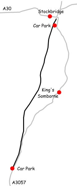
Related Wikis

Bossington, Hampshire

Bossington is a village and civil parish in the Test Valley district of Hampshire, England. According to the 2001 census it had a population of 41. The...
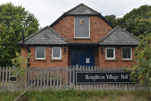
Houghton, Hampshire

Houghton ( HOH-tən) is a small village and civil parish in the Test Valley district of Hampshire, England. The village is situated alongside the River...

Houghton Down

Houghton Down is a hamlet in the civil parish of Houghton in the Test Valley district of Hampshire, England. Its nearest town is Stockbridge, which lies...

Horsebridge railway station

Horsebridge was a railway station on the closed Sprat and Winkle Line which served the Hampshire village of Houghton. It closed in 1964, a casualty of...

Testway

Testway is a 5-mile (8 km) off-road cycle path in Hampshire, England. The path follows the route of the disused Sprat and Winkle Line between Stonymarsh...
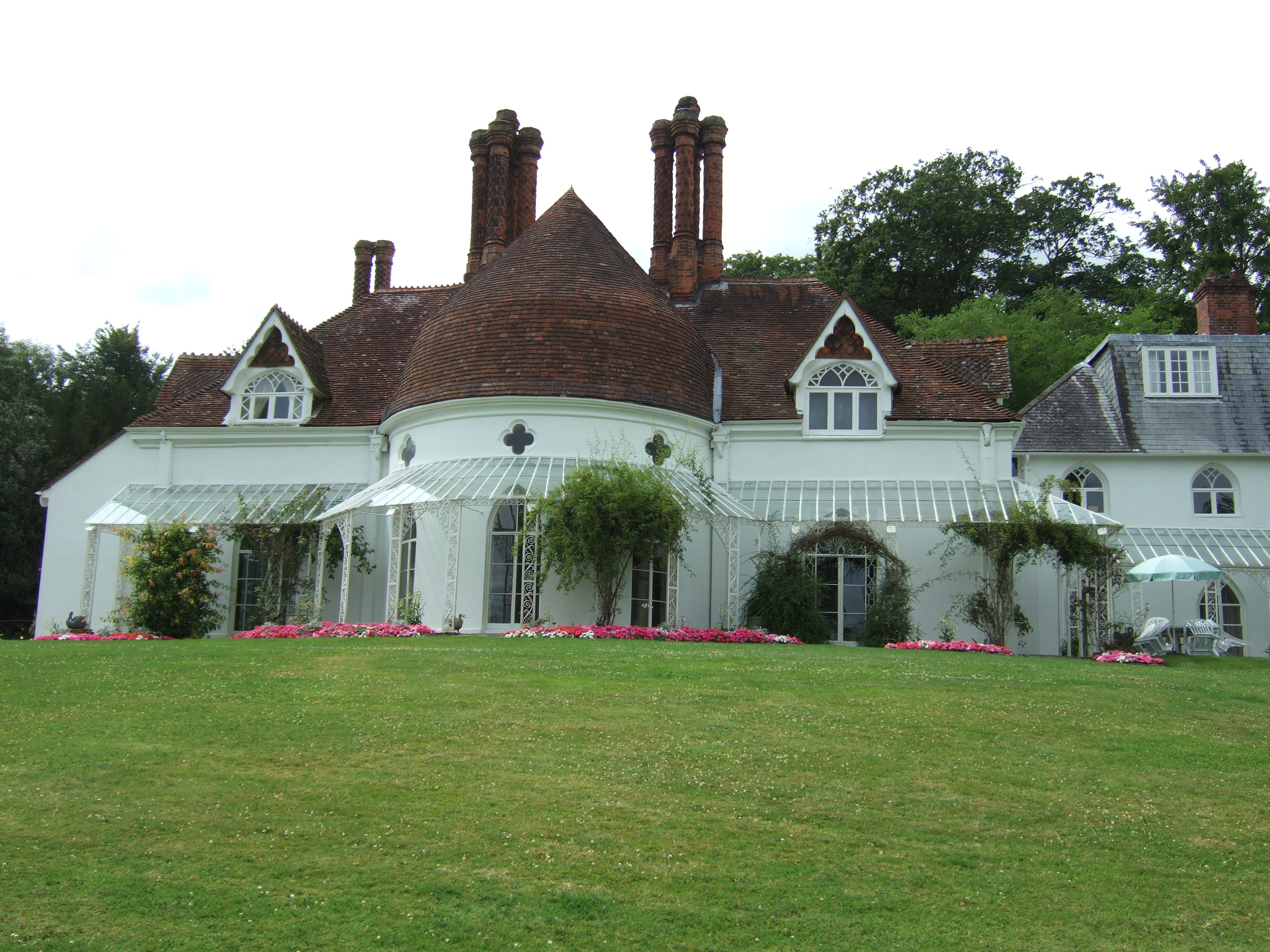
Houghton Lodge

Houghton Lodge is a Grade II* listed house on the River Test in Hampshire, England which was built in the 1790s, probably intended as a fishing lodge...

Broughton, Hampshire

Broughton is a village and civil parish in the Test Valley district of Hampshire, England, about 10 miles (16 km) north of Romsey. The Manor of Broughton...

North Houghton

North Houghton is a hamlet in the civil parish of Houghton in the Test Valley district of Hampshire, England. Its nearest town is Stockbridge, which lies...

Nearby Amenities

Located within 500m of 51.082272,-1.5348353
Power: pole
Source: Bing
Lat/Long: 51.0847192/-1.529103
Power: pole
Source: Bing
Lat/Long: 51.0858954/-1.5335481
Power: pole
Source: Bing
Lat/Long: 51.0866247/-1.5362592
Power: pole
Source: Bing
Lat/Long: 51.0854874/-1.5319676
Power: pole
Source: Bing
Lat/Long: 51.0862642/-1.5348832
Power: pole
Source: Bing
Lat/Long: 51.0851219/-1.5304656
The data included in this document is from www.openstreetmap.org. The data is made available under ODbL.

Have you been to Balls Plantation?

Leave your review of Balls Plantation below (or comments, questions and feedback).