Hall Copse

Wood, Forest in Hampshire Test Valley

England

Hall Copse

Pigs in field beside Hackleys Lane
Pigs in field beside Hackleys Lane Credit: David Martin

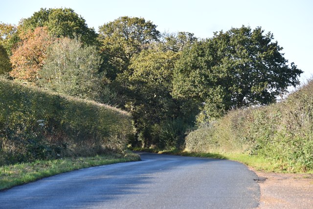
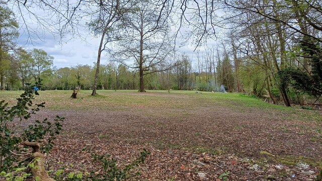
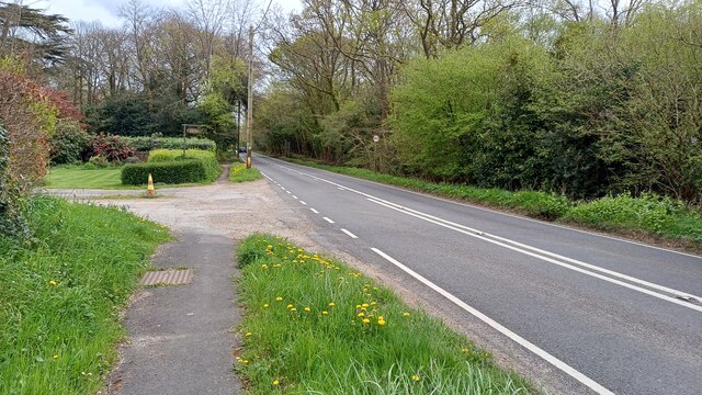
Hall Copse is a picturesque wood located in Hampshire, England. Spanning over an area of approximately 100 acres, this forested area is a haven for nature enthusiasts and provides a serene escape from the bustling city life. It is situated in close proximity to the village of Hall, hence the name.

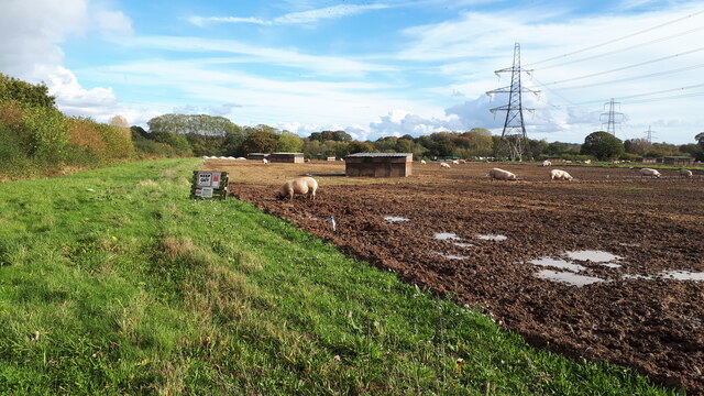
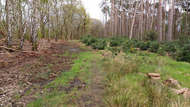
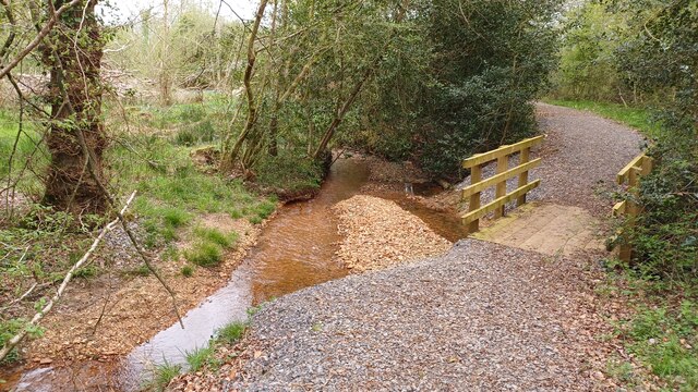
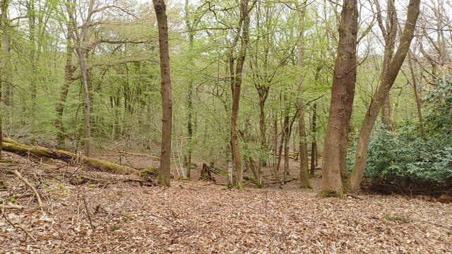
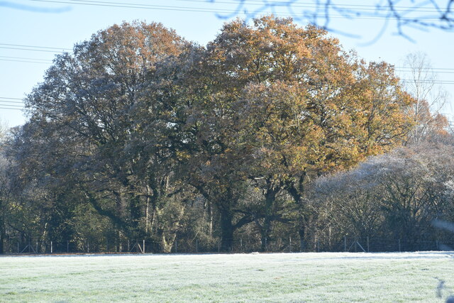
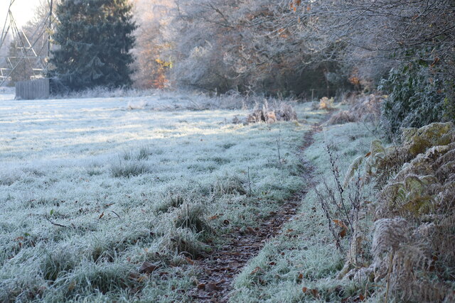
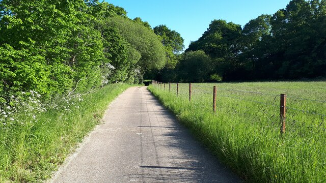
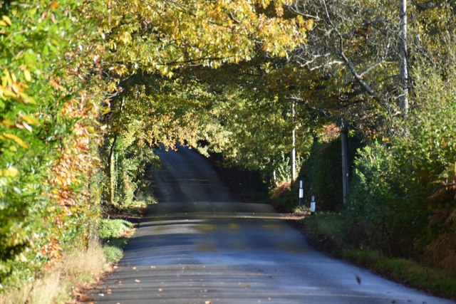
Covered in a dense canopy of trees, Hall Copse boasts a diverse range of flora and fauna. Ancient oak and beech trees dominate the landscape, their towering trunks reaching towards the sky. The forest floor is adorned with a carpet of wildflowers, adding vibrant splashes of color to the surroundings.

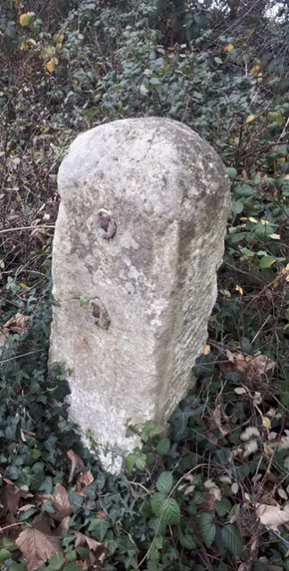
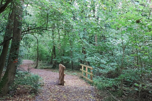
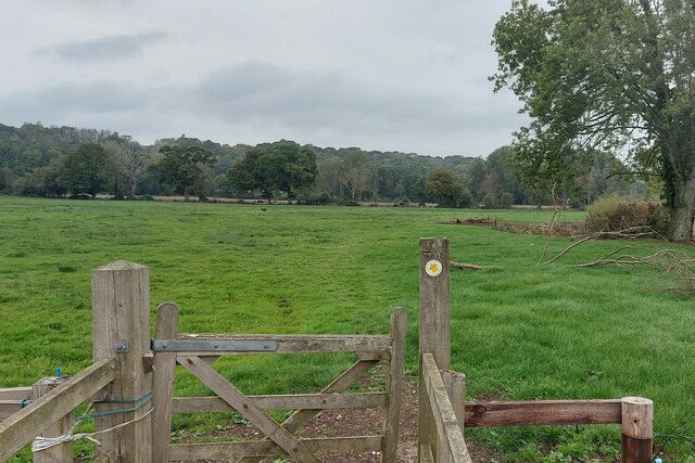
The wood is crisscrossed with a network of well-maintained footpaths and walking trails, making it an ideal destination for leisurely strolls and hikes. As visitors wander through the woods, they may encounter various wildlife species such as deer, rabbits, and a variety of bird species. The peaceful atmosphere and the tranquil sound of birdsong create a soothing ambiance, allowing visitors to immerse themselves in nature.

Hall Copse is not only a natural haven but also serves as an important ecological site. It plays a crucial role in maintaining the local biodiversity and preserving the ecosystem. Various conservation efforts have been undertaken to protect the wood and its inhabitants.

Overall, Hall Copse offers a captivating blend of natural beauty, recreational opportunities, and ecological significance. Whether one seeks a peaceful retreat, an adventure in the great outdoors, or a deeper connection with nature, this Hampshire wood provides an idyllic setting to satisfy all these desires.

If you have any feedback on the listing, please let us know in the comments section below.

Hall Copse Images

Images are sourced within 2km of 50.982339/-1.5365321 or Grid Reference SU3220. Thanks to Geograph Open Source API. All images are credited.

Pigs in field beside Hackleys Lane
Old Milestone by the A3090, Pauncefoot Hill, Romsey Extra parish Stone post (plate lost) by the A3090, in parish of ROMSEY EXTRA (TEST VALLEY District), Pauncefoot House; 10m North of junction with road marked to West Wellow, by the road, on East side of road. Romsey rectangle stone, erected by the Romsey & Ringwood turnpike trust in the 19th century. 

Inscription once read:-
(Romsey 1)
(Ringwood 17)

Grade II listed. 
List Entry Number: 1301221 <span class="nowrap"><a title="https://historicengland.org.uk/listing/the-list/list-entry/1301221" rel="nofollow ugc noopener" href="https://historicengland.org.uk/listing/the-list/list-entry/1301221">Link</a><img style="margin-left:2px;" alt="External link" title="External link - shift click to open in new window" src="https://s1.geograph.org.uk/img/external.png" width="10" height="10"/></span>

Milestone Society National ID: HA_RORI01.
Old Milestone by the A3090, Pauncefoot Hill, Romsey Extra parish
Stone post (plate lost) by the A3090, in parish of ROMSEY EXTRA (TEST VALLEY District), Pauncefoot House; 10m North of junction with road marked to West Wellow, by the road, on East side of road. Romsey rectangle stone, erected by the Romsey & Ringwood turnpike trust in the 19th century. Inscription once read:- (Romsey 1) (Ringwood 17) Grade II listed. List Entry Number: 1301221 LinkExternal link Milestone Society National ID: HA_RORI01.
The Test Way in Squabb Wood Unlike the section through the northern part of the wood, this part of the Way is very tidy.
The Test Way in Squabb Wood
Unlike the section through the northern part of the wood, this part of the Way is very tidy.
The Test Way heading north to Squabb Wood
Ryedown Lane Looking west from a conspicuous lay-by.
Ryedown Lane
Looking west from a conspicuous lay-by.
Car Boot Sale Field beside Tanners Lane It may have a proper name, but as it has long been the venue for a large car boot sale, that's what we have always called it...
Car Boot Sale Field beside Tanners Lane
It may have a proper name, but as it has long been the venue for a large car boot sale, that's what we have always called it...
Shootash Garage
Shootash Garage
A27 through Shootash
Path through Squabb Wood There is evidence of recent forestry work, particularly on the left.
Path through Squabb Wood
There is evidence of recent forestry work, particularly on the left.
Stream in the woods near Monk's Cottages
Hillside view in Squabb Wood The path here descends on the northern side of ridge into a valley west of Roke Manor.
Hillside view in Squabb Wood
The path here descends on the northern side of ridge into a valley west of Roke Manor.
Wellow Mill, seen across field Former water mill now converted to residential use - there is no public access to the riverside.
Wellow Mill, seen across field
Former water mill now converted to residential use - there is no public access to the riverside.
Trees seen across frosty field near Fir Hill Farm
Frost on footpath near Cooper's Clump
Floodwater beside Woodington Lane The main River Blackwater channel runs just in front of the line of trees.
Floodwater beside Woodington Lane
The main River Blackwater channel runs just in front of the line of trees.
Footbridge cut off by floodwater The River Blackwater is here well out of its usual channel and the lower three steps of the bridge are under water.
Footbridge cut off by floodwater
The River Blackwater is here well out of its usual channel and the lower three steps of the bridge are under water.
Access track near Fir Hill The footpath runs along this private track which provides access to a few properties and the West Wellow Wastewater Treatment Works.
Access track near Fir Hill
The footpath runs along this private track which provides access to a few properties and the West Wellow Wastewater Treatment Works.
Ryedown Lane Looking in the Romsey direction from opposite Chestnut Cottages.
Ryedown Lane
Looking in the Romsey direction from opposite Chestnut Cottages.
Show me another place!

Hall Copse is located at Grid Ref: SU3220 (Lat: 50.982339, Lng: -1.5365321)

Administrative County: Hampshire

District: Test Valley

Police Authority: Hampshire

What 3 Words

///matter.gent.shame. Near Romsey, Hampshire

Related Wikis

Embley (school)

Embley School (formerly Hampshire Collegiate School) is an independent day and boarding school for both girls and boys aged 2 to 18 located in Embley Park...

Embley Park

Embley Park, in Wellow (near Romsey, Hampshire), was the family home of Florence Nightingale from 1825 until her death in 1910. It is also where Florence...

Embley, Hampshire

Embley is a small village in the Test Valley district of Hampshire, England in the United Kingdom. Its nearest town is Romsey, which lies approximately...

Shootash

Shootash was, before WWI, originally an area consisting of a few farmsteads, woodland and common land which subsequently developed during the 20th century...

Related Videos

A walk around historic park in Romsey UK

uk #travel #romsey #memories #mychannel #uk #abby #mychannel #youtubechannel #memories #old #church #hampshire ...

Hiking Shootash Carboot Withdrawal Symptoms

https://www.google.com/maps/place/Shootash,+Romsey+SO51+6FD/@50.9966679,-1.5479706 ...

Prayer walking a labyrinth

This prayer was recorded while walking the labyrinth at Wisdom House, Romsey. It was used by Romsey Methodist Church in ...

Nearby Amenities

Located within 500m of 50.982339,-1.5365321
Golf: pin
Lat/Long: 50.9826766/-1.5435821
Golf: pin
Lat/Long: 50.9826245/-1.5415976
Golf: pin
Lat/Long: 50.9838307/-1.5431879
The data included in this document is from www.openstreetmap.org. The data is made available under ODbL.

Have you been to Hall Copse?

Leave your review of Hall Copse below (or comments, questions and feedback).