Blundestone Wood

Wood, Forest in Derbyshire Derbyshire Dales

England

Blundestone Wood

Upper Holloway Farm Walking along the footpath that runs down towards the farm.
Upper Holloway Farm Credit: steven ruffles

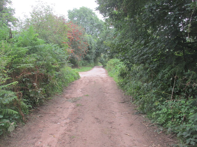
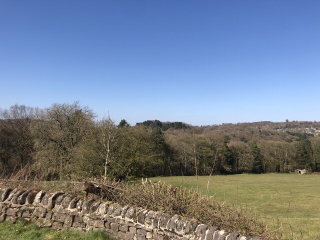
Blundestone Wood is a picturesque forest located in Derbyshire, England. Spanning over a vast area, it is known for its diverse range of flora and fauna, making it a popular destination for nature enthusiasts and hikers alike.

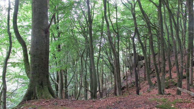
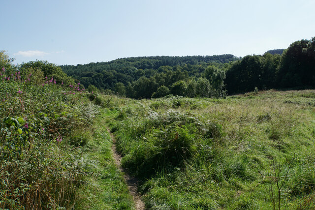
The woodland is predominantly composed of broadleaf trees, including oak, beech, and birch, which create a dense canopy, providing shade and shelter for various wildlife species. The forest floor is adorned with an array of wildflowers, ferns, and mosses, creating a vibrant and colorful landscape.

Blundestone Wood is home to a variety of wildlife, including deer, foxes, badgers, and numerous bird species. Birdwatchers can spot woodpeckers, owls, and various songbirds, making it an ideal spot for birdwatching enthusiasts.

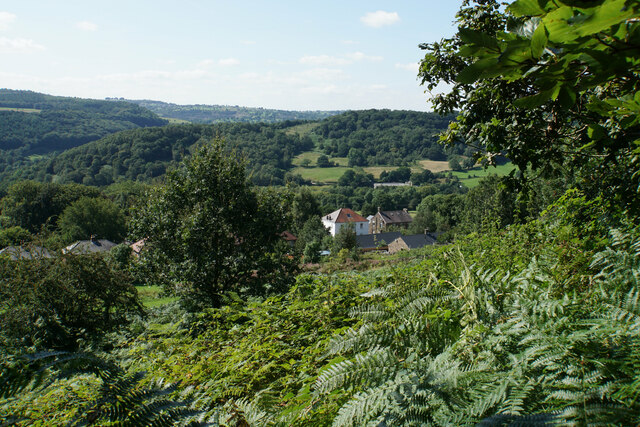
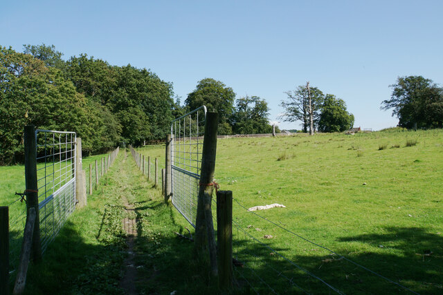
The forest offers a network of well-maintained trails, allowing visitors to explore the woodland at their own pace. These paths wind through the trees, offering stunning views of the surrounding countryside. Along the way, there are several designated picnic areas where visitors can rest and enjoy the tranquil surroundings.

Blundestone Wood is also rich in history, with remnants of ancient settlements and archaeological sites scattered throughout the forest. These historical features add an intriguing element to the woodland, enticing history buffs to delve into the area's past.

Overall, Blundestone Wood in Derbyshire is a captivating and diverse forest, offering visitors a chance to immerse themselves in nature, discover its rich wildlife, and explore its historical significance.

If you have any feedback on the listing, please let us know in the comments section below.

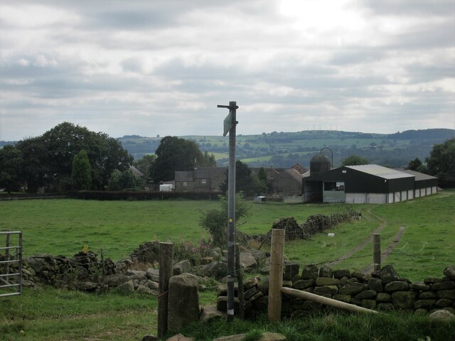
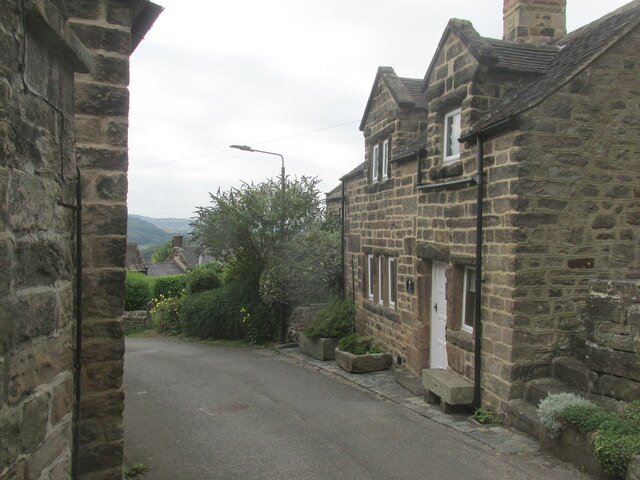
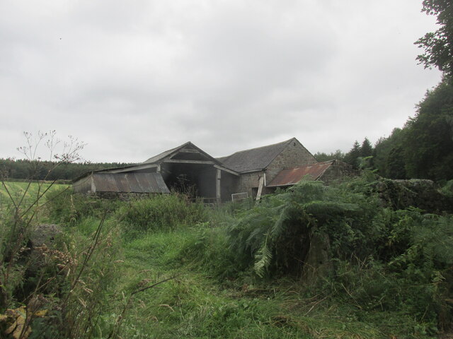
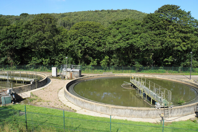
Blundestone Wood Images

Images are sourced within 2km of 53.088611/-1.5227788 or Grid Reference SK3254. Thanks to Geograph Open Source API. All images are credited.

Upper Holloway Farm Walking along the footpath that runs down towards the farm.
Upper Holloway Farm
Walking along the footpath that runs down towards the farm.
Cottages in Holloway Narrow street in the village.
Cottages in Holloway
Narrow street in the village.
Intake Lane Close to Birchwood Farm campsite.
Intake Lane
Close to Birchwood Farm campsite.
Old barn alongside the Midshires Way Intake Lane.
Old barn alongside the Midshires Way
Intake Lane.
Bauston Tor In the trees above the Incline.
Bauston Tor
In the trees above the Incline.
Path from Holloway to Long Lane Signs warn that this is a cliffside path but it does not seem particularly precarious.
Path from Holloway to Long Lane
Signs warn that this is a cliffside path but it does not seem particularly precarious.
View over the northern end of Holloway A view from a path leading up to Long Lane. The Derwent valley is in the background.
View over the northern end of Holloway
A view from a path leading up to Long Lane. The Derwent valley is in the background.
The Hollow, Holloway Older cottages in Holloway.
The Hollow, Holloway
Older cottages in Holloway.
Path to Holloway The path passes through the grounds of Lea Hurst but is fully fenced off from the rest of the estate.
Path to Holloway
The path passes through the grounds of Lea Hurst but is fully fenced off from the rest of the estate.
Path in Lea Wood The path traverses the hill before descending to the Cromford Canal.
Path in Lea Wood
The path traverses the hill before descending to the Cromford Canal.
Lea Wood A view looking down the hill towards Lea Brook at the bottom, though it cannot be seen from here.
Lea Wood
A view looking down the hill towards Lea Brook at the bottom, though it cannot be seen from here.
Signpost in Lea Wood There are 5 directions here though I only found 3 paths.
Signpost in Lea Wood
There are 5 directions here though I only found 3 paths.
A bit of open space above Lea Wood Much of the sides of the Derwent valley is thickly wooded, but this is a clearing above the wood.
A bit of open space above Lea Wood
Much of the sides of the Derwent valley is thickly wooded, but this is a clearing above the wood.
Birch Wood The wood is on the east bank of the River Derwent south of Hollywood
Birch Wood
The wood is on the east bank of the River Derwent south of Hollywood
Path above Aqueduct Cottage The path descends out of Lea Wood to the Cromford Canal. Aqueduct Cottage is being renovated by Derbyshire Wildlife Trust and their work includes the path out of the wood.
Path above Aqueduct Cottage
The path descends out of Lea Wood to the Cromford Canal. Aqueduct Cottage is being renovated by Derbyshire Wildlife Trust and their work includes the path out of the wood.
Tiddlers in the Cromford Canal The water didn't look especially clear, but it was clear enough to see these.
Tiddlers in the Cromford Canal
The water didn't look especially clear, but it was clear enough to see these.
The Cromford Canal No longer used for navigation, and the foliage is encroaching.
The Cromford Canal
No longer used for navigation, and the foliage is encroaching.
Sewage works in the Derwent valley The valley is full of the trappings of human activity, road, rail, canal and sewage treatment. Bow Wood rises behind on the other side of the river.
Sewage works in the Derwent valley
The valley is full of the trappings of human activity, road, rail, canal and sewage treatment. Bow Wood rises behind on the other side of the river.
Show me another place!

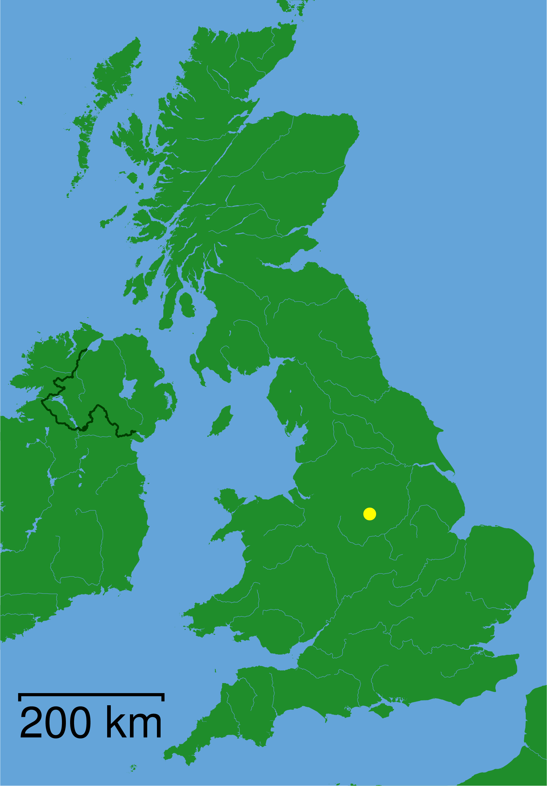
Blundestone Wood is located at Grid Ref: SK3254 (Lat: 53.088611, Lng: -1.5227788)

Administrative County: Derbyshire

District: Derbyshire Dales

Police Authority: Derbyshire

What 3 Words

///quicksand.spotty.newspaper. Near Wirksworth, Derbyshire

Related Wikis

Nearby Amenities

Located within 500m of 53.088611,-1.5227788
Barrier: stile
Material: wood
Source: survey;gps
Steps: 1
Stile: stepover
Lat/Long: 53.0860766/-1.5205399
Barrier: stile
Material: wood
Source: survey;gps
Steps: 2
Stile: stepover
Lat/Long: 53.0894018/-1.5257115
Barrier: stile
Steps: 2
Stile: stepover
Lat/Long: 53.0897518/-1.5258308
Barrier: stile
Material: stone
Source: survey;gps
Stile: squeezer
Lat/Long: 53.0916112/-1.5280509
Barrier: stile
Material: stone
Source: survey;gps
Steps: 1
Stile: squeezer
Lat/Long: 53.0916434/-1.5281357
Ele: 139.0000000
Lat/Long: 53.0882138/-1.5201263
Ele: 137.0000000
Lat/Long: 53.0881555/-1.5201243
Ele: 147
Lat/Long: 53.0875423/-1.5210318
Ele: 148
Lat/Long: 53.087522/-1.5212181
Ele: 150
Lat/Long: 53.0875032/-1.5216726
Ele: 141
Lat/Long: 53.0874001/-1.5239203
Ele: 137
Lat/Long: 53.0889508/-1.5198892
Ele: 133
Lat/Long: 53.0914759/-1.5185624
Ele: 135.0000000
Lat/Long: 53.0917372/-1.5189779
Ele: 133
Lat/Long: 53.0915794/-1.5186684
Barrier: stile
Ele: 133
Steps: 1
Stile: stepover
Lat/Long: 53.0912009/-1.518333
Ele: 131
Lat/Long: 53.0908517/-1.518573
Barrier: stile
Ele: 131
Steps: 1
Stile: stepover
Lat/Long: 53.0903492/-1.5189016
Ele: 132
Lat/Long: 53.0899901/-1.5189925
Ele: 134
Lat/Long: 53.0897474/-1.5191497
Ele: 137
Lat/Long: 53.0889089/-1.5197283
Ele: 137
Lat/Long: 53.0885384/-1.5199482
Ford: stepping_stones
Lat/Long: 53.0872875/-1.525034
Ele: 134
Lat/Long: 53.0873943/-1.5258129
Ele: 139
Lat/Long: 53.087549/-1.5276172
Barrier: stile
Stile: squeezer
Lat/Long: 53.0874142/-1.5238582
Barrier: stile
Steps: 1
Stile: stepover
Lat/Long: 53.0872738/-1.5251426
Barrier: stile
Stile: squeezer
Lat/Long: 53.0876875/-1.5235711
Information: route_marker
Tourism: information
Lat/Long: 53.0888/-1.5252419
Barrier: stile
Steps: 1
Stile: stepover
Lat/Long: 53.0888238/-1.5251981
Barrier: stile
Material: wood
Source: survey;gps
Stile: stepover
Lat/Long: 53.0892333/-1.5256294
Welcome to Crabtree Wood
Information: board
Tourism: information
Lat/Long: 53.0915987/-1.5281973
Information: route_marker
Tourism: information
Lat/Long: 53.0860741/-1.5205289
Information: route_marker
Tourism: information
Lat/Long: 53.0866784/-1.521647
Information: route_marker
Tourism: information
Lat/Long: 53.0872185/-1.5228301
Information: route_marker
Tourism: information
Lat/Long: 53.0877219/-1.5236288
Information: route_marker
Tourism: information
Lat/Long: 53.0857847/-1.5202078
Barrier: kissing_gate
Lat/Long: 53.0847587/-1.5190875
Information: route_marker
Tourism: information
Lat/Long: 53.0888169/-1.52521
Information: route_marker
Tourism: information
Lat/Long: 53.0894004/-1.5257236
Information: route_marker
Tourism: information
Lat/Long: 53.0906045/-1.5262433
Information: route_marker
Tourism: information
Lat/Long: 53.0897513/-1.5258129
Information: route_marker
Tourism: information
Lat/Long: 53.0916436/-1.5281149
Information: route_marker
Tourism: information
Lat/Long: 53.0914663/-1.5271847
Information: route_marker
Tourism: information
Lat/Long: 53.0912412/-1.5183886
Information: route_marker
Tourism: information
Lat/Long: 53.0914346/-1.5184825
Bench
Lat/Long: 53.0890476/-1.5255996
The data included in this document is from www.openstreetmap.org. The data is made available under ODbL.

Have you been to Blundestone Wood?

Leave your review of Blundestone Wood below (or comments, questions and feedback).