Blacksmith's Copse

Wood, Forest in Berkshire

England

Blacksmith's Copse

Near Foxwood Farm From the footpath near Foxwood Farm.
Near Foxwood Farm Credit: Wayland Smith

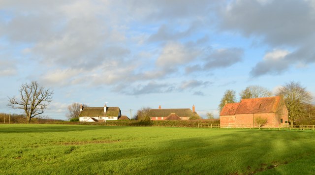
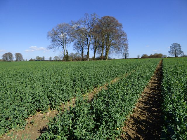
Blacksmith's Copse is a picturesque woodland located in Berkshire, England. Situated on the outskirts of a small village, this forested area covers approximately 50 acres and is a popular destination for nature enthusiasts and hikers alike.

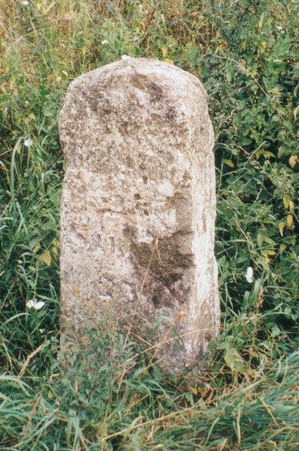
The copse takes its name from the historical presence of a blacksmith's workshop that once stood nearby. Although the workshop is no longer in operation, the copse retains its name as a tribute to the area's rich industrial heritage.

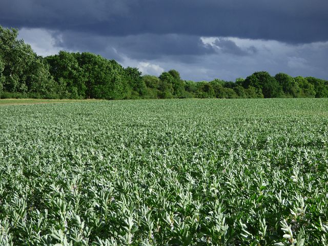
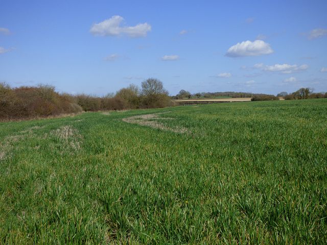
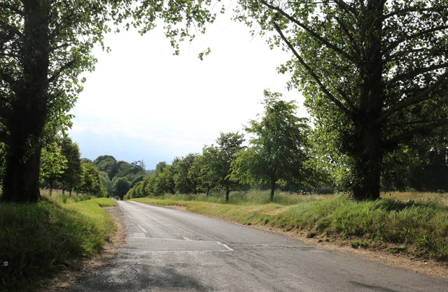
The woodland is characterized by a diverse range of tree species, including oak, beech, and ash. The dense canopy provides ample shade, creating a cool and tranquil atmosphere within the copse. A network of well-maintained paths winds through the forest, allowing visitors to explore the area and appreciate its natural beauty.

Blacksmith's Copse is home to a variety of wildlife, including squirrels, rabbits, and various bird species. Birdwatchers often visit the copse to catch glimpses of woodland birds such as woodpeckers and thrushes. The forest floor is also adorned with an array of wildflowers and ferns, adding to the copse's enchanting ambiance.

The copse is managed by a local conservation group, ensuring the preservation of its natural habitat and promoting sustainable practices. Visitors are encouraged to respect the environment by sticking to designated paths and refraining from littering.

Overall, Blacksmith's Copse offers a serene escape from the hustle and bustle of daily life, providing an opportunity to reconnect with nature and appreciate the beauty of Berkshire's woodlands.

If you have any feedback on the listing, please let us know in the comments section below.

Blacksmith's Copse Images

Images are sourced within 2km of 51.381878/-1.544911 or Grid Reference SU3164. Thanks to Geograph Open Source API. All images are credited.

Near Foxwood Farm From the footpath near Foxwood Farm.
Near Foxwood Farm
From the footpath near Foxwood Farm.
Country lane, Shalbourne, Wiltshire
Winter's sunshine, Bagshot, Wiltshire
Old Milestone by the A338, south of Hungerford Carved stone post by the A338, in parish of Hungerford (West Berkshire District), Salisbury Road; lay-by near Hollytree Cottages, North of Prosperous Farm, on wide grass verge at northern entrance of lay-by, on East side of road. Hungerford tombstone, erected by the Leckford or Sousley Water turnpike trust in the 18th century. 

Inscription reads:-
TO
HUNGERFORD
2
SARUM
25
Carved benchmark and rivet on top.

Grade II listed.
List Entry Number: 1289529 <span class="nowrap"><a title="https://historicengland.org.uk/listing/the-list/list-entry/1289529" rel="nofollow ugc noopener" href="https://historicengland.org.uk/listing/the-list/list-entry/1289529">Link</a><img style="margin-left:2px;" alt="External link" title="External link - shift click to open in new window" src="https://s1.geograph.org.uk/img/external.png" width="10" height="10"/></span>

Milestone Society National ID: BE_HGSA02
Old Milestone by the A338, south of Hungerford
Carved stone post by the A338, in parish of Hungerford (West Berkshire District), Salisbury Road; lay-by near Hollytree Cottages, North of Prosperous Farm, on wide grass verge at northern entrance of lay-by, on East side of road. Hungerford tombstone, erected by the Leckford or Sousley Water turnpike trust in the 18th century. Inscription reads:- TO HUNGERFORD 2 SARUM 25 Carved benchmark and rivet on top. Grade II listed. List Entry Number: 1289529 LinkExternal link Milestone Society National ID: BE_HGSA02
Farmland, Hungerford A crop of beans under a threatening-looking sky beside the footpath approaching Elm Copse.
Farmland, Hungerford
A crop of beans under a threatening-looking sky beside the footpath approaching Elm Copse.
Footpath through pasture, Shalbourne The footpath is omitted from the Ordnance Suvery's 1:50000 map, but is clear and easily followed as it approaches the eastern end of a row of houses on Ham Road.
Footpath through pasture, Shalbourne
The footpath is omitted from the Ordnance Suvery's 1:50000 map, but is clear and easily followed as it approaches the eastern end of a row of houses on Ham Road.
Farmland, Hungerford Looking into Berkshire from the boundary with Wiltshire.
Farmland, Hungerford
Looking into Berkshire from the boundary with Wiltshire.
Farmland, Hungerford The footpath heading towards Standen Manor from North Standen.
Farmland, Hungerford
The footpath heading towards Standen Manor from North Standen.
Farmland, Hungerford Oil-seed rape and a clump of beeches to the east of Standen Manor.
Farmland, Hungerford
Oil-seed rape and a clump of beeches to the east of Standen Manor.
Old Milestone by the A338, Shalbourne Hungerford tombstone by the A338, in parish of Shalbourne (Kennet District), Eastcourt Farm, between Bagshot turn and new bridge, on grass bank in front of hedge.

Inscription once read:-
(HUNGERFORD)
(3)
(SARUM)
(34)
Rivet bench mark on top.

Grade II listed.
List Entry Number: 1300100 <span class="nowrap"><a title="https://historicengland.org.uk/listing/the-list/list-entry/1300100" rel="nofollow ugc noopener" href="https://historicengland.org.uk/listing/the-list/list-entry/1300100">Link</a><img style="margin-left:2px;" alt="External link" title="External link - shift click to open in new window" src="https://s1.geograph.org.uk/img/external.png" width="10" height="10"/></span>

Surveyed

Milestone Society National ID: WI_hgsa03
Old Milestone by the A338, Shalbourne
Hungerford tombstone by the A338, in parish of Shalbourne (Kennet District), Eastcourt Farm, between Bagshot turn and new bridge, on grass bank in front of hedge. Inscription once read:- (HUNGERFORD) (3) (SARUM) (34) Rivet bench mark on top. Grade II listed. List Entry Number: 1300100 LinkExternal link Surveyed Milestone Society National ID: WI_hgsa03
Six Acre Lane near Shalbourne
Private road to Standen Manor All the trees beyond the first pair were planted around 2010 and are now a lot bigger.
Private road to Standen Manor
All the trees beyond the first pair were planted around 2010 and are now a lot bigger.
Verge by the  A338, Bagshot
Verge by the A338, Bagshot
The A338, Shalbourne
The entrance to Newtown Farm, Shalbourne
View from the A338, Shalbourne Looking towards Ham Hill
View from the A338, Shalbourne
Looking towards Ham Hill
Show me another place!

Blacksmith's Copse is located at Grid Ref: SU3164 (Lat: 51.381878, Lng: -1.544911)

Unitary Authority: Wiltshire

Police Authority: Wiltshire

What 3 Words

///lost.mainly.venturing. Near Shalbourne, Wiltshire

Related Wikis

Shalbourne

Shalbourne is a village and civil parish in the English county of Wiltshire, about 3 miles (4.8 km) southwest of Hungerford, Berkshire. The parish has...

Ham, Wiltshire

Ham is a small village and civil parish in Wiltshire, England. The parish borders the county of Berkshire, and the village lies about 3+1⁄4 miles (5.2...

Anvilles

Anvilles is a hamlet in the English county of Berkshire, and within the civil parish of Inkpen (formerly in Kintbury). == See also == Civil parishes in...

Little Bedwyn

Little Bedwyn (also spelt Little Bedwin, and sometimes called Bedwyn Parva) is a village and civil parish on the River Dun in Wiltshire, England, about...

Nearby Amenities

Located within 500m of 51.381878,-1.544911
Barrier: yes
Lat/Long: 51.3798459/-1.5454543
Bagshot
Place: hamlet
Lat/Long: 51.3856189/-1.5451241
Post Box
Brand: Royal Mail
Brand Wikidata: Q638098
Brand Wikipedia: en:Royal Mail
Collection Times: Mo-Fr 09:00; Sa 07:00
Operator: Royal Mail
Operator Wikidata: Q638098
Post Box Type: lamp
Ref: RG17 130D
Royal Cypher: EIIR
Royal Cypher Wikidata: Q33102113
Lat/Long: 51.3854507/-1.5450972
The data included in this document is from www.openstreetmap.org. The data is made available under ODbL.

Have you been to Blacksmith's Copse?

Leave your review of Blacksmith's Copse below (or comments, questions and feedback).