Baverstock's Copse

Wood, Forest in Berkshire

England

Baverstock's Copse

Lane to Newtown A short lane to the hamlet of Newtown which consists of a farm and around half a dozen houses.
Lane to Newtown Credit: Des Blenkinsopp

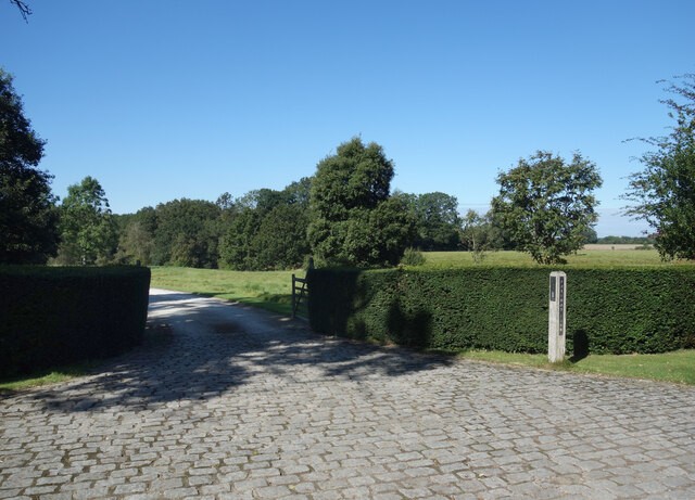
Baverstock's Copse is a picturesque woodland located in the county of Berkshire in southern England. It covers an area of approximately 30 acres and is a popular destination for nature enthusiasts and hikers alike.

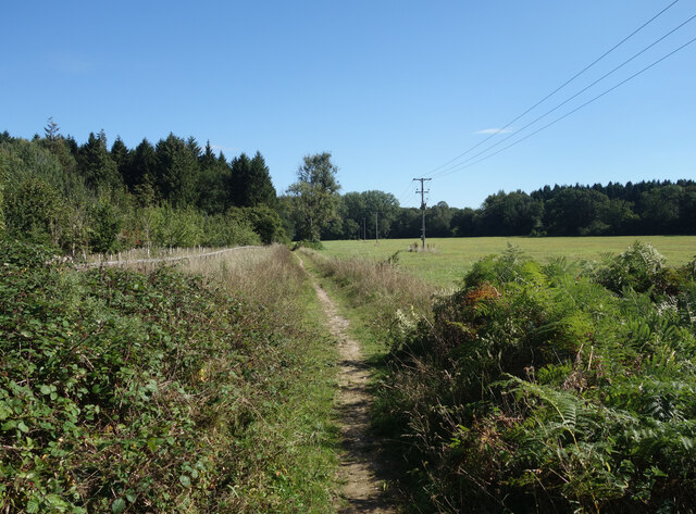
The copse is characterized by its dense canopy of trees, predominantly consisting of oak, beech, and birch. These towering trees provide shelter and a habitat for a variety of wildlife, including birds, squirrels, and deer. The woodland floor is covered in a thick carpet of ferns, wildflowers, and moss, creating a vibrant and enchanting atmosphere.

Traversing through the copse, visitors will discover a network of well-maintained footpaths that meander through the trees. These paths offer a chance to explore the woodland at one's own pace, providing opportunities for quiet reflection and solitude. There are also several picnic areas and benches strategically placed, allowing visitors to pause and immerse themselves in the tranquility of the surroundings.

Baverstock's Copse is a designated Site of Special Scientific Interest (SSSI), primarily due to its diverse range of flora and fauna. Conservation efforts are in place to protect and preserve the natural habitat, ensuring the copse remains a haven for wildlife and a cherished natural landscape for future generations to enjoy.

Overall, Baverstock's Copse is a hidden gem within Berkshire, offering a peaceful retreat from the hustle and bustle of modern life. Its beauty, serenity, and ecological significance make it a must-visit destination for nature lovers and those seeking a connection with the natural world.

If you have any feedback on the listing, please let us know in the comments section below.

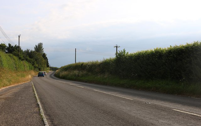
Baverstock's Copse Images

Images are sourced within 2km of 51.376107/-1.5523818 or Grid Reference SU3164. Thanks to Geograph Open Source API. All images are credited.

Lane to Newtown A short lane to the hamlet of Newtown which consists of a farm and around half a dozen houses.
Lane to Newtown
A short lane to the hamlet of Newtown which consists of a farm and around half a dozen houses.
Folly Farm Surrounded by fields and woods. This is a view from the bridleway which skirts around the edge of the farm outbuildings.
Folly Farm
Surrounded by fields and woods. This is a view from the bridleway which skirts around the edge of the farm outbuildings.
Burridge Heath Farm A neat and tidy place along a quiet lane.
Burridge Heath Farm
A neat and tidy place along a quiet lane.
Entrance to Foxwood Farm Probably no longer in the agriculture business.
Entrance to Foxwood Farm
Probably no longer in the agriculture business.
Bridleway near Bedwyn Just one of the many paths around this pleasant area of fields and woods all within easy reach of Bedwyn Station.
Bridleway near Bedwyn
Just one of the many paths around this pleasant area of fields and woods all within easy reach of Bedwyn Station.
Near Foxwood Farm From the footpath near Foxwood Farm.
Near Foxwood Farm
From the footpath near Foxwood Farm.
Country lane, Shalbourne, Wiltshire
Winter's sunshine, Bagshot, Wiltshire
Dodge Ram 150 pickup, Shalbourne Classic Car Show 2016 Not all the vehicles on display at this year's show were in 'showroom' condition. This 1985 pickup truck is showing signs of having had a hard life. Very handy for trips to one's local Waitrose. None but the brave would park anywhere near this monster.
Dodge Ram 150 pickup, Shalbourne Classic Car Show 2016
Not all the vehicles on display at this year's show were in 'showroom' condition. This 1985 pickup truck is showing signs of having had a hard life. Very handy for trips to one's local Waitrose. None but the brave would park anywhere near this monster.
The junction of Burr Lane, Kingston Road and Rivar Road in Shalbourne Looking north-eastward.
The junction of Burr Lane, Kingston Road and Rivar Road in Shalbourne
Looking north-eastward.
Footpath through pasture, Shalbourne The footpath is omitted from the Ordnance Suvery's 1:50000 map, but is clear and easily followed as it approaches the eastern end of a row of houses on Ham Road.
Footpath through pasture, Shalbourne
The footpath is omitted from the Ordnance Suvery's 1:50000 map, but is clear and easily followed as it approaches the eastern end of a row of houses on Ham Road.
Farmland, Hungerford Looking into Berkshire from the boundary with Wiltshire.
Farmland, Hungerford
Looking into Berkshire from the boundary with Wiltshire.
Old Milestone by the A338, Shalbourne Hungerford tombstone by the A338, in parish of Shalbourne (Kennet District), Eastcourt Farm, between Bagshot turn and new bridge, on grass bank in front of hedge.

Inscription once read:-
(HUNGERFORD)
(3)
(SARUM)
(34)
Rivet bench mark on top.

Grade II listed.
List Entry Number: 1300100 <span class="nowrap"><a title="https://historicengland.org.uk/listing/the-list/list-entry/1300100" rel="nofollow ugc noopener" href="https://historicengland.org.uk/listing/the-list/list-entry/1300100">Link</a><img style="margin-left:2px;" alt="External link" title="External link - shift click to open in new window" src="https://s1.geograph.org.uk/img/external.png" width="10" height="10"/></span>

Surveyed

Milestone Society National ID: WI_hgsa03
Old Milestone by the A338, Shalbourne
Hungerford tombstone by the A338, in parish of Shalbourne (Kennet District), Eastcourt Farm, between Bagshot turn and new bridge, on grass bank in front of hedge. Inscription once read:- (HUNGERFORD) (3) (SARUM) (34) Rivet bench mark on top. Grade II listed. List Entry Number: 1300100 LinkExternal link Surveyed Milestone Society National ID: WI_hgsa03
Old Milestone by the A338, Shalbourne Hungerford tombstone by the A338, in parish of Shalbourne (Kennet District), South of Newtown Store, 10m North of footpath sign, on nettle covered bank in front of hedge.

Inscription reads:-
HUNGERFORD
4
SARUM
23

Grade II listed.
List Entry Number: 1365516 <span class="nowrap"><a title="https://historicengland.org.uk/listing/the-list/list-entry/1365516" rel="nofollow ugc noopener" href="https://historicengland.org.uk/listing/the-list/list-entry/1365516">Link</a><img style="margin-left:2px;" alt="External link" title="External link - shift click to open in new window" src="https://s1.geograph.org.uk/img/external.png" width="10" height="10"/></span>

Surveyed

Milestone Society National ID: WI_hgsa04
Old Milestone by the A338, Shalbourne
Hungerford tombstone by the A338, in parish of Shalbourne (Kennet District), South of Newtown Store, 10m North of footpath sign, on nettle covered bank in front of hedge. Inscription reads:- HUNGERFORD 4 SARUM 23 Grade II listed. List Entry Number: 1365516 LinkExternal link Surveyed Milestone Society National ID: WI_hgsa04
Six Acre Lane near Shalbourne
The A338, Shalbourne
The entrance to Newtown Farm, Shalbourne
Show me another place!

Baverstock's Copse is located at Grid Ref: SU3164 (Lat: 51.376107, Lng: -1.5523818)

Unitary Authority: Wiltshire

Police Authority: Wiltshire

What 3 Words

///sailor.cringes.advising. Near Shalbourne, Wiltshire

Related Wikis

Shalbourne

Shalbourne is a village and civil parish in the English county of Wiltshire, about 3 miles (4.8 km) southwest of Hungerford, Berkshire. The parish has...

Ham, Wiltshire

Ham is a small village and civil parish in Wiltshire, England. The parish borders the county of Berkshire, and the village lies about 3+1⁄4 miles (5.2...

Little Bedwyn

Little Bedwyn (also spelt Little Bedwin, and sometimes called Bedwyn Parva) is a village and civil parish on the River Dun in Wiltshire, England, about...

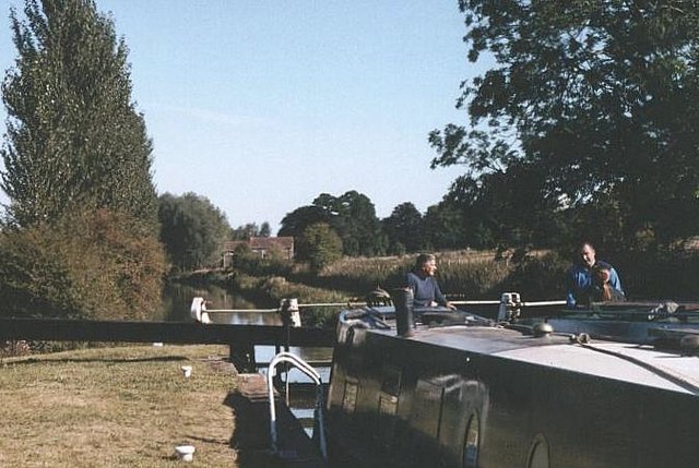
Potter's Lock, Wiltshire

Potter's Lock is on the Kennet and Avon Canal, at Bedwyn, Wiltshire, England. The lock has a rise/fall of 7 ft 6 in (2.28 m). == References == == See... ==

Little Bedwyn Lock

Little Bedwyn Lock is a lock on the Kennet and Avon Canal, at Little Bedwyn, Wiltshire, England. The canal is administered by the Canal & River Trust....

Anvilles

Anvilles is a hamlet in the English county of Berkshire, and within the civil parish of Inkpen (formerly in Kintbury). == See also == Civil parishes in...

Burnt Mill Lock

Burnt Mill Lock is on the Kennet and Avon Canal, at Great Bedwyn, Wiltshire, England. The lock has a rise/fall of 7 ft 9 in (2.36 m). == References... ==
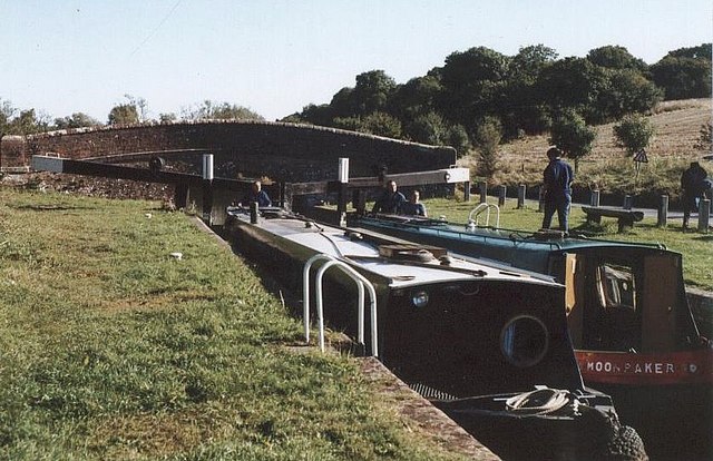
Oakhill Down Lock

Oakhill Down Lock is a lock on the Kennet and Avon Canal, at Froxfield, Wiltshire, England, between Newbury Bridge and Pewsey Wharf.The lock was built...

Nearby Amenities

Located within 500m of 51.376107,-1.5523818
Power: pole
Source: Bing
Lat/Long: 51.372276/-1.5488472
The data included in this document is from www.openstreetmap.org. The data is made available under ODbL.

Have you been to Baverstock's Copse?

Leave your review of Baverstock's Copse below (or comments, questions and feedback).