Dickleburgh Moor

Settlement in Norfolk South Norfolk

England

Dickleburgh Moor

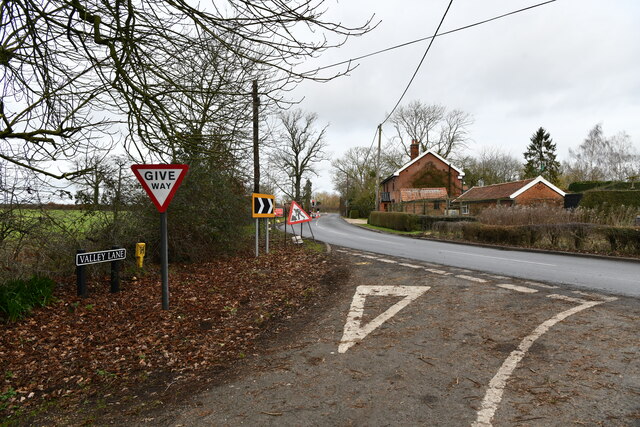
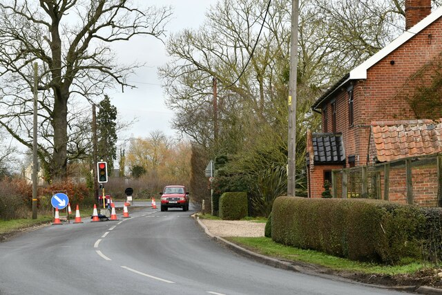
Norwich Road at the junction of the Scole Bypass
Norwich Road at the junction of the Scole Bypass Credit: David Howard

The requested URL returned error: 429 Too Many Requests

If you have any feedback on the listing, please let us know in the comments section below.

Dickleburgh Moor Images

Images are sourced within 2km of 52.404987/1.191697 or Grid Reference TM1783. Thanks to Geograph Open Source API. All images are credited.

Norwich Road at the junction of the Scole Bypass
Burston and Shimpling: Where Valley lane joins Station Road
Burston and Shimpling: Station Road
Dickleburgh Village Stores Dickleburgh village stores Norfolk.
Dickleburgh Village Stores
Dickleburgh village stores Norfolk.
Old Farmhouse Old farmhouse marked on the 1:25:000 map as The Beeches near to Dickleburgh Norfolk.
Old Farmhouse
Old farmhouse marked on the 1:25:000 map as The Beeches near to Dickleburgh Norfolk.
Roundabout Ahead Roundabout from the village of Thelveton onto the A140 near to Thelveton Norfolk.
Roundabout Ahead
Roundabout from the village of Thelveton onto the A140 near to Thelveton Norfolk.
All Saints church at Dickleburgh, Norfolk It stands at the heart of the village next to the main road, which used to be heavy with traffic travelling between Ipswich and Norwich until the bypass was built. The church is probably 14th century but it has been affected by the Victorian restorer.
All Saints church at Dickleburgh, Norfolk
It stands at the heart of the village next to the main road, which used to be heavy with traffic travelling between Ipswich and Norwich until the bypass was built. The church is probably 14th century but it has been affected by the Victorian restorer.
Footpath to Dickleburgh Moor The building on the left of the picture belongs to New Farm.
Footpath to Dickleburgh Moor
The building on the left of the picture belongs to New Farm.
Road to Oak Farm The farm can be seen in the distance.
Road to Oak Farm
The farm can be seen in the distance.
Hall Lane, looking north
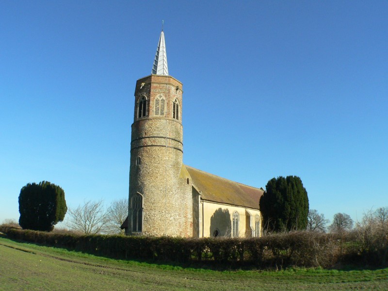
St George's Church, Shimpling, now redundant The Redundant Church in Shimpling, a landmark in this area, is reached along a rough track.

For more information visit <span class="nowrap"><a title="http://www.norfolkchurches.co.uk/shimpling/shimpling.htm" rel="nofollow ugc noopener" href="http://www.norfolkchurches.co.uk/shimpling/shimpling.htm">Link</a><img style="margin-left:2px;" alt="External link" title="External link - shift click to open in new window" src="https://s1.geograph.org.uk/img/external.png" width="10" height="10"/></span>
St George's Church, Shimpling, now redundant
The Redundant Church in Shimpling, a landmark in this area, is reached along a rough track. For more information visit LinkExternal link
Footbridge and footpath
Footpath Path sheltered by hedges and trees on each side.
Footpath
Path sheltered by hedges and trees on each side.
Relatively quiet moment on the A140 near the Old Ram The Norwich - Ipswich carries a heavy load of traffic for a single carriageway road, although the blue sign at the end of the lay-by promises Dual carriageway 2 miles ahead: the brief respite of the Scole bypass to the south.
Relatively quiet moment on the A140 near the Old Ram
The Norwich - Ipswich carries a heavy load of traffic for a single carriageway road, although the blue sign at the end of the lay-by promises Dual carriageway 2 miles ahead: the brief respite of the Scole bypass to the south.
Autumn landscape off A140 north of Dickleburgh Although only early September and a warm day, the atmosphere is autumnal.  This drainage channel is full of flowering thistles while in the background and on the left is ploughed land and the foreground shows stubble with perhaps an undercrop coming through: or are they weeds?
Autumn landscape off A140 north of Dickleburgh
Although only early September and a warm day, the atmosphere is autumnal. This drainage channel is full of flowering thistles while in the background and on the left is ploughed land and the foreground shows stubble with perhaps an undercrop coming through: or are they weeds?
Across the autumn plough near Broad Way Both Explorer and Landranger show a building just south of this point but no building now exists. The pylons in the distance are in <a href="https://www.geograph.org.uk/gridref/TM1585">TM1585</a>.
Across the autumn plough near Broad Way
Both Explorer and Landranger show a building just south of this point but no building now exists. The pylons in the distance are in TM1585.
Broad Way no more Explorer indicates a continuing track northwards from this point but after turning into the field shown in <a href="https://www.geograph.org.uk/photo/555360">TM1684 : Across the autumn plough near Broad Way</a> the track is totally overgrown and no further progress is possible except for small wildlife.
Broad Way no more
Explorer indicates a continuing track northwards from this point but after turning into the field shown in TM1684 : Across the autumn plough near Broad Way the track is totally overgrown and no further progress is possible except for small wildlife.
Through the hedge and across the fields A view eastwards from Broad Way towards the A140.
Through the hedge and across the fields
A view eastwards from Broad Way towards the A140.
Show me another place!

Dickleburgh Moor is located at Grid Ref: TM1783 (Lat: 52.404987, Lng: 1.191697)

Administrative County: Norfolk

District: South Norfolk

Police Authority: Norfolk

What 3 Words

///pointed.amused.exits. Near Dickleburgh, Norfolk

Nearby Locations

Dickleburgh Moor

Related Wikis

Dickleburgh

Dickleburgh is a village and former civil parish, now in the parish of Dickleburgh and Rushall, in the South Norfolk district of the English county of...

Rushall, Norfolk

Rushall is a village and former civil parish, now in the parish of Dickleburgh and Rushall, in the South Norfolk district, in the county of Norfolk, England...

St George's Church, Shimpling

St George's Church is a redundant Anglican church in the village of Shimpling, Norfolk, England. It is recorded in the National Heritage List for England...

Shimpling, Norfolk

Shimpling is a village and former civil parish 16 miles (26 km) south of Norwich, now in the parish of Burston and Shimpling, in the South Norfolk district...

Nearby Amenities

Located within 500m of 52.404987,1.191697
Traffic Calming: island
Lat/Long: 52.407011/1.1888549
Parking
Parking: street_side
Lat/Long: 52.4044598/1.1860115
Post Box
Collection Times: Mo-Fr 09:00; Sa 09:00
Operator: Royal Mail
Post Box Type: lamp
Ref: IP21 7099
Royal Cypher: EIIR
Royal Cypher Wikidata: Q33102113
Source: survey
Lat/Long: 52.4065189/1.1932399
Description: Boudicca Way
Information: route_marker
Tourism: information
Lat/Long: 52.4074167/1.1857617
Note: Gap to side of gate.
Lat/Long: 52.4072568/1.1885747
Communication Mobile Phone: yes
Man Made: mast
Material: metal
Operator: Three UK;EE
Tower Construction: freestanding
Tower Type: communication
Lat/Long: 52.4036855/1.1858408
The data included in this document is from www.openstreetmap.org. The data is made available under ODbL.

Have you been to Dickleburgh Moor?

Leave your review of Dickleburgh Moor below (or comments, questions and feedback).