The Alders

Wood, Forest in Warwickshire

England

The Alders

Direction Sign – Signpost at the junction of Wall Hill Road and Bridle Brook Lane Located on a grass triangle in the centre of the junction of Wall Hill Road and Bridle Brook Lane in Allesley parish. 3 arms and annulus finial. See also <a title="https://www.geograph.org.uk/photo/7653066" href="https://www.geograph.org.uk/photo/7653066">Link</a>.

Milestone Society National ID: WA_SP2983
Direction Sign – Signpost at the junction of Wall Hill Road and Bridle Brook Lane Credit: D Phillips

The Alders is a picturesque woodland area located in Warwickshire, England. This tranquil forest is characterized by its dense population of alder trees, which give the area its name. These trees provide a lush canopy overhead, creating a cool and shaded environment perfect for peaceful walks and nature exploration.

The Alders is home to a variety of wildlife, including birds, small mammals, and insects. Visitors may catch glimpses of deer, squirrels, and a wide array of bird species as they wander through the forest. The sound of rustling leaves and chirping birds adds to the serene atmosphere of this natural oasis.

Trails wind through the Alders, offering visitors the opportunity to explore the beauty of the forest at their own pace. Whether walking, jogging, or simply enjoying a leisurely stroll, visitors can appreciate the natural beauty and tranquility of this woodland retreat.

The Alders is a popular destination for nature lovers, hikers, and birdwatchers seeking a peaceful escape from the hustle and bustle of everyday life. With its scenic beauty and abundant wildlife, The Alders is a must-visit destination for anyone looking to connect with nature in Warwickshire.

If you have any feedback on the listing, please let us know in the comments section below.
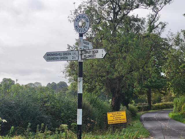
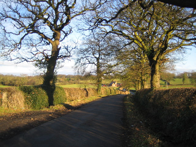
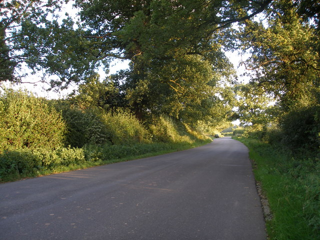
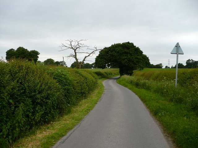
The Alders Images

Images are sourced within 2km of 52.452938/-1.5453474 or Grid Reference SP3083. Thanks to Geograph Open Source API. All images are credited.

Direction Sign – Signpost at the junction of Wall Hill Road and Bridle Brook Lane Located on a grass triangle in the centre of the junction of Wall Hill Road and Bridle Brook Lane in Allesley parish. 3 arms and annulus finial. See also <a title="https://www.geograph.org.uk/photo/7653066" href="https://www.geograph.org.uk/photo/7653066">Link</a>.

Milestone Society National ID: WA_SP2983
Direction Sign – Signpost at the junction of Wall Hill Road and Bridle Brook Lane
Located on a grass triangle in the centre of the junction of Wall Hill Road and Bridle Brook Lane in Allesley parish. 3 arms and annulus finial. See also Link. Milestone Society National ID: WA_SP2983
Direction Sign – Signpost at the junction of Wall Hill Road and Bridle Brook Lane Located on a grass triangle in the centre of the junction of Wall Hill Road and Bridle Brook Lane in Allesley parish. 3 arms and annulus finial. See also <a title="https://www.geograph.org.uk/photo/7653062" href="https://www.geograph.org.uk/photo/7653062">Link</a>.

Milestone Society National ID: WA_SP2983
Direction Sign – Signpost at the junction of Wall Hill Road and Bridle Brook Lane
Located on a grass triangle in the centre of the junction of Wall Hill Road and Bridle Brook Lane in Allesley parish. 3 arms and annulus finial. See also Link. Milestone Society National ID: WA_SP2983
Pikers Lane Looking West towards Pikers Lane Farm.
Pikers Lane
Looking West towards Pikers Lane Farm.
Footpath Near Pikers Lane Footpath from Hawkes End to Pikers Lane Farm.
Footpath Near Pikers Lane
Footpath from Hawkes End to Pikers Lane Farm.
The Lane at Wall Hill, near Corley This stretch of lane cuts through the corner of this square. Behind the photographer is a cottage and a line of pylons, and just beyond the car in the photograph the road forks to Brownshill Green and Hawkes End.
The Lane at Wall Hill, near Corley
This stretch of lane cuts through the corner of this square. Behind the photographer is a cottage and a line of pylons, and just beyond the car in the photograph the road forks to Brownshill Green and Hawkes End.
Field near Hawkes End Looking towards the gate on the footpath between Hawkes Mill Lane and Browns Lane.   Metal gates have replaced many of the wooden stiles round here. Sheep with lambs are in the field beyond.
Field near Hawkes End
Looking towards the gate on the footpath between Hawkes Mill Lane and Browns Lane. Metal gates have replaced many of the wooden stiles round here. Sheep with lambs are in the field beyond.
Junction in Hawkes End
Pikers Lane Pikers lane, taken on a cloudy day.
Pikers Lane
Pikers lane, taken on a cloudy day.
The Farm on "Pikers" Watch out for cars and horses on this bend, and the scary dog which lives on the farm.
The Farm on "Pikers"
Watch out for cars and horses on this bend, and the scary dog which lives on the farm.
Pikers Lane The northern end of Pikers Lane.
Pikers Lane
The northern end of Pikers Lane.
Pikers lane junction The junction of Pikers lane and wall hill road, the road goes up a noticeable hill just outside the picture
Pikers lane junction
The junction of Pikers lane and wall hill road, the road goes up a noticeable hill just outside the picture
Hollyfast Lane This is the only straight part of Hollyfast Lane, all the rest is tight blind turns.
Hollyfast Lane
This is the only straight part of Hollyfast Lane, all the rest is tight blind turns.
The entrance to Corley Centre, Church Lane, Corley Corley Centre consists of a school and Coventry Autism Support Service (CASS). 
The school caters for 72 students aged 11 - 16 with complex social and communication difficulties and associated learning difficulties. The school includes extended day and residential facilities. <span class="nowrap"><a title="www.corleycentre.com" rel="nofollow ugc noopener" href="http://www.corleycentre.com">Link</a><img style="margin-left:2px;" alt="External link" title="External link - shift click to open in new window" src="https://s1.geograph.org.uk/img/external.png" width="10" height="10"/></span>
The entrance to Corley Centre, Church Lane, Corley
Corley Centre consists of a school and Coventry Autism Support Service (CASS). The school caters for 72 students aged 11 - 16 with complex social and communication difficulties and associated learning difficulties. The school includes extended day and residential facilities. LinkExternal link
The lane to Marslands Farm, Corley This is a very tranquil and unspoilt lane. According to the OS 1:25,000 map, the lane is a public highway up to this point. The tarmac surface is unchanged past the gate though, so I wonder whether it is public highway for a few hundred yards further. I expect not many people come even this far, as no other rights of way lead on from this point.
The lane to Marslands Farm, Corley
This is a very tranquil and unspoilt lane. According to the OS 1:25,000 map, the lane is a public highway up to this point. The tarmac surface is unchanged past the gate though, so I wonder whether it is public highway for a few hundred yards further. I expect not many people come even this far, as no other rights of way lead on from this point.
Pikers Lane Farm, Pikers Lane, Allesley A well maintained original farmhouse - the only property on this short very narrow lane.
Pikers Lane Farm, Pikers Lane, Allesley
A well maintained original farmhouse - the only property on this short very narrow lane.
Church Lane, Corley A communications mast towers above Scots pines and a water tank.
Church Lane, Corley
A communications mast towers above Scots pines and a water tank.
Caged trig point, Corley This one isn't allowed to roam from the Severn Trent site on Church Lane.
Caged trig point, Corley
This one isn't allowed to roam from the Severn Trent site on Church Lane.
Oak by the lane to Marsland Farm By the section of the lane marked as a permissive route on OS maps. Overlooking farmland to the northwest of Coventry.
Oak by the lane to Marsland Farm
By the section of the lane marked as a permissive route on OS maps. Overlooking farmland to the northwest of Coventry.
Show me another place!

The Alders is located at Grid Ref: SP3083 (Lat: 52.452938, Lng: -1.5453474)

Unitary Authority: Coventry

Police Authority: West Midlands

What 3 Words

///cowboy.paid.agent. Near Keresley, West Midlands

Nearby Locations

The Alders

Related Wikis

Corley

Corley (and the associated hamlets of Corley Ash and Corley Moor) is a village and civil parish in the North Warwickshire district of Warwickshire, England...

Keresley End

Keresley End is a village in the Nuneaton & Bedworth District of Warwickshire, England, also known as Keresley Village or Keresley Newlands. Population...

Coventry Colliery

Coventry Colliery was a coal mine located in the village of Keresley End in northern Warwickshire, between Bedworth and Coventry, England. Closed in 1991...

Cardinal Newman Catholic School and Community College

Cardinal Newman Catholic School is a coeducational Roman Catholic secondary school and sixth form located in the Keresley area of Coventry, West Midlands...

Nearby Amenities

Located within 500m of 52.452938,-1.5453474
Post Box
Collection Times: Mo-Fr 15:15; Sa 10:00
Operator: Royal Mail
Operator Wikidata: Q638098
Post Box Type: lamp
Ref: CV7 272
Royal Cypher: GVIR
Royal Cypher Wikidata: Q33102169
Source: survey
Lat/Long: 52.4489865/-1.5472499
Bus Stop
Tamworth Rd / Queenswood
Bus: yes
Naptan AtcoCode: 43000013301
Naptan Bearing: SE
Naptan BusStopType: MKD
Naptan CommonName: Queenswood
Naptan Indicator: adj
Naptan NaptanCode: nwmptpdj
Naptan PlusbusZoneRef: BHAMNWS
Naptan Status: ACT
Naptan StopType: BCT
Naptan Street: TAMWORTH RD
Naptan Towards: Coventry
Naptan Verified: no
Public Transport: platform
Route Ref: 735
Source: WMCA
Lat/Long: 52.4523066/-1.5502647
Bus Stop
Tamworth Rd / Queenswood
Bus: yes
Naptan AtcoCode: 43000013302
Naptan Bearing: NW
Naptan BusStopType: MKD
Naptan CommonName: Queenswood
Naptan Indicator: opp
Naptan NaptanCode: nwmptpdm
Naptan PlusbusZoneRef: BHAMNWS
Naptan Status: ACT
Naptan StopType: BCT
Naptan Street: TAMWORTH RD
Naptan Towards: Corley
Naptan Verified: no
Public Transport: platform
Route Ref: 735
Source: WMCA
Lat/Long: 52.4528115/-1.5509619
Power: tower
Source: OS 1:25k
Lat/Long: 52.449819/-1.540272
Barrier: kissing_gate
Lat/Long: 52.4492992/-1.5489035
Barrier: kissing_gate
Lat/Long: 52.4507297/-1.5414855
Barrier: kissing_gate
Lat/Long: 52.4492736/-1.5495319
Barrier: stile
Lat/Long: 52.4517511/-1.53899
Barrier: stile
Lat/Long: 52.4519169/-1.5384953
Barrier: kissing_gate
Lat/Long: 52.4571118/-1.5475048
Barrier: kissing_gate
Lat/Long: 52.4571623/-1.543718
Barrier: kissing_gate
Lat/Long: 52.4509111/-1.5407404
Barrier: kissing_gate
Lat/Long: 52.4542303/-1.5426273
Colour: red and white
Inscription: LTS High Pressure Gas Pipeline
Marker: aerial
Material: plastic
Utility: gas
Lat/Long: 52.4568174/-1.5471819
Colour: red and white
Inscription: LTS High Pressure Gas Pipeline
Marker: aerial
Material: plastic
Utility: gas
Lat/Long: 52.4571737/-1.5476697
Colour: red and white
Inscription: LTS High Pressure Gas Pipeline
Marker: aerial
Material: plastic
Utility: gas
Lat/Long: 52.4542169/-1.5430659
The data included in this document is from www.openstreetmap.org. The data is made available under ODbL.

Have you been to The Alders?

Leave your review of The Alders below (or comments, questions and feedback).