Devonport

Settlement in Devon

England

Devonport

Gloomy A386 A386 on a gloomy Tuesday morning
Gloomy A386 Credit: Noah Drury

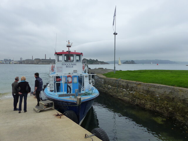
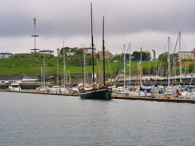
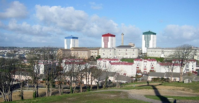
Devonport is a historic town located in the county of Devon, England. Situated on the western bank of the River Tamar, it is a part of the larger city of Plymouth. With a population of around 24,000 people, Devonport is a thriving community with a rich maritime heritage.

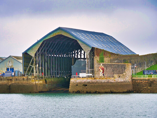
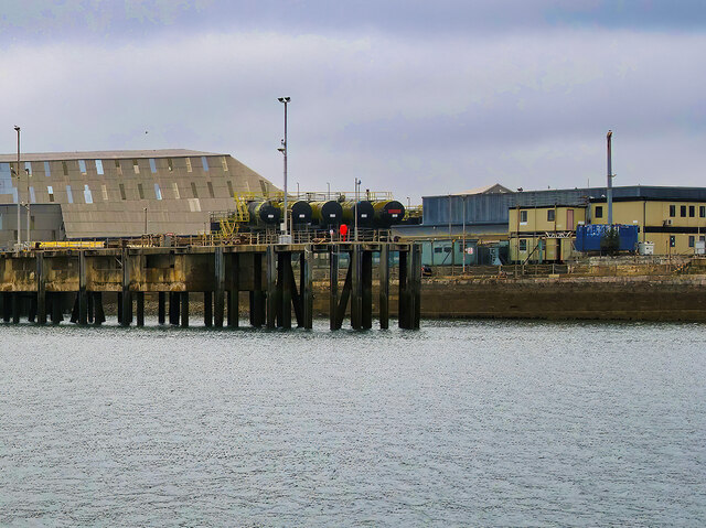
The town is known for its naval history, as it has been a significant naval base for centuries. Devonport Royal Dockyard, established in the 17th century, is one of the largest naval dockyards in Europe. It has played a vital role in the defense and maintenance of the Royal Navy's fleet. Today, it continues to be a major employer in the area and contributes significantly to the local economy.

Devonport features a mix of architectural styles, including Georgian and Victorian era buildings, showcasing its historical significance. The town boasts several landmarks, such as Devonport Column, a 120-feet high structure built in 1824 to commemorate the British victory in the Napoleonic Wars.

In addition to its naval heritage, Devonport offers a range of amenities and attractions for residents and visitors. It has a vibrant shopping district with a variety of shops, cafes, and restaurants. The town also has several parks and green spaces, providing opportunities for outdoor activities and relaxation.

Overall, Devonport is a picturesque town that combines its rich naval history with modern amenities, making it a desirable place to live and visit for those interested in maritime heritage and a vibrant community setting.

If you have any feedback on the listing, please let us know in the comments section below.
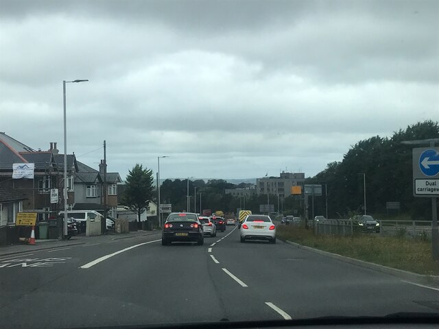
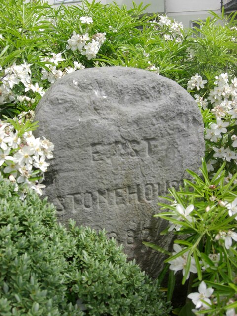
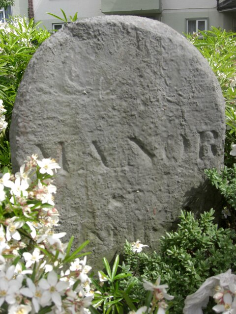
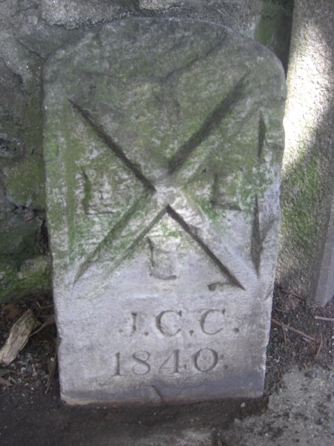
Devonport Images

Images are sourced within 2km of 50.37745/-4.179238 or Grid Reference SX4555. Thanks to Geograph Open Source API. All images are credited.

Gloomy A386 A386 on a gloomy Tuesday morning
Gloomy A386
A386 on a gloomy Tuesday morning
Old Boundary Marker on North Quay, Plymouth Municipal Boundary Marker between buttresses and against a stone wall on the north side of North Quay, behind the buildings on the south side of Millbay Road. Erected by East Stonehouse Local Board of Health.

Milestone Society National ID: DV_ESBS01pb
Old Boundary Marker on North Quay, Plymouth
Municipal Boundary Marker between buttresses and against a stone wall on the north side of North Quay, behind the buildings on the south side of Millbay Road. Erected by East Stonehouse Local Board of Health. Milestone Society National ID: DV_ESBS01pb
Old Boundary Marker on Stoke Road, Plymouth Municipal Boundary Marker inside the railings of Stoke Road flats next to DV_MOS06pb stone, on the north side of a roundabout. Inscribed EAST / STONEHOUSE / 1883 and originally erected by East Stonehouse Local Board of Health.

Milestone Society National ID: DV_ESBS05pb
Old Boundary Marker on Stoke Road, Plymouth
Municipal Boundary Marker inside the railings of Stoke Road flats next to DV_MOS06pb stone, on the north side of a roundabout. Inscribed EAST / STONEHOUSE / 1883 and originally erected by East Stonehouse Local Board of Health. Milestone Society National ID: DV_ESBS05pb
Old Boundary Marker on Stoke Road, Plymouth Parish Boundary Marker inside the railings of Stoke Road flats next to DV_ESB05pb stone, on the north side of a roundabout. Inscribed MANOR / OF / STONEHOUSE.

Milestone Society National ID: DV_MOS06pb
Old Boundary Marker on Stoke Road, Plymouth
Parish Boundary Marker inside the railings of Stoke Road flats next to DV_ESB05pb stone, on the north side of a roundabout. Inscribed MANOR / OF / STONEHOUSE. Milestone Society National ID: DV_MOS06pb
Old Boundary Marker in Victoria Park, Plymouth Municipal Boundary Marker set on a concrete base beside Devonport boundary marker DV_DCBB11pb inside the wall at the northwest entrance to Victoria Park, Plymouth. J.C.C. refers to Joseph C Cookworthy, mayor.

Milestone Society National ID: DV_PCBS12pb
Old Boundary Marker in Victoria Park, Plymouth
Municipal Boundary Marker set on a concrete base beside Devonport boundary marker DV_DCBB11pb inside the wall at the northwest entrance to Victoria Park, Plymouth. J.C.C. refers to Joseph C Cookworthy, mayor. Milestone Society National ID: DV_PCBS12pb
Old Boundary Markers in back Wilton Street, Plymouth Two Municipal Boundary Markers against the rear wall of a house in the back lane of Wilton Street, Plymouth.

On the left is Devonport municipal borough boundary marker DV_DCBB14pb. Inscribed D.C. B. / St LEVAN / MAYOR / 1891. St Levan was The Right Honourable John, Lord Saint Levan.

On the right is Plymouth borough boundary marker DV_PCBS15pb. Inscribed VII / J.C.C. / 1840. J.C.C. refers to Joseph C Cookworthy, mayor.
Old Boundary Markers in back Wilton Street, Plymouth
Two Municipal Boundary Markers against the rear wall of a house in the back lane of Wilton Street, Plymouth. On the left is Devonport municipal borough boundary marker DV_DCBB14pb. Inscribed D.C. B. / St LEVAN / MAYOR / 1891. St Levan was The Right Honourable John, Lord Saint Levan. On the right is Plymouth borough boundary marker DV_PCBS15pb. Inscribed VII / J.C.C. / 1840. J.C.C. refers to Joseph C Cookworthy, mayor.
Old Boundary Marker on Cecil Street, Plymouth Water Boundary Marker on the west side of Cecil Street, Plymouth, against the side wall of "Cornerstone" beside a gate. It is inscribed STONEHOUSE / LEAT / AND BANKS / 1593 but dates from the 1850’s. 

Milestone Society National ID: DV_SLBB03em
Old Boundary Marker on Cecil Street, Plymouth
Water Boundary Marker on the west side of Cecil Street, Plymouth, against the side wall of "Cornerstone" beside a gate. It is inscribed STONEHOUSE / LEAT / AND BANKS / 1593 but dates from the 1850’s. Milestone Society National ID: DV_SLBB03em
Brewhouse at Royal William Yard The Royal William Victualling Yard occupies virtually the whole of the Devil's Point peninsula - about 18 acres - to the south of Stonehouse within the conurbation of Plymouth.
The Yard was given Royal Assent on June 3rd 1824 during the reign of King George IV, but was not completed until 9 years later by which time George had died and his brother William had become King William IV. So the Yard was named after this latter monarch on 3rd December 1833.
The architects of this fine set of buildings (much admired by the architectural historian, Pevsner) were Sir John Rennie the Younger (1794-1874) and Philip Richards, and the contractor was Hugh McIntosh. The cost of the building was estimated at £2,000,000 which in the early C19th was a colossal amount of money, equivalent to billions today.
The original purpose of the Yard, as its name suggests, was to supply victuals - that is food, drink and provisions - for the Royal Navy. With the burgeoning British Empire in the C19th, the Navy grew in size dramatically, and so therefore did its requirement for victuals. This Yard therefore played an important part in "oiling the wheels" of the vast machine that was the Royal Navy. Not only food items but uniforms and all the general paraphernalia required by the Navy's ships (other than munitions etc.)  was stored here. In addition the yard contained a brewery, a slaughterhouse, mill, bakehouse and, essentially, a huge cooperage. Barrels made by the coopers were required in vast quantities to store the provisions on board the ships - not just liquids such as beer, but salted meats etc.
As the character of the Royal Navy changed over the decades, so the Yard had to adapt; and during the C20th, with the decline in Britain's maritime supremacy, the Yard suffered a similar decline. In 1992 the Navy gave up ownership of the land and buildings and they passed into private hands. Since then the Grade I listed buildings have had numerous uses, but are now undergoing major renovations and conversion into apartments, businesses, restaurants and galleries.
Brewhouse at Royal William Yard
The Royal William Victualling Yard occupies virtually the whole of the Devil's Point peninsula - about 18 acres - to the south of Stonehouse within the conurbation of Plymouth. The Yard was given Royal Assent on June 3rd 1824 during the reign of King George IV, but was not completed until 9 years later by which time George had died and his brother William had become King William IV. So the Yard was named after this latter monarch on 3rd December 1833. The architects of this fine set of buildings (much admired by the architectural historian, Pevsner) were Sir John Rennie the Younger (1794-1874) and Philip Richards, and the contractor was Hugh McIntosh. The cost of the building was estimated at £2,000,000 which in the early C19th was a colossal amount of money, equivalent to billions today. The original purpose of the Yard, as its name suggests, was to supply victuals - that is food, drink and provisions - for the Royal Navy. With the burgeoning British Empire in the C19th, the Navy grew in size dramatically, and so therefore did its requirement for victuals. This Yard therefore played an important part in "oiling the wheels" of the vast machine that was the Royal Navy. Not only food items but uniforms and all the general paraphernalia required by the Navy's ships (other than munitions etc.) was stored here. In addition the yard contained a brewery, a slaughterhouse, mill, bakehouse and, essentially, a huge cooperage. Barrels made by the coopers were required in vast quantities to store the provisions on board the ships - not just liquids such as beer, but salted meats etc. As the character of the Royal Navy changed over the decades, so the Yard had to adapt; and during the C20th, with the decline in Britain's maritime supremacy, the Yard suffered a similar decline. In 1992 the Navy gave up ownership of the land and buildings and they passed into private hands. Since then the Grade I listed buildings have had numerous uses, but are now undergoing major renovations and conversion into apartments, businesses, restaurants and galleries.
The Swan Former pub undergoing conversion to housing.
The Swan
Former pub undergoing conversion to housing.
The Cremyll passenger Ferry "Edgcumbe Belle" The ferry takes foot passengers between Cremyll, close to the Mount Edgcumbe Estate, and the city of Plymouth.
The Cremyll passenger Ferry "Edgcumbe Belle"
The ferry takes foot passengers between Cremyll, close to the Mount Edgcumbe Estate, and the city of Plymouth.
The "Edgcumbe Arms" public house, Cremyll, Cornwall
Mayflower Marina, Plymouth
Devonport South Yard, Covered Slip No 1 Limestone and granite slip dating from the 1770s with a timber-framed cover with a metal sheet mansard roof 1814 designed by Sir Robert Seppings added in 1814.

Covers for slips were introduced into naval dockyards in the early nineteenth century. This is one of two surviving at Devonport. When built, they were the widest span roofs in Britain, and the widest in the world except for riding schools in Germany and Russia.

Grade II* listed (Historic England list entry number 1388431 <span class="nowrap"><a title="https://historicengland.org.uk/listing/the-list/list-entry/1388431?section=official-list-entry" rel="nofollow ugc noopener" href="https://historicengland.org.uk/listing/the-list/list-entry/1388431?section=official-list-entry">Link</a><img style="margin-left:2px;" alt="External link" title="External link - shift click to open in new window" src="https://s1.geograph.org.uk/img/external.png" width="10" height="10"/></span> ).
Devonport South Yard, Covered Slip No 1
Limestone and granite slip dating from the 1770s with a timber-framed cover with a metal sheet mansard roof 1814 designed by Sir Robert Seppings added in 1814. Covers for slips were introduced into naval dockyards in the early nineteenth century. This is one of two surviving at Devonport. When built, they were the widest span roofs in Britain, and the widest in the world except for riding schools in Germany and Russia. Grade II* listed (Historic England list entry number 1388431 LinkExternal link ).
HMNB Devonport, Rubble Jetty
South Rubble Buoy Green (Starboard) lateral marker "South Rubble" at the southern end of the Hamoaze, an estuarine stretch of the tidal River Tamar, between its confluence with the River Lynher and Plymouth Sound.
South Rubble Buoy
Green (Starboard) lateral marker "South Rubble" at the southern end of the Hamoaze, an estuarine stretch of the tidal River Tamar, between its confluence with the River Lynher and Plymouth Sound.
USNS Robert E. Peary at HMNB Devonport United States Navy Lewis and Clark-class dry cargo ship "Robert E Peary" berthed at Devonport.
USNS Robert E. Peary at HMNB Devonport
United States Navy Lewis and Clark-class dry cargo ship "Robert E Peary" berthed at Devonport.
HMNB Devonport Her Majesty's Naval Base, Devonport (HMNB Devonport), is one of three operating bases in the United Kingdom for the Royal Navy (the others being HMNB Clyde and HMNB Portsmouth). HMNB Devonport is located in Devonport, in the west of the city of Plymouth. Having begun as Royal Navy Dockyard in the late-17th century, it is now the largest naval base in Western Europe and is the sole nuclear repair and refuelling facility for the Royal Navy. Shipbuilding ceased at Devonport in the early 1970s, but ship maintenance work has continued: the now privatised maintenance facilities are operated by Babcock Marine who took over in 2007.
HM Naval Base Devonport is the home port of the Devonport Flotilla which includes the largest ship in the Royal Navy HMS Ocean and the Trafalgar-class submarines. Devonport will no longer be used as a base for attack submarines after these move to Faslane by 2017, and the Type 45 destroyers are based at Portsmouth. However, Devonport retains a long-term role as the dedicated home of the amphibious fleet, survey vessels and half the frigate fleet.
HMNB Devonport
Her Majesty's Naval Base, Devonport (HMNB Devonport), is one of three operating bases in the United Kingdom for the Royal Navy (the others being HMNB Clyde and HMNB Portsmouth). HMNB Devonport is located in Devonport, in the west of the city of Plymouth. Having begun as Royal Navy Dockyard in the late-17th century, it is now the largest naval base in Western Europe and is the sole nuclear repair and refuelling facility for the Royal Navy. Shipbuilding ceased at Devonport in the early 1970s, but ship maintenance work has continued: the now privatised maintenance facilities are operated by Babcock Marine who took over in 2007. HM Naval Base Devonport is the home port of the Devonport Flotilla which includes the largest ship in the Royal Navy HMS Ocean and the Trafalgar-class submarines. Devonport will no longer be used as a base for attack submarines after these move to Faslane by 2017, and the Type 45 destroyers are based at Portsmouth. However, Devonport retains a long-term role as the dedicated home of the amphibious fleet, survey vessels and half the frigate fleet.
US Navy Ship at Devonport United States Navy Lewis and Clark-class dry cargo ship "Robert E Peary" berthed at HMNB Devonport.
US Navy Ship at Devonport
United States Navy Lewis and Clark-class dry cargo ship "Robert E Peary" berthed at HMNB Devonport.
Show me another place!

Devonport is located at Grid Ref: SX4555 (Lat: 50.37745, Lng: -4.179238)

Unitary Authority: Plymouth

Police Authority: Devon and Cornwall

What 3 Words

///paints.scam.racing. Near Torpoint, Cornwall

Related Wikis

Devonport, Plymouth

Devonport ( DEV-ən-port), formerly named Plymouth Dock or just Dock, is a district of Plymouth in the English county of Devon, although it was, at one...

UTC Plymouth

UTC Plymouth is a university technical college (UTC) that opened in the Devonport area of Plymouth, Devon, England in September 2013. The college is located...

Morice Town

Morice Town is a suburb of Plymouth in the English county of Devon. It named after Sir William Morice who owned the land at the time that it was being...

Albert Road Halt railway station

Albert Road Halt was a railway station in Plymouth in the English county of Devon. It was located between Ford and Devonport Park tunnels. == History... ==

Nearby Amenities

Located within 500m of 50.37745,-4.179238
Ferry Terminal
Ferry: yes
Public Transport: station
Lat/Long: 50.3757744/-4.1838617
Traffic Signals
Lat/Long: 50.378562/-4.1763295
Source: PGS
Lat/Long: 50.3800588/-4.1832618
Source: PGS
Lat/Long: 50.3798267/-4.1849278
Source: PGS
Lat/Long: 50.3782591/-4.184796
Source: PGS
Lat/Long: 50.3758009/-4.1838657
Source: PGS
Lat/Long: 50.3749471/-4.1837332
Source: PGS
Lat/Long: 50.3748866/-4.1842981
Mini Roundabout
Direction: clockwise
Lat/Long: 50.380257/-4.1780942
Crossing
Crossing: uncontrolled
Crossing Markings: yes
Lat/Long: 50.3762445/-4.1799437
Mini Roundabout
Direction: clockwise
Lat/Long: 50.3779519/-4.1794048
Ferry Terminal
Ferry: yes
Public Transport: station
Lat/Long: 50.3761073/-4.1839317
Crossing
Crossing: marked
Crossing Island: no
Crossing Markings: yes
Mapillary: 1030482014191608
Survey Date: 2021-10-22
Tactile Paving: yes
Lat/Long: 50.3732522/-4.1769377
Crossing
Crossing: marked
Crossing Island: no
Crossing Markings: yes
Tactile Paving: yes
Lat/Long: 50.373426/-4.1771018
Traffic Signals
Crossing: traffic_signals
Tactile Paving: yes
Lat/Long: 50.3768175/-4.1762109
Ferry Terminal
Ferry: yes
Public Transport: station
Lat/Long: 50.3753891/-4.1837933
Post Box
Collection Times: Mo-Fr 09:00; Sa 07:00
Mapillary: 1394267384354243
Post Box Type: pillar
Ref: PL2 180D
Royal Cypher: GVIR
Royal Cypher Wikidata: Q33102169
Survey Date: 2022-04-10
Lat/Long: 50.3786928/-4.1756024
Ferry Terminal
Torpoint Ferry
Ferry: yes
Name Kw: Kowbal Penntorr
Public Transport: station
Lat/Long: 50.3757095/-4.1839524
The Doris Gun
Historic: memorial
Lat/Long: 50.3755358/-4.1739679
Crossing
Crossing: uncontrolled
Crossing Markings: zebra
Lat/Long: 50.3775955/-4.1801155
Crossing
Crossing: marked
Crossing Markings: zebra
Lat/Long: 50.3779478/-4.1784923
Barrier: lift_gate
Lat/Long: 50.3781318/-4.178603
Barrier: bollard
Bicycle: yes
Bollard: fixed
Foot: yes
Lat/Long: 50.3735619/-4.1770563
Morice Town
Place: suburb
Wikidata: Q6912171
Lat/Long: 50.380625/-4.1773241
St James Church (Site Of)
Historic: yes
Lat/Long: 50.3805839/-4.1793411
St Chad (Site Of)
Historic: yes
Note: Was on Moon Street which was here
Lat/Long: 50.3774976/-4.1792286
Bench
Backrest: yes
Lat/Long: 50.3755618/-4.1740258
Bench
Backrest: yes
Lat/Long: 50.3757891/-4.1734914
Recycling
Recycling Type: container
Survey Date: 2022-07-26
Lat/Long: 50.3758743/-4.1728321
Bench
Backrest: yes
Lat/Long: 50.3755599/-4.1738661
Bench
Backrest: yes
Lat/Long: 50.3758384/-4.1729662
Bench
Backrest: yes
Lat/Long: 50.3758264/-4.1731232
Bicycle Parking
Bicycle Parking: stands
Capacity: 6
Covered: no
Lat/Long: 50.3758936/-4.1733671
Bench
Backrest: yes
Lat/Long: 50.375621/-4.1739504
Defibrillator
Defibrillator Location: outside round building (mini security tower?) by Torpoint ferry (east bank)
Emergency: defibrillator
Indoor: no
Ref GB The Circuit: E102760F-417E-4F22-BEEC-AD7500B9F589
Lat/Long: 50.3757862/-4.1832033
Barrier: yes
Lat/Long: 50.3778606/-4.1749634
Leisure: slipway
Lat/Long: 50.3741815/-4.183761
Direction: W
Generator Method: photovoltaic
Generator Output Electricity: yes
Generator Solar Modules: 6
Generator Source: solar
Generator Type: solar_photovoltaic_panel
Location: roof
Power: generator
Lat/Long: 50.3750919/-4.1764603
Direction: SSE
Generator Method: photovoltaic
Generator Output Electricity: yes
Generator Solar Modules: 8
Generator Source: solar
Generator Type: solar_photovoltaic_panel
Location: roof
Power: generator
Lat/Long: 50.3737039/-4.1811898
Direction: WSW
Generator Method: photovoltaic
Generator Output Electricity: yes
Generator Solar Modules: 8
Generator Source: solar
Generator Type: solar_photovoltaic_panel
Location: roof
Power: generator
Lat/Long: 50.3736844/-4.1814986
Direction: SSE
Generator Method: photovoltaic
Generator Output Electricity: yes
Generator Solar Modules: 8
Generator Source: solar
Generator Type: solar_photovoltaic_panel
Location: roof
Power: generator
Lat/Long: 50.3739985/-4.1813233
Direction: 100
Generator Method: photovoltaic
Generator Output Electricity: yes
Generator Solar Modules: 8
Generator Source: solar
Generator Type: solar_photovoltaic_panel
Location: roof
Power: generator
Lat/Long: 50.3739109/-4.1773785
Direction: 260
Generator Method: photovoltaic
Generator Output Electricity: yes
Generator Solar Modules: 8
Generator Source: solar
Generator Type: solar_photovoltaic_panel
Location: roof
Power: generator
Lat/Long: 50.3742125/-4.1780961
Direction: 260
Generator Method: photovoltaic
Generator Output Electricity: yes
Generator Solar Modules: 8
Generator Source: solar
Generator Type: solar_photovoltaic_panel
Location: roof
Power: generator
Lat/Long: 50.3741646/-4.1780837
Direction: S
Generator Method: photovoltaic
Generator Output Electricity: yes
Generator Solar Modules: 6
Generator Source: solar
Generator Type: solar_photovoltaic_panel
Location: roof
Power: generator
Lat/Long: 50.3747601/-4.1747483
Direction: S
Generator Method: photovoltaic
Generator Output Electricity: yes
Generator Solar Modules: 14
Generator Source: solar
Generator Type: solar_photovoltaic_panel
Location: roof
Power: generator
Lat/Long: 50.3751333/-4.1769449
Direction: 170
Generator Method: photovoltaic
Generator Output Electricity: yes
Generator Solar Modules: 4
Generator Source: solar
Generator Type: solar_photovoltaic_panel
Location: roof
Power: generator
Lat/Long: 50.3744503/-4.1776153
Direction: 80
Generator Method: photovoltaic
Generator Output Electricity: yes
Generator Solar Modules: 8
Generator Source: solar
Generator Type: solar_photovoltaic_panel
Location: roof
Power: generator
Lat/Long: 50.3742195/-4.1780382
Direction: 80
Generator Method: photovoltaic
Generator Output Electricity: yes
Generator Solar Modules: 8
Generator Source: solar
Generator Type: solar_photovoltaic_panel
Location: roof
Power: generator
Lat/Long: 50.3741722/-4.1780262
Direction: SSE
Generator Method: photovoltaic
Generator Output Electricity: yes
Generator Solar Modules: 8
Generator Source: solar
Generator Type: solar_photovoltaic_panel
Location: roof
Power: generator
Lat/Long: 50.3739187/-4.181517
Direction: W
Generator Method: photovoltaic
Generator Output Electricity: yes
Generator Solar Modules: 6
Generator Source: solar
Generator Type: solar_photovoltaic_panel
Location: roof
Power: generator
Lat/Long: 50.3749814/-4.1769771
Direction: 170
Generator Method: photovoltaic
Generator Output Electricity: yes
Generator Solar Modules: 4
Generator Source: solar
Generator Type: solar_photovoltaic_panel
Location: roof
Power: generator
Lat/Long: 50.3747435/-4.177499
Direction: 170
Generator Method: photovoltaic
Generator Output Electricity: yes
Generator Solar Modules: 6
Generator Source: solar
Generator Type: solar_photovoltaic_panel
Location: roof
Power: generator
Lat/Long: 50.374437/-4.1776911
Direction: 80
Generator Method: photovoltaic
Generator Output Electricity: yes
Generator Solar Modules: 8
Generator Source: solar
Generator Type: solar_photovoltaic_panel
Location: roof
Power: generator
Lat/Long: 50.3742615/-4.1780478
Direction: 170
Generator Method: photovoltaic
Generator Output Electricity: yes
Generator Solar Modules: 8
Generator Source: solar
Generator Type: solar_photovoltaic_panel
Location: roof
Power: generator
Lat/Long: 50.3743968/-4.1780771
Direction: 260
Generator Method: photovoltaic
Generator Output Electricity: yes
Generator Solar Modules: 8
Generator Source: solar
Generator Type: solar_photovoltaic_panel
Location: roof
Power: generator
Lat/Long: 50.3742611/-4.1781124
Direction: 170
Generator Method: photovoltaic
Generator Output Electricity: yes
Generator Solar Modules: 8
Generator Source: solar
Generator Type: solar_photovoltaic_panel
Location: roof
Power: generator
Lat/Long: 50.3744056/-4.1780028
Direction: SSE
Generator Method: photovoltaic
Generator Output Electricity: yes
Generator Solar Modules: 8
Generator Source: solar
Generator Type: solar_photovoltaic_panel
Location: roof
Power: generator
Lat/Long: 50.3740941/-4.1810747
Direction: W
Generator Method: photovoltaic
Generator Output Electricity: yes
Generator Solar Modules: 14
Generator Source: solar
Generator Type: solar_photovoltaic_panel
Location: roof
Power: generator
Lat/Long: 50.3750463/-4.1769761
Direction: WSW
Generator Method: photovoltaic
Generator Output Electricity: yes
Generator Solar Modules: 6
Generator Source: solar
Generator Type: solar_photovoltaic_panel
Location: roof
Power: generator
Lat/Long: 50.3738682/-4.1809043
Direction: 145
Generator Method: photovoltaic
Generator Output Electricity: yes
Generator Solar Modules: 8
Generator Source: solar
Generator Type: solar_photovoltaic_panel
Location: roof
Power: generator
Lat/Long: 50.3747462/-4.1740732
Direction: W
Generator Method: photovoltaic
Generator Output Electricity: yes
Generator Solar Modules: 6
Generator Source: solar
Generator Type: solar_photovoltaic_panel
Location: roof
Power: generator
Lat/Long: 50.374999/-4.1764745
Direction: SSE
Generator Method: photovoltaic
Generator Output Electricity: yes
Generator Solar Modules: 6
Generator Source: solar
Generator Type: solar_photovoltaic_panel
Location: roof
Power: generator
Lat/Long: 50.3736373/-4.1814281
Direction: WSW
Generator Method: photovoltaic
Generator Output Electricity: yes
Generator Solar Modules: 108
Generator Source: solar
Generator Type: solar_photovoltaic_panel
Location: roof
Power: generator
Lat/Long: 50.3732946/-4.1805469
Direction: 170
Generator Method: photovoltaic
Generator Output Electricity: yes
Generator Solar Modules: 8
Generator Source: solar
Generator Type: solar_photovoltaic_panel
Location: roof
Power: generator
Lat/Long: 50.3747595/-4.1773617
Direction: 170
Generator Method: photovoltaic
Generator Output Electricity: yes
Generator Solar Modules: 8
Generator Source: solar
Generator Type: solar_photovoltaic_panel
Location: roof
Power: generator
Lat/Long: 50.3745132/-4.1773935
Direction: ENE
Generator Method: photovoltaic
Generator Output Electricity: yes
Generator Solar Modules: 44
Generator Source: solar
Generator Type: solar_photovoltaic_panel
Location: roof
Power: generator
Lat/Long: 50.3732633/-4.180364
Direction: S
Generator Method: photovoltaic
Generator Output Electricity: yes
Generator Solar Modules: 16
Generator Source: solar
Generator Type: solar_photovoltaic_panel
Location: roof
Power: generator
Lat/Long: 50.3747051/-4.1748967
Direction: 170
Generator Method: photovoltaic
Generator Output Electricity: yes
Generator Solar Modules: 8
Generator Source: solar
Generator Type: solar_photovoltaic_panel
Location: roof
Power: generator
Lat/Long: 50.3744127/-4.1773725
Direction: W
Generator Method: photovoltaic
Generator Output Electricity: yes
Generator Solar Modules: 6
Generator Source: solar
Generator Type: solar_photovoltaic_panel
Location: roof
Power: generator
Lat/Long: 50.3750458/-4.1764777
Direction: SSE
Generator Method: photovoltaic
Generator Output Electricity: yes
Generator Solar Modules: 30
Generator Source: solar
Generator Type: solar_photovoltaic_panel
Location: roof
Power: generator
Lat/Long: 50.3731863/-4.1803995
Direction: 170
Generator Method: photovoltaic
Generator Output Electricity: yes
Generator Solar Modules: 8
Generator Source: solar
Generator Type: solar_photovoltaic_panel
Location: roof
Power: generator
Lat/Long: 50.3744147/-4.1779232
Direction: 145
Generator Method: photovoltaic
Generator Output Electricity: yes
Generator Solar Modules: 8
Generator Source: solar
Generator Type: solar_photovoltaic_panel
Location: roof
Power: generator
Lat/Long: 50.3747249/-4.1741467
Direction: WSW
Generator Method: photovoltaic
Generator Output Electricity: yes
Generator Solar Modules: 8
Generator Source: solar
Generator Type: solar_photovoltaic_panel
Location: roof
Power: generator
Lat/Long: 50.3737161/-4.1815259
Direction: 100
Generator Method: photovoltaic
Generator Output Electricity: yes
Generator Solar Modules: 8
Generator Source: solar
Generator Type: solar_photovoltaic_panel
Location: roof
Power: generator
Lat/Long: 50.3738135/-4.1774231
Direction: W
Generator Method: photovoltaic
Generator Output Electricity: yes
Generator Solar Modules: 6
Generator Source: solar
Generator Type: solar_photovoltaic_panel
Location: roof
Power: generator
Lat/Long: 50.3749533/-4.1764699
Direction: WSW
Generator Method: photovoltaic
Generator Output Electricity: yes
Generator Solar Modules: 35
Generator Source: solar
Generator Type: solar_photovoltaic_panel
Location: roof
Power: generator
Lat/Long: 50.3809672/-4.1772865
Direction: SSE
Generator Method: photovoltaic
Generator Output Electricity: yes
Generator Solar Modules: 15
Generator Source: solar
Generator Type: solar_photovoltaic_panel
Location: roof
Power: generator
Lat/Long: 50.3811281/-4.1772739
Direction: SSE
Generator Method: photovoltaic
Generator Output Electricity: yes
Generator Solar Modules: 12
Generator Source: solar
Generator Type: solar_photovoltaic_panel
Location: roof
Power: generator
Lat/Long: 50.3808892/-4.1747943
Direction: ENE
Generator Method: photovoltaic
Generator Output Electricity: yes
Generator Solar Modules: 7
Generator Source: solar
Generator Type: solar_photovoltaic_panel
Location: roof
Power: generator
Lat/Long: 50.3810563/-4.1772235
Direction: ENE
Generator Method: photovoltaic
Generator Output Electricity: yes
Generator Solar Modules: 35
Generator Source: solar
Generator Type: solar_photovoltaic_panel
Location: roof
Power: generator
Lat/Long: 50.3809774/-4.1772079
Direction: SSE
Generator Method: photovoltaic
Generator Output Electricity: yes
Generator Solar Modules: 14
Generator Source: solar
Generator Type: solar_photovoltaic_panel
Location: roof
Power: generator
Lat/Long: 50.3806176/-4.1743287
Direction: SSE
Generator Method: photovoltaic
Generator Output Electricity: yes
Generator Solar Modules: 10
Generator Source: solar
Generator Type: solar_photovoltaic_panel
Location: roof
Power: generator
Lat/Long: 50.3808759/-4.1765315
Direction: SSE
Generator Method: photovoltaic
Generator Output Electricity: yes
Generator Solar Modules: 12
Generator Source: solar
Generator Type: solar_photovoltaic_panel
Location: roof
Power: generator
Lat/Long: 50.3810746/-4.1774417
Direction: WSW
Generator Method: photovoltaic
Generator Output Electricity: yes
Generator Solar Modules: 5
Generator Source: solar
Generator Type: solar_photovoltaic_panel
Location: roof
Power: generator
Lat/Long: 50.3810517/-4.177318
Direction: 260
Generator Method: photovoltaic
Generator Output Electricity: yes
Generator Solar Modules: 15
Generator Source: solar
Generator Type: solar_photovoltaic_panel
Location: roof
Power: generator
Lat/Long: 50.3819462/-4.1792264
Post Office
Devonport Post Office
Addr Country: GB
Addr Postcode: PL1 4AE
Brand: Post Office
Brand Wikidata: Q1783168
Contact Website: https://www.postoffice.co.uk/branch-finder/1525395/devonport
Ref Pol Id: 2980
Lat/Long: 50.3739019/-4.1790433
Barrier: bollard
Bollard: fixed
Lat/Long: 50.3733454/-4.1789017
Toilets
Unisex: yes
Wheelchair: yes
Lat/Long: 50.3761058/-4.1825318
Barrier: bollard
Bollard: fixed
Lat/Long: 50.3804904/-4.1747766
Toilets
Changing Table: yes
Fee: no
Unisex: yes
Wheelchair: yes
Lat/Long: 50.3757432/-4.1728175
Dressing Room
Lat/Long: 50.3758059/-4.1727984
Bench
Backrest: yes
Lat/Long: 50.3760609/-4.1760962
Bench
Backrest: yes
Lat/Long: 50.3757694/-4.1766956
Bench
Backrest: yes
Lat/Long: 50.3762835/-4.1751673
Bench
Backrest: yes
Lat/Long: 50.376271/-4.1752132
Bench
Backrest: yes
Lat/Long: 50.3764387/-4.1746449
Bicycle Parking
Bicycle Parking: stands
Capacity: 6
Covered: no
Fee: no
Lat/Long: 50.3753999/-4.1753127
Bench
Backrest: yes
Lat/Long: 50.3759857/-4.1739399
Bench
Backrest: yes
Lat/Long: 50.3761107/-4.1732694
Bench
Backrest: yes
Lat/Long: 50.3761729/-4.173189
Bench
Backrest: yes
Lat/Long: 50.3761876/-4.1730543
Bench
Backrest: yes
Lat/Long: 50.3761434/-4.1729588
Bench
Backrest: yes
Lat/Long: 50.3753727/-4.1744429
Bench
Backrest: yes
Lat/Long: 50.3754486/-4.1753041
Bench
Backrest: yes
Lat/Long: 50.3754136/-4.1756363
Bench
Backrest: yes
Survey Date: 2022-01-21
Lat/Long: 50.3754826/-4.1759397
Bench
Backrest: yes
Lat/Long: 50.3754311/-4.1762028
Waste Basket
Lat/Long: 50.3754749/-4.1770028
Waste Basket
Lat/Long: 50.3754771/-4.1769791
Bench
Backrest: yes
Lat/Long: 50.3754731/-4.1779876
Waste Basket
Lat/Long: 50.3754275/-4.1790727
Bench
Backrest: yes
Lat/Long: 50.376029/-4.1784771
Bench
Backrest: yes
Lat/Long: 50.3760713/-4.1780555
Bench
Backrest: yes
Lat/Long: 50.3762036/-4.1777139
Waste Basket
Lat/Long: 50.376114/-4.1779532
Waste Basket
Lat/Long: 50.3765921/-4.1786582
Bench
Backrest: yes
Lat/Long: 50.374164/-4.179436
Bench
Backrest: yes
Lat/Long: 50.3741277/-4.1794161
Waste Basket
Lat/Long: 50.3742439/-4.1794901
Bicycle Parking
Bicycle Parking: stands
Capacity: 8
Covered: no
Fee: no
Lat/Long: 50.374065/-4.1793642
Barrier: bollard
Bollard: fixed
Lat/Long: 50.3734527/-4.1785032
Crossing
Crossing: marked
Crossing Markings: yes
Lat/Long: 50.3779697/-4.1789771
Crossing
Crossing: marked
Crossing Markings: yes
Lat/Long: 50.3784129/-4.1796506
Crossing
Crossing: unmarked
Crossing Island: yes
Crossing Markings: no
Tactile Paving: yes
Lat/Long: 50.3789372/-4.1730762
Bus Stop
Exmouth Road
Bench: yes
Bin: no
Bus: yes
Departures Board: timetable
Lit: yes
Naptan AtcoCode: 1180PLG40054
Naptan Bearing: W
Naptan CommonName: Exmouth Road
Naptan Indicator: W-bound
Naptan NaptanCode: plyamwj
Naptan PlusbusZoneRef: PLYMTH
Naptan Street: Albert Road
Naptan Verified: no
Public Transport: platform
Shelter: yes
Tactile Paving: no
Lat/Long: 50.3788246/-4.1735509
Bench
Survey Date: 2022-01-21
Lat/Long: 50.374236/-4.1746595
Bench
Backrest: yes
Survey Date: 2022-01-21
Lat/Long: 50.3742767/-4.1745144
Bench
Backrest: no
Survey Date: 2022-01-21
Lat/Long: 50.3731385/-4.1772608
Telephone
Booth: KX100
Covered: booth
Survey Date: 2022-01-21
Lat/Long: 50.3730863/-4.1781159
Bench
Backrest: yes
Survey Date: 2022-01-21
Lat/Long: 50.3744167/-4.1746756
Post Box
Collection Times: Mo-Fr 09:00; Sa 07:00
Ref: PL1 178D
Royal Cypher: EIIR
Royal Cypher Wikidata: Q33102113
Survey Date: 2022-01-21
Lat/Long: 50.374192/-4.1746922
Waste Basket
Survey Date: 2022-01-21
Lat/Long: 50.3739019/-4.1758356
Bench
Backrest: yes
Survey Date: 2022-01-21
Lat/Long: 50.3731015/-4.1786473
Waste Basket
Ref: 616
Survey Date: 2022-01-21
Lat/Long: 50.3739081/-4.1792196
Waste Basket
Survey Date: 2022-01-21
Lat/Long: 50.37384/-4.1791895
Post Box
Collection Times: Mo-Fr 17:00; Sa 11:30
Ref: PL1 335
Royal Cypher: EIIR
Royal Cypher Wikidata: Q33102113
Survey Date: 2022-01-21
Lat/Long: 50.3738661/-4.1791602
Atm
Brand: NatWest
Brand Wikidata: Q2740021
Operator: NatWest
Operator Wikidata: Q2740021
Survey Date: 2022-01-21
Lat/Long: 50.3741895/-4.1793251
Bus Stop
Granby Way
Bench: yes
Bin: no
Bus: yes
Departures Board: timetable
Lit: yes
Mapillary: 1124368191494637
Naptan AtcoCode: 1180PLG40047
Naptan Bearing: N
Naptan CommonName: Granby Way
Naptan Indicator: N-bound
Naptan NaptanCode: plyajmt
Naptan PlusbusZoneRef: PLYMTH
Naptan Street: Park Avenue
Public Transport: platform
Shelter: yes
Survey Date: 2022-08-15
Tactile Paving: yes
Lat/Long: 50.3738611/-4.1772908
Bench
Backrest: yes
Survey Date: 2022-01-21
Lat/Long: 50.37549/-4.1744138
Bench
Backrest: yes
Survey Date: 2022-01-21
Lat/Long: 50.3756224/-4.1742933
Waste Basket
Ref: 619
Survey Date: 2022-01-21
Lat/Long: 50.3731865/-4.1786068
Bench
Backrest: yes
Survey Date: 2022-01-21
Lat/Long: 50.3738092/-4.179178
Recycling
Recycling Cans: yes
Recycling Glass Bottles: yes
Recycling Paper: yes
Recycling Plastic: yes
Recycling Type: container
Ref: 617
Survey Date: 2022-01-21
Lat/Long: 50.3738636/-4.1791722
Bus Stop
Granby Way
Bench: yes
Bin: no
Bus: yes
Departures Board: realtime
Lit: yes
Mapillary: 5407979115950481
Naptan AtcoCode: 1180PLG40046
Naptan Bearing: S
Naptan CommonName: Granby Way
Naptan Indicator: S-bound
Naptan NaptanCode: plyajpg
Naptan PlusbusZoneRef: PLYMTH
Naptan Street: Park Avenue
Public Transport: platform
Shelter: yes
Survey Date: 2022-08-29
Tactile Paving: yes
Lat/Long: 50.3736809/-4.1770362
Bench
Backrest: no
Survey Date: 2022-01-21
Lat/Long: 50.3730807/-4.1776861
Bus Stop
St Aubyn Road
Bench: no
Bin: no
Bus: yes
Lit: yes
Naptan AtcoCode: 1180PLG40048
Naptan Bearing: S
Naptan CommonName: St Aubyn Road
Naptan Indicator: S-bound
Naptan NaptanCode: plyajpj
Naptan PlusbusZoneRef: PLYMTH
Public Transport: platform
Shelter: no
Survey Date: 2022-01-21
Tactile Paving: no
Lat/Long: 50.3748699/-4.1770901
Bus Stop
Washborne Tower
Bench: yes
Bin: no
Bus: yes
Lit: yes
Naptan AtcoCode: 1180PLG40049
Naptan Bearing: N
Naptan CommonName: Washborne Tower
Naptan Indicator: N-bound
Naptan NaptanCode: plyajmw
Naptan PlusbusZoneRef: PLYMTH
Naptan Street: Park Avenue
Public Transport: platform
Shelter: yes
Survey Date: 2022-01-21
Tactile Paving: yes
Lat/Long: 50.3749534/-4.1772599
Fire Hydrant
Emergency: fire_hydrant
Fire Hydrant Diameter Signed: no
Fire Hydrant Position: sidewalk
Fire Hydrant Type: underground
Survey Date: 2022-02-08
Lat/Long: 50.3786489/-4.1758949
Telephone
Booth: KX100
Check Date: 2024-05-06
Covered: booth
Lat/Long: 50.3787098/-4.1763652
Waste Basket
Survey Date: 2022-02-08
Lat/Long: 50.3786023/-4.1770139
Fire Hydrant
Emergency: fire_hydrant
Fire Hydrant Type: underground
Survey Date: 2022-02-08
Lat/Long: 50.3785857/-4.1772985
Atm
Brand: Cashzone
Brand Wikidata: Q110738461
Network: Allpoint
Network Wikidata: Q4733264
Operator: Cash Zone
Survey Date: 2022-02-08
Lat/Long: 50.3788689/-4.1743274
Waste Basket
Survey Date: 2022-02-08
Lat/Long: 50.3810927/-4.1784013
Fire Hydrant
Emergency: fire_hydrant
Fire Hydrant Type: underground
Survey Date: 2022-02-08
Lat/Long: 50.379784/-4.1751496
Bus Stop
Ross Street
Bench: no
Bin: no
Bus: yes
Lit: yes
Naptan AtcoCode: 1180PLG40053
Naptan Bearing: E
Naptan CommonName: Ross Street
Naptan Indicator: E-bound
Naptan NaptanCode: plyampa
Naptan PlusbusZoneRef: PLYMTH
Naptan Street: Albert Road
Public Transport: platform
Shelter: no
Survey Date: 2022-02-08
Tactile Paving: no
Lat/Long: 50.37879/-4.1749085
Post Box
Collection Times: Mo-Fr 09:00; Sa 07:00
Ref: PL2 185D
Royal Cypher: GVIR
Royal Cypher Wikidata: Q33102169
Survey Date: 2022-02-08
Lat/Long: 50.3803838/-4.1781823
Bus Stop
Ross Street
Bench: no
Bin: no
Bus: yes
Departures Board: timetable
Lit: yes
Mapillary: 1394267384354243
Naptan AtcoCode: 1180PLG40052
Naptan Bearing: W
Naptan CommonName: Ross Street
Naptan Indicator: W-bound
Naptan NaptanCode: plyamgm
Naptan PlusbusZoneRef: PLYMTH
Naptan Street: Albert Road
Public Transport: platform
Shelter: no
Survey Date: 2022-04-10
Tactile Paving: yes
Lat/Long: 50.3786056/-4.1754717
Waste Basket
Survey Date: 2022-02-08
Waste: dog_excrement
Lat/Long: 50.3786193/-4.1768257
Bus Stop
Albert Gate
Bench: yes
Bin: yes
Bus: yes
Departures Board: realtime
Lit: yes
Naptan AtcoCode: 1180PLG40090
Naptan Bearing: E
Naptan CommonName: Albert Gate
Naptan Indicator: E-bound
Naptan NaptanCode: plyajpt
Naptan PlusbusZoneRef: PLYMTH
Public Transport: platform
Shelter: yes
Survey Date: 2022-02-08
Tactile Paving: no
Lat/Long: 50.3785827/-4.1770951
Telephone
Booth: KX100
Covered: booth
Survey Date: 2022-02-20
Lat/Long: 50.3760114/-4.1825869
Bicycle Parking
Access: private
Bicycle Parking: lockers
Survey Date: 2022-02-20
Lat/Long: 50.3760662/-4.1825717
Post Box
Collection Times: Mo-Fr 09:00; Sa 07:00
Post Box Mounting: pier
Post Box Type: lamp
Ref: PL1 857D
Royal Cypher: EIIR
Royal Cypher Wikidata: Q33102113
Survey Date: 2022-02-20
Lat/Long: 50.3761315/-4.1823843
Street Lamp
Ref: 8
Survey Date: 2022-06-05
Lat/Long: 50.3756028/-4.1736252
Street Lamp
Ref: 6
Survey Date: 2022-06-05
Lat/Long: 50.3756582/-4.1744309
Street Lamp
Ref: 1
Survey Date: 2022-06-05
Lat/Long: 50.3754447/-4.1767178
Street Lamp
Ref: 11
Survey Date: 2022-06-05
Lat/Long: 50.3753429/-4.1771931
Street Lamp
Ref: 10
Survey Date: 2022-06-05
Lat/Long: 50.3749645/-4.1772109
Man Made: street_cabinet
Survey Date: 2022-06-05
Lat/Long: 50.3743833/-4.1770941
Street Lamp
Survey Date: 2022-06-05
Lat/Long: 50.375464/-4.176148
Street Lamp
Ref: 8
Survey Date: 2022-06-05
Lat/Long: 50.3743768/-4.1772371
Man Made: street_cabinet
Survey Date: 2022-06-05
Lat/Long: 50.3743531/-4.1770874
Recycling
Brand: The Salvation Army
Brand Wikidata: Q188307
Operator: Salvation Army
Recycling Clothes: yes
Recycling Glass Bottles: no
Recycling Paper: no
Recycling Plastic: no
Recycling Type: container
Survey Date: 2022-06-05
Lat/Long: 50.3734696/-4.1768933
Street Lamp
Ref: 7
Survey Date: 2022-06-05
Lat/Long: 50.3756595/-4.1741143
Bench
Backrest: yes
Survey Date: 2022-06-05
Lat/Long: 50.3757772/-4.1745505
Waste Basket
Ref: 570
Survey Date: 2022-06-05
Lat/Long: 50.3757343/-4.1746204
Information: guidepost
Survey Date: 2022-06-05
Tourism: information
Lat/Long: 50.3755122/-4.1769454
Street Lamp
Ref: 5
Survey Date: 2022-06-05
Lat/Long: 50.375658/-4.1745972
Street Lamp
Survey Date: 2022-06-05
Lat/Long: 50.3753693/-4.1749994
Fire Hydrant
Emergency: fire_hydrant
Fire Hydrant Diameter: 63
Fire Hydrant Position: sidewalk
Fire Hydrant Type: underground
Survey Date: 2022-06-05
Lat/Long: 50.375199/-4.1770582
Fire Hydrant
Emergency: fire_hydrant
Fire Hydrant Diameter Signed: no
Fire Hydrant Position: sidewalk
Fire Hydrant Type: underground
Survey Date: 2022-06-05
Lat/Long: 50.3745361/-4.1770826
Telephone
Booth: KX100
Survey Date: 2022-06-05
Lat/Long: 50.3735142/-4.1770319
Street Lamp
Ref: 11
Survey Date: 2022-06-05
Lat/Long: 50.3756083/-4.1731074
Waste Basket
Survey Date: 2022-06-05
Lat/Long: 50.3755076/-4.1771533
Grit Bin
Survey Date: 2022-07-07
Lat/Long: 50.3765256/-4.1764658
Street Lamp
Survey Date: 2022-07-07
Lat/Long: 50.3771843/-4.1757866
Street Lamp
Survey Date: 2022-07-07
Lat/Long: 50.377264/-4.1752095
Power: substation
Survey Date: 2022-07-07
Lat/Long: 50.3777296/-4.1728321
Fire Hydrant
Emergency: fire_hydrant
Fire Hydrant Type: underground
Survey Date: 2022-07-07
Lat/Long: 50.3777406/-4.1723604
Street Lamp
Survey Date: 2022-07-07
Lat/Long: 50.3772855/-4.1747834
Street Lamp
Survey Date: 2022-07-07
Lat/Long: 50.3773469/-4.1743024
Grit Bin
Survey Date: 2022-07-07
Lat/Long: 50.3776569/-4.1723636
Bench
Backrest: yes
Survey Date: 2022-07-07
Lat/Long: 50.3766957/-4.1751319
Street Lamp
Ref: 4
Survey Date: 2022-07-07
Lat/Long: 50.3774325/-4.1738185
Fire Hydrant
Emergency: fire_hydrant
Fire Hydrant Type: underground
Survey Date: 2022-07-07
Lat/Long: 50.3738019/-4.1780417
Man Made: surveillance
Surveillance Type: camera
Survey Date: 2022-07-07
Lat/Long: 50.3763374/-4.1752254
Information: guidepost
Survey Date: 2022-07-07
Tourism: information
Lat/Long: 50.3771468/-4.1759972
Man Made: surveillance
Surveillance Type: camera
Survey Date: 2022-07-07
Lat/Long: 50.3759062/-4.1765638
Bench
Backrest: yes
Survey Date: 2022-07-07
Lat/Long: 50.3760638/-4.1764427
Fire Hydrant
Emergency: fire_hydrant
Fire Hydrant Diameter: 150
Fire Hydrant Position: sidewalk
Fire Hydrant Type: underground
Survey Date: 2022-07-07
Lat/Long: 50.3744899/-4.1783698
Entrance: main
Lat/Long: 50.3777765/-4.1725384
Brand: Premier
Brand Wikidata: Q7240340
Shop: convenience
Website: https://www.premier-stores.co.uk/our-stores/morice-town-stores
Lat/Long: 50.3810383/-4.178484
Bus Stop
Keat Street
Bench: yes
Bin: no
Bus: yes
Lit: yes
Naptan AtcoCode: 1180PLG40093
Naptan Bearing: S
Naptan CommonName: Keat Street
Naptan Indicator: S-bound
Naptan NaptanCode: plyagtp
Naptan PlusbusZoneRef: PLYMTH
Public Transport: platform
Shelter: yes
Survey Date: 2022-07-12
Tactile Paving: yes
Lat/Long: 50.3812611/-4.1798764
Man Made: surveillance
Surveillance Type: camera
Survey Date: 2022-07-12
Lat/Long: 50.3734913/-4.1770205
Atm
Survey Date: 2022-07-12
Lat/Long: 50.3784135/-4.1783681
Bus Stop
Keyham Road Flats
Bench: no
Bin: no
Bus: yes
Lit: yes
Naptan AtcoCode: 1180PLG40092
Naptan Bearing: N
Naptan CommonName: Keyham Road Flats
Naptan Indicator: N-bound
Naptan NaptanCode: plyagtj
Naptan PlusbusZoneRef: PLYMTH
Naptan Street: Keyham Road
Public Transport: platform
Shelter: no
Survey Date: 2022-07-12
Tactile Paving: no
Lat/Long: 50.3807288/-4.1799031
Communication Mobile Phone: yes
Man Made: mast
Survey Date: 2022-07-15
Tower Type: communication
Lat/Long: 50.3734451/-4.1768026
Fire Hydrant
Emergency: fire_hydrant
Fire Hydrant Type: underground
Survey Date: 2022-07-15
Lat/Long: 50.3789021/-4.1738521
Bus Stop
Ferry Road
Bench: no
Bin: no
Bus: yes
Lit: yes
Naptan AtcoCode: 1180PLG40089
Naptan Bearing: SW
Naptan CommonName: Ferry Road
Naptan Indicator: SW-bound
Naptan NaptanCode: plyajgd
Naptan PlusbusZoneRef: PLYMTH
Naptan Street: Ferry Road
Public Transport: platform
Shelter: no
Survey Date: 2022-07-24
Tactile Paving: no
Lat/Long: 50.3767745/-4.1781855
Fire Hydrant
Emergency: fire_hydrant
Fire Hydrant Diameter: 110
Fire Hydrant Position: sidewalk
Fire Hydrant Type: underground
Survey Date: 2022-07-24
Lat/Long: 50.376541/-4.180749
Life Ring
Emergency: life_ring
Survey Date: 2022-07-24
Lat/Long: 50.3757353/-4.1835352
Waste Basket
Survey Date: 2022-07-24
Lat/Long: 50.375611/-4.1835339
Street Lamp
Ref: 4
Survey Date: 2022-07-24
Lat/Long: 50.3756376/-4.1793012
Man Made: street_cabinet
Survey Date: 2022-07-24
Lat/Long: 50.3750293/-4.1795945
Street Lamp
Ref: 7
Survey Date: 2022-07-24
Lat/Long: 50.3747176/-4.1797771
Street Lamp
Survey Date: 2022-07-24
Lat/Long: 50.3743836/-4.1796535
Recycling
Recycling Clothes: yes
Recycling Glass Bottles: no
Recycling Paper: no
Recycling Plastic: no
Recycling Type: container
Survey Date: 2022-07-24
Lat/Long: 50.374056/-4.1798106
Fire Hydrant
Emergency: fire_hydrant
Fire Hydrant Type: underground
Survey Date: 2022-07-24
Lat/Long: 50.3731541/-4.180167
Life Ring
Emergency: life_ring
Survey Date: 2022-07-24
Lat/Long: 50.3761664/-4.1836996
Man Made: surveillance
Surveillance Type: camera
Survey Date: 2022-07-24
Lat/Long: 50.3767647/-4.1788652
Waste Basket
Survey Date: 2022-07-24
Lat/Long: 50.3759301/-4.1836133
Grit Bin
Survey Date: 2022-07-24
Lat/Long: 50.3757197/-4.1835358
Bus Stop
Pottery Road
Bench: no
Bus: yes
Naptan AtcoCode: 1180PLG40088
Naptan Bearing: NE
Naptan CommonName: Pottery Road
Naptan Indicator: NE-bound
Naptan NaptanCode: plyagmg
Naptan PlusbusZoneRef: PLYMTH
Naptan Street: Pottery Road
Public Transport: platform
Shelter: no
Survey Date: 2022-07-24
Lat/Long: 50.3763608/-4.1815294
Taxi
Survey Date: 2022-07-24
Lat/Long: 50.3758629/-4.1826964
Shelter
Survey Date: 2022-07-24
Lat/Long: 50.3756376/-4.1835282
Life Ring
Emergency: life_ring
Survey Date: 2022-07-24
Lat/Long: 50.3754166/-4.1835055
Street Lamp
Ref: 3
Survey Date: 2022-07-24
Lat/Long: 50.3759753/-4.1791766
Fire Hydrant
Emergency: fire_hydrant
Fire Hydrant Diameter Signed: no
Fire Hydrant Position: sidewalk
Fire Hydrant Type: underground
Survey Date: 2022-07-24
Lat/Long: 50.3733178/-4.1772201
Street Lamp
Ref: 6
Survey Date: 2022-07-24
Lat/Long: 50.375071/-4.1795629
Recycling
Recycling Clothes: no
Recycling Glass Bottles: yes
Recycling Paper: no
Recycling Plastic: no
Recycling Type: container
Survey Date: 2022-07-24
Lat/Long: 50.3738434/-4.1796998
Waste Basket
Survey Date: 2022-07-26
Lat/Long: 50.377538/-4.1723948
Street Lamp
Survey Date: 2022-07-26
Lat/Long: 50.377509/-4.1724268
Bench
Backrest: yes
Survey Date: 2022-07-26
Lat/Long: 50.3768501/-4.1726291
Street Lamp
Survey Date: 2022-07-26
Lat/Long: 50.3768486/-4.172538
Bench
Survey Date: 2022-07-26
Lat/Long: 50.3764509/-4.1728946
Street Lamp
Ref: 36
Survey Date: 2022-07-26
Lat/Long: 50.3764113/-4.1725476
Fire Hydrant
Emergency: fire_hydrant
Fire Hydrant Type: underground
Survey Date: 2022-07-26
Lat/Long: 50.3816256/-4.1800652
Bench
Backrest: yes
Survey Date: 2022-07-26
Lat/Long: 50.3769751/-4.1725629
Street Lamp
Ref: 35
Survey Date: 2022-07-26
Lat/Long: 50.3761745/-4.1727099
Street Lamp
Survey Date: 2022-07-26
Lat/Long: 50.3765533/-4.1728896
Street Lamp
Survey Date: 2022-07-26
Lat/Long: 50.377202/-4.1725733
Atm
Inside Morrisons
Survey Date: 2022-08-15
Lat/Long: 50.3739165/-4.179109
Photo Booth
Survey Date: 2022-08-15
Lat/Long: 50.3739594/-4.1789552
Bus Stop
Ferry Road
Bus: yes
Naptan AtcoCode: 1180FWX38753
Naptan Bearing: NE
Naptan CommonName: Ferry Road
Naptan Indicator: NE-bound
Naptan NaptanCode: plyajga
Naptan PlusbusZoneRef: PLYMTH
Naptan Verified: no
Public Transport: platform
Source: naptan;bing;naptan_compare_tool
Lat/Long: 50.3769201/-4.1775849
Addr Housenumber: 22
Addr Street: Pottery Road
Lat/Long: 50.3764397/-4.1811649
Addr Housenumber: 4
Addr Street: Pottery Road
Lat/Long: 50.3765418/-4.1806221
Addr Housenumber: 36
Addr Street: Pottery Road
Lat/Long: 50.3763742/-4.1815855
Access: yes
Leisure: pitch
Sport: table_tennis
Survey Date: 2023-05-06
Lat/Long: 50.3758019/-4.1732848
Bus Stop
Bench: yes
Naptan AtcoCode: 1180PLG40087
Naptan NaptanCode: plyagda
Shelter: yes
Survey Date: 2023-05-06
Lat/Long: 50.3759793/-4.1831468
Waste Basket
Survey Date: 2023-05-06
Lat/Long: 50.3760228/-4.1831474
Bench
Backrest: yes
Survey Date: 2023-05-06
Lat/Long: 50.3759994/-4.1734758
Bench
Backrest: yes
Survey Date: 2023-05-06
Lat/Long: 50.3760658/-4.1746411
Bench
Backrest: yes
Survey Date: 2023-05-06
Lat/Long: 50.3763137/-4.1742695
Addr Housename: Flat 4
Addr Housenumber: 58
Addr Street: Clarence Place
Lat/Long: 50.3785555/-4.1786669
Fire Hydrant
Emergency: fire_hydrant
Fire Hydrant Type: underground
Survey Date: 2023-05-25
Lat/Long: 50.3817697/-4.179323
Fire Hydrant
Emergency: fire_hydrant
Fire Hydrant Type: underground
Survey Date: 2023-05-25
Lat/Long: 50.3783681/-4.178681
Taxi
Capacity: 4
Survey Date: 2023-05-25
Lat/Long: 50.3783368/-4.1779555
Bus Stop
Albert Gate
Bench: yes
Bus: yes
Naptan AtcoCode: 1180PLG40091
Naptan Bearing: W
Naptan CommonName: Albert Gate
Naptan Indicator: W-bound
Naptan NaptanCode: plyajma
Naptan PlusbusZoneRef: PLYMTH
Naptan Verified: no
Public Transport: platform
Shelter: yes
Survey Date: 2023-05-25
Lat/Long: 50.378319/-4.1780707
Fire Hydrant
Emergency: fire_hydrant
Fire Hydrant Type: underground
Survey Date: 2023-05-25
Lat/Long: 50.3738022/-4.1771295
Fire Hydrant
Emergency: fire_hydrant
Fire Hydrant Type: underground
Survey Date: 2023-08-06
Lat/Long: 50.3737673/-4.1816846
Fire Hydrant
Emergency: fire_hydrant
Fire Hydrant Type: underground
Survey Date: 2023-08-06
Lat/Long: 50.3740801/-4.1801303
Fire Hydrant
Emergency: fire_hydrant
Fire Hydrant Type: underground
Survey Date: 2023-08-06
Lat/Long: 50.3733777/-4.1814388
Fire Hydrant
Emergency: fire_hydrant
Fire Hydrant Type: underground
Survey Date: 2023-08-06
Lat/Long: 50.3744037/-4.1789693
Bicycle Rental
Bicycle Rental: docking_station
Brand: Beryl
Brand Wikidata: Q106575365
Fee: yes
Network: Beryl Plymouth
Operator: Beryl
Operator Type: business
Operator Wikidata: Q106575369
Lat/Long: 50.3782524/-4.1788773
Bicycle Rental
Bicycle Rental: docking_station
Brand: Beryl
Brand Wikidata: Q106575365
Fee: yes
Network: Beryl Plymouth
Operator: Beryl
Operator Type: business
Operator Wikidata: Q106575369
Lat/Long: 50.3759595/-4.1826348
Bicycle Rental
Bicycle Rental: docking_station
Brand: Beryl
Brand Wikidata: Q106575365
Fee: yes
Network: Beryl Plymouth
Operator: Beryl
Operator Type: business
Operator Wikidata: Q106575369
Lat/Long: 50.3804735/-4.1754072
Defibrillator
Defibrillator Location: Inside Salvation Army LifeHouse main entrance
Emergency: defibrillator
Indoor: yes
Ref GB The Circuit: E6981A9E-9D79-464A-BE01-AD270086012B
Survey Date: 2023-11-09
Lat/Long: 50.3733014/-4.1766963
Bus Stop
Bus: yes
Public Transport: platform
Lat/Long: 50.3802341/-4.1830812
Crossing
Crossing: uncontrolled
Crossing Markings: zebra
Lat/Long: 50.3805298/-4.1831127
Crossing
Crossing: uncontrolled
Crossing Markings: zebra
Lat/Long: 50.3800941/-4.1814371
Crossing
Crossing: uncontrolled
Crossing Markings: zebra
Lat/Long: 50.3798709/-4.1801907
Bus Stop
Bus: yes
Public Transport: platform
Lat/Long: 50.3804603/-4.180351
Crossing
Crossing: uncontrolled
Crossing Markings: zebra
Lat/Long: 50.3806494/-4.1804239
Source: PGS
Lat/Long: 50.3780274/-4.1846731
Man Made: crane
Lat/Long: 50.3797102/-4.1835963
Crossing
Crossing: uncontrolled
Crossing Markings: yes
Lat/Long: 50.3778924/-4.1789638
Crossing
Crossing: uncontrolled
Crossing Markings: zebra
Lat/Long: 50.3778838/-4.178556
Access: no
Leisure: slipway
Lat/Long: 50.3770379/-4.1813745
Access: no
Leisure: slipway
Lat/Long: 50.3750058/-4.1837473
Access: no
Leisure: slipway
Lat/Long: 50.3751077/-4.1842289
Muster Bell
Man Made: tower
Tower Construction: mast
Tower Type: bell_tower
Website: https://historicengland.org.uk/listing/the-list/list-entry/1378563?section=official-list-entry
Lat/Long: 50.3733465/-4.1818889
Source: PGS
Lat/Long: 50.3780006/-4.1847015
Source: PGS
Lat/Long: 50.3780006/-4.1847015
Source: PGS
Lat/Long: 50.3780006/-4.1847015
Bench
Backrest: yes
Survey Date: 2024-05-06
Lat/Long: 50.3767999/-4.1821509
Bench
Backrest: yes
Survey Date: 2024-05-06
Lat/Long: 50.376806/-4.1820594
Fire Hydrant
Emergency: fire_hydrant
Fire Hydrant Diameter: 110
Fire Hydrant Position: sidewalk
Fire Hydrant Type: underground
Survey Date: 2024-05-06
Lat/Long: 50.3767825/-4.1819819
Bench
Backrest: yes
Survey Date: 2024-05-06
Lat/Long: 50.3768742/-4.1813355
The data included in this document is from www.openstreetmap.org. The data is made available under ODbL.

Have you been to Devonport?

Leave your review of Devonport below (or comments, questions and feedback).