Four Acre Plantation

Wood, Forest in Derbyshire

England

Four Acre Plantation

More new houses This is, I think, the final row of houses to be built on this development on the edge of Mickleover.
More new houses Credit: Malcolm Neal

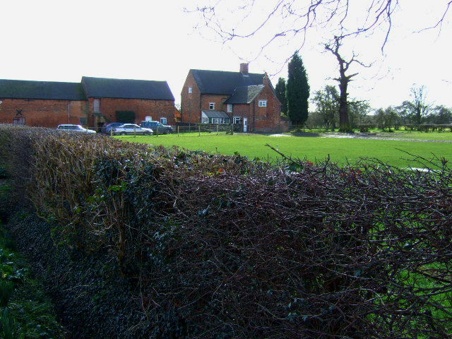
Four Acre Plantation is a stunning woodland located in Derbyshire, England. Spread over four acres, this plantation is a natural treasure that offers a serene and tranquil environment for nature lovers and outdoor enthusiasts.

The plantation is predominantly composed of a diverse range of trees, including oak, beech, and pine, which create a dense and lush forest canopy. These trees provide a habitat for a variety of wildlife, such as birds, squirrels, and rabbits, making it an ideal location for birdwatching and observing local fauna.

Visitors can explore the plantation through a network of well-maintained walking paths that wind their way through the woodland. These paths offer an opportunity to immerse oneself in the natural beauty of the surroundings, with the sounds of rustling leaves and birdsong providing a soothing and peaceful atmosphere.

Four Acre Plantation is a popular destination for outdoor activities, such as hiking, jogging, and picnicking. The plantation is equipped with picnic areas and benches, allowing visitors to relax and enjoy a meal amidst the tranquility of the forest. There are also designated areas for children to play and explore, ensuring that the plantation caters to visitors of all ages.

The plantation is easily accessible, with ample parking facilities available for visitors. It is open year-round, allowing visitors to experience the changing seasons and witness the vibrant colors of autumn or the blossoming of wildflowers in spring.

Overall, Four Acre Plantation in Derbyshire is a natural haven that offers a peaceful escape from the hustle and bustle of daily life. With its diverse woodland, wildlife, and recreational facilities, it is a place where visitors can reconnect with nature and appreciate the beauty of the natural world.

If you have any feedback on the listing, please let us know in the comments section below.

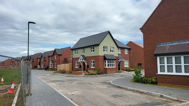
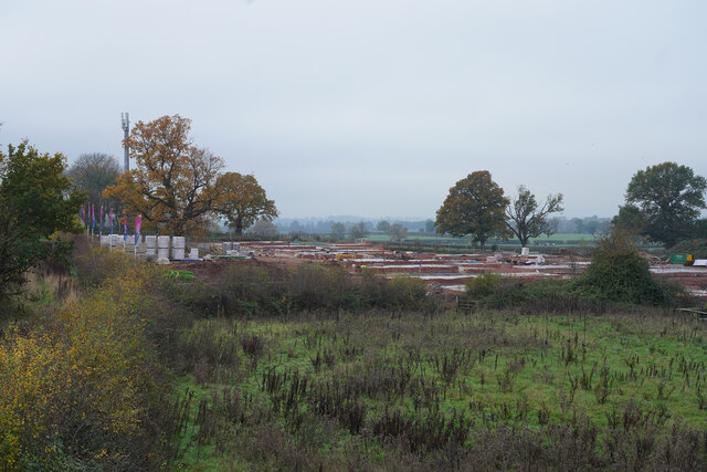
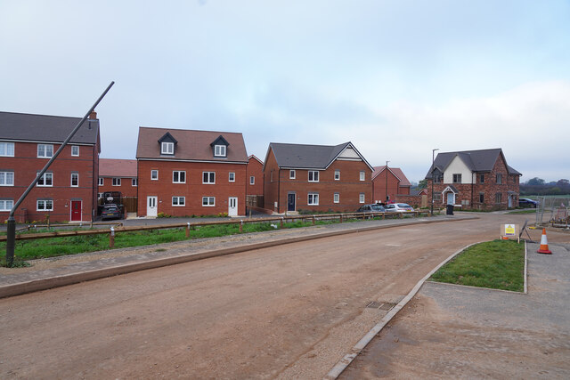
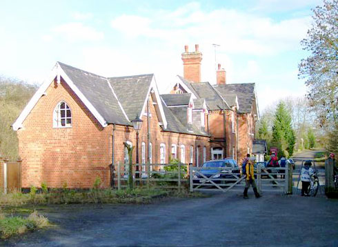
Four Acre Plantation Images

Images are sourced within 2km of 52.905441/-1.5538897 or Grid Reference SK3034. Thanks to Geograph Open Source API. All images are credited.

More new houses This is, I think, the final row of houses to be built on this development on the edge of Mickleover.
More new houses
This is, I think, the final row of houses to be built on this development on the edge of Mickleover.
A bright winter morning Out for some exercise this bright morning gave good views along the Etwall road. This looks towards the new island leading to the several housing estates being built just outside Mickleover and the city of Derby boundary on the right hand side of the image.
A bright winter morning
Out for some exercise this bright morning gave good views along the Etwall road. This looks towards the new island leading to the several housing estates being built just outside Mickleover and the city of Derby boundary on the right hand side of the image.
Bloor Homes development of 252 properties Manor Farm Field is honestly named housing development, which part of the urban growth of Mickleover.
Bloor Homes development of 252 properties
Manor Farm Field is honestly named housing development, which part of the urban growth of Mickleover.
New foundations The foundations are for houses in phase two of the Catchett Park development on the edge of Derby just outside Mickleover.
New foundations
The foundations are for houses in phase two of the Catchett Park development on the edge of Derby just outside Mickleover.
New houses The houses are part of Cotchett Park and at present are on the edge of the development but by the looks of the preparation work will eventually be completely surrounded by other houses.
New houses
The houses are part of Cotchett Park and at present are on the edge of the development but by the looks of the preparation work will eventually be completely surrounded by other houses.
Mickleover station, Derby Mickleover station, now a private residence, was on the former Great Northern Railway between Derby and Burton upon Trent. After the line closed in 1968 the BR Research Division used the section between Mickleover and Egginton Junction as a test track. This closed in July 1990. Today the five miles between Mackworth in Derby and Etwall (with a diversion to avoid Mickleover tunnel) is a cyclepath, part of NCN54.
Mickleover station, Derby
Mickleover station, now a private residence, was on the former Great Northern Railway between Derby and Burton upon Trent. After the line closed in 1968 the BR Research Division used the section between Mickleover and Egginton Junction as a test track. This closed in July 1990. Today the five miles between Mackworth in Derby and Etwall (with a diversion to avoid Mickleover tunnel) is a cyclepath, part of NCN54.
Great Northern Public House The newly refitted Great Northern Public House which was named after the Great Northern Railway (GNR Line) which once ran on the lines below the bridge next to the pub, It was built in the late 1800's as The Northern Hotel.

<span class="nowrap"><a title="https://web.archive.org/web/20060625160141/http://www.picturesofderby.co.uk/area_mickleover%20page%201.htm" rel="nofollow ugc noopener" href="https://web.archive.org/web/20060625160141/http://www.picturesofderby.co.uk/area_mickleover%20page%201.htm">Archive Link</a><img style="margin-left:2px;" alt="External link" title="External link - shift click to open in new window" src="https://s1.geograph.org.uk/img/external.png" width="10" height="10"/></span>
Great Northern Public House
The newly refitted Great Northern Public House which was named after the Great Northern Railway (GNR Line) which once ran on the lines below the bridge next to the pub, It was built in the late 1800's as The Northern Hotel. Archive LinkExternal link
The Limes, Mickleover The Limes, a large white 19th Century Villa standing in its own grounds and built in 1836.

<span class="nowrap"><a title="https://web.archive.org/web/20060625160141/http://www.picturesofderby.co.uk/area_mickleover%20page%201.htm" rel="nofollow ugc noopener" href="https://web.archive.org/web/20060625160141/http://www.picturesofderby.co.uk/area_mickleover%20page%201.htm">Archive Link</a><img style="margin-left:2px;" alt="External link" title="External link - shift click to open in new window" src="https://s1.geograph.org.uk/img/external.png" width="10" height="10"/></span>
The Limes, Mickleover
The Limes, a large white 19th Century Villa standing in its own grounds and built in 1836. Archive LinkExternal link
Mickleover community centre Mickleover community centre, this was previously a public elementary school which was built in the late 1870’s and admitted the first children in 1881. The school was enlarged in 1905 and the infants were eventually transferred from the existing school in Fennel Street (Limes Avenue) in 1916. The School continued as an all age school until 1948-50, when the senior children were moved to Pastures Hill Secondary Modern or Ashbourne Grammar School. The School then became the junior mixed and infants school with Mr. J.W. Best as headmaster. In 1957 the junior children moved into the new school in Vicarage Road. The school continued until it's closure in 1986. An historical and unusual event occurred at the school back on 7th February 1900, the first children's matinee in British Cinema took place at the school. Why this took place at Mickleover, which never even had a cinema, is not known. It wasn't until 1910 that Derby even had a cinema and sometime after that before regular children's matinees were shown After three years of being empty, Derby City Council decided to give it to the people of Mickleover in 1989, to be used as a Community Centre. There is now an excellent tearoom, staffed by volunteers.

<span class="nowrap"><a title="https://web.archive.org/web/20060625160141/http://www.picturesofderby.co.uk/area_mickleover%20page%201.htm" rel="nofollow ugc noopener" href="https://web.archive.org/web/20060625160141/http://www.picturesofderby.co.uk/area_mickleover%20page%201.htm">Archive Link</a><img style="margin-left:2px;" alt="External link" title="External link - shift click to open in new window" src="https://s1.geograph.org.uk/img/external.png" width="10" height="10"/></span>
Mickleover community centre
Mickleover community centre, this was previously a public elementary school which was built in the late 1870’s and admitted the first children in 1881. The school was enlarged in 1905 and the infants were eventually transferred from the existing school in Fennel Street (Limes Avenue) in 1916. The School continued as an all age school until 1948-50, when the senior children were moved to Pastures Hill Secondary Modern or Ashbourne Grammar School. The School then became the junior mixed and infants school with Mr. J.W. Best as headmaster. In 1957 the junior children moved into the new school in Vicarage Road. The school continued until it's closure in 1986. An historical and unusual event occurred at the school back on 7th February 1900, the first children's matinee in British Cinema took place at the school. Why this took place at Mickleover, which never even had a cinema, is not known. It wasn't until 1910 that Derby even had a cinema and sometime after that before regular children's matinees were shown After three years of being empty, Derby City Council decided to give it to the people of Mickleover in 1989, to be used as a Community Centre. There is now an excellent tearoom, staffed by volunteers. Archive LinkExternal link
Nags Head Pub on Uttoxeter Road, Mickleover The Nags Head Pub on Uttoxeter Road, built in the 18th century, during the 1970's a Pullman Railway Carriage graced the site as a restaurant 

<span class="nowrap"><a title="https://web.archive.org/web/20060625160141/http://www.picturesofderby.co.uk/area_mickleover%20page%201.htm" rel="nofollow ugc noopener" href="https://web.archive.org/web/20060625160141/http://www.picturesofderby.co.uk/area_mickleover%20page%201.htm">Archive Link</a><img style="margin-left:2px;" alt="External link" title="External link - shift click to open in new window" src="https://s1.geograph.org.uk/img/external.png" width="10" height="10"/></span>
Nags Head Pub on Uttoxeter Road, Mickleover
The Nags Head Pub on Uttoxeter Road, built in the 18th century, during the 1970's a Pullman Railway Carriage graced the site as a restaurant Archive LinkExternal link
Old Hall, Orchard Street The Old Hall, on Orchard Street, this is one of the few surviving timber-framed buildings in Derbyshire. Dated from 1655, it was built by a Cromwellian officer, Captain Robert Crotchet. Box framed on a stone plinth infilled with brick nogging using stretcher bond, it consists of two storeys, attic and gables. The roof was originally thatched but is now tiled. Inside, an oak staircase survives, with turned balusters and panelling. Oliver Cromwell once stayed here, while Tutbury Castle was under siege during the Civil War

<span class="nowrap"><a title="https://web.archive.org/web/20060625160141/http://www.picturesofderby.co.uk/area_mickleover%20page%201.htm" rel="nofollow ugc noopener" href="https://web.archive.org/web/20060625160141/http://www.picturesofderby.co.uk/area_mickleover%20page%201.htm">Archive Link</a><img style="margin-left:2px;" alt="External link" title="External link - shift click to open in new window" src="https://s1.geograph.org.uk/img/external.png" width="10" height="10"/></span>
Old Hall, Orchard Street
The Old Hall, on Orchard Street, this is one of the few surviving timber-framed buildings in Derbyshire. Dated from 1655, it was built by a Cromwellian officer, Captain Robert Crotchet. Box framed on a stone plinth infilled with brick nogging using stretcher bond, it consists of two storeys, attic and gables. The roof was originally thatched but is now tiled. Inside, an oak staircase survives, with turned balusters and panelling. Oliver Cromwell once stayed here, while Tutbury Castle was under siege during the Civil War Archive LinkExternal link
Row of Cottages on Station Road, Mickleover These delightful cottages are waiting demolition for new houses to be built

<span class="nowrap"><a title="https://web.archive.org/web/20060625160141/http://www.picturesofderby.co.uk/area_mickleover%20page%201.htm" rel="nofollow ugc noopener" href="https://web.archive.org/web/20060625160141/http://www.picturesofderby.co.uk/area_mickleover%20page%201.htm">Archive Link</a><img style="margin-left:2px;" alt="External link" title="External link - shift click to open in new window" src="https://s1.geograph.org.uk/img/external.png" width="10" height="10"/></span>
Row of Cottages on Station Road, Mickleover
These delightful cottages are waiting demolition for new houses to be built Archive LinkExternal link
Holly Cottage Holly Cottage, Vicarage Road, Mickleover

<span class="nowrap"><a title="https://web.archive.org/web/20060625160141/http://www.picturesofderby.co.uk/area_mickleover%20page%201.htm" rel="nofollow ugc noopener" href="https://web.archive.org/web/20060625160141/http://www.picturesofderby.co.uk/area_mickleover%20page%201.htm">Archive Link</a><img style="margin-left:2px;" alt="External link" title="External link - shift click to open in new window" src="https://s1.geograph.org.uk/img/external.png" width="10" height="10"/></span>
Holly Cottage
Holly Cottage, Vicarage Road, Mickleover Archive LinkExternal link
Houses Marshaw Close, Mickleover, Derby Street scene Marshaw Close, Mickleover, Derby
Houses Marshaw Close, Mickleover, Derby
Street scene Marshaw Close, Mickleover, Derby
Mickleover School This school in Mickleover is next to the Etwall to Derby cycle trail along the old railway line.  The school looks rather shabby from this view but the inevitable high security fencing to keep out vandals makes photography very difficult too.
Mickleover School
This school in Mickleover is next to the Etwall to Derby cycle trail along the old railway line. The school looks rather shabby from this view but the inevitable high security fencing to keep out vandals makes photography very difficult too.
Pastures Avenue, Littleover Exclusive private road leading off the junction between Pastures Hill and Rykneld Road.
Pastures Avenue, Littleover
Exclusive private road leading off the junction between Pastures Hill and Rykneld Road.
Hackwood Farm The farm and buildings from the drive.
Hackwood Farm
The farm and buildings from the drive.
Hackwood Farm The drive and buildings.
Hackwood Farm
The drive and buildings.
Show me another place!

Four Acre Plantation is located at Grid Ref: SK3034 (Lat: 52.905441, Lng: -1.5538897)

Unitary Authority: Derby

Police Authority: Derbyshire

What 3 Words

///events.minute.rush. Near Findern, Derbyshire

Nearby Locations

Four Acre Plantation

Related Wikis

Mickleover

Mickleover is a town in the unitary authority of Derby, in Derbyshire, England. It is 2 miles (3.2 km) west of Derby, 10 miles (16 km) northeast of Burton...
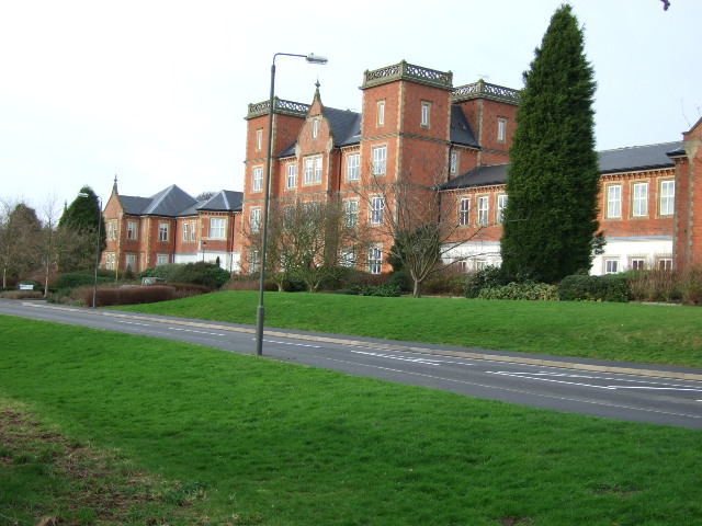
Pastures Hospital

Pastures Hospital was a mental health facility at Mickleover in Derbyshire, England. The church is a Grade II listed building. == History == The hospital...

Mickleover railway station

Mickleover railway station is a disused railway station which served the town of Mickleover and village of Radbourne in Derbyshire, England. It was opened...
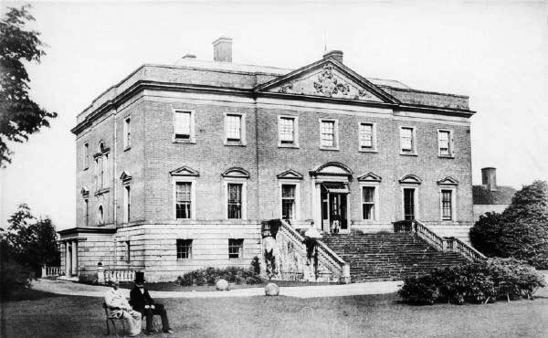
Radbourne Hall

Radbourne Hall is an 18th-century Georgian country house, the seat of the Chandos-Pole family, at Radbourne, Derbyshire. It is a Grade I listed building...

Bearwardcote

Bearwardcote is a civil parish in the South Derbyshire district of Derbyshire, England. According to the 2001 census it had a population of 26. The hamlet...

The Millennium Centre

The Millennium Centre was located in Littleover, Derby. It was a post-16 sixth form centre, run jointly by Derby Moor Community Sports College Trust and...

Littleover Community School

Littleover Community School is a coeducational secondary school situated on Pastures Hill, Littleover, Derbyshire in England, with pupils aged 11–18.It...

Murray Park School

Murray Park School is a secondary school on Murray Road in Mickleover, Derby, England. It has about 1050 pupils, most of whom live in the Mickleover and...

Nearby Amenities

Located within 500m of 52.905441,-1.5538897
Turning Circle
Lat/Long: 52.9095079/-1.5520197
Turning Circle
Lat/Long: 52.9062495/-1.5523559
Turning Circle
Lat/Long: 52.9041075/-1.5531815
Turning Circle
Lat/Long: 52.9053529/-1.5472692
Turning Circle
Lat/Long: 52.906928/-1.550292
Turning Circle
Lat/Long: 52.9060048/-1.5506061
Turning Circle
Lat/Long: 52.9053346/-1.5522435
Post Box
Operator: Royal Mail
Operator Wikidata: Q638098
Ref: DE3 760
Source: survey
Lat/Long: 52.9058442/-1.5481608
Bus Stop
Lidgate Close
Bus: yes
Public Transport: platform
Lat/Long: 52.9056278/-1.55334
Bus Stop
Greenside Court
Bench: yes
Bus: yes
Naptan AtcoCode: 109000008921
Naptan NaptanCode: dbyapadw
Public Transport: platform
Shelter: yes
Lat/Long: 52.908285/-1.5533866
Traffic Calming: hump
Lat/Long: 52.9077448/-1.5476286
Traffic Calming: hump
Lat/Long: 52.9077096/-1.5478575
Bench
Lat/Long: 52.907337/-1.5493072
Bench
Lat/Long: 52.9073518/-1.5492524
Bench
Lat/Long: 52.9074132/-1.5490422
Bench
Lat/Long: 52.9088854/-1.5503536
Bench
Lat/Long: 52.9088699/-1.5506626
Post Box
Operator: Royal Mail
Operator Wikidata: Q638098
Ref: DE3 735
Lat/Long: 52.9085431/-1.553234
Barrier: bollard
Lat/Long: 52.9041491/-1.547558
Bus Stop
Greenside Court
Bench: no
Bus: yes
Public Transport: platform
Shelter: no
Lat/Long: 52.9077641/-1.5534376
Barrier: cycle_barrier
Lat/Long: 52.9085322/-1.5511505
Bus Stop
Holly Court
Bus: yes
Naptan AtcoCode: 109000008914
Naptan NaptanCode: dbyamwtw
Public Transport: platform
Lat/Long: 52.9060785/-1.5468232
Bus Stop
Holly Court
Bus: yes
Public Transport: platform
Lat/Long: 52.9060375/-1.5475236
Bus Stop
Prescot Close
Bus: yes
Public Transport: platform
Lat/Long: 52.9052649/-1.5506186
Bus Stop
Prescot Close
Bus: yes
Naptan AtcoCode: 109000008916
Naptan NaptanCode: dbyapadg
Public Transport: platform
Lat/Long: 52.9056011/-1.5498428
Bus Stop
Lidgate Close
Bus: yes
Naptan AtcoCode: 109000008919
Naptan NaptanCode: dbyapadp
Public Transport: platform
Lat/Long: 52.9059993/-1.5532686
Turning Circle
Lat/Long: 52.9033553/-1.5524311
Turning Circle
Lat/Long: 52.9065789/-1.5523257
Turning Circle
Lat/Long: 52.9084032/-1.5513927
Barrier: cycle_barrier
Lat/Long: 52.9070445/-1.5500947
Street Lamp
Lat/Long: 52.9071088/-1.5534816
Street Lamp
Lat/Long: 52.9072887/-1.5531906
Street Lamp
Lat/Long: 52.9073097/-1.5525123
Street Lamp
Lat/Long: 52.9073902/-1.553503
Street Lamp
Lat/Long: 52.9074013/-1.5527326
Street Lamp
Lat/Long: 52.9075184/-1.5524661
Street Lamp
Lat/Long: 52.9077254/-1.5522972
Street Lamp
Lat/Long: 52.9078313/-1.5525616
Street Lamp
Lat/Long: 52.9080606/-1.5523466
Street Lamp
Lat/Long: 52.9083143/-1.5521514
Street Lamp
Lat/Long: 52.9083626/-1.5524322
Street Lamp
Lat/Long: 52.9083759/-1.5517122
Street Lamp
Lat/Long: 52.908488/-1.551495
Street Lamp
Lat/Long: 52.9085964/-1.5522854
Street Lamp
Lat/Long: 52.9088561/-1.5530072
Street Lamp
Lat/Long: 52.9088564/-1.5525688
Street Lamp
Lat/Long: 52.9072072/-1.5506416
Street Lamp
Lat/Long: 52.9074287/-1.5505588
Street Lamp
Lat/Long: 52.9075977/-1.5521211
Street Lamp
Lat/Long: 52.9077136/-1.5507229
Street Lamp
Lat/Long: 52.9077736/-1.5511376
Street Lamp
Lat/Long: 52.9079085/-1.5511846
Street Lamp
Lat/Long: 52.9080474/-1.5509143
Street Lamp
Lat/Long: 52.9083055/-1.5510606
Street Lamp
Lat/Long: 52.9083513/-1.5514373
Street Lamp
Lat/Long: 52.9085737/-1.5512028
Street Lamp
Lat/Long: 52.9088736/-1.5513764
Street Lamp
Lat/Long: 52.9091692/-1.5515481
Barrier: entrance
Lat/Long: 52.9074649/-1.552604
Entrance: yes
Lat/Long: 52.9074774/-1.552575
Entrance: yes
Lat/Long: 52.9075039/-1.5526871
Entrance: yes
Lat/Long: 52.907526/-1.5528379
Entrance: yes
Lat/Long: 52.9075279/-1.5527623
Entrance: yes
Lat/Long: 52.9075519/-1.5527455
Barrier: entrance
Lat/Long: 52.9075646/-1.5525905
Entrance: yes
Lat/Long: 52.9075907/-1.5527465
Entrance: yes
Lat/Long: 52.9076003/-1.5525911
Entrance: yes
Lat/Long: 52.9076257/-1.5526064
Barrier: entrance
Lat/Long: 52.9087789/-1.5506615
Barrier: entrance
Lat/Long: 52.9088706/-1.5502884
Barrier: entrance
Lat/Long: 52.9089956/-1.550585
Street Lamp
Lat/Long: 52.9096494/-1.5514579
Street Lamp
Lat/Long: 52.9077265/-1.5515979
Street Lamp
Lat/Long: 52.9094693/-1.5516641
Turning Circle
Lat/Long: 52.9043276/-1.5507471
Bus Stop
All Saints Court
Bus: yes
Public Transport: platform
Lat/Long: 52.9033016/-1.5486042
Bus Stop
All Saints Court
Bus: yes
Public Transport: platform
Lat/Long: 52.9032652/-1.5488671
Bus Stop
Bus: yes
Public Transport: platform
Lat/Long: 52.9010172/-1.5547881
Noexit: yes
Lat/Long: 52.9031345/-1.5562317
Noexit: yes
Lat/Long: 52.9030351/-1.5560711
Power: substation
Lat/Long: 52.9033887/-1.5487288
Waste Basket
Waste: dog_excrement
Lat/Long: 52.9032238/-1.5512508
Direction: 135
Generator Method: photovoltaic
Generator Output Electricity: yes
Generator Solar Modules: 14
Generator Source: solar
Generator Type: solar_photovoltaic_panel
Location: roof
Power: generator
Lat/Long: 52.9052767/-1.5470278
Direction: 160
Generator Method: photovoltaic
Generator Output Electricity: yes
Generator Solar Modules: 8
Generator Source: solar
Generator Type: solar_photovoltaic_panel
Location: roof
Power: generator
Lat/Long: 52.9050567/-1.5480148
Direction: 250
Generator Method: photovoltaic
Generator Output Electricity: yes
Generator Solar Modules: 16
Generator Source: solar
Generator Type: solar_photovoltaic_panel
Location: roof
Power: generator
Lat/Long: 52.9051748/-1.5489858
Direction: 160
Generator Method: photovoltaic
Generator Output Electricity: yes
Generator Solar Modules: 17
Generator Source: solar
Generator Type: solar_photovoltaic_panel
Location: roof
Power: generator
Lat/Long: 52.9054336/-1.5495357
Direction: 160
Generator Method: photovoltaic
Generator Output Electricity: yes
Generator Solar Modules: 14
Generator Source: solar
Generator Type: solar_photovoltaic_panel
Location: roof
Power: generator
Lat/Long: 52.9054507/-1.5492078
Direction: 160
Generator Method: photovoltaic
Generator Output Electricity: yes
Generator Solar Modules: 18
Generator Source: solar
Generator Type: solar_photovoltaic_panel
Location: roof
Power: generator
Lat/Long: 52.9054741/-1.5490824
Direction: 160
Generator Method: photovoltaic
Generator Output Electricity: yes
Generator Solar Modules: 15
Generator Source: solar
Generator Type: solar_photovoltaic_panel
Location: roof
Power: generator
Lat/Long: 52.9055291/-1.5488088
Direction: 250
Generator Method: photovoltaic
Generator Output Electricity: yes
Generator Solar Modules: 8
Generator Source: solar
Generator Type: solar_photovoltaic_panel
Location: roof
Power: generator
Lat/Long: 52.9053155/-1.5489952
Direction: 160
Generator Method: photovoltaic
Generator Output Electricity: yes
Generator Solar Modules: 12
Generator Source: solar
Generator Type: solar_photovoltaic_panel
Location: roof
Power: generator
Lat/Long: 52.9051207/-1.5505663
Direction: 160
Generator Method: photovoltaic
Generator Output Electricity: yes
Generator Solar Modules: 17
Generator Source: solar
Generator Type: solar_photovoltaic_panel
Location: roof
Power: generator
Lat/Long: 52.9041503/-1.5513703
Direction: 250
Generator Method: photovoltaic
Generator Output Electricity: yes
Generator Solar Modules: 8
Generator Source: solar
Generator Type: solar_photovoltaic_panel
Location: roof
Power: generator
Lat/Long: 52.9042562/-1.5514239
Direction: 110
Generator Method: photovoltaic
Generator Output Electricity: yes
Generator Solar Modules: 8
Generator Source: solar
Generator Type: solar_photovoltaic_panel
Location: roof
Power: generator
Lat/Long: 52.9042684/-1.5513635
Direction: 250
Generator Method: photovoltaic
Generator Output Electricity: yes
Generator Solar Modules: 14
Generator Source: solar
Generator Type: solar_photovoltaic_panel
Location: roof
Power: generator
Lat/Long: 52.9048738/-1.5520791
Direction: 250
Generator Method: photovoltaic
Generator Output Electricity: yes
Generator Solar Modules: 8
Generator Source: solar
Generator Type: solar_photovoltaic_panel
Location: roof
Power: generator
Lat/Long: 52.9049292/-1.5519597
Direction: 70
Generator Method: photovoltaic
Generator Output Electricity: yes
Generator Solar Modules: 8
Generator Source: solar
Generator Type: solar_photovoltaic_panel
Location: roof
Power: generator
Lat/Long: 52.9049428/-1.5519051
Direction: 250
Generator Method: photovoltaic
Generator Output Electricity: yes
Generator Solar Modules: 12
Generator Source: solar
Generator Type: solar_photovoltaic_panel
Location: roof
Power: generator
Lat/Long: 52.9056735/-1.5526904
Direction: 250
Generator Method: photovoltaic
Generator Output Electricity: yes
Generator Solar Modules: 6
Generator Source: solar
Generator Type: solar_photovoltaic_panel
Location: roof
Power: generator
Lat/Long: 52.9056323/-1.5526731
Direction: 160
Generator Method: photovoltaic
Generator Output Electricity: yes
Generator Solar Modules: 18
Generator Source: solar
Generator Type: solar_photovoltaic_panel
Location: roof
Power: generator
Lat/Long: 52.9059362/-1.5526685
Direction: 165
Generator Method: photovoltaic
Generator Output Electricity: yes
Generator Solar Modules: 8
Generator Source: solar
Generator Type: solar_photovoltaic_panel
Location: roof
Power: generator
Lat/Long: 52.9070918/-1.5529937
Direction: 190
Generator Method: photovoltaic
Generator Output Electricity: yes
Generator Solar Modules: 6
Generator Source: solar
Generator Type: solar_photovoltaic_panel
Location: roof
Power: generator
Lat/Long: 52.9078858/-1.5537039
Direction: 190
Generator Method: photovoltaic
Generator Output Electricity: yes
Generator Solar Modules: 10
Generator Source: solar
Generator Type: solar_photovoltaic_panel
Location: roof
Power: generator
Lat/Long: 52.9078955/-1.5537769
Direction: 80
Generator Method: photovoltaic
Generator Output Electricity: yes
Generator Solar Modules: 9
Generator Source: solar
Generator Type: solar_photovoltaic_panel
Location: roof
Power: generator
Lat/Long: 52.9084344/-1.5544238
Direction: 260
Generator Method: photovoltaic
Generator Output Electricity: yes
Generator Solar Modules: 8
Generator Source: solar
Generator Type: solar_photovoltaic_panel
Location: roof
Power: generator
Lat/Long: 52.9084298/-1.5545101
Direction: 275
Generator Method: photovoltaic
Generator Output Electricity: yes
Generator Solar Modules: 8
Generator Source: solar
Generator Type: solar_photovoltaic_panel
Location: roof
Power: generator
Lat/Long: 52.9082575/-1.5526464
Direction: 95
Generator Method: photovoltaic
Generator Output Electricity: yes
Generator Solar Modules: 8
Generator Source: solar
Generator Type: solar_photovoltaic_panel
Location: roof
Power: generator
Lat/Long: 52.9082517/-1.5525758
Direction: 90
Generator Method: photovoltaic
Generator Output Electricity: yes
Generator Solar Modules: 8
Generator Source: solar
Generator Type: solar_photovoltaic_panel
Location: roof
Power: generator
Lat/Long: 52.9081177/-1.5530949
Direction: 270
Generator Method: photovoltaic
Generator Output Electricity: yes
Generator Solar Modules: 8
Generator Source: solar
Generator Type: solar_photovoltaic_panel
Location: roof
Power: generator
Lat/Long: 52.908118/-1.553132
Direction: 160
Generator Method: photovoltaic
Generator Output Electricity: yes
Generator Solar Modules: 18
Generator Source: solar
Generator Type: solar_photovoltaic_panel
Location: roof
Power: generator
Lat/Long: 52.9087073/-1.5521495
Direction: 160
Generator Method: photovoltaic
Generator Output Electricity: yes
Generator Solar Modules: 10
Generator Source: solar
Generator Type: solar_photovoltaic_panel
Location: roof
Power: generator
Lat/Long: 52.9076521/-1.5512991
Direction: 160
Generator Method: photovoltaic
Generator Output Electricity: yes
Generator Solar Modules: 15
Generator Source: solar
Generator Type: solar_photovoltaic_panel
Location: roof
Power: generator
Lat/Long: 52.9061215/-1.5489482
Direction: 160
Generator Method: photovoltaic
Generator Output Electricity: yes
Generator Solar Modules: 15
Generator Source: solar
Generator Type: solar_photovoltaic_panel
Location: roof
Power: generator
Lat/Long: 52.9058521/-1.548853
Direction: 160
Generator Method: photovoltaic
Generator Output Electricity: yes
Generator Solar Modules: 15
Generator Source: solar
Generator Type: solar_photovoltaic_panel
Location: roof
Power: generator
Lat/Long: 52.9058279/-1.5489335
Direction: 150
Generator Method: photovoltaic
Generator Output Electricity: yes
Generator Solar Modules: 54
Generator Source: solar
Generator Type: solar_photovoltaic_panel
Location: roof
Power: generator
Lat/Long: 52.9060802/-1.5476192
Direction: 155
Generator Method: photovoltaic
Generator Output Electricity: yes
Generator Solar Modules: 36
Generator Source: solar
Generator Type: solar_photovoltaic_panel
Location: roof
Power: generator
Lat/Long: 52.9063941/-1.5477345
Direction: 155
Generator Method: photovoltaic
Generator Output Electricity: yes
Generator Solar Modules: 36
Generator Source: solar
Generator Type: solar_photovoltaic_panel
Location: roof
Power: generator
Lat/Long: 52.9064588/-1.5474878
Direction: 160
Generator Method: photovoltaic
Generator Output Electricity: yes
Generator Solar Modules: 16
Generator Source: solar
Generator Type: solar_photovoltaic_panel
Location: roof
Power: generator
Lat/Long: 52.9097878/-1.5526752
Direction: 250
Generator Method: photovoltaic
Generator Output Electricity: yes
Generator Solar Modules: 16
Generator Source: solar
Generator Type: solar_photovoltaic_panel
Location: roof
Power: generator
Lat/Long: 52.9094535/-1.5539219
Turning Circle
Lat/Long: 52.9089517/-1.5517287
Turning Circle
Lat/Long: 52.9068003/-1.5514031
Bus Stop
Mickleover Turn
Bus: yes
Naptan AtcoCode: 100055177
Naptan NaptanCode: dbsjdwmd
Public Transport: platform
Lat/Long: 52.9016263/-1.5520549
Entrance: yes
Lat/Long: 52.9076909/-1.5486858
Noexit: yes
Lat/Long: 52.9013351/-1.5553613
Barrier: cycle_barrier
Cycle Barrier: double
Lat/Long: 52.902498/-1.5516999
Noexit: yes
Lat/Long: 52.9020146/-1.5577237
Waste Basket
Lat/Long: 52.9013157/-1.5565751
The data included in this document is from www.openstreetmap.org. The data is made available under ODbL.

Have you been to Four Acre Plantation?

Leave your review of Four Acre Plantation below (or comments, questions and feedback).