Jubilee Plantation

Wood, Forest in Oxfordshire West Oxfordshire

England

Jubilee Plantation

D'Arcy Dalton Way D'Arcy Dalton Way heading through the gated entrance into Sarsden House
D'Arcy Dalton Way Credit: Shaun Ferguson

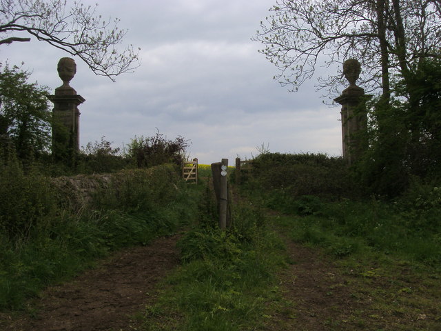
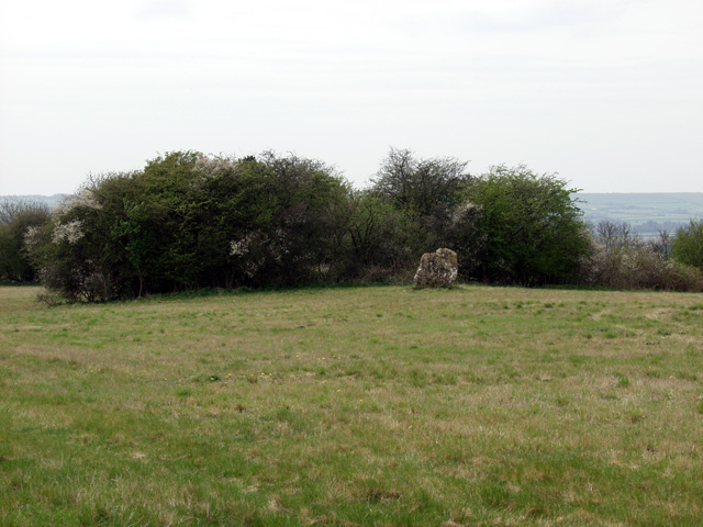
Jubilee Plantation is a picturesque woodland located in Oxfordshire, England. Covering an area of approximately 500 acres, it is a popular destination for nature enthusiasts and those seeking tranquility amidst the natural beauty of the countryside.

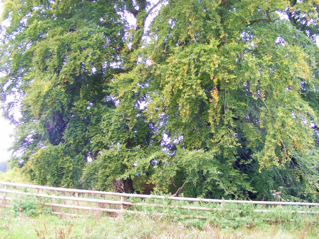
The plantation is characterized by its diverse range of tree species, including oak, beech, and birch, which create a rich and vibrant landscape throughout the year. The trees provide a habitat for a variety of wildlife, such as deer, foxes, and a wide range of bird species, making it a haven for wildlife enthusiasts and birdwatchers.

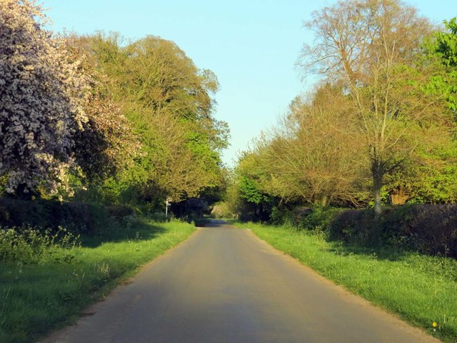
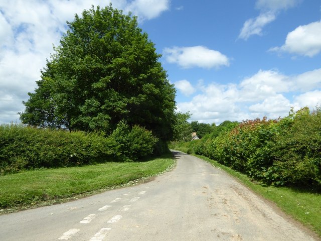
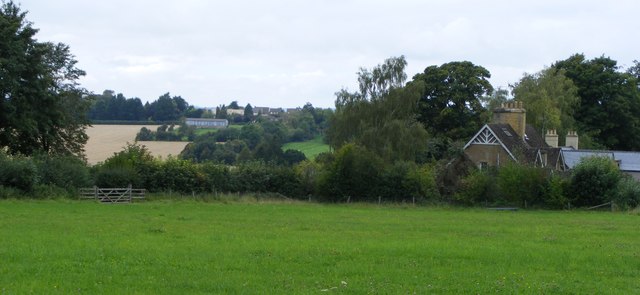
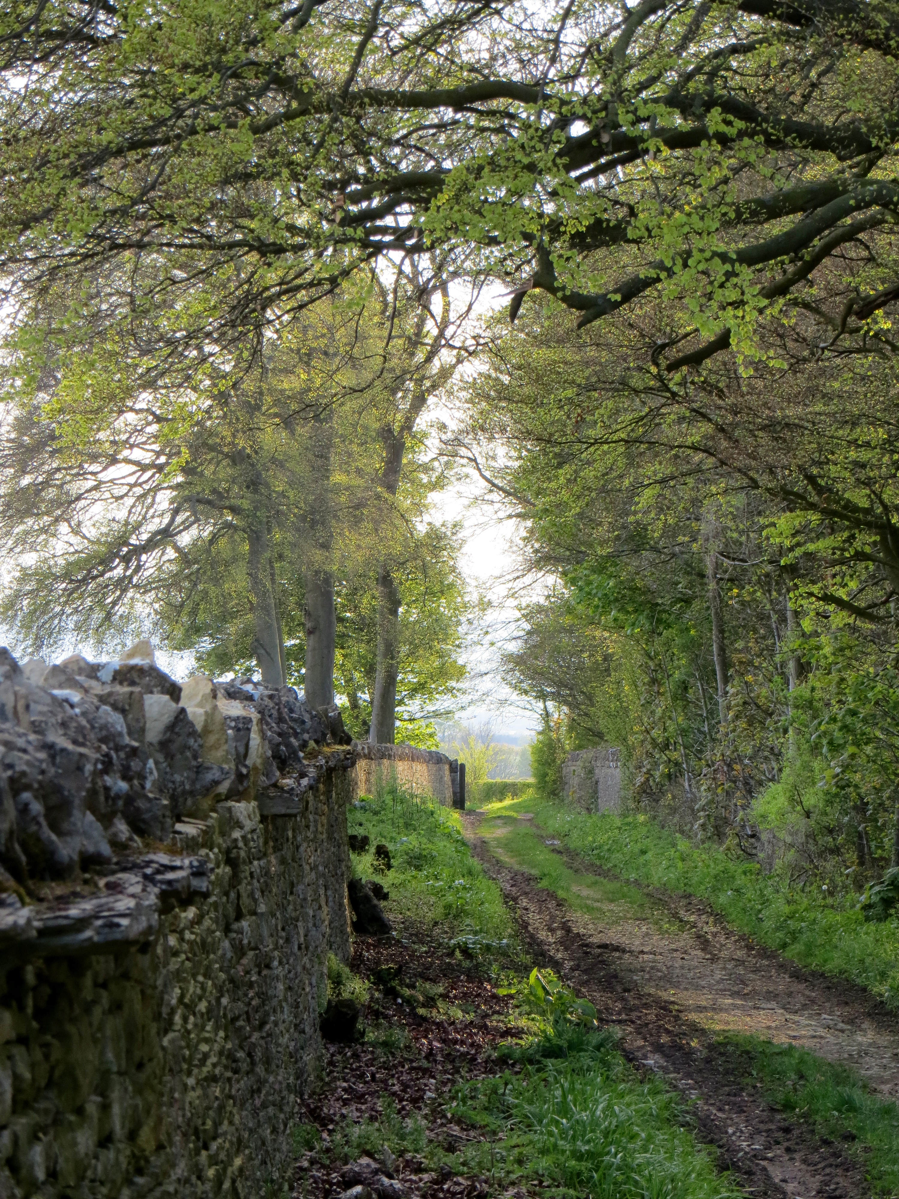
The woodland is crisscrossed with a network of well-maintained walking trails, allowing visitors to explore the area at their own pace. These trails offer stunning views of the surrounding countryside, with rolling hills and open fields adding to the charm of the plantation.

One of the standout features of Jubilee Plantation is its ancient woodland, which has been preserved for centuries. This area is home to some of the oldest trees in the woodland, some dating back hundreds of years. Their gnarled trunks and majestic canopies provide a sense of history and awe, reminding visitors of the long-standing connection between humans and nature.

Jubilee Plantation is open to the public year-round and is managed by local conservation organizations, ensuring the preservation of its natural beauty and the protection of its wildlife. Whether for a leisurely stroll, a picnic amidst the trees, or simply to immerse oneself in the tranquility of nature, Jubilee Plantation offers an idyllic escape from the bustling city life of Oxfordshire.

If you have any feedback on the listing, please let us know in the comments section below.

Jubilee Plantation Images

Images are sourced within 2km of 51.897701/-1.563977 or Grid Reference SP3022. Thanks to Geograph Open Source API. All images are credited.
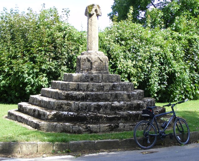
D'Arcy Dalton Way D'Arcy Dalton Way heading through the gated entrance into Sarsden House
D'Arcy Dalton Way
D'Arcy Dalton Way heading through the gated entrance into Sarsden House
D'Arcy Dalton Way D'Arcy Dalton Way heading to Fairgreen Farm
D'Arcy Dalton Way
D'Arcy Dalton Way heading to Fairgreen Farm
D'Arcy Dalton Way D'Arcy Dalton Way heading out past the Sarsden House park boundary gate piers
D'Arcy Dalton Way
D'Arcy Dalton Way heading out past the Sarsden House park boundary gate piers
D'Arcy Dalton Way D'Arcy Dalton Way heading to Lyneham
D'Arcy Dalton Way
D'Arcy Dalton Way heading to Lyneham
Road entering Sarsden Road entering Sarsden passing turning to Merriscourt Farm
Road entering Sarsden
Road entering Sarsden passing turning to Merriscourt Farm
Rural road to Chadlington
A bend in the road to Chadlington
Wayside cross, Sarsden According to the Historic England listing there is a question of the age of this wayside cross in Sarsden.  The cross is described as "apparently early to mid-C14 but possibly early C19 reusing medieval stonework", the thinking being that it may have used some stone from Churchill church which was demolished in the early 19th century.  The cross is Grade II* listed.

Historic England description
Not shown on O.S. map. Wayside cross. Apparently early to mid-C14 but possibly early C19 reusing medieval stonework. Limestone. Short octagonal shaft with gabled canopy having small circular socket to top on octagonal plinth with blind cinquefoil-headed panel to each side. Base of 6 wide steps forming irregular octagon. The cross is not marked on detailed estate maps of the area made in 1788 and 1795 nor do the accompanying terriers give any indication of its existence through field names. The cross was drawn by J.C, Buckler in 1825, the year in which most of the old church at Churchill (q.v.) was demolished, and it is possible that fragments from there were used to make up the cross. (Buildings of England: Oxfordshire: p753; B.J. Marples: The Medieval Crosses of Oxfordshire: Oxoneinsia 38 (1973), pp.302, 303, 308; Bodleian Library, Oxford: MS.Top.0xon.a.68 No.453; Oxfordshire County Record Office, estate maps) [2645]
Source: <span class="nowrap"><a title="https://www.historicengland.org.uk/listing/the-list/list-entry/1053279" rel="nofollow ugc noopener" href="https://www.historicengland.org.uk/listing/the-list/list-entry/1053279">Link</a><img style="margin-left:2px;" alt="External link" title="External link - shift click to open in new window" src="https://s1.geograph.org.uk/img/external.png" width="10" height="10"/></span>
Wayside cross, Sarsden
According to the Historic England listing there is a question of the age of this wayside cross in Sarsden. The cross is described as "apparently early to mid-C14 but possibly early C19 reusing medieval stonework", the thinking being that it may have used some stone from Churchill church which was demolished in the early 19th century. The cross is Grade II* listed. Historic England description Not shown on O.S. map. Wayside cross. Apparently early to mid-C14 but possibly early C19 reusing medieval stonework. Limestone. Short octagonal shaft with gabled canopy having small circular socket to top on octagonal plinth with blind cinquefoil-headed panel to each side. Base of 6 wide steps forming irregular octagon. The cross is not marked on detailed estate maps of the area made in 1788 and 1795 nor do the accompanying terriers give any indication of its existence through field names. The cross was drawn by J.C, Buckler in 1825, the year in which most of the old church at Churchill (q.v.) was demolished, and it is possible that fragments from there were used to make up the cross. (Buildings of England: Oxfordshire: p753; B.J. Marples: The Medieval Crosses of Oxfordshire: Oxoneinsia 38 (1973), pp.302, 303, 308; Bodleian Library, Oxford: MS.Top.0xon.a.68 No.453; Oxfordshire County Record Office, estate maps) [2645] Source: LinkExternal link
Country road in Sarsden Out of view to the immediate left is the Sarsden wayside cross.
Country road in Sarsden
Out of view to the immediate left is the Sarsden wayside cross.
Old Milestone by the A361, north of Lyneham Barrow Metal plate attached to stone post by the A361, in parish of Lyneham (West Oxfordshire District), by the road, on West side of road, North of Lyneham Barrow. Chipping Norton iron plate, erected by the Burford, Chipping Norton, Banbury & Aynho turnpike trust in the 19th century. 

Inscription reads:-
Chipping
Norton
4
Burford
7
Miles

Oxfordshire HER.
HER Number: 3976 <span class="nowrap"><a title="https://www.heritagegateway.org.uk/Gateway/Results_Single.aspx?uid=MOX1329&resourceID=1033" rel="nofollow ugc noopener" href="https://www.heritagegateway.org.uk/Gateway/Results_Single.aspx?uid=MOX1329&resourceID=1033">Link</a><img style="margin-left:2px;" alt="External link" title="External link - shift click to open in new window" src="https://s1.geograph.org.uk/img/external.png" width="10" height="10"/></span>

Milestone Society National ID: OX_BFBA07
Old Milestone by the A361, north of Lyneham Barrow
Metal plate attached to stone post by the A361, in parish of Lyneham (West Oxfordshire District), by the road, on West side of road, North of Lyneham Barrow. Chipping Norton iron plate, erected by the Burford, Chipping Norton, Banbury & Aynho turnpike trust in the 19th century. Inscription reads:- Chipping Norton 4 Burford 7 Miles Oxfordshire HER. HER Number: 3976 LinkExternal link Milestone Society National ID: OX_BFBA07
Burford Road at the end of Pudlicote Lane
Sarsden Cross Wayside cross. Apparently early to mid-C14 but possibly early C19 reusing
medieval stonework. Limestone. Short octagonal shaft with gabled canopy having
small circular socket to top on octagonal plinth with blind cinquefoil-headed
panel to each side. Base of 6 wide steps forming irregular octagon. The cross is not marked on detailed estate maps of the area made in 1788 and 1795 nor do the accompanying terriers give any indication of its existence through field names.
The cross was drawn by J.C, Buckler in 1825, the year in which most of the old
church at Churchill (q.v.) was demolished, and it is possible that fragments
from there were used to make up the cross. (britishlistedbuildings.co.uk)
Sarsden Cross
Wayside cross. Apparently early to mid-C14 but possibly early C19 reusing medieval stonework. Limestone. Short octagonal shaft with gabled canopy having small circular socket to top on octagonal plinth with blind cinquefoil-headed panel to each side. Base of 6 wide steps forming irregular octagon. The cross is not marked on detailed estate maps of the area made in 1788 and 1795 nor do the accompanying terriers give any indication of its existence through field names. The cross was drawn by J.C, Buckler in 1825, the year in which most of the old church at Churchill (q.v.) was demolished, and it is possible that fragments from there were used to make up the cross. (britishlistedbuildings.co.uk)
Road junction in Sarsden
Squires Clump tumulus This monument includes an Anglo-Saxon burial mound, or 'hlaew', situated
in Squire's Clump, 500m south west of Iron Buildings. The barrow lies on a
false crest overlooking the land to the south, east and west, including the
present village of Sarsden. The barrow mound measures 23m in diameter and stands up to 3m high. It has a flat top with an otherwise conical profile. The mound is surrounded by a dry stone revetment wall which sits on a narrow 0.5m wide berm. This is surrounded by a quarry ditch from which material was obtained during the construction of the mound. This has been redug and survives as a 4m wide and 0.8m deep feature. The Squire's Clump barrow was used as a landscape feature during the 18th century when beech trees were planted around it and the wall was rebuilt. The name Squire's Clump can also be attributed to this phase in the monument's history. (ancientmonuments.uk)
Squires Clump tumulus
This monument includes an Anglo-Saxon burial mound, or 'hlaew', situated in Squire's Clump, 500m south west of Iron Buildings. The barrow lies on a false crest overlooking the land to the south, east and west, including the present village of Sarsden. The barrow mound measures 23m in diameter and stands up to 3m high. It has a flat top with an otherwise conical profile. The mound is surrounded by a dry stone revetment wall which sits on a narrow 0.5m wide berm. This is surrounded by a quarry ditch from which material was obtained during the construction of the mound. This has been redug and survives as a 4m wide and 0.8m deep feature. The Squire's Clump barrow was used as a landscape feature during the 18th century when beech trees were planted around it and the wall was rebuilt. The name Squire's Clump can also be attributed to this phase in the monument's history. (ancientmonuments.uk)
View from Sarsden towards William Smith Close, Churchill
Sarsden signpost
Sarsden signpost
Sarsden Estate wooden sign
Show me another place!

Jubilee Plantation is located at Grid Ref: SP3022 (Lat: 51.897701, Lng: -1.563977)

Administrative County: Oxfordshire

District: West Oxfordshire

Police Authority: Thames Valley

What 3 Words

///dizziness.secondly.different. Near Shipton under Wychwood, Oxfordshire

Related Wikis

Lyneham Longbarrow

Lyneham Longbarrow (grid reference SP297210) is a long barrow near Lyneham, Oxfordshire. It is beside the A361 road, between Shipton-under-Wychwood and...

Sarsden

Sarsden is a village and civil parish about 3 miles (5 km) south of Chipping Norton, Oxfordshire. The 2001 Census recorded the parish population as 83...

Knollbury

Knollbury is a scheduled Iron Age hillfort enclosure to the north west of Chadlington in Oxfordshire. Believed to be defensive in nature the enclosure...

Sarsgrove Wood

Sarsgrove Wood is a 41.9-hectare (104-acre) biological Site of Special Scientific Interest south of Chipping Norton in Oxfordshire.This ancient wood has...

The Dower House, Sarsgrove Wood

The Dower House, Sarsgrove Wood is a Grade II* listed house in Sarsgrove Wood, Churchill, Oxfordshire, England (near Chipping Norton).The house has been...

Lyneham, Oxfordshire

Lyneham is a village and civil parish about 5 miles (8 km) southwest of Chipping Norton, Oxfordshire. It is bounded to the southwest by the River Evenlode...

Churchill and Sarsden

Churchill and Sarsden are civil parishes in West Oxfordshire with a common parish council, about 3 miles (5 km) southwest of Chipping Norton. The joint...

Chadlington

Chadlington is a village and civil parish in the Evenlode Valley about 3 miles (5 km) south of Chipping Norton, Oxfordshire. The village has four neighbourhoods...

Have you been to Jubilee Plantation?

Leave your review of Jubilee Plantation below (or comments, questions and feedback).