Low Clump

Wood, Forest in Durham

England

Low Clump

Wheat field
Wheat field Credit: N Chadwick

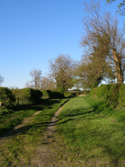
Low Clump, Durham is a small woodland area located in the county of Durham in northeast England. Situated near the village of Wood, it is a part of the larger Forest of Durham. The woodland is known for its natural beauty and tranquil atmosphere, making it a popular destination for nature enthusiasts and hikers.

Covering an area of approximately 50 acres, Low Clump is characterized by its dense tree cover, composed mainly of broadleaf species such as oak, beech, and ash. The forest floor is adorned with a variety of wildflowers and ferns, adding to its picturesque charm. The woodland is also home to a diverse range of wildlife, including birds, mammals, and insects.

Low Clump offers a network of well-maintained walking trails, allowing visitors to explore the woodland at their own pace. These trails lead through different sections of the forest, showcasing its various habitats and offering breathtaking views of the surrounding countryside.

The woodland is managed by the local authorities, who ensure its preservation and accessibility to the public. Facilities such as car parks and picnic areas are available nearby, making Low Clump an ideal spot for day trips or family outings.

Overall, Low Clump, Durham is a serene woodland area that offers a peaceful retreat from the bustle of everyday life. With its natural beauty, diverse wildlife, and well-maintained trails, it provides an opportunity for visitors to immerse themselves in the tranquility of nature.

If you have any feedback on the listing, please let us know in the comments section below.
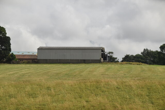
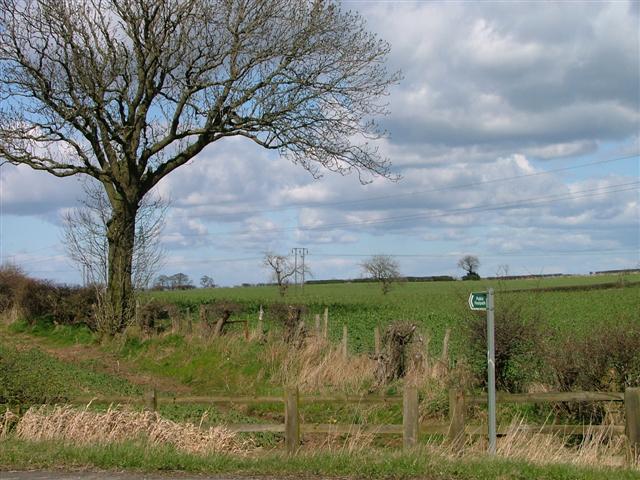
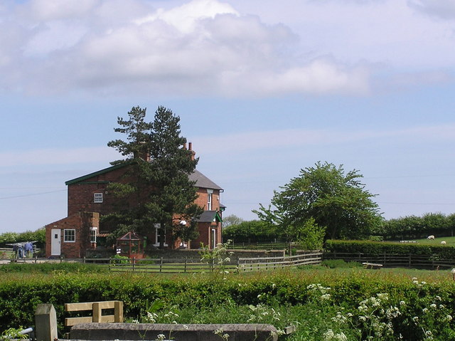
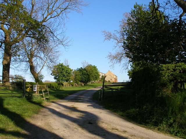
Low Clump Images

Images are sourced within 2km of 54.597668/-1.541763 or Grid Reference NZ2922. Thanks to Geograph Open Source API. All images are credited.

Wheat field
Wheat field
Disused railway trackbed at Preston le Skerne This track bed was part of an 18 mile railway which ran from Shildon to Newport near Middlesbrough. When originally opened it was operated by electric locomotives which lasted for 20 years until 1935 when the railway reverted to steam. The railway was built to move high volumes of mineral traffic from the Durham coal fields to Teesside. It also served Royal Ordnance Factory No59 which was situated at what is now Newton Aycliffe during the Second World War.
Disused railway trackbed at Preston le Skerne
This track bed was part of an 18 mile railway which ran from Shildon to Newport near Middlesbrough. When originally opened it was operated by electric locomotives which lasted for 20 years until 1935 when the railway reverted to steam. The railway was built to move high volumes of mineral traffic from the Durham coal fields to Teesside. It also served Royal Ordnance Factory No59 which was situated at what is now Newton Aycliffe during the Second World War.
Railway underbridge at Preston le Skerne A rail underbridge on the disused Shildon to Newport line at the point where Leehall Lane meets Wildgoose Lane at Preston le Skerne
Railway underbridge at Preston le Skerne
A rail underbridge on the disused Shildon to Newport line at the point where Leehall Lane meets Wildgoose Lane at Preston le Skerne
Platelayer's hut near Preston le Skerne What was once a platelayer's hut next to the former Shildon to Newport Railway which was in remarkably good condition given its age.
Platelayer's hut near Preston le Skerne
What was once a platelayer's hut next to the former Shildon to Newport Railway which was in remarkably good condition given its age.
Heworth Farm
Heworth Farm
Barn and Arable Field, Off Lodge Lane
Public Footpath to Preston West Farm Taken at its junction with Ricknall Lane.
Public Footpath to Preston West Farm
Taken at its junction with Ricknall Lane.
Railway Bridge. Railway bridge on the Clarence Railway 1833. Preston-le-Skerne.
Railway Bridge.
Railway bridge on the Clarence Railway 1833. Preston-le-Skerne.
Preston-le-Skerne :  Medieval Village Surviving earthworks of the village's houses and field system can clearly be seen around the modern farms of Preston Manor Farm and Preston East and West Farms. The railway embankment of the disused Clarence Railway can be seen on the horizon.
Preston-le-Skerne : Medieval Village
Surviving earthworks of the village's houses and field system can clearly be seen around the modern farms of Preston Manor Farm and Preston East and West Farms. The railway embankment of the disused Clarence Railway can be seen on the horizon.
Whinfield  House From Green Lane.
Whinfield House
From Green Lane.
Wildgoose Lane. Trackbed of the old Clarence Railway (1833)
Wildgoose Lane.
Trackbed of the old Clarence Railway (1833)
Road to Lovesome Hill Farm
High House Lane from the junction with Lovesome Hill farm road
Lovesome Hill Farm sign
Old rail trackbed at Preston le Skerne Viewed from Peston Lane a section of the Clarence Line built for carrying coals from the County Durham Coalfield to Teesmouth docks, closed in the 1960's.
Old rail trackbed at Preston le Skerne
Viewed from Peston Lane a section of the Clarence Line built for carrying coals from the County Durham Coalfield to Teesmouth docks, closed in the 1960's.
River Skerne bridge To allow flow under the East Coast Main Line near Preston le Skerne, County Durham
River Skerne bridge
To allow flow under the East Coast Main Line near Preston le Skerne, County Durham
Public Right of Way footbridge Constructed to carry footpath diverted from an original at grade crossing of the East Coast Main Line just to the east. Crossing the River Skerne and going through a Flood Arch under the railway. Often impassable due to River level.
Public Right of Way footbridge
Constructed to carry footpath diverted from an original at grade crossing of the East Coast Main Line just to the east. Crossing the River Skerne and going through a Flood Arch under the railway. Often impassable due to River level.
Preston East Farm Preston le Skerne At the eastern end of Preston Lane in this County Durham hamlet
Preston East Farm Preston le Skerne
At the eastern end of Preston Lane in this County Durham hamlet
Show me another place!

Low Clump is located at Grid Ref: NZ2922 (Lat: 54.597668, Lng: -1.541763)

Unitary Authority: County Durham

Police Authority: Durham

What 3 Words

///trap.habit.wake. Near Coatham Mundeville, Co. Durham

Related Wikis

Aycliffe railway station

Aycliffe railway station served the village of Aycliffe in County Durham, England. The railway station was served by trains on the East Coast Main Line...

Aycliffe Village

Aycliffe Village is a village in County Durham, in England. It is situated immediately to the south of the town of Newton Aycliffe. == History == ��3...

Preston-le-Skerne

Preston-le-Skerne is a hamlet in the civil parish of Mordon, County Durham, in England. It is situated a short distance to the east of Newton Aycliffe...

Brafferton, County Durham

Brafferton is a village and civil parish in County Durham, England. It is administered as part of the borough of Darlington. The population of Brafferton...

Aycliffe Stadium

Aycliffe Stadium was a sports facility located in County Durham, England, on the southern edge of the Aycliffe Industrial Estate, which has Newton Aycliffe...

Newton Aycliffe F.C.

Newton Aycliffe Football Club is an English football club based in Newton Aycliffe, County Durham. The club's ground is The SecuriCorp Stadium based at...

ROF Aycliffe

ROF Aycliffe, was a Royal Ordnance Factory built on an 867-acre (3.51 km2) site off Heighington Lane, Aycliffe, County Durham, England during the early...

UTC South Durham

UTC South Durham is a University Technical College located in Newton Aycliffe, County Durham. It opened in 2016 and caters for 14–19 year olds with an...

Nearby Amenities

Located within 500m of 54.597668,-1.541763
Power: tower
Lat/Long: 54.5975387/-1.5346392
Power: tower
Lat/Long: 54.5961018/-1.5347203
Man Made: mast
Lat/Long: 54.5979614/-1.5393654
Material: wood
Power: pole
Lat/Long: 54.5987321/-1.5396389
Material: wood
Power: pole
Lat/Long: 54.599366/-1.5392312
Material: wood
Power: pole
Lat/Long: 54.6001289/-1.5387914
Material: wood
Power: pole
Lat/Long: 54.6010561/-1.5382864
Power: pole
Lat/Long: 54.5975589/-1.5485761
Power: pole
Lat/Long: 54.5977734/-1.5470096
Man Made: tower
Tower Construction: lattice
Tower Type: communication
Lat/Long: 54.5979746/-1.5393439
The data included in this document is from www.openstreetmap.org. The data is made available under ODbL.

Have you been to Low Clump?

Leave your review of Low Clump below (or comments, questions and feedback).