Temple Hill Spinney

Wood, Forest in Warwickshire Warwick

England

Temple Hill Spinney

Myton Lane, Warwick
Myton Lane, Warwick Credit: David Howard

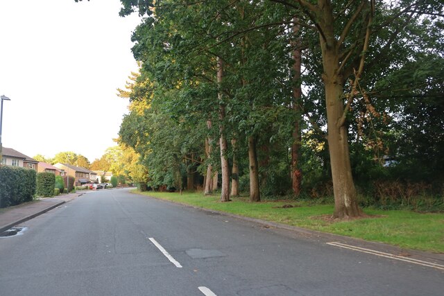
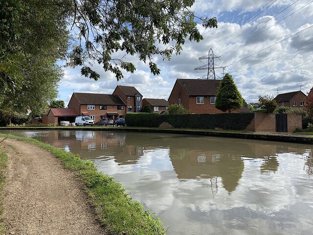
Temple Hill Spinney, located in Warwickshire, is a picturesque woodland area that spans over a vast expanse of land. It is one of the largest woodlands in the area and is often referred to as a forest due to its size and dense vegetation. The spinney is nestled within the heart of the Warwickshire countryside, offering visitors a serene and tranquil escape from the hustle and bustle of city life.

The woodland is predominantly composed of deciduous trees, including oak, ash, and beech, which create a beautiful canopy of foliage during the spring and summer months. It is also home to a diverse range of flora and fauna, with bluebells carpeting the forest floor in the spring and various bird species filling the air with their melodious songs.

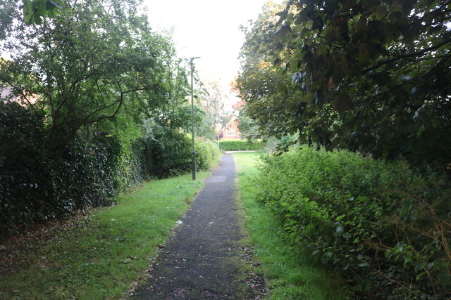
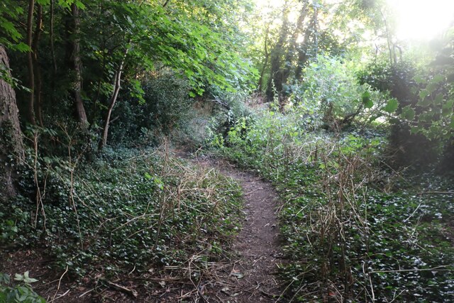
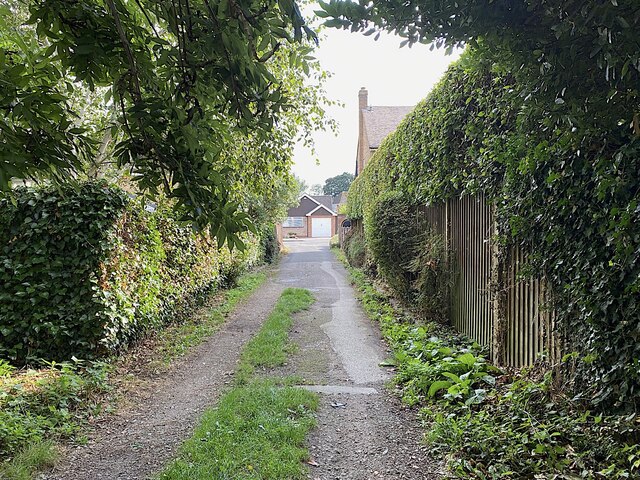
Temple Hill Spinney is a popular destination for nature enthusiasts, hikers, and birdwatchers. It offers a network of well-maintained footpaths and trails that allow visitors to explore the woodland at their own pace. The tranquil atmosphere and stunning natural beauty make it an ideal spot for picnics, photography, or simply immersing oneself in the serenity of the surroundings.

The spinney is also steeped in history, with remnants of ancient earthworks and archaeological sites scattered throughout the area. The Temple Hill itself is an ancient mound that adds an air of mystery and intrigue to the woodland.

Overall, Temple Hill Spinney in Warwickshire is a haven of natural beauty, offering visitors a chance to escape into a world of tranquility and discover the wonders of the British countryside.

If you have any feedback on the listing, please let us know in the comments section below.

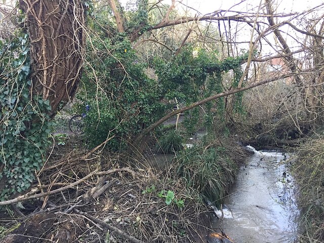
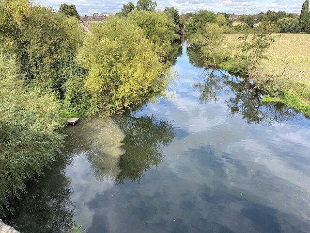
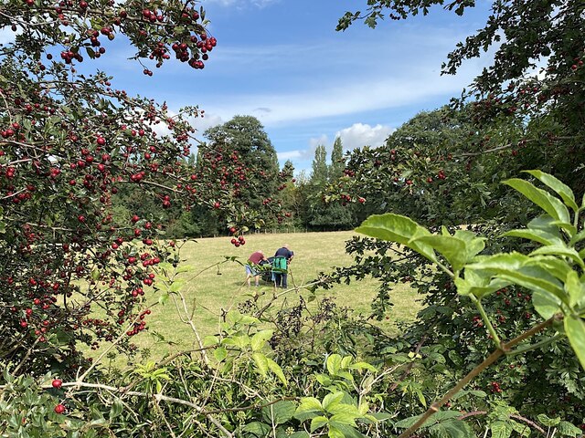
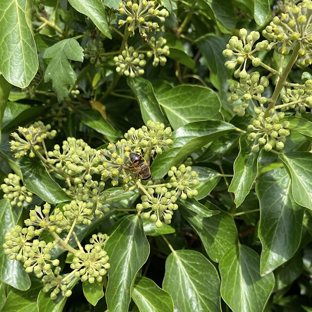
Temple Hill Spinney Images

Images are sourced within 2km of 52.271079/-1.573119 or Grid Reference SP2963. Thanks to Geograph Open Source API. All images are credited.

Myton Lane, Warwick
Myton Lane, Warwick
Path from Myton Lane to Myton Road
Woodland by Myton Lane, Warwick
Track to Leam Road, Myton, Warwick Leam Road bridge over the railway is behind the camera.
Track to Leam Road, Myton, Warwick
Leam Road bridge over the railway is behind the camera.
Canal overflow channel, Emscote, Warwick The Grand Union Canal between Warwick and Offchurch is a 'sink', ie, at a low level with water flowing into it from locks at each end. To avoid flooding there are several overflow weirs along the 7 km stretch. In the photo the canal is at high level left between bridge 46 and the Avon Aqueduct <a href="https://www.geograph.org.uk/photo/1677024">SP2965 : Towpath and overflow weir, Grand Union Canal, Emscote Road</a>. Water drops in a pipe or chute and is channelled to the River Avon behind the camera. The view is from this footbridge <a href="https://www.geograph.org.uk/photo/4448216">SP3065 : Small footbridge next to the River Avon</a>.
Canal overflow channel, Emscote, Warwick
The Grand Union Canal between Warwick and Offchurch is a 'sink', ie, at a low level with water flowing into it from locks at each end. To avoid flooding there are several overflow weirs along the 7 km stretch. In the photo the canal is at high level left between bridge 46 and the Avon Aqueduct SP2965 : Towpath and overflow weir, Grand Union Canal, Emscote Road. Water drops in a pipe or chute and is channelled to the River Avon behind the camera. The view is from this footbridge SP3065 : Small footbridge next to the River Avon.
Canal overflow discharging to the River Avon, Warwick The cloudy water is overflow from the Grand Union Canal. It leaves the canal by a weir <a href="https://www.geograph.org.uk/photo/1677024">SP2965 : Towpath and overflow weir, Grand Union Canal, Emscote Road</a> and finds its way to the river by a channel more or less <a href="https://www.geograph.org.uk/photo/7085714">SP3065 : Canal overflow channel, Emscote, Warwick</a>. The viewpoint is the Avon Aqueduct, completed  in 1800 <a href="https://www.geograph.org.uk/photo/5039865">SP3065 : Aqueduct Over The Avon</a>.
Canal overflow discharging to the River Avon, Warwick
The cloudy water is overflow from the Grand Union Canal. It leaves the canal by a weir SP2965 : Towpath and overflow weir, Grand Union Canal, Emscote Road and finds its way to the river by a channel more or less SP3065 : Canal overflow channel, Emscote, Warwick. The viewpoint is the Avon Aqueduct, completed in 1800 SP3065 : Aqueduct Over The Avon.
Anglers call it a day, Jephson's Farm, Warwick Jephson's Farm rents out some fishing pegs on the bank of the River Avon. These two gents were struggling with a heavy cart of fishing gear. The view is from the canal towpath.
Anglers call it a day, Jephson's Farm, Warwick
Jephson's Farm rents out some fishing pegs on the bank of the River Avon. These two gents were struggling with a heavy cart of fishing gear. The view is from the canal towpath.
Bee on ivy flowers by the canal, Myton, Warwick Mid-September seems early in the year to be seeing this. One associates bees-on-ivy with early winter. Perhaps ivy has a long flowering season. Note the adult form of the leaves.
Bee on ivy flowers by the canal, Myton, Warwick
Mid-September seems early in the year to be seeing this. One associates bees-on-ivy with early winter. Perhaps ivy has a long flowering season. Note the adult form of the leaves.
Aragon Drive estate across the canal, Myton, Warwick
Grand Union Canal through Myton, Warwick The kissing gate is access to a Lidl supermarket. There is much coming and going from these moorings. The Canal & River Trust have erected a Towpath Code of Conduct. The principle that pedestrians have priority has to be greeted with hollow laughter. Cyclists and joggers don't stop for anybody.
Grand Union Canal through Myton, Warwick
The kissing gate is access to a Lidl supermarket. There is much coming and going from these moorings. The Canal & River Trust have erected a Towpath Code of Conduct. The principle that pedestrians have priority has to be greeted with hollow laughter. Cyclists and joggers don't stop for anybody.
Canal towpath near Lidl, Myton, Warwick The Towpath Code of Conduct erected nearby says 'Pedestrians have priority. Considerate cycling permitted.'  The photographer was startled by this pair and took quick refuge in the verge. A similar scene is portrayed on the cover of the Coventry and Warwick Explorer map (OS 1:25k sheet 221).
Canal towpath near Lidl, Myton, Warwick
The Towpath Code of Conduct erected nearby says 'Pedestrians have priority. Considerate cycling permitted.' The photographer was startled by this pair and took quick refuge in the verge. A similar scene is portrayed on the cover of the Coventry and Warwick Explorer map (OS 1:25k sheet 221).
Lidl car park, Myton Road, Warwick The Lidl store is popular but some people miss the nursery and garden centre that was on the site before. Lidl are building a second store just off the Emscote Road in Warwick <a href="https://www.geograph.org.uk/photo/7035709">SP2965 : New Lidl store, Pickard Street, Warwick: the site fence is coming down</a>.
Lidl car park, Myton Road, Warwick
The Lidl store is popular but some people miss the nursery and garden centre that was on the site before. Lidl are building a second store just off the Emscote Road in Warwick SP2965 : New Lidl store, Pickard Street, Warwick: the site fence is coming down.
Saltie II on the canal in Myton, Warwick Saltie II identifies herself as the Saltisford Canal Trust's Self Drive Day Boat. It was taking a slightly erratic course; perhaps the steersman was distracted. The Trust has restored and manages the Saltisford Arm, the remaining length of the terminal section of the Warwick and Birmingham Canal (opened in 1800) <a href="https://www.geograph.org.uk/photo/4651">SP2765 : Saltisford Arm, Warwick</a>. In the background are flats in Howard Walk off Aragon Drive.
Saltie II on the canal in Myton, Warwick
Saltie II identifies herself as the Saltisford Canal Trust's Self Drive Day Boat. It was taking a slightly erratic course; perhaps the steersman was distracted. The Trust has restored and manages the Saltisford Arm, the remaining length of the terminal section of the Warwick and Birmingham Canal (opened in 1800) SP2765 : Saltisford Arm, Warwick. In the background are flats in Howard Walk off Aragon Drive.
Well-connected new housing, Heathcote, Warwick A long-expected development on farmland will have ready access to M40 and the towns.
Well-connected new housing, Heathcote, Warwick
A long-expected development on farmland will have ready access to M40 and the towns.
Tree cover, Riverside, Warwick Looking down from the Avon Aqueduct, a footbridge takes a path over the canal overflow before it joins the Avon.
Tree cover, Riverside, Warwick
Looking down from the Avon Aqueduct, a footbridge takes a path over the canal overflow before it joins the Avon.
New ballast west of Leamington Spa It has been suggested, convincingly, that the discarded poles and yellow things are temporary LED lighting stands similar to these: <span class="nowrap"><a title="https://riteliteportablelighting.co.uk/rail-sector/" rel="nofollow ugc noopener" href="https://riteliteportablelighting.co.uk/rail-sector/">Link</a><img style="margin-left:2px;" alt="External link" title="External link - shift click to open in new window" src="https://s1.geograph.org.uk/img/external.png" width="10" height="10"/></span> They were not there weeks later so it is assumed that they were collected. The view is from the canal aqueduct.
New ballast west of Leamington Spa
It has been suggested, convincingly, that the discarded poles and yellow things are temporary LED lighting stands similar to these: LinkExternal link They were not there weeks later so it is assumed that they were collected. The view is from the canal aqueduct.
Messy canal overflow, Warwick Excess water in the Grand Union Canal flows over a weir just east of bridge 46 (Emscote Road) <a href="https://www.geograph.org.uk/photo/1677024">SP2965 : Towpath and overflow weir, Grand Union Canal, Emscote Road</a>. It is discharged in the open space to the north and finds its way to the River Avon. Large volumes of water have flooded the footpath. The view is from the steel staircase down to the riverbank.
Messy canal overflow, Warwick
Excess water in the Grand Union Canal flows over a weir just east of bridge 46 (Emscote Road) SP2965 : Towpath and overflow weir, Grand Union Canal, Emscote Road. It is discharged in the open space to the north and finds its way to the River Avon. Large volumes of water have flooded the footpath. The view is from the steel staircase down to the riverbank.
Fallen catkins of Sweet Chestnut, Warwick By Myton Road near Lidl. Note the characteristic twist of the trunk.
Fallen catkins of Sweet Chestnut, Warwick
By Myton Road near Lidl. Note the characteristic twist of the trunk.
Show me another place!

Temple Hill Spinney is located at Grid Ref: SP2963 (Lat: 52.271079, Lng: -1.573119)

Administrative County: Warwickshire

District: Warwick

Police Authority: Warwickshire

What 3 Words

///cases.pink.wisdom. Near Warwick, Warwickshire

Related Wikis

Warwick School

Warwick School is a selective, public school (British independent boarding and day school) in Warwick, England. Known until about 1900 as King's School...

Castle Bridge

Castle Bridge is a grade II* listed road bridge in Warwick, Warwickshire, England, which carries the A425 road over the River Avon.In 1788, the Earl of...

Myton School

Myton School is a coeducational secondary school and sixth form. Most students live locally, although the school attracts students from outside the priority...
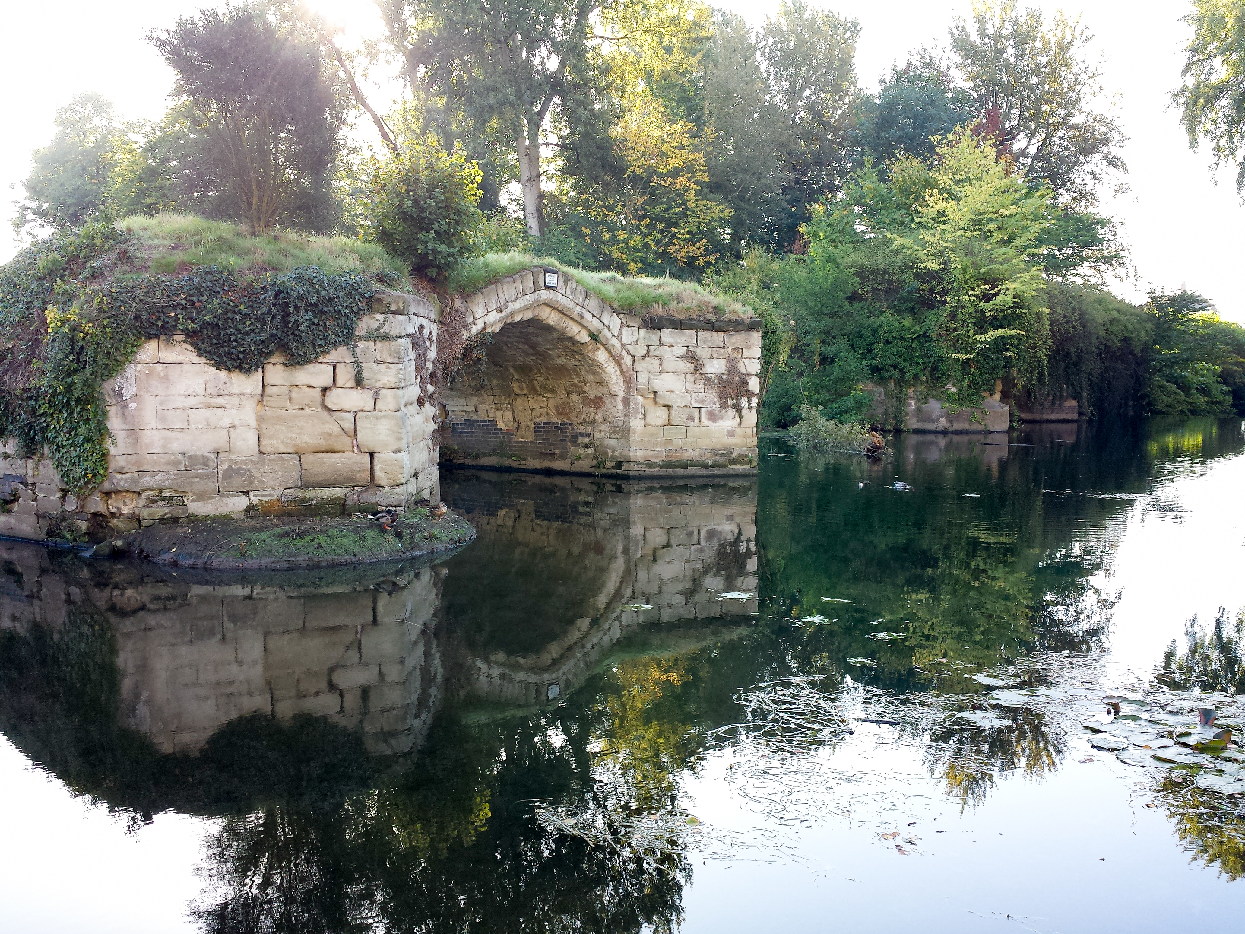
Old Castle Bridge

The Old Castle Bridge in Warwick, England is a ruined medieval bridge. The multi-arch stone bridge was built across the River Avon a short distance south...
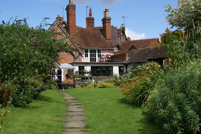
The Mill Garden

The Mill Garden is a private garden adjacent to Warwick Castle measuring half an acre open to the public and situated on the bank of the River Avon in...
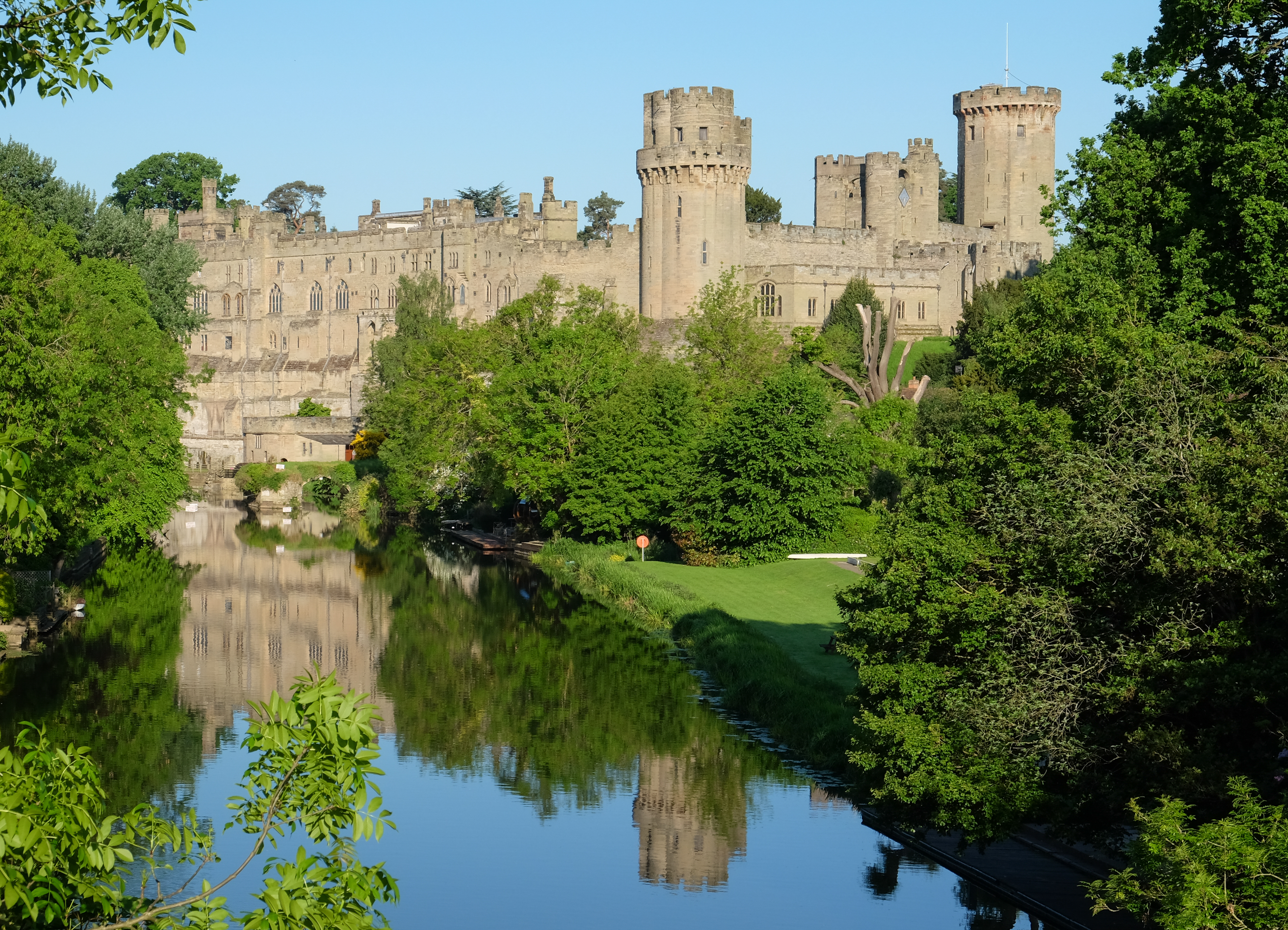
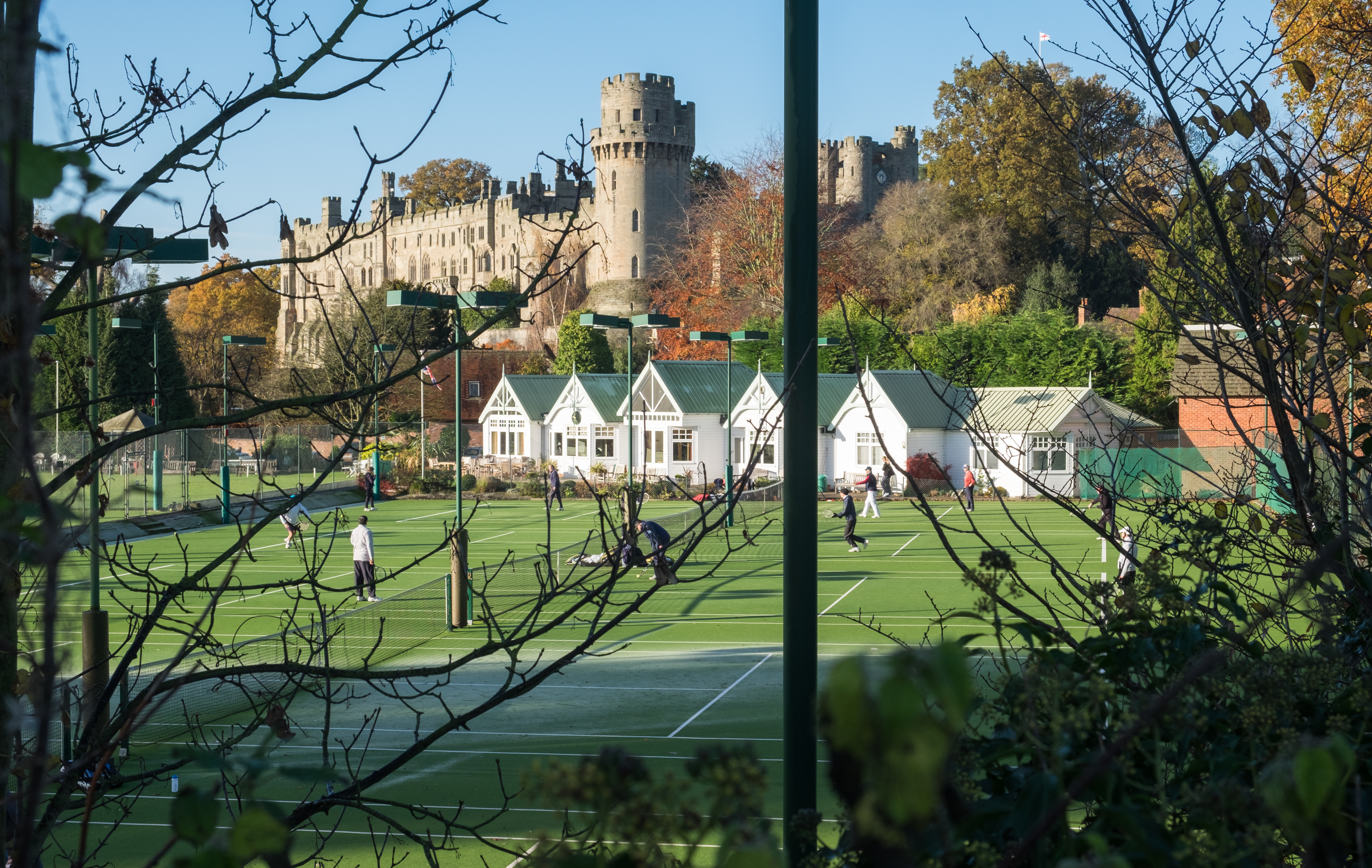
Warwick Castle

Warwick Castle is a medieval castle developed from a wooden fort, originally built by William the Conqueror during 1068. Warwick is the county town of...

List of owners of Warwick Castle

Warwick Castle, in Warwickshire, UK, was first constructed in 1068. Over its 950 years of history it has been owned by 36 different individuals, plus...

Warwick Boat Club

Warwick Boat Club is a rowing club on the River Avon. == History == The club was founded in 1861. Unusually it includes separate "sections" and good grounds...

Nearby Amenities

Located within 500m of 52.271079,-1.573119
Traffic Signals
Crossing Markings: no
Source: Warwicks CC Aerial Imagery 2013
Traffic Signals: signal
Traffic Signals Direction: forward
Lat/Long: 52.2743964/-1.5737639
Bus Stop
Warwick Technology Park
Bench: no
Bin: no
Bus: yes
Covered: no
Lit: yes
Naptan AtcoCode: 4200F141501
Naptan Bearing: S
Naptan CommonName: Warwick Technology Park
Naptan Indicator: Adj
Naptan Landmark: Warwick Technology Park
Naptan NaptanCode: warajtgw
Naptan PlusbusZoneRef: LMNGTNS
Naptan Street: Private Road
Passenger Information Display: no
Physically Present: yes
Public Transport: platform
Shelter: no
Source: naptan_import
Tactile Paving: no
Lat/Long: 52.2743984/-1.5699895
Bus Stop
Warwick Technology Park
Bench: no
Bin: no
Bus: yes
Covered: no
Lit: yes
Naptan AtcoCode: 4200F141502
Naptan Bearing: N
Naptan CommonName: Warwick Technology Park
Naptan Indicator: Adj
Naptan Landmark: Warwick Technology Park
Naptan NaptanCode: warajtja
Naptan PlusbusZoneRef: LMNGTNS
Naptan Street: Private Road
Passenger Information Display: no
Physically Present: no
Public Transport: platform
Shelter: no
Source: naptan_import
Tactile Paving: no
Lat/Long: 52.2744695/-1.5701636
Barrier: lift_gate
Source: survey
Lat/Long: 52.274808/-1.5697921
Barrier: kerb
Kerb: lowered
Lat/Long: 52.2743279/-1.5703023
Crossing
Bicycle: yes
Crossing: uncontrolled
Lat/Long: 52.2743137/-1.5702467
King's High Sports Ground
Landuse: recreation_ground
Leisure: sports_centre
Lat/Long: 52.2754104/-1.5731342
Traffic Signals
Bicycle: no
Crossing Island: yes
Crossing Markings: no
Crossing Ref: pelican
Traffic Signals: signal
Traffic Signals Direction: backward
Lat/Long: 52.2746703/-1.57355
Crossing
Lat/Long: 52.2754022/-1.5746521
Communication Mobile Phone: yes
Man Made: mast
Source: survey
Tower Construction: tube
Tower Type: communication
Lat/Long: 52.2749323/-1.5700205
Traffic Signals
Crossing Markings: no
Lat/Long: 52.2747893/-1.5728983
Traffic Signals
Crossing Markings: no
Lat/Long: 52.2748767/-1.5728773
Crossing
Lat/Long: 52.2751222/-1.5736565
Traffic Signals
Crossing Markings: no
Traffic Signals: signal
Traffic Signals Direction: backward
Lat/Long: 52.2746961/-1.5740964
Barrier: lift_gate
Lat/Long: 52.2744167/-1.5698359
Noexit: yes
Lat/Long: 52.2752656/-1.5746049
Noexit: yes
Lat/Long: 52.2753518/-1.5746504
Barrier: kerb
Lat/Long: 52.2753242/-1.5747475
Barrier: kerb
Lat/Long: 52.2752807/-1.574865
Barrier: kerb
Lat/Long: 52.2752088/-1.5747796
Crossing
Crossing: uncontrolled
Crossing Island: no
Tactile Paving: yes
Lat/Long: 52.2748655/-1.5732211
Crossing
Crossing: uncontrolled
Lat/Long: 52.2749181/-1.5730288
Generator Method: photovoltaic
Generator Output Electricity: yes
Generator Solar Modules: 106
Generator Source: solar
Generator Type: solar_photovoltaic_panel
Location: roof
Power: generator
Lat/Long: 52.2734817/-1.5670575
Generator Method: photovoltaic
Generator Output Electricity: yes
Generator Solar Modules: 70
Generator Source: solar
Generator Type: solar_photovoltaic_panel
Location: roof
Power: generator
Lat/Long: 52.2737525/-1.5679156
Generator Method: photovoltaic
Generator Output Electricity: yes
Generator Source: solar
Generator Type: solar_photovoltaic_panel
Location: roof
Power: generator
Lat/Long: 52.2742125/-1.5682436
Generator Method: photovoltaic
Generator Output Electricity: yes
Generator Solar Modules: 21
Generator Source: solar
Generator Type: solar_photovoltaic_panel
Location: roof
Power: generator
Lat/Long: 52.2735203/-1.5671941
Generator Method: photovoltaic
Generator Output Electricity: yes
Generator Solar Modules: 7
Generator Source: solar
Generator Type: solar_photovoltaic_panel
Location: roof
Power: generator
Lat/Long: 52.2735324/-1.5672618
Generator Method: photovoltaic
Generator Output Electricity: yes
Generator Solar Modules: 14
Generator Source: solar
Generator Type: solar_photovoltaic_panel
Location: roof
Power: generator
Lat/Long: 52.2735539/-1.5673073
Entrance: yes
Lat/Long: 52.2752732/-1.5704828
Cycleway: asl
Direction: backward
Lat/Long: 52.2746465/-1.5736094
Cycleway: asl
Direction: forward
Lat/Long: 52.2744308/-1.5738051
Bus: yes
Public Transport: stop_position
Lat/Long: 52.2744362/-1.5700816
Street Lamp
Lat/Long: 52.2731188/-1.572219
Street Lamp
Lamp Mount: bent_mast
Lamp Type: led
Lat/Long: 52.2733881/-1.572515
Street Lamp
Lamp Mount: bent_mast
Lamp Type: led
Lat/Long: 52.2736491/-1.5727977
Street Lamp
Lamp Mount: bent_mast
Lamp Type: led
Lat/Long: 52.2738426/-1.5730184
Street Lamp
Lamp Mount: bent_mast
Lamp Type: led
Lat/Long: 52.274018/-1.5731879
Street Lamp
Lamp Mount: bent_mast
Lamp Type: led
Lat/Long: 52.2741588/-1.5733508
Street Lamp
Lamp Mount: bent_mast
Lamp Type: led
Lat/Long: 52.2743112/-1.5734961
Street Lamp
Lamp Mount: bent_mast
Lamp Type: led
Ref: 37
Lat/Long: 52.2744709/-1.5736711
Street Lamp
Lamp Mount: bent_mast
Lamp Type: led
Ref: 8
Lat/Long: 52.27455/-1.5736091
Street Lamp
Lamp Mount: bent_mast
Lamp Type: led
Ref: 36
Lat/Long: 52.2746644/-1.5738985
Street Lamp
Lamp Mount: bent_mast
Lamp Type: led
Ref: 35
Lat/Long: 52.2748078/-1.5740869
Street Lamp
Lamp Mount: bent_mast
Lamp Type: led
Ref: 34
Lat/Long: 52.2749507/-1.5742559
Street Lamp
Lamp Mount: bent_mast
Lamp Type: led
Ref: 33
Lat/Long: 52.2751814/-1.5745468
Street Lamp
Lamp Mount: bent_mast
Lamp Type: led
Ref: 32
Lat/Long: 52.2752249/-1.574835
Street Lamp
Lamp Mount: bent_mast
Lamp Type: led
Ref: 2
Lat/Long: 52.275439/-1.5745947
Give Way
Direction: forward
Lat/Long: 52.2741885/-1.5703832
Give Way
Direction: backward
Lat/Long: 52.2746981/-1.5696639
Warwick
Board Type: welcome_sign
Information: board
Tourism: information
Lat/Long: 52.2753614/-1.5749755
Barrier: kerb
Lat/Long: 52.2742963/-1.5701838
Barrier: kerb
Lat/Long: 52.2751005/-1.5735777
Barrier: kerb
Lat/Long: 52.2751436/-1.5737304
Barrier: kerb
Lat/Long: 52.2753895/-1.5746636
Barrier: kerb
Lat/Long: 52.2754136/-1.5746402
Crossing
Crossing Ref: puffin
Lat/Long: 52.2746233/-1.5736672
Crossing
Crossing Ref: puffin
Lat/Long: 52.2746936/-1.5736467
Street Lamp
Lamp Mount: bent_mast
Lamp Type: led
Ref: 21
Lat/Long: 52.2735453/-1.5691409
Street Lamp
Lamp Mount: bent_mast
Lamp Type: led
Ref: 14
Lat/Long: 52.2745524/-1.5715046
Street Lamp
Lamp Mount: bent_mast
Lamp Type: led
Ref: 16
Lat/Long: 52.274313/-1.5706605
Street Lamp
Lamp Mount: bent_mast
Lamp Type: led
Ref: 7
Lat/Long: 52.2747972/-1.5734292
Street Lamp
Direction: 215
Lamp Mount: bent_mast
Lamp Type: led
Ref: 19
Lat/Long: 52.273921/-1.5696053
Street Lamp
Lamp Mount: bent_mast
Lamp Type: led
Ref: 12
Lat/Long: 52.2747935/-1.5724343
Street Lamp
Lamp Mount: bent_mast
Lamp Type: led
Ref: 3
Lat/Long: 52.2752531/-1.5744538
Street Lamp
Lamp Mount: bent_mast
Lamp Type: led
Ref: 18
Lat/Long: 52.2741076/-1.5700393
Street Lamp
Lamp Mount: bent_mast
Lamp Type: led
Ref: 23
Lat/Long: 52.2732687/-1.5683791
Street Lamp
Lamp Mount: bent_mast
Lamp Type: led
Ref: 5
Lat/Long: 52.2750782/-1.5738798
Street Lamp
Lamp Mount: bent_mast
Lamp Type: led
Ref: 13
Lat/Long: 52.2746465/-1.5718677
Street Lamp
Lamp Mount: bent_mast
Lamp Type: led
Ref: 15
Lat/Long: 52.2744233/-1.5710285
Street Lamp
Lamp Mount: bent_mast
Lamp Type: led
Ref: 10
Lat/Long: 52.2749199/-1.5728566
Street Lamp
Lamp Mount: bent_mast
Lamp Type: led
Ref: 22
Lat/Long: 52.2734154/-1.5687831
Street Lamp
Lamp Mount: bent_mast
Lamp Type: led
Ref: 27
Lat/Long: 52.2729522/-1.5667599
Street Lamp
Lamp Mount: bent_mast
Lamp Type: led
Ref: 4
Lat/Long: 52.2752499/-1.5740733
Street Lamp
Lamp Mount: bent_mast
Lamp Type: led
Ref: 20
Lat/Long: 52.2736958/-1.5694873
Street Lamp
Lamp Mount: bent_mast
Lamp Type: led
Ref: 9
Lat/Long: 52.2747048/-1.5729962
Street Lamp
Lamp Mount: bent_mast
Lamp Type: led
Ref: 11
Lat/Long: 52.2746929/-1.5726288
Street Lamp
Lamp Mount: bent_mast
Lamp Type: led
Ref: 25
Lat/Long: 52.2730181/-1.5675628
Street Lamp
Lamp Mount: bent_mast
Lamp Type: led
Ref: 6
Lat/Long: 52.2750563/-1.5733527
Street Lamp
Lamp Mount: bent_mast
Lamp Type: led
Ref: 28
Lat/Long: 52.272831/-1.5663833
Street Lamp
Lamp Mount: bent_mast
Lamp Type: led
Ref: 26
Lat/Long: 52.2730519/-1.5671658
Street Lamp
Lamp Mount: bent_mast
Lamp Type: led
Ref: 17
Lat/Long: 52.2740923/-1.5704512
Street Lamp
Lamp Mount: bent_mast
Lamp Type: led
Ref: 24
Lat/Long: 52.2731307/-1.5679682
Street Lamp
Lamp Mount: bent_mast
Lamp Type: led
Ref: 29
Lat/Long: 52.2725777/-1.5662965
Street Lamp
Lamp Mount: straight_mast
Lamp Type: led
Ref: 3
Lat/Long: 52.2746473/-1.5698236
Street Lamp
Lamp Mount: straight_mast
Lamp Type: led
Lat/Long: 52.2748013/-1.5694541
Street Lamp
Lamp Mount: straight_mast
Lamp Type: led
Ref: 8
Lat/Long: 52.2743433/-1.5704702
Street Lamp
Lamp Mount: bent_mast
Lamp Type: led
Lat/Long: 52.2742196/-1.5701442
Street Lamp
Lamp Mount: straight_mast
Lamp Type: led
Ref: 2
Lat/Long: 52.2744052/-1.5700041
Street Lamp
Lamp Mount: straight_mast
Lamp Type: led
Ref: 4
Lat/Long: 52.27464/-1.5695846
Man Made: utility_pole
Material: wood
Operator: Openreach
Utility: telecom
Lat/Long: 52.2750995/-1.5739582
Street Lamp
Lamp Mount: straight_mast
Lamp Type: led
Ref: 4
Lat/Long: 52.2746048/-1.571623
Street Lamp
Lamp Mount: straight_mast
Lamp Type: led
Ref: 2
Lat/Long: 52.2747363/-1.5720728
Street Lamp
Lamp Mount: straight_mast
Lamp Type: led
Ref: 3
Lat/Long: 52.2746672/-1.5718334
Street Lamp
Lamp Mount: straight_mast
Lamp Type: led
Ref: 1
Lat/Long: 52.2748326/-1.5724107
Street Lamp
Lamp Mount: straight_mast
Lamp Type: led
Ref: 8
Lat/Long: 52.2743951/-1.5707406
Street Lamp
Lamp Mount: straight_mast
Lamp Type: led
Ref: 5
Lat/Long: 52.2745446/-1.5713348
Man Made: utility_pole
Material: wood
Lat/Long: 52.2746353/-1.5722751
Street Lamp
Lamp Mount: straight_mast
Lamp Type: led
Ref: 6
Lat/Long: 52.2744701/-1.5710756
The data included in this document is from www.openstreetmap.org. The data is made available under ODbL.

Have you been to Temple Hill Spinney?

Leave your review of Temple Hill Spinney below (or comments, questions and feedback).