Broad Wood

Wood, Forest in Durham

England

Broad Wood

A1(M) northbound
A1(M) northbound Credit: Alex McGregor

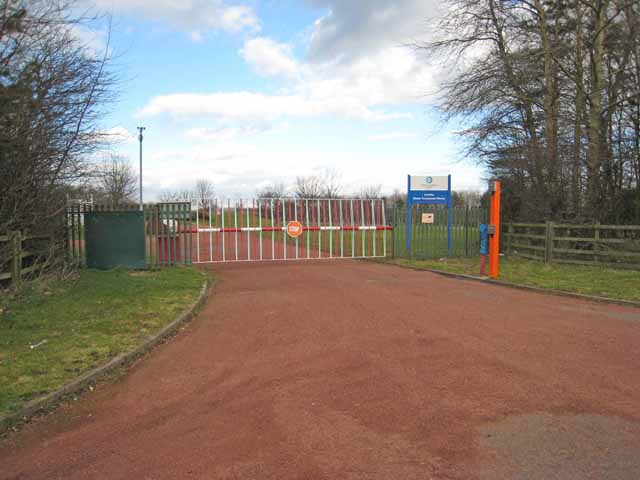
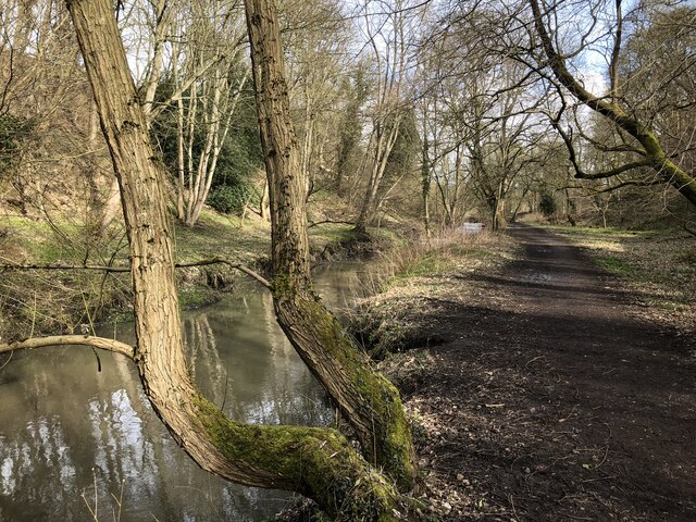
Broad Wood is a vast forest located in Durham, England. Covering an area of approximately 500 acres, it is a prominent natural landmark with a rich history and diverse ecosystem. The wood is situated on undulating terrain, characterized by a mixture of dense woodland, open meadows, and a small lake.

The forest is home to a variety of tree species, including oak, beech, birch, and pine, creating a vibrant and colorful landscape throughout the year. The dense canopy provides a perfect habitat for a wide range of wildlife, such as deer, foxes, rabbits, and various bird species. The wood is also known for its diverse plant life, with a plethora of wildflowers, ferns, and mosses adding to its natural beauty.

Broad Wood offers an array of recreational opportunities for visitors. There are several well-maintained walking trails that wind through the forest, providing scenic views and an opportunity to immerse oneself in nature. The lake within the wood offers fishing and boating activities, attracting enthusiasts from far and wide.

Due to its historical significance, Broad Wood has also been designated as a Site of Special Scientific Interest (SSSI). Archaeological evidence suggests that the wood has been in existence for centuries, with remnants of ancient settlements and burial mounds found within its boundaries.

Overall, Broad Wood is a stunning and ecologically significant forest that offers both natural beauty and recreational activities for visitors. Its diverse ecosystem, rich history, and tranquil ambiance make it a cherished natural asset in Durham.

If you have any feedback on the listing, please let us know in the comments section below.
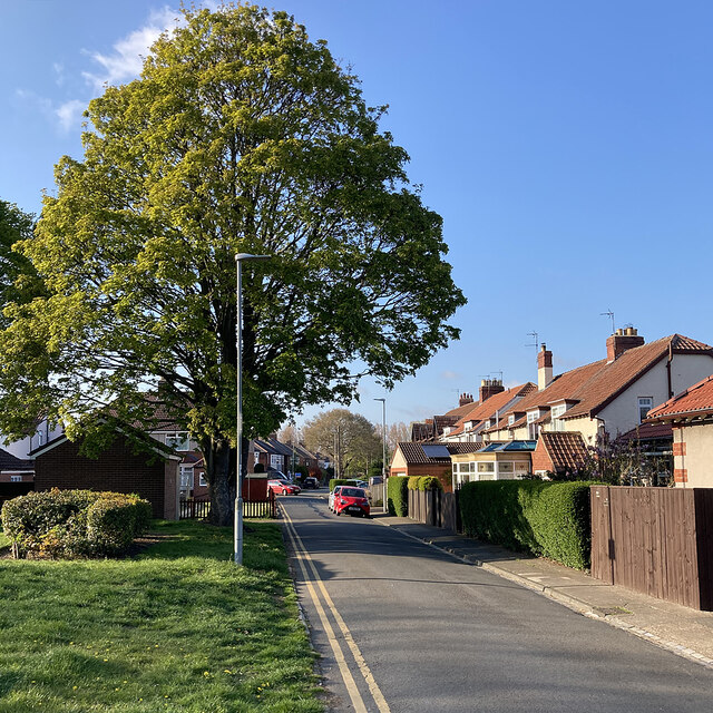
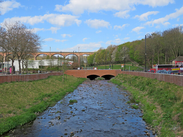
Broad Wood Images

Images are sourced within 2km of 54.849581/-1.5512488 or Grid Reference NZ2850. Thanks to Geograph Open Source API. All images are credited.

A1(M) northbound
A1(M) northbound
Gateway to Lumley Water Treatment Works
The Dun Cow The Dun Cow Public house near Houghton Gate
The Dun Cow
The Dun Cow Public house near Houghton Gate
Breckon Hill Photo taken while walking along the rivers foot path
Breckon Hill
Photo taken while walking along the rivers foot path
The Dun Cow, Bournmoor
Woodland path beside Lumley Park Burn
Lumley Park Burn We took the footpath beside the burn, rather than the Weardale Way, which runs parallel but a little further up in the woods.
Lush vegetation mixed with debris, fly tipping and the odd old tyre can be found within and beside the stream.
Lumley Park Burn
We took the footpath beside the burn, rather than the Weardale Way, which runs parallel but a little further up in the woods. Lush vegetation mixed with debris, fly tipping and the odd old tyre can be found within and beside the stream.
Beside Lumley Park Burn
Following Lumley Park Burn towards Bournmoor Near the end of the Weardale Way's 2 mile route along the Burn
Following Lumley Park Burn towards Bournmoor
Near the end of the Weardale Way's 2 mile route along the Burn
Benchmark on bridge Benchmark on left bottom of Lumley dene bridge
Benchmark on bridge
Benchmark on left bottom of Lumley dene bridge
Chester-le-Street
Chester-le-Street
The High Crown Inn The High Crown Inn public house.
The High Crown Inn
The High Crown Inn public house.
Chester-le-Street: Church Chare on an April evening The tall spire of the parish church of St Mary and St Cuthbert and the red-brick Cestria Primary School.
Chester-le-Street: Church Chare on an April evening
The tall spire of the parish church of St Mary and St Cuthbert and the red-brick Cestria Primary School.
Chester-le-Street: Holmlands Park Looking towards Lindom Avenue and Roman Avenue on a bright April evening.
Chester-le-Street: Holmlands Park
Looking towards Lindom Avenue and Roman Avenue on a bright April evening.
Chester-le-Street: up Co-operative Street A steep terraced street west of Front Street.
Chester-le-Street: up Co-operative Street
A steep terraced street west of Front Street.
Chester-le-Street: flood alleviation Chester (or Cong) Burn was culverted under the Market Place in 1962. Following floods in 2012 this was identified as the main cause and a £6.2m scheme funded by Durham County Council, the Environment Agency and the European Union Regional Development Fund which uncovered the burn should reduce the risk of flooding from exceptional storms. A nearby information board explains that the flood walls north and south of the re-exposed burn increase its capacity, allowing it to hold more water to reduce the risk of flooding. The area has been landscaped to "create a more welcoming, park-like feel". The railway viaduct is in the distance to the left of centre.
Chester-le-Street: flood alleviation
Chester (or Cong) Burn was culverted under the Market Place in 1962. Following floods in 2012 this was identified as the main cause and a £6.2m scheme funded by Durham County Council, the Environment Agency and the European Union Regional Development Fund which uncovered the burn should reduce the risk of flooding from exceptional storms. A nearby information board explains that the flood walls north and south of the re-exposed burn increase its capacity, allowing it to hold more water to reduce the risk of flooding. The area has been landscaped to "create a more welcoming, park-like feel". The railway viaduct is in the distance to the left of centre.
Show me another place!

Broad Wood is located at Grid Ref: NZ2850 (Lat: 54.849581, Lng: -1.5512488)

Unitary Authority: County Durham

Police Authority: Durham

What 3 Words

///shapes.claps.strong. Near Chester-le-Street, Co. Durham

Related Wikis

Chester-le-Street Amateur Rowing Club

Chester-le-Street Amateur Rowing Club is a rowing club on the River Wear, based at the Riverside Sports Complex, Chester-le-Street, County Durham. ��2...

Lumley Castle

Lumley Castle is a 14th-century quadrangular castle at Chester-le-Street in the North of England, near the city of Durham and a property of the Earl of...

Riverside Ground

The Riverside Ground, known for sponsorship reasons as the Seat Unique Riverside, is a cricket venue in Chester-le-Street, County Durham, England. It is...

Lumley Thicks

Lumley Thicks is a small village in County Durham, in England. It is situated between Chester-le-Street and Houghton-le-Spring, north of Great Lumley.

Nearby Amenities

Located within 500m of 54.849581,-1.5512488
Bus Stop
Golf Club (bridge)
Bus: yes
Naptan AtcoCode: 13002301D
Naptan Bearing: SE
Naptan CommonName: Golf Club (bridge)
Naptan Indicator: south east bound
Naptan Landmark: Landmark not known
Naptan NaptanCode: durampmp
Naptan Notes: just south of bridge and entrance to golf club- lumley new rd- chester le street
Naptan Street: B1284 Lumley New Road
Naptan Verified: yes
Public Transport: platform
Shelter: yes
Source: naptan_import; GPS survey
Lat/Long: 54.85091/-1.5567193
Bus Stop
Golf Club
Bus: yes
Naptan AtcoCode: 13002301H
Naptan Bearing: NW
Naptan CommonName: Golf Club (bridge)
Naptan Indicator: north west bound
Naptan Landmark: Landmark not known
Naptan NaptanCode: durampmt
Naptan Notes: opp entrance to golf club- lumley new rd- chester le street
Naptan Street: B1284 Lumley New Road
Naptan Verified: yes
Public Transport: platform
Shelter: yes
Source: naptan_import;GPS survey
Lat/Long: 54.8508845/-1.5571246
Bus Stop
Back Lane End (new rd. end)
Naptan AtcoCode: 13002302C
Naptan Bearing: E
Naptan CommonName: Back Lane End (new rd. end)
Naptan Indicator: east bound
Naptan Landmark: Landmark not known
Naptan NaptanCode: durampmw
Naptan Notes: Lumley New Rd just w of where it meets Back Lane- Great Lumley
Naptan Street: B1284 Lumley New Road
Naptan Verified: yes
Source: naptan_import; GPS survey
Lat/Long: 54.8471953/-1.5488976
Bus Stop
Back Lane End (new rd. end)
Bench: no
Bin: no
Bus: yes
Lit: yes
Naptan AtcoCode: 13002302D
Naptan Bearing: SE
Naptan CommonName: Back Lane End (new rd. end)
Naptan Indicator: south east bound
Naptan Landmark: Landmark not known
Naptan NaptanCode: durampta
Naptan Notes: On Back Lane just se of where it meets Lumley New Rd near Castle Dene- Great Lumley
Naptan Street: Back Lane
Naptan Verified: yes
Public Transport: platform
Shelter: no
Source: naptan_import; GPS survey
Tactile Paving: no
Lat/Long: 54.8467741/-1.5480755
Bus Stop
Back Lane End (new rd. end)
Bus: yes
Naptan AtcoCode: 13002302G
Naptan Bearing: W
Naptan CommonName: Back Lane End (new rd. end)
Naptan Indicator: west bound
Naptan Landmark: Landmark not known
Naptan NaptanCode: duramptd
Naptan Notes: Lumley New Rd- just e of where it joins Back Lane- nr Castle Dene- Great Lumley
Naptan Street: B1284 Lumley New Road
Naptan Verified: yes
Public Transport: platform
Shelter: yes
Source: naptan_import; GPS survey
Lat/Long: 54.8469514/-1.5476773
Bus Stop
Back Lane End (new rd. end)
Naptan AtcoCode: 13002302H
Naptan Bearing: NW
Naptan CommonName: Back Lane End (new rd. end)
Naptan Indicator: north west bound
Naptan Landmark: Landmark not known
Naptan NaptanCode: duramptg
Naptan Notes: Back Lane- just se of where it joins Lumley New Rd nr Castle Dene- Great Lumley
Naptan Street: Back Lane
Naptan Verified: yes
Source: naptan_import; GPS survey
Lat/Long: 54.8468419/-1.5482891
Barrier: stile
Foot: yes
Lat/Long: 54.8464463/-1.5545829
Barrier: stile
Foot: yes
Lat/Long: 54.8465531/-1.5547259
Crossing
Crossing: uncontrolled
Crossing Island: no
Lat/Long: 54.8513163/-1.5577589
Noexit: yes
Lat/Long: 54.8516758/-1.557721
Clock
Display: sundial
Wikidata: Q26597640
Lat/Long: 54.8535542/-1.5540129
Disused: yes
Man Made: mineshaft
Note: Position approximate. Coal Authority map shows a series of mine shafts along valley floor
Resource: coal
Lat/Long: 54.8503826/-1.5490294
Give Way
Direction: backward
Lat/Long: 54.8470462/-1.5483252
The data included in this document is from www.openstreetmap.org. The data is made available under ODbL.

Have you been to Broad Wood?

Leave your review of Broad Wood below (or comments, questions and feedback).