Tursdale Wood

Wood, Forest in Durham

England

Tursdale Wood

The A688 seen from Durham Services
The A688 seen from Durham Services Credit: habiloid

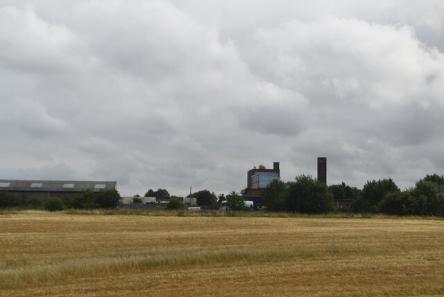
Tursdale Wood is a picturesque woodland located in County Durham, England. Spanning over a vast area, the wood is a haven for nature lovers and outdoor enthusiasts alike. Situated near the village of Tursdale, the wood is easily accessible and offers a serene and tranquil environment.

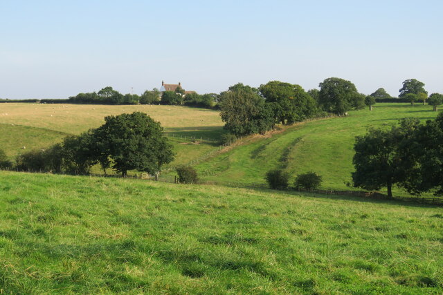
The wood is characterized by a diverse range of tree species, including oak, beech, and birch, which create a stunning canopy over the forest floor. The rich biodiversity within Tursdale Wood attracts a wide array of wildlife, making it a popular spot for birdwatching and animal sightings. Visitors may be lucky enough to spot woodpeckers, owls, deer, and various small mammals during their exploration of the wood.

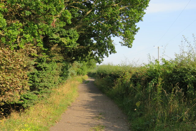
The woodland features several well-maintained walking trails, allowing visitors to fully immerse themselves in the beauty of nature. These trails wind through the wood, offering breathtaking views of the surrounding landscape. Along the way, visitors will come across clearings and glades, perfect spots for picnics or simply to take a moment to appreciate the tranquility of the area.

Tursdale Wood also holds historical significance, with remnants of ancient settlements and archaeological sites scattered throughout the area. These sites serve as a testament to the wood's rich heritage and provide an opportunity for history enthusiasts to delve into the past.

Overall, Tursdale Wood is a remarkable destination for those seeking solace in nature. With its vibrant flora and fauna, well-maintained trails, and historical significance, it offers an unforgettable experience for visitors of all ages.

If you have any feedback on the listing, please let us know in the comments section below.

Tursdale Wood Images

Images are sourced within 2km of 54.728614/-1.553921 or Grid Reference NZ2837. Thanks to Geograph Open Source API. All images are credited.

The A688 seen from Durham Services
Integra 61 Groundwork Preparatory work for construction of new industrial units as part of the Integra 61 development.
Integra 61 Groundwork
Preparatory work for construction of new industrial units as part of the Integra 61 development.
Roundabout at Amazon Warehouse
Durham  Services  car  park  with  A688  beyond Leading to A1(M) Junction 61
Durham Services car park with A688 beyond
Leading to A1(M) Junction 61
Tursdale Works
Tursdale Works
Durham Road, Bowburn The A177 Durham to Stockton road passes through the village
Durham Road, Bowburn
The A177 Durham to Stockton road passes through the village
A featureless grid square. The A688 looking towards Tursdale
Bowburn Methodist Church
Road Chef Durham motorway services
Durham Services Premier Inn.
Durham Services
Premier Inn.
Durham motorway services area At Junction 61 on the A1(M).
Durham motorway services area
At Junction 61 on the A1(M).
Premier Inn at Durham Motorway Services
Newsagents, Durham Road West, Bowburn
Approaching the A1 Junction 61 on the A1 is ahead; Durham services are just out of shot to the right.
Approaching the A1
Junction 61 on the A1 is ahead; Durham services are just out of shot to the right.
Track Alongside Croxdale Wood The Weardale Way used this track from High Butterby Farm to Croxdale Hall.
Track Alongside Croxdale Wood
The Weardale Way used this track from High Butterby Farm to Croxdale Hall.
View Across Skip Beck to High Croxdale
Croxdale Cemetery The OS flush bracket [S8971] is located on the north-west facing wall of the cemetery building.
Croxdale Cemetery
The OS flush bracket [S8971] is located on the north-west facing wall of the cemetery building.
Croxdale Cemetery There is an OS flush bracket [S8971] located on the north-west facing wall of the cemetery building. It is about 2 foot above ground level and directly below the roof apex.
Croxdale Cemetery
There is an OS flush bracket [S8971] located on the north-west facing wall of the cemetery building. It is about 2 foot above ground level and directly below the roof apex.
Show me another place!

Tursdale Wood is located at Grid Ref: NZ2837 (Lat: 54.728614, Lng: -1.553921)

Unitary Authority: County Durham

Police Authority: Durham

What 3 Words

///buck.fruits.enter. Near Bowburn, Co. Durham

Related Wikis

Hett, County Durham

Hett is a village and former civil parish, now in the parish of Croxdale and Hett, in the County Durham district, in the ceremonial county of Durham, England...

Croxdale and Hett

Croxdale and Hett is a civil parish in County Durham, England. It is situated approximately four miles south of Durham. The population of the civil parish...

Croxdale Hall

Croxdale Hall is a privately owned country mansion situated at Croxdale near Sunderland Bridge, County Durham. It is a Grade I listed building. == Ownership... ==

Croxdale

Croxdale is a village in the civil parish of Croxdale and Hett, situated about 3 miles (4.8 km) south of Durham City, in County Durham , England and on...

Nearby Amenities

Located within 500m of 54.728614,-1.553921
Hett Mill level crossing
Automated: yes
Ele: 78.23
Emergency Phone: yes
Fixme: what kind of emergency phone is this?
Railway: level_crossing
Lat/Long: 54.7257475/-1.5484333
Barrier: trunk
Note: I don't think there's a standard for a tree trunk across a path yet, is there?
Lat/Long: 54.7308151/-1.5475554
Power: pole
Lat/Long: 54.7307844/-1.5472817
Barrier: entrance
Lat/Long: 54.7289714/-1.5479804
Bench
Ele: 86.16
Lat/Long: 54.7307282/-1.5597024
Communication Mobile Phone: yes
Ele: 91.45
Man Made: mast
Operator: Vodaphone
Tower Construction: freestanding
Tower Type: communication
Lat/Long: 54.7309438/-1.5602598
Ele: 92.17
Note: Sign here says WBW is straight on out of hedge...?
Lat/Long: 54.7313828/-1.5597707
Note: Position estimated
Power: pole
Lat/Long: 54.730085/-1.5470871
Note: Position estimated
Power: pole
Lat/Long: 54.7294225/-1.5469541
Note: Position estimated
Power: pole
Lat/Long: 54.7289252/-1.5474631
Note: Position estimated
Power: pole
Lat/Long: 54.7284256/-1.5479717
Ele: 94.57
Power: pole
Lat/Long: 54.7279298/-1.5484923
Power: pole
Lat/Long: 54.7275043/-1.5489361
Man Made: tower
Note: Triangular mobile(?) mast. Position estimated.
Tower Type: communication
Lat/Long: 54.7279175/-1.5595154
Barrier: stile
Ele: 120.05
Lat/Long: 54.7252829/-1.5589625
Power: pole
Lat/Long: 54.7252928/-1.5588595
Power: pole
Lat/Long: 54.725785/-1.5588434
Barrier: stile
Ele: 107.79
Lat/Long: 54.725273/-1.5558383
Barrier: stile
Ele: 95.3
Lat/Long: 54.7250402/-1.5511507
Ele: 95.3
Power: pole
Lat/Long: 54.7250875/-1.5511468
Ele: 92.17
Power: pole
Lat/Long: 54.725724/-1.5508601
Power: pole
Lat/Long: 54.7262624/-1.5503002
Barrier: stile
Ele: 79.43
Lat/Long: 54.7257001/-1.548537
Power: pole
Lat/Long: 54.7264572/-1.5500834
Power: pole
Lat/Long: 54.7266465/-1.5498845
Power: pole
Lat/Long: 54.7271855/-1.5492793
Hett Mill level crossing
Automated: yes
Ele: 78.23
Emergency Phone: yes
Fixme: what kind of emergency phone is this? fill in description
Railway: level_crossing
Lat/Long: 54.725789/-1.5484263
Railway: signal
Railway Signal Direction: backward
Railway Signal Main: GB-NR:main
Railway Signal Main Form: light
Railway Signal Main Height: normal
Railway Signal Operator: Network Rail
Railway Signal Position: left
Lat/Long: 54.7295209/-1.5603161
Railway: signal
Railway Signal Direction: forward
Railway Signal Main: GB-NR:main
Railway Signal Main Form: light
Railway Signal Main Height: normal
Railway Signal Operator: Network Rail
Railway Signal Position: left
Lat/Long: 54.729572/-1.5602893
Man Made: surveillance
Surveillance: outdoor
Surveillance Type: camera
Surveillance Zone: level_crossing
Lat/Long: 54.7256859/-1.5483655
Bench
Lat/Long: 54.7307739/-1.5596952
Power: pole
Lat/Long: 54.7274083/-1.5592915
Power: pole
Lat/Long: 54.7264766/-1.5590293
Power: pole
Lat/Long: 54.7244904/-1.5514371
The data included in this document is from www.openstreetmap.org. The data is made available under ODbL.

Have you been to Tursdale Wood?

Leave your review of Tursdale Wood below (or comments, questions and feedback).