Denton

Settlement in Norfolk South Norfolk

England

Denton

Direction Sign – Signpost on Norwich Road, Denton Located on the north side of the T junction of Norwich Road and Chapel Hill in Denton parish. 3 arms and cap finial. See also <a title="https://www.geograph.org.uk/photo/4166781" href="https://www.geograph.org.uk/photo/4166781">Link</a>.

Milestone Society National ID: NO_TM2788
Direction Sign – Signpost on Norwich Road, Denton Credit: A Farthing

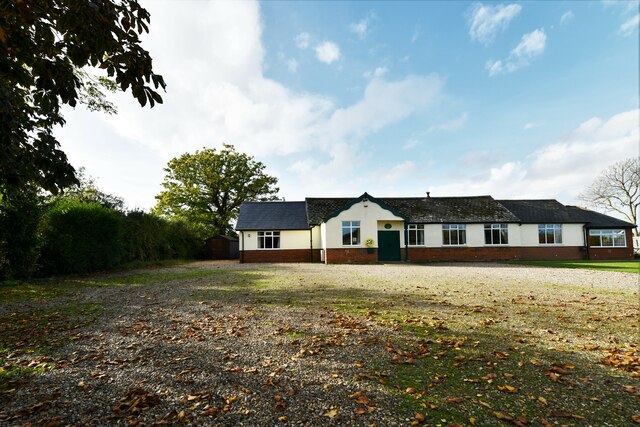
Denton is a small village located in Norfolk, England. Situated approximately 20 miles southeast of the city of Norwich, it is part of the South Norfolk district. With a population of around 500 residents, Denton offers a peaceful and close-knit community atmosphere.

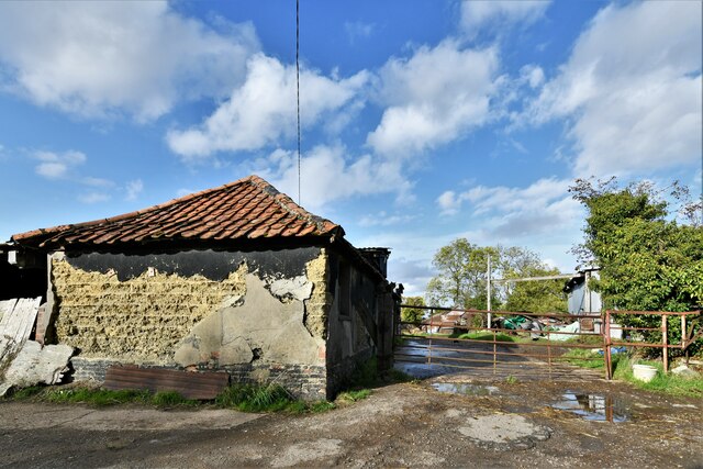
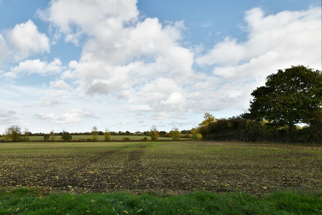
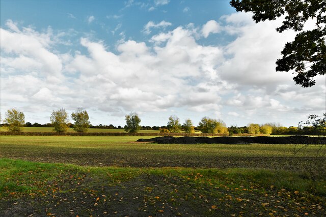
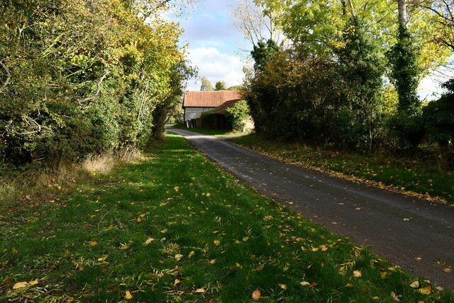
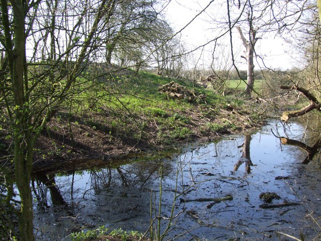
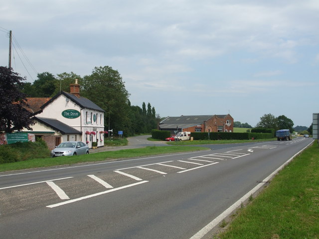
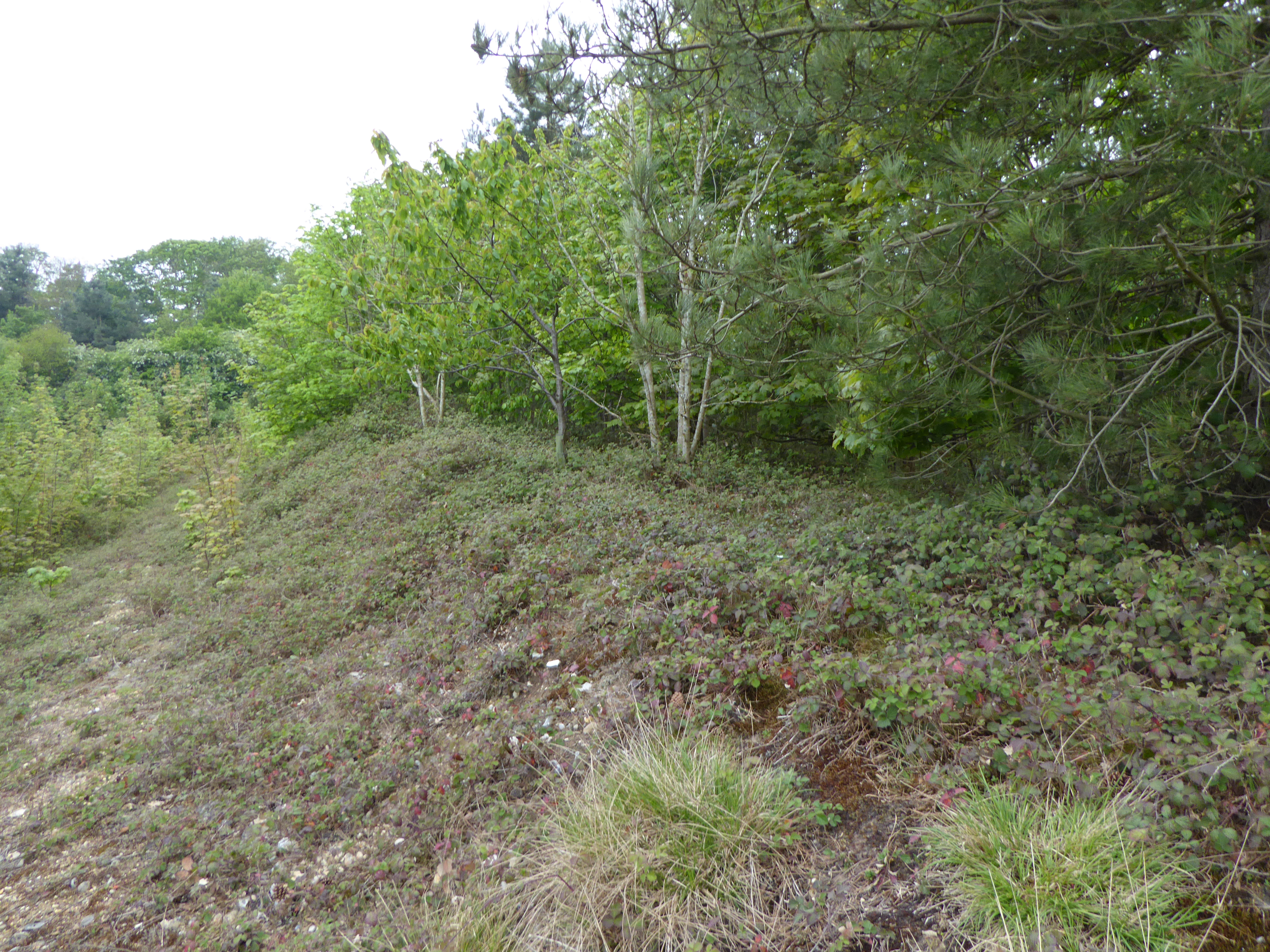
The village is known for its picturesque countryside, featuring rolling hills, lush green fields, and charming country lanes. It is surrounded by agricultural land, predominantly used for farming activities such as crop cultivation and livestock rearing. This rural setting offers residents and visitors ample opportunities for outdoor activities such as walking, cycling, and horseback riding.

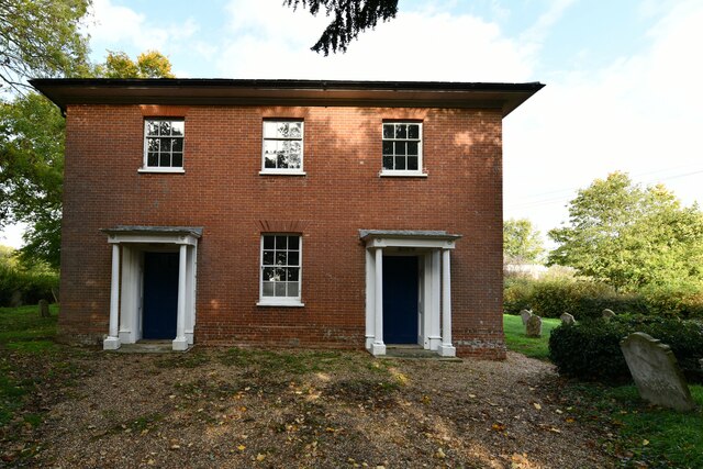
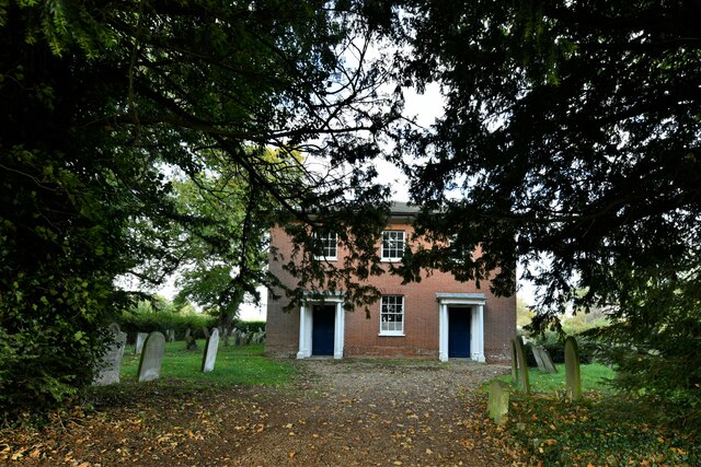
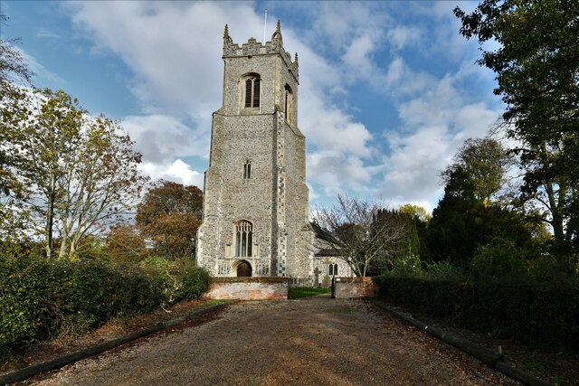
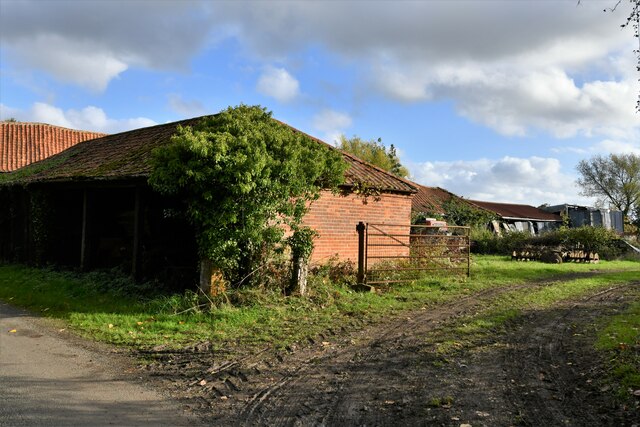
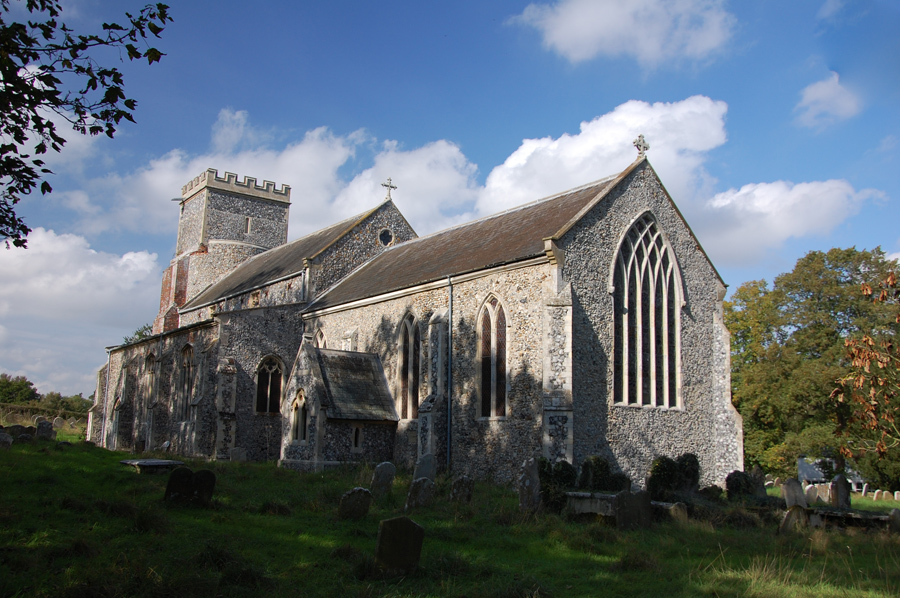
Denton boasts a rich history, with evidence of settlements dating back to the Roman period. The village is home to St. Mary's Church, an ancient place of worship that showcases stunning architecture and serves as a reminder of Denton's heritage. Additionally, there are several historic buildings scattered throughout the village, including traditional thatched cottages and timber-framed houses, adding to its rustic charm.

Despite its small size, Denton provides essential amenities for its residents, including a village hall, primary school, and a local pub. The community spirit is evident through various events and gatherings organized throughout the year, fostering a strong sense of belonging.

Overall, Denton offers a tranquil and idyllic setting, perfect for those seeking a quiet retreat in the Norfolk countryside. Its rich history, scenic landscapes, and close community make it an attractive place to live or visit.

If you have any feedback on the listing, please let us know in the comments section below.
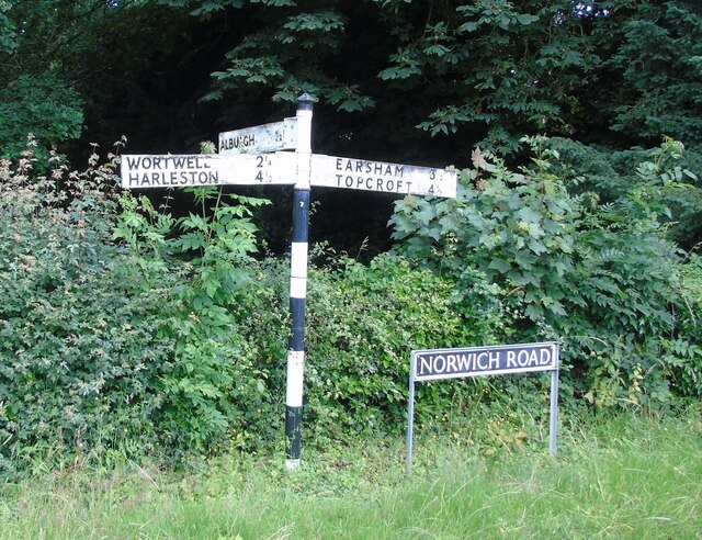
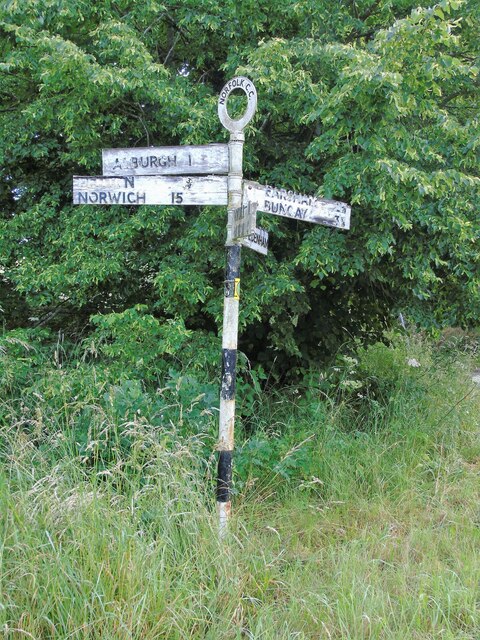
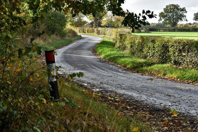
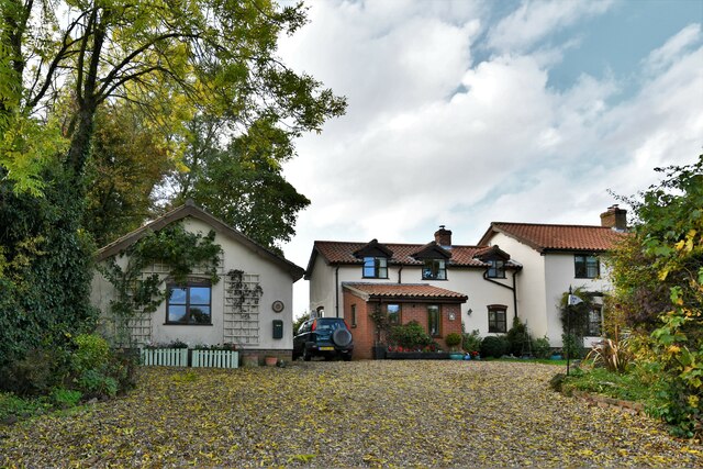
Denton Images

Images are sourced within 2km of 52.446136/1.3530387 or Grid Reference TM2788. Thanks to Geograph Open Source API. All images are credited.

Direction Sign – Signpost on Norwich Road, Denton Located on the north side of the T junction of Norwich Road and Chapel Hill in Denton parish. 3 arms and cap finial. See also <a title="https://www.geograph.org.uk/photo/4166781" href="https://www.geograph.org.uk/photo/4166781">Link</a>.

Milestone Society National ID: NO_TM2788
Direction Sign – Signpost on Norwich Road, Denton
Located on the north side of the T junction of Norwich Road and Chapel Hill in Denton parish. 3 arms and cap finial. See also Link. Milestone Society National ID: NO_TM2788
Direction Sign – Signpost on Danacre Road, Denton Located on the northeast side of the crossroads of Denton Road, Danacre Road and Alburgh Road in Denton parish. 5 arms and annulus finial. See also <a title="https://www.geograph.org.uk/photo/4167419" href="https://www.geograph.org.uk/photo/4167419">Link</a>.

Milestone Society National ID: NO_TM2887
Direction Sign – Signpost on Danacre Road, Denton
Located on the northeast side of the crossroads of Denton Road, Danacre Road and Alburgh Road in Denton parish. 5 arms and annulus finial. See also Link. Milestone Society National ID: NO_TM2887
Denton: Denton Road
Denton: Denton Road
Denton: Denton Road
Denton: Denton Road
Denton: 'Rose Cottage' and two other dwellings
Denton: Skinners Meadow
Denton: 'Jasmine Cottage'
Denton: The community centre
Denton United Reformed Church
Denton: Haggards Farm
Denton: Crop beginning to show
Topcroft Street: Misery Corner
Alburgh, All Saints Church: Western aspect
Topcroft Street, Misery Corner Manor Farm Road
Denton: Paynes Hill
Denton: Paynes Hill
Denton: Paynes Hill Farm
Show me another place!

Denton is located at Grid Ref: TM2788 (Lat: 52.446136, Lng: 1.3530387)

Administrative County: Norfolk

District: South Norfolk

Police Authority: Norfolk

What 3 Words

///heartburn.performs.surveyed. Near Bungay, Suffolk

Nearby Locations

Denton Denton

Related Wikis

Denton, Norfolk

Denton is a village and civil parish in the English county of Norfolk. Denton is located 3.8 miles north-east of Harleston and 13 miles south of Norwich...

Denton Castle

Denton Castle is a motte and bailey castle built in the village of Denton, Norfolk, England. == History == Denton Castle was built after 1088, following...

Alburgh

Alburgh is a village and civil parish in the English county of Norfolk. It lies about four miles (6 km) north-east of Harleston and 16 miles (26 km) south...

Homersfield railway station

Homersfield was a railway station which served the village of Homersfield in Suffolk, England, although the station was located in Alburgh, across the...

Flixton Quarry

Flixton Quarry is a 0.7 hectares (1.7 acres) geological Site of Special Scientific Interest 3.75 miles (6.04 km) south-west of Bungay in the English county...
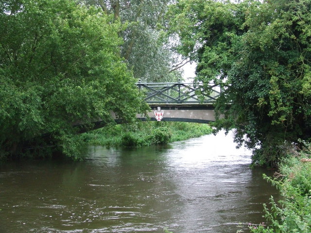
Homersfield Bridge

Homersfield Bridge is a road bridge across the River Waveney between Norfolk and Suffolk, and stands partly in the civil parishes of Alburgh and Wortwell...

Homersfield

Homersfield, also known as St Mary, South Elmham, is a village and civil parish in the north of the English county of Suffolk. It is in the East Suffolk...

Wortwell railway station

Wortwell was a station in the small hamlet of Wortwell, Norfolk. It was opened in 1855, as part of the Waveney Valley Line between Tivetshall and Beccles...

Nearby Amenities

Located within 500m of 52.446136,1.3530387
Chapel Hill, adj
Naptan AtcoCode: 2900D0112
Naptan Bearing: N
Naptan BusStopType: CUS
Naptan CommonName: Chapel Hill
Naptan Indicator: adj
Naptan Locality: Denton
Naptan NaptanCode: nfoamdmw
Naptan Street: Norwich Road
Naptan Verified: no
Source: naptan_import
Lat/Long: 52.44644/1.3532004
Middle Road, opp
Naptan AtcoCode: 2900D0116
Naptan Bearing: N
Naptan BusStopType: CUS
Naptan CommonName: Middle Road
Naptan Indicator: opp
Naptan Landmark: Middle Road
Naptan Locality: Denton
Naptan NaptanCode: nfoamdpd
Naptan Street: Trunch Hill
Naptan Verified: no
Source: naptan_import
Lat/Long: 52.4435421/1.3526423
Chapel Hill, opp
Naptan AtcoCode: 2900D012
Naptan Bearing: S
Naptan BusStopType: CUS
Naptan CommonName: Chapel Hill
Naptan Indicator: opp
Naptan Landmark: Chapel Hill
Naptan Locality: Denton
Naptan NaptanCode: nfoamdpt
Naptan ShortCommonName: Chapel Hill
Naptan Street: Norwich Road
Naptan Verified: no
Source: naptan_import
Lat/Long: 52.4464367/1.3533333
Middle Road, adj
Naptan AtcoCode: 2900D016
Naptan Bearing: S
Naptan BusStopType: CUS
Naptan CommonName: Middle Road
Naptan Indicator: adj
Naptan Landmark: Middle Road
Naptan Locality: Denton
Naptan NaptanCode: nfoamdtm
Naptan Street: Trunch Hill
Naptan Verified: no
Source: naptan_import
Lat/Long: 52.443576/1.3527184
Information: board
Tourism: information
Lat/Long: 52.4487308/1.3552219
Telephone
Lat/Long: 52.4487671/1.3552392
Recycling
Lat/Long: 52.4478108/1.3552066
Bench
Backrest: yes
Colour: brown
Material: wood
Seats: 3
Lat/Long: 52.4459537/1.3582117
Bench
Backrest: yes
Colour: brown
Material: wood
Seats: 3
Lat/Long: 52.4460598/1.3581057
Bench
Backrest: yes
Colour: brown
Material: wood
Seats: 3
Lat/Long: 52.4477183/1.3545011
Bench
Backrest: yes
Colour: brown
Material: wood
Seats: 3
Lat/Long: 52.4478132/1.3545876
Ford: yes
Lat/Long: 52.4422067/1.3516685
Ford: yes
Lat/Long: 52.4423269/1.3502167
Post Box
Operator: Royal Mail
Operator Wikidata: Q638098
Post Box Mounting: brick_pillar
Post Box Type: wall
Ref: IP20 7022
Royal Cypher: GR
Royal Cypher Wikidata: Q33102273
Lat/Long: 52.4463302/1.3531038
Denton
Place: village
Lat/Long: 52.4470157/1.3539845
Power: pole
Lat/Long: 52.4465833/1.346125
Power: pole
Lat/Long: 52.4464544/1.3471824
Power: pole
Lat/Long: 52.4463233/1.3482796
Power: pole
Lat/Long: 52.4461999/1.3492538
Defibrillator
Defibrillator Location: outside Denton Village Hall
Emergency: defibrillator
Indoor: no
Lat/Long: 52.4488649/1.3546932
Entrance: yes
Lat/Long: 52.4488769/1.3546987
The data included in this document is from www.openstreetmap.org. The data is made available under ODbL.

Have you been to Denton?

Leave your review of Denton below (or comments, questions and feedback).