Arrad Foot

Settlement in Lancashire South Lakeland

England

Arrad Foot

Cumbrian landscape A patchwork of grassy fields and low hills in the distance
Cumbrian landscape Credit: Eirian Evans

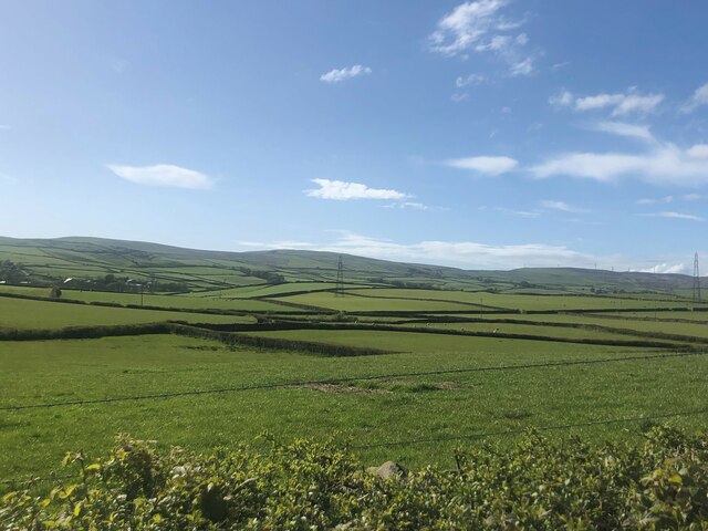
Arrad Foot is a small hamlet located in the county of Lancashire, England. Situated near the southern boundary of the Lake District National Park, it lies about 2 miles south-east of the town of Ulverston. Despite its small size, Arrad Foot enjoys a picturesque setting, surrounded by lush green fields and rolling countryside.

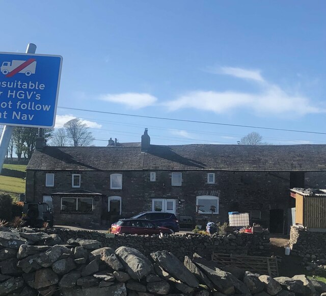
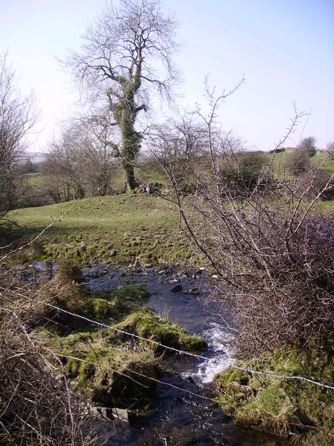
The hamlet is primarily residential, with a small number of houses and cottages scattered throughout the area. It is known for its peaceful and rural atmosphere, making it an ideal destination for those seeking tranquility away from the hustle and bustle of city life. The River Crake flows nearby, giving residents and visitors the opportunity to enjoy leisurely walks along its banks.

While Arrad Foot may lack major amenities, the nearby town of Ulverston provides easy access to essential services such as shops, schools, and healthcare facilities. Additionally, the hamlet benefits from its proximity to the Lake District, a popular tourist destination renowned for its stunning landscapes and outdoor recreational activities. Visitors to Arrad Foot can easily explore the surrounding area and partake in activities such as hiking, cycling, and boating.

Overall, Arrad Foot offers a charming and peaceful retreat for residents and visitors alike, with its scenic beauty and close proximity to both nature and urban amenities making it an attractive place to live or visit.

If you have any feedback on the listing, please let us know in the comments section below.
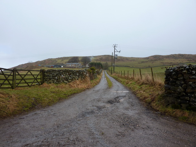
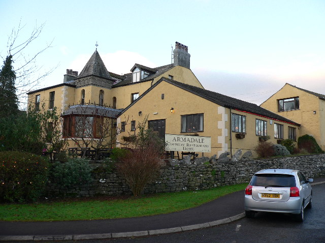
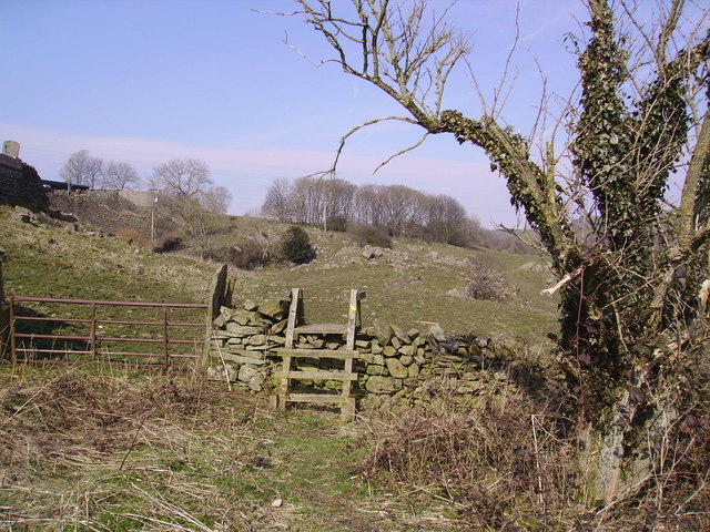
Arrad Foot Images

Images are sourced within 2km of 54.217862/-3.065049 or Grid Reference SD3080. Thanks to Geograph Open Source API. All images are credited.

Cumbrian landscape A patchwork of grassy fields and low hills in the distance
Cumbrian landscape
A patchwork of grassy fields and low hills in the distance
Mansriggs Farm
Mansriggs Farm
The Sir John Barrow Monument (aka the Hoad Monument) The monument, on Hoad Hill near Ulverston in the Furness area of Cumbria in North-west England, was erected in 1850 to commemorate Sir John Barrow (1764-1848), a founder member of the Royal Geographical Society. The monument has been restored since this photograph was taken.
The Sir John Barrow Monument (aka the Hoad Monument)
The monument, on Hoad Hill near Ulverston in the Furness area of Cumbria in North-west England, was erected in 1850 to commemorate Sir John Barrow (1764-1848), a founder member of the Royal Geographical Society. The monument has been restored since this photograph was taken.
Old Milestone by A590, Causeway End The Milestone is located beneath Hoad Hill on the East side of the road.  Parish of Ulverston (South Lakeland District). Carved stone post, Lancs County Council stone triangle design, erected by the County Council in the 19th/20th Century. 

Inscription reads:-  
TO / ULVERSTON 1 MILE / BARROW 9¼  : : TO / GRANGE 14¾  MLS / KENDAL 25  / LANCASTER 36 : : ULVERSTON

Milestone Society National ID: LA_LABA36
Old Milestone by A590, Causeway End
The Milestone is located beneath Hoad Hill on the East side of the road.  Parish of Ulverston (South Lakeland District). Carved stone post, Lancs County Council stone triangle design, erected by the County Council in the 19th/20th Century.  Inscription reads:- TO / ULVERSTON 1 MILE / BARROW 9¼ : : TO / GRANGE 14¾ MLS / KENDAL 25 / LANCASTER 36 : : ULVERSTON Milestone Society National ID: LA_LABA36
Boggy Field Looking towards Arad Foot from the mossland near Causeway End.
Boggy Field
Looking towards Arad Foot from the mossland near Causeway End.
Gate and Stile Public Footpath near Mansriggs Farm
Gate and Stile
Public Footpath near Mansriggs Farm
Beck near Bowstead Gates From the road near Benn Cragg
Beck near Bowstead Gates
From the road near Benn Cragg
Low Scathwaite In the low fells between Ulverston and Spark Bridge
Low Scathwaite
In the low fells between Ulverston and Spark Bridge
Ben Crag Ben Crag from footpath to High Scathwaite
Ben Crag
Ben Crag from footpath to High Scathwaite
Great Oath Hill On the skyline.
Great Oath Hill
On the skyline.
Converted farm building at The Falls
Road to The Alps
Road to The Alps
Alpine Road
Alpine Road
Footpath to Newlands
Alpine Road
Alpine Road
Hoad Hill View northwards from the top of the Sir John Barrow Monument.
The line across the middle of the photo is the track to the monument. The Coniston Fells are in the background.
Hoad Hill
View northwards from the top of the Sir John Barrow Monument. The line across the middle of the photo is the track to the monument. The Coniston Fells are in the background.
The Alps
The Alps
A road to Newland Bottom
Show me another place!

Arrad Foot is located at Grid Ref: SD3080 (Lat: 54.217862, Lng: -3.065049)

Administrative County: Cumbria

District: South Lakeland

Police Authority: Cumbria

What 3 Words

///reflector.pave.fears. Near Ulverston, Cumbria

Nearby Locations

Arrad Foot

Related Wikis

Arrad Foot

Arrad Foot is a hamlet in South Lakeland, Cumbria, England. The hamlet is situated on a minor road just off the A590 road, with the village of Greenodd...

Mansriggs

Mansriggs is a settlement and civil parish in the South Lakeland district, in the county of Cumbria, England. Because of its small population, in the 2011...

Greenodd railway station

Greenodd railway station was on the route between Ulverston and Lakeside, built by the Furness Railway. It served the village of Greenodd, then in Lancashire...

St Mary's Church, Penny Bridge

St Mary's Church is on a site overlooking the villages of Penny Bridge and Greenodd, in the parish of Egton with Newland, Cumbria, England. It is an active...

Egton with Newland

Egton with Newland, sometimes written as "Egton-with-Newland", is a civil parish in the South Lakeland district of the English county of Cumbria. It includes...

Greenodd

Greenodd is a village in the Furness area of the county of Cumbria, England, but within the historical county of Lancashire. For local government purposes...

River Crake

The River Crake is a short river in the English Lake District. The name probably derives from the Celtic languages (most likely Brythonic languages; ie...

Hoad Monument

Hoad Monument (officially called the Sir John Barrow Monument) is a 100-foot (30 m) tower at the top of the 436-foot (133 m) Hoad Hill, near Ulverston...

Nearby Amenities

Located within 500m of 54.217862,-3.065049
Bus Stop
The Race Horse Inn (N bound)
Naptan AtcoCode: 090079211203
Naptan Bearing: N
Naptan BusStopType: CUS
Naptan CommonName: The Race Horse Inn (N bound)
Naptan Indicator: o/s
Naptan Landmark: The Race Horse Inn
Naptan NaptanCode: cumdgwpg
Naptan Street: No name
Naptan Verified: no
Source: naptan_import
Lat/Long: 54.2189964/-3.0627429
Bus Stop
The Race Horse Inn (S bound)
Naptan AtcoCode: 090079213304
Naptan Bearing: S
Naptan BusStopType: CUS
Naptan CommonName: The Race Horse Inn (S bound)
Naptan Indicator: opp
Naptan Landmark: The Race Horse Inn
Naptan NaptanCode: cumdgwpt
Naptan Street: No name
Naptan Verified: no
Source: naptan_import
Lat/Long: 54.2190075/-3.0625131
Noexit: yes
Lat/Long: 54.2170755/-3.0633874
Parking
Access: yes
Fee: no
Parking: layby
Lat/Long: 54.2134797/-3.0652392
Power: pole
Lat/Long: 54.2211213/-3.0609011
Power: pole
Lat/Long: 54.2203403/-3.0608226
Power: pole
Lat/Long: 54.2211255/-3.0608868
Power: pole
Lat/Long: 54.2205988/-3.0615405
Power: pole
Lat/Long: 54.2199679/-3.0623414
Power: pole
Lat/Long: 54.2201569/-3.063083
Power: pole
Lat/Long: 54.2205766/-3.0646707
Power: pole
Lat/Long: 54.2208267/-3.0655906
Power: pole
Lat/Long: 54.2197636/-3.0607561
Power: pole
Lat/Long: 54.218884/-3.0606634
Power: pole
Lat/Long: 54.2182502/-3.0605683
Power: pole
Lat/Long: 54.2170884/-3.0605517
Power: pole
Lat/Long: 54.2162656/-3.0605255
Power: pole
Lat/Long: 54.2154721/-3.0604899
Power: pole
Lat/Long: 54.2147035/-3.0604828
Power: pole
Lat/Long: 54.2160016/-3.0596818
Power: pole
Lat/Long: 54.215675/-3.0584672
Power: pole
Lat/Long: 54.2161989/-3.0665092
Power: pole
Lat/Long: 54.2168549/-3.0651877
Power: pole
Lat/Long: 54.2168369/-3.0644152
The data included in this document is from www.openstreetmap.org. The data is made available under ODbL.

Have you been to Arrad Foot?

Leave your review of Arrad Foot below (or comments, questions and feedback).