Butterby Wood
Wood, Forest in Durham
England
Butterby Wood

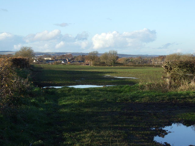
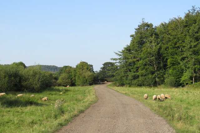
Butterby Wood is a picturesque forest located in the county of Durham, England. Spread across an area of approximately 50 acres, it is known for its natural beauty and diverse wildlife. The wood is situated near the village of Butterby and is easily accessible for both locals and tourists.
The wood is predominantly composed of deciduous trees, including oak, beech, and birch, creating a vibrant and colorful landscape throughout the year. It is particularly captivating during the autumn season when the leaves change their hues, providing a breathtaking display of red, orange, and gold.
With its dense canopy and well-maintained trails, Butterby Wood offers the perfect environment for leisurely walks and nature exploration. Visitors can immerse themselves in the tranquility of the forest, surrounded by the soothing sounds of birds chirping and leaves rustling in the wind.
The wood is also home to a wide variety of wildlife, from small mammals like squirrels and rabbits to a diverse range of bird species. Nature enthusiasts can spot woodpeckers, owls, and even the occasional deer roaming freely within the wood.
Butterby Wood is not only a sanctuary for flora and fauna but also serves as an educational hub. It hosts various guided tours and educational programs, where visitors can learn about the forest's ecological importance and conservation efforts.
Overall, Butterby Wood offers a mesmerizing natural escape for individuals seeking solace in the heart of Durham, combining tranquility, natural beauty, and an opportunity to connect with the wonders of the natural world.
If you have any feedback on the listing, please let us know in the comments section below.
Butterby Wood Images
Images are sourced within 2km of 54.741617/-1.5585312 or Grid Reference NZ2838. Thanks to Geograph Open Source API. All images are credited.


Butterby Wood is located at Grid Ref: NZ2838 (Lat: 54.741617, Lng: -1.5585312)
Unitary Authority: County Durham
Police Authority: Durham
What 3 Words
///acoustics.kettles.reforming. Near Bowburn, Co. Durham
Nearby Locations
Related Wikis

Butterby Oxbow
Butterby Oxbow is a Site of Special Scientific Interest in the Durham City district of County Durham, England. It consists of a former meander of the...

Croxdale Hall
Croxdale Hall is a privately owned country mansion situated at Croxdale near Sunderland Bridge, County Durham. It is a Grade I listed building. == Ownership... ==
Sunderland Bridge (village)
Sunderland Bridge is a village and former civil parish, now in the parish of Croxdale and Hett, in the County Durham district, in the ceremonial county...
Bowburn
Bowburn is a village in County Durham, England. It is situated about 3 miles (4.8 km) to the south-east of Durham, on the A177, between Coxhoe to the south...

Houghall
Houghall [pron: /ˈhɒfl/] is a hamlet in County Durham, in England. It is situated approximately 1.5 miles (2.4 km) to the south of Durham city centre....
High Shincliffe
High Shincliffe is a village in County Durham, England. It is situated about two miles south-east of Durham City, on the A177 road to Stockton-on-Tees...

Croxdale and Hett
Croxdale and Hett is a civil parish in County Durham, England. It is situated approximately four miles south of Durham. The population of the civil parish...

Hett, County Durham
Hett is a village and former civil parish, now in the parish of Croxdale and Hett, in the County Durham district, in the ceremonial county of Durham, England...
Nearby Amenities
Located within 500m of 54.741617,-1.5585312Have you been to Butterby Wood?
Leave your review of Butterby Wood below (or comments, questions and feedback).