Pit Copse

Wood, Forest in Wiltshire New Forest

England

Pit Copse

Forest lawn on lower edge of Brook Wood
Forest lawn on lower edge of Brook Wood Credit: David Martin

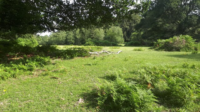
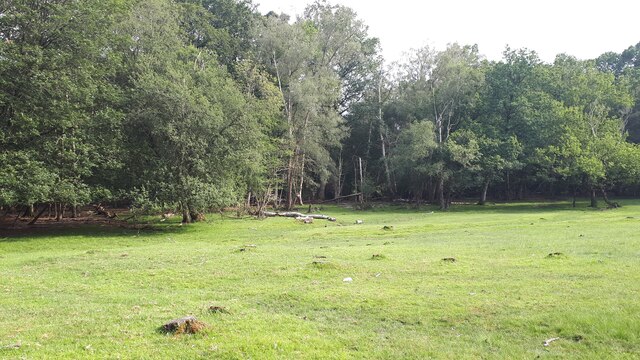
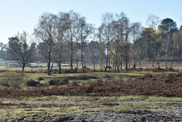
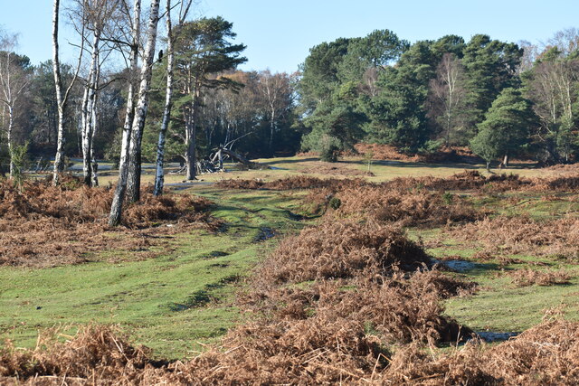
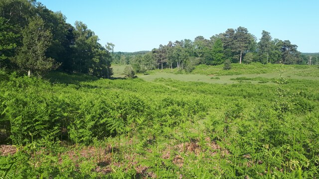
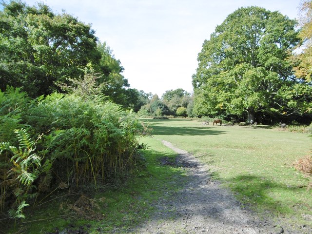
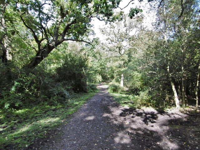
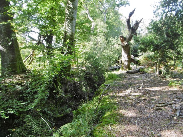
Pit Copse is a picturesque woodland area located in the county of Wiltshire, England. Situated near the village of Pitton, it covers an area of approximately 100 acres and is renowned for its natural beauty and rich biodiversity. The copse is primarily composed of deciduous trees, including oak, beech, and ash, which create a dense canopy that provides shade and shelter for a variety of flora and fauna.

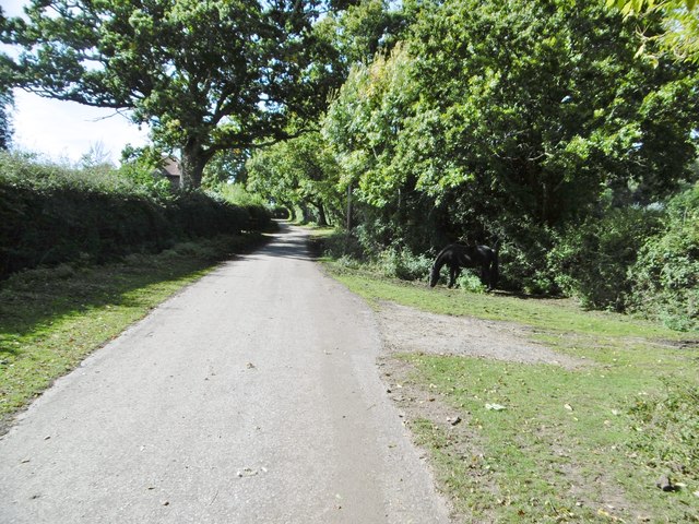
Within Pit Copse, visitors can explore a network of walking trails that wind through the woodland, offering stunning views of the surrounding countryside and an opportunity to immerse oneself in the peaceful ambiance of nature. The well-maintained paths are suitable for all abilities, making it a popular destination for families, nature enthusiasts, and dog walkers.

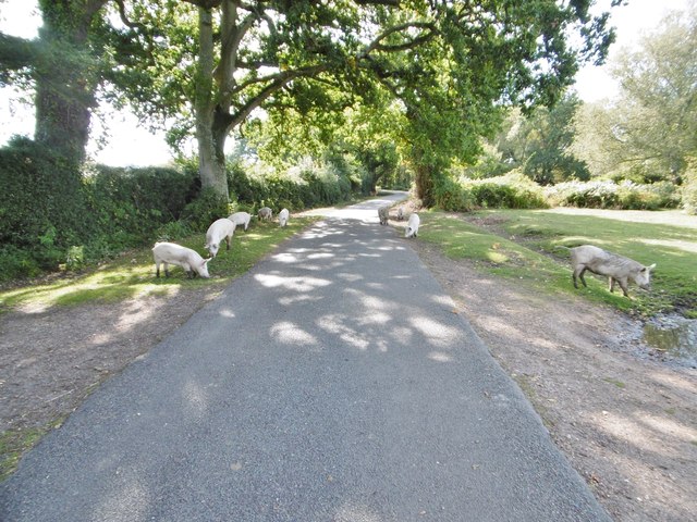
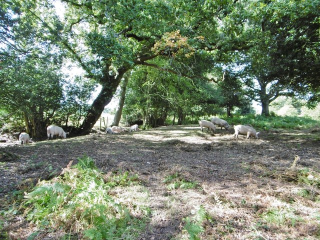
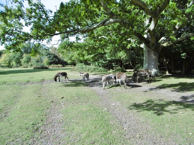
The copse is home to a diverse range of wildlife, from small mammals such as squirrels, rabbits, and badgers, to a multitude of bird species including woodpeckers, owls, and songbirds. In spring, the woodland floor is carpeted with vibrant wildflowers, attracting butterflies and other pollinators.

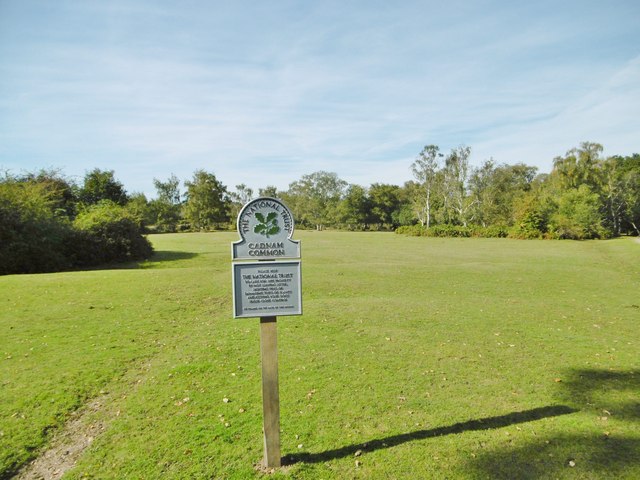
Pit Copse is not only cherished for its natural beauty but also for its historical significance. Nestled within the woodland is a Bronze Age barrow, providing a glimpse into the area's ancient past. The copse is also part of a larger conservation area, managed by local authorities and nature organizations, to protect its unique ecosystem and ensure its preservation for generations to come.

Overall, Pit Copse offers a tranquil escape from the hustle and bustle of modern life, inviting visitors to reconnect with nature and appreciate the wonders of the British countryside.

If you have any feedback on the listing, please let us know in the comments section below.

Pit Copse Images

Images are sourced within 2km of 50.936766/-1.5997175 or Grid Reference SU2815. Thanks to Geograph Open Source API. All images are credited.

Forest lawn on lower edge of Brook Wood
View across clearing in Brook Wood
Signage - M27 southbound
View across Half Moon Common
Grassy path across Half Moon Common
Bracken-filled valley adjacent to Half Moon Common Former boundaries have been removed, making this area continuous with the more open and grassy Half Moon Common.
Bracken-filled valley adjacent to Half Moon Common
Former boundaries have been removed, making this area continuous with the more open and grassy Half Moon Common.
Direction Sign – Signpost on Penn Common, Bramshaw Located in the centre of the crossroads at Penn Common in Bramshaw parish. 3 arms and disc finial.

Milestone Society National ID: HA_SU2716
Direction Sign – Signpost on Penn Common, Bramshaw
Located in the centre of the crossroads at Penn Common in Bramshaw parish. 3 arms and disc finial. Milestone Society National ID: HA_SU2716
Newbridge, cattle grid At the south-eastern boundary of Cadnam Common.
Newbridge, cattle grid
At the south-eastern boundary of Cadnam Common.
Cadnam Common, National Trust marker Cadnam Common is an "adjacent common", sharing geographical and ecological features with the New Forest, but not crown land; this common is owned by the National Trust. <span class="nowrap"><a title="http://www.nationaltrust.org.uk/new-forest-northern-commons/" rel="nofollow ugc noopener" href="http://www.nationaltrust.org.uk/new-forest-northern-commons/">Link</a><img style="margin-left:2px;" alt="External link" title="External link - shift click to open in new window" src="https://s1.geograph.org.uk/img/external.png" width="10" height="10"/></span>
Cadnam Common, National Trust marker
Cadnam Common is an "adjacent common", sharing geographical and ecological features with the New Forest, but not crown land; this common is owned by the National Trust. LinkExternal link
Cadnam Common, pannage pigs A herd of eleven pigs, doing what they should do in the pannage season - forage for acorns and beech mast, which can be poisonous to other livestock. <span class="nowrap"><a title="http://www.thenewforest.co.uk/discover/pigs.aspx#" rel="nofollow ugc noopener" href="http://www.thenewforest.co.uk/discover/pigs.aspx#">Link</a><img style="margin-left:2px;" alt="External link" title="External link - shift click to open in new window" src="https://s1.geograph.org.uk/img/external.png" width="10" height="10"/></span>
Cadnam Common, pannage pigs
A herd of eleven pigs, doing what they should do in the pannage season - forage for acorns and beech mast, which can be poisonous to other livestock. LinkExternal link
Cadnam, Busketts Yard Stables on Cadnam Lane.
Cadnam, Busketts Yard
Stables on Cadnam Lane.
Cadnam Common, pannage pigs On the western boundary of the common; pigs doing what is expected of them at this time of year - forage for fallen acorns, which can be poisonous to other livestock. <span class="nowrap"><a title="http://www.thenewforest.co.uk/discover/pigs.aspx#" rel="nofollow ugc noopener" href="http://www.thenewforest.co.uk/discover/pigs.aspx#">Link</a><img style="margin-left:2px;" alt="External link" title="External link - shift click to open in new window" src="https://s1.geograph.org.uk/img/external.png" width="10" height="10"/></span>
Cadnam Common, pannage pigs
On the western boundary of the common; pigs doing what is expected of them at this time of year - forage for fallen acorns, which can be poisonous to other livestock. LinkExternal link
Cadnam Common An "adjacent common", similar to the New Forest physically and ecologically, but not Crown land; this common is owned by the National Trust. <span class="nowrap"><a title="http://www.nationaltrust.org.uk/new-forest-northern-commons/" rel="nofollow ugc noopener" href="http://www.nationaltrust.org.uk/new-forest-northern-commons/">Link</a><img style="margin-left:2px;" alt="External link" title="External link - shift click to open in new window" src="https://s1.geograph.org.uk/img/external.png" width="10" height="10"/></span>
Cadnam Common
An "adjacent common", similar to the New Forest physically and ecologically, but not Crown land; this common is owned by the National Trust. LinkExternal link
Cadnam Common, donkeys
Cadnam, Storm's Farm Stables overlooking Cadnam Common.
Cadnam, Storm's Farm
Stables overlooking Cadnam Common.
Cadnam, byway From Storm's Farm to Kewlake Lane.
Cadnam, byway
From Storm's Farm to Kewlake Lane.
Cadnam, track Along the southern boundary of Cadnam Common.
Cadnam, track
Along the southern boundary of Cadnam Common.
Cadnam Common, ditch & embankment At the western boundary of the common.
Cadnam Common, ditch & embankment
At the western boundary of the common.
Show me another place!

Pit Copse is located at Grid Ref: SU2815 (Lat: 50.936766, Lng: -1.5997175)

Administrative County: Hampshire

District: New Forest

Police Authority: Hampshire

What 3 Words

///unity.lunge.crowd. Near Cadnam, Hampshire

Related Wikis

Bramshaw

Bramshaw is a small village and civil parish in Hampshire, England. It lies just inside the New Forest. The name Bramshaw means Bramble Wood. Until 1895...

Brook, New Forest

Brook is a hamlet in the civil parish of Bramshaw, in Hampshire, England. It lies just inside the New Forest. The hamlet contains a mix of 18th and 19th...

Copythorne

Copythorne is a village and civil parish in Hampshire, England, within the boundaries of the New Forest National Park. == Overview == Copythorne is in...

Copythorne Common

Copythorne Common is a 17-hectare (42-acre) nature reserve west of Southampton in Hampshire. It is managed by the Hampshire and Isle of Wight Wildlife...

Bartley Lodge

Bartley Lodge is a country house near Cadnam in Hampshire, England, within the boundaries of the New Forest National Park. It was built in the 18th century...

Landford Heath

Landford Heath (grid reference SU265178) is an 11.75 hectare biological Site of Special Scientific Interest near Landford in southeast Wiltshire, England...

Bartley, Hampshire

Bartley is a village in Hampshire, England, within the boundaries of the New Forest National Park, seven miles (11 km) west of Southampton. == Overview... ==

Cadnam

Cadnam is a village situated in Hampshire, England, within the boundaries of the New Forest National Park. The village has existed since the medieval period...

Nearby Amenities

Located within 500m of 50.936766,-1.5997175
Barrier: stile
Lat/Long: 50.9361152/-1.5996402
Barrier: cattle_grid
Lat/Long: 50.9400592/-1.6040992
Camera Angle: 15
Camera Direction: 300
Camera Mount: tree
Camera Type: dome
Height: 2
Man Made: surveillance
Surveillance: outdoor
Surveillance Type: camera
Surveillance Zone: entrance
Lat/Long: 50.9376884/-1.6027539
Access: private
Ele: 75
Natural: peak
Lat/Long: 50.9389761/-1.6017188
Ele: 48
Natural: peak
Lat/Long: 50.9364504/-1.5969002
The data included in this document is from www.openstreetmap.org. The data is made available under ODbL.

Have you been to Pit Copse?

Leave your review of Pit Copse below (or comments, questions and feedback).