Denholme Gate

Settlement in Yorkshire

England

Denholme Gate

Derelict Thornton Pressure Filters building, Close Head Lane, Thornton A sign above the entrance (see <a href="https://www.geograph.org.uk/photo/7034532">SE0832 : Derelict Thornton Pressure Filters building, Close Head Lane, Thornton</a>) reads:
"B.C.W.W.
THORNTON PRESSURE FILTERS
1926"
Derelict Thornton Pressure Filters building, Close Head Lane, Thornton Credit: habiloid

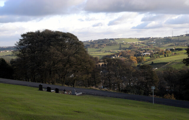
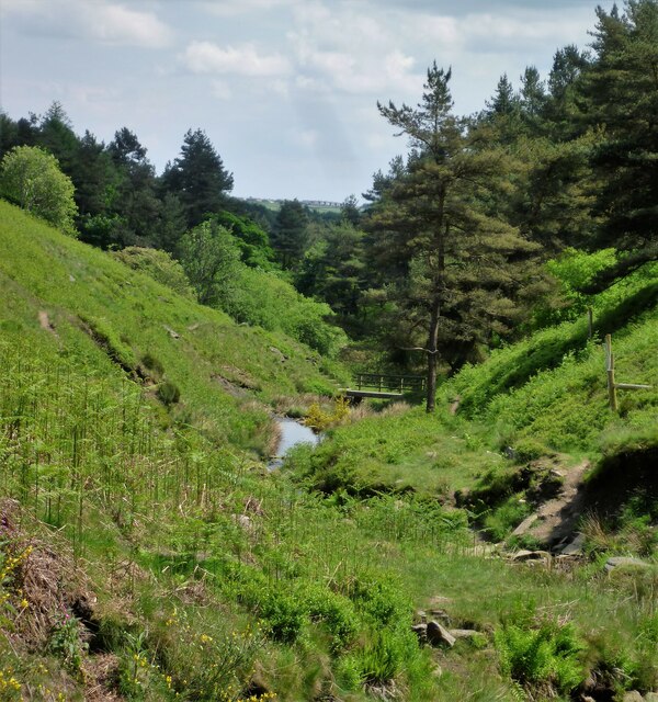
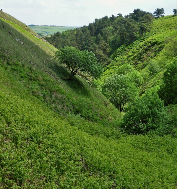
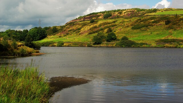
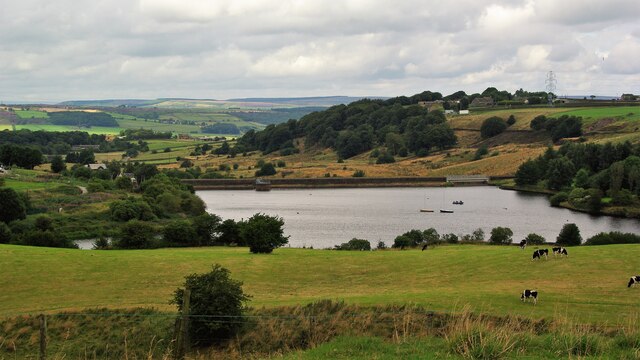
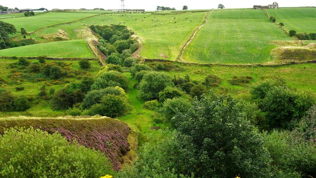
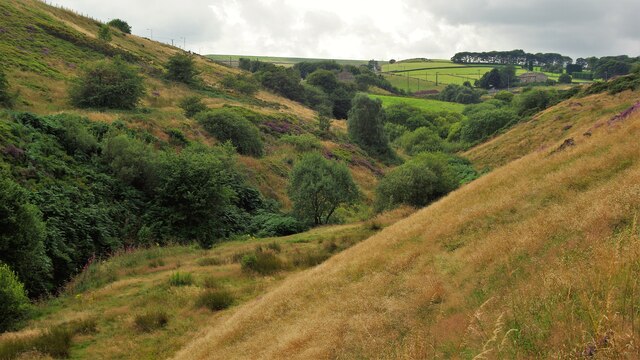
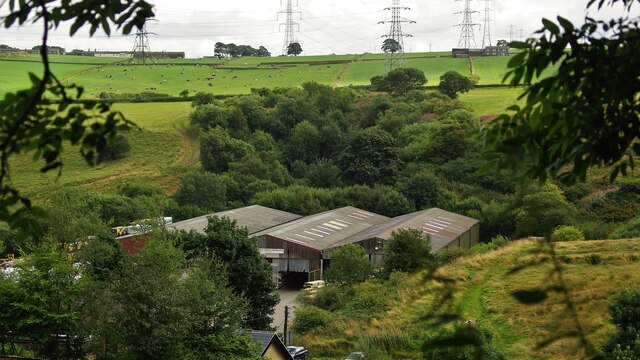
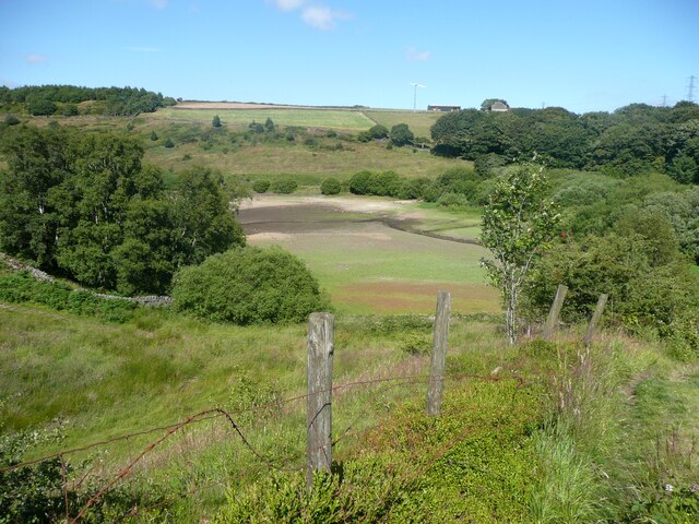
Denholme Gate is a small village located in the heart of West Yorkshire, England. Situated within the district of Bradford, it lies about 9 miles west of the city center. Nestled in the picturesque landscape of the South Pennines, Denholme Gate is surrounded by rolling hills and lush green meadows, offering breathtaking views of the countryside.

The village is known for its quaint charm and peaceful atmosphere, making it an ideal destination for those seeking a tranquil getaway. Its name derives from the old gate that once stood on the main road, serving as a boundary marker between Denholme and the neighboring village of Thornton. The gate has long since disappeared, but the name has remained.

Denholme Gate is primarily a residential area, with a small population that enjoys a close-knit community spirit. The village boasts a few amenities, including a local pub, a village hall, and a primary school, providing essential services for its residents. Nearby, there are also a number of picturesque walks and hiking trails, perfect for outdoor enthusiasts looking to explore the stunning countryside.

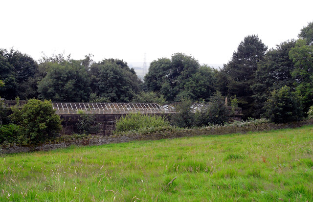
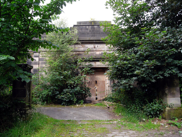
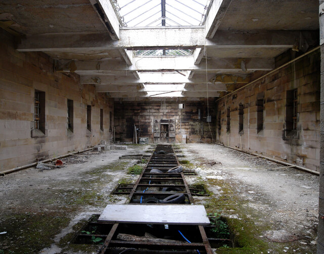
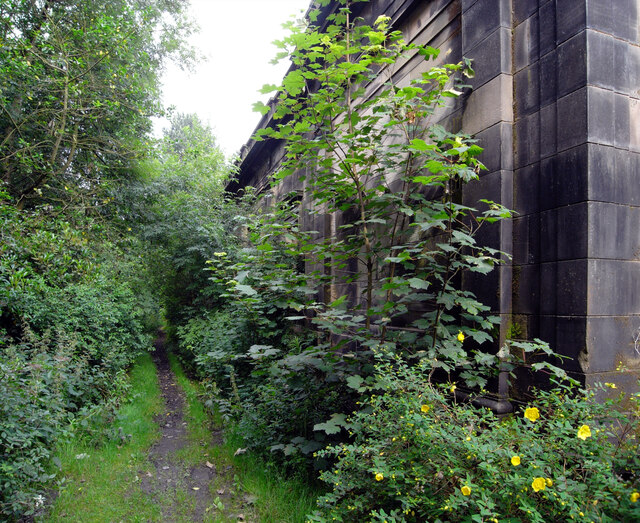
Despite its small size, Denholme Gate has a rich history. It was once a bustling center for the textile industry, with numerous mills dotting the landscape. However, like many other villages in the region, the decline of the textile industry led to the closure of these mills, transforming Denholme Gate into a peaceful residential area.

Overall, Denholme Gate offers a serene escape from the hustle and bustle of city life, providing a glimpse into the rural beauty and history of Yorkshire.

If you have any feedback on the listing, please let us know in the comments section below.

Denholme Gate Images

Images are sourced within 2km of 53.789216/-1.891893 or Grid Reference SE0732. Thanks to Geograph Open Source API. All images are credited.

Derelict Thornton Pressure Filters building, Close Head Lane, Thornton A sign above the entrance (see <a href="https://www.geograph.org.uk/photo/7034532">SE0832 : Derelict Thornton Pressure Filters building, Close Head Lane, Thornton</a>) reads:
"B.C.W.W.
THORNTON PRESSURE FILTERS
1926"
Derelict Thornton Pressure Filters building, Close Head Lane, Thornton
A sign above the entrance (see SE0832 : Derelict Thornton Pressure Filters building, Close Head Lane, Thornton) reads: "B.C.W.W. THORNTON PRESSURE FILTERS 1926"
Derelict Thornton Pressure Filters building, Close Head Lane, Thornton The sign above the entrance reads:
"B.C.W.W.
THORNTON PRESSURE FILTERS
1926"
Derelict Thornton Pressure Filters building, Close Head Lane, Thornton
The sign above the entrance reads: "B.C.W.W. THORNTON PRESSURE FILTERS 1926"
Inside the derelict Thornton Pressure Filters building, Close Head Lane, Thornton A sign above the entrance to the building (see <a href="https://www.geograph.org.uk/photo/7034532">SE0832 : Derelict Thornton Pressure Filters building, Close Head Lane, Thornton</a>) reads:
"B.C.W.W.
THORNTON PRESSURE FILTERS
1926"
Inside the derelict Thornton Pressure Filters building, Close Head Lane, Thornton
A sign above the entrance to the building (see SE0832 : Derelict Thornton Pressure Filters building, Close Head Lane, Thornton) reads: "B.C.W.W. THORNTON PRESSURE FILTERS 1926"
The side of the derelict Thornton Pressure Filters building, Close Head Lane, Thornton A sign above the entrance (see <a href="https://www.geograph.org.uk/photo/7034532">SE0832 : Derelict Thornton Pressure Filters building, Close Head Lane, Thornton</a>) reads:
"B.C.W.W.
THORNTON PRESSURE FILTERS
1926"
The side of the derelict Thornton Pressure Filters building, Close Head Lane, Thornton
A sign above the entrance (see SE0832 : Derelict Thornton Pressure Filters building, Close Head Lane, Thornton) reads: "B.C.W.W. THORNTON PRESSURE FILTERS 1926"
A view from Thornton Cemetery
Footbridge in Ogden Clough There are steps down to the bridge but after the crossing the path has no destination other than scrambling in the clough.
Footbridge in Ogden Clough
There are steps down to the bridge but after the crossing the path has no destination other than scrambling in the clough.
Ogden Clough from near Waterworks Cascade/Footbridge View down the clough
Ogden Clough from near Waterworks Cascade/Footbridge
View down the clough
Thornton Moor Reservoir View to the valve tower from the top of Hambleton Lane
Thornton Moor Reservoir
View to the valve tower from the top of Hambleton Lane
Soil Hill Mast View from footpath near Mount Zion Church Upper Brockholes
Soil Hill Mast
View from footpath near Mount Zion Church Upper Brockholes
The Promenade Ogden Water The road on top of the dam of the reservoir shortly after it was made over as 'Victorian'
The Promenade Ogden Water
The road on top of the dam of the reservoir shortly after it was made over as 'Victorian'
Doe Park Reservoir & Quarried Hill Top View to the site of Lowe Quarry above the reservoir
Doe Park Reservoir & Quarried Hill Top
View to the site of Lowe Quarry above the reservoir
Dam Wall of Doe Park Reservoir View North from Birk Hill
Dam Wall of Doe Park Reservoir
View North from Birk Hill
Old Railway Route to Thornton Wells Head Tunnel View from on top of Birk Hill Tunnel South of Denholme Station site. The cuttings leading into the tunnels are full of trees
Old Railway Route to Thornton Wells Head Tunnel
View from on top of Birk Hill Tunnel South of Denholme Station site. The cuttings leading into the tunnels are full of trees
Carperley Beck Valley View West from Station Sawmills. The level skyline in the centre is the dam of Thornton Moor Reservoir
Carperley Beck Valley
View West from Station Sawmills. The level skyline in the centre is the dam of Thornton Moor Reservoir
Station Sawmills Sawmills on the site of Denholme Railway Station Yard and the tree filled cutting leading to Birk Hill Tunnel beyond. The sawmills have in turn gone and this is now a housing estate.
Station Sawmills
Sawmills on the site of Denholme Railway Station Yard and the tree filled cutting leading to Birk Hill Tunnel beyond. The sawmills have in turn gone and this is now a housing estate.
View of the bed of Doe Park Reservoir, Denholme This was taken from Denholme Footpath 59. After a long period of mainly dry weather the bed is exposed in the upper parts of the reservoir.
View of the bed of Doe Park Reservoir, Denholme
This was taken from Denholme Footpath 59. After a long period of mainly dry weather the bed is exposed in the upper parts of the reservoir.
Denholme Footpath 59 Here the path is descending towards the footbridge over Denholme Beck.
Denholme Footpath 59
Here the path is descending towards the footbridge over Denholme Beck.
Denholme Footpath 57
Show me another place!

Denholme Gate is located at Grid Ref: SE0732 (Lat: 53.789216, Lng: -1.891893)

Division: West Riding

Unitary Authority: Bradford

Police Authority: West Yorkshire

What 3 Words

///escapes.oxidation.shared. Near Denholme, West Yorkshire

Related Wikis

Denholme Clough Fault

The Denholme Clough Fault is a small fault located in Denholme, England. The fault is approximately 500 metres (1,600 ft) long. The fault has produced...

Denholme railway station

Denholme railway station was a station on the Keighley-Queensbury section of the Queensbury Lines which ran between Keighley, Bradford and Halifax via...

Denholme

Denholme is a town and civil parish in the Bradford Metropolitan Borough, West Yorkshire, England. It is 8 miles (13 km) west of Bradford, 7 miles (11...

Ogden, West Yorkshire

Ogden in West Yorkshire, England, is a small hamlet 5.0 miles (8 km) north of Halifax. The hamlet falls within the Calderdale Ward of Illingworth and Mixenden...

Nearby Amenities

Located within 500m of 53.789216,-1.891893
Post Box
Operator: Royal Mail
Post Box Type: lamp
Ref: BD13 441
Royal Cypher: EIIR
Lat/Long: 53.7875518/-1.8866686
Bus Stop
Halifax Road Cragg Lane
Local Ref: 45023541
Naptan AtcoCode: 450023541
Naptan Bearing: NE
Naptan CommonName: Halifax Road Cragg Lane
Naptan Crossing: Cragg Lane
Naptan Indicator: Stop 45023541
Naptan Notes: OSR taken place 040805
Naptan PlusbusZoneRef: LEEDS
Naptan ShortCommonName: Cragg Lane
Naptan Street: Halifax Road
Naptan Verified: no
Shelter: yes
Source: naptan_import
Lat/Long: 53.7885811/-1.8936827
Bus Stop
Well Heads Keelham School
Local Ref: 45021045
Naptan AtcoCode: 450021045
Naptan Bearing: SW
Naptan CommonName: Well Heads Keelham School
Naptan Crossing: Brighouse Road
Naptan Indicator: Stop 45021045
Naptan Landmark: Keelham Primary School
Naptan Notes: OSR taken place 250805
Naptan PlusbusZoneRef: LEEDS
Naptan ShortCommonName: Keelham Primary Sch
Naptan Street: Well Heads
Naptan Verified: no
Source: naptan_import
Lat/Long: 53.7883006/-1.8872677
Bus Stop
Brighouse Road Denholme
Local Ref: 45021006
Naptan AtcoCode: 450021006
Naptan Bearing: SE
Naptan CommonName: Brighouse Road Denholme
Naptan Indicator: Stop 45021006
Naptan Landmark: Old Fort
Naptan Notes: OSR taken place 040805Stop reinstated for 697 service to Bradford
Naptan PlusbusZoneRef: LEEDS
Naptan ShortCommonName: Brgh Rd Cragg Ln
Naptan Street: Brighouse Road
Naptan Verified: no
Shelter: no
Source: naptan_import
Lat/Long: 53.7895168/-1.8902699
Bus Stop
Thornton Road Brighouse Road
Local Ref: 45021007
Naptan AtcoCode: 450021007
Naptan Bearing: NE
Naptan CommonName: Thornton Road Brighouse Road
Naptan Crossing: Brighouse Road
Naptan Indicator: Stop 45021007
Naptan Landmark: The Brown Cow PH
Naptan PlusbusZoneRef: LEEDS
Naptan ShortCommonName: Brighouse Road
Naptan Street: Thornton Road
Naptan Verified: no
Source: naptan_import
Lat/Long: 53.787508/-1.8855698
Bus Stop
Thornton Road Brighouse & Denholme Road
Bench: yes
Local Ref: 45023537
Naptan AtcoCode: 450023537
Naptan Bearing: SW
Naptan CommonName: Thornton Road Brighouse & Denholme Road
Naptan Crossing: Brig & Denholme Rd
Naptan Indicator: Stop 45023537
Naptan Landmark: Copper Kettle PH
Naptan PlusbusZoneRef: LEEDS
Naptan ShortCommonName: Brig & Denholme Rd
Naptan Street: Thornton Road
Shelter: yes
Source: naptan_import
Towards: Cullingworth, Denholme, Keighley
Lat/Long: 53.7869837/-1.8866404
Bus Stop
Halifax Road Thornton Road
Local Ref: 45023539
Naptan AtcoCode: 450023539
Naptan Bearing: S
Naptan CommonName: Halifax Road Thornton Road
Naptan Crossing: Thornton Road
Naptan Indicator: Stop 45023539
Naptan PlusbusZoneRef: LEEDS
Naptan ShortCommonName: Thornton Road
Naptan Street: Halifax Road
Naptan Verified: no
Shelter: no
Source: naptan_import
Lat/Long: 53.7851975/-1.8948496
Bus Stop
Halifax Road Cricket Ground
Local Ref: 45023540
Naptan AtcoCode: 450023540
Naptan Bearing: N
Naptan CommonName: Halifax Road Cricket Ground
Naptan Indicator: Stop 45023540
Naptan Notes: OSR taken place 040805
Naptan PlusbusZoneRef: LEEDS
Naptan ShortCommonName: Foreside Mill
Naptan Street: Halifax Road
Naptan Verified: yes
Ref: 45023540
Shelter: no
Source: naptan_import
Towards: Cullingworth, Denholme, Keighley
Lat/Long: 53.7858178/-1.8949543
Bus Stop
Halifax Road Smithy Hill
Kerb: raised
Local Ref: 45023542
Naptan AtcoCode: 450023542
Naptan Bearing: NE
Naptan CommonName: Halifax Road Smithy Hill
Naptan Crossing: Monarch Gate
Naptan Indicator: Stop 45023542
Naptan Notes: OSR taken place 040805
Naptan PlusbusZoneRef: LEEDS
Naptan ShortCommonName: Monarch Gate
Naptan Street: Smithy Hill
Naptan Verified: no
Shelter: no
Source: naptan_import
Lat/Long: 53.7916129/-1.8923593
Bus Stop
Halifax Road Denholme Gate Farm
Local Ref: 45023543
Naptan AtcoCode: 450023543
Naptan Bearing: N
Naptan CommonName: Halifax Road Denholme Gate Farm
Naptan Crossing: Smithy Hill
Naptan Indicator: Stop 45023543
Naptan Landmark: Denholme Gate Farm
Naptan PlusbusZoneRef: LEEDS
Naptan ShortCommonName: Smithy Hill
Naptan Street: Halifax Road
Naptan Verified: no
Shelter: yes
Source: naptan_import
Lat/Long: 53.7935078/-1.8914114
Bus Stop
Halifax Road Cragg Lane
Local Ref: 45051285
Naptan AtcoCode: 450051285
Naptan Bearing: SW
Naptan BusStopType: CUS
Naptan CommonName: Halifax Road Cragg Lane
Naptan Indicator: Stop 45051285
Naptan PlusbusZoneRef: LEEDS
Naptan ShortCommonName: Cragg Lane
Naptan Street: Halifax Road
Naptan Verified: no
Source: naptan_import
Lat/Long: 53.7884771/-1.8935209
Bus Stop
Smithy Hill Denholme
Local Ref: 45051286
Naptan AtcoCode: 450051286
Naptan Bearing: SW
Naptan BusStopType: CUS
Naptan CommonName: Smithy Hill Denholme
Naptan Indicator: Stop 45051286
Naptan PlusbusZoneRef: LEEDS
Naptan ShortCommonName: Hill Croft
Naptan Street: Smithy Hill
Naptan Verified: no
Source: naptan_import
Lat/Long: 53.7915589/-1.8922228
Bus Stop
School Services
Bus: yes
Local Ref: 45051065
Naptan AtcoCode: 450051065
Naptan Bearing: NE
Naptan BusStopType: CUS
Naptan CommonName: School Services
Naptan Indicator: Stop 45051065
Naptan PlusbusZoneRef: LEEDS
Naptan ShortCommonName: Brighouse Road
Naptan Street: Well Heads
Naptan Verified: no
Public Transport: platform
Source: naptan_import
Lat/Long: 53.7883509/-1.8873523
Denholme Clough
Is In Country Code: GB
Is In County: West Yorkshire
Is In Municipality: Bradford
Place: hamlet
Source: npe
Lat/Long: 53.7897828/-1.8883462
Keelham
Is In Country Code: GB
Is In County: West Yorkshire
Is In Municipality: Bradford
Place: hamlet
Source: npe
Lat/Long: 53.7882994/-1.8865588
Ford: stepping_stones
Lat/Long: 53.793197/-1.888557
Post Box
Operator: Royal Mail
Post Box Type: lamp
Ref: BD13 442D
Royal Cypher: EIIR
Lat/Long: 53.7881751/-1.8940014
Disused Amenity: pub
Old Name: Copper Kettle
Source: OS_OpenData_StreetView;Bing
Lat/Long: 53.787293/-1.8864068
Cafe
Robertshaw's Bakery Cafe
Addr City: Bradford
Addr Postcode: BD13 4HH
Addr Street: Brighouse Road
Addr Village: Denholme
Fhrs Id: 328321
Phone: +44 1274 833149
Source Addr: FHRS Open Data
Website: https://www.robertshawsfarmshop.co.uk/pages/bakerycafe
Lat/Long: 53.7877031/-1.8860765
Barrier: stile
Lat/Long: 53.7898981/-1.8928081
Barrier: stile
Lat/Long: 53.7897442/-1.8914844
Barrier: stile
Source: bing:local knowledge
Lat/Long: 53.7902815/-1.897745
Barrier: stile
Lat/Long: 53.7898729/-1.8978884
Man Made: culvert
Source: bing:local knowledge
Lat/Long: 53.7862496/-1.8975341
Barrier: stile
Source: gps:local knowledge
Lat/Long: 53.7869794/-1.8900883
Natural: spring
Source: bing:local knowledge
Lat/Long: 53.7866727/-1.8885286
Traffic Signals
Lat/Long: 53.7872932/-1.886
Natural: spring
Lat/Long: 53.7926274/-1.8885675
Ford: stepping_stones
Lat/Long: 53.7923283/-1.8896894
Power: pole
Lat/Long: 53.7862397/-1.8945402
Power: pole
Lat/Long: 53.7865322/-1.8941143
Power: pole
Lat/Long: 53.7868417/-1.8936644
Power: pole
Lat/Long: 53.786482/-1.8927729
Power: pole
Lat/Long: 53.7861818/-1.8920066
Power: pole
Lat/Long: 53.7858147/-1.8911336
Power: pole
Lat/Long: 53.7854272/-1.8902028
Power: pole
Lat/Long: 53.7850285/-1.8892108
Power: pole
Lat/Long: 53.7923534/-1.8962275
Power: pole
Lat/Long: 53.7917308/-1.896237
Power: pole
Lat/Long: 53.7911393/-1.8962694
Power: pole
Lat/Long: 53.7912285/-1.8953512
Power: pole
Lat/Long: 53.791273/-1.8947597
Power: pole
Lat/Long: 53.7902037/-1.8965115
Power: pole
Lat/Long: 53.7893674/-1.8965239
Power: pole
Lat/Long: 53.7885248/-1.8965752
Power: pole
Lat/Long: 53.7876173/-1.8965752
Power: pole
Lat/Long: 53.7867946/-1.8966354
Power: pole
Lat/Long: 53.7861961/-1.896643
Power: pole
Lat/Long: 53.7910913/-1.8964657
Power: pole
Lat/Long: 53.7904277/-1.8963292
Power: pole
Lat/Long: 53.7901734/-1.8963198
Power: pole
Lat/Long: 53.7898279/-1.8963453
Power: pole
Lat/Long: 53.7891727/-1.8963734
Power: pole
Lat/Long: 53.7885548/-1.8964164
Power: pole
Lat/Long: 53.7879827/-1.8964338
Power: pole
Lat/Long: 53.7873893/-1.8951343
Power: pole
Lat/Long: 53.7876433/-1.8927952
Power: pole
Lat/Long: 53.7879123/-1.8920317
Power: pole
Lat/Long: 53.7881855/-1.8912845
Power: pole
Lat/Long: 53.7884434/-1.890605
Power: pole
Lat/Long: 53.7887069/-1.8899279
Power: pole
Lat/Long: 53.7888531/-1.8895613
The data included in this document is from www.openstreetmap.org. The data is made available under ODbL.

Have you been to Denholme Gate?

Leave your review of Denholme Gate below (or comments, questions and feedback).