Rookery Copse

Wood, Forest in Wiltshire New Forest

England

Rookery Copse

King's Garn Gutter
King's Garn Gutter Credit: Helen Steed

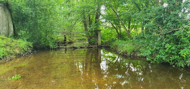
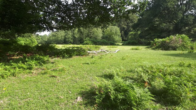
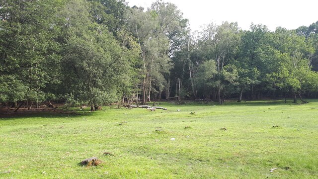
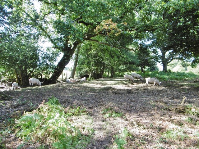
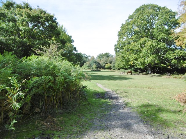
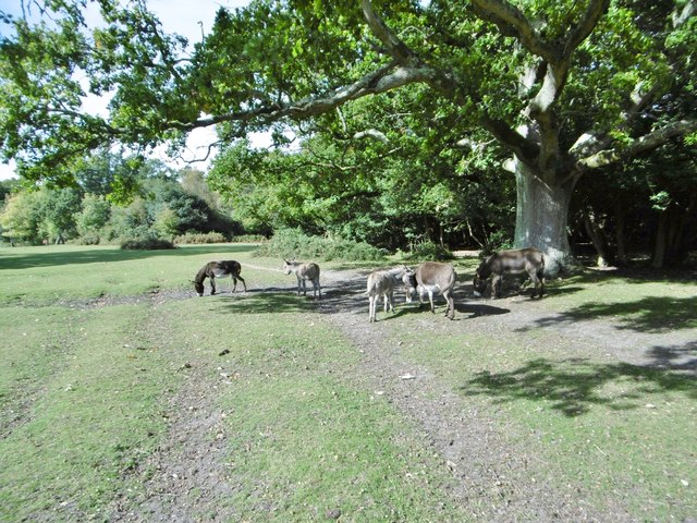
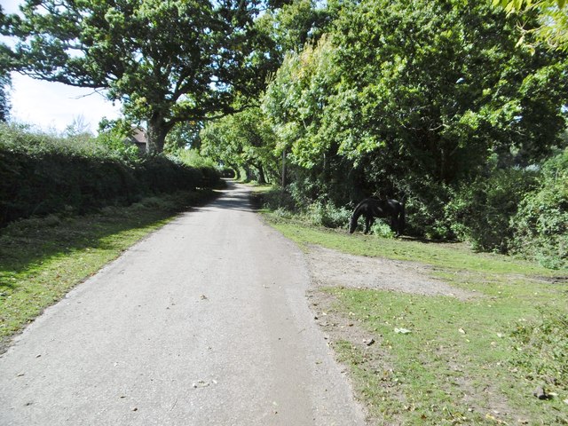
Rookery Copse is a beautiful woodland located in Wiltshire, England. It covers an area of approximately 50 acres and is known for its diverse ecosystem and tranquil atmosphere. The copse is situated in an area of rolling countryside, surrounded by fields and farmland.

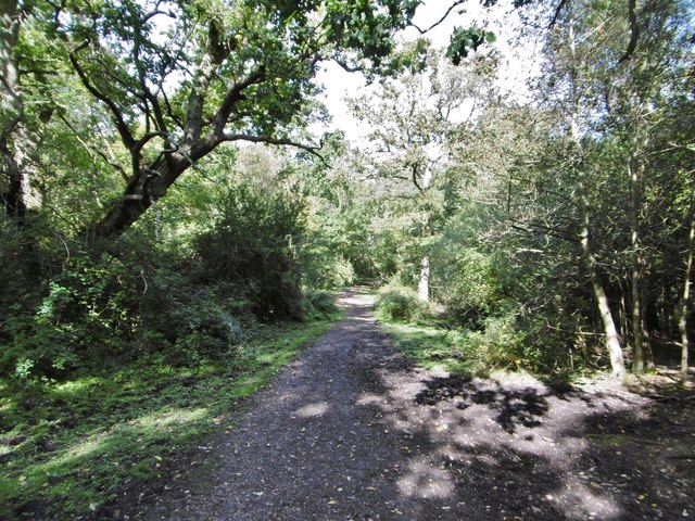
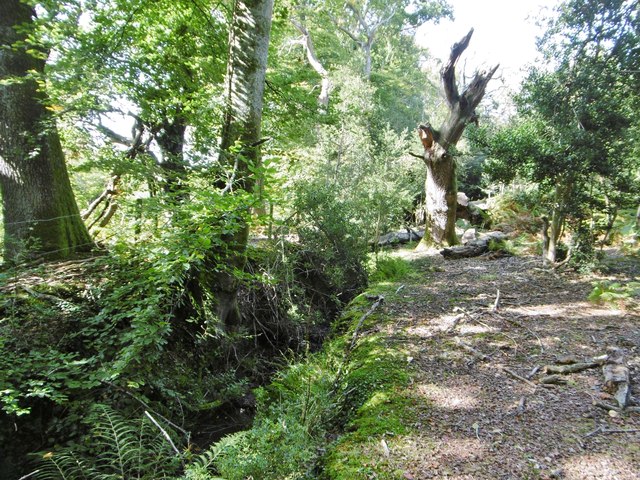
The woodland is predominantly made up of deciduous trees, including oak, beech, and ash, which create a dense canopy overhead. This provides a cool and shady environment, perfect for leisurely walks and nature exploration. The forest floor is covered in a rich carpet of ferns, bluebells, and wildflowers, adding to the area's natural charm.

Rookery Copse is home to a variety of wildlife species, making it a popular spot for nature enthusiasts and birdwatchers. Visitors may spot various bird species, such as woodpeckers, owls, and jays, as well as mammals like deer and foxes. The copse also supports a diverse insect population, with butterflies, beetles, and bees buzzing around the wildflowers.

The woodland has several well-maintained walking trails, providing visitors with the opportunity to explore the area at their own pace. These paths wind through the trees, offering glimpses of picturesque views and allowing visitors to immerse themselves in the peaceful ambiance of the copse.

Rookery Copse is a haven for those seeking tranquility and a chance to connect with nature. Its natural beauty and diverse wildlife make it a must-visit destination for anyone looking to escape the hustle and bustle of everyday life.

If you have any feedback on the listing, please let us know in the comments section below.

Rookery Copse Images

Images are sourced within 2km of 50.932101/-1.6109851 or Grid Reference SU2714. Thanks to Geograph Open Source API. All images are credited.

King's Garn Gutter
King's Garn Gutter
Forest lawn on lower edge of Brook Wood
View across clearing in Brook Wood
Cadnam Common, pannage pigs On the western boundary of the common; pigs doing what is expected of them at this time of year - forage for fallen acorns, which can be poisonous to other livestock. <span class="nowrap"><a title="http://www.thenewforest.co.uk/discover/pigs.aspx#" rel="nofollow ugc noopener" href="http://www.thenewforest.co.uk/discover/pigs.aspx#">Link</a><img style="margin-left:2px;" alt="External link" title="External link - shift click to open in new window" src="https://s1.geograph.org.uk/img/external.png" width="10" height="10"/></span>
Cadnam Common, pannage pigs
On the western boundary of the common; pigs doing what is expected of them at this time of year - forage for fallen acorns, which can be poisonous to other livestock. LinkExternal link
Cadnam Common An "adjacent common", similar to the New Forest physically and ecologically, but not Crown land; this common is owned by the National Trust. <span class="nowrap"><a title="http://www.nationaltrust.org.uk/new-forest-northern-commons/" rel="nofollow ugc noopener" href="http://www.nationaltrust.org.uk/new-forest-northern-commons/">Link</a><img style="margin-left:2px;" alt="External link" title="External link - shift click to open in new window" src="https://s1.geograph.org.uk/img/external.png" width="10" height="10"/></span>
Cadnam Common
An "adjacent common", similar to the New Forest physically and ecologically, but not Crown land; this common is owned by the National Trust. LinkExternal link
Cadnam Common, donkeys
Cadnam, Storm's Farm Stables overlooking Cadnam Common.
Cadnam, Storm's Farm
Stables overlooking Cadnam Common.
Cadnam, byway From Storm's Farm to Kewlake Lane.
Cadnam, byway
From Storm's Farm to Kewlake Lane.
Cadnam, track Along the southern boundary of Cadnam Common.
Cadnam, track
Along the southern boundary of Cadnam Common.
Cadnam Common, ditch & embankment At the western boundary of the common.
Cadnam Common, ditch & embankment
At the western boundary of the common.
Cadnam Common, track Parallel to the western boundary of the common.
Cadnam Common, track
Parallel to the western boundary of the common.
Cadnam Common, lawn "Lawn" is a New Forest term for expanses of grassland closely cropped by livestock.
Cadnam Common, lawn
"Lawn" is a New Forest term for expanses of grassland closely cropped by livestock.
Cadnam Common, pond
Cadnam Common, pond
Cadnam Bog
Cadnam Bog
Cadnam Common, track
Cadnam Common, ponies New Forest ponies, heading for fresh pasture.
Cadnam Common, ponies
New Forest ponies, heading for fresh pasture.
Cadnam Common, pond
Cadnam Common, pond
Furzley Common, Stagbury Hill A distinctive hill in an otherwise gentle landscape.
Furzley Common, Stagbury Hill
A distinctive hill in an otherwise gentle landscape.
Show me another place!

Rookery Copse is located at Grid Ref: SU2714 (Lat: 50.932101, Lng: -1.6109851)

Administrative County: Hampshire

District: New Forest

Police Authority: Hampshire

What 3 Words

///ironclad.lawfully.hospitals. Near Cadnam, Hampshire

Related Wikis

Brook, New Forest

Brook is a hamlet in the civil parish of Bramshaw, in Hampshire, England. It lies just inside the New Forest. The hamlet contains a mix of 18th and 19th...

Bramshaw

Bramshaw is a small village and civil parish in Hampshire, England. It lies just inside the New Forest. The name Bramshaw means Bramble Wood. Until 1895...

Upper Canterton

Upper Canterton is a village in Hampshire, England, located at 50°54′36″N 1°37′24″W. It is near Minstead. == References == The geographic coordinates are...

Bartley Lodge

Bartley Lodge is a country house near Cadnam in Hampshire, England, within the boundaries of the New Forest National Park. It was built in the 18th century...

Landford Heath

Landford Heath (grid reference SU265178) is an 11.75 hectare biological Site of Special Scientific Interest near Landford in southeast Wiltshire, England...

Minstead

Minstead is a small village and civil parish in the New Forest, Hampshire, about 2 miles (3.2 km) north of Lyndhurst. There is a shop and a pub, the Trusty...

Cadnam

Cadnam is a village situated in Hampshire, England, within the boundaries of the New Forest National Park. The village has existed since the medieval period...

Copythorne

Copythorne is a village and civil parish in Hampshire, England, within the boundaries of the New Forest National Park. == Overview == Copythorne is in...

Nearby Amenities

Located within 500m of 50.932101,-1.6109851
Bus Stop
Bramshaw Post Office
Bus: yes
Naptan AtcoCode: 1900HA080156
Naptan Bearing: S
Naptan BusStopType: CUS
Naptan CommonName: Bramshaw Post Office
Naptan Indicator: Sch Svc
Naptan NaptanCode: hamagjwa
Naptan Street: B3079
Naptan Verified: no
Public Transport: platform
Source: naptan_import
Lat/Long: 50.9300383/-1.6167424
Bus Stop
Bramshaw Post Office
Bus: yes
Naptan AtcoCode: 1900HA080157
Naptan Bearing: N
Naptan BusStopType: CUS
Naptan CommonName: Bramshaw Post Office
Naptan Indicator: Sch Svc
Naptan NaptanCode: hamagjtm
Naptan Street: B3079
Naptan Verified: no
Public Transport: platform
Source: naptan_import
Lat/Long: 50.9300269/-1.6168912
Public Bookcase
Booth: K6
Disused Amenity: telephone
Man Made: telephone_box
Public Bookcase Type: phone_box
Lat/Long: 50.9304448/-1.6167244
Bramshaw Village Store and Newsagents
Shop: convenience
Lat/Long: 50.9300593/-1.6165312
Barrier: stile
Lat/Long: 50.9345279/-1.6163421
Barrier: cattle_grid
Lat/Long: 50.9344928/-1.6125763
Post Box
Collection Times: Mo-Fr 09:00; Sa 07:00
Operator: Royal Mail
Operator Wikidata: Q638098
Post Box Type: wall
Ref: SO43 109
Royal Cypher: EIIR
Royal Cypher Wikidata: Q33102113
Lat/Long: 50.9300788/-1.6166653
Burnford Bridge
Place: locality
Lat/Long: 50.9337907/-1.6165383
Bramshaw Hill
Place: hamlet
Lat/Long: 50.931894/-1.6166828
The data included in this document is from www.openstreetmap.org. The data is made available under ODbL.

Have you been to Rookery Copse?

Leave your review of Rookery Copse below (or comments, questions and feedback).