Lower Pope's Wood

Wood, Forest in Wiltshire New Forest

England

Lower Pope's Wood

The Rufus Stone
The Rufus Stone Credit: Helen Steed

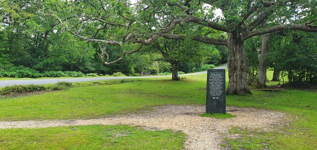
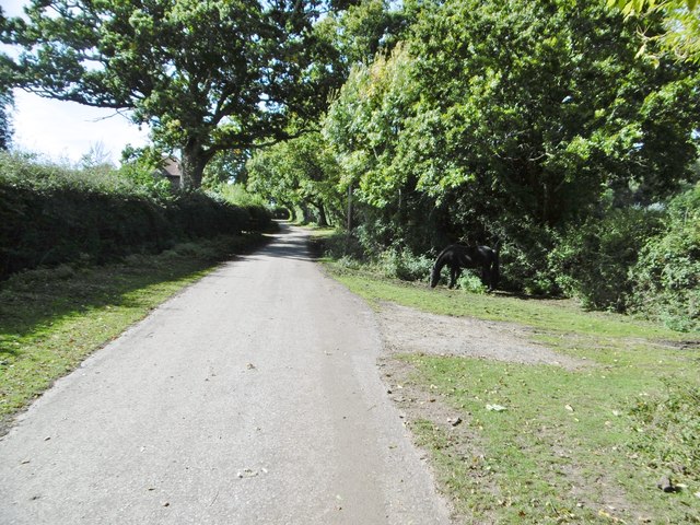
Lower Pope's Wood is a picturesque woodland located in Wiltshire, England. Covering an area of approximately 25 hectares, this ancient forest is a haven for nature enthusiasts and outdoor lovers alike. Situated near the village of Pope's Wood, the wood is easily accessible and offers a tranquil retreat from the hustle and bustle of everyday life.

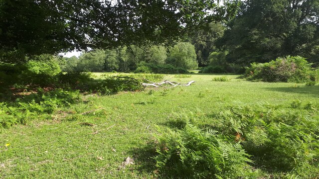
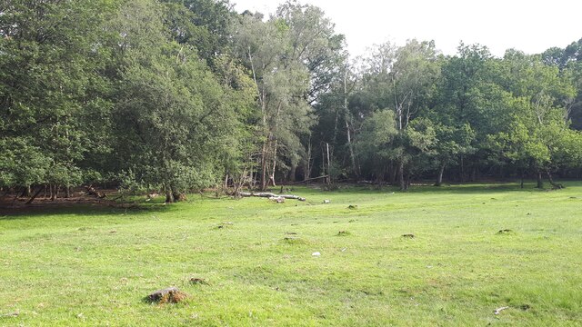
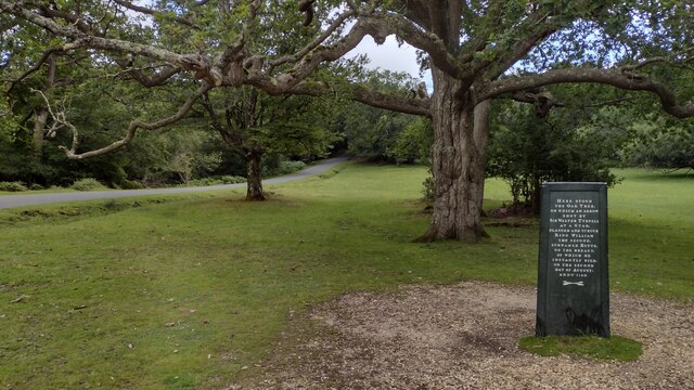
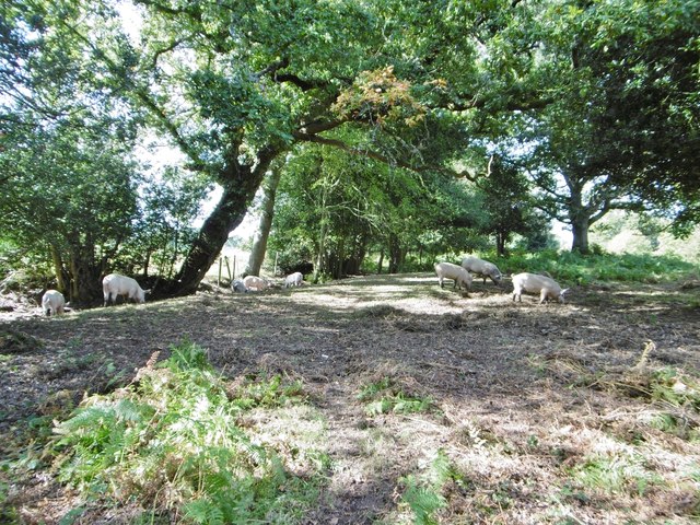
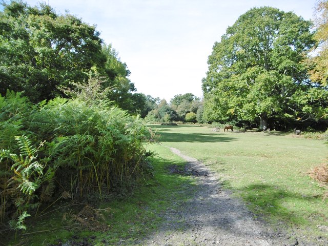
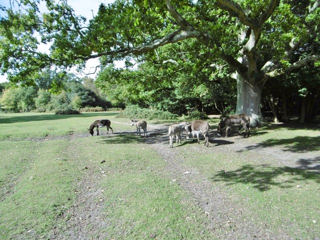
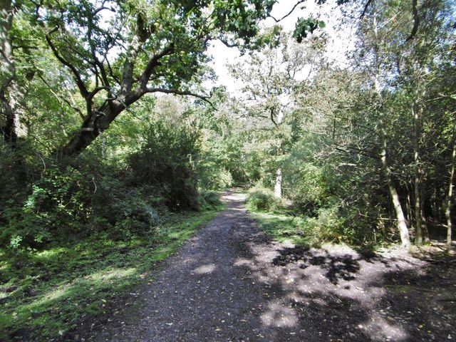
The wood is predominantly composed of broad-leaved trees, with oak, ash, and beech being the most common species. These towering trees create a dense canopy that provides shade and shelter for an abundant variety of wildlife. Visitors can expect to encounter a diverse range of flora and fauna, including wildflowers, ferns, and mosses, as well as birds, squirrels, and deer.

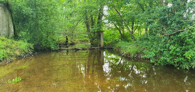
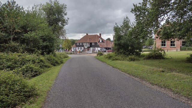
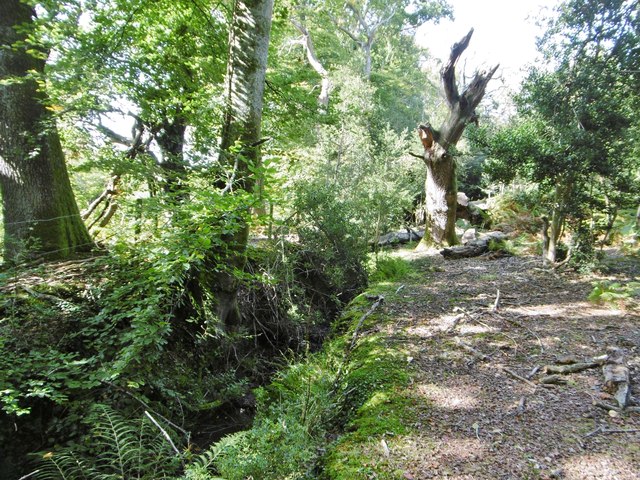
The wood is crisscrossed by a network of well-maintained footpaths, making it an ideal location for leisurely walks and nature trails. Exploring the wood, visitors are treated to breathtaking views and opportunities to immerse themselves in the peaceful surroundings. The wood also features a small stream that adds to its natural charm.

In addition to its natural beauty, Lower Pope's Wood is of historical significance. It is believed to have been part of a larger forest that once covered the region in medieval times. The wood retains an air of mystery and nostalgia, with remnants of ancient boundary banks and ditches providing glimpses into its past.

Lower Pope's Wood is a true gem in Wiltshire's countryside, offering a serene and enchanting experience for all who venture into its tranquil depths. Whether it's a leisurely stroll, birdwatching, or simply enjoying the tranquility of nature, this woodland is a must-visit destination for nature enthusiasts and those seeking solace in the great outdoors.

If you have any feedback on the listing, please let us know in the comments section below.

Lower Pope's Wood Images

Images are sourced within 2km of 50.928589/-1.6124373 or Grid Reference SU2714. Thanks to Geograph Open Source API. All images are credited.

The Rufus Stone
The Rufus Stone
King's Garn Gutter
King's Garn Gutter
Forest lawn on lower edge of Brook Wood
View across clearing in Brook Wood
Rufus Stone Rufus Stone encased in a protective cover
Rufus Stone
Rufus Stone encased in a protective cover
Lane to Brook Lane to Brook passing the Sir Walter Tyrell pub
Lane to Brook
Lane to Brook passing the Sir Walter Tyrell pub
Signage - A31 northbound
Cadnam Common, pannage pigs On the western boundary of the common; pigs doing what is expected of them at this time of year - forage for fallen acorns, which can be poisonous to other livestock. <span class="nowrap"><a title="http://www.thenewforest.co.uk/discover/pigs.aspx#" rel="nofollow ugc noopener" href="http://www.thenewforest.co.uk/discover/pigs.aspx#">Link</a><img style="margin-left:2px;" alt="External link" title="External link - shift click to open in new window" src="https://s1.geograph.org.uk/img/external.png" width="10" height="10"/></span>
Cadnam Common, pannage pigs
On the western boundary of the common; pigs doing what is expected of them at this time of year - forage for fallen acorns, which can be poisonous to other livestock. LinkExternal link
Cadnam Common An "adjacent common", similar to the New Forest physically and ecologically, but not Crown land; this common is owned by the National Trust. <span class="nowrap"><a title="http://www.nationaltrust.org.uk/new-forest-northern-commons/" rel="nofollow ugc noopener" href="http://www.nationaltrust.org.uk/new-forest-northern-commons/">Link</a><img style="margin-left:2px;" alt="External link" title="External link - shift click to open in new window" src="https://s1.geograph.org.uk/img/external.png" width="10" height="10"/></span>
Cadnam Common
An "adjacent common", similar to the New Forest physically and ecologically, but not Crown land; this common is owned by the National Trust. LinkExternal link
Cadnam Common, donkeys
Cadnam, Storm's Farm Stables overlooking Cadnam Common.
Cadnam, Storm's Farm
Stables overlooking Cadnam Common.
Cadnam, byway From Storm's Farm to Kewlake Lane.
Cadnam, byway
From Storm's Farm to Kewlake Lane.
Cadnam, track Along the southern boundary of Cadnam Common.
Cadnam, track
Along the southern boundary of Cadnam Common.
Cadnam Common, ditch & embankment At the western boundary of the common.
Cadnam Common, ditch & embankment
At the western boundary of the common.
Cadnam Common, track Parallel to the western boundary of the common.
Cadnam Common, track
Parallel to the western boundary of the common.
Cadnam Common, lawn "Lawn" is a New Forest term for expanses of grassland closely cropped by livestock.
Cadnam Common, lawn
"Lawn" is a New Forest term for expanses of grassland closely cropped by livestock.
Cadnam Common, pond
Cadnam Common, pond
Show me another place!

Lower Pope's Wood is located at Grid Ref: SU2714 (Lat: 50.928589, Lng: -1.6124373)

Administrative County: Hampshire

District: New Forest

Police Authority: Hampshire

What 3 Words

///asleep.disprove.outfit. Near Cadnam, Hampshire

Related Wikis

Brook, New Forest

Brook is a hamlet in the civil parish of Bramshaw, in Hampshire, England. It lies just inside the New Forest. The hamlet contains a mix of 18th and 19th...

Bramshaw

Bramshaw is a small village and civil parish in Hampshire, England. It lies just inside the New Forest. The name Bramshaw means Bramble Wood. Until 1895...

Upper Canterton

Upper Canterton is a village in Hampshire, England, located at 50°54′36″N 1°37′24″W. It is near Minstead. == References == The geographic coordinates are...

Bartley Lodge

Bartley Lodge is a country house near Cadnam in Hampshire, England, within the boundaries of the New Forest National Park. It was built in the 18th century...

Minstead

Minstead is a small village and civil parish in the New Forest, Hampshire, about 2 miles (3.2 km) north of Lyndhurst. There is a shop and a pub, the Trusty...

Cadnam

Cadnam is a village situated in Hampshire, England, within the boundaries of the New Forest National Park. The village has existed since the medieval period...

Copythorne

Copythorne is a village and civil parish in Hampshire, England, within the boundaries of the New Forest National Park. == Overview == Copythorne is in...

Minstead Lodge

Minstead Lodge in Hampshire is a building of historical significance built in about 1830 and is Grade II listed on the English Heritage Register. Today...

Nearby Amenities

Located within 500m of 50.928589,-1.6124373
Odbl: clean
Lat/Long: 50.9286202/-1.6168041
Brook
Is In: Hampshire, England, UK
Place: hamlet
Wikidata: Q4974305
Lat/Long: 50.9254563/-1.6139838
Bus Stop
Green Dragon PH
Bus: yes
Naptan AtcoCode: 1900HA080154
Naptan Bearing: W
Naptan BusStopType: CUS
Naptan CommonName: Green Dragon PH
Naptan Crossing: Roger Penny Way B3078
Naptan Indicator: Sch Svc
Naptan NaptanCode: hamagmad
Naptan Street: B3079
Naptan Verified: no
Source: naptan_import
Lat/Long: 50.9254519/-1.6126093
Bus Stop
Green Dragon PH
Bench: no
Bin: no
Bus: yes
Lit: no
Naptan AtcoCode: 1900HA080155
Naptan Bearing: E
Naptan BusStopType: CUS
Naptan CommonName: Green Dragon PH
Naptan Crossing: B3078 Roger Penny Way
Naptan Indicator: Sch Svc
Naptan NaptanCode: hamagmaj
Naptan Street: B3079
Naptan Verified: no
Shelter: no
Source: naptan_import
Tactile Paving: no
Lat/Long: 50.925587/-1.6124527
Bus Stop
Bramshaw Post Office
Bus: yes
Naptan AtcoCode: 1900HA080156
Naptan Bearing: S
Naptan BusStopType: CUS
Naptan CommonName: Bramshaw Post Office
Naptan Indicator: Sch Svc
Naptan NaptanCode: hamagjwa
Naptan Street: B3079
Naptan Verified: no
Public Transport: platform
Source: naptan_import
Lat/Long: 50.9300383/-1.6167424
Bus Stop
Bramshaw Post Office
Bus: yes
Naptan AtcoCode: 1900HA080157
Naptan Bearing: N
Naptan BusStopType: CUS
Naptan CommonName: Bramshaw Post Office
Naptan Indicator: Sch Svc
Naptan NaptanCode: hamagjtm
Naptan Street: B3079
Naptan Verified: no
Public Transport: platform
Source: naptan_import
Lat/Long: 50.9300269/-1.6168912
Public Bookcase
Booth: K6
Disused Amenity: telephone
Man Made: telephone_box
Public Bookcase Type: phone_box
Lat/Long: 50.9304448/-1.6167244
Bar
Bramshaw Golf Course Clubhouse & Bar
Lat/Long: 50.926367/-1.6138113
Bramshaw Village Store and Newsagents
Shop: convenience
Lat/Long: 50.9300593/-1.6165312
Pub
The Green Dragon
Addr City: New Forest
Addr Housename: The Green Dragon
Addr Postcode: SO43 7HE
Contact Facebook: https://www.facebook.com/Greendragonbrook/
Contact Instagram: https://www.instagram.com/greendragonbrook/
Email: greendragon@wadworth.co.uk
Phone: +44 2380 813359
Website: https://www.greendragonbrook.co.uk/
Wikidata: Q26459976
Lat/Long: 50.9253025/-1.6126773
Pub
The Bell Inn
Addr City: New Forest
Addr Housename: The Bell Inn
Addr Postcode: SO43 7HE
Contact Facebook: https://www.facebook.com/Bellinnnewforest
Contact Instagram: https://www.instagram.com/bellinn_newforest/
Email: reception@bramshaw.co.uk
Phone: +44 2380 812214
Website: https://bellinn-newforest.co.uk/
Wikidata: Q26387093
Lat/Long: 50.925886/-1.6138693
Post Box
Collection Times: Mo-Fr 09:00; Sa 07:00
Operator: Royal Mail
Operator Wikidata: Q638098
Post Box Type: wall
Ref: SO43 109
Royal Cypher: EIIR
Royal Cypher Wikidata: Q33102113
Lat/Long: 50.9300788/-1.6166653
Post Box
Collection Times: Mo-Fr 16:45; Sa 07:30
Operator: Royal Mail
Operator Wikidata: Q638098
Post Box Mounting: brick_pillar
Post Box Type: wall
Ref: SO43 23
Royal Cypher: VR
Royal Cypher Wikidata: Q33102356
Lat/Long: 50.9256199/-1.6135151
Bramshaw Hill
Place: hamlet
Lat/Long: 50.931894/-1.6166828
Give Way
Direction: forward
Lat/Long: 50.9259003/-1.6145262
The data included in this document is from www.openstreetmap.org. The data is made available under ODbL.

Have you been to Lower Pope's Wood?

Leave your review of Lower Pope's Wood below (or comments, questions and feedback).