Holidays Hill Inclosure

Wood, Forest in Hampshire New Forest

England

Holidays Hill Inclosure

Old oak and forest clearing
Old oak and forest clearing Credit: John Myers

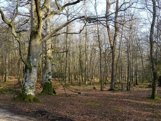
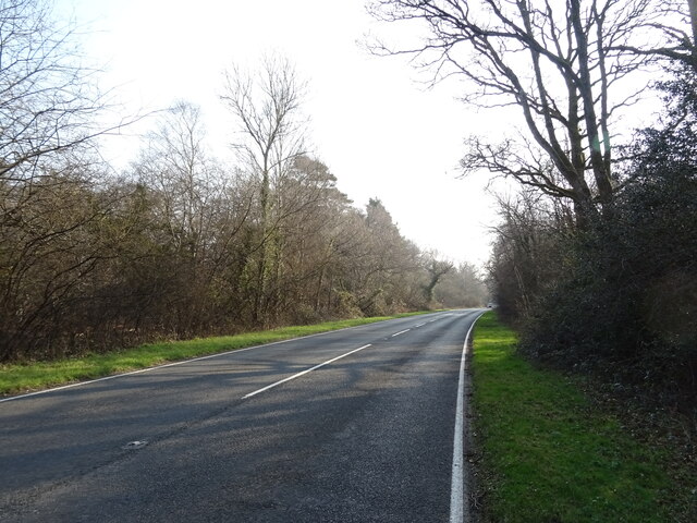
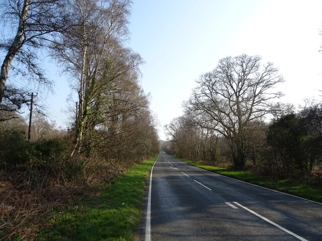
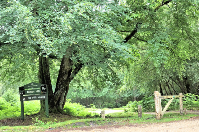
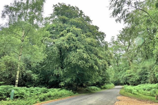
Holidays Hill Inclosure is a picturesque woodland area located in Hampshire, England. Spanning over a vast area, it is a part of the larger New Forest National Park. The inclosure is known for its stunning natural beauty and is a popular destination for nature enthusiasts and outdoor adventurers.

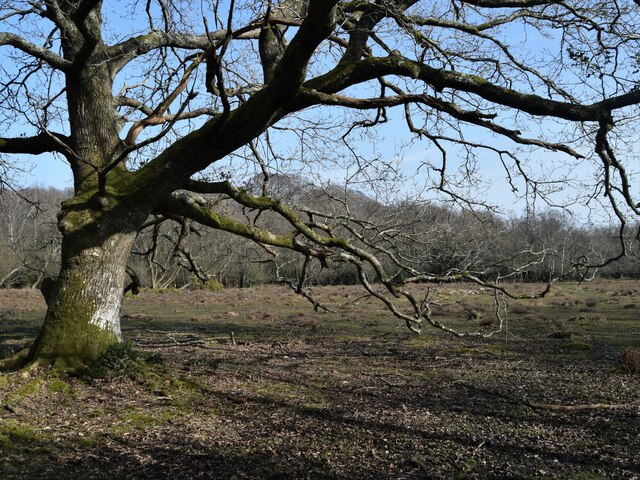
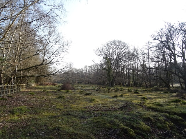
The wood is densely populated with a variety of native trees, including oak, beech, and birch, creating a diverse and vibrant ecosystem. The canopy of trees provides ample shade, creating a cool and tranquil atmosphere, making it an ideal spot for leisurely walks and picnics.

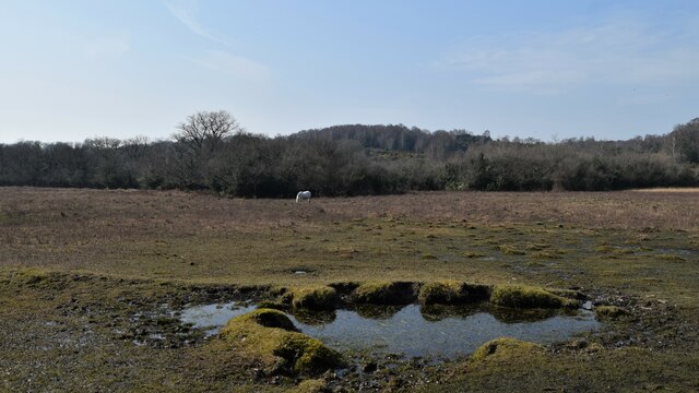
The forest floor is covered in a thick layer of moss and leaf litter, which provides a habitat for a wide array of plant and animal species. Visitors can spot a range of wildlife, such as deer, squirrels, and various bird species, as they explore the trails that wind through the inclosure.

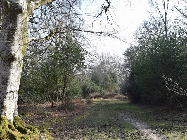
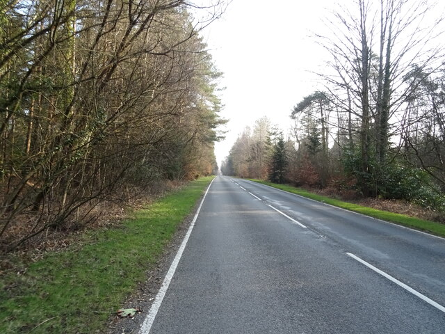
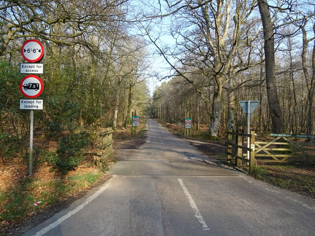
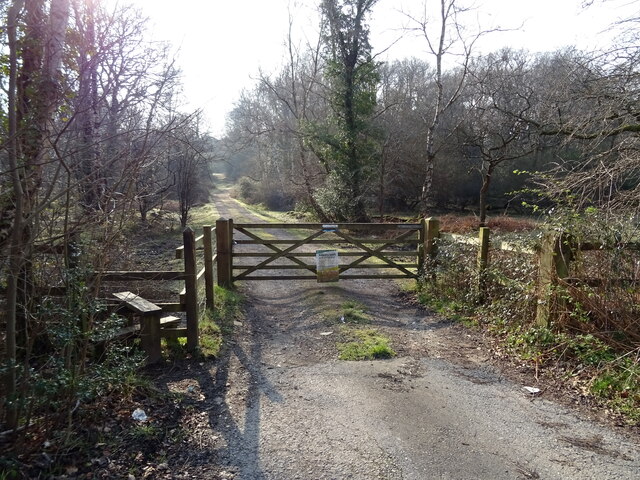
Holidays Hill Inclosure offers several well-maintained walking and cycling paths, allowing visitors to explore the area at their own pace. These paths also provide access to hidden gems within the inclosure, such as a small stream and a picturesque pond.

With its peaceful ambiance and stunning natural surroundings, Holidays Hill Inclosure is a haven for those seeking a break from the hustle and bustle of everyday life. Whether it's a leisurely stroll, a family picnic, or an adventure-filled bike ride, this woodland area offers something for everyone to enjoy.

If you have any feedback on the listing, please let us know in the comments section below.

Holidays Hill Inclosure Images

Images are sourced within 2km of 50.865902/-1.6260016 or Grid Reference SU2607. Thanks to Geograph Open Source API. All images are credited.

Old oak and forest clearing
Forest track South from James Hill car park
Forest track
South from James Hill car park
Pool and pony Rather boggy ground between Emery Down and Acres Down
Pool and pony
Rather boggy ground between Emery Down and Acres Down
The Tall Trees Trail South from the car park at Brock Hill
The Tall Trees Trail
South from the car park at Brock Hill
Pasture and woodland
Cattle grid on Lyndhurst Road approaching the A35
A35 towards Lyndhurst  The A35 is a major (and regularly congested) route along England's south coast. It runs for 97 miles, connecting Honiton in Devon with Southampton in Hampshire, via Poole and Bournemouth, with much of its route passing through Dorset and the New Forest. It is a trunk road for some of its length.
<span class="nowrap"><a title="http://www.sabre-roads.org.uk/wiki/index.php?title=A35" rel="nofollow ugc noopener" href="http://www.sabre-roads.org.uk/wiki/index.php?title=A35">Link</a><img style="margin-left:2px;" alt="External link" title="External link - shift click to open in new window" src="https://s1.geograph.org.uk/img/external.png" width="10" height="10"/></span>  SABRE
A35 towards Lyndhurst
The A35 is a major (and regularly congested) route along England's south coast. It runs for 97 miles, connecting Honiton in Devon with Southampton in Hampshire, via Poole and Bournemouth, with much of its route passing through Dorset and the New Forest. It is a trunk road for some of its length. LinkExternal link SABRE
New Forest woodland
New Forest woodland
Cattle grid on Bolderwood Arboretum Ornamental Drive
Crossroads on the A35 towards Lyndhurst  The A35 is a major (and regularly congested) route along England's south coast. It runs for 97 miles, connecting Honiton in Devon with Southampton in Hampshire, via Poole and Bournemouth, with much of its route passing through Dorset and the New Forest. It is a trunk road for some of its length.
<span class="nowrap"><a title="http://www.sabre-roads.org.uk/wiki/index.php?title=A35" rel="nofollow ugc noopener" href="http://www.sabre-roads.org.uk/wiki/index.php?title=A35">Link</a><img style="margin-left:2px;" alt="External link" title="External link - shift click to open in new window" src="https://s1.geograph.org.uk/img/external.png" width="10" height="10"/></span>  SABRE
Crossroads on the A35 towards Lyndhurst
The A35 is a major (and regularly congested) route along England's south coast. It runs for 97 miles, connecting Honiton in Devon with Southampton in Hampshire, via Poole and Bournemouth, with much of its route passing through Dorset and the New Forest. It is a trunk road for some of its length. LinkExternal link SABRE
Woodland, Warwick Slade
A35 towards Lyndhurst  The A35 is a major (and regularly congested) route along England's south coast. It runs for 97 miles, connecting Honiton in Devon with Southampton in Hampshire, via Poole and Bournemouth, with much of its route passing through Dorset and the New Forest. It is a trunk road for some of its length.
<span class="nowrap"><a title="http://www.sabre-roads.org.uk/wiki/index.php?title=A35" rel="nofollow ugc noopener" href="http://www.sabre-roads.org.uk/wiki/index.php?title=A35">Link</a><img style="margin-left:2px;" alt="External link" title="External link - shift click to open in new window" src="https://s1.geograph.org.uk/img/external.png" width="10" height="10"/></span>  SABRE
A35 towards Lyndhurst
The A35 is a major (and regularly congested) route along England's south coast. It runs for 97 miles, connecting Honiton in Devon with Southampton in Hampshire, via Poole and Bournemouth, with much of its route passing through Dorset and the New Forest. It is a trunk road for some of its length. LinkExternal link SABRE
Grazing beside the A35
Gated track to sewage works
A35 towards Lyndhurst  The A35 is a major (and regularly congested) route along England's south coast. It runs for 97 miles, connecting Honiton in Devon with Southampton in Hampshire, via Poole and Bournemouth, with much of its route passing through Dorset and the New Forest. It is a trunk road for some of its length.
<span class="nowrap"><a title="http://www.sabre-roads.org.uk/wiki/index.php?title=A35" rel="nofollow ugc noopener" href="http://www.sabre-roads.org.uk/wiki/index.php?title=A35">Link</a><img style="margin-left:2px;" alt="External link" title="External link - shift click to open in new window" src="https://s1.geograph.org.uk/img/external.png" width="10" height="10"/></span>  SABRE
A35 towards Lyndhurst
The A35 is a major (and regularly congested) route along England's south coast. It runs for 97 miles, connecting Honiton in Devon with Southampton in Hampshire, via Poole and Bournemouth, with much of its route passing through Dorset and the New Forest. It is a trunk road for some of its length. LinkExternal link SABRE
Anderson Inclosure Woodland in Anderson Inclosure.
Anderson Inclosure
Woodland in Anderson Inclosure.
James Hill Car Park One of many visitors car parks in the New Forest.
James Hill Car Park
One of many visitors car parks in the New Forest.
Forest Road to Emery Down
Show me another place!

Holidays Hill Inclosure is located at Grid Ref: SU2607 (Lat: 50.865902, Lng: -1.6260016)

Administrative County: Hampshire

District: New Forest

Police Authority: Hampshire

What 3 Words

///mocked.snoozing.protester. Near Lyndhurst, Hampshire

Related Wikis

Portuguese Fireplace

The Portuguese Fireplace is a war memorial in the New Forest National Park, near the village of Lyndhurst, Hampshire, England. It is located on the road...

New Forest

The New Forest is one of the largest remaining tracts of unenclosed pasture land, heathland and forest in Southern England, covering southwest Hampshire...

Knightwood Oak

The Knightwood Oak is a pedunculate oak and the largest, and perhaps most famous, oak tree in the New Forest, in southern England. It is also known as...

Bolderwood, Hampshire

Bolderwood is an area of the New Forest in Hampshire. Bolderwood hosts a deer sanctuary with a public deer observation platform. As a result, the public...

New Forest District

New Forest is a local government district in Hampshire, England. Its council is based in Lyndhurst, although the largest town is Totton. The district also...

Allum Green

Allum Green is a hamlet southwest of Lyndhurst, Hampshire, England. During the night of 5/6 September 1940 it was the scene of a Luftwaffe bombing raid...

Bank, Hampshire

Bank is a village in the English county of Hampshire. The settlement is within the civil parish of Lyndhurst in the New Forest, and is located approximately...

Emery Down

Emery Down is a small village in the New Forest National Park in Hampshire, England. Its nearest town is Lyndhurst, which lies approximately 1.4 miles...

Nearby Amenities

Located within 500m of 50.865902,-1.6260016
Lcn Ref: 152
Lat/Long: 50.8692059/-1.6262388
Portuguese Fireplace
Historic: memorial
Wikidata: Q7232635
Wikipedia: en:Portuguese Fireplace
Lat/Long: 50.8689771/-1.6241116
Lcn Ref: 154
Lat/Long: 50.8677734/-1.6248056
Bench
Lat/Long: 50.8645142/-1.6256903
Bench
Lat/Long: 50.8677856/-1.6250479
Playground: stepping_stones
Lat/Long: 50.8665591/-1.6250089
Board Type: nature
Information: board
Tourism: information
Lat/Long: 50.8678251/-1.6251663
Lounger
Access: yes
Lit: no
Material: wood
Lat/Long: 50.8653863/-1.6255907
Lounger
Access: yes
Lit: no
Material: wood
Lat/Long: 50.8660599/-1.6214225
The data included in this document is from www.openstreetmap.org. The data is made available under ODbL.

Have you been to Holidays Hill Inclosure?

Leave your review of Holidays Hill Inclosure below (or comments, questions and feedback).