Arno's Vale

Settlement in Somerset

England

Arno's Vale

Knowle Golf Course, Bristol
Knowle Golf Course, Bristol Credit: Alex McGregor

Arno's Vale is a small village located in Somerset, England. Situated just three miles southeast of the city of Bristol, Arno's Vale is set amidst picturesque countryside, providing residents with a tranquil and idyllic setting. The village is known for its historic significance and natural beauty, making it a popular destination for tourists and locals alike.

One of the notable landmarks in Arno's Vale is the Victorian cemetery, which was established in 1839. This cemetery is renowned for its stunning architecture and beautiful landscaping, attracting visitors who appreciate its historical and cultural value. Additionally, the cemetery is also home to a variety of wildlife, including birds and bats, making it a haven for nature enthusiasts.

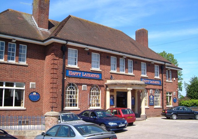
The village itself has a small population, and the community is tight-knit and friendly. The residents take pride in their village and actively participate in local events and activities. Arno's Vale is home to a few local businesses, including a charming country pub, which serves traditional English food and drinks.

For those who enjoy outdoor activities, Arno's Vale offers ample opportunities for hiking and walking. The surrounding countryside is dotted with scenic trails and footpaths, allowing visitors to explore the area's natural beauty.

Overall, Arno's Vale is a charming village with a rich history and stunning natural surroundings. Whether you are interested in history, nature, or simply seeking a peaceful retreat, Arno's Vale has something to offer for everyone.

If you have any feedback on the listing, please let us know in the comments section below.

Arno's Vale Images

Images are sourced within 2km of 51.441468/-2.5599668 or Grid Reference ST6171. Thanks to Geograph Open Source API. All images are credited.

Knowle Golf Course, Bristol
All-weather pitches at the South Bristol Sports Centre
Football pitches, Bristol This recreation ground is between Sturminster Road and Knowle Golf Course.
Football pitches, Bristol
This recreation ground is between Sturminster Road and Knowle Golf Course.
The Happy Landings, Hengrove Lane, Bristol A cheerful name for a pub. This is diagonally across the Wells Road junction from <a href="https://www.geograph.org.uk/photo/179886">ST6069 : Rosedale House, Brislington</a>.
The Happy Landings, Hengrove Lane, Bristol
A cheerful name for a pub. This is diagonally across the Wells Road junction from ST6069 : Rosedale House, Brislington.
Young trees in the grounds of South Bristol Sports Centre
Wells Road letterbox Standing at a slight angle outside the shops, a George V box by Carron.
Wells Road letterbox
Standing at a slight angle outside the shops, a George V box by Carron.
A dance hall on Hengrove Lane A small hall is now used as a dance studio.
A dance hall on Hengrove Lane
A small hall is now used as a dance studio.
Big blocks by the brook Airport Road is undergoing a massive development.
Big blocks by the brook
Airport Road is undergoing a massive development.
Changing the face of Knowle The inter-war houses of Knowle cover many acres, but are now facing a new boklok on the block.
Changing the face of Knowle
The inter-war houses of Knowle cover many acres, but are now facing a new boklok on the block.
The path to a new home The development on the Airport Road has already been completed in a few spots, or is very near at least.
The path to a new home
The development on the Airport Road has already been completed in a few spots, or is very near at least.
Sheltering near Bear's Bridge The Wells Road/Airport Road intersection is a very busy junction in south Bristol. Close to the many traffic lights are a collection of utility cabinets, gas supplies and pollution monitors.
Sheltering near Bear's Bridge
The Wells Road/Airport Road intersection is a very busy junction in south Bristol. Close to the many traffic lights are a collection of utility cabinets, gas supplies and pollution monitors.
Ravenhead Drive, where once were riders Today's modern housing belies the recent past. In the 1950s this was the site of the old Knowle speedway and greyound track. This part was the top bend of the speedway, where riders would slide around towards the far end of the present road. Just beyond were kennels.
Ravenhead Drive, where once were riders
Today's modern housing belies the recent past. In the 1950s this was the site of the old Knowle speedway and greyound track. This part was the top bend of the speedway, where riders would slide around towards the far end of the present road. Just beyond were kennels.
At the back of the stands Ravenhead Drive lies largely across the site of the old Knowle speedway track. Just after the war this site would have been a packed stand, some offices and kennels.
At the back of the stands
Ravenhead Drive lies largely across the site of the old Knowle speedway track. Just after the war this site would have been a packed stand, some offices and kennels.
Bristol : Brislington - Hungerford Road Looking along Hungerford Road.
Bristol : Brislington - Hungerford Road
Looking along Hungerford Road.
Bristol : Brislington - Hungerford Crescent Looking along Hungerford Crescent off Hungerford Road.
Bristol : Brislington - Hungerford Crescent
Looking along Hungerford Crescent off Hungerford Road.
Bristol : Brislington - West Town Lane B3119 Looking along the road.
Bristol : Brislington - West Town Lane B3119
Looking along the road.
Bristol : Brislington - Pavilion A run down looking pavilion alongside the sports pitches.
Bristol : Brislington - Pavilion
A run down looking pavilion alongside the sports pitches.
Bristol : Brislington - Pavilion A sports pavilion alongside the athletic fields.
Bristol : Brislington - Pavilion
A sports pavilion alongside the athletic fields.
Show me another place!

Arno's Vale is located at Grid Ref: ST6171 (Lat: 51.441468, Lng: -2.5599668)

Unitary Authority: Bristol

Police Authority: Avon and Somerset

What 3 Words

///with.assure.since. Near Bristol

Nearby Locations

Arno's Vale

Related Wikis

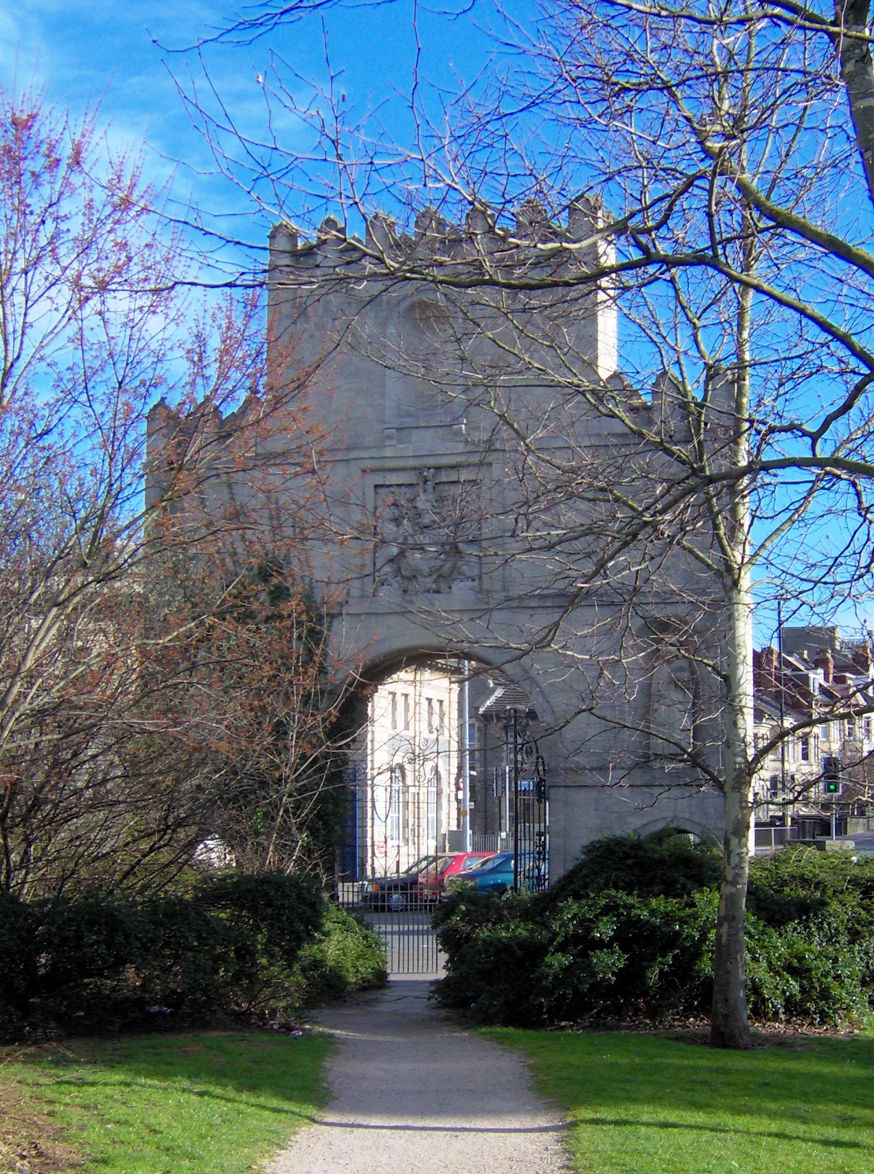
Arno's Court Triumphal Arch

Arnos Court Triumphal Arch (grid reference ST612716) is an 18th-century monument in Junction Road, Brislington, Bristol, England. == Description == The...

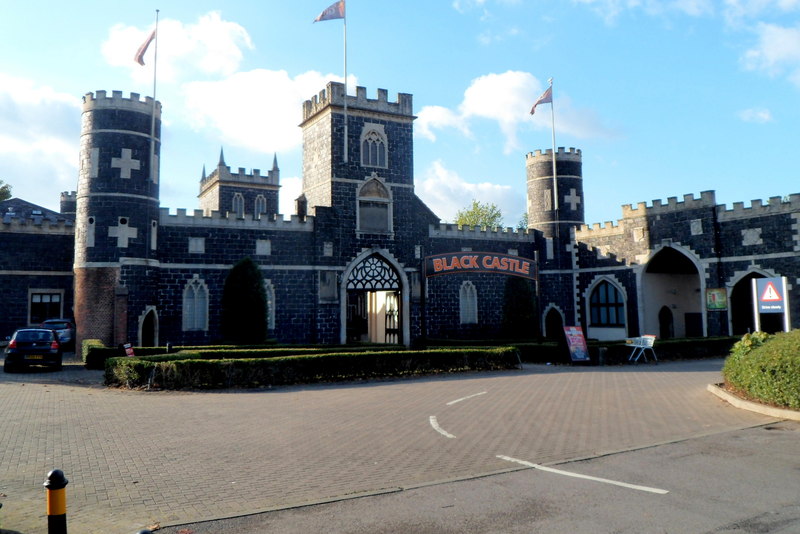
Black Castle, Bristol

Black Castle Public House is a Grade I-listed building and public house on Junction Road in the Brislington suburb of the English city of Bristol. It is...

Totterdown

Totterdown is an inner-suburb of Bristol, England, situated just south of the River Avon and to the south-east of Temple Meads railway station and the...

St Philip's Marsh depot

St Philip's Marsh depot is a railway depot located in the St Philip's Marsh district of Bristol, England. It was established as a steam locomotive shed...

Arnos Vale Cemetery

Arnos Vale Cemetery (grid reference ST606716) (also written Arno's Vale Cemetery), in Arnos Vale, Bristol, England, was established in 1837. Its first...

Mary Carpenter

Mary Carpenter (3 April 1807 – 14 June 1877) was an English educational and social reformer. The daughter of a Unitarian minister, she founded a ragged...

St Philip's Marsh

St Philip's Marsh is an industrial inner suburb of Bristol, England. It is bounded by River Avon and Harbour feeder canal making it an almost island area...

Waverley F.C.

Waverley F.C. were an English association football club based in Bristol during the Victorian era. Founded in 1889 as an offshoot of Waverley Cricket Club...

Nearby Amenities

Located within 500m of 51.441468,-2.5599668
Traffic Signals
Bicycle: yes
Button Operated: yes
Crossing: traffic_signals
Crossing Ref: pelican
Tactile Paving: yes
Traffic Signals Sound: no
Traffic Signals Vibration: yes
Lat/Long: 51.441486/-2.5597637
Crossing
Bicycle: yes
Button Operated: yes
Crossing: traffic_signals
Crossing Island: no
Crossing Ref: puffin
Mapillary: 229823002244461
Survey Date: 2020-08-21
Tactile Paving: yes
Traffic Signals Arrow: no
Traffic Signals Minimap: no
Traffic Signals Sound: yes
Traffic Signals Vibration: yes
Lat/Long: 51.4450823/-2.5586711
Barrier: block
Lat/Long: 51.4406543/-2.5579404
Noexit: yes
Lat/Long: 51.438267/-2.5570243
Recycling
Lat/Long: 51.4441997/-2.5599409
Barrier: bollard
Bicycle: yes
Bollard: fixed
Foot: yes
Lat/Long: 51.4445899/-2.5631755
Traffic Signals
Button Operated: yes
Crossing: traffic_signals
Crossing Ref: pelican
Tactile Paving: yes
Traffic Signals Sound: yes
Traffic Signals Vibration: yes
Lat/Long: 51.4376808/-2.5572773
Traffic Signals
Button Operated: yes
Crossing: traffic_signals
Tactile Paving: yes
Traffic Signals Sound: no
Traffic Signals Vibration: yes
Lat/Long: 51.4419469/-2.5612021
Barrier: bollard
Bicycle: yes
Foot: yes
Lat/Long: 51.4415648/-2.556899
Bus Stop
Winchester Road
Naptan AtcoCode: 0100BRA10436
Naptan Bearing: NW
Naptan CommonName: Winchester Road
Naptan Crossing: Winchester Road
Naptan NaptanCode: bstmamt
Naptan PlusbusZoneRef: BRSTLTM
Naptan Street: Sandy Park Road
Naptan Verified: no
Source: naptan_import
Lat/Long: 51.4402924/-2.5539885
Bus Stop
Repton Road
Bench: yes
Bin: no
Mapillary: 822592915335216
Naptan AtcoCode: 0100BRA10437
Naptan Bearing: NW
Naptan CommonName: Repton Road
Naptan Crossing: Repton Road
Naptan Landmark: The Sandringham
Naptan NaptanCode: bstmadm
Naptan PlusbusZoneRef: BRSTLTM
Naptan Street: Sandy Park Road
Naptan Verified: no
Public Transport: platform
Shelter: yes
Source: naptan_import
Survey Date: 2020-08-21
Lat/Long: 51.4409295/-2.5561688
Bus Stop
Arnos Court (A)
Bench: yes
Bin: no
Mapillary: 439851827455948
Naptan AtcoCode: 0100BRA10438
Naptan Bearing: W
Naptan CommonName: Arno's Court a
Naptan Crossing: Bath Road
Naptan NaptanCode: bstjwgw
Naptan PlusbusZoneRef: BRSTLTM
Naptan Street: Sandy Park Road
Naptan Verified: no
Public Transport: platform
Shelter: yes
Source: naptan_import
Survey Date: 2020-08-21
Lat/Long: 51.4414461/-2.5590959
Bus Stop
Arnos Court (C)
Bench: yes
Bin: yes
Lit: yes
Mapillary: 777718869555813
Naptan AtcoCode: 0100BRA10445
Naptan Bearing: E
Naptan CommonName: Arno's Court c
Naptan Crossing: St Philips Causeway
Naptan Landmark: Tv Studios
Naptan NaptanCode: bstjtwd
Naptan PlusbusZoneRef: BRSTLTM
Naptan Street: Bath Road
Naptan Verified: no
Public Transport: platform
Shelter: yes
Source: naptan_import
Survey Date: 2020-08-21
Tactile Paving: yes
Lat/Long: 51.4421137/-2.561403
Bus Stop
Repton Road
Naptan AtcoCode: 0100BRA10446
Naptan Bearing: E
Naptan CommonName: Repton Road
Naptan Crossing: Repton Raod
Naptan Landmark: The Sandringham
Naptan NaptanCode: bstmagd
Naptan PlusbusZoneRef: BRSTLTM
Naptan Street: Sandy Park Road
Naptan Verified: no
Shelter: yes
Source: naptan_import
Lat/Long: 51.4407276/-2.5551304
Bus Stop
Winchester Road
Naptan AtcoCode: 0100BRA10447
Naptan Bearing: E
Naptan CommonName: Winchester Road
Naptan Crossing: Winchester Road
Naptan NaptanCode: bstmapg
Naptan PlusbusZoneRef: BRSTLTM
Naptan Street: Sandy Park Road
Naptan Verified: no
Source: naptan_import
Lat/Long: 51.4402233/-2.5533834
Bus Stop
Tramway Road
Bench: yes
Bin: yes
Lit: yes
Naptan AtcoCode: 0100BRA10931
Naptan Bearing: N
Naptan CommonName: Tramway Road
Naptan Crossing: Tramway Road
Naptan NaptanCode: bstjwmd
Naptan PlusbusZoneRef: BRSTLTM
Naptan Street: Bath Road
Naptan Verified: no
Shelter: yes
Source: naptan_import
Tactile Paving: yes
Lat/Long: 51.4382188/-2.557898
Bus Stop
Tramway Road
Bench: yes
Bin: yes
Lit: yes
Mapillary: 1139994886483988
Naptan AtcoCode: 0100BRA10932
Naptan Bearing: SE
Naptan CommonName: Tramway Road
Naptan Crossing: Tramway Road
Naptan NaptanCode: bstjwpw
Naptan PlusbusZoneRef: BRSTLTM
Naptan Street: Bath Road
Naptan Verified: no
Public Transport: platform
Shelter: yes
Source: naptan_import
Survey Date: 2021-03-19
Tactile Paving: yes
Lat/Long: 51.4375582/-2.5568486
Bus Stop
Arnos Court (B)
Bench: yes
Bin: yes
Lit: yes
Naptan AtcoCode: 0100BRA10933
Naptan Bearing: N
Naptan CommonName: Arno's Court b
Naptan Crossing: King's Road
Naptan Landmark: Arno's Court Park
Naptan NaptanCode: bstjwgj
Naptan PlusbusZoneRef: BRSTLTM
Naptan Street: Bath Road
Naptan Verified: no
Shelter: yes
Source: naptan_import
Tactile Paving: yes
Lat/Long: 51.4406698/-2.5597195
Bus Stop
Sandholme Road (A)
Bench: no
Bin: no
Mapillary: 3979393755463318
Naptan AtcoCode: 0100BRA16936
Naptan Bearing: NE
Naptan CommonName: Sandholme Road A
Naptan Crossing: Upper Sandhurst Road
Naptan NaptanCode: bstpajp
Naptan PlusbusZoneRef: BRSTLTM
Naptan Street: Sandholme Road
Naptan Verified: no
Public Transport: platform
Shelter: no
Source: naptan_import
Survey Date: 2020-08-21
Lat/Long: 51.4422096/-2.5545693
Bus Stop
Sandholme Road (B)
Naptan AtcoCode: 0100BRA16939
Naptan Bearing: SW
Naptan BusStopType: CUS
Naptan CommonName: Sandholme Road (b)
Naptan Crossing: Upper Sandhurst Road
Naptan NaptanCode: bstpajw
Naptan PlusbusZoneRef: BRSTLTM
Naptan Street: Sandholme Road
Naptan Verified: no
Source: naptan_import
Lat/Long: 51.4422763/-2.5546887
Bus Stop
Kings Road
Naptan AtcoCode: 0100BRC53376
Naptan Bearing: N
Naptan CommonName: Kings Road
Naptan Crossing: Hampstead Road
Naptan NaptanCode: bstjwda
Naptan PlusbusZoneRef: BRSTLTM
Naptan Street: King's Road
Naptan Verified: no
Shelter: no
Source: naptan_import
Lat/Long: 51.4392723/-2.5605225
Bus Stop
Kings Road
Naptan AtcoCode: 0100BRC53377
Naptan Bearing: N
Naptan CommonName: Kings Road
Naptan Crossing: Hampstead Road
Naptan NaptanCode: bstjwat
Naptan PlusbusZoneRef: BRSTLTM
Naptan Street: King's Road
Naptan Verified: no
Shelter: no
Source: naptan_import
Lat/Long: 51.4393708/-2.5605956
Barrier: bollard
Bicycle: yes
Bollard: fixed
Foot: yes
Lat/Long: 51.4441895/-2.5584163
Barrier: bollard
Bicycle: yes
Foot: yes
Lat/Long: 51.4430053/-2.5578504
Barrier: bollard
Bicycle: yes
Foot: yes
Lat/Long: 51.4431656/-2.5579875
Traffic Signals
Button Operated: yes
Crossing: traffic_signals
Crossing Ref: pelican
Tactile Paving: yes
Traffic Signals Sound: no
Traffic Signals Vibration: yes
Lat/Long: 51.4377403/-2.5570931
Traffic Signals
Button Operated: yes
Crossing: traffic_signals
Crossing Ref: pelican
Tactile Paving: yes
Traffic Signals Sound: yes
Traffic Signals Vibration: yes
Lat/Long: 51.4377454/-2.5572121
Traffic Signals
Button Operated: yes
Crossing: traffic_signals
Crossing Ref: pelican
Tactile Paving: yes
Traffic Signals Sound: no
Traffic Signals Vibration: yes
Lat/Long: 51.4378161/-2.5571391
Speed Camera
Maxspeed: 30 mph
Lat/Long: 51.437979/-2.5576678
Crossing
Button Operated: yes
Crossing: traffic_signals
Crossing Ref: pelican
Lat/Long: 51.4459074/-2.5604981
Crossing
Button Operated: yes
Crossing: traffic_signals
Crossing Ref: pelican
Mapillary: 218663129741645
Survey Date: 2020-07-12
Tactile Paving: yes
Lat/Long: 51.445909/-2.5599963
Traffic Signals
Button Operated: yes
Crossing: traffic_signals
Crossing Ref: puffin
Tactile Paving: yes
Traffic Signals Sound: yes
Traffic Signals Vibration: yes
Lat/Long: 51.4403258/-2.5594182
Traffic Signals
Bicycle: yes
Button Operated: yes
Crossing: traffic_signals
Crossing Ref: puffin
Tactile Paving: yes
Traffic Signals Sound: yes
Traffic Signals Vibration: yes
Lat/Long: 51.4412681/-2.5599587
Crossing
Bicycle: yes
Button Operated: yes
Crossing: traffic_signals
Crossing Ref: puffin
Mapillary: 308700077467621
Survey Date: 2021-03-19
Tactile Paving: yes
Traffic Signals Sound: yes
Traffic Signals Vibration: yes
Lat/Long: 51.4413456/-2.5598745
Crossing
Crossing: marked
Crossing Markings: yes
Crossing Ref: zebra
Tactile Paving: yes
Lat/Long: 51.4436065/-2.5597656
Post Box
Collection Times: Mo-Fr 17:15; Sa 12:45
Post Box Type: wall
Ref: BS4 113
Royal Cypher: EVIIR
Royal Cypher Wikidata: Q33102324
Lat/Long: 51.4398853/-2.5592058
Traffic Signals
Button Operated: yes
Crossing: traffic_signals
Tactile Paving: yes
Traffic Signals Sound: no
Traffic Signals Vibration: yes
Lat/Long: 51.4420675/-2.5610924
Suncloud
Tourism: artwork
Lat/Long: 51.4432967/-2.5665567
Power: substation
Lat/Long: 51.4436603/-2.5647115
Post Box
Collection Times: Mo-Fr 09:00; Sa 07:00
Post Box Type: pillar
Ref: BS4 114D
Royal Cypher: VR
Royal Cypher Wikidata: Q33102356
Lat/Long: 51.442199/-2.5625756
Waste Basket
Check Date: 2021-05-06
Lat/Long: 51.4425099/-2.5646098
Veterinary
pdsa PetAid hospital
Lat/Long: 51.4377338/-2.5583016
Building: house
Source: survey
Lat/Long: 51.4416153/-2.5568894
Post Box
Ref: BS4 95
Source: survey
Lat/Long: 51.4432844/-2.5573974
Crossing
Crossing: marked
Crossing Ref: zebra
Tactile Paving: yes
Lat/Long: 51.4436061/-2.559476
Traffic Signals
Lat/Long: 51.4418349/-2.5607858
Traffic Signals
Lat/Long: 51.4418302/-2.5606078
Traffic Signals
Button Operated: yes
Crossing: traffic_signals
Tactile Paving: yes
Traffic Signals Sound: no
Traffic Signals Vibration: yes
Lat/Long: 51.4419898/-2.5609977
Crossing
Button Operated: yes
Crossing: traffic_signals
Mapillary: 2776596165938647
Survey Date: 2020-08-21
Tactile Paving: yes
Traffic Signals Sound: no
Traffic Signals Vibration: yes
Lat/Long: 51.4420737/-2.5609164
Traffic Signals
Button Operated: yes
Crossing: traffic_signals
Tactile Paving: yes
Traffic Signals Sound: no
Traffic Signals Vibration: yes
Lat/Long: 51.4421942/-2.5608466
Bench
Backrest: yes
Lat/Long: 51.4422598/-2.5606646
Bench
Backrest: yes
Lat/Long: 51.4422711/-2.5606753
Traffic Signals
Button Operated: yes
Crossing: traffic_signals
Crossing Ref: puffin
Tactile Paving: yes
Traffic Signals Sound: yes
Traffic Signals Vibration: yes
Lat/Long: 51.4424037/-2.5644607
Waste Basket
Lat/Long: 51.4425869/-2.5589903
Grit Bin
Lat/Long: 51.4417104/-2.5623673
Barrier: lift_gate
Bicycle: yes
Foot: yes
Lat/Long: 51.4417735/-2.5622656
Noexit: yes
Lat/Long: 51.4383958/-2.5569072
Noexit: yes
Lat/Long: 51.4396383/-2.5575807
Traffic Signals
Lat/Long: 51.4374564/-2.5568554
Bench
Lat/Long: 51.4395378/-2.5643443
Atm
Lat/Long: 51.4407096/-2.5554796
Atm
Lat/Long: 51.4406957/-2.5547833
Post Box
Post Box Type: pillar
Ref: BS4 1094
Royal Cypher: EIIR
Royal Cypher Wikidata: Q33102113
Lat/Long: 51.440621/-2.5547566
Crossing
Crossing: uncontrolled
Lat/Long: 51.440586/-2.5547937
Waste Basket
Lat/Long: 51.4408024/-2.5557508
Bus Stop
Arnos Court (D)
Bench: yes
Bin: no
Lit: yes
Mapillary: 461986838195614
Naptan AtcoCode: 0100BRA10439
Naptan NaptanCode: bstjpwm
Public Transport: platform
Shelter: yes
Survey Date: 2020-08-21
Tactile Paving: yes
Lat/Long: 51.442087/-2.5626598
Barrier: swing_gate
Bicycle: yes
Foot: yes
Lat/Long: 51.4428175/-2.566319
Grit Bin
Lat/Long: 51.4430035/-2.5663872
Addr Street: Chatsworth Road
Lat/Long: 51.4428345/-2.562601
Waste Basket
Check Date: 2023-08-18
Lat/Long: 51.4422626/-2.5632584
Barrier: bollard
Bicycle: yes
Bollard: fixed
Foot: yes
Lat/Long: 51.4436299/-2.5633795
Restaurant
Cloisters
Check Date: 2023-12-26
Lat/Long: 51.441514/-2.56065
Waste Basket
Check Date: 2023-12-26
Lat/Long: 51.4416394/-2.5598936
Crossing
Bicycle: yes
Button Operated: yes
Crossing: traffic_signals
Crossing Ref: pelican
Mapillary: 4259735024091338
Survey Date: 2020-08-21
Tactile Paving: yes
Traffic Signals Sound: no
Traffic Signals Vibration: yes
Lat/Long: 51.4415207/-2.5598745
Traffic Signals
Lat/Long: 51.4415959/-2.5601169
Bench
Backrest: yes
Lat/Long: 51.4426013/-2.5609262
Bench
Backrest: yes
Lat/Long: 51.44259/-2.5609155
Waste Basket
Lat/Long: 51.4439724/-2.5608722
Power: substation
Lat/Long: 51.4445826/-2.5602014
Toilets
Changing Table: yes
Fee: no
Wheelchair: yes
Lat/Long: 51.4415061/-2.5662994
Drinking Water: no
Drinking Water Legal: no
Man Made: water_tap
Lat/Long: 51.4422764/-2.5651655
Waste Basket
Check Date: 2024-04-13
Lat/Long: 51.4427236/-2.5657529
Bus Stop
Paintworks
Bench: yes
Bin: yes
Bus: yes
Lit: yes
Mapillary: 1093045647853983
Public Transport: platform
Shelter: yes
Survey Date: 2020-08-21
Tactile Paving: yes
Lat/Long: 51.4427278/-2.5657985
Atm
Check Date: 2023-08-21
Lat/Long: 51.4433257/-2.5594747
Bicycle Parking
Bicycle Parking: stands
Capacity: 8
Covered: no
Lat/Long: 51.4436878/-2.5594148
Addr City: Bristol
Addr Housenumber: 33
Addr Postcode: BS4 3PT
Addr Street: Sandgate Road
Lat/Long: 51.4408654/-2.5535592
Paintworks
Place: neighbourhood
Lat/Long: 51.4441162/-2.5647417
Entrance: main
Lat/Long: 51.4435604/-2.5595503
Entrance: service
Lat/Long: 51.4444746/-2.5546787
Entrance: main
Lat/Long: 51.4453993/-2.5587962
Give Way
Lat/Long: 51.4457978/-2.5581954
Entrance: emergency
Lat/Long: 51.4453798/-2.5590766
Natural: rock
Lat/Long: 51.4450808/-2.5589364
Argos
Addr City: Bristol
Addr Housename: Sainsbury's
Addr Postcode: BS4 3BD
Addr Street: Bloomfield Road Link
Addr Suburb: Brislington
Brand: Argos
Brand Wikidata: Q4789707
Brand Wikipedia: en:Argos (retailer)
Contact Website: https://www.argos.co.uk/stores/4386-bristol-castle-court-argos-in-sainsburys
Location: indoor
Shop: catalogue
Lat/Long: 51.4430345/-2.5593853
Bench
Material: wood
Lat/Long: 51.4392754/-2.5610468
Bench
Material: wood
Lat/Long: 51.4391752/-2.5639142
Bench
Backrest: no
Material: wood
Lat/Long: 51.4392793/-2.5657796
Bench
Backrest: no
Material: wood
Lat/Long: 51.4399122/-2.5631493
Entrance: yes
Lat/Long: 51.4410917/-2.5645761
Renatec Ltd
Addr City: Bristol
Addr Postcode: BS4 3HH
Addr Street: King's Road
Email: lynndon@renatec.co.uk
Fax: +44 117 971 3547
Note: Independent specialist in repair of new and older French cars: Renault, Citroen, Peugeot etc
Opening Hours: Mo-Fr 08:00-17:30
Phone: +44 117 977 7789
Service Vehicle Air Conditioning: yes
Service Vehicle Brakes: yes
Service Vehicle Car Repair: yes
Service Vehicle Diagnostics: yes
Service Vehicle Electrical: yes
Service Vehicle Inspection: yes
Service Vehicle Mot Test Station: yes
Service Vehicle Oil Change: yes
Service Vehicle Repairs: yes
Shop: car_repair
Website: http://www.renatec.co.uk/
Lat/Long: 51.4390502/-2.5613971
Barrier: cycle_barrier
Cycle Barrier: double
Cycle Barrier Installation: fixed
Lat/Long: 51.4409673/-2.5599643
Waste Basket
Lat/Long: 51.4420941/-2.5626951
Mill Stone
Lat/Long: 51.4445191/-2.5632504
Grit Bin
Lat/Long: 51.4436448/-2.5657286
Traffic Calming: bump
Lat/Long: 51.443507/-2.5660043
Grit Bin
Lat/Long: 51.4433538/-2.566328
Arnos Court Stable Gateway
Historic: memorial
Memorial: plaque
Lat/Long: 51.4418682/-2.5602603
Waste Basket
Lat/Long: 51.4375816/-2.5568821
Traffic Signals
Button Operated: yes
Crossing: traffic_signals
Crossing Ref: pelican
Tactile Paving: yes
Traffic Signals Sound: no
Traffic Signals Vibration: yes
Lat/Long: 51.4376564/-2.5571792
Waste Basket
Lat/Long: 51.4381794/-2.5578866
Barrier: swing_gate
Lat/Long: 51.4400288/-2.5590633
Barrier: swing_gate
Lat/Long: 51.4401804/-2.5591709
Traffic Signals
Button Operated: yes
Crossing: traffic_signals
Crossing Ref: puffin
Tactile Paving: yes
Traffic Signals Sound: yes
Traffic Signals Vibration: yes
Lat/Long: 51.4403489/-2.5593189
Barrier: bollard
Bollard: rising
Lat/Long: 51.4453474/-2.5566504
Barrier: swing_gate
Lat/Long: 51.4388825/-2.5569116
Millennium Milepost Sparke Evans Park
Description: 1) Chew Valley Lake 9, Whitchurch 3 2) Arno's Cemetary 0.25 3) Temple Meads 1, Bristol City Centre 1.5
Image: https://www.cyclestreets.net/location/194750/cyclestreets194750-size640.jpg
Information: guidepost
Ncn Milepost: rowe
Sustrans Ref: MP 809
Tourism: information
Lat/Long: 51.4451376/-2.5635089
Crossing
Crossing: marked
Lat/Long: 51.4415523/-2.5578564
Entrance: main
Lat/Long: 51.4409394/-2.5555686
Waste Basket
Lat/Long: 51.4407123/-2.5550609
Barrier: bollard
Lat/Long: 51.4405182/-2.554725
Barrier: bollard
Lat/Long: 51.4405052/-2.554724
Barrier: bollard
Lat/Long: 51.440477/-2.5546053
Barrier: bollard
Lat/Long: 51.4404735/-2.554624
Bicycle Parking
Capacity: 4
Lat/Long: 51.4405134/-2.554737
Leisure: picnic_table
Lat/Long: 51.4407809/-2.5552118
Leisure: picnic_table
Lat/Long: 51.4408039/-2.555199
Leisure: picnic_table
Lat/Long: 51.4407905/-2.5552453
Leisure: picnic_table
Lat/Long: 51.4408127/-2.5552306
Traffic Calming: bump
Lat/Long: 51.4421882/-2.5618993
Crossing
Crossing: marked
Tactile Paving: yes
Lat/Long: 51.4421666/-2.5614631
Street Lamp
Lat/Long: 51.4434893/-2.5567561
Crossing
Crossing: uncontrolled
Crossing Island: no
Crossing Ref: zebra
Tactile Paving: no
Lat/Long: 51.4435703/-2.565726
Elevator
Lat/Long: 51.4443983/-2.5649395
Royal Photographic Society
Addr City: Bristol
Addr Country: GB
Addr Housename: Paintworks
Addr Housenumber: 337
Addr Postcode: BS4 3AR
Addr Street: Central Road
Entrance: yes
Fee: no
Opening Hours: Th-Su 10:00-17:00
Tourism: gallery
Website: https://rps.org/
Lat/Long: 51.4438784/-2.564547
Martin Parr Foundation
Addr City: Bristol
Addr Country: GB
Addr Housename: Paintworks
Addr Housenumber: 316
Addr Postcode: BS4 3AR
Addr Street: Central Road
Entrance: yes
Fee: no
Level: 0
Tourism: gallery
Lat/Long: 51.4438256/-2.5647255
Barrier: block
Lat/Long: 51.4436187/-2.5656709
Grit Bin
Lat/Long: 51.4436435/-2.5657492
Fire Hydrant
Emergency: fire_hydrant
Fire Hydrant Diameter: 75
Fire Hydrant Position: lane
Fire Hydrant Type: underground
Water Source: main
Lat/Long: 51.4435628/-2.565775
Information: guidepost
Tourism: information
Lat/Long: 51.4436133/-2.5657073
Crux
Addr City: Bristol
Addr Country: GB
Addr Housename: Paintworks
Addr Postcode: BS4 3AR
Addr Street: Central Road
Check Date: 2023-08-18
Entrance: yes
Level: 0
Office: company
Lat/Long: 51.4436856/-2.564358
Elevator
Lat/Long: 51.4440435/-2.5636349
Noexit: yes
Lat/Long: 51.4441663/-2.5635614
Fire Hydrant
Emergency: fire_hydrant
Fire Hydrant Diameter: 75
Fire Hydrant Position: lane
Fire Hydrant Type: underground
Water Source: main
Lat/Long: 51.4445575/-2.5635649
Elevator
Lat/Long: 51.4437157/-2.56422
Noexit: yes
Lat/Long: 51.4433961/-2.5540504
Noexit: yes
Lat/Long: 51.4397591/-2.5572628
Entrance: yes
Lat/Long: 51.4388522/-2.556519
Noexit: yes
Lat/Long: 51.4390544/-2.5574624
Entrance: yes
Lat/Long: 51.4423475/-2.5615384
Street Lamp
Lat/Long: 51.4458/-2.5605273
Power: substation
Lat/Long: 51.4375047/-2.5623708
Fast Food
Cheungs Kitchen
Addr City: Bristol
Addr Housenumber: 15
Addr Postcode: BS4 3PJ
Addr Street: Sandhurst Road
Cuisine: chinese
Diet Vegan: yes
Drive Through: no
Website: https://www.cheungsvegankitchen.com/
Lat/Long: 51.4414785/-2.5549704
Recycling
Recycling Scrap Metal: yes
Recycling Type: container
Lat/Long: 51.4411886/-2.5549456
Entrance: main
Lat/Long: 51.4411772/-2.5549232
Man Made: surveillance
Lat/Long: 51.4411707/-2.5549011
Man Made: surveillance
Lat/Long: 51.4411839/-2.554946
Bench
Backrest: no
Material: wood
Seats: 3
Lat/Long: 51.4383182/-2.563364
Noexit: yes
Lat/Long: 51.4404545/-2.5576124
Barrier: height_restrictor
Height: 3
Lat/Long: 51.4388543/-2.5568149
Entrance: main
Lat/Long: 51.439906/-2.5568378
Recycling
Recycling Cardboard: yes
Recycling Magazines: yes
Recycling Newspaper: yes
Recycling Waste: yes
Recycling Type: container
Lat/Long: 51.4405827/-2.5577879
Addr Housenumber: 1
Addr Street: Roman Walk
Lat/Long: 51.4388739/-2.5573252
Addr Housenumber: 4-6
Addr Street: Roman Walk
Entrance: main
Lat/Long: 51.4389567/-2.5572653
Addr Housenumber: 2-3
Addr Street: Roman Walk
Entrance: main
Lat/Long: 51.4389385/-2.5573678
Addr Housenumber: 7-11
Addr Street: Roman Walk
Entrance: main
Lat/Long: 51.4391733/-2.5573891
Addr Housenumber: 12-16
Addr Street: Roman Walk
Entrance: main
Lat/Long: 51.4392186/-2.5575268
Street Lamp
Lat/Long: 51.4396563/-2.5576925
Addr Housenumber: 25
Addr Street: Roman Walk
Entrance: main
Lat/Long: 51.4397986/-2.5577949
Street Lamp
Lat/Long: 51.4388991/-2.5570377
Street Lamp
Lat/Long: 51.4391993/-2.5571772
Street Lamp
Lat/Long: 51.4395027/-2.5573193
Street Lamp
Lat/Long: 51.4398037/-2.5574595
Street Lamp
Lat/Long: 51.4400958/-2.5576224
Street Lamp
Lat/Long: 51.4403909/-2.5578048
Barrier: jersey_barrier
Lat/Long: 51.4404985/-2.5579263
Noexit: yes
Lat/Long: 51.4400414/-2.557722
Barrier: sally_port
Noexit: yes
Lat/Long: 51.4407018/-2.5579759
Addr Housenumber: 28-30
Addr Street: Roman Walk
Entrance: main
Lat/Long: 51.439726/-2.5580881
Addr Housenumber: 27
Addr Street: Roman Walk
Entrance: main
Lat/Long: 51.4397726/-2.558057
Addr Housenumber: 26
Addr Street: Roman Walk
Entrance: main
Lat/Long: 51.4398406/-2.558162
Addr Housenumber: 23
Addr Street: Roman Walk
Entrance: main
Lat/Long: 51.4397515/-2.5576692
Addr Housenumber: 24
Addr Street: Roman Walk
Entrance: main
Lat/Long: 51.4397288/-2.5577607
Entrance: service
Lat/Long: 51.4399552/-2.5586576
Entrance: main
Lat/Long: 51.4401748/-2.5589816
Bicycle Parking
Bicycle Parking: stands
Capacity: 8
Covered: no
Lat/Long: 51.4416034/-2.566148
Entrance: main
Lat/Long: 51.4415318/-2.5662864
Information: map
Tourism: information
Lat/Long: 51.4413376/-2.5658542
Generator Method: photovoltaic
Generator Output Electricity: yes
Generator Source: solar
Generator Type: solar_photovoltaic_panel
Location: roof
Power: generator
Lat/Long: 51.4389355/-2.5615712
Direction: 250
Generator Method: photovoltaic
Generator Output Electricity: yes
Generator Solar Modules: 10
Generator Source: solar
Generator Type: solar_photovoltaic_panel
Location: roof
Power: generator
Lat/Long: 51.4376903/-2.5610896
Generator Method: photovoltaic
Generator Output Electricity: yes
Generator Source: solar
Generator Type: solar_photovoltaic_panel
Location: roof
Power: generator
Lat/Long: 51.4385494/-2.5604884
Generator Method: photovoltaic
Generator Output Electricity: yes
Generator Source: solar
Generator Type: solar_photovoltaic_panel
Location: roof
Power: generator
Lat/Long: 51.4391659/-2.5593309
Generator Method: photovoltaic
Generator Output Electricity: yes
Generator Source: solar
Generator Type: solar_photovoltaic_panel
Location: roof
Power: generator
Lat/Long: 51.438509/-2.5592009
Generator Method: photovoltaic
Generator Output Electricity: yes
Generator Source: solar
Generator Type: solar_photovoltaic_panel
Location: roof
Power: generator
Lat/Long: 51.4378614/-2.5595144
Generator Method: photovoltaic
Generator Output Electricity: yes
Generator Source: solar
Generator Type: solar_photovoltaic_panel
Location: roof
Power: generator
Lat/Long: 51.4380153/-2.5596039
Generator Method: photovoltaic
Generator Output Electricity: yes
Generator Source: solar
Generator Type: solar_photovoltaic_panel
Location: roof
Power: generator
Lat/Long: 51.4379401/-2.5560605
Generator Method: photovoltaic
Generator Output Electricity: yes
Generator Source: solar
Generator Type: solar_photovoltaic_panel
Location: roof
Power: generator
Lat/Long: 51.4384217/-2.5563351
Generator Method: photovoltaic
Generator Output Electricity: yes
Generator Source: solar
Generator Type: solar_photovoltaic_panel
Location: roof
Power: generator
Lat/Long: 51.4392347/-2.5582025
Generator Method: photovoltaic
Generator Output Electricity: yes
Generator Source: solar
Generator Type: solar_photovoltaic_panel
Location: roof
Power: generator
Lat/Long: 51.4382255/-2.5582684
Street Lamp
Lat/Long: 51.439899/-2.5539033
Street Lamp
Lat/Long: 51.4401002/-2.554858
Street Lamp
Lat/Long: 51.4396741/-2.5546783
Street Lamp
Lat/Long: 51.4392892/-2.5543598
Street Lamp
Lat/Long: 51.4389014/-2.5543462
Generator Method: photovoltaic
Generator Output Electricity: yes
Generator Solar Modules: 12
Generator Source: solar
Generator Type: solar_photovoltaic_panel
Location: roof
Power: generator
Lat/Long: 51.4443237/-2.5652751
Generator Method: photovoltaic
Generator Output Electricity: yes
Generator Solar Modules: 12
Generator Source: solar
Generator Type: solar_photovoltaic_panel
Location: roof
Power: generator
Lat/Long: 51.444358/-2.5650318
Generator Method: photovoltaic
Generator Output Electricity: yes
Generator Solar Modules: 12
Generator Source: solar
Generator Type: solar_photovoltaic_panel
Location: roof
Power: generator
Lat/Long: 51.4444153/-2.5645017
Generator Method: photovoltaic
Generator Output Electricity: yes
Generator Solar Modules: 12
Generator Source: solar
Generator Type: solar_photovoltaic_panel
Location: roof
Power: generator
Lat/Long: 51.4444412/-2.5642404
Generator Method: photovoltaic
Generator Output Electricity: yes
Generator Solar Modules: 45
Generator Source: solar
Generator Type: solar_photovoltaic_panel
Location: roof
Power: generator
Lat/Long: 51.4443154/-2.5647603
Generator Method: photovoltaic
Generator Output Electricity: yes
Generator Solar Modules: 14
Generator Source: solar
Generator Type: solar_photovoltaic_panel
Location: roof
Power: generator
Lat/Long: 51.4444749/-2.5638484
Generator Method: photovoltaic
Generator Output Electricity: yes
Generator Solar Modules: 12
Generator Source: solar
Generator Type: solar_photovoltaic_panel
Location: roof
Power: generator
Lat/Long: 51.4444808/-2.5636621
Generator Method: photovoltaic
Generator Output Electricity: yes
Generator Solar Modules: 34
Generator Source: solar
Generator Type: solar_photovoltaic_panel
Location: roof
Power: generator
Lat/Long: 51.4444562/-2.5633805
Generator Method: photovoltaic
Generator Output Electricity: yes
Generator Solar Modules: 5
Generator Source: solar
Generator Type: solar_photovoltaic_panel
Location: roof
Power: generator
Lat/Long: 51.4440037/-2.5636871
Generator Method: photovoltaic
Generator Output Electricity: yes
Generator Solar Modules: 5
Generator Source: solar
Generator Type: solar_photovoltaic_panel
Location: roof
Power: generator
Lat/Long: 51.4439568/-2.5636937
Generator Method: photovoltaic
Generator Output Electricity: yes
Generator Solar Modules: 5
Generator Source: solar
Generator Type: solar_photovoltaic_panel
Location: roof
Power: generator
Lat/Long: 51.4439108/-2.5637001
Generator Method: photovoltaic
Generator Output Electricity: yes
Generator Solar Modules: 5
Generator Source: solar
Generator Type: solar_photovoltaic_panel
Location: roof
Power: generator
Lat/Long: 51.4438633/-2.5637067
Generator Method: photovoltaic
Generator Output Electricity: yes
Generator Solar Modules: 5
Generator Source: solar
Generator Type: solar_photovoltaic_panel
Location: roof
Power: generator
Lat/Long: 51.443812/-2.5637139
Generator Method: photovoltaic
Generator Output Electricity: yes
Generator Solar Modules: 5
Generator Source: solar
Generator Type: solar_photovoltaic_panel
Location: roof
Power: generator
Lat/Long: 51.4437676/-2.56372
Generator Method: photovoltaic
Generator Output Electricity: yes
Generator Solar Modules: 5
Generator Source: solar
Generator Type: solar_photovoltaic_panel
Location: roof
Power: generator
Lat/Long: 51.4437208/-2.5637266
Generator Method: photovoltaic
Generator Output Electricity: yes
Generator Solar Modules: 24
Generator Source: solar
Generator Type: solar_photovoltaic_panel
Location: roof
Power: generator
Lat/Long: 51.443935/-2.5639574
Generator Method: photovoltaic
Generator Output Electricity: yes
Generator Solar Modules: 48
Generator Source: solar
Generator Type: solar_photovoltaic_panel
Location: roof
Power: generator
Lat/Long: 51.4441726/-2.5633732
Generator Method: photovoltaic
Generator Output Electricity: yes
Generator Solar Modules: 100
Generator Source: solar
Generator Type: solar_photovoltaic_panel
Location: roof
Power: generator
Lat/Long: 51.4439222/-2.563405
Generator Method: photovoltaic
Generator Output Electricity: yes
Generator Solar Modules: 40
Generator Source: solar
Generator Type: solar_photovoltaic_panel
Location: roof
Power: generator
Lat/Long: 51.4439217/-2.5645215
Generator Method: photovoltaic
Generator Output Electricity: yes
Generator Solar Modules: 60
Generator Source: solar
Generator Type: solar_photovoltaic_panel
Location: roof
Power: generator
Lat/Long: 51.4437702/-2.5648177
Generator Method: photovoltaic
Generator Output Electricity: yes
Generator Solar Modules: 38
Generator Source: solar
Generator Type: solar_photovoltaic_panel
Location: roof
Power: generator
Lat/Long: 51.4437657/-2.5642789
Generator Method: photovoltaic
Generator Output Electricity: yes
Generator Solar Modules: 55
Generator Source: solar
Generator Type: solar_photovoltaic_panel
Location: roof
Power: generator
Lat/Long: 51.4437436/-2.5644689
Direction: 165
Generator Method: photovoltaic
Generator Output Electricity: yes
Generator Solar Modules: 5
Generator Source: solar
Generator Type: solar_photovoltaic_panel
Location: roof
Power: generator
Lat/Long: 51.4437253/-2.565691
Direction: 165
Generator Method: photovoltaic
Generator Output Electricity: yes
Generator Solar Modules: 5
Generator Source: solar
Generator Type: solar_photovoltaic_panel
Location: roof
Power: generator
Lat/Long: 51.4437661/-2.565708
Direction: 165
Generator Method: photovoltaic
Generator Output Electricity: yes
Generator Solar Modules: 5
Generator Source: solar
Generator Type: solar_photovoltaic_panel
Location: roof
Power: generator
Lat/Long: 51.4438088/-2.5657259
Direction: 165
Generator Method: photovoltaic
Generator Output Electricity: yes
Generator Solar Modules: 5
Generator Source: solar
Generator Type: solar_photovoltaic_panel
Location: roof
Power: generator
Lat/Long: 51.4438516/-2.5657438
Direction: 165
Generator Method: photovoltaic
Generator Output Electricity: yes
Generator Solar Modules: 5
Generator Source: solar
Generator Type: solar_photovoltaic_panel
Location: roof
Power: generator
Lat/Long: 51.4438952/-2.5657621
Direction: 165
Generator Method: photovoltaic
Generator Output Electricity: yes
Generator Solar Modules: 5
Generator Source: solar
Generator Type: solar_photovoltaic_panel
Location: roof
Power: generator
Lat/Long: 51.4439353/-2.5657788
Direction: 165
Generator Method: photovoltaic
Generator Output Electricity: yes
Generator Solar Modules: 5
Generator Source: solar
Generator Type: solar_photovoltaic_panel
Location: roof
Power: generator
Lat/Long: 51.4439772/-2.5657964
Direction: 165
Generator Method: photovoltaic
Generator Output Electricity: yes
Generator Solar Modules: 5
Generator Source: solar
Generator Type: solar_photovoltaic_panel
Location: roof
Power: generator
Lat/Long: 51.4440183/-2.5658136
Direction: 165
Generator Method: photovoltaic
Generator Output Electricity: yes
Generator Solar Modules: 5
Generator Source: solar
Generator Type: solar_photovoltaic_panel
Location: roof
Power: generator
Lat/Long: 51.4440625/-2.5658321
Board Type: history
Information: board
Tourism: information
Lat/Long: 51.4393692/-2.5658254
Playground: slide
Lat/Long: 51.4405056/-2.5607279
Playground: swing
Lat/Long: 51.4403785/-2.5607427
Bench
Backrest: no
Lat/Long: 51.4403488/-2.5604798
Bench
Backrest: no
Lat/Long: 51.4403559/-2.5601606
Bench
Backrest: no
Lat/Long: 51.4402059/-2.5602813
Covered: no
Leisure: picnic_table
Lat/Long: 51.4406063/-2.5606414
Covered: no
Leisure: picnic_table
Lat/Long: 51.4403108/-2.5600842
Playground: roundabout
Lat/Long: 51.4402932/-2.5604054
Bench
Backrest: no
Lat/Long: 51.4403835/-2.5606414
Bench
Backrest: no
Lat/Long: 51.4404767/-2.5606535
Covered: no
Leisure: picnic_table
Lat/Long: 51.4402587/-2.5600952
Historic: memorial
Memorial: ghost_bike
Lat/Long: 51.4409137/-2.5616697
Board Type: wildlife
Information: board
Tourism: information
Lat/Long: 51.4411603/-2.5662984
Entrance: yes
Lat/Long: 51.4423077/-2.5648382
Entrance: yes
Lat/Long: 51.4423381/-2.564981
Crossing
Crossing: unmarked
Kerb: flush
Tactile Paving: yes
Lat/Long: 51.4424209/-2.5648607
Entrance: yes
Lat/Long: 51.4414557/-2.5661285
Entrance: yes
Lat/Long: 51.4411256/-2.5647412
Crossing
Crossing: uncontrolled
Crossing Markings: yes
Lat/Long: 51.4438155/-2.5589321
Bench
Backrest: no
Material: wood
Seats: 3
Lat/Long: 51.4382494/-2.5634537
Historic: memorial
Material: stone
Memorial: war_memorial
Lat/Long: 51.4392823/-2.5656946
The data included in this document is from www.openstreetmap.org. The data is made available under ODbL.

Have you been to Arno's Vale?

Leave your review of Arno's Vale below (or comments, questions and feedback).