Aberdyfi

Settlement in Merionethshire

Wales

Aberdyfi

Sand Dunes at Aberdovey This square consists of just dunes and sand, much of which is covered at high tide. Looking approximately south, towards Ynyslas across the Dovey Estuary.
Sand Dunes at Aberdovey Credit: John Lucas

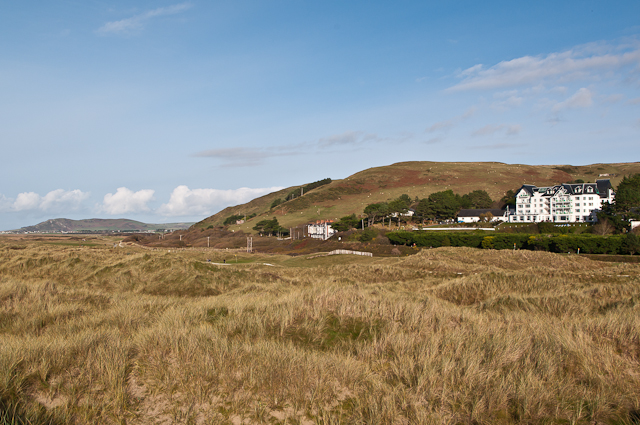
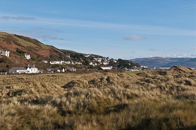
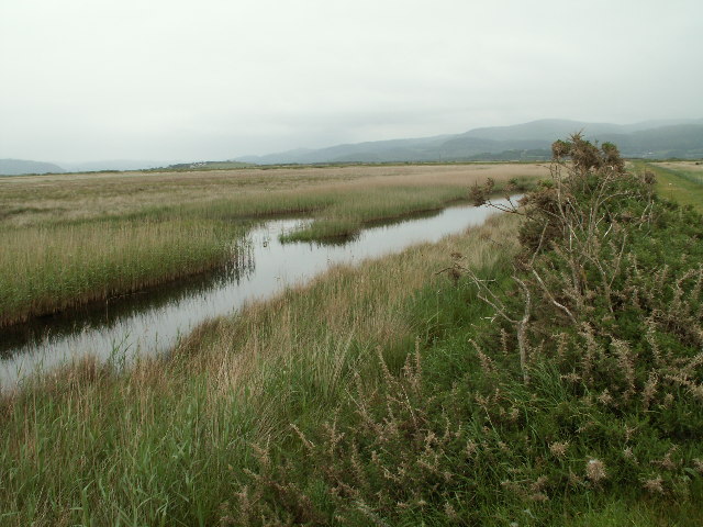
Aberdyfi, also known as Aberdovey, is a picturesque village nestled on the west coast of Wales, in the county of Merionethshire. Situated at the mouth of the River Dyfi, it lies within the Snowdonia National Park, offering stunning natural surroundings.

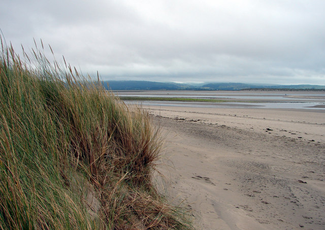
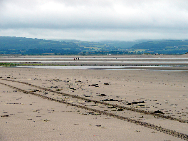
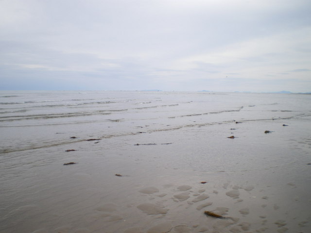
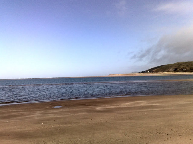
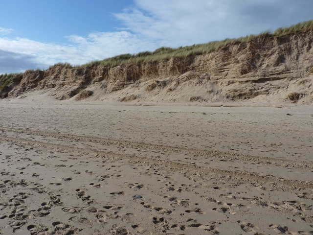
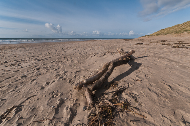
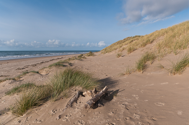
With a population of approximately 1,300 residents, Aberdyfi attracts a steady stream of tourists who are drawn to its sandy beaches, clear blue waters, and charming harbor. The village is renowned for its sailing and watersports facilities, making it a popular destination for enthusiasts. Sailing regattas and fishing trips can often be observed from the harbor, adding to the vibrant atmosphere.

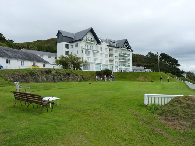
Aberdyfi's quaint streets are lined with colorful Georgian and Victorian houses, giving it a distinct charm. The village also boasts a number of independent shops, cafes, and restaurants, offering visitors a variety of options for shopping and dining.

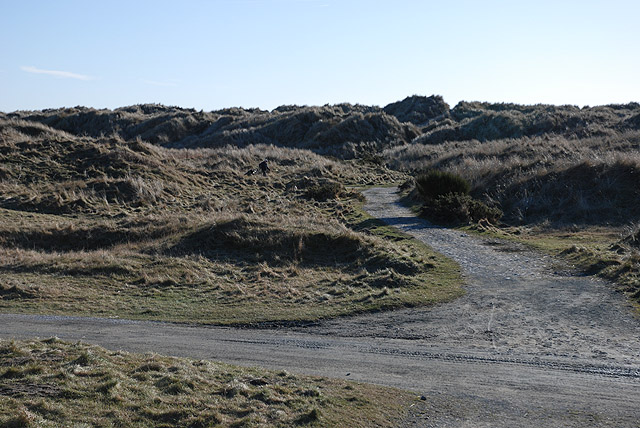
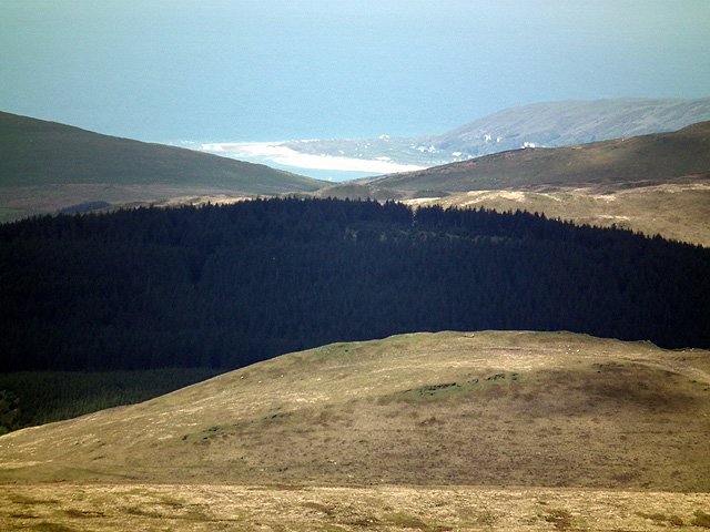
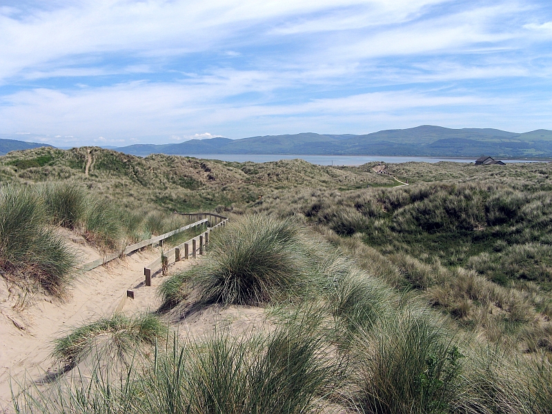
The area surrounding Aberdyfi offers a wealth of outdoor activities, including hiking, cycling, and golfing. The nearby Snowdonia National Park provides ample opportunities for exploration, with its rugged mountains, scenic trails, and cascading waterfalls.

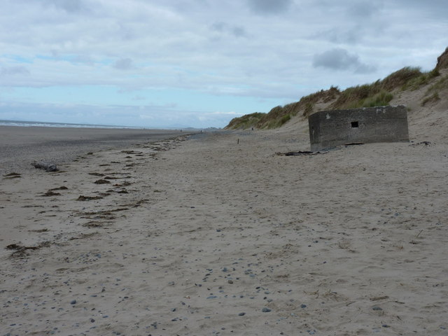
For history enthusiasts, Aberdyfi is home to the Aberdyfi Castle, an ancient fortification dating back to the 13th century. The ruins serve as a reminder of the village's rich heritage.

Overall, Aberdyfi is a tranquil coastal village that combines natural beauty, outdoor adventures, and historic landmarks, making it an idyllic destination for nature lovers and those seeking a relaxing getaway.

If you have any feedback on the listing, please let us know in the comments section below.
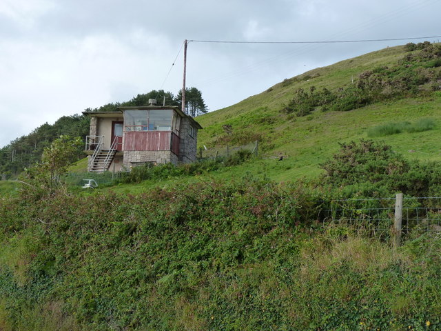
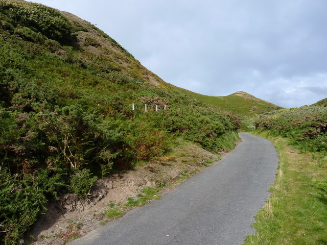
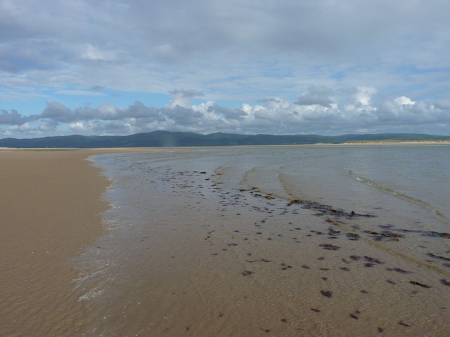
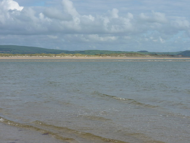
Aberdyfi Images

Images are sourced within 2km of 52.543927/-4.044392 or Grid Reference SN6195. Thanks to Geograph Open Source API. All images are credited.

Sand Dunes at Aberdovey This square consists of just dunes and sand, much of which is covered at high tide. Looking approximately south, towards Ynyslas across the Dovey Estuary.
Sand Dunes at Aberdovey
This square consists of just dunes and sand, much of which is covered at high tide. Looking approximately south, towards Ynyslas across the Dovey Estuary.
Tracks in the sand A beach patrol had recently passed this way. The view is across the Dyfi Estuary towards Ynyslas.
Tracks in the sand
A beach patrol had recently passed this way. The view is across the Dyfi Estuary towards Ynyslas.
NW towards Aberdovey Bar Just about on the edge of the bar at Ynyslas, looking towards a group of anglers on Aberdovey Bar. The tide needed to go out quite a bit more to expose much of the sandbank at Ynyslas.
NW towards Aberdovey Bar
Just about on the edge of the bar at Ynyslas, looking towards a group of anglers on Aberdovey Bar. The tide needed to go out quite a bit more to expose much of the sandbank at Ynyslas.
Cambrian coast railway line west of Aberdyfi
Track over Aberdyfi golf course Giving access to the dunes.
Track over Aberdyfi golf course
Giving access to the dunes.
Aberdyfi beach Aberdyfi beach including I think the Trefeddian hotel in the distance.
Aberdyfi beach
Aberdyfi beach including I think the Trefeddian hotel in the distance.
The Trefeddian Hotel A landmark hotel on the road just south of Aberdovey; the current building sits on the site of a Victorian predecessor, and to a certain extent echoes the architectural style of that predecessor.
The Trefeddian Hotel
A landmark hotel on the road just south of Aberdovey; the current building sits on the site of a Victorian predecessor, and to a certain extent echoes the architectural style of that predecessor.
Pillbox at the dune front A WWII pillbox on the edge of the dunes north of Aberdovey; this one is effectively complete, but there are the remains of 2 or 3 more along the beach further north, all of which appear to have been blown up, in an effort to destroy them.
Pillbox at the dune front
A WWII pillbox on the edge of the dunes north of Aberdovey; this one is effectively complete, but there are the remains of 2 or 3 more along the beach further north, all of which appear to have been blown up, in an effort to destroy them.
Former Coastguard lookout station Abandoned lookout station on the side of the A493 just north of Aberdovey
Former Coastguard lookout station
Abandoned lookout station on the side of the A493 just north of Aberdovey
Track & bridleway up Cwm Safn-ast
Incoming tide on Aberdovey beach
Across the incoming tide to a small sandbank The current sand layout in the Dyfi estuary (Aug 2011) leaves a low sandbank exposed offshore as the tide flows. It attracts a population of gulls and wading birds, until the waves eventually drown it and they are forced elsewhere. In the distance, the dunes and beach of Ynyslas and Twni Bâch.
Across the incoming tide to a small sandbank
The current sand layout in the Dyfi estuary (Aug 2011) leaves a low sandbank exposed offshore as the tide flows. It attracts a population of gulls and wading birds, until the waves eventually drown it and they are forced elsewhere. In the distance, the dunes and beach of Ynyslas and Twni Bâch.
Dune bedding at Aberdovey It's not uncommon to find ancient dune bedding preserved in sandstone rocks, especially throughout the Midlands; this is the bedding process in action in modern dunes.
Dune bedding at Aberdovey
It's not uncommon to find ancient dune bedding preserved in sandstone rocks, especially throughout the Midlands; this is the bedding process in action in modern dunes.
The dunes at Aberdovey are just visible from the summit of Plynlimon The distance is about 13 miles.
The dunes at Aberdovey are just visible from the summit of Plynlimon
The distance is about 13 miles.
Aberdovey beach Dead branches washed up on Aberdovey beach, with the dunes on the right.
Aberdovey beach
Dead branches washed up on Aberdovey beach, with the dunes on the right.
Aberdovey  Dunes alongside Aberdovey beach.
Aberdovey
Dunes alongside Aberdovey beach.
Aberdovey golf course The links of Aberdovey Golf Club.  On the right is the Trefeddian Hotel.
Aberdovey golf course
The links of Aberdovey Golf Club. On the right is the Trefeddian Hotel.
Aberdovey dunes The dunes above Aberdovey beach, with the village in the background.  The building above the brighter green area towards the right of centre of the photo is the clubhouse of Aberdovey Golf Club.
Aberdovey dunes
The dunes above Aberdovey beach, with the village in the background. The building above the brighter green area towards the right of centre of the photo is the clubhouse of Aberdovey Golf Club.
Show me another place!

Aberdyfi is located at Grid Ref: SN6195 (Lat: 52.543927, Lng: -4.044392)

Unitary Authority: Gwynedd

Police Authority: North Wales

Also known as: Aberdovey

What 3 Words

///trembles.moving.waltzed. Near Tywyn, Gwynedd

Related Wikis

Aberdyfi

Aberdyfi (Welsh pronunciation: [abɛrˈdəvi]), also known as Aberdovey ( a-bər-DUH-vee), is a village and community in Gwynedd, Wales, located on the northern...

Aberdovey Lifeboat Station

Aberdovey Lifeboat Station (Welsh: Gorsaf Bad Achub Aberdyfi) is an RNLI lifeboat station in the coastal village of Aberdyfi, Gwynedd, West Wales, on the...

Penhelig railway station

Penhelig railway station (Welsh: Penhelyg) serves the eastern outskirts of the seaside resort of Aberdyfi in Gwynedd, Wales. It was opened by the Great...

Aberdovey railway station

Aberdovey railway station (Welsh: Aberdyfi) serves the seaside resort of Aberdyfi in Gwynedd, Wales. The station is on the Cambrian Coast Railway with...

Ynyslas

Ynyslas (Welsh pronunciation: [ənɪsˈlas], meaning "Blue Island") is a small Welsh village about 1.5 miles north of Borth and 8 miles north of Aberystwyth...

Dyfi National Nature Reserve

The Dyfi National Nature Reserve, managed by Natural Resources Wales, the successor body to the Countryside Council for Wales, is located 7 miles (11 km...

Ynyslas Sand Dunes

Ynyslas Sand Dunes (Welsh: Twyni Tywod Ynyslas) are sand dunes located in Ceredigion, Wales. They border Cardigan Bay and the Dyfi Estuary between Ynyslas...

Afon Leri

The Afon Leri (Welsh pronunciation: [ˈlɛri]) (English: River Leri) is a river in Ceredigion, Wales. It rises at Llyn Craig-y-Pistyll and is joined at...

Nearby Amenities

Located within 500m of 52.543927,-4.044392
Source: PGS
Lat/Long: 52.5421985/-4.0511301
Source: PGS
Lat/Long: 52.5423031/-4.0503034
Source: PGS
Lat/Long: 52.5424309/-4.0488943
Source: PGS
Lat/Long: 52.5424828/-4.0479542
Source: PGS
Lat/Long: 52.5428128/-4.0468459
Source: PGS
Lat/Long: 52.5431177/-4.0459772
Source: PGS
Lat/Long: 52.5432722/-4.0453813
Source: PGS
Lat/Long: 52.543701/-4.0438215
Source: PGS
Lat/Long: 52.5439599/-4.0440445
Source: PGS
Lat/Long: 52.5441467/-4.0424239
Source: PGS
Lat/Long: 52.5441141/-4.0416836
Source: PGS
Lat/Long: 52.5440994/-4.0408521
Source: PGS
Lat/Long: 52.5444045/-4.0399991
Source: PGS
Lat/Long: 52.5447063/-4.0391703
Source: PGS
Lat/Long: 52.5448596/-4.0388458
Source: PGS
Lat/Long: 52.5449216/-4.0375423
Source: PGS
Lat/Long: 52.5448759/-4.0375209
Traffic Signals
Lat/Long: 52.5436551/-4.0452372
Toilets
Lat/Long: 52.543658/-4.0450542
Restaurant
Coast Deli & Dining
Addr City: Aberdovey
Addr Housenumber: 7
Addr Postcode: LL35 0EE
Addr Street: Seaview Terrace
Lat/Long: 52.5439843/-4.0446304
Recycling
Recycling Type: container
Lat/Long: 52.5438965/-4.0488091
Shelter
Penybryn shelter
Description: Shelter gifted by local landowner in 1897. Previously a castle 1151 to 1157.
Leisure: bandstand
Lat/Long: 52.5442/-4.0469393
Source: PGS
Lat/Long: 52.5431956/-4.0451895
Leisure: slipway
Seamark Small Craft Facility Category: slipway
Seamark Type: small_craft_facility
Lat/Long: 52.543056/-4.045859
Tourist information centre
Information: office
Phone: +44 1654 767321
Tourism: information
Website: https://www.aberdovey.org.uk/
Lat/Long: 52.543506/-4.0448118
Cigydd Aberdyfi Butcher
Addr City: Aberdovey
Addr Housenumber: 3
Addr Postcode: LL35 0EU
Addr Street: Copperhill Street
Opening Hours: Tu-Sa 08:00-16:00
Phone: +44 1654 767223
Shop: butcher
Toilets Wheelchair: no
Lat/Long: 52.5441112/-4.0446016
Fast Food
coast... to go
Opening Hours: Mo-Sa 09:00-20:30; PH,Su 09:00-16:00
Lat/Long: 52.543844/-4.046443
Costcutter
Brand: Costcutter
Brand Wikidata: Q5175072
Contact Website: https://store-locator.costcutter.co.uk/costcutter-67aeae1ea131
Shop: convenience
Lat/Long: 52.543915/-4.0447504
Cafe
The Sandwich Shop
Opening Hours: PH,Th-Tu 09:00-17:00
Lat/Long: 52.5438603/-4.0465757
Ice Cream
The Fridge
Lat/Long: 52.5437847/-4.0450814
Ice Cream
The Sweet Shop
Lat/Long: 52.5438225/-4.0449493
Disused Shop: yes
Lat/Long: 52.5436968/-4.0455759
Restaurant
Sea Breeze
Lat/Long: 52.5439648/-4.047815
Pub
The Dovey Inn
Wikidata: Q80583217
Lat/Long: 52.5440611/-4.0443781
Restaurant
Cuisine: fish_and_chips
Lat/Long: 52.5439483/-4.0476988
Pub
The Britannia
Wikidata: Q80857539
Lat/Long: 52.5443182/-4.0437715
Cafe
Lat/Long: 52.5438614/-4.0453089
Power: substation
Lat/Long: 52.546838/-4.047252
Playground: basketswing
Lat/Long: 52.5437278/-4.0491441
Playground: roundabout
Lat/Long: 52.5437524/-4.0495766
Playground: slide
Lat/Long: 52.5437351/-4.0493461
Life Ring
Emergency: life_ring
Lat/Long: 52.5432863/-4.0478675
Bench
Lat/Long: 52.5433336/-4.04889
Atm
Cash In: no
Check Date: 2023-06-11
Fee: yes
Opening Hours: 24/7
Operator: Cashzone
Lat/Long: 52.5435923/-4.0455196
Bench
Lat/Long: 52.5440314/-4.0488986
Life Ring
Emergency: life_ring
Lat/Long: 52.5433206/-4.0488986
Waste Basket
Lat/Long: 52.5439694/-4.0491068
Pharmacy
Thomas & Co Medical Hall
Opening Hours: Mo, We-Fr 08:30-15:00; Tu, Sa 08:30-13:00
Lat/Long: 52.5436994/-4.0453451
Waste Basket
Lat/Long: 52.5440326/-4.0489188
Cafe
Walkers
Cuisine: fish_and_chips
Lat/Long: 52.5439473/-4.0476618
Barrier: lift_gate
Lat/Long: 52.5435389/-4.0458283
Direction: 150
Generator Method: photovoltaic
Generator Output Electricity: yes
Generator Solar Modules: 8
Generator Source: solar
Generator Type: solar_photovoltaic_panel
Location: roof
Power: generator
Lat/Long: 52.5472262/-4.04709
Direction: 150
Generator Method: photovoltaic
Generator Output Electricity: yes
Generator Solar Modules: 8
Generator Source: solar
Generator Type: solar_photovoltaic_panel
Location: roof
Power: generator
Lat/Long: 52.5472809/-4.0471423
Direction: 215
Generator Method: photovoltaic
Generator Output Electricity: yes
Generator Solar Modules: 18
Generator Source: solar
Generator Type: solar_photovoltaic_panel
Location: roof
Power: generator
Lat/Long: 52.5453423/-4.0501276
Direction: SSE
Generator Method: photovoltaic
Generator Output Electricity: yes
Generator Solar Modules: 6
Generator Source: solar
Generator Type: solar_photovoltaic_panel
Location: roof
Power: generator
Lat/Long: 52.5434094/-4.0451279
Direction: S
Generator Method: photovoltaic
Generator Output Electricity: yes
Generator Solar Modules: 16
Generator Source: solar
Generator Type: solar_photovoltaic_panel
Location: roof
Power: generator
Lat/Long: 52.5477294/-4.0474239
Leisure: picnic_table
Lat/Long: 52.5436685/-4.0491174
Bench
Lat/Long: 52.5436857/-4.0495257
Charging Station
Lat/Long: 52.5437496/-4.0471604
Bench
Lat/Long: 52.5437875/-4.0494039
Playground: climbingframe
Lat/Long: 52.5437423/-4.0494719
Bench
Lat/Long: 52.5437833/-4.0491916
Bench
Lat/Long: 52.5436556/-4.0492039
Shelter
Lat/Long: 52.5436524/-4.0491187
Playground: seesaw
Lat/Long: 52.5437335/-4.049252
Charging Station
Lat/Long: 52.5437484/-4.0471228
Cafe
Lat/Long: 52.5434849/-4.0448426
The data included in this document is from www.openstreetmap.org. The data is made available under ODbL.

Have you been to Aberdyfi?

Leave your review of Aberdyfi below (or comments, questions and feedback).