Ash Coppice
Wood, Forest in Staffordshire Lichfield
England
Ash Coppice

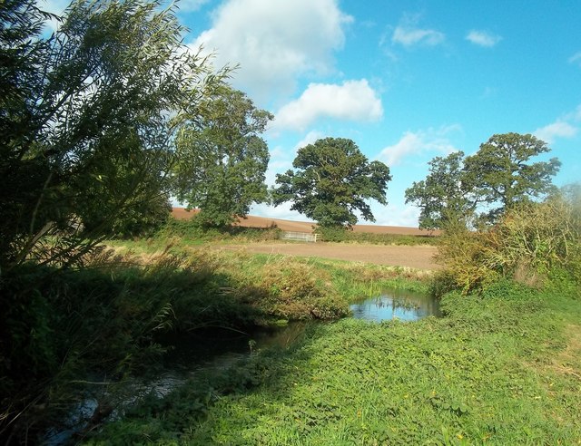
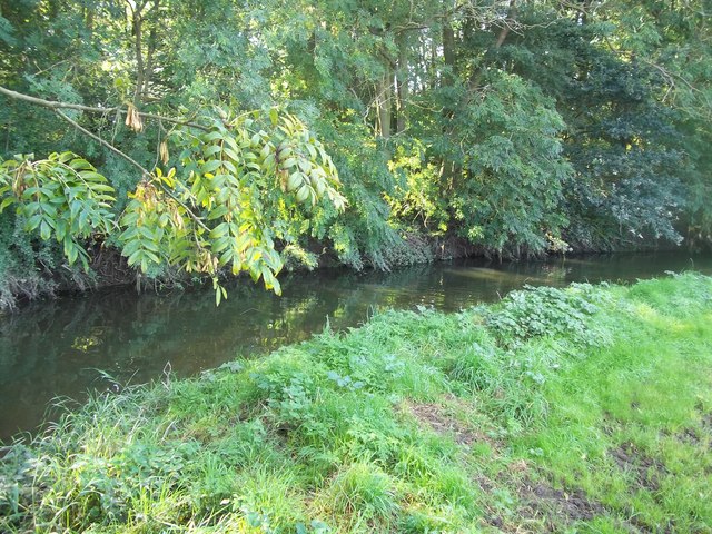
Ash Coppice is a serene woodland located in the county of Staffordshire, England. Covering an area of approximately 50 hectares, this enchanting forest is home to a diverse range of flora and fauna, making it a popular destination for nature enthusiasts and hikers.
The woodland primarily consists of ash trees, which thrive in the damp and fertile soil. These trees create a dense canopy that provides shelter for an abundance of wildlife. Visitors to Ash Coppice can expect to encounter various species of birds, including woodpeckers, owls, and warblers, as well as small mammals such as squirrels, foxes, and rabbits.
The forest is crisscrossed by a network of well-maintained trails, allowing visitors to explore the woodland at their own pace. These paths lead visitors through a rich tapestry of natural beauty, including vibrant wildflowers, moss-covered rocks, and babbling brooks. Additionally, there are several designated picnic areas scattered throughout the forest, providing visitors with the perfect spot to relax and enjoy a meal amidst the tranquil surroundings.
Ash Coppice also holds historical significance, with remnants of ancient settlements and archaeological sites scattered throughout the woodland. These remnants serve as a reminder of the area's rich heritage and provide an interesting glimpse into the past for those interested in history.
Overall, Ash Coppice offers a peaceful retreat from the hustle and bustle of everyday life. With its stunning natural beauty, abundant wildlife, and historical significance, it is a must-visit destination for nature lovers and history enthusiasts alike.
If you have any feedback on the listing, please let us know in the comments section below.
Ash Coppice Images
Images are sourced within 2km of 52.690956/-1.6172109 or Grid Reference SK2510. Thanks to Geograph Open Source API. All images are credited.


Ash Coppice is located at Grid Ref: SK2510 (Lat: 52.690956, Lng: -1.6172109)
Administrative County: Staffordshire
District: Lichfield
Police Authority: Staffordshire
What 3 Words
///clockwork.gent.coughed. Near Donisthorpe, Leicestershire
Nearby Locations
Related Wikis

Clifton Campville
Clifton Campville is a village, former manor and civil parish in Staffordshire, England. It lies on the River Mease, about 10 miles (16 km) east of the...

Church of St Andrew, Clifton Campville
The Church of St Andrew is a Grade I listed church in the village of Clifton Campville, Staffordshire. It was built in the 13th and 14th centuries. The...

Thorpe Constantine
Thorpe Constantine is a small village and civil parish in Staffordshire, England. It lies about 6 miles (10 km) north-east of Tamworth and 6 miles south...

River Mease SSSI
River Mease SSSI is a 23.0 hectares (57 acres) biological Site of Special Scientific Interest. It is a stretch of the River Mease and its tributary Gilwiskaw...

Haunton
Haunton is a village in Staffordshire, England. It lies on the River Mease, about 7 miles (11 km) north of Tamworth, 1½ miles east of Harlaston and 1 mile...

All Saints' Church, Lullington
All Saints’ Church, Lullington is a Grade II* listed parish church in the Church of England in Lullington, Derbyshire. == History == The church dates...

Chilcote
Chilcote is a village and civil parish in the North West Leicestershire district of Leicestershire, England. Until 1897 it was in Derbyshire. The parish...

Lullington, Derbyshire
Lullington is a village and civil parish in the district of South Derbyshire in Derbyshire, England. The population of the civil parish at the 2011 Census...
Nearby Amenities
Located within 500m of 52.690956,-1.6172109Have you been to Ash Coppice?
Leave your review of Ash Coppice below (or comments, questions and feedback).