Deeping St James

Settlement in Lincolnshire South Kesteven

England

Deeping St James

River Welland from Market Deeping bridge This view is from the parapet of the stone bridge built in 1842, looking east. The left bank is the back of the properties on the south side of the Market Place, and beyond.
River Welland from Market Deeping bridge Credit: Brian Green

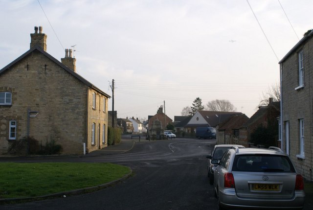
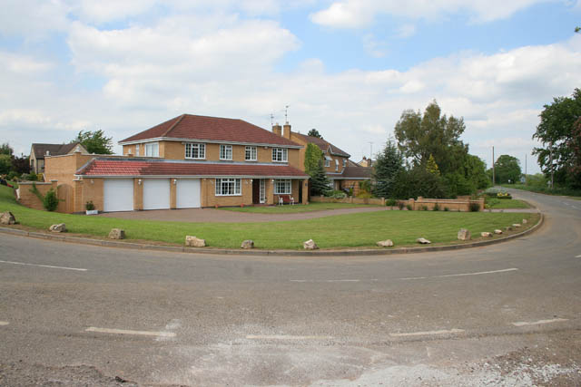
Deeping St James is a quaint village nestled in the county of Lincolnshire, England. Located on the banks of the River Welland, it is part of the district of South Kesteven. With a population of around 6,000 residents, it is a tight-knit community with a strong sense of history and charm.

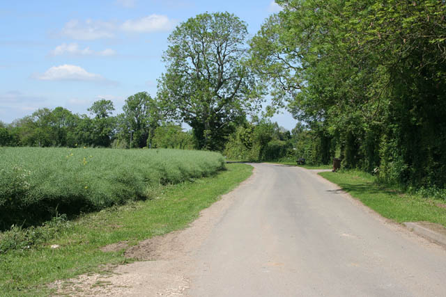
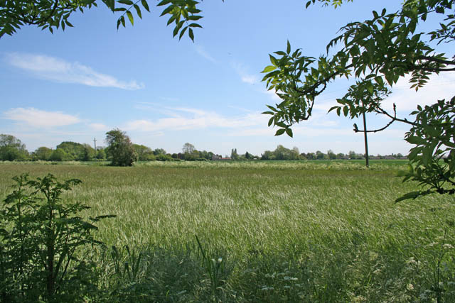
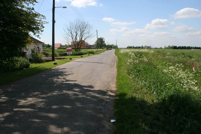
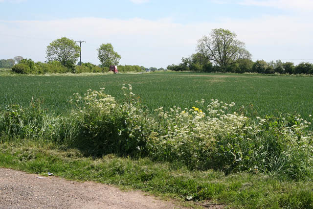
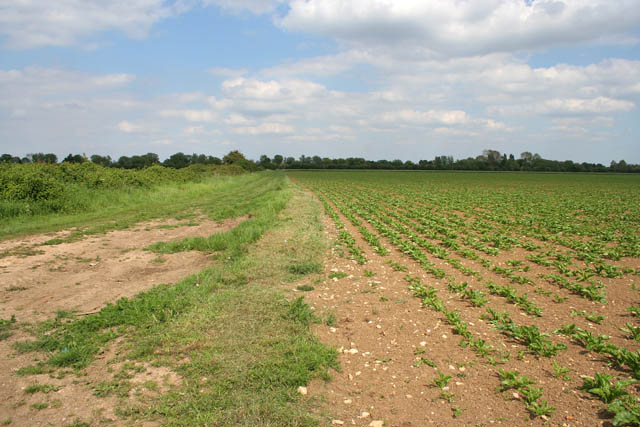
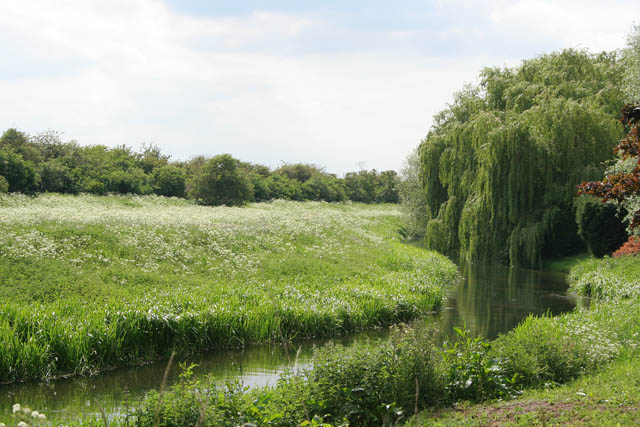
The village is known for its picturesque countryside, with rolling hills and fields surrounding the area. It offers a peaceful and idyllic setting for residents and visitors alike. The River Welland flows through the village, providing beautiful views and opportunities for boating and fishing.

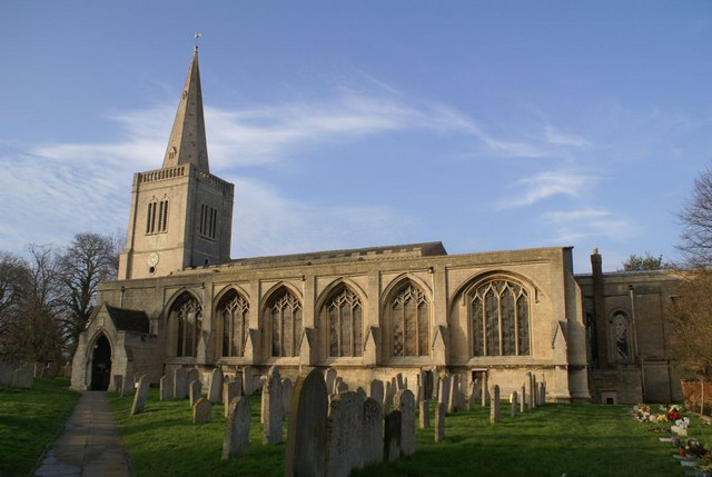
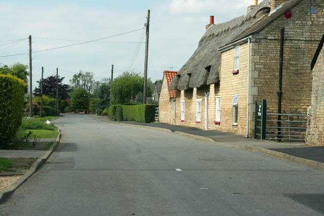
Deeping St James has a rich history dating back to Roman times, with evidence of settlements and artifacts found in the area. The village is home to several historic buildings, including the 13th-century St James' Church, which stands as a prominent landmark. Other notable landmarks include the Market Deeping Heritage Trail and the Deeping Gate Lock, showcasing the village's connection to the waterways.

The village has a range of amenities to cater to its residents, including local shops, pubs, and restaurants. It also has primary and secondary schools, making it an attractive place for families. The community is active and vibrant, with various events and festivals held throughout the year, including the Deepings Literary Festival and the Deeping Carnival.

Deeping St James offers a peaceful and scenic lifestyle, with its historic charm and strong community spirit. It is an ideal place for those seeking a quieter way of life while still having access to essential amenities and a rich cultural heritage.

If you have any feedback on the listing, please let us know in the comments section below.

Deeping St James Images

Images are sourced within 2km of 52.670673/-0.288792 or Grid Reference TF1509. Thanks to Geograph Open Source API. All images are credited.

River Welland from Market Deeping bridge This view is from the parapet of the stone bridge built in 1842, looking east. The left bank is the back of the properties on the south side of the Market Place, and beyond.
River Welland from Market Deeping bridge
This view is from the parapet of the stone bridge built in 1842, looking east. The left bank is the back of the properties on the south side of the Market Place, and beyond.
Market Deeping town centre road junction Both the A15 and A16 trunk roads used to thunder through here before the 4 mile western bypass was built and opened in 1998 at a cost of £7M. This view is now the B1524; it links the south and north access points of the bypass with the town centre. The B1525 (west to east routes) used to be part of the A16, prior to the bypass opening.
Market Deeping town centre road junction
Both the A15 and A16 trunk roads used to thunder through here before the 4 mile western bypass was built and opened in 1998 at a cost of £7M. This view is now the B1524; it links the south and north access points of the bypass with the town centre. The B1525 (west to east routes) used to be part of the A16, prior to the bypass opening.
The Priory Church of Deeping St James Larger than your average Parish Church because it was a priory until the reformation. Norman arches, a graveside shelter and 12th C font to be found inside.
The Priory Church of Deeping St James
Larger than your average Parish Church because it was a priory until the reformation. Norman arches, a graveside shelter and 12th C font to be found inside.
Deeping St James village In the middle of the road area stands the old lock up. Notice the faint outline of an AWAC plane in the sky.
Deeping St James village
In the middle of the road area stands the old lock up. Notice the faint outline of an AWAC plane in the sky.
Northborough's historic St Andrews Church The small village church dominated by the large de la Mare Chancery added on about 1350
Northborough's historic St Andrews Church
The small village church dominated by the large de la Mare Chancery added on about 1350
Church Street Northborough on a  February afternoon
Church Street Northborough on a February afternoon
Sutton's Lane, Deeping Gate On the opposite side of the River Welland to Market Deeping, Deeping Gate is stretched out along Sutton's Lane with most of the houses being on the river side of the road. Spot the wheelie bin!
The oilseed rape on the left has finished flowering and the long seed pods are forming.
Sutton's Lane, Deeping Gate
On the opposite side of the River Welland to Market Deeping, Deeping Gate is stretched out along Sutton's Lane with most of the houses being on the river side of the road. Spot the wheelie bin! The oilseed rape on the left has finished flowering and the long seed pods are forming.
Arable farmland off Sutton's Lane It looks like wheat but it's difficult to tell this time of the year.
Arable farmland off Sutton's Lane
It looks like wheat but it's difficult to tell this time of the year.
Sutton's Lane, Deeping Gate Looking towards the B1524.
Sutton's Lane, Deeping Gate
Looking towards the B1524.
Gate on the B1524 You can just see the old Lincoln Road going from left to right in the centre of this photograph. It was diverted to run slightly to the west when the A15 was built. The old road is marked as an "other route with public access" on the map. There are concrete bollards to stop cars at the start of this path several metres to the left. Here the land owner has "parked" a large piece of farm machinery to stop determined drivers using this gate.
Gate on the B1524
You can just see the old Lincoln Road going from left to right in the centre of this photograph. It was diverted to run slightly to the west when the A15 was built. The old road is marked as an "other route with public access" on the map. There are concrete bollards to stop cars at the start of this path several metres to the left. Here the land owner has "parked" a large piece of farm machinery to stop determined drivers using this gate.
The B1524, Lincoln Road This seems to be the preferred the main route out of Market Deeping to the A15 and Peterborough. Note that it has been built on an embankment. A lot of roads are like this through the Fens, keeping routes open in case of flooding.
The B1524, Lincoln Road
This seems to be the preferred the main route out of Market Deeping to the A15 and Peterborough. Note that it has been built on an embankment. A lot of roads are like this through the Fens, keeping routes open in case of flooding.
Field off Lincoln Road This field sits between the new <a href="https://www.geograph.org.uk/photo/442601">TF1408 : The B1524, Lincoln Road</a> and the old Lincoln Road which is now a public access route popular with joggers, cyclists and walkers. See <a href="https://www.geograph.org.uk/photo/442591">TF1408 : Gate on the B1524</a>
The yellow signs advertising the Deeping Show were posted far and wide in this area.
Field off Lincoln Road
This field sits between the new TF1408 : The B1524, Lincoln Road and the old Lincoln Road which is now a public access route popular with joggers, cyclists and walkers. See TF1408 : Gate on the B1524 The yellow signs advertising the Deeping Show were posted far and wide in this area.
Rippon's Drove Many of the lanes, tracks and country roads through the Fens carry the name "Drove", an old name given to routes that were used to move livestock.
Rippon's Drove
Many of the lanes, tracks and country roads through the Fens carry the name "Drove", an old name given to routes that were used to move livestock.
North Fen Looking towards Peakirk Road from Rippon's Drove.
North Fen
Looking towards Peakirk Road from Rippon's Drove.
Cottages on Eastgate, Deeping St James The main street through Deeping St James follows the contours of the River Welland. The houses on the right are mainly post war and back onto the river. When these stone cottages were built they would have had a clear view of the water.
Cottages on Eastgate, Deeping St James
The main street through Deeping St James follows the contours of the River Welland. The houses on the right are mainly post war and back onto the river. When these stone cottages were built they would have had a clear view of the water.
Giddeon's Drove One of many tracks that go nowhere in particular. The trees on the horizon follow the River Welland in Deeping St James.
Giddeon's Drove
One of many tracks that go nowhere in particular. The trees on the horizon follow the River Welland in Deeping St James.
House on a bend This is the last house as you leave Deeping St James. Station Road to the right and Eastgate to the left. The bend is really sharp, almost a hairpin bend.
House on a bend
This is the last house as you leave Deeping St James. Station Road to the right and Eastgate to the left. The bend is really sharp, almost a hairpin bend.
River Welland The gardens on the southwest side of the main street through Deeping St James go right down to the river. The Welland isquite narrow at this point. In <a href="https://www.geograph.org.uk/gridref/TF1707">TF1707</a> the Maxey Cut, the Fally River Drain and the South Drain flow into the river making it much wider.
River Welland
The gardens on the southwest side of the main street through Deeping St James go right down to the river. The Welland isquite narrow at this point. In TF1707 the Maxey Cut, the Fally River Drain and the South Drain flow into the river making it much wider.
Show me another place!

Deeping St James is located at Grid Ref: TF1509 (Lat: 52.670673, Lng: -0.288792)

Division: Parts of Kesteven

Administrative County: Lincolnshire

District: South Kesteven

Police Authority: Lincolnshire

What 3 Words

///mouth.party.outfitter. Near Northborough, Cambridgeshire

Related Wikis

Deeping St James Priory

Deeping St James Priory was a priory in Deeping St James, Lincolnshire, England. It was a dependency of Thorney Abbey. == History == In 1139 Baldwin Fitz...

The Deepings School

The Deepings School is a coeducational secondary school and sixth form with academy status, located on Park Road in Deeping St James (near Peterborough...

Deeping St James

Deeping St James is a large village in the South Kesteven district of Lincolnshire, England. The population of the civil parish (including Frognall) was...

Deeping Gate

Deeping Gate is a village and civil parish, lying on the River Welland in Cambridgeshire. Traditionally, the area was part of the Soke of Peterborough...

Nearby Amenities

Located within 500m of 52.670673,-0.288792
Bus Stop
Church Gate
Bus: yes
Naptan AtcoCode: 270000009512
Naptan Bearing: NW
Naptan CommonName: Church Gate
Naptan Indicator: NW - bound
Naptan Landmark: Church Gate
Naptan NaptanCode: linjdawd
Naptan Street: Church Street
Naptan Verified: no
Public Transport: platform
Source: naptan_import
Lat/Long: 52.6707395/-0.289297
Bus Stop
Church Gate
Bus: yes
Naptan AtcoCode: 270000009513
Naptan Bearing: SE
Naptan CommonName: Church Gate
Naptan Indicator: SE - bound
Naptan Landmark: Church Gate
Naptan NaptanCode: linjdawg
Naptan Street: Church Street
Naptan Verified: no
Public Transport: platform
Source: naptan_import
Lat/Long: 52.6708406/-0.2894557
Bus Stop
River Bank Close
Bus: yes
Naptan AtcoCode: 270000009514
Naptan Bearing: NE
Naptan CommonName: River Bank Close
Naptan Indicator: opp
Naptan Landmark: River Bank Close
Naptan NaptanCode: linjdawj
Naptan Street: Church Street
Naptan Verified: no
Public Transport: platform
Source: naptan_import
Lat/Long: 52.6706703/-0.2932339
Bus Stop
River Bank Close
Bus: yes
Naptan AtcoCode: 270000009515
Naptan Bearing: SW
Naptan CommonName: River Bank Close
Naptan Indicator: adj
Naptan Landmark: River Bank Close
Naptan NaptanCode: linjdawm
Naptan Street: Church Street
Naptan Verified: no
Public Transport: platform
Source: naptan_import
Lat/Long: 52.6705965/-0.2931036
Bus Stop
Priory Close
Bus: yes
Naptan AtcoCode: 270002700777
Naptan Bearing: NW
Naptan CommonName: Priory Close
Naptan Indicator: adj
Naptan Landmark: Priory Close
Naptan Street: Broadgate Lane
Naptan Verified: no
Public Transport: platform
Source: naptan_import
Lat/Long: 52.6732318/-0.2888002
Parslins
Place: locality
Source: Bing
Lat/Long: 52.6739662/-0.2869719
Historic: monument
Lat/Long: 52.6707605/-0.2886413
Power: pole
Lat/Long: 52.6669167/-0.2919332
Power: pole
Lat/Long: 52.6675838/-0.2928531
Power: pole
Lat/Long: 52.6684379/-0.2940342
Power: pole
Lat/Long: 52.6688712/-0.2952335
Generator Method: photovoltaic
Generator Output Electricity: yes
Generator Solar Modules: 17
Generator Source: solar
Generator Type: solar_photovoltaic_panel
Location: roof
Power: generator
Lat/Long: 52.6703637/-0.2936295
Generator Method: photovoltaic
Generator Output Electricity: yes
Generator Solar Modules: 21
Generator Source: solar
Generator Type: solar_photovoltaic_panel
Location: roof
Power: generator
Lat/Long: 52.6701677/-0.2937824
Generator Method: photovoltaic
Generator Output Electricity: yes
Generator Solar Modules: 15
Generator Source: solar
Generator Type: solar_photovoltaic_panel
Location: roof
Power: generator
Lat/Long: 52.6713119/-0.2960072
Generator Method: photovoltaic
Generator Output Electricity: yes
Generator Source: solar
Generator Type: solar_photovoltaic_panel
Location: roof
Power: generator
Lat/Long: 52.6714022/-0.2954111
Generator Method: photovoltaic
Generator Output Electricity: yes
Generator Source: solar
Generator Type: solar_photovoltaic_panel
Location: roof
Power: generator
Lat/Long: 52.6715811/-0.29441
Generator Method: photovoltaic
Generator Output Electricity: yes
Generator Source: solar
Generator Type: solar_photovoltaic_panel
Location: roof
Power: generator
Lat/Long: 52.6716079/-0.2942504
Generator Method: photovoltaic
Generator Output Electricity: yes
Generator Source: solar
Generator Type: solar_photovoltaic_panel
Location: roof
Power: generator
Lat/Long: 52.6717266/-0.2939768
Generator Method: photovoltaic
Generator Output Electricity: yes
Generator Solar Modules: 8
Generator Source: solar
Generator Type: solar_photovoltaic_panel
Location: roof
Power: generator
Lat/Long: 52.6720568/-0.295562
Generator Method: photovoltaic
Generator Output Electricity: yes
Generator Solar Modules: 8
Generator Source: solar
Generator Type: solar_photovoltaic_panel
Power: generator
Lat/Long: 52.6720218/-0.2954681
Generator Method: photovoltaic
Generator Output Electricity: yes
Generator Solar Modules: 16
Generator Source: solar
Generator Type: solar_photovoltaic_panel
Location: roof
Power: generator
Lat/Long: 52.6717746/-0.2947775
Generator Method: photovoltaic
Generator Output Electricity: yes
Generator Solar Modules: 16
Generator Source: solar
Generator Type: solar_photovoltaic_panel
Location: roof
Power: generator
Lat/Long: 52.6718771/-0.2948043
Generator Method: photovoltaic
Generator Output Electricity: yes
Generator Solar Modules: 21
Generator Source: solar
Generator Type: solar_photovoltaic_panel
Location: roof
Power: generator
Lat/Long: 52.6734336/-0.292912
Generator Method: photovoltaic
Generator Output Electricity: yes
Generator Solar Modules: 6
Generator Source: solar
Generator Type: solar_photovoltaic_panel
Location: roof
Power: generator
Lat/Long: 52.6731319/-0.2934511
Generator Method: photovoltaic
Generator Output Electricity: yes
Generator Solar Modules: 8
Generator Source: solar
Generator Type: solar_photovoltaic_panel
Location: roof
Power: generator
Lat/Long: 52.673114/-0.2935678
Generator Method: photovoltaic
Generator Output Electricity: yes
Generator Solar Modules: 4
Generator Source: solar
Generator Type: solar_photovoltaic_panel
Location: roof
Power: generator
Lat/Long: 52.6730221/-0.2935262
Generator Method: photovoltaic
Generator Output Electricity: yes
Generator Solar Modules: 11
Generator Source: solar
Generator Type: solar_photovoltaic_panel
Location: roof
Power: generator
Lat/Long: 52.6729546/-0.2935798
Generator Method: photovoltaic
Generator Output Electricity: yes
Generator Solar Modules: 14
Generator Source: solar
Generator Type: solar_photovoltaic_panel
Location: roof
Power: generator
Lat/Long: 52.6729757/-0.293372
Generator Method: photovoltaic
Generator Output Electricity: yes
Generator Solar Modules: 3
Generator Source: solar
Generator Type: solar_photovoltaic_panel
Location: roof
Power: generator
Lat/Long: 52.6728115/-0.2910961
Generator Method: photovoltaic
Generator Output Electricity: yes
Generator Solar Modules: 5
Generator Source: solar
Generator Type: solar_photovoltaic_panel
Location: roof
Power: generator
Lat/Long: 52.6727667/-0.2903585
Generator Method: photovoltaic
Generator Output Electricity: yes
Generator Solar Modules: 7
Generator Source: solar
Generator Type: solar_photovoltaic_panel
Location: roof
Power: generator
Lat/Long: 52.6728277/-0.289975
Generator Method: photovoltaic
Generator Output Electricity: yes
Generator Solar Modules: 5
Generator Source: solar
Generator Type: solar_photovoltaic_panel
Location: roof
Power: generator
Lat/Long: 52.6732498/-0.2899522
Generator Method: photovoltaic
Generator Output Electricity: yes
Generator Solar Modules: 15
Generator Source: solar
Generator Type: solar_photovoltaic_panel
Location: roof
Power: generator
Lat/Long: 52.6740012/-0.2909473
Generator Method: photovoltaic
Generator Output Electricity: yes
Generator Solar Modules: 14
Generator Source: solar
Generator Type: solar_photovoltaic_panel
Location: roof
Power: generator
Lat/Long: 52.6743508/-0.2906831
Generator Method: photovoltaic
Generator Output Electricity: yes
Generator Source: solar
Generator Type: solar_photovoltaic_panel
Location: roof
Power: generator
Lat/Long: 52.6749022/-0.2868569
Generator Method: photovoltaic
Generator Output Electricity: yes
Generator Solar Modules: 6
Generator Source: solar
Generator Type: solar_photovoltaic_panel
Location: roof
Power: generator
Lat/Long: 52.6748566/-0.2886875
Generator Method: photovoltaic
Generator Output Electricity: yes
Generator Solar Modules: 8
Generator Source: solar
Generator Type: solar_photovoltaic_panel
Location: roof
Power: generator
Lat/Long: 52.6749554/-0.2909674
Generator Method: photovoltaic
Generator Output Electricity: yes
Generator Solar Modules: 8
Generator Source: solar
Generator Type: solar_photovoltaic_panel
Location: roof
Power: generator
Lat/Long: 52.6749522/-0.2910076
Crossing
Lat/Long: 52.6748693/-0.2896643
Crossing
Lat/Long: 52.6718549/-0.2876892
Crossing
Lat/Long: 52.672903/-0.2886127
Crossing
Lat/Long: 52.6741407/-0.2892931
Crossing
Lat/Long: 52.6744375/-0.2894568
Crossing
Lat/Long: 52.6707118/-0.2929107
Crossing
Lat/Long: 52.6704242/-0.2938182
Waste Basket
Lat/Long: 52.6729478/-0.2941275
Crossing
Lat/Long: 52.6733348/-0.2941648
Crossing
Lat/Long: 52.6732355/-0.2944841
Crossing
Lat/Long: 52.6719288/-0.2877044
Crossing
Lat/Long: 52.673324/-0.2888227
Telephone
Defibrillator
Booth: K6
Covered: booth
Defibrillator Location: inside red phone box, (by St James Church car park) nChurch Street, Deeping St James
Emergency: defibrillator
Man Made: telephone_box
Lat/Long: 52.6709735/-0.2901001
Community Centre
The Cross School
Addr City: Deeping St James
Addr Housenumber: 1
Addr Postcode: PE6 8HH
Addr Street: Eastgate
Fhrs Authority: South Kesteven
Fhrs Id: 237966
Fhrs Local Authority Id: 4341
Lat/Long: 52.6707906/-0.2884501
Picture Framing Workshop
Shop: frame
Lat/Long: 52.6706849/-0.2890831
The Old Bakery
Addr City: Deeping St James
Addr Housenumber: 20
Addr Postcode: PE6 8HD
Addr Street: Church Street
Fhrs Authority: South Kesteven
Fhrs Id: 238846
Fhrs Local Authority Id: 4321
Shop: bakery
Lat/Long: 52.6710443/-0.2911913
Cloverbrook
Office: company
Lat/Long: 52.6709907/-0.291591
Fast Food
Riceland Takeaway
Addr City: Deeping St James
Addr Housenumber: 24
Addr Postcode: PE6 8HD
Addr Street: Church Street
Fhrs Authority: South Kesteven
Fhrs Id: 238261
Fhrs Local Authority Id: 4323
Lat/Long: 52.6708475/-0.2923018
Defibrillator
Emergency: defibrillator
Ref GB The Circuit: CE4E2454-94BE-412E-8DB7-ADB70113D25B
Lat/Long: 52.670295/-0.2938663
Pub
The Waterton Arms
Addr City: Deeping St James
Addr Housenumber: 68-70
Addr Postcode: PE6 8HD
Addr Street: Church Street
Fhrs Authority: South Kesteven
Fhrs Id: 238758
Fhrs Local Authority Id: 4330
Lat/Long: 52.6702571/-0.2947345
Kindergarten
Jimmy D's Playgroup
Addr City: Deeping St James
Addr Housename: Deeping St James County Primary School
Addr Postcode: PE6 8PZ
Addr Street: Hereward Way
Fhrs Authority: South Kesteven
Fhrs Id: 238083
Fhrs Local Authority Id: 4362
Lat/Long: 52.6729831/-0.2932405
Fast Food
The Spice Merchant
Addr City: Deeping St James
Addr Housenumber: 77
Addr Postcode: PE6 8PX
Addr Street: Manor Way
Fhrs Authority: South Kesteven
Fhrs Id: 1085510
Fhrs Local Authority Id: 88034
Lat/Long: 52.6729969/-0.2941954
Milton News
Shop: newsagent
Lat/Long: 52.673018/-0.2941217
Fast Food
Nova Pizzas
Addr City: Deeping St James
Addr Housenumber: 69
Addr Postcode: PE6 8PX
Addr Street: Manor Way
Fhrs Authority: South Kesteven
Fhrs Id: 237965
Fhrs Local Authority Id: 4380
Lat/Long: 52.6730408/-0.294068
Tam's Tanning
Shop: beauty
Lat/Long: 52.6731067/-0.2938561
Fast Food
Beijing Palace
Addr City: Deeping St James
Addr Housenumber: 61
Addr Postcode: PE6 8PX
Addr Street: Manor Way
Fhrs Authority: South Kesteven
Fhrs Id: 238722
Fhrs Local Authority Id: 7397
Lat/Long: 52.6730855/-0.2939299
Social Facility
Sense
Addr City: Deeping St James
Addr Housenumber: 32a
Addr Postcode: PE6 8NW
Addr Street: Broadgate Lane
Fhrs Authority: South Kesteven
Fhrs Id: 238340
Fhrs Local Authority Id: 4309
Social Facility: assisted_living
Lat/Long: 52.6735067/-0.2876508
Pharmacy
Deeping St James Pharmacy
Healthcare: pharmacy
Lat/Long: 52.6746403/-0.2885091
Stylistics
Shop: hairdresser
Lat/Long: 52.6746387/-0.288595
Apollo Computer Systems
Shop: computer
Lat/Long: 52.6746387/-0.2886808
Fast Food
Zilli
Addr City: Deeping St James
Addr Housenumber: 9
Addr Postcode: PE6 8NT
Addr Street: Rycroft Avenue
Fhrs Authority: South Kesteven
Fhrs Id: 1206669
Fhrs Local Authority Id: 88397
Lat/Long: 52.6746322/-0.2887666
Sam's Convenience Store
Addr City: Deeping St James
Addr Housenumber: 1-5 Rycroft Avenue
Addr Postcode: PE6 8NT
Addr Street: Rycroft Avenue
Brand: Premier
Brand Wikidata: Q7240340
Fhrs Authority: South Kesteven
Fhrs Id: 238646
Fhrs Local Authority Id: 4401
Shop: convenience
Lat/Long: 52.6746354/-0.2888846
Line Attachment: pin
Location Transition: yes
Material: wood
Power: pole
Lat/Long: 52.6698574/-0.2960773
The data included in this document is from www.openstreetmap.org. The data is made available under ODbL.

Have you been to Deeping St James?

Leave your review of Deeping St James below (or comments, questions and feedback).