Gosforth Wood

Wood, Forest in Northumberland

England

Gosforth Wood

Weetslade Road, Dudley
Weetslade Road, Dudley Credit: Roger Cornfoot

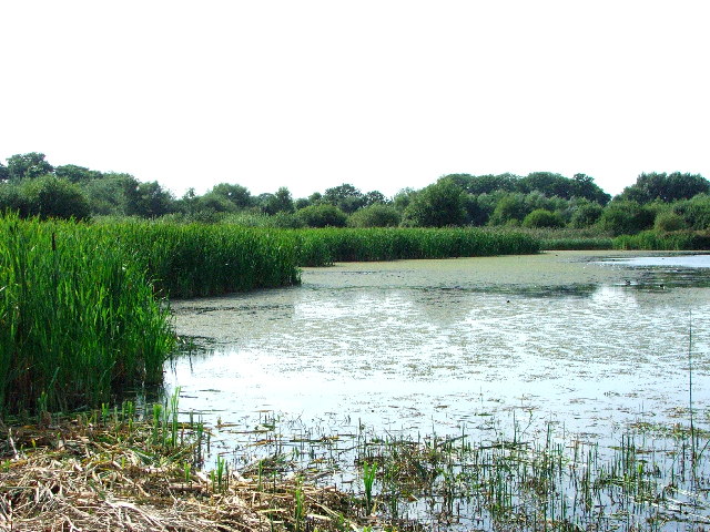
Gosforth Wood is a picturesque woodland located in the county of Northumberland, England. Covering an area of approximately 100 hectares, it is situated near the village of Gosforth, just a few miles away from the Northumberland National Park.

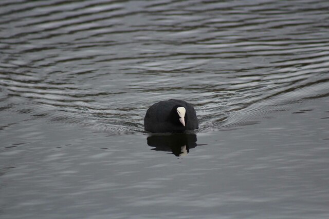
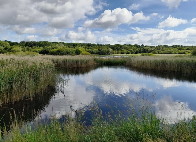
The wood is home to a diverse range of flora and fauna, making it a popular destination for nature enthusiasts and wildlife lovers. The dominant tree species found in Gosforth Wood include oak, birch, and beech, creating a rich and vibrant canopy that provides shelter and habitat to numerous woodland creatures.

Walking through the wood, visitors can enjoy the peaceful and tranquil atmosphere, with the sound of birdsong and the rustling of leaves underfoot. The woodland floor is adorned with a variety of wildflowers, including bluebells and primroses, which bloom in abundance during the spring months, adding a splash of color to the surroundings.

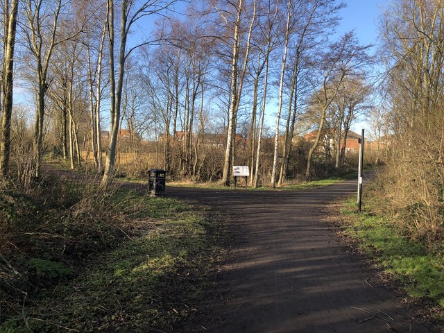
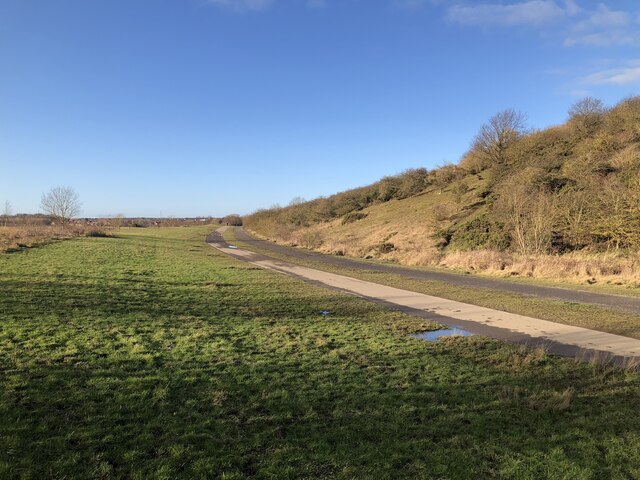
The wood also boasts several well-maintained footpaths and trails, allowing visitors to explore the area easily. These paths lead through different sections of the wood, revealing hidden treasures such as ancient ruins and archaeological sites, giving a glimpse into the area's rich history.

Gosforth Wood is a haven for wildlife, with sightings of red squirrels, roe deer, and a myriad of bird species being common. Conservation efforts are in place to protect and preserve the natural habitat, ensuring the long-term sustainability of the woodland ecosystem.

Overall, Gosforth Wood is a stunning natural gem in Northumberland, offering a peaceful retreat for those seeking a connection with nature and a chance to explore the beauty of this enchanting woodland.

If you have any feedback on the listing, please let us know in the comments section below.

Gosforth Wood Images

Images are sourced within 2km of 55.03513/-1.5972122 or Grid Reference NZ2571. Thanks to Geograph Open Source API. All images are credited.

Weetslade Road, Dudley
Junction with Burradon Road
Newcastle 'K9'  dog care centre, Burradon Converted public house.
Newcastle 'K9' dog care centre, Burradon
Converted public house.
Former Mineral Railway Junction Junction of the former Seaton Burn Waggonway (branching right) and Fawdon Waggonway (branching left). The waggonways were upgraded from horse / rope haulage to railways in the late 1800s and continued to operate into the 1960s. This section of the route is now bridleway.
Former Mineral Railway Junction
Junction of the former Seaton Burn Waggonway (branching right) and Fawdon Waggonway (branching left). The waggonways were upgraded from horse / rope haulage to railways in the late 1800s and continued to operate into the 1960s. This section of the route is now bridleway.
Former site of Weetslade Colliery The heavily mined area has been landscaped and is now Weetslade Country Park. The path in the image follows the route of the mineral railway while the higher ground to the right is the landscaped pit heap, affording views to the coast and Cheviot hills. The colliery itself was to the left and behind the camera, and was linked to the nearby Burradon colliery.
Former site of Weetslade Colliery
The heavily mined area has been landscaped and is now Weetslade Country Park. The path in the image follows the route of the mineral railway while the higher ground to the right is the landscaped pit heap, affording views to the coast and Cheviot hills. The colliery itself was to the left and behind the camera, and was linked to the nearby Burradon colliery.
TransPennine Express Train A class 802 multiple unit operating a TransPennine Express service from Edinburgh - Newcastle.
TransPennine Express Train
A class 802 multiple unit operating a TransPennine Express service from Edinburgh - Newcastle.
North Gosforth Chapel
Waterfowl on Killingworth Lake Canada Goose, two male one female Pochard and a Tufted Duck with head tucked in.
Waterfowl on Killingworth Lake
Canada Goose, two male one female Pochard and a Tufted Duck with head tucked in.
Coot on Killingworth Lake
Tufted Ducks on Killingworth Lake A male being pursued by two females
Tufted Ducks on Killingworth Lake
A male being pursued by two females
Mute Swan on Killingworth Lake
Male and Female Gadwall on Killingworth Lake
Male Goosander on Killingworth Lake
View over Gosforth Lake Taken from the bird hide this is a view over Gosforth Lake on Gosforth Park Nature Reserve.
View over Gosforth Lake
Taken from the bird hide this is a view over Gosforth Lake on Gosforth Park Nature Reserve.
Gosforth Park Nature Reserve Set amongst acres of woodland this reserve is run by the Northumbria Natural History Society. Deer, otter and red squirrels live in harmony with many species of bird.
Gosforth Park Nature Reserve
Set amongst acres of woodland this reserve is run by the Northumbria Natural History Society. Deer, otter and red squirrels live in harmony with many species of bird.
St Joseph's Business Centre This business centre used to be known as St Mary's RC Comprehensive Lower School; I know this, as I used to go there.
St Joseph's Business Centre
This business centre used to be known as St Mary's RC Comprehensive Lower School; I know this, as I used to go there.
Westmoor Methodist Church Quite a handsome church on Great Lime Road
Westmoor Methodist Church
Quite a handsome church on Great Lime Road
Ex- Jobcentre This used to be the dole office for the Killingworth/Westmoor area.  Have falling unemployment rates contributed towards its closure?  I doubt it.

Before it was ever the Job Centre, this was the old Westmoor Co-operative Society shop. It boasted grocery, butchers, clothing , furnishing and haberdashery departments. It was always knows as 'Westmoor Store'

Above the shop was the 'Store Hall'. This was a large hall with a stage, where  
pantomimes were held and the room was available for hire for other social occasions, such as weddings.
Ex- Jobcentre
This used to be the dole office for the Killingworth/Westmoor area. Have falling unemployment rates contributed towards its closure? I doubt it. Before it was ever the Job Centre, this was the old Westmoor Co-operative Society shop. It boasted grocery, butchers, clothing , furnishing and haberdashery departments. It was always knows as 'Westmoor Store' Above the shop was the 'Store Hall'. This was a large hall with a stage, where pantomimes were held and the room was available for hire for other social occasions, such as weddings.
Show me another place!

Gosforth Wood is located at Grid Ref: NZ2571 (Lat: 55.03513, Lng: -1.5972122)

Unitary Authority: Newcastle upon Tyne

Police Authority: Northumbria

What 3 Words

///thick.bikes.chose. Near Wideopen, Northumberland

Nearby Locations

Gosforth Wood

Related Wikis

Gosforth Nature Reserve

Gosforth Nature Reserve is a wildlife haven in Tyne and Wear, England. It includes extensive woodland and wetland habitats and is managed by the Natural...

Gosforth House

Gosforth House now known as Brandling House is a Grade II listed building built as a mansion house and now serving as a hospitality and conference centre...

Killingworth railway station

Killingworth railway station served the town of Killingworth, Tyne and Wear, England from 1847 to 1965 on the East Coast Main Line. == History == The station...

Newcastle Racecourse

Newcastle Racecourse is a horse racing course located at Gosforth Park in Newcastle upon Tyne, England, owned by Arena Racing Company. It stages both flat...

Nearby Amenities

Located within 500m of 55.03513,-1.5972122
Crossing
Crossing: uncontrolled
Crossing Markings: zebra
Crossing Ref: zebra
Lat/Long: 55.0350539/-1.5943455
Noexit: yes
Lat/Long: 55.0383632/-1.5932732
Restaurant
Gosforth Park Garden Centre
Addr City: Newcastle Upon Tyne
Addr Postcode: NE3 5EP
Addr Street: Great Lime Road
Addr Suburb: Gosforth Park
Contact Website: https://www.dobbies.com/gosforth
Fhrs Id: 1158004
Internet Access: wlan
Internet Access Fee: no
Operator: Dobbies Garden Centres
Outdoor Seating: yes
Smoking: no
Wheelchair: yes
Lat/Long: 55.0348001/-1.5930396
Access: yes
Entrance: yes
Wheelchair: yes
Lat/Long: 55.0345127/-1.5941146
Access: yes
Entrance: yes
Wheelchair: yes
Lat/Long: 55.0352817/-1.5939354
Access: yes
Entrance: yes
Wheelchair: yes
Lat/Long: 55.0353564/-1.5937684
Noexit: yes
Lat/Long: 55.038349/-1.5928703
Traffic Signals
Traffic Signals: signal
Lat/Long: 55.0322222/-1.5913048
Traffic Signals
Traffic Signals: signal
Lat/Long: 55.0325822/-1.5907584
Noexit: yes
Lat/Long: 55.0330742/-1.5904099
Addr Housenumber: 32
Addr Street: White House Drive
Addr Suburb: Moorfields
Lat/Long: 55.0359726/-1.5898445
Noexit: yes
Lat/Long: 55.0359957/-1.5903971
Noexit: yes
Lat/Long: 55.0355515/-1.5901276
Noexit: yes
Lat/Long: 55.0355739/-1.5912045
Noexit: yes
Lat/Long: 55.0355407/-1.5899303
Noexit: yes
Lat/Long: 55.0364476/-1.5898941
Barrier: bollard
Bicycle: yes
Bollard: fixed
Foot: yes
Material: plastic
Vehicle: no
Lat/Long: 55.0365751/-1.5942149
Crossing
Crossing: uncontrolled
Crossing Markings: zebra
Crossing Ref: zebra
Lat/Long: 55.034939/-1.594103
The data included in this document is from www.openstreetmap.org. The data is made available under ODbL.

Have you been to Gosforth Wood?

Leave your review of Gosforth Wood below (or comments, questions and feedback).