Dedham
Settlement in Essex Colchester
England
Dedham

Dedham is a picturesque village located in the county of Essex, England. Situated on the River Stour, the village has a charming and idyllic atmosphere that attracts visitors from far and wide. With a population of around 2,000 residents, Dedham is a small but tight-knit community that exudes a sense of tranquility and rural charm.
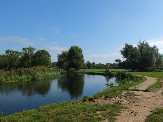
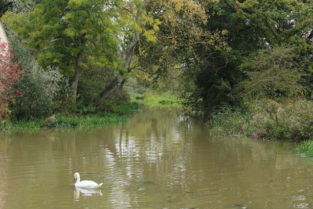
The village is renowned for its stunning landscapes, with rolling hills, meadows, and ancient woodlands surrounding the area. This natural beauty has inspired many artists over the years, most notably John Constable, who painted several of his famous landscapes in and around Dedham. In fact, Dedham is often regarded as the birthplace of the Romantic landscape movement.
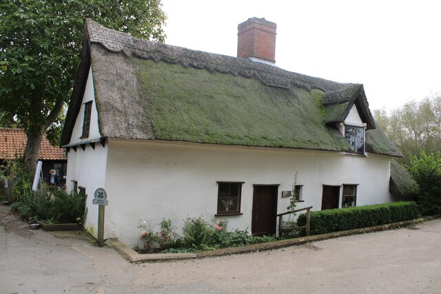
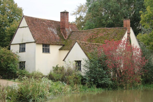
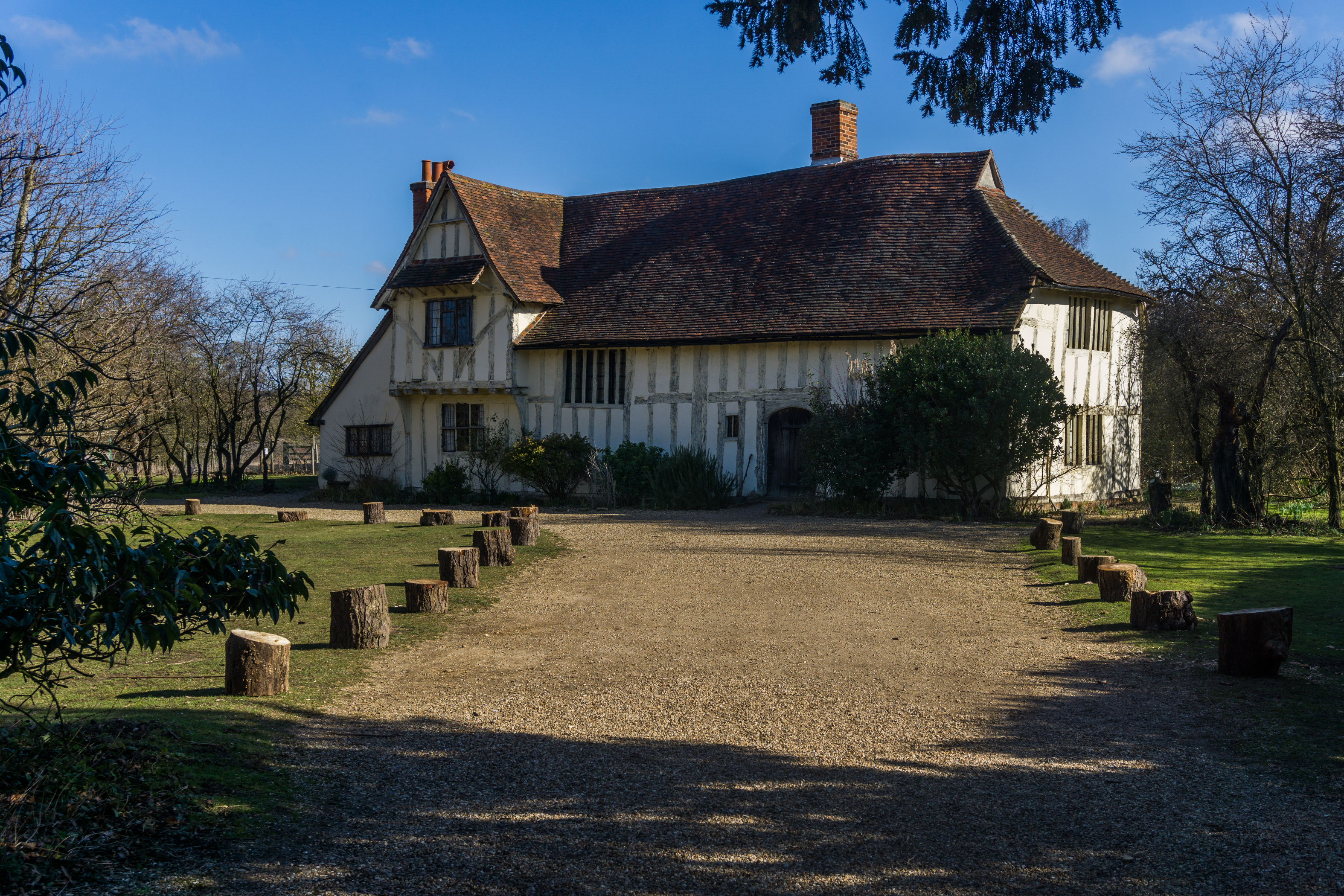
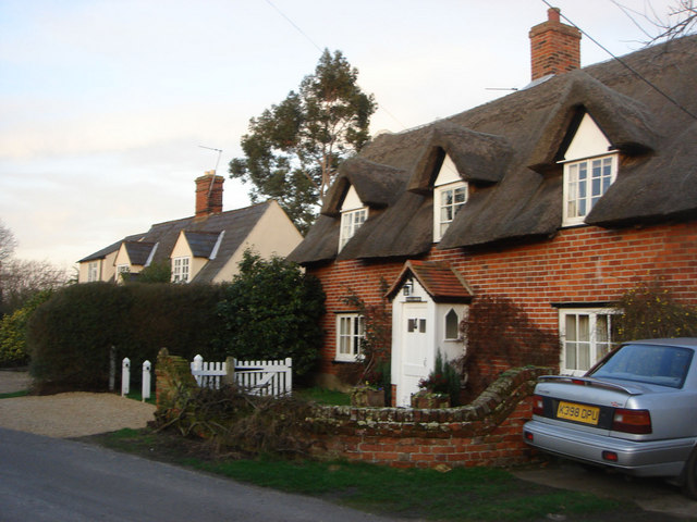
Dedham boasts an impressive array of historic buildings, which contribute to its undeniable charm. The most prominent landmark is the 15th-century St. Mary's Church, known for its impressive tower and beautiful stained glass windows. The village also features a number of quaint cottages, some dating back to the Tudor period, as well as a handful of traditional pubs and tea rooms.
In terms of amenities, Dedham offers a range of local shops, including a grocery store, a post office, and a few independent boutiques. The village also has a primary school and a medical center, ensuring that residents have access to essential services.
Overall, Dedham is a delightful village that seamlessly blends history, natural beauty, and a strong sense of community. It is an ideal destination for those seeking a peaceful retreat or an opportunity to immerse themselves in the rich cultural heritage of rural England.
If you have any feedback on the listing, please let us know in the comments section below.
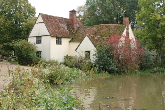
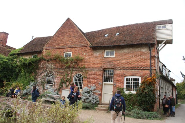
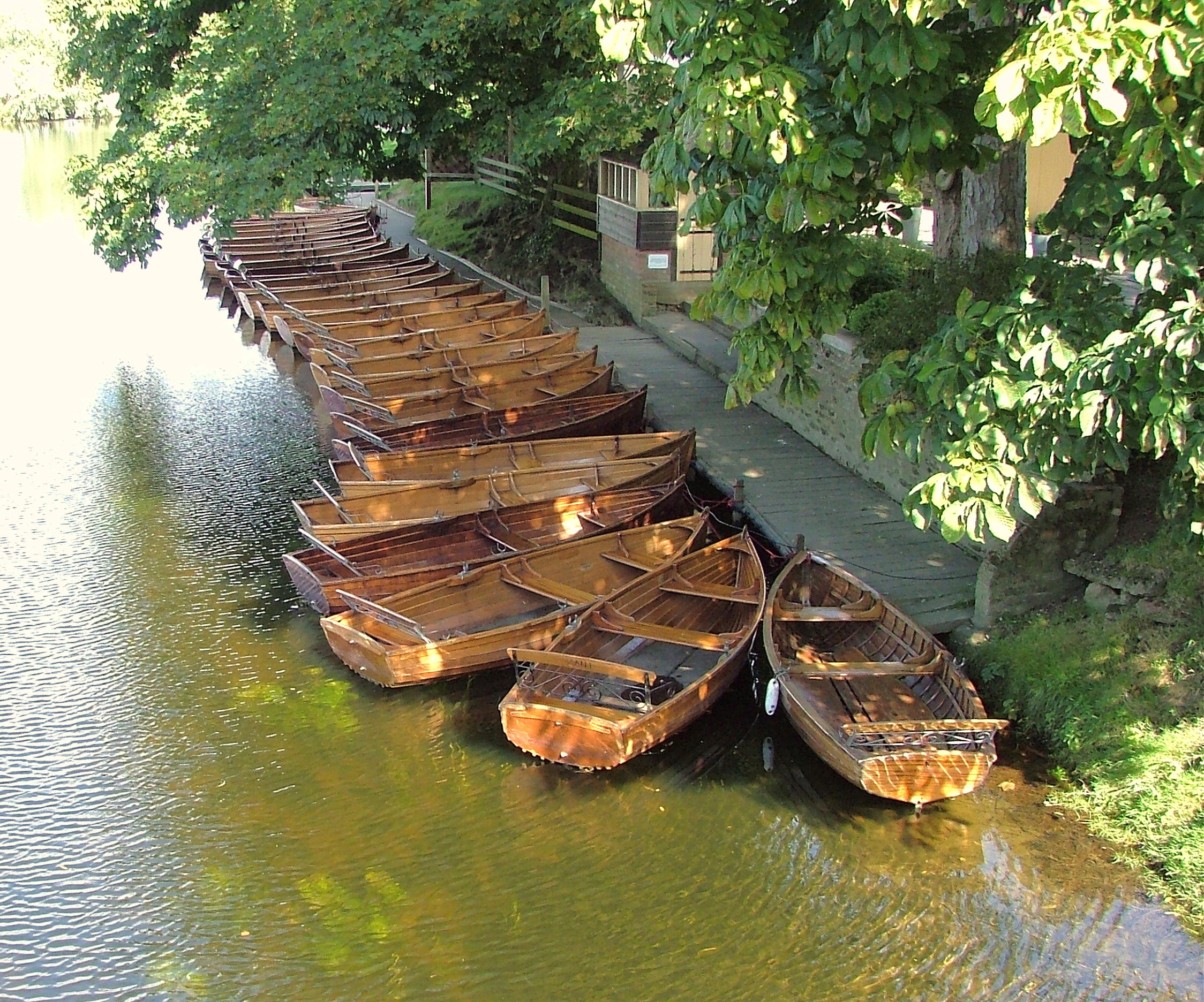
Dedham Images
Images are sourced within 2km of 51.958823/0.993441 or Grid Reference TM0533. Thanks to Geograph Open Source API. All images are credited.


Dedham is located at Grid Ref: TM0533 (Lat: 51.958823, Lng: 0.993441)
Administrative County: Essex
District: Colchester
Police Authority: Essex
What 3 Words
///overlaps.price.manifests. Near Dedham, Essex
Nearby Locations
Related Wikis
Dedham, Essex
Dedham is a village in the City of Colchester district of Essex, England. It is near the River Stour, which is the border of Essex and Suffolk. The nearest...

Castle House, Dedham
Castle House in Dedham, Essex, England was the home of Sir Alfred Munnings from 1919 till his death in 1959. Architecturally the building contains a mixture...
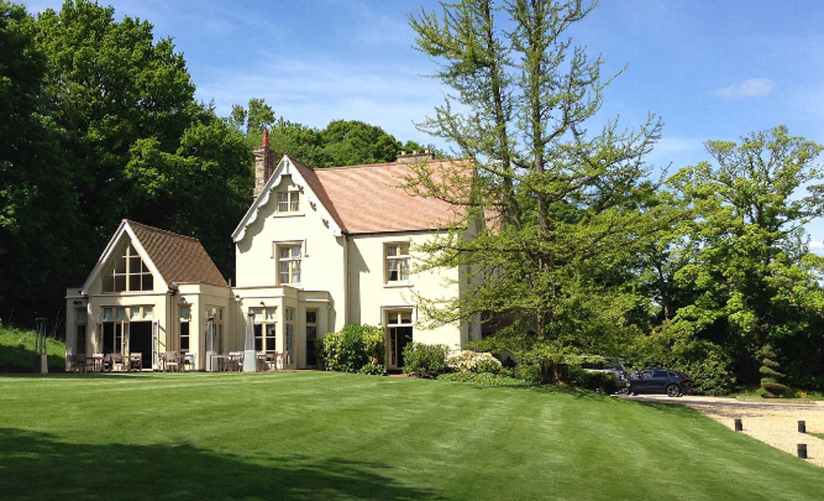
Maison Talbooth, Dedham
Maison Talbooth, Dedham in Essex is a building of historical significance. The construction was started in 1846 and completed by 1850. The architect was...

Bridge Cottage
Bridge Cottage is a 16th-century thatched cottage in Flatford, East Bergholt, Suffolk, England. It has been a National Trust property since 1943 and a...
Flatford
Flatford is a small hamlet in the civil parish of East Bergholt, in the Babergh district, in the county of Suffolk, England. It is most famous for Flatford...
Dedham Heath
Dedham Heath, known locally as The Heath, is a hamlet in the civil parish of Dedham, in the Colchester district, in the county of Essex, England. In 2021...

East Bergholt Abbey
East Bergholt Abbey was an abbey in Suffolk, England. It was built on land purchased in 1857 on the site of Old Hall manor. == History == === Old Hall... ===
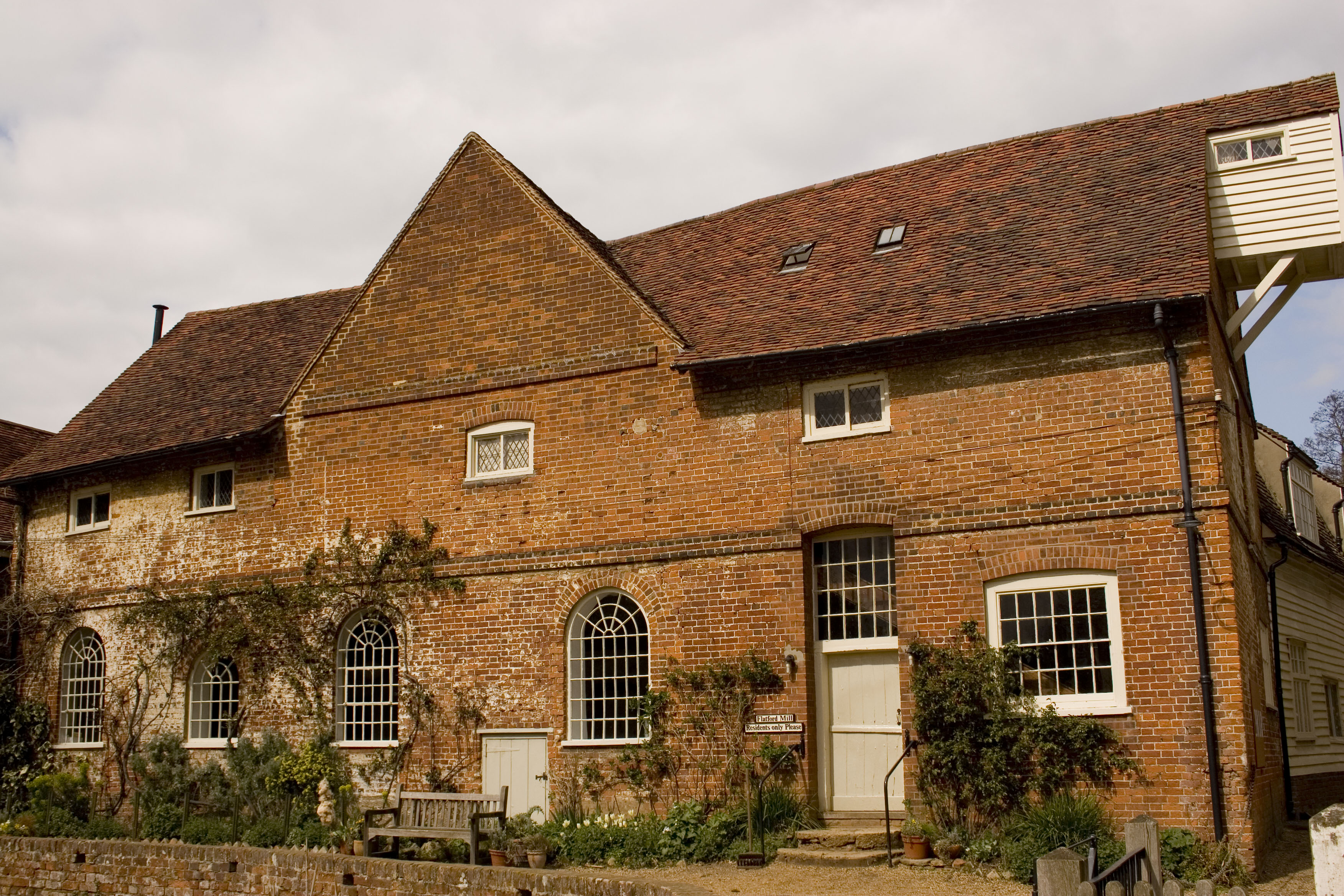
Flatford Mill
Flatford Mill is a Grade I listed watermill on the River Stour at Flatford in East Bergholt, Suffolk, England. According to the date-stone the mill was...
Nearby Amenities
Located within 500m of 51.958823,0.993441Have you been to Dedham?
Leave your review of Dedham below (or comments, questions and feedback).