Smith's Covert

Wood, Forest in Warwickshire Warwick

England

Smith's Covert

Grand Union Canal from Hatton top lock (No. 46) The café is on the right.
Grand Union Canal from Hatton top lock (No. 46) Credit: Chris Allen

Smith's Covert is a charming woodland located in Warwickshire, England. Spread across a vast area, this forest is a haven for nature enthusiasts and provides a peaceful retreat for visitors seeking tranquility amidst nature.

The woodland is known for its dense canopy of trees, predominantly consisting of oak, beech, and birch species. The towering trees create a lush green environment, offering shade during the summer months and a picturesque landscape throughout the year. The forest floor is adorned with a rich carpet of ferns, wildflowers, and moss, adding to the enchanting atmosphere.

Smith's Covert is home to a diverse range of wildlife, making it a perfect spot for wildlife enthusiasts and birdwatchers. Common sightings include deer, foxes, badgers, and a variety of bird species such as woodpeckers, owls, and thrushes. The forest's serene atmosphere and abundant natural resources provide a safe habitat for these creatures to thrive.

The woodland offers several well-maintained walking trails that wind through the forest, allowing visitors to explore its beauty at their own pace. These trails cater to all levels of fitness and provide opportunities for both leisurely strolls and more challenging hikes. Along the paths, visitors can discover hidden streams, small waterfalls, and picturesque viewpoints, adding to the allure of the woodland.

Smith's Covert is a popular destination for outdoor activities such as picnicking, photography, and nature study. The forest's peaceful ambiance makes it an ideal location for individuals looking to escape the hustle and bustle of daily life and reconnect with nature. Whether it's a leisurely walk or an immersive nature experience, Smith's Covert offers a truly magical woodland experience for all who visit.

If you have any feedback on the listing, please let us know in the comments section below.

Smith's Covert Images

Images are sourced within 2km of 52.299121/-1.6291599 or Grid Reference SP2566. Thanks to Geograph Open Source API. All images are credited.

Grand Union Canal from Hatton top lock (No. 46) The café is on the right.
Grand Union Canal from Hatton top lock (No. 46)
The café is on the right.
Grand Union Canal - plaque The Transport Trust has placed a commemorative plaque on the top lock (No. 46) of the Hatton flight near Warwick.
Grand Union Canal - plaque
The Transport Trust has placed a commemorative plaque on the top lock (No. 46) of the Hatton flight near Warwick.
Grand Union Canal - dry dock Although this is by Hatton locks this is billed as Knowle Hill Wharf Dry Dock
Grand Union Canal - dry dock
Although this is by Hatton locks this is billed as Knowle Hill Wharf Dry Dock
Grand Union Canal - Hatton locks There are 21 locks in the flight with the top lock being No. 46 and the numbers descending from there. The closest lock here is No. 42. To the right of the lock is a former narrow lock that was replaced by the broad lock. Further to the right is a former beam engine house that was part of the maintenance yard.
Grand Union Canal - Hatton locks
There are 21 locks in the flight with the top lock being No. 46 and the numbers descending from there. The closest lock here is No. 42. To the right of the lock is a former narrow lock that was replaced by the broad lock. Further to the right is a former beam engine house that was part of the maintenance yard.
Grand Union Canal - Hatton locks Lock No. 43 seen from the bridge leading to the maintenance yard and lock offices. In the right background is a dry dock. The footbridge on the right crosses a former narrow lock.
Grand Union Canal - Hatton locks
Lock No. 43 seen from the bridge leading to the maintenance yard and lock offices. In the right background is a dry dock. The footbridge on the right crosses a former narrow lock.
Grand Union Canal - bridge No. 54 A concrete bridge crossing the Hatton flight of 21 broad locks. The locks were widened in concrete in the 1930s and this bridge may date to the remodelling in the 1930s.
Grand Union Canal - bridge No. 54
A concrete bridge crossing the Hatton flight of 21 broad locks. The locks were widened in concrete in the 1930s and this bridge may date to the remodelling in the 1930s.
Grand Union Canal - lock No. 44 Part of the Hatton flight of 21 locks.
Grand Union Canal - lock No. 44
Part of the Hatton flight of 21 locks.
Grand Union Canal - lock No. 45 One of 21 broad locks on the Hatton flight.
Grand Union Canal - lock No. 45
One of 21 broad locks on the Hatton flight.
Grand Union Canal - lock No. 46 This is the top lock of the Hatton flight of 21 broad locks. The remains of the replaced narrow lock are to the right. The red plaque is a Transport Trust heritage marker.
Grand Union Canal - lock No. 46
This is the top lock of the Hatton flight of 21 broad locks. The remains of the replaced narrow lock are to the right. The red plaque is a Transport Trust heritage marker.
Grand Union Canal - lock No. 39 Part of the Hatton flight of 21 broad locks and seen from lock No. 40. This well shows that the 1930s wide (or broad) locks can take two standard narrow boats side by side.  Especially helpful when a powered boat was towing a 'butty' (an unpowered barge).
Grand Union Canal - lock No. 39
Part of the Hatton flight of 21 broad locks and seen from lock No. 40. This well shows that the 1930s wide (or broad) locks can take two standard narrow boats side by side. Especially helpful when a powered boat was towing a 'butty' (an unpowered barge).
Grand Union Canal - Hatton locks Looking down part of the Hatton flight with lock No. 42 in the foreground.
Grand Union Canal - Hatton locks
Looking down part of the Hatton flight with lock No. 42 in the foreground.
Dragonfly sculpture at Hatton In a pond alongside the Grand Union Canal at the Hatton flight of locks.
Dragonfly sculpture at Hatton
In a pond alongside the Grand Union Canal at the Hatton flight of locks.
Grand Union Canal - Hatton locks Lock No. 40 is seen in the foreground and the photographer is by lock No. 41. The Hatton flight has 21 locks and was modernised in the 1930s with the narrow locks being replaced by the broad locks that could take two narrowboats side by side. I have no idea who the random people are sitting on the balance beam.
Grand Union Canal - Hatton locks
Lock No. 40 is seen in the foreground and the photographer is by lock No. 41. The Hatton flight has 21 locks and was modernised in the 1930s with the narrow locks being replaced by the broad locks that could take two narrowboats side by side. I have no idea who the random people are sitting on the balance beam.
Grand Union Canal - lock No. 41 On the Hatton flight of 21 broad locks.
Grand Union Canal - lock No. 41
On the Hatton flight of 21 broad locks.
Grand Union Canal - lock No.38 Part of the Hatton flight of 21 broad locks. Looking towards London.
Grand Union Canal - lock No.38
Part of the Hatton flight of 21 broad locks. Looking towards London.
Grand Union Canal - lock No. 38 Looking up part of the Hatton flight.
Grand Union Canal - lock No. 38
Looking up part of the Hatton flight.
Grand Union Canal - lock No. 36 On the Hatton flight of 21 broad locks.
Grand Union Canal - lock No. 36
On the Hatton flight of 21 broad locks.
Grand Union Canal - lock No. 36 and bridge No. 53 Part of the Hatton flight of locks.
Grand Union Canal - lock No. 36 and bridge No. 53
Part of the Hatton flight of locks.
Show me another place!

Smith's Covert is located at Grid Ref: SP2566 (Lat: 52.299121, Lng: -1.6291599)

Administrative County: Warwickshire

District: Warwick

Police Authority: Warwickshire

What 3 Words

///loafer.handfuls.feelers. Near Hatton, Warwickshire

Nearby Locations

Smith's Covert

Related Wikis

Central Hospital, Hatton

Central Hospital was a psychiatric hospital located in Hatton, Warwickshire, England. == History == Building began in 1846 on a 42-acre (17 ha) site purchased...
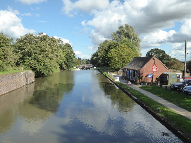
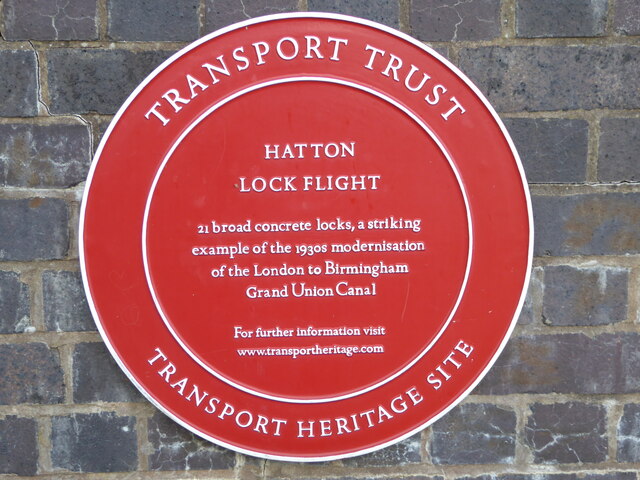
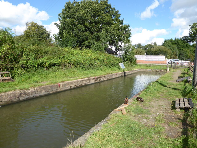
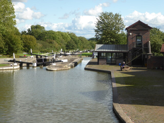
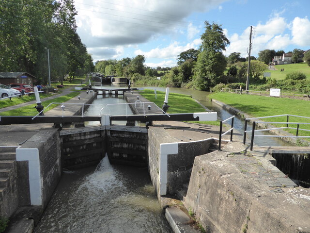
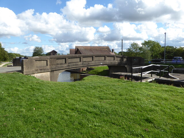
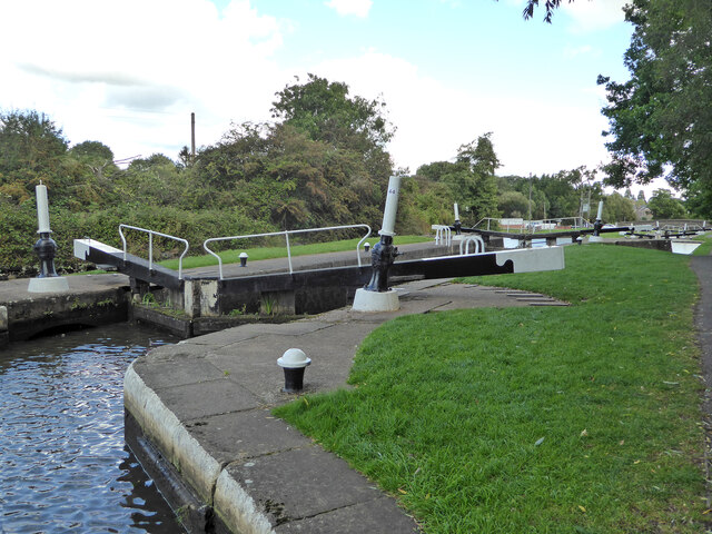
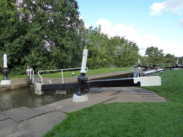
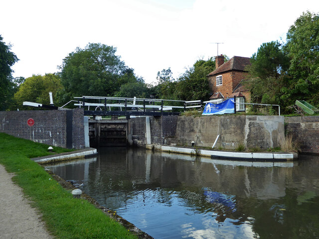
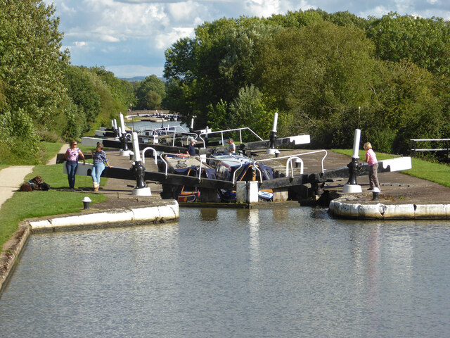
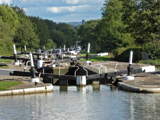
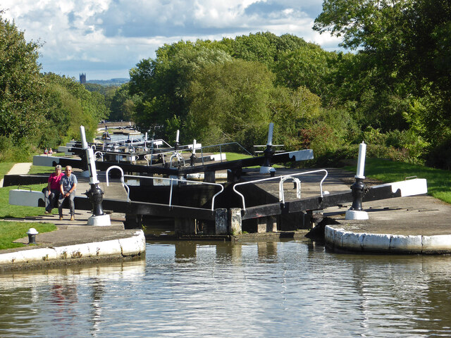
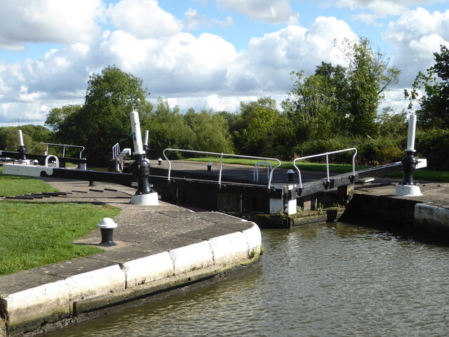
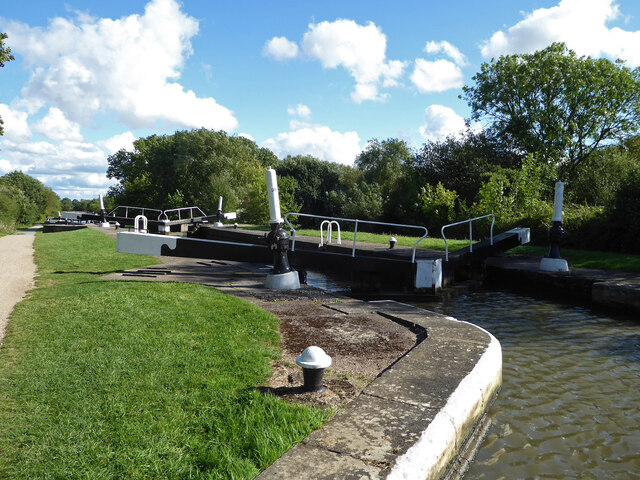
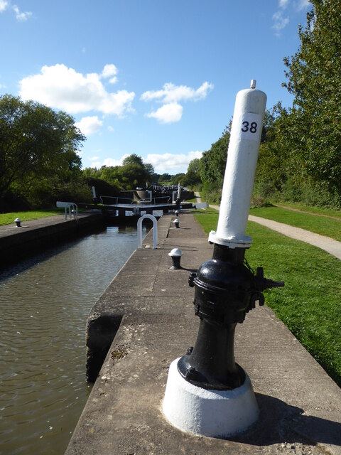
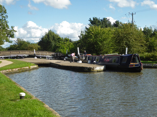
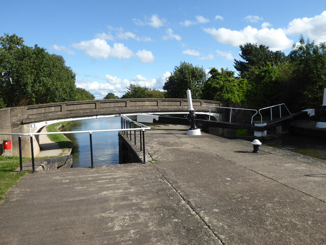
Hatton Locks

The Hatton Locks or Hatton Flight are a flight of 21 locks on the Grand Union Canal in Hatton, Warwickshire, England. The flight spans less than 2 miles...

Hatton, Warwickshire

Hatton is a village and civil parish about 4 miles (6 km) west-northwest of Warwick, in the Warwick District of Warwickshire in England. The parish had...

Budbrooke

Budbrooke is a village and civil parish in the Warwick district of Warwickshire, England. It is 3 miles west of Warwick and according to the 2001 census...

Budbrooke Barracks

Budbrooke Barracks was a military installation near Budbrooke in Warwickshire, England. == History == The barracks were built on agricultural land in 1877...

Warwick Parkway railway station

Warwick Parkway is a railway station with park and ride facilities on the western outskirts of Warwick in Warwickshire, England. It also serves the village...

Warwick and Leamington (UK Parliament constituency)

Warwick and Leamington is a constituency represented in the House of Commons of the UK Parliament since the 2017 general election by Matt Western, of the...

Saltisford Canal Arm

The Saltisford Canal Arm is a short stretch of canal located in the town of Warwick, Warwickshire, England. Opened in the 1790s, originally it wasn't an...

Nearby Amenities

Located within 500m of 52.299121,-1.6291599
Seamark Type: gate
Waterway: lock_gate
Lat/Long: 52.2949417/-1.6298724
Seamark Type: gate
Waterway: lock_gate
Lat/Long: 52.2964314/-1.6349381
Bus Stop
Mollington Grove
Bus: yes
Covered: no
Naptan AtcoCode: 4200F027000
Naptan Bearing: NW
Naptan CommonName: Mollington Grove
Naptan Crossing: Mollington Grove
Naptan Indicator: Opp
Naptan Landmark: Hatton Park
Naptan NaptanCode: wardgmtj
Naptan Street: Barcheston Drive
Naptan Verified: no
Passenger Information Display: no
Public Transport: platform
Source: naptan_import
Lat/Long: 52.2988002/-1.6344759
Bus Stop
Barcheston Drive
Bus: yes
Covered: no
Naptan AtcoCode: 4200F126420
Naptan Bearing: N
Naptan CommonName: Barcheston Drive
Naptan Crossing: Barcheston Drive
Naptan Indicator: Adj
Naptan Landmark: Hatton Park
Naptan NaptanCode: waradmat
Naptan Street: Charingworth Drive
Naptan Verified: no
Passenger Information Display: no
Public Transport: platform
Shelter: no
Source: naptan_import
Lat/Long: 52.2973516/-1.6320637
Bus Stop
Barcheston Drive
Bus: yes
Covered: no
Naptan AtcoCode: 4200F126421
Naptan Bearing: S
Naptan CommonName: Barcheston Drive
Naptan Crossing: Barcheston Drive
Naptan Indicator: Opp
Naptan Landmark: Hatton Park
Naptan NaptanCode: waradmaw
Naptan Street: Charingworth Drive
Naptan Verified: no
Passenger Information Display: no
Public Transport: platform
Source: naptan_import
Lat/Long: 52.2975332/-1.6318029
Bus Stop
Dorsington Close
Bus: yes
Covered: no
Naptan AtcoCode: 4200F126490
Naptan Bearing: SE
Naptan CommonName: Dorsington Close
Naptan Crossing: Dorsington Close
Naptan Indicator: Opp
Naptan Landmark: Hatton Park
Naptan NaptanCode: waradmdg
Naptan Street: Barcheston Driive
Naptan Verified: no
Passenger Information Display: no
Public Transport: platform
Source: naptan_import
Lat/Long: 52.3015056/-1.630222
Bus Stop
Charingworth Drive
Bus: yes
Covered: no
Naptan AtcoCode: 4200F126510
Naptan Bearing: S
Naptan CommonName: Charingworth Drive
Naptan Crossing: Charingworth Drive
Naptan Indicator: Adj
Naptan Landmark: Hatton Park
Naptan NaptanCode: waradmdp
Naptan Street: Barcheston Drive
Naptan Verified: no
Passenger Information Display: no
Public Transport: platform
Source: naptan_import
Lat/Long: 52.3003659/-1.6291397
Crossing
Crossing: unmarked
Crossing Markings: no
Lat/Long: 52.2980277/-1.6323224
Crossing
Crossing: unmarked
Crossing Markings: no
Lat/Long: 52.2982257/-1.6316925
Crossing
Crossing Island: yes
Source: Warwicks CC Aerial Imagery 2013
Lat/Long: 52.3010086/-1.629553
35
Lock: yes
Seamark Type: gate
Waterway: lock_gate
Lat/Long: 52.2957246/-1.632545
Seamark Type: gate
Waterway: lock_gate
Lat/Long: 52.2947307/-1.6284761
Seamark Type: gate
Waterway: lock_gate
Lat/Long: 52.2950462/-1.6302417
Seamark Type: gate
Waterway: lock_gate
Lat/Long: 52.2947169/-1.6280509
Seamark Type: gate
Waterway: lock_gate
Lat/Long: 52.295615/-1.632186
Turning Circle
Lat/Long: 52.3023036/-1.6306821
Turning Circle
Lat/Long: 52.3026119/-1.6314913
Crossing
Crossing Island: yes
Lat/Long: 52.3017327/-1.6307821
Source: Warwicks CC Aeriaal Imagery 2013
Traffic Calming: choker
Lat/Long: 52.3000482/-1.6280511
Crossing
Crossing Island: yes
Source: Warwicks CC Aeriaal Imagery 2013
Lat/Long: 52.299354/-1.6356265
Crossing
Crossing: unmarked
Crossing Island: yes
Crossing Markings: no
Kerb: lowered
Tactile Paving: yes
Lat/Long: 52.2966603/-1.6328012
Traffic Calming: island
Lat/Long: 52.3000994/-1.6288088
Crossing
Crossing: unmarked
Crossing Island: yes
Crossing Markings: no
Tactile Paving: yes
Lat/Long: 52.2964656/-1.632053
Crossing
Crossing: unmarked
Crossing Island: yes
Crossing Markings: no
Tactile Paving: yes
Lat/Long: 52.2968147/-1.6322067
Crossing
Crossing: unmarked
Crossing Island: yes
Crossing Markings: no
Kerb: lowered
Tactile Paving: yes
Lat/Long: 52.2967323/-1.6327459
Seamark Type: gate
Waterway: lock_gate
Lat/Long: 52.2963246/-1.6345735
Hatton Park
Is In: Warwickshire
Place: village
Website: https://www.hattonpark.net/
Lat/Long: 52.2996033/-1.6341953
Fuel
Shell Hatton
Addr City: Warwick
Addr Housenumber: 383
Addr Place: Hertford Hill
Addr Postcode: CV35 7DZ
Addr Street: Birmingham Road
Brand: Shell
Brand Wikidata: Q110716465
Compressed Air: yes
Fhrs Id: 241892
Phone: +44 1926 409230
Ref Navads: NVDS353_10019144
Website: https://find.shell.com/gb/fuel/10019144-shell-hatton
Lat/Long: 52.2950216/-1.6270302
Post Box
Brand: Royal Mail
Brand Wikidata: Q638098
Brand Wikipedia: en:Royal Mail
Collection Times: Mo-Fr 16:45; Sa 09:00
Operator: Royal Mail
Operator Wikidata: Q638098
Post Box Type: pillar
Ref: CV35 16
Royal Cypher: EIIR
Royal Cypher Wikidata: Q33102113
Source: survey
Lat/Long: 52.2991291/-1.6352938
Crossing
Crossing: unmarked
Crossing Markings: no
Lat/Long: 52.2978288/-1.6314185
Crossing
Crossing Island: yes
Source: Warwicks CC Aeriaal Imagery 2013
Lat/Long: 52.2987726/-1.634326
Crossing
Crossing Island: yes
Source: Warwicks CC Aeriaal Imagery 2013
Lat/Long: 52.2996515/-1.6362351
Give Way
Direction: backward
Lat/Long: 52.3002233/-1.634738
Give Way
Direction: backward
Source: Warwicks CC Aeriaal Imagery 2013
Lat/Long: 52.2997217/-1.6364365
Give Way
Direction: forward
Source: Warwicks CC Aeriaal Imagery 2013
Lat/Long: 52.3001425/-1.6292683
Give Way
Direction: backward
Source: Warwicks CC Aeriaal Imagery 2013
Lat/Long: 52.302611/-1.6327978
Crossing
Crossing Island: yes
Source: Warwicks CC Aerial Imagery 2013
Lat/Long: 52.3027725/-1.6333285
Give Way
Direction: backward
Source: Warwicks CC Aerial Imagery 2013
Lat/Long: 52.2997996/-1.6270728
Give Way
Direction: backward
Source: Warwicks CC Aeriaal Imagery 2013
Lat/Long: 52.3000306/-1.6274875
Give Way
Source: Warwicks CC Aerial Imagery 2013
Lat/Long: 52.3028231/-1.6313013
Give Way
Direction: backward
Source: Warwicks CC Aerial Imagery 2013
Lat/Long: 52.3029737/-1.6316378
Barrier: bollard
Lat/Long: 52.2959527/-1.6262577
Barrier: cycle_barrier
Lat/Long: 52.2952895/-1.6263109
Fire Hydrant
Emergency: fire_hydrant
Fire Hydrant Position: sidewalk
Fire Hydrant Type: underground
Lat/Long: 52.3004734/-1.6268161
Fire Hydrant
Emergency: fire_hydrant
Fire Hydrant Position: sidewalk
Fire Hydrant Type: underground
Lat/Long: 52.3001765/-1.6293454
Crossing
Crossing: unmarked
Crossing Markings: no
Tactile Paving: yes
Lat/Long: 52.300206/-1.6292664
Crossing
Crossing: unmarked
Crossing Island: yes
Crossing Markings: no
Tactile Paving: yes
Lat/Long: 52.2965473/-1.632018
Crossing
Crossing: unmarked
Crossing Island: yes
Crossing Markings: no
Tactile Paving: yes
Lat/Long: 52.2968529/-1.6323374
Generator Method: photovoltaic
Generator Output Electricity: yes
Generator Source: solar
Generator Type: solar_photovoltaic_panel
Location: roof
Power: generator
Lat/Long: 52.3005981/-1.6286132
Give Way
Direction: forward
Source: bing
Lat/Long: 52.3000736/-1.6282564
Generator Method: photovoltaic
Generator Output Electricity: yes
Generator Source: solar
Generator Type: solar_photovoltaic_panel
Location: roof
Power: generator
Lat/Long: 52.2993548/-1.6330348
Generator Method: photovoltaic
Generator Output Electricity: yes
Generator Source: solar
Generator Type: solar_photovoltaic_panel
Location: roof
Power: generator
Lat/Long: 52.2998608/-1.6320129
Parcel Locker
knight
Brand: Amazon Hub
Brand Wikidata: Q100274430
Brand Wikipedia: en:Amazon Locker
Operator: Amazon
Parcel Mail In: yes
Source: survey
Lat/Long: 52.2950523/-1.6273411
Noexit: yes
Lat/Long: 52.3026746/-1.6333573
Brand: National Grid
Brand Wikidata: Q1465461
Material: wood
Operator: National Grid Electricity Distribution
Operator Old: Western Power Distribution
Operator Wikidata: Q7988183
Owner: National Grid Electricity Distribution (East Midlands) Plc
Owner Wikidata: Q114348127
Power: pole
Lat/Long: 52.2956828/-1.6330482
Brand: National Grid
Brand Wikidata: Q1465461
Material: wood
Operator: National Grid Electricity Distribution
Operator Old: Western Power Distribution
Operator Wikidata: Q7988183
Owner: National Grid Electricity Distribution (East Midlands) Plc
Owner Wikidata: Q114348127
Power: pole
Lat/Long: 52.29472/-1.6298177
Brand: National Grid
Brand Wikidata: Q1465461
Material: wood
Operator: National Grid Electricity Distribution
Operator Old: Western Power Distribution
Operator Wikidata: Q7988183
Owner: National Grid Electricity Distribution (East Midlands) Plc
Owner Wikidata: Q114348127
Power: pole
Lat/Long: 52.2950283/-1.6308267
Brand: National Grid
Brand Wikidata: Q1465461
Material: wood
Operator: National Grid Electricity Distribution
Operator Old: Western Power Distribution
Operator Wikidata: Q7988183
Owner: National Grid Electricity Distribution (East Midlands) Plc
Owner Wikidata: Q114348127
Power: pole
Lat/Long: 52.2953643/-1.6318254
Brand: National Grid
Brand Wikidata: Q1465461
Material: wood
Operator: National Grid Electricity Distribution
Operator Old: Western Power Distribution
Operator Wikidata: Q7988183
Owner: National Grid Electricity Distribution (East Midlands) Plc
Owner Wikidata: Q114348127
Power: pole
Lat/Long: 52.2960379/-1.6342326
Give Way
Direction: backward
Source: bing
Lat/Long: 52.2995926/-1.6360213
Street Lamp
Lat/Long: 52.2967849/-1.6325486
Street Lamp
Lat/Long: 52.2964772/-1.6327048
Street Lamp
Lat/Long: 52.2966617/-1.6320991
Give Way
Direction: backward
Lat/Long: 52.2951129/-1.6264422
Street Lamp
Lat/Long: 52.2965245/-1.6318461
Street Lamp
Lat/Long: 52.2963846/-1.6322673
Street Lamp
Lat/Long: 52.2968935/-1.6323775
Street Lamp
Lat/Long: 52.2968332/-1.6328979
Street Lamp
Lat/Long: 52.2966014/-1.6328337
Street Lamp
Lat/Long: 52.2969914/-1.6264872
Street Lamp
Lat/Long: 52.2980102/-1.6269589
Street Lamp
Lat/Long: 52.2996844/-1.6259334
Street Lamp
Lat/Long: 52.2991456/-1.6262789
Street Lamp
Lat/Long: 52.2994075/-1.6262264
Street Lamp
Lat/Long: 52.2984322/-1.6271147
Street Lamp
Lat/Long: 52.2994244/-1.6258005
Street Lamp
Lat/Long: 52.2986532/-1.6270493
Street Lamp
Lat/Long: 52.2982978/-1.6270766
Street Lamp
Lat/Long: 52.2963587/-1.6262773
Street Lamp
Lat/Long: 52.2995693/-1.6261354
Street Lamp
Lat/Long: 52.2998903/-1.6261189
Street Lamp
Lat/Long: 52.2996191/-1.6263088
Street Lamp
Lat/Long: 52.2967825/-1.626402
Street Lamp
Lat/Long: 52.2995216/-1.6255304
Street Lamp
Lat/Long: 52.2992763/-1.6260499
Street Lamp
Lat/Long: 52.2965872/-1.6263242
Street Lamp
Lat/Long: 52.2976193/-1.6267733
Street Lamp
Lat/Long: 52.297806/-1.6268688
Street Lamp
Lat/Long: 52.29616/-1.6262826
Street Lamp
Lat/Long: 52.2993574/-1.626751
Street Lamp
Lat/Long: 52.2989242/-1.6268578
Street Lamp
Lat/Long: 52.2972077/-1.6265961
Street Lamp
Lat/Long: 52.299661/-1.6252116
Street Lamp
Lat/Long: 52.2974138/-1.6266819
Street Lamp
Lat/Long: 52.2957353/-1.6263043
Street Lamp
Lat/Long: 52.2955236/-1.6263536
Street Lamp
Lat/Long: 52.2953/-1.6263979
Street Lamp
Lat/Long: 52.2999407/-1.6260407
Street Lamp
Lat/Long: 52.2959096/-1.6262949
Street Lamp
Lat/Long: 52.300144/-1.6294601
Street Lamp
Lat/Long: 52.3005562/-1.6263547
Street Lamp
Lat/Long: 52.3003433/-1.6274283
Street Lamp
Lat/Long: 52.3006265/-1.6259549
Street Lamp
Lat/Long: 52.3000323/-1.6283369
Street Lamp
Lat/Long: 52.3001256/-1.6286619
Street Lamp
Lat/Long: 52.3008149/-1.6260452
Street Lamp
Lat/Long: 52.300623/-1.6276902
Street Lamp
Lat/Long: 52.300076/-1.6292632
Street Lamp
Lat/Long: 52.3005051/-1.6274631
Street Lamp
Lat/Long: 52.2999612/-1.6275003
Street Lamp
Lat/Long: 52.3001198/-1.6284689
Street Lamp
Lat/Long: 52.3000424/-1.6277222
Street Lamp
Lat/Long: 52.3001482/-1.6290457
Street Lamp
Lat/Long: 52.3003924/-1.6270558
Street Lamp
Lat/Long: 52.3001724/-1.6274779
Street Lamp
Lat/Long: 52.3000065/-1.6280452
Street Lamp
Lat/Long: 52.3005044/-1.6267895
Street Lamp
Lat/Long: 52.2997985/-1.626801
Street Lamp
Lat/Long: 52.2998676/-1.6249096
Street Lamp
Lat/Long: 52.2994979/-1.627279
Street Lamp
Lat/Long: 52.3003917/-1.6264079
Street Lamp
Lat/Long: 52.2996913/-1.6249046
Street Lamp
Lat/Long: 52.2992612/-1.6270927
Street Lamp
Lat/Long: 52.30007/-1.625178
Street Lamp
Lat/Long: 52.3001286/-1.6262713
Street Lamp
Lat/Long: 52.3004276/-1.6251901
Street Lamp
Lat/Long: 52.3002287/-1.626177
Street Lamp
Lat/Long: 52.2996382/-1.6270771
Street Lamp
Lat/Long: 52.2998212/-1.6251283
Street Lamp
Lat/Long: 52.3000158/-1.6253225
Street Lamp
Lat/Long: 52.3001221/-1.6258787
Street Lamp
Lat/Long: 52.2999543/-1.6272304
Street Lamp
Lat/Long: 52.2998617/-1.6270479
Street Lamp
Lat/Long: 52.3002446/-1.6252855
Street Lamp
Lat/Long: 52.2999399/-1.6264665
Street Lamp
Lat/Long: 52.3001621/-1.6254955
Street Lamp
Lat/Long: 52.2978029/-1.6317272
Street Lamp
Lat/Long: 52.297834/-1.6320707
Street Lamp
Lat/Long: 52.2980698/-1.6319694
Street Lamp
Lat/Long: 52.2978016/-1.631485
Street Lamp
Lat/Long: 52.2970127/-1.6320441
Street Lamp
Lat/Long: 52.2981374/-1.6318308
Street Lamp
Lat/Long: 52.2979388/-1.6322113
Street Lamp
Lat/Long: 52.2979267/-1.6314987
Street Lamp
Lat/Long: 52.2979919/-1.6316434
Street Lamp
Lat/Long: 52.2980553/-1.6322434
Street Lamp
Lat/Long: 52.2981205/-1.6324925
Street Lamp
Lat/Long: 52.2981704/-1.6316516
Street Lamp
Lat/Long: 52.2976654/-1.632003
Street Lamp
Lat/Long: 52.2977131/-1.6317996
Street Lamp
Lat/Long: 52.2972149/-1.6319212
Street Lamp
Lat/Long: 52.297446/-1.6318605
Street Lamp
Lat/Long: 52.295074/-1.6261049
Street Lamp
Lat/Long: 52.295104/-1.6265859
Street Lamp
Lat/Long: 52.2951524/-1.6270847
Street Lamp
Lat/Long: 52.2952343/-1.6276531
Street Lamp
Lat/Long: 52.2953777/-1.6281084
Street Lamp
Lat/Long: 52.2955668/-1.6286021
Street Lamp
Lat/Long: 52.2957359/-1.6290947
Street Lamp
Lat/Long: 52.2958768/-1.6296341
Street Lamp
Lat/Long: 52.2959596/-1.6301274
Street Lamp
Lat/Long: 52.296058/-1.6307263
Street Lamp
Lat/Long: 52.2961828/-1.6312298
Street Lamp
Lat/Long: 52.2969649/-1.6332897
Street Lamp
Lat/Long: 52.2969772/-1.6336229
Street Lamp
Lat/Long: 52.2970965/-1.6339954
Street Lamp
Lat/Long: 52.2972301/-1.6343453
Street Lamp
Lat/Long: 52.2973755/-1.6346692
Street Lamp
Lat/Long: 52.2975342/-1.6350066
Street Lamp
Lat/Long: 52.2978003/-1.6354594
Street Lamp
Lat/Long: 52.2980911/-1.6356645
Street Lamp
Lat/Long: 52.2983742/-1.6360462
Street Lamp
Lat/Long: 52.2986599/-1.6364421
Street Lamp
Lat/Long: 52.2985518/-1.6345839
Street Lamp
Lat/Long: 52.2980299/-1.6352217
Street Lamp
Lat/Long: 52.2983147/-1.6348665
Street Lamp
Lat/Long: 52.2994809/-1.6334137
Street Lamp
Lat/Long: 52.2988936/-1.6341312
Street Lamp
Lat/Long: 52.2992935/-1.6336376
Street Lamp
Lat/Long: 52.2990981/-1.6338741
Street Lamp
Lat/Long: 52.2996672/-1.6331829
Street Lamp
Lat/Long: 52.2976367/-1.6308344
Street Lamp
Lat/Long: 52.2977938/-1.6310691
Street Lamp
Lat/Long: 52.2976297/-1.6305394
Street Lamp
Lat/Long: 52.2973878/-1.6302048
Street Lamp
Lat/Long: 52.2974731/-1.6304441
Street Lamp
Lat/Long: 52.2975232/-1.6305757
Street Lamp
Lat/Long: 52.2973946/-1.6309989
Street Lamp
Lat/Long: 52.2972725/-1.6312758
Street Lamp
Lat/Long: 52.2970225/-1.6314419
Street Lamp
Lat/Long: 52.2966624/-1.6315818
Street Lamp
Lat/Long: 52.296518/-1.6316715
Street Lamp
Lat/Long: 52.2975386/-1.6300101
Street Lamp
Lat/Long: 52.2977796/-1.6299442
Street Lamp
Lat/Long: 52.2979189/-1.630144
Street Lamp
Lat/Long: 52.2981024/-1.6298896
Street Lamp
Lat/Long: 52.298128/-1.6303863
Street Lamp
Lat/Long: 52.2981804/-1.6307675
Street Lamp
Lat/Long: 52.2980989/-1.6311101
Street Lamp
Lat/Long: 52.2981298/-1.6328041
Street Lamp
Lat/Long: 52.2982683/-1.6329843
Street Lamp
Lat/Long: 52.2982532/-1.6332064
Street Lamp
Lat/Long: 52.2984026/-1.6334279
Street Lamp
Lat/Long: 52.2983916/-1.6336655
Street Lamp
Lat/Long: 52.2985515/-1.6337228
Street Lamp
Lat/Long: 52.2986084/-1.6340169
Street Lamp
Lat/Long: 52.298627/-1.6342245
Street Lamp
Lat/Long: 52.2987165/-1.6340491
Street Lamp
Lat/Long: 52.2987374/-1.6345092
Street Lamp
Lat/Long: 52.2987609/-1.6343051
Street Lamp
Lat/Long: 52.2988825/-1.6343889
Street Lamp
Lat/Long: 52.2990398/-1.6346855
Street Lamp
Lat/Long: 52.2988749/-1.6348604
Street Lamp
Lat/Long: 52.2990755/-1.6350375
Street Lamp
Lat/Long: 52.2989774/-1.635149
Street Lamp
Lat/Long: 52.299272/-1.6352969
Street Lamp
Lat/Long: 52.2990835/-1.6354164
Street Lamp
Lat/Long: 52.2993203/-1.6356998
Street Lamp
Lat/Long: 52.2992149/-1.6357743
Street Lamp
Lat/Long: 52.2993613/-1.6361308
Street Lamp
Lat/Long: 52.299523/-1.6361205
Street Lamp
Lat/Long: 52.2995372/-1.6358815
Street Lamp
Lat/Long: 52.2996407/-1.6362028
Street Lamp
Lat/Long: 52.2997028/-1.6359525
Street Lamp
Lat/Long: 52.2996306/-1.6363222
Street Lamp
Lat/Long: 52.299548/-1.6364229
Street Lamp
Lat/Long: 52.2997848/-1.6363274
Street Lamp
Lat/Long: 52.2998974/-1.6361183
Street Lamp
Lat/Long: 52.3000751/-1.6298592
Street Lamp
Lat/Long: 52.2999486/-1.6301955
Street Lamp
Lat/Long: 52.2997727/-1.6305023
Street Lamp
Lat/Long: 52.2995617/-1.6306739
Street Lamp
Lat/Long: 52.2993303/-1.6306643
Street Lamp
Lat/Long: 52.2991883/-1.6310103
Street Lamp
Lat/Long: 52.2989043/-1.6310651
Street Lamp
Lat/Long: 52.2987037/-1.6313911
Street Lamp
Lat/Long: 52.2984583/-1.6315764
Street Lamp
Lat/Long: 52.2981289/-1.6330467
Street Lamp
Lat/Long: 52.2980737/-1.6333412
Street Lamp
Lat/Long: 52.2979871/-1.6334226
Street Lamp
Lat/Long: 52.297716/-1.6336395
Street Lamp
Lat/Long: 52.2974904/-1.6338121
Street Lamp
Lat/Long: 52.2973505/-1.63402
Street Lamp
Lat/Long: 52.2978855/-1.633201
Street Lamp
Lat/Long: 52.2976122/-1.6325898
Street Lamp
Lat/Long: 52.2975925/-1.6323025
Street Lamp
Lat/Long: 52.2985112/-1.6334617
Street Lamp
Lat/Long: 52.2987198/-1.6333223
Street Lamp
Lat/Long: 52.2988873/-1.6328806
Street Lamp
Lat/Long: 52.2987273/-1.6326719
Street Lamp
Lat/Long: 52.2987934/-1.6323948
Street Lamp
Lat/Long: 52.2990071/-1.6323615
Street Lamp
Lat/Long: 52.2990439/-1.6320149
Street Lamp
Lat/Long: 52.298858/-1.6317173
Street Lamp
Lat/Long: 52.2988935/-1.6314409
Street Lamp
Lat/Long: 52.2990803/-1.6312559
Street Lamp
Lat/Long: 52.2991614/-1.632129
Street Lamp
Lat/Long: 52.2993226/-1.6320015
Street Lamp
Lat/Long: 52.2993707/-1.6322353
Street Lamp
Lat/Long: 52.2995185/-1.6326449
Street Lamp
Lat/Long: 52.2996979/-1.6328349
Street Lamp
Lat/Long: 52.299537/-1.6320716
Street Lamp
Lat/Long: 52.2997386/-1.6320391
Street Lamp
Lat/Long: 52.2985876/-1.6324239
Street Lamp
Lat/Long: 52.2983897/-1.6326897
Street Lamp
Lat/Long: 52.2983406/-1.6323999
Street Lamp
Lat/Long: 52.2990228/-1.6331742
Street Lamp
Lat/Long: 52.2991932/-1.6335178
Crossing
Crossing: unmarked
Crossing Markings: no
Lat/Long: 52.2977436/-1.6318344
Crossing
Crossing: unmarked
Crossing Markings: no
Lat/Long: 52.2977541/-1.6319514
Direction: backward
Maxspeed: 40 mph
Traffic Sign: maxspeed
Traffic Sign Direction: backward
Lat/Long: 52.2970922/-1.6320831
Maxspeed: 40 mph
Traffic Sign: maxspeed
Traffic Sign Direction: backward
Lat/Long: 52.2949683/-1.6264941
Street Lamp
Lat/Long: 52.3002504/-1.6293435
Street Lamp
Lat/Long: 52.3004928/-1.6291942
Street Lamp
Lat/Long: 52.3007751/-1.6292802
Street Lamp
Lat/Long: 52.3007201/-1.6294661
Street Lamp
Lat/Long: 52.3009615/-1.6296682
Street Lamp
Lat/Long: 52.3010448/-1.6294642
Street Lamp
Lat/Long: 52.3012349/-1.6297481
Street Lamp
Lat/Long: 52.3013188/-1.6300943
Street Lamp
Lat/Long: 52.3015614/-1.6302475
Street Lamp
Lat/Long: 52.3015676/-1.6305505
Street Lamp
Lat/Long: 52.3017957/-1.6307693
Street Lamp
Lat/Long: 52.3018495/-1.6311694
Street Lamp
Lat/Long: 52.3019867/-1.6312782
Street Lamp
Lat/Long: 52.3020107/-1.6315904
Street Lamp
Lat/Long: 52.3021423/-1.6319881
Street Lamp
Lat/Long: 52.3023179/-1.632394
Street Lamp
Lat/Long: 52.3025467/-1.6326418
Street Lamp
Lat/Long: 52.3025615/-1.632862
Street Lamp
Lat/Long: 52.3027284/-1.6330838
Street Lamp
Lat/Long: 52.302779/-1.6333449
Street Lamp
Lat/Long: 52.3014581/-1.6304939
Street Lamp
Lat/Long: 52.3012863/-1.630719
Street Lamp
Lat/Long: 52.3011248/-1.6307874
Street Lamp
Lat/Long: 52.3010778/-1.6309332
Street Lamp
Lat/Long: 52.3010353/-1.6304381
Street Lamp
Lat/Long: 52.30091/-1.6302075
Street Lamp
Lat/Long: 52.3007848/-1.6299752
Street Lamp
Lat/Long: 52.3011404/-1.6311421
Street Lamp
Lat/Long: 52.3018099/-1.6315384
Street Lamp
Lat/Long: 52.3015604/-1.6315774
Street Lamp
Lat/Long: 52.3014297/-1.6319237
Street Lamp
Lat/Long: 52.3016352/-1.6322472
Street Lamp
Lat/Long: 52.3017795/-1.6326691
Street Lamp
Lat/Long: 52.3019538/-1.632411
Street Lamp
Lat/Long: 52.302072/-1.6328047
Street Lamp
Lat/Long: 52.3023142/-1.633154
Street Lamp
Lat/Long: 52.3023288/-1.6335173
Street Lamp
Lat/Long: 52.3024845/-1.6337251
Street Lamp
Lat/Long: 52.3027057/-1.6327754
Street Lamp
Lat/Long: 52.3028866/-1.632351
Street Lamp
Lat/Long: 52.3031403/-1.6322429
Street Lamp
Lat/Long: 52.3029703/-1.6318257
Street Lamp
Lat/Long: 52.3030777/-1.6315145
Street Lamp
Lat/Long: 52.3032846/-1.6315216
Street Lamp
Lat/Long: 52.3028945/-1.6316005
Street Lamp
Lat/Long: 52.3028776/-1.6312296
Street Lamp
Lat/Long: 52.3027455/-1.6314432
Street Lamp
Lat/Long: 52.3027216/-1.6310363
Street Lamp
Lat/Long: 52.3026314/-1.6307933
Street Lamp
Lat/Long: 52.3025943/-1.6304482
Street Lamp
Lat/Long: 52.3024164/-1.630661
Street Lamp
Lat/Long: 52.302238/-1.6308175
Street Lamp
Lat/Long: 52.3003696/-1.6359397
Street Lamp
Lat/Long: 52.3019891/-1.6345297
Street Lamp
Lat/Long: 52.3019337/-1.6343007
Street Lamp
Lat/Long: 52.3018254/-1.6345885
Street Lamp
Lat/Long: 52.3017894/-1.6343319
Street Lamp
Lat/Long: 52.3017452/-1.6347933
Street Lamp
Lat/Long: 52.30174/-1.6345736
Street Lamp
Lat/Long: 52.3016746/-1.6351541
Street Lamp
Lat/Long: 52.3017361/-1.6350237
Street Lamp
Lat/Long: 52.3016316/-1.6346842
Street Lamp
Lat/Long: 52.3013685/-1.6353612
Street Lamp
Lat/Long: 52.3015097/-1.6350332
Street Lamp
Lat/Long: 52.2998537/-1.6356209
Street Lamp
Lat/Long: 52.3000215/-1.6358413
Street Lamp
Lat/Long: 52.3001064/-1.635555
Street Lamp
Lat/Long: 52.2999656/-1.6353005
Street Lamp
Lat/Long: 52.3001884/-1.6352254
Street Lamp
Lat/Long: 52.3000839/-1.6347917
Street Lamp
Lat/Long: 52.3002238/-1.6345331
Street Lamp
Lat/Long: 52.3004444/-1.6342036
Street Lamp
Lat/Long: 52.3003556/-1.6348805
Street Lamp
Lat/Long: 52.3006855/-1.6341202
Street Lamp
Lat/Long: 52.3007996/-1.6336574
Street Lamp
Lat/Long: 52.3008455/-1.6341784
Street Lamp
Lat/Long: 52.3011769/-1.6337865
Street Lamp
Lat/Long: 52.30112/-1.6338027
Street Lamp
Lat/Long: 52.3010591/-1.634354
Street Lamp
Lat/Long: 52.3009625/-1.6345605
Street Lamp
Lat/Long: 52.3010625/-1.6346823
Street Lamp
Lat/Long: 52.3011737/-1.6348281
Street Lamp
Lat/Long: 52.3011522/-1.6345759
Street Lamp
Lat/Long: 52.301199/-1.6342887
Street Lamp
Lat/Long: 52.301255/-1.6341513
Street Lamp
Lat/Long: 52.3013152/-1.6340198
Street Lamp
Lat/Long: 52.3014436/-1.633808
Street Lamp
Lat/Long: 52.3014924/-1.6339406
Street Lamp
Lat/Long: 52.3012172/-1.6333608
Street Lamp
Lat/Long: 52.3013335/-1.6336565
Street Lamp
Lat/Long: 52.3015309/-1.6335947
Street Lamp
Lat/Long: 52.3016166/-1.6336899
Street Lamp
Lat/Long: 52.3005508/-1.6352832
Street Lamp
Lat/Long: 52.3007288/-1.6354758
Street Lamp
Lat/Long: 52.3009934/-1.6356481
Street Lamp
Lat/Long: 52.3011655/-1.63542
Street Lamp
Lat/Long: 52.3013608/-1.6355189
Give Way
Direction: forward
Lat/Long: 52.298042/-1.6317212
Give Way
Direction: forward
Lat/Long: 52.2980201/-1.6320577
Give Way
Direction: forward
Lat/Long: 52.2978443/-1.6316904
Give Way
Direction: backward
Lat/Long: 52.2975676/-1.6306389
Give Way
Direction: backward
Lat/Long: 52.2974601/-1.6301648
Give Way
Direction: backward
Lat/Long: 52.2984483/-1.6336244
Give Way
Direction: backward
Lat/Long: 52.2988799/-1.6330743
Give Way
Direction: backward
Lat/Long: 52.298723/-1.6325118
Give Way
Direction: backward
Lat/Long: 52.2990742/-1.6322278
Give Way
Direction: backward
Lat/Long: 52.2994311/-1.632224
Give Way
Direction: backward
Lat/Long: 52.3014869/-1.6303706
Give Way
Direction: backward
Lat/Long: 52.2982074/-1.633023
Give Way
Direction: backward
Lat/Long: 52.298081/-1.6332374
Give Way
Direction: backward
Lat/Long: 52.2978912/-1.6354
Give Way
Direction: forward
Lat/Long: 52.2977981/-1.631967
Give Way
Direction: forward
Lat/Long: 52.301032/-1.6338137
Give Way
Direction: backward
Lat/Long: 52.3019329/-1.6313398
Give Way
Direction: backward
Lat/Long: 52.3010874/-1.6357615
The data included in this document is from www.openstreetmap.org. The data is made available under ODbL.

Have you been to Smith's Covert?

Leave your review of Smith's Covert below (or comments, questions and feedback).