Bracken Wood

Wood, Forest in Yorkshire

England

Bracken Wood

On Pool Hill This hill is classed as a TumP. It's an excellent viewpoint.
On Pool Hill Credit: David Bremner

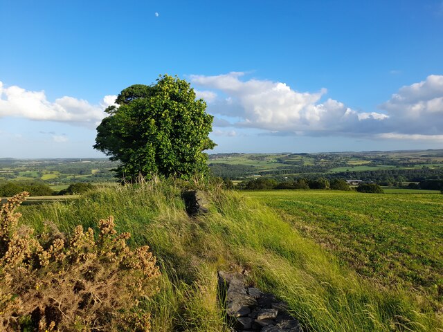
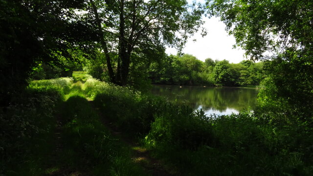
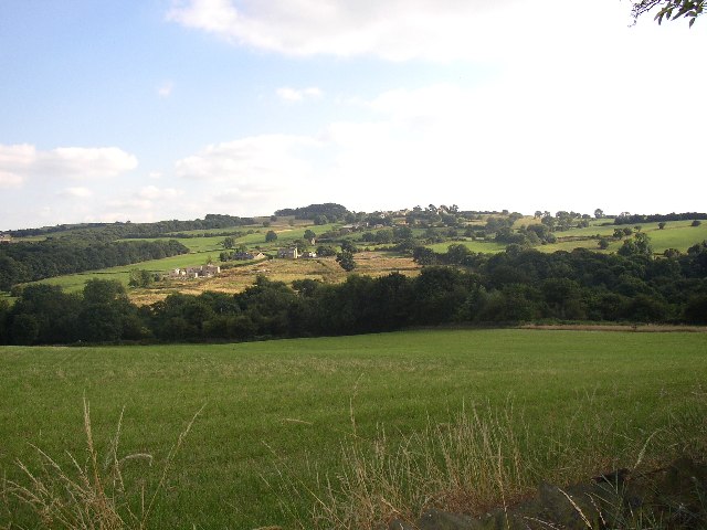
Bracken Wood is a picturesque woodland located in the county of Yorkshire, England. Covering an area of approximately 100 acres, it is a haven for nature enthusiasts and outdoor lovers alike. The wood is situated near the village of Bracken, and its proximity to the Yorkshire Dales National Park adds to its charm and appeal.

The woodland is characterized by its dense vegetation, predominantly consisting of mature oak and beech trees. These towering giants provide a canopy of shade, creating a cool and tranquil atmosphere within the wood. The forest floor is adorned with a carpet of lush ferns and bracken, giving the wood its name.

Birdsong fills the air as a variety of avian species call Bracken Wood home. Visitors may catch a glimpse of the elusive tawny owl or spot woodpeckers tapping away on tree trunks. The wood is also inhabited by mammals such as squirrels, rabbits, and occasionally deer, further enhancing its biodiversity.

Several walking trails meander through the wood, offering visitors the opportunity to explore its beauty at their own pace. These trails are well-maintained and signposted, ensuring a safe and enjoyable experience for all. For those seeking a longer adventure, Bracken Wood is conveniently connected to a network of footpaths that extend into the surrounding countryside.

Bracken Wood is a true natural treasure, providing a peaceful retreat for those seeking solace in nature's embrace. Its idyllic setting, diverse wildlife, and well-maintained trails make it a must-visit destination for anyone exploring Yorkshire's beautiful countryside.

If you have any feedback on the listing, please let us know in the comments section below.
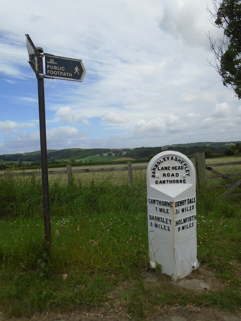
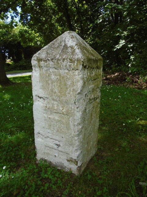
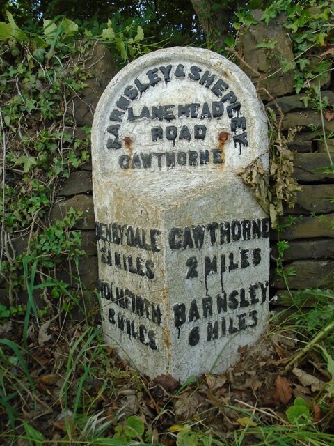
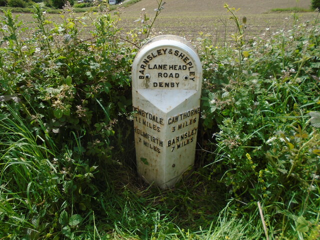
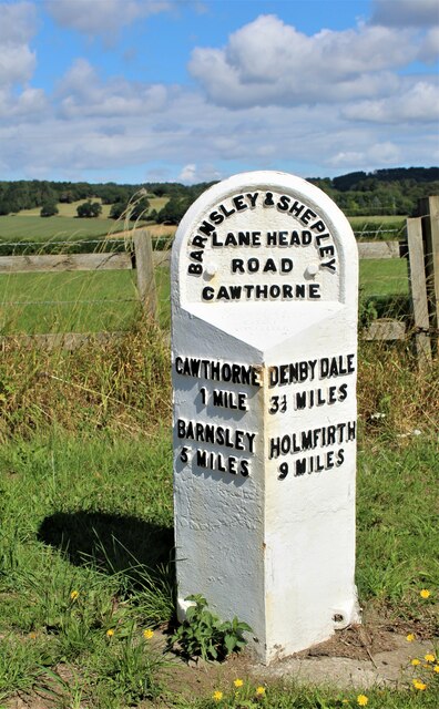
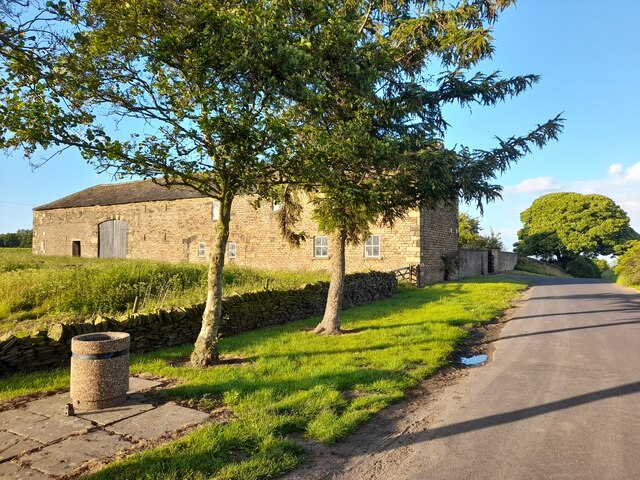
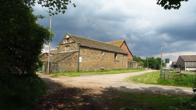
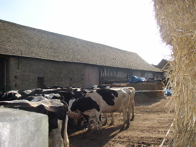
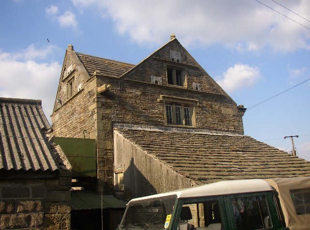
Bracken Wood Images

Images are sourced within 2km of 53.562875/-1.6204258 or Grid Reference SE2507. Thanks to Geograph Open Source API. All images are credited.

On Pool Hill This hill is classed as a TumP. It's an excellent viewpoint.
On Pool Hill
This hill is classed as a TumP. It's an excellent viewpoint.
Old milestone Travelling westwards and back out of Cawthorne village is the 5 miles from Barnsley West Riding CC milestone.   It is on the north side of the road at Clough Green and opposite the pipeworks.  Another milestone that was professionally painted in 2015.   The full height of the metal attachment with the two fastening bolts at ground level visible.   About 15-20cm of stone will be under ground level.  The Public Footpath sign indicates a section of the Barnsley Boundary Walk.   Grade II listed 1286788.
Old milestone
Travelling westwards and back out of Cawthorne village is the 5 miles from Barnsley West Riding CC milestone. It is on the north side of the road at Clough Green and opposite the pipeworks. Another milestone that was professionally painted in 2015. The full height of the metal attachment with the two fastening bolts at ground level visible. About 15-20cm of stone will be under ground level. The Public Footpath sign indicates a section of the Barnsley Boundary Walk. Grade II listed 1286788.
Old milestone The route between Barnsley, Shepley Lane Head and Holmfirth was never turnpiked.  So before County Councils erected milestones in the late 19C/early 20C simple stones would have been set up at junctions to guide travellers.   This stone is at the junction of the A635 with North Lane which meanders towards Penistone.  It is thought that it was originally inscribed with Penistone, Barnsley and Huddersfield.  Although painted in 2015 it is under a large tree hence the green mould.  On the day of this picture it was covered with an advertising hoarding, taken off and replaced.
Old milestone
The route between Barnsley, Shepley Lane Head and Holmfirth was never turnpiked. So before County Councils erected milestones in the late 19C/early 20C simple stones would have been set up at junctions to guide travellers. This stone is at the junction of the A635 with North Lane which meanders towards Penistone. It is thought that it was originally inscribed with Penistone, Barnsley and Huddersfield. Although painted in 2015 it is under a large tree hence the green mould. On the day of this picture it was covered with an advertising hoarding, taken off and replaced.
Old milestone The 6 miles from Barnsley, late 19C West Riding CC, milestone is just west of Coach Gate Lane which leads to the ancient Gunthwaite Hall.   It is on a very narrow verge almost at the Barnsley/Kirklees boundary.  Not well painted but in a very difficult place to work.  It is Grade II listed 1314730.
Old milestone
The 6 miles from Barnsley, late 19C West Riding CC, milestone is just west of Coach Gate Lane which leads to the ancient Gunthwaite Hall. It is on a very narrow verge almost at the Barnsley/Kirklees boundary. Not well painted but in a very difficult place to work. It is Grade II listed 1314730.
Old milestone Vegetation had to be cleared to reveal this West Riding CC milestone.  It is one of 615 set up in 1893/94 for the newly formed West Riding Council all over its extensive 'territory' from Sedbergh in the north west to south of Rotherham and over the Pennines into Saddleworth.   Over half are still in situ.  It is on the south side of the A635 between Denby Lane and Lower Denby Lane.
Old milestone
Vegetation had to be cleared to reveal this West Riding CC milestone. It is one of 615 set up in 1893/94 for the newly formed West Riding Council all over its extensive 'territory' from Sedbergh in the north west to south of Rotherham and over the Pennines into Saddleworth. Over half are still in situ. It is on the south side of the A635 between Denby Lane and Lower Denby Lane.
Old milestone A view of the milestone on the A635 between Denby Lane and Low Denby Lane before the grass had been trodden down.  Grade II listed 1135324.
Old milestone
A view of the milestone on the A635 between Denby Lane and Low Denby Lane before the grass had been trodden down. Grade II listed 1135324.
Milepost on the A635
Farm Buildings, Papist Hill Note the fine concrete bin.
Farm Buildings, Papist Hill
Note the fine concrete bin.
Gunthwaite Dam near Upper Denby
Track leading West towards Gunthwaite Hall
Gunthwaite Hall Barn near Upper Denby
Gunthwaite Hall Barn near Upper Denby The barn at Gunthwaite Hall was built in the middle of the 16th century, for Godfrey Bosvile (1520-80) lord of the manors of Gunthwaite and Oxpring. It is a northern aisled barn with a low pitched roof, stone walls up to three-quarter height and then timber framing to the eaves. There are some fine tudor doorways for pedestrian access as well as two large wagon doors on each side.
The barn is eleven bays long and now divided in two. Otherwise it is more or less unaltered except for repairs. It is still in agricultural use, being used for animal shelter and crop storage.
Gunthwaite Hall Barn near Upper Denby
The barn at Gunthwaite Hall was built in the middle of the 16th century, for Godfrey Bosvile (1520-80) lord of the manors of Gunthwaite and Oxpring. It is a northern aisled barn with a low pitched roof, stone walls up to three-quarter height and then timber framing to the eaves. There are some fine tudor doorways for pedestrian access as well as two large wagon doors on each side. The barn is eleven bays long and now divided in two. Otherwise it is more or less unaltered except for repairs. It is still in agricultural use, being used for animal shelter and crop storage.
Gunthwaite Barn This is an eleven-bay aisled barn 50m long, with timber-framing on a stone base.  It is at Gunthwaite Hall at SE238065, and was built between 1500 and 1550.
Gunthwaite Barn
This is an eleven-bay aisled barn 50m long, with timber-framing on a stone base. It is at Gunthwaite Hall at SE238065, and was built between 1500 and 1550.
Gunthwaite Spa This is a strongly tasting spring that is supposed to have healing qualities and was at one time blessed annually by religious leaders from Wakefield, Doncaster and Pontefract.
Gunthwaite Spa
This is a strongly tasting spring that is supposed to have healing qualities and was at one time blessed annually by religious leaders from Wakefield, Doncaster and Pontefract.
Farmbuilding adjoining Gunthwaite Hall Barn This was built in 1701 for Godfrey Bosvile. The left side has two part-blocked cart entries from a farmyard. Note the dovecote openings around the window in each gable. For further details and a photo of the side of the building see <span class="nowrap"><a title="http://www.imagesofengland.org.uk/search/details.aspx?pid=1&id=333816" rel="nofollow ugc noopener" href="http://www.imagesofengland.org.uk/search/details.aspx?pid=1&id=333816">Link</a><img style="margin-left:2px;" alt="External link" title="External link - shift click to open in new window" src="https://s1.geograph.org.uk/img/external.png" width="10" height="10"/></span>
Farmbuilding adjoining Gunthwaite Hall Barn
This was built in 1701 for Godfrey Bosvile. The left side has two part-blocked cart entries from a farmyard. Note the dovecote openings around the window in each gable. For further details and a photo of the side of the building see LinkExternal link
View towards the Cat Hill area of Hoyland Swaine This is taken from the lane near Broad Oak, in Gunthwaite.
View towards the Cat Hill area of Hoyland Swaine
This is taken from the lane near Broad Oak, in Gunthwaite.
Path to Deffer Wood Deffer Wood - one of the largest expanses of (working) coniferous plantation in the area. In bulk, mature woodland, it has several areas which have been clear-felled and replanted producing areas of uneven age woodland.
Path to Deffer Wood
Deffer Wood - one of the largest expanses of (working) coniferous plantation in the area. In bulk, mature woodland, it has several areas which have been clear-felled and replanted producing areas of uneven age woodland.
Show me another place!

Bracken Wood is located at Grid Ref: SE2507 (Lat: 53.562875, Lng: -1.6204258)

Division: West Riding

Unitary Authority: Barnsley

Police Authority: South Yorkshire

What 3 Words

///dawn.promising.pulses. Near Denby Dale, West Yorkshire

Related Wikis

Gunthwaite

Gunthwaite is a hamlet in the Metropolitan Borough of Barnsley in South Yorkshire, England. It is in the civil parish of Gunthwaite and Ingbirchworth and...

Barnsley West and Penistone (UK Parliament constituency)

Barnsley West and Penistone was a parliamentary constituency in South Yorkshire which returned one Member of Parliament (MP) to the House of Commons of...

Cannon Hall

Cannon Hall is a country house museum located between the villages of Cawthorne and High Hoyland some 5 miles (8 km) west of Barnsley, South Yorkshire...

Cannon Hall Farm

Cannon Hall Farm is a working farm and tourist attraction close to the village of Cawthorne, near Barnsley in the English county of South Yorkshire. Open...

Upper Denby

Upper Denby is a small village within the civil parish of Denby Dale, and the borough of Kirklees in West Yorkshire, England. Lying 11 miles (17 km) to...

Denby Dale

Denby Dale is a village and civil parish in the metropolitan borough of Kirklees in West Yorkshire, England. It is 10 miles (17 km) to the south-east of...

Denby Dale Viaduct

Denby Dale Viaduct is a grade II listed railway viaduct in Denby Dale, West Yorkshire, England. The curving viaduct carries the Penistone line over the...

Scissett

Scissett is a village in West Yorkshire, England. It is 8 miles (13 km) south-east of Huddersfield and 10 miles (16 km) north-west of Barnsley. According...

Nearby Amenities

Located within 500m of 53.562875,-1.6204258
Ford: yes
Lat/Long: 53.563416/-1.625437
Luke Well
Natural: spring
Lat/Long: 53.5602691/-1.6144106
Barrier: stile
Stile: stepover
Lat/Long: 53.5610888/-1.6215791
Barrier: stile
Stile: stepover
Lat/Long: 53.5615277/-1.6268012
Barrier: stile
Stile: stepover
Lat/Long: 53.5610284/-1.6268935
The data included in this document is from www.openstreetmap.org. The data is made available under ODbL.

Have you been to Bracken Wood?

Leave your review of Bracken Wood below (or comments, questions and feedback).