Starveall Wood
Wood, Forest in Oxfordshire West Oxfordshire
England
Starveall Wood

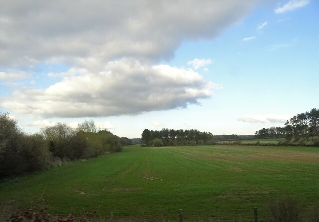
Starveall Wood is a picturesque forest located in Oxfordshire, England. Spanning over a vast area, this woodland is nestled within the stunning Chiltern Hills, a designated Area of Outstanding Natural Beauty. The forest is known for its diverse flora and fauna, offering a tranquil retreat for nature enthusiasts and hikers alike.
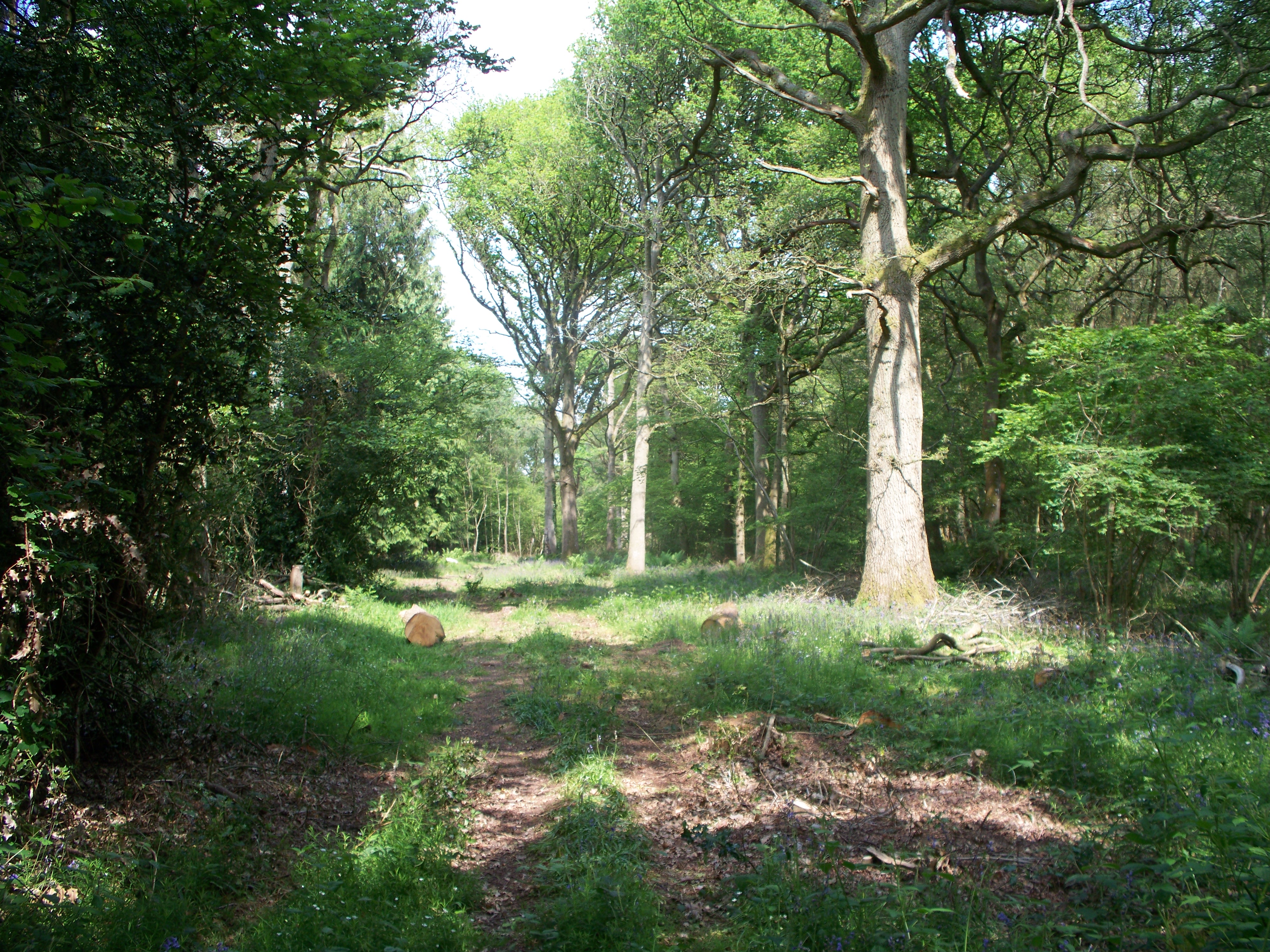
The name "Starveall Wood" is believed to have originated from its historical use as a source of fuel during harsh winters. The forest is predominantly composed of deciduous trees, including oak, beech, and ash, creating a stunning tapestry of colors during the autumn months. Bluebells carpet the forest floor in the spring, creating a breathtaking sight for visitors.
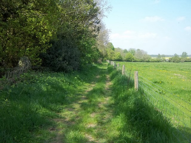
The woodland is crisscrossed with a network of well-maintained footpaths and trails, allowing visitors to explore its beauty at their own pace. These paths offer opportunities for both short leisurely walks and more challenging hikes. With its undulating terrain and stunning vistas, Starveall Wood provides a perfect backdrop for outdoor activities such as birdwatching, photography, and picnicking.
The forest is home to a diverse range of wildlife, including deer, badgers, foxes, and numerous bird species. Nature enthusiasts can spot woodpeckers, owls, and various songbirds while wandering through the woodland. Additionally, the forest is known for its rich insect life, with butterflies and dragonflies fluttering among the trees.
Overall, Starveall Wood in Oxfordshire is a captivating destination for those seeking a peaceful escape into nature. Its scenic beauty, varied trails, and abundant wildlife make it a must-visit location for both locals and tourists alike.
If you have any feedback on the listing, please let us know in the comments section below.
Starveall Wood Images
Images are sourced within 2km of 51.879427/-1.6398694 or Grid Reference SP2420. Thanks to Geograph Open Source API. All images are credited.

![Bruern Abbey [1] Seen from the bridleway is the entrance to the country house, Bruern Abbey.](https://s3.geograph.org.uk/geophotos/02/39/86/2398603_61883a35.jpg)
![Bruern Abbey [2] A view, along the avenue of tree, of the country house, Bruern Abbey, from the bridleway that is part of the Oxfordshire Way. The house was built in 1720 for Sir John Cole and is probably on the site of a former Cistercian abbey founded in 1147.](https://s0.geograph.org.uk/geophotos/02/39/86/2398612_7089b8d3.jpg)
![Bruern Abbey avenue A view along the avenue of trees, the opposite way to <a href="https://www.geograph.org.uk/photo/2398612">SP2620 : Bruern Abbey [2]</a>. The avenue stretches some 600 yards from the house to the minor road.](https://s2.geograph.org.uk/geophotos/02/39/86/2398618_4c688e70.jpg)
![Bridleway crosses road [1] The bridleway, part of the Oxfordshire Way, meets the minor road near Bruern Abbey.](https://s0.geograph.org.uk/geophotos/02/39/86/2398624_7d810d5c.jpg)
![Bridleway crosses road [2] The bridleway, part of the Oxfordshire Way, crosses the minor road near Bruern Abbey and heads towards Bledington.](https://s3.geograph.org.uk/geophotos/02/40/02/2400223_c564dac2.jpg)


![Fifield Heath [1] From the footpath, a view across the heath to the woodland named Ash Strip.](https://s3.geograph.org.uk/geophotos/02/40/02/2400235_9894e133.jpg)
![Fifield Heath [2] A view from the footpath across the heath to the woodland named Foxholes Copse. A bridleway runs along the edge of the copse and is a popular walk to Foxholes Nature Reserve.](https://s0.geograph.org.uk/geophotos/02/40/02/2400236_df45f4d2.jpg)


Starveall Wood is located at Grid Ref: SP2420 (Lat: 51.879427, Lng: -1.6398694)
Administrative County: Oxfordshire
District: West Oxfordshire
Police Authority: Thames Valley
What 3 Words
///community.verges.monks. Near Shipton under Wychwood, Oxfordshire
Nearby Locations
Related Wikis
Bould Wood
Bould Wood is a 58.2-hectare (144-acre) biological Site of Special Scientific Interest north of Shipton-under-Wychwood in Oxfordshire. An area of 23...

Bould
Bould is a hamlet in Idbury civil parish, Oxfordshire, about 4.5 miles (7.2 km) southeast of Stow-on-the-Wold in neighbouring Gloucestershire. The hamlet...

Bruern
Bruern or Bruern Abbey is a hamlet and civil parish on the River Evenlode about 6 miles (10 km) north of Burford in West Oxfordshire. The 2001 Census recorded...
Idbury
Idbury is a village and civil parish in the Cotswold Hills in Oxfordshire, about 4+1⁄2 miles (7 km) southeast of Stow-on-the-Wold in neighbouring Gloucestershire...
Nearby Amenities
Located within 500m of 51.879427,-1.6398694Have you been to Starveall Wood?
Leave your review of Starveall Wood below (or comments, questions and feedback).